SENC
-
Posts
910 -
Joined
-
Last visited
Content Type
Profiles
Blogs
Forums
American Weather
Media Demo
Store
Gallery
Everything posted by SENC
-
Good Morning My fellow Weather Nerds! I hope everyone is Loving this "Pattern change", (I know I am).. NO, the Fish are NOT "running" yet.. (Spots & Kings etc..) Current Conditions.. (On the Beach) Water Temp currently is.. 82F Winds are from the North @ 10-15 gusting to 24 mph Swells (waves) are at 4' to 5' from the ESE and Sloppy.. ICW condition(s).. Low of 57F High of 67F, 73F, forecasted for today Pressure 30.23 in Partly Cloudy w/Visibility 10 miles Dew Point 53 F Humidity 75 % Precipitation 0.00 inches The Weather went from 95 to 55.. Like it saw a State Trooper..
-
Well, this *tweet* aged well.. (The) Hybrid low west of Portugal have LOW (re)formation chances..
-
After this Hyper-Active Tropical Hurricane season,, Going into Fall/Indian Summer.... (Short Lived).. Wouldn't it be "On par" with 2020,, To get a YUGE Blizzard , about Mid-Late October/Early to Mid-November time frame, covering the WHOLE State of NC, et al? Several feet,, in the Mountains, to 12++ inches all the way down to the Coastal Area(s)?? THAT would put a "Night Cap" too 2020 for the Southeastern Forum, Don't cha think?...
-
Meh, I'll be pleasantly Surprised..
-
May I please "comment" on this Code yellow , I've not really mentioned this, just "observations" via Radar/Nexrad, It's been, how can I say? Almost a Homebrew? system thats been just off the coast now,, for several days, bringing Numerous Showers & T-storms across My area, here on the coast.. You could actually "see" the cyclonic Motions on Radar, (the past 3 days),, though I've NOT said anything, being a Weather weenie & all that.. interesting,, nether-the-less, for a possible "homebrew" system.. Maybe @shaggy & @downeastnc, can chime in Since they are also close to "Coastal" areas here in SENC, abit just north, closer to Morehead City.. It's downright TROPICAL HUMIDITY, right now here just north of Wilmington..
-
Bring it, Ready for FALL FISHING! here on the Coast!
-
Whatever 'happens" I'll be fer sure to get video from "Ocean front views", & video,, possibly live streamed, for your Viewing pleasure.. I might even take Da John boat "beach front too Lea Island for "Maximum" exposer..
-
Eyes wide open here on the Coast..
-
70's & 80s turning on the AC? .. WUT!
-
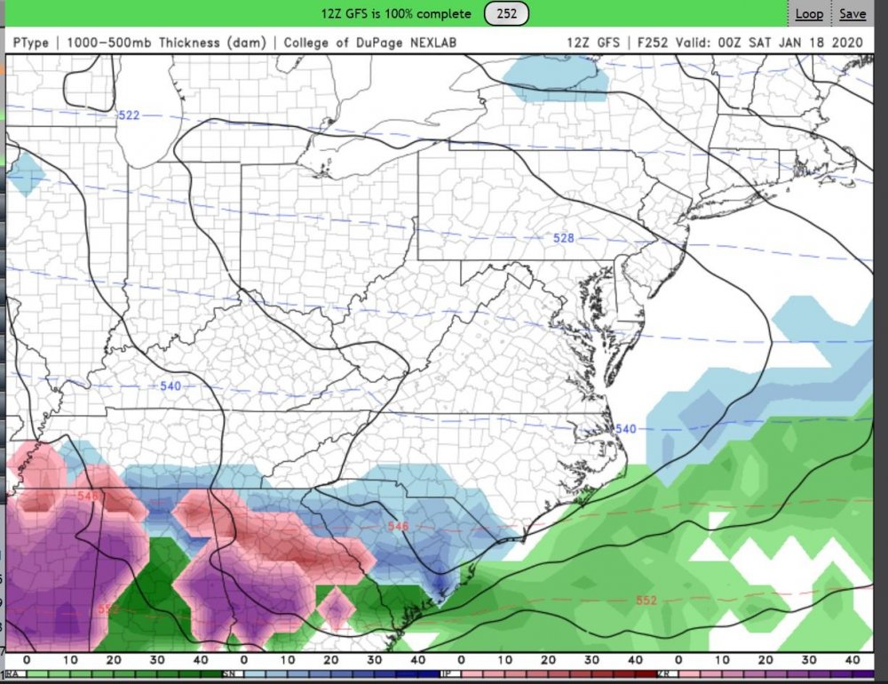
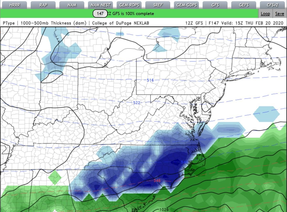
I grabbed these for the upcoming event.. @DownEast Might be the Big Winner up His way.. We will, In SENC, (as always) have to get the great rates in order to overcome BL/warmnose Issues, get some sloppy white goodness.. (I have this tune in My head,, Slip, slip sliding away??

-
Still up in the Air.. 12Z is running lets see what it brings..

-
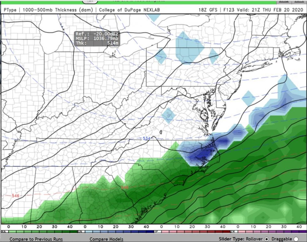
NWS calling for 32F & rain here on the immediate Coast for this event.. Looks great out in Fantasy Land though..
-
We are used too it Don't worry..
-
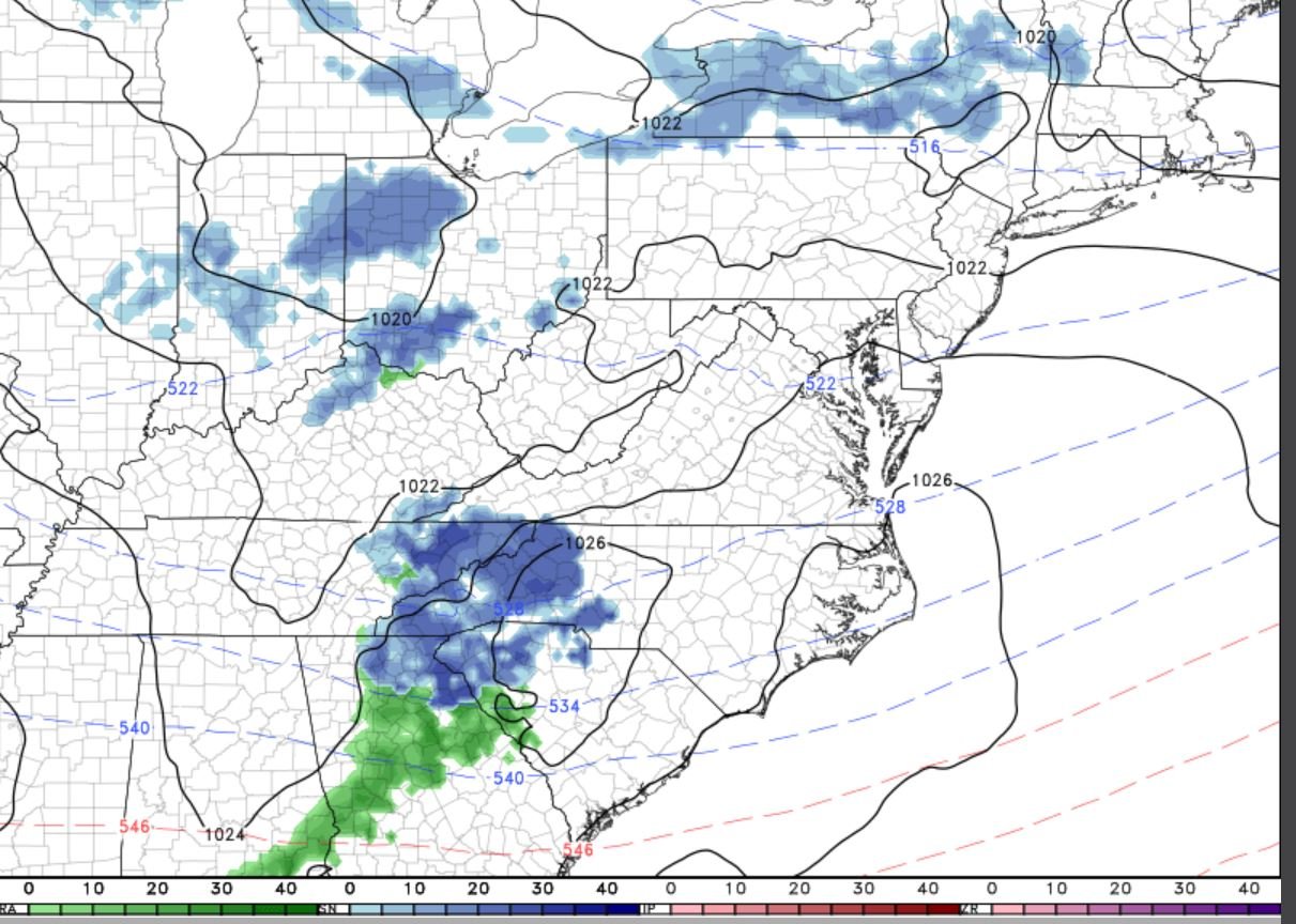
OH Holy, C**T,, BombOGenises! Coastal Low! WOOT! (and those other Panel(s)).. 4" to 6" here? OMG..
-
20-21 Forecast bitterly Cold & Dry, with chances of Flizzards & Gizzards..
-
Plant some Rice.. I did a few years back, (Carolina Gold Heirloom rice),, Down here in ILM,, Was quite successful..
-
I don't hear that Corn-Fed Gal,,,,, Singing yet...….
-
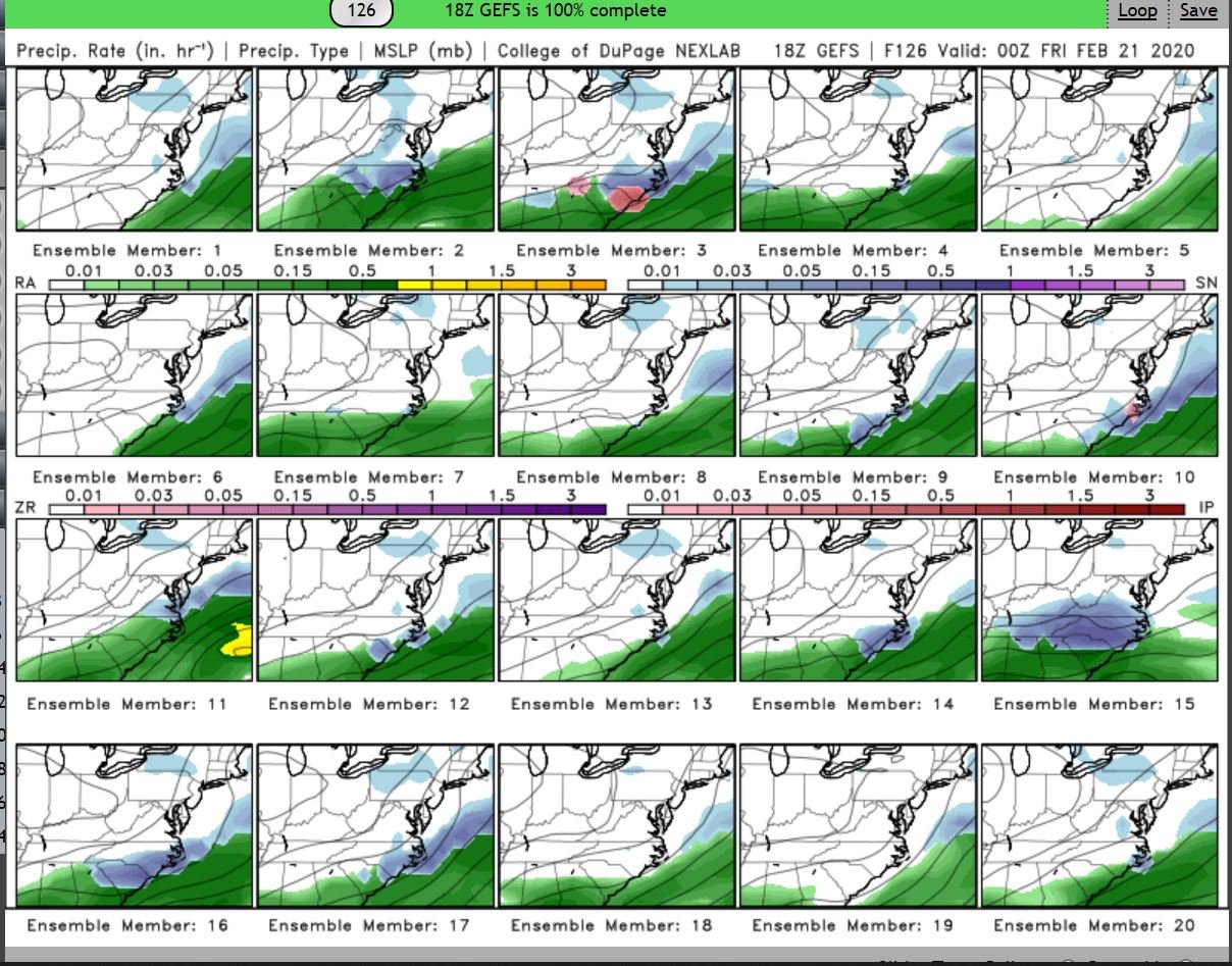
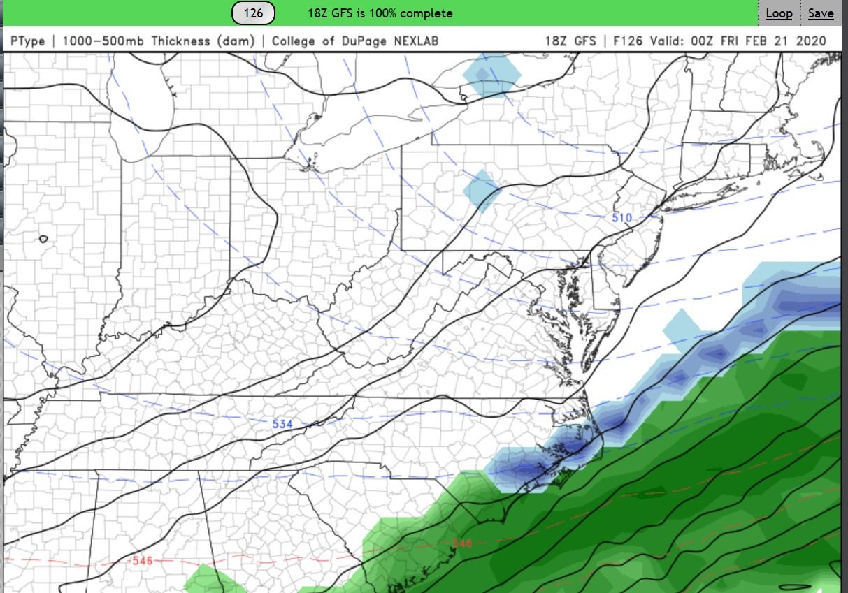
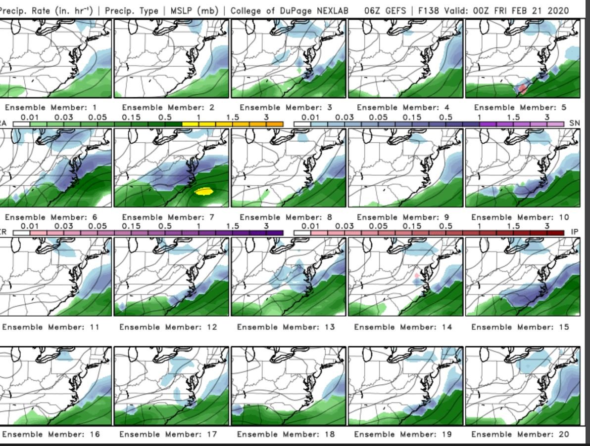
the 12Z run,, Only goes out too 11Z tomorrow, looks Very Promising though with what I posted above..
-
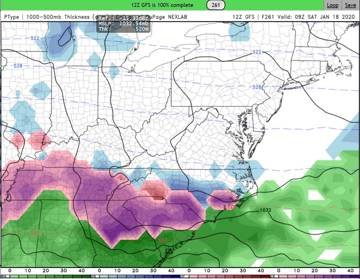
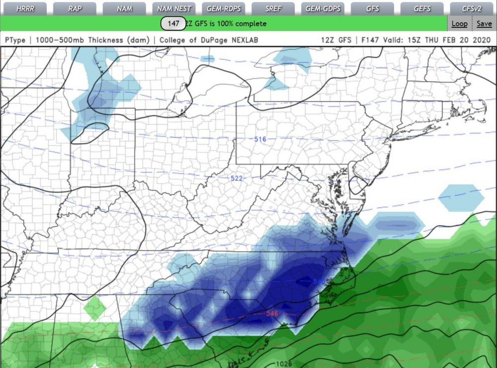
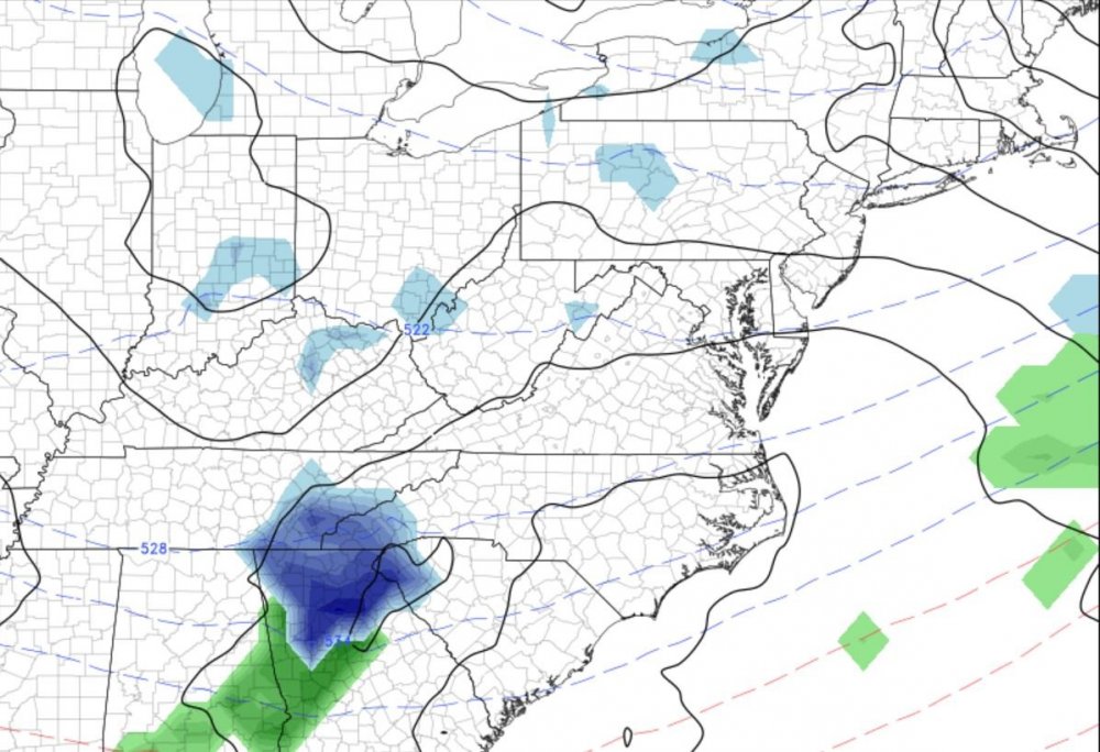
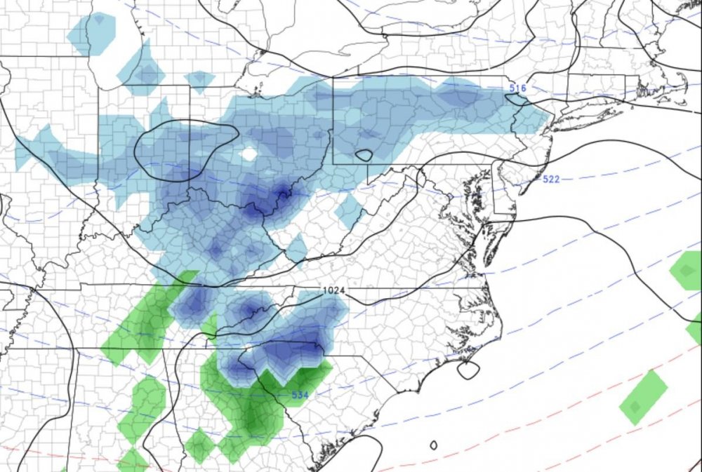
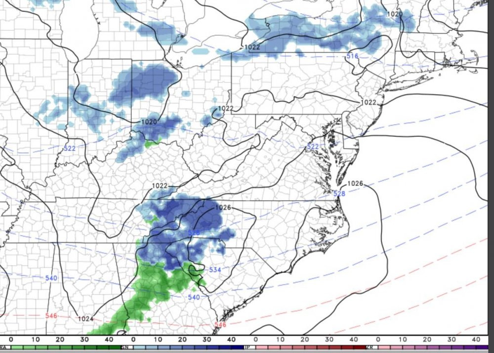
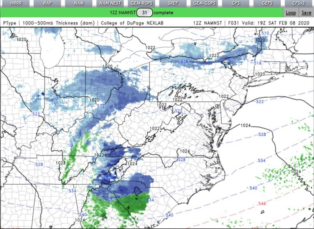
Hope ya'll Upsate Folks cash-in, Tonight, into tomorrow.. I'll Keep your Mid-50's & Lows 60's down here in the coast for ya'll Enjoy your snow.. WHY? I'm NOT ready for it, broken/Inop..,, water-heater & too dern Poor,, to turn the Emergency heat on with the HVAC, (Heat pump is on the fritz),, LandLord,,, (Cough-SlumLord), doesn't have $$ to fix the broken things.. So we freeze... The 12ZGFS (and 12Z NAM) and NamNest looks intriguing out too 18Z Saturday tomorrow.. Looks GREAT for some of you Upstate Folks (Al/SC/NC),, if it comes to pass.. The 12Z HRRR Only went out too 11Z tomorrow, though @ the end of the Run starts too look Promisingly in Line with the Panels I posted above..
-
Believe it or not.. Several Reports of Sleet/SN Mix waaay down here in SENC (Boiling Springs & Southport area(s))..
-
with temps in the Triple digits, w/ nearly 100% Humidity & Dews..
-
We shall see, as I live in the area.. Checked the Models, certainly possible but highly unlikely..
-
BUT, I don't want the Electric Bill
-
If this "materializes" should be great getting rid of iguanas ..
-
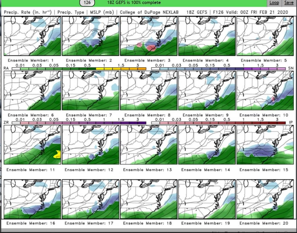
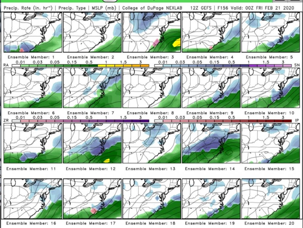
Well,, This looks promising for, as of Now, 4~6 runs in a row now? (Similar too the 7~8th time frame that was showing "Snow" 7~8th timeframe, out 2 weeks ago?) -------------- (Country Song)------------------- Commence Hound Dog Howling about NO COLD.. ******* Models I loved & hugged You long ago,, You promised Me so much Snow,, Yet,, here,, on the Edge I sit,, Leaving melted tears of regret? First verse.. Carry ON.. 12Z..