NJwx85
-
Posts
19,663 -
Joined
-
Last visited
Content Type
Profiles
Blogs
Forums
American Weather
Media Demo
Store
Gallery
Everything posted by NJwx85
-
It's already noticeably more light out. If I leave work right at 5 I can almost make it home before total darkness. A sign of better things to come. Only another month or so of this garbage left. Only 35 days until pitchers and catchers.
-
This failed because of timing. It happens. There might be something good around the 20th before the pattern flips.
- 993 replies
-
- 1
-

-
- metsfan vs snowman
- bomb
- (and 2 more)
-
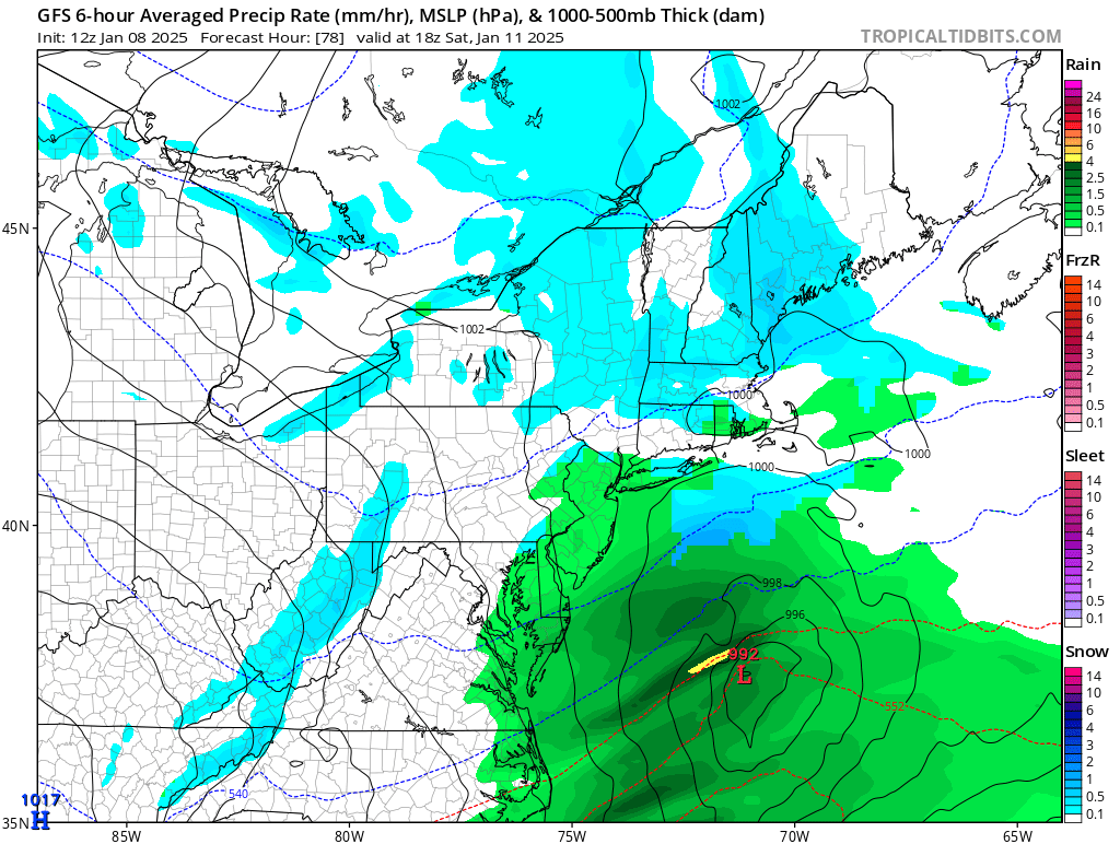
I'm showing 34 degrees at the surface at 18z Saturday near Newark.
-
What snow?

- 993 replies
-
- 2
-

-

-
- metsfan vs snowman
- bomb
- (and 2 more)
-
This is what happens when the system doesn't phase until it's past us. As you can see, the eventual coastal deepens quite dramatically offshore.
- 993 replies
-
- 1
-
-
- metsfan vs snowman
- bomb
- (and 2 more)
-
The storm saw the new congestion pricing and decided to take a hard right turn.
- 993 replies
-
- 4
-

-
-
- metsfan vs snowman
- bomb
- (and 2 more)
-
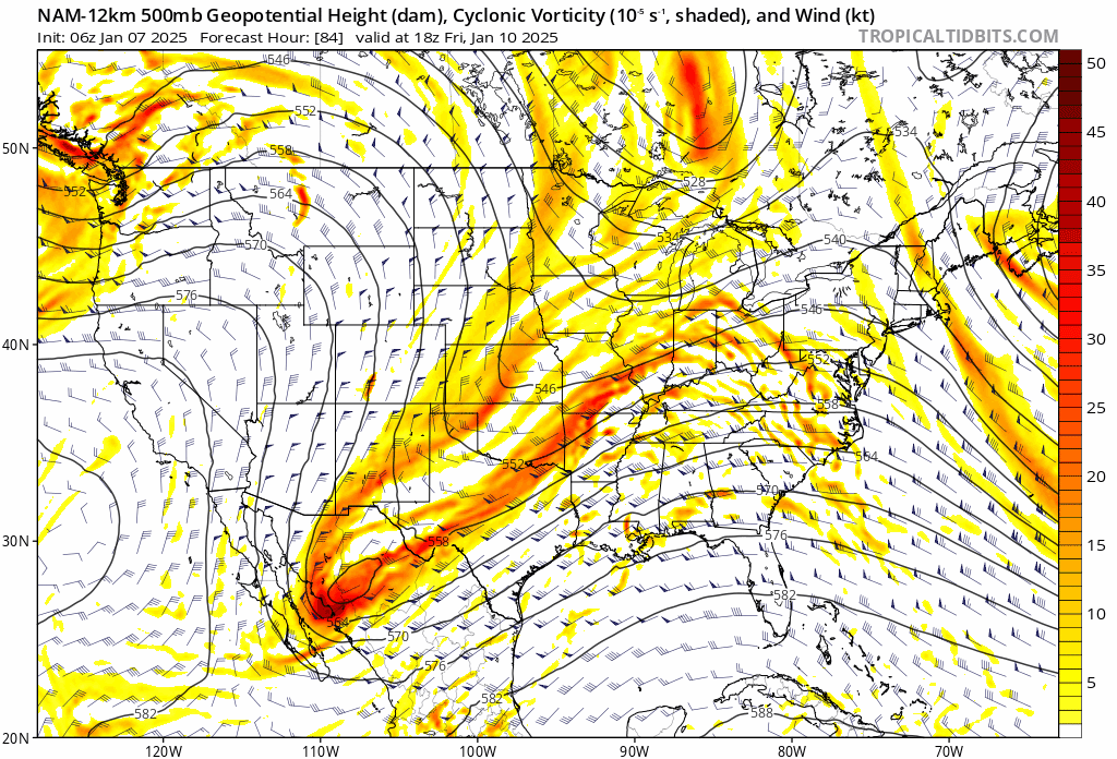
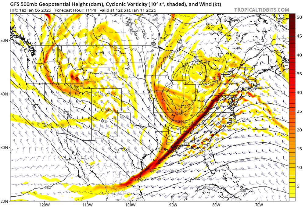
Yeah I thought the trough looked better initially but it actually ends up worse than the GFS.
-
It has the trough negatively tilted at hr 84, agree.
-
If you look at the last few runs of the GFS, the trend is for a more positively tilted trough and lower heights at the coast. My call right now is for nothing significant North of Toms River.
- 993 replies
-
- 1
-
-
- metsfan vs snowman
- bomb
- (and 2 more)
-
And to think some here were upset yesterday because the 18z GFS showed a coastal scraper.
- 993 replies
-
- 2
-
-
- metsfan vs snowman
- bomb
- (and 2 more)
-
-
This is trending towards nothing up here and I'm fine with that. Have my son's birthday party on Saturday afternoon anyway. And no legit snowlover would be happy with a 1-3" event when the GFS was showing 20-30" yesterday.
- 993 replies
-
- 3
-

-

-
- metsfan vs snowman
- bomb
- (and 2 more)
-
-
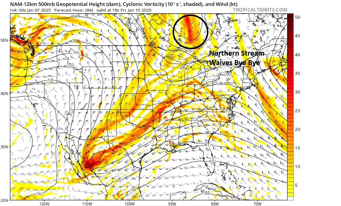
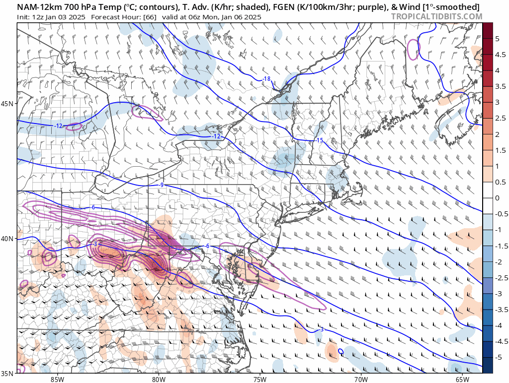
12z NAM looking better. Maybe it's the start of a trend. Today is probably the last day for significant changes.

-
Long range NAM but this would result in a suppressed solution.

- 993 replies
-
- 1
-
-
- metsfan vs snowman
- bomb
- (and 2 more)
-
Looks nothing like the Euro at H5.
- 993 replies
-
- 1
-
-
- metsfan vs snowman
- bomb
- (and 2 more)
-
You want the NAM to be showing a track into Albany at this range. If it’s not super amped beyond 60hrs that’s a tell.
- 993 replies
-
- 2
-
-
- metsfan vs snowman
- bomb
- (and 2 more)
-
No. In fact, the consensus was out to sea, didn't come back till Christmas Eve. It was a Christmas miracle. Of course, the models weren't nearly as good back then. That was one of my first memories from being on this board.
- 993 replies
-
- 4
-
-
- metsfan vs snowman
- bomb
- (and 2 more)
-
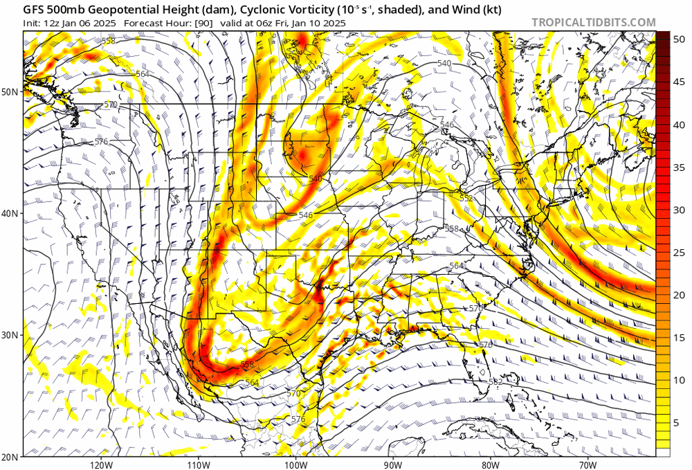
At hour 84, the GFS is more amped than 12z.
- 993 replies
-
- 1
-
-
- metsfan vs snowman
- bomb
- (and 2 more)
-
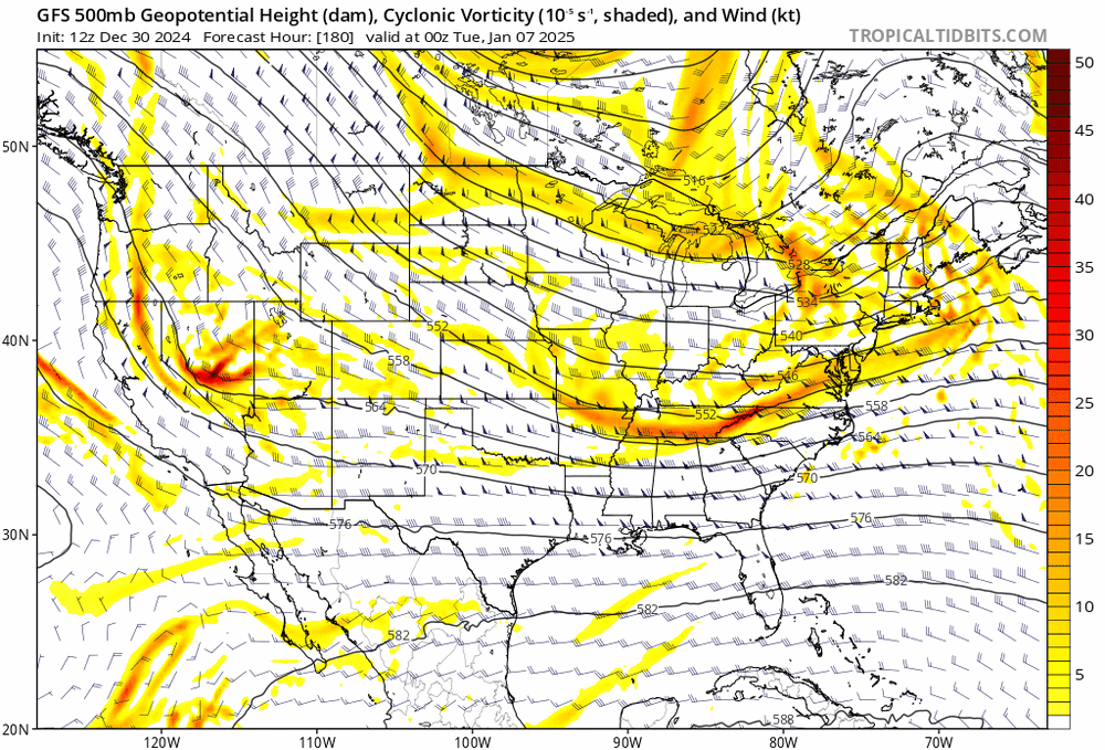
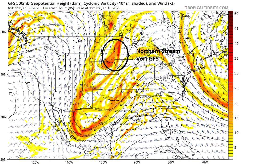
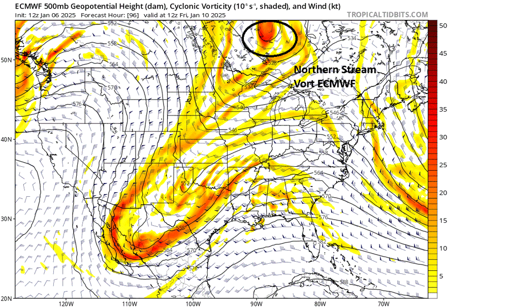
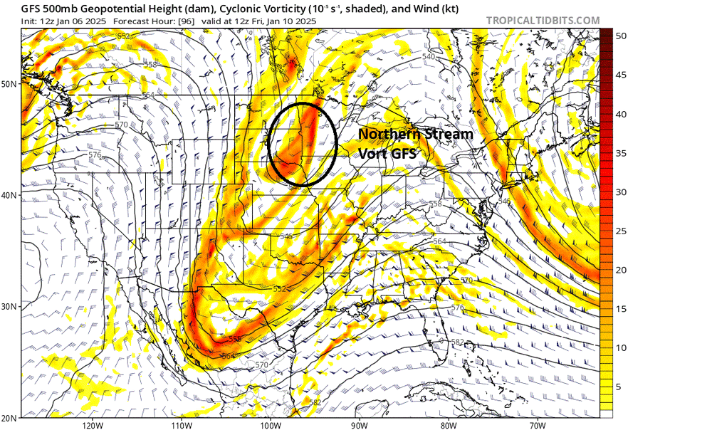
12z Euro and 18z GFS are nearly identical at H5 at hour and then differences begin. GFS is already digging the Northern stream into the Dakotas while the Euro is well North of the border.
-
The Euro and GFS are pretty similar earlier on. The major differences aloft occur late Thursday night into Friday morning. It all comes down to timing.
- 993 replies
-
- 5
-
-
- metsfan vs snowman
- bomb
- (and 2 more)
-
Snowfall NYC subforum Jan 6 and OBS if needed
NJwx85 replied to wdrag's topic in New York City Metro
A lot of what you see falling on the Northern fringe will be extremely light. Going to be lots of subsidence North of where this sets up.
-
Snowfall NYC subforum Jan 6 and OBS if needed
NJwx85 replied to wdrag's topic in New York City Metro
Just a less reliable model correcting South. -
Snowfall NYC subforum Jan 6 and OBS if needed
NJwx85 replied to wdrag's topic in New York City Metro
I've had 4 measurable snowfalls already, two plowable and it's only January 3rd. The important thing is that we're in an active pattern so there will continue to be storm chances. We had a period in October and November where it rained like twice in a 60 day span. -
Snowfall NYC subforum Jan 6 and OBS if needed
NJwx85 replied to wdrag's topic in New York City Metro
The PV dropping down through New England killed this storm and the one that would have come the end of next week. The energy coming out of the plains won't dig enough and the pattern is flat and overall progressive. It comes down to bad timing.