NJwx85
-
Posts
19,663 -
Joined
-
Last visited
Content Type
Profiles
Blogs
Forums
American Weather
Media Demo
Store
Gallery
Everything posted by NJwx85
-
That's what you get for living in the middle of the ocean.
-
You've been on here long enough to know that not everyone can win in a setup like this.
-
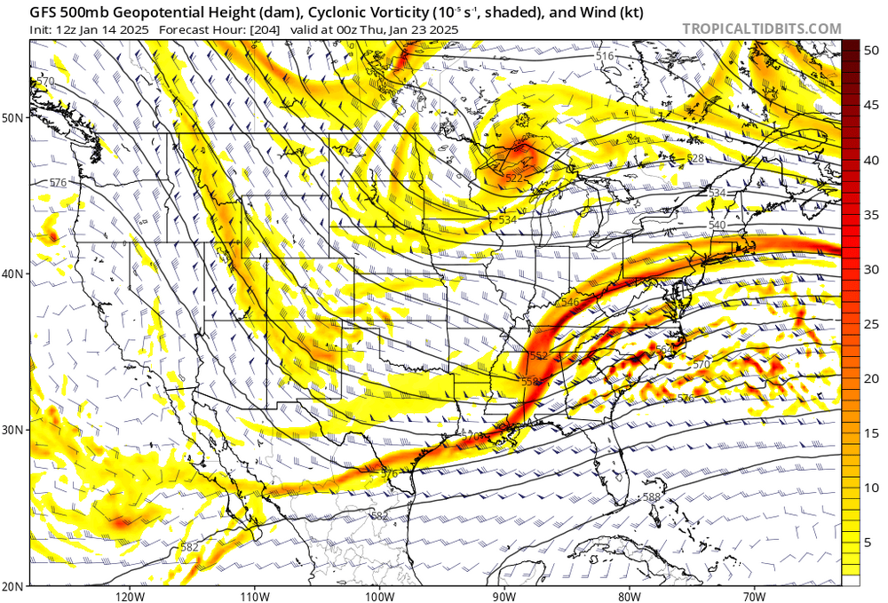
GFS has been very steady. I think it has the best handle of all the guidance.
-
Why are you using the EPS mean to make a snowfall forecast?
-
That's more like it, NAM caves.
-
15z SREF looks warm for the coast.
-
I'm going to go out on a limb and say that if we don't cash in with the storm towards the end of next week, our next chance won't come until mid February.
-
Orographically enhanced lift.
-
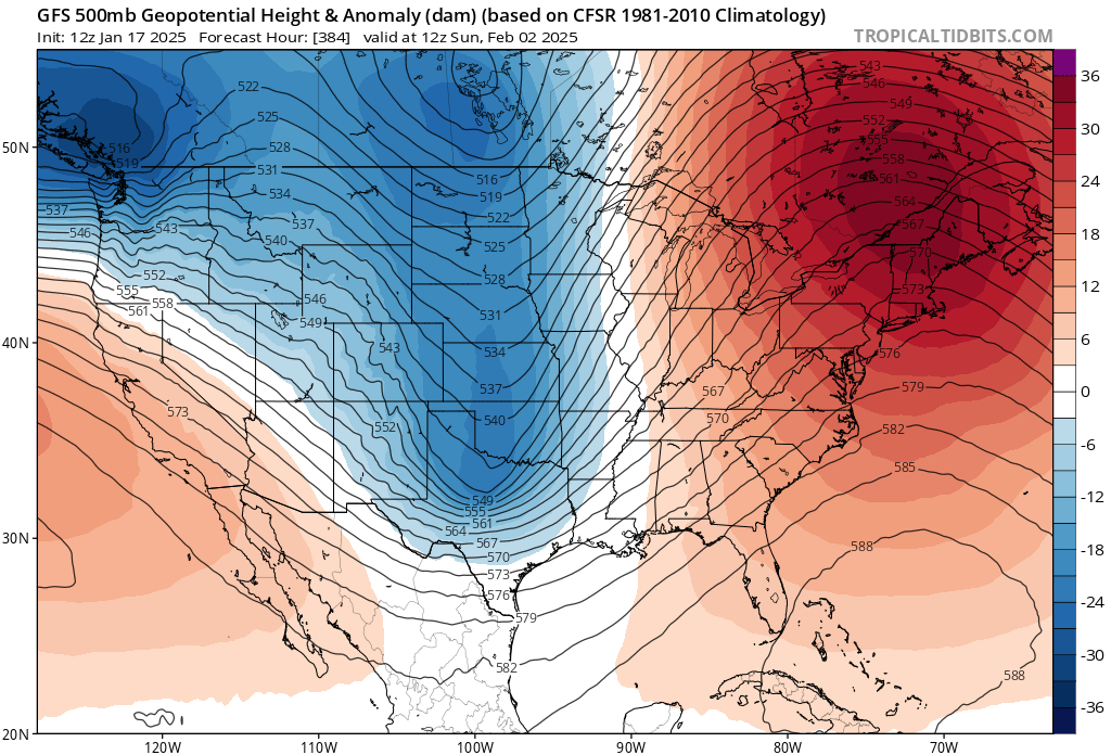
Does this look like a cold pattern to you in the East?
-
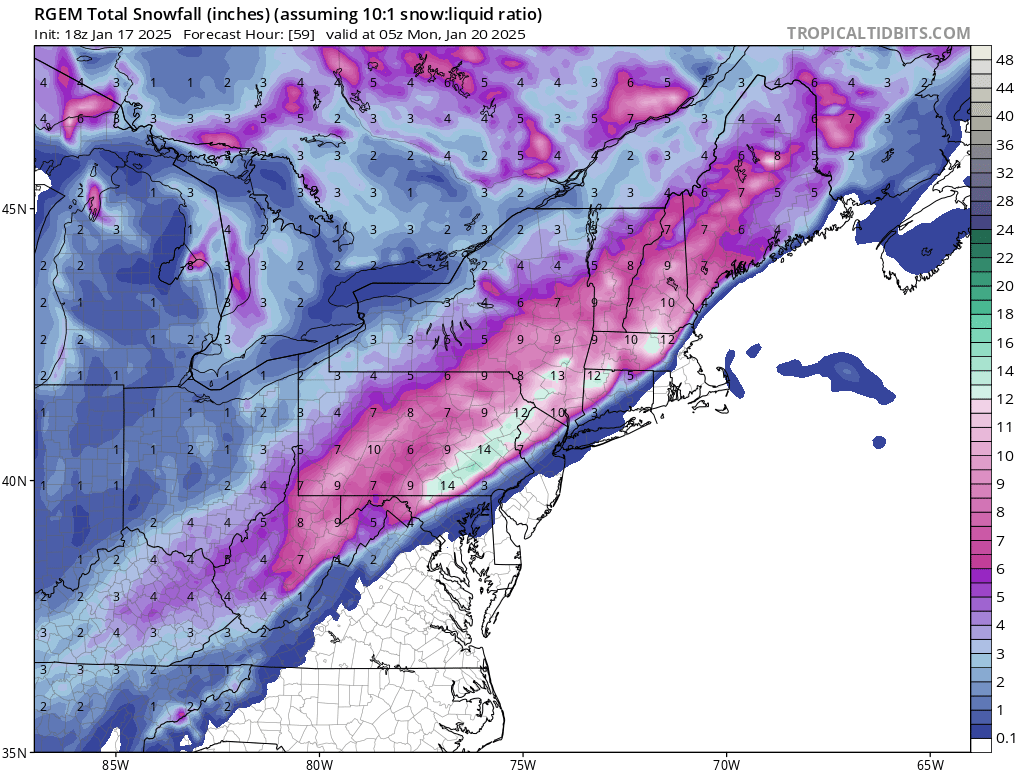
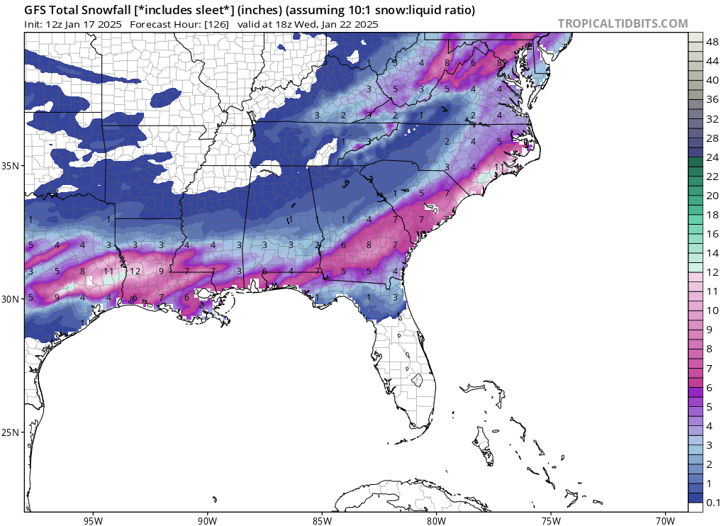
I'd rather see what gives me the most snow. And so does everyone else here. I'm just being honest about it. If I had to make a public forecast, 2-4" for the immediate coast and city looks likely. 4-6" North of 287 in Westchester and 4-6" West of the Hudson in the LHV. A bit less East of the city, with mostly rain for the South facing shore areas. Rain changing over to snow for the I-78 corridor. 1-3" for both of those areas. 6"+ possible well North and West.
-
Of course you would, but you live in South Jersey. That's the same distance from NYC to Riverhead. So in other words, two completely different worlds meteorologically.
-
The next storm never had a chance of making it up this way. This storm reinforces the block and brings the arctic high in behind it. There's a chance at something this time next week before the pattern completely breaks down. We could reach 60 degrees before the end of the month as a southeast ridge develops and the pattern supports cutters.
-
The next real threat around here will be towards the end of next week as the blocking breaks down and the cold air departs.
-
Not just that the RGEM might be over amped. It's a sign that perhaps some of the modeling is too strong. Again, I'm not giving it much weight at this stage given that the rest of the guidance appears mostly locked in.
-
The NAM is a good model inside of 36hours. It's good for those that know how to use it. And it's better with certain setups than others.
-
When the NAM is this flat at this range, it can sometimes mean that the other models are over amped. Again, it's an outlier right now.
-
12Z GFS has a high of 15 in Washington DC on Monday after 6-8" on Sunday, slightly warmer here. Going to be a strategical nightmare.
-
Out of area, but would be historic next week.
-
Not really, because the NAM beyond 48hrs is historically over amped. That's why it normally overblows totals and then gradually corrects inside of 36hrs.
-
It's a bit troublesome to me that the NAM is so weak with development. I think it's because it's quite a bit less amped up than even the 12z GFS. Usually in this type of setup the NAM would be showing a coastal hugger. It's completely on its own and the rest of the modeling has been fairly consistent so I'm largely tossing it, but it's still possible that things don't get going quickly enough.
-
We would be fine here in Rockland County even on the RGEM. Got to be able to smell the rain to get the heaviest snowfall.
-
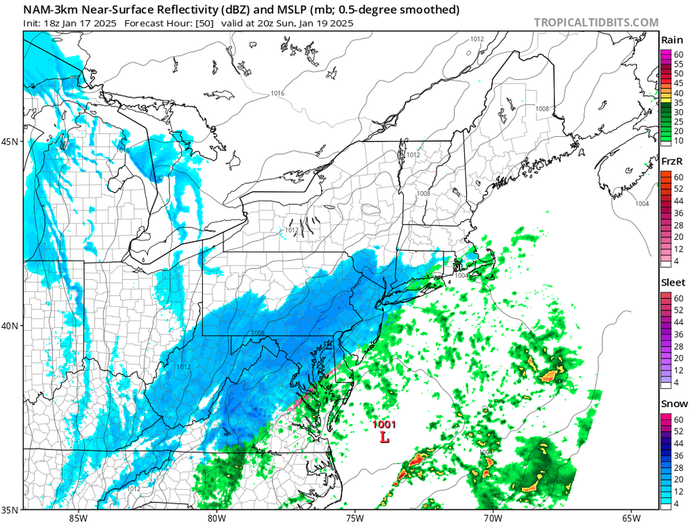
12z RGEM is mostly snow, and heavy just to the NW of NYC proper. This is one of those storms where it could be ripping snow on the Palisades Parkway and raining in midtown. But even in this scenario, mostly everyone would flip to a burst of heavy snow at the end except for the far East end.

-
I like a quick 4-6" Sunday night into early Monday morning pretty much region wide. It could be slightly more than that if things play out perfectly.
-
Lots of potential here.