hlcater
-
Posts
2,638 -
Joined
-
Last visited
Content Type
Profiles
Blogs
Forums
American Weather
Media Demo
Store
Gallery
Everything posted by hlcater
-

January 10th-12th Winter Storm Potential
hlcater replied to Thundersnow12's topic in Lakes/Ohio Valley
HRRR brings another wave of precip across my area tomorrow morning, and while temps would definitely support snow, the complete lack of moisture in the DGZ suggests otherwise. Could get some more freezing rain or graupel rather than snow if it's right. -
January 10th-12th Winter Storm Potential
hlcater replied to Thundersnow12's topic in Lakes/Ohio Valley
Freezing rain has begun here. Looking at radar, we could see 0.10+ of accrual before switching to snow. -
January 10th-12th Winter Storm Potential
hlcater replied to Thundersnow12's topic in Lakes/Ohio Valley
FWIW, the WRF suite NSSL/ARW/NMMB is not as bullish on the first wave as the NAM/HRRR/RAP are. -
January 10th-12th Winter Storm Potential
hlcater replied to Thundersnow12's topic in Lakes/Ohio Valley
I’m still not sure what exactly to expect from this system. Some models(UK/GEM/ICON) show very little, while others(NAM/EC/GFS) show a solid hit. I’m still worried about being missed SE. -
January 10th-12th Winter Storm Potential
hlcater replied to Thundersnow12's topic in Lakes/Ohio Valley
Thinking with trends this morning of a more progressive, and therefore more southerly, second wave that it seems fairly likely that the best snow slides southeast of here. If I had to take a stab, Id bet area from Kirksville to Sterling and far SE WI get the best snow. It’s a narrow band in any case, so any additional change in track to the south and we may get shut out entirely. -
January 10th-12th Winter Storm Potential
hlcater replied to Thundersnow12's topic in Lakes/Ohio Valley
One thing that puts a hold on that for me is the positive NAO/AO. To me, that would lend more credence to the storm cutting more NW, like it currently is, opposed to sliding south. -
January 10th-12th Winter Storm Potential
hlcater replied to Thundersnow12's topic in Lakes/Ohio Valley
Do you happen to have the operational by chance? -
January 10th-12th Winter Storm Potential
hlcater replied to Thundersnow12's topic in Lakes/Ohio Valley
#1 analog is super Tuesday -
1337 tornadoes and the first high risk will be on 4/20.
-
Time to get the lawn chairs out?
-
Current snow depth: 0.0". What a lovely way to head into Christmas!
-
Might squeeze some dixie severe out of that.
-
Looks like yet another 2010s december for the trash bin. Yippee1
-
Autumn/Winter 2019-2020 Banter/Complaint Thread
hlcater replied to IWXwx's topic in Lakes/Ohio Valley
where we can have split flow in April to maximize suffering. -
I'm holding it against you if the 00z GFS isn't correct verbatim. Either way, I am concerned the low develops too quickly and ends up getting suppressed in the southern high plains before it can really eject. ie the favorite solution that the Euro/UKie have been showing for a few days now.
-
yes
-
Snow squall moving across the state today has created a massive pileup in Des Moines. Yikes...
-
The past 4-5 winters say hello
-
What makes you think that? Especially seeing as it is likely we more or less lose the first 10-15 days of the month. Long range looks slightly better, but even still it doesn’t even look that great, just seasonable. Though even seasonable is something significant considering the run of poor Decembers we’re on.
-
Wind threat looks pretty substantial(regionally speaking) and I’m hoping we can squeeze out a few 60mph gusts tomorrow. Even if we don’t get that, 50-55mph seems like a lock.
-
Wow that’s amazing! Do you mind if I forward it to accuweather with no credit to you? Thanks in advance! Topically, I received 2.6” in Iowa City, with 4.1” measured in Hiawatha. I was hoping for a little more, but it’ll suffice for now.
-
Wow! Is that tornado in your profile pic from Michigan!?!?!?!?!!??!
-
Not a single flake in Iowa City so far, meanwhile CR has been in a nice band for several hours. I don't understand how I'm always on the wrong side of the cut off. If I'm in CR, it will dump in Iowa City, but if I'm in Iowa City it will dump in CR.
-
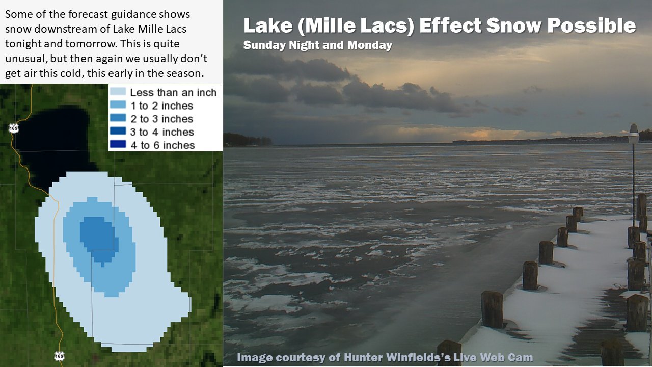
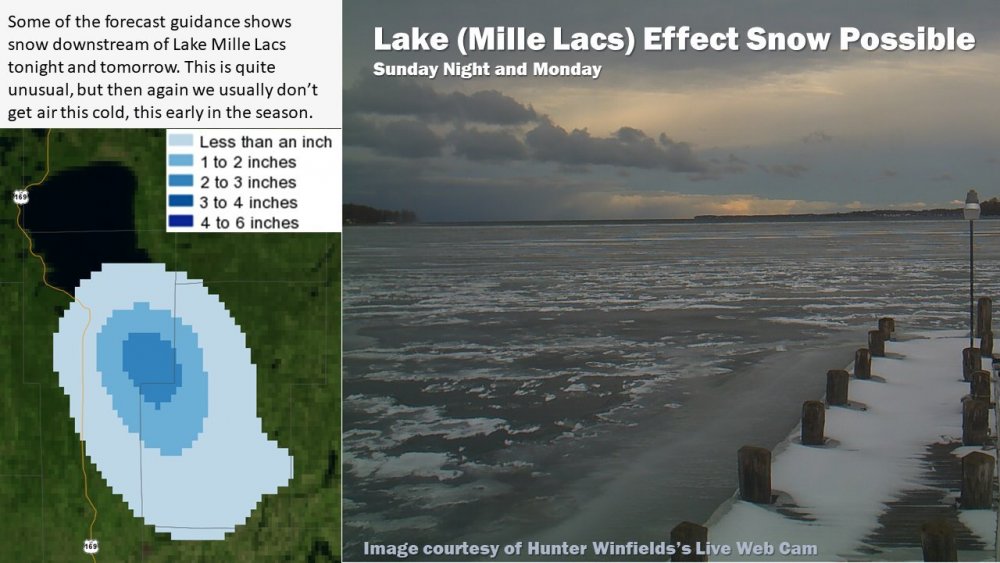
Kinda neat to see LES off of a relatively small body of water.
-
Looking like a solid 2-5” event out this way. Would expect to see advisories issued at some point.