hlcater
-
Posts
2,686 -
Joined
-
Last visited
Content Type
Profiles
Blogs
Forums
American Weather
Media Demo
Store
Gallery
Everything posted by hlcater
-
ready 2 b torched
-

Winter 2021-22 Short/Medium Range Discussion
hlcater replied to Chicago Storm's topic in Lakes/Ohio Valley
-
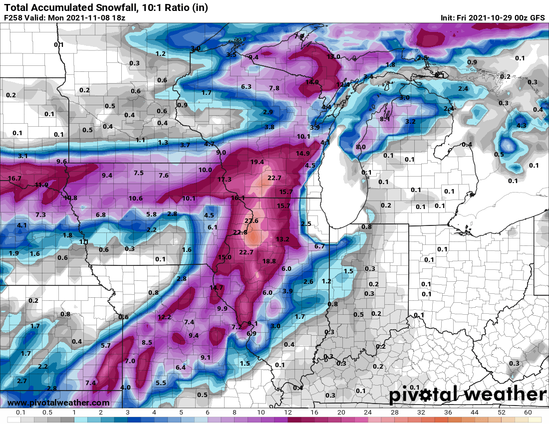
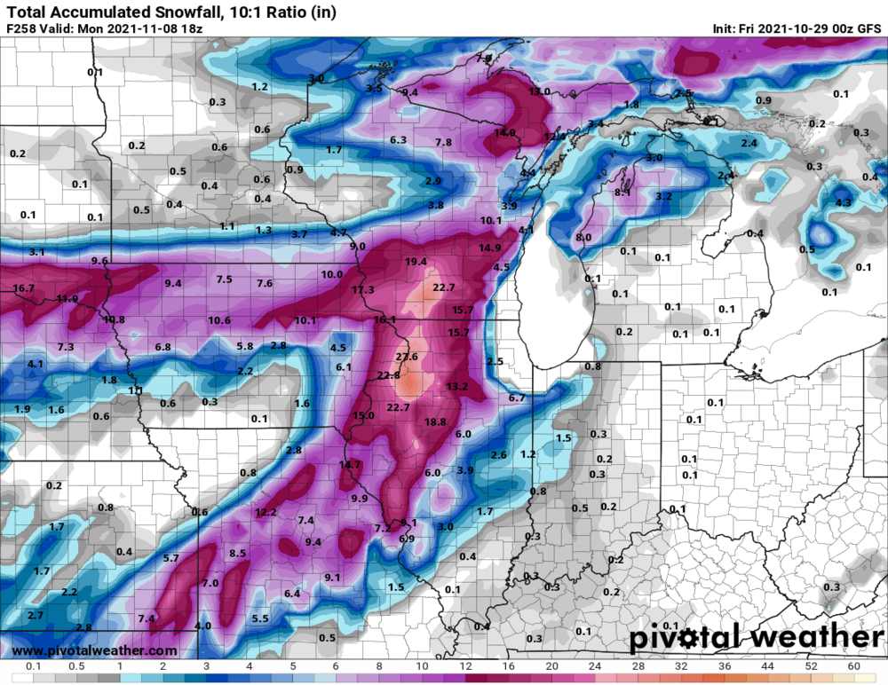
The solution to getting snow across portions of iowa seems to be letting the low deepen quickly. The 18z euro has a far better developed deformation zone to the west of the low compared to other models and has 1-4" across eastern iowa because of it.
-
Winter 2021-22 Short/Medium Range Discussion
hlcater replied to Chicago Storm's topic in Lakes/Ohio Valley
GFS has a system in the medium range that hasn't shown up previously -
Perpetual cool NW flow with absolutely zero precip to be seen. December 2017 vibes.
-
This pattern is just brutal
-
I’d say 20-24” in CR. There is precedent for large storms elsewhere in Iowa, CR has just had an epic run of bad luck and is not representative of climo imo.
-
First flakes in Iowa city today. No accumulation as expected
-
agreed. This gradual slope down to winter has been somewhat atypical over the past 5-6 seasons.
-
hoosier loves it when the young guns run
-
Looking like several snow chances in the sub after about day 5. More or less on schedule I guess
-
in a coma
-
What a beautiful image
-
how do I post as guest
-
I prefer wet n' wild
-
Bastardi is an idiot, straight up. There is no "wealth of knowledge" over there, I can assure you of that.
-
yea nope nevermind lol
-
damn dude nice job
-
Tomorrow is kinda interesting. Rapidly progressive triple point could support some highly sheared, relatively low topped supercells with a hail and brief tornado threat. I have an exam at 6:30 so I will not be chasing. Would expect supercells to be very long and quite skinny based on relatively weak directional shear but exceptional speed shear. Interested to see how that ages.
-
Sit on the surface low tomorrow and profit off some high octane tornadic rain showers.
-
2021 Atlantic Hurricane season
hlcater replied to StormchaserChuck!'s topic in Tropical Headquarters
lol -
I see this thread is off to an excellent start
-
150kts FL. No SFMR data so im interested to see what the sonde shows. 0.85 reduction is 130kts.
-
I’d not be surprised to see the true intensity here north of 140kts barring any marked changes prior to the 00z fix