hlcater
-
Posts
2,686 -
Joined
-
Last visited
Content Type
Profiles
Blogs
Forums
American Weather
Media Demo
Store
Gallery
Everything posted by hlcater
-
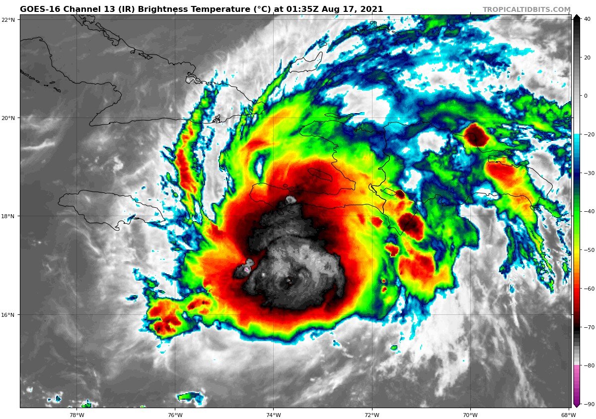
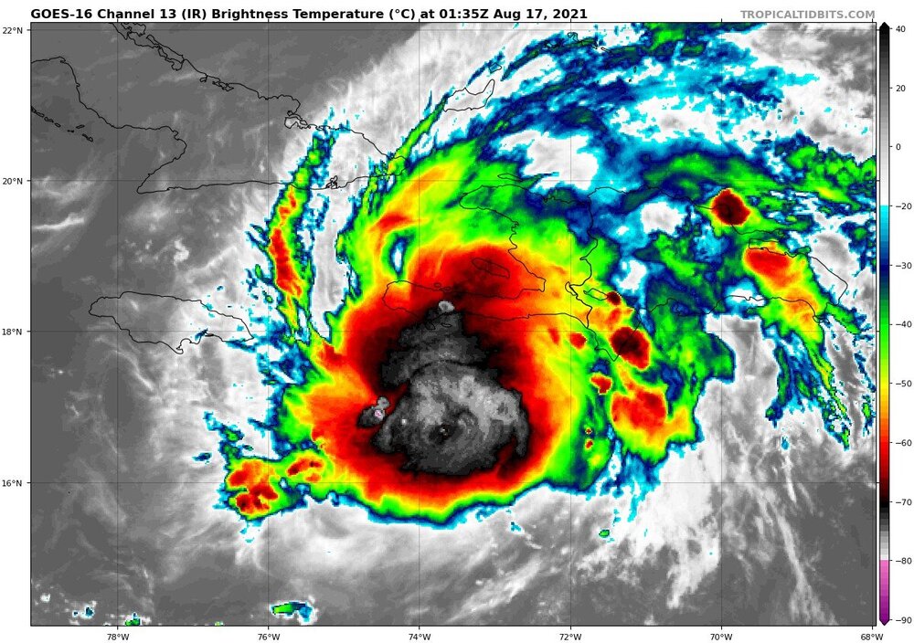
Hot take: this isn’t a hurricane right now. I haven’t seen any observations to indicate that it is
-
That stretch (of mostly rural) Mexican coastline definitely got a surprise tonight. A rapidly intensifying high end cat 3 is no joke.
-
Thinking we see some #EXTREME coastal erosion and inland flooding from this one
-
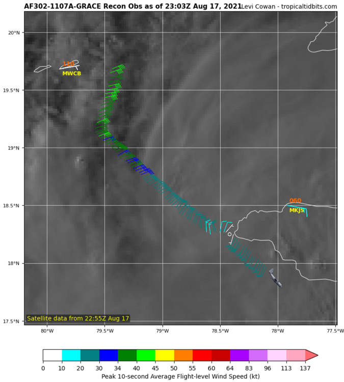
Grace's pressure is 992mb on the extrap just offshore of the Yucatan. Also considerably lower than the NHC current estimate of 999. Surface winds are stronger too with 55kts in the NE quad, where as the NHC has winds pegged at 45kts.
-
I regret opening this thread. Wowzers.
-
And indeed it is. Take a look at sondes 14-17.
-
Looks like grace took a bite of dry air over the last few hours.
-
Nicely stacked too.
-
1004 on the extrap. So mild strengthening occurred while grace transited Jamaica.
-
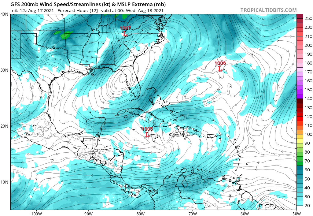
Nice poleward outflow channel developing too as seen on the GFS frame below. However, this may get impinged upon by that upper level ridge as soon as tomorrow. Will have to see how it evolves

-
Well the LLC is not where I thought it was going to be, and the system is *incredibly* isobaric. The large envelope is likely why there's such expansive thunderstorm activity. Bodes for a fairly resilient system if nothing else.
-
the center has relocated significantly to the south.
-
Grace is almost surely back to TS strength. With such a persistent convective complex(even if decoupled), I find it hard to imagine that there’s not sustained 35-40kt winds somewhere, especially since it was already basically there this morning.
-
Curious to see how Grace interacts with this lee cyclone off the tip of the Haitian peninsula. Genuinely not sure what this sort of interaction might entail.
-
better evacuate now
-
Starting to wonder with the current degree of disorganization if a passage south of the greater antilles is moving into the picture. 24hr trends on ensembles seem to suggest so. For this to become reality, would need to see grace continue to struggle into tomorrow. In either case, the earlier runs with a strengthening storm managing to avoid at least hispaniola/cuba to the north seem a bit less likely today and models have been correcting south as a result.
-
Wondering if there's some funny business on the OFB/western edge of the cold pool later. Especially as that boundary is now cooking under full sun. Could be an alternative play to wisconsin.
-
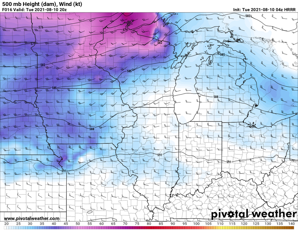
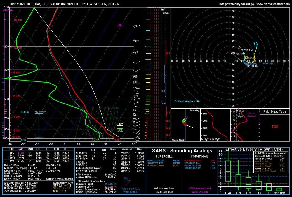
Agreed. Much like today, I don't think anyone can argue against the threat of widespread severe weather again tomorrow, especially as there is finally some respectable mid level flow. That, combined with a thermodynamic environment that is in many ways similar to today (perhaps slightly less extreme) should yield, at the very least, a threat for damaging winds in linear segments. The part I'm less confident on is how this evolves in the context of supercells. Effective shear should meet or exceed 40kts which is also a breath of fresh air, but there isn't really a ton of directional shear available as winds should be SSWly, even optimistically. Secondly, shear vectors off the boundary are.... not great at ~45 degrees or so. With both those things in mind, the way I see this working out from a supercell/tornado standpoint is for the modeled MCS on CAMs later tonight to throw a boundary and then chase wherever that boundary intersects with the cold front. I'm not sure there's enough directional shear or a high enough chance for a discrete supercell otherwise. Should note that the HRRR is again overmixing tomorrows dewpoints into the 60s along the boundaries, while consensus has dews near 80, so it can be tossed.
-
Storms taking shape nicely north of 20
-
The HRRR is trash. Look at the spreads it’s cranking out. 97/67? Lol nah. Let’s try 91/78. Based on obs, that’s where we’re heading
-
Just as today was obvious for tornadoes. Tomorrow is obvious for damaging winds. Perhaps significant. Cams vary widely on placement, but this setup has instability and low level lapse rates in excess and a conservative 25 kts of EBWD. That said, there has been a trend on the HRRR for a shortwave to round the base of the larger scale trough tomorrow and over spread the extremely unstable (5000 MLCAPE??) warm sector with 35-40kts of flow. If this scenario is realized, all bets are off.
-
Solid call on the 10. ez tornado day that was painfully obvious last night. Not at all surprised
-
I honestly didn't think LL SRH was that impressive(150 0-1, 300 0-3). What stuck out to me more was the excess of 0-3km CAPE/vort associated with that old MCV style feature. This, combined with sufficient SRH should yield opportunities for tornadoes even if storm mode was messy. I just think it will be difficult for longer lived mesocyclones to develop due to both storm interaction and poor EBWD somewhat capping potential of this event somewhat. As far as damaging winds, I think LRs are poor, but a few bowing segments near and after 00z could yield marginally severe gusts, so I think a 15 is good there too.
-
I think storm mode and sustenance concerns are enough to preclude an enhanced if you ask me. I think the 5 is fine
-
Ez tornadoes in IL tomorrow. Book it. I won’t be chasing though