Wurbus
-
Posts
666 -
Joined
-
Last visited
Content Type
Profiles
Blogs
Forums
American Weather
Media Demo
Store
Gallery
Everything posted by Wurbus
-
December 2020 Medium/Long Term Pattern Discussion.
Wurbus replied to John1122's topic in Tennessee Valley
That low just gets cutoff over Michigan and spins for days. If that happens, some of those totals in MI are going to be insane, especially with lake effect snow. -
December 2020 Medium/Long Term Pattern Discussion.
Wurbus replied to John1122's topic in Tennessee Valley
Euro has the Nov 30th/Dec 1st system cutting up through Nashville with some plateau/mountain love and flurries/light snow for most of East TN after it moves through. Looks to be chilly, regardless of precip. -
Fall/Winter Banter - Football, Basketball, Snowball?
Wurbus replied to John1122's topic in Tennessee Valley
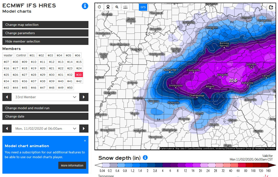
1st weenie run of the season!! Courtesy of EPS member #33. I actually thought this was rain at first because it was so big!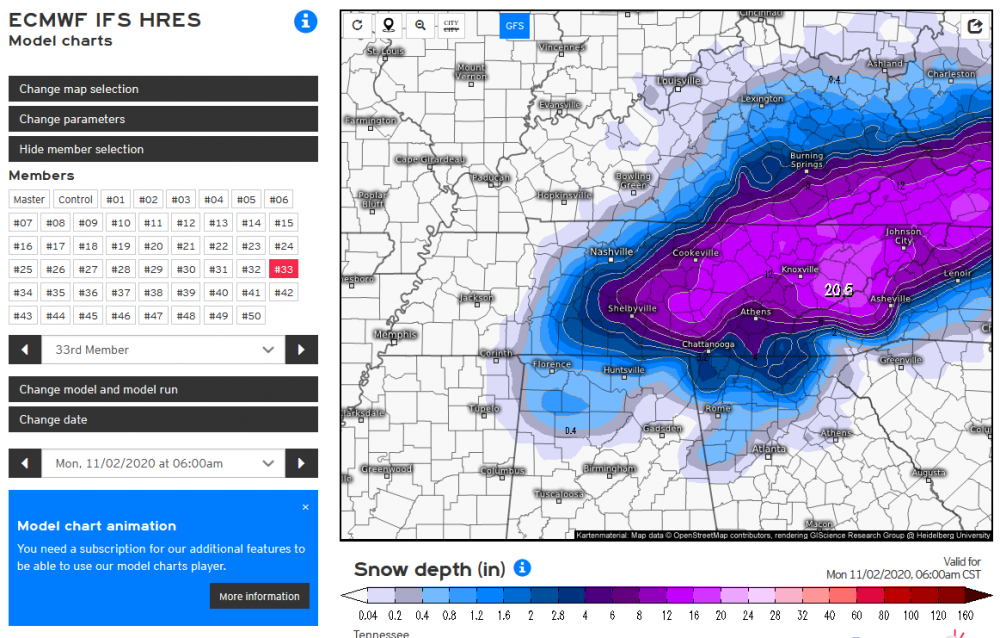
-
Not sure where to post this, but it is an interesting read on how forecast accuracy is down due to less flights because of COVID. https://www.cnn.com/2020/07/18/weather/fewer-flights-covid-weather-forecast-hurricane-impact/index.html
-
TYS actually tied the record low of 39 this morning.
-
Cole Sullivan, from WBIR, tweeted that there are still 77 people missing in Putnam county. This is awful news and I'm praying for everyone that was affected in these storms!
-
TN valley heavy rain/flooding week of whenever
Wurbus replied to janetjanet998's topic in Tennessee Valley
Close to 5 inches near Karns. I think February is the new monsoon season here in East TN. Hopefully the models back off some totals from next week's system as well. -
67 degrees and Knoxville is under a severe thunderstorm warning at 1am in late December..... pretty incredible.
-
TN valley heavy rain/flooding week of whenever
Wurbus replied to janetjanet998's topic in Tennessee Valley
Latest GFS brings the fire hose right up the eastern valley again for the weekend system. The below image is a 24 hour total.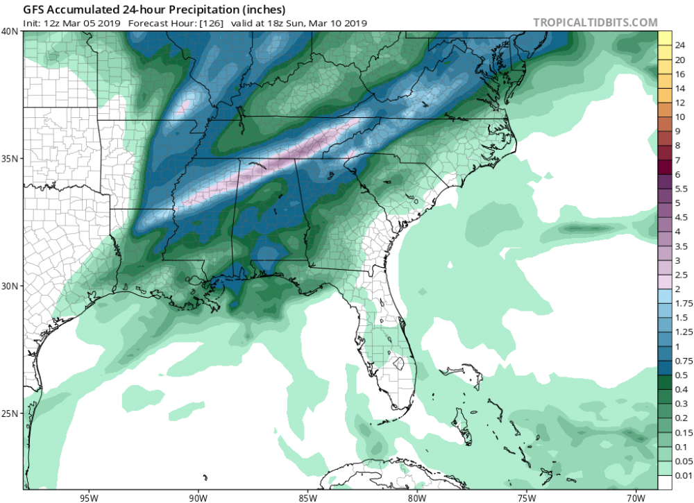
-
TN valley heavy rain/flooding week of whenever
Wurbus replied to janetjanet998's topic in Tennessee Valley
Rock slide on I40 at MM 7.5 on the NC side. 40 is closed in both directions. I havent seen any other details on how long the cleanup will take. -
I think if you change the toggle on TT from "MSLP & Precip (Rain/Frozen)" to "Radar (Rain/Frozen)" you can see the radar on the FV3 out to 210.
-
On the main run of the RGEM the high over Iowa is at 1038 at the end of the run. There is a 1042 high, but that is sitting over Idaho.
-
It was mentioned in the Tennessee Valley thread the other day, but the TT formula is off for the FV3. If you compare the snow total map to other sites it is significantly increased on TT for some reason.