Wurbus
-
Posts
666 -
Joined
-
Last visited
Content Type
Profiles
Blogs
Forums
American Weather
Media Demo
Store
Gallery
Everything posted by Wurbus
-
GFS was a mess. Mostly cold rain for everyone while the low meandered around TN for 24 hours while transferring to the coast. Extreme NE TN is about the only winners around here.
-
Lots of big DAWGS (GA fan, couldn't resist) on there for someone. Should be an interesting week ahead of us again!
-
Best I could do while working. Euro rolling
-
Would have been perfect if that pesky warm nose would stay out of the valley! Would be nice to have 1 system to not worry about the warm nose.
-
I went from a dusting to about 1/2 inch after that band went through Knoxville. We should start a petition for MRX to just issue special weather statements and no WWA or WSW.
-
Been insanely busy with work today, but quick update from my location between Karns & Cedar Bluff. I have stayed all snow since it started around 1. We had a heavy burst of now for about 15 minutes earlier that turned the grass white. Then it stopped for about 10 minutes and has been a flurry/light snow since about 2pm.
-
Maybe it is confusing total QPF with Snow accumulation!
-
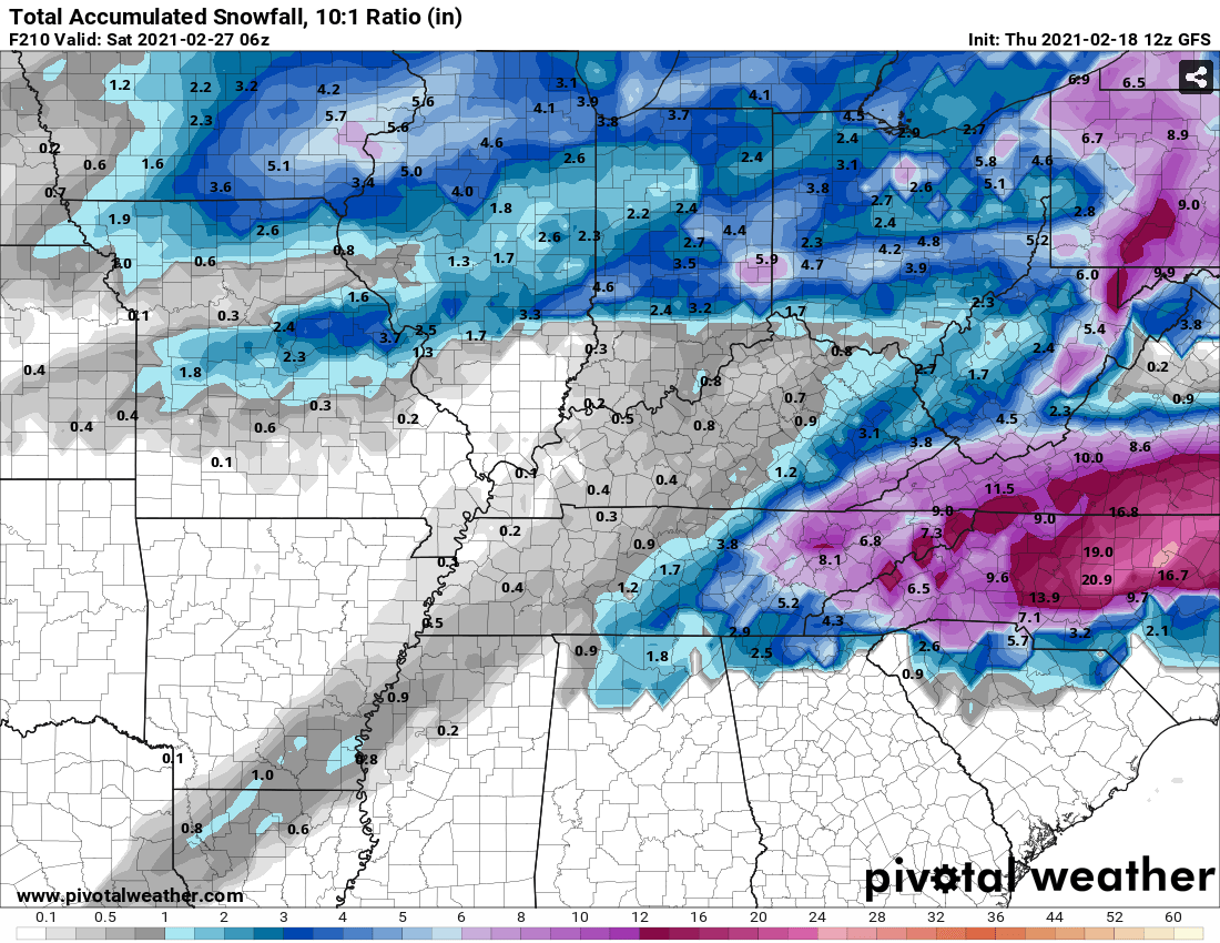
I remember a couple February's ago when this happened with rain and Knoxville got 5+ inches of rain, but can't remember this ever happening with snow. If this happens, great for mby, but hopefully we all score on this one!
-
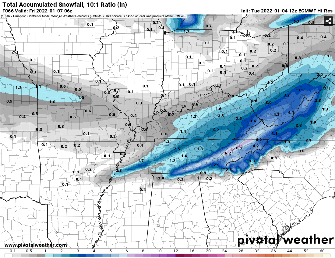
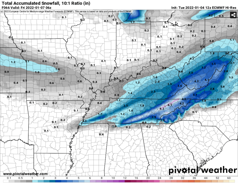
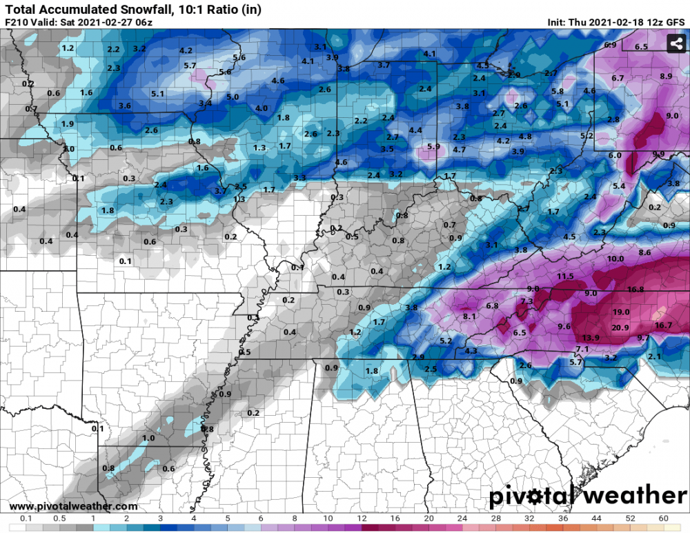
Never seen KNX get the most snow before, but Euro just hammers the greater valley.
-
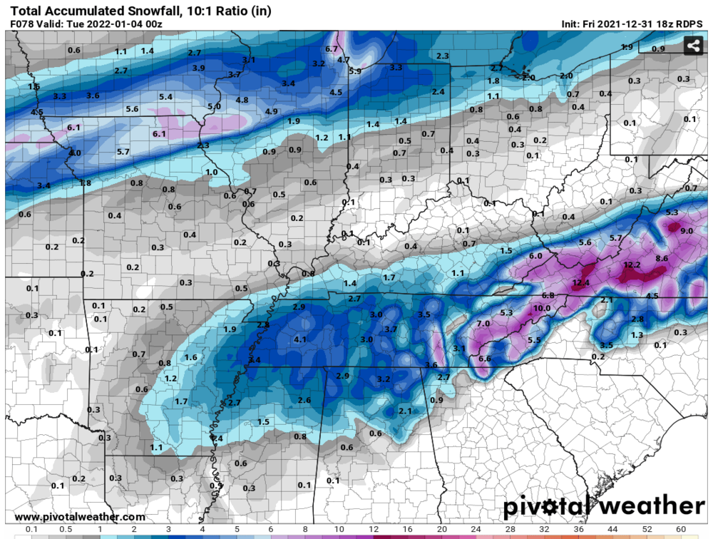
Not sure why Pivotal is running so slow for the GFS, but below is the TT snowfall map for the event.
-
I wound up with about 2 inches on the deck. Road was slushy and lightly covered earlier, but has mostly melted once it tapered off. Still enough to cause a tree to fall somewhere in the neighborhood and shook the house this morning.
-
Mostly snow with some mixing issues now. Deck is starting to get white.
-
Finally just started mixing with sleet where I'm at in Knoxville.
-
Wind is howling and I hear the rain beating against the windows near Cedar Bluff/Karns. If it switches over soon, and we get pasted, I could see a lot of power outages with trees falling in this wind.
-
Those rates on the GFS....
-
No one has mentioned it, but just looked at the UKMet on Pivotal and it has basically no snow accumulation outside of the mountains. However, it was more amped with the 2nd system later in the week. Definitely an outlier compared to the other models, but wanted to mention it.
-
HRRR was the same way. Hopefully, this isn't a trend for the rest of the models.
-
18z RGEM brought it! Nice increase forum wide, besides those 2 pesky snow holes.
-
Plumes had an uptick from 9z to 15z across most Eastern area's. Knoxville only had 1 plume above 4 inches and now has 6 over 4 inches.
-
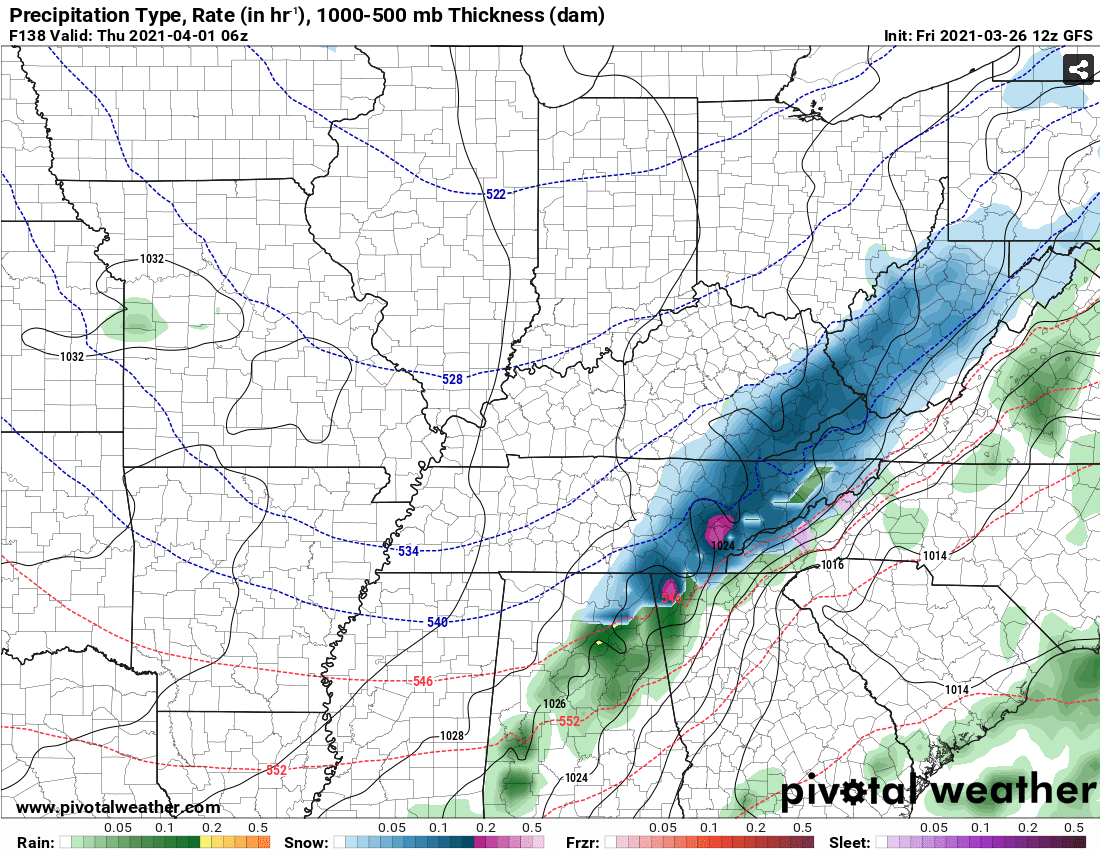
GFS is playing an April Fools joke

-
TN valley heavy rain/flooding week of whenever
Wurbus replied to janetjanet998's topic in Tennessee Valley
12z models still look on track for 3-6 inches of rain over the next few days. I just had a bunch of water drainage issues fixed around my house a few weeks ago, so this should be a good test for all that work. -
Fall/Winter Banter - Football, Basketball, Snowball?
Wurbus replied to John1122's topic in Tennessee Valley
Weird thing I noticed on the GFS was the snow depth. It shows 8 inches of snow falling in KNX, but a snow depth of less than an inch. I would think IF that much actually fell, we would have at least a couple inches on grassy surfaces. Maybe it is actually showing road snow depth! -
The elusive "It's a week away" storm. Para has it as well, but it is more north and hammers mid-northern KY. CMC is a completely different solution and has the storm in the Midwest.
-
Finally seeing some precipitation near Karns area. Looks like it is mostly sleet with some snow mixed in at the moment.