Wurbus
-
Posts
666 -
Joined
-
Last visited
Content Type
Profiles
Blogs
Forums
American Weather
Media Demo
Store
Gallery
Everything posted by Wurbus
-
Getting some very fine light flurries here in Knoxville at the moment.
-
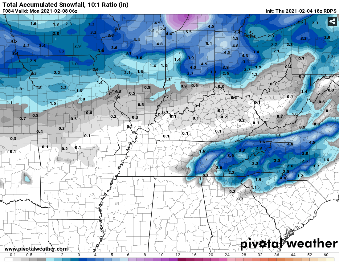
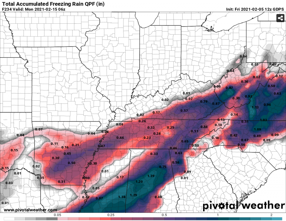
Mostly rain for the 1st system in East TN after the initial onset of FRZ. Middle/West TN still gets in on all the "fun". 2nd system shifted east some, but still all rain for most of middle TN and all of East TN. West TN still has snow/sloppy mess with some backside snow for west/mid TN.
-
FRZ/Sleet across the whole state by 96 except for extreme east TN. Looks like FRZ for Knoxville as well sitting at 32 degrees. We will see if the big chunk of precip comes in as rain or not here in a few.
-
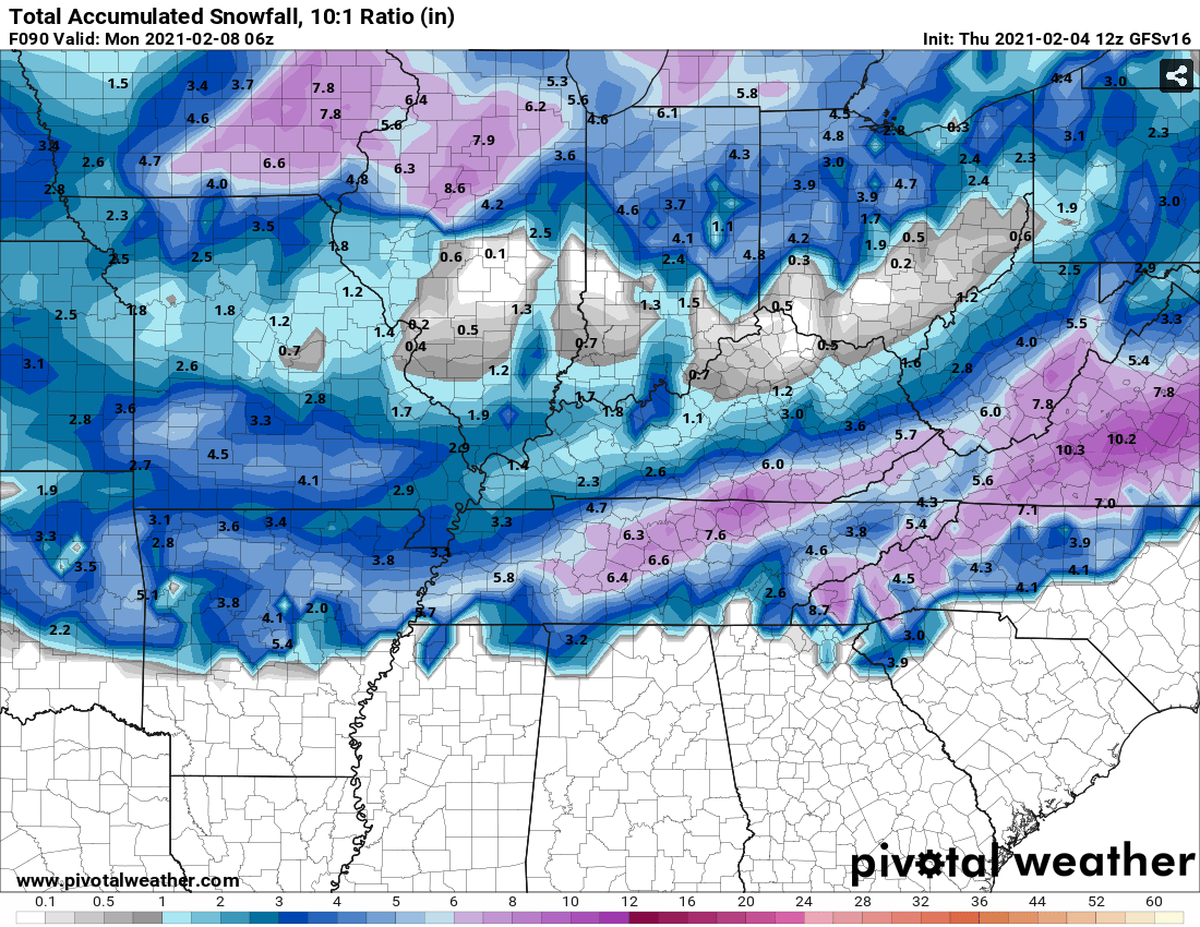
GFS about 4 degrees warmer across the board through 84 compared to 06z.
-
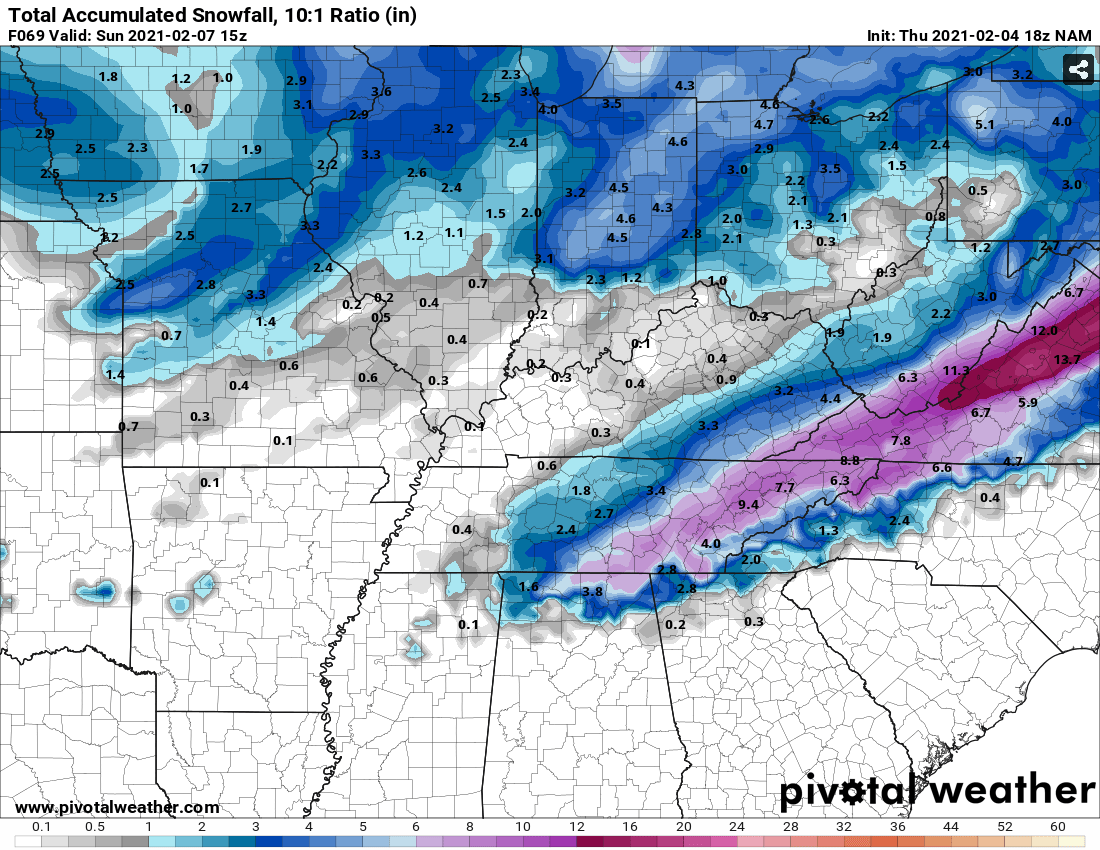
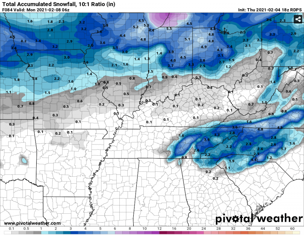
There is a 2nd storm nailing Memphis with snow late next weekend as well. Memphis is going to look like the North Pole if those verify.
-
That is a warm nose from hell. I'm not sure I've ever seen one go all the way up into Ohio
-
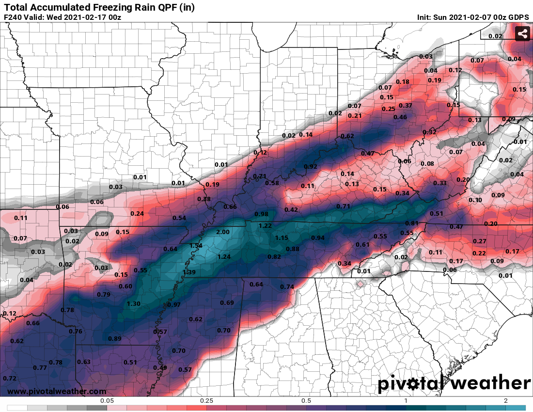
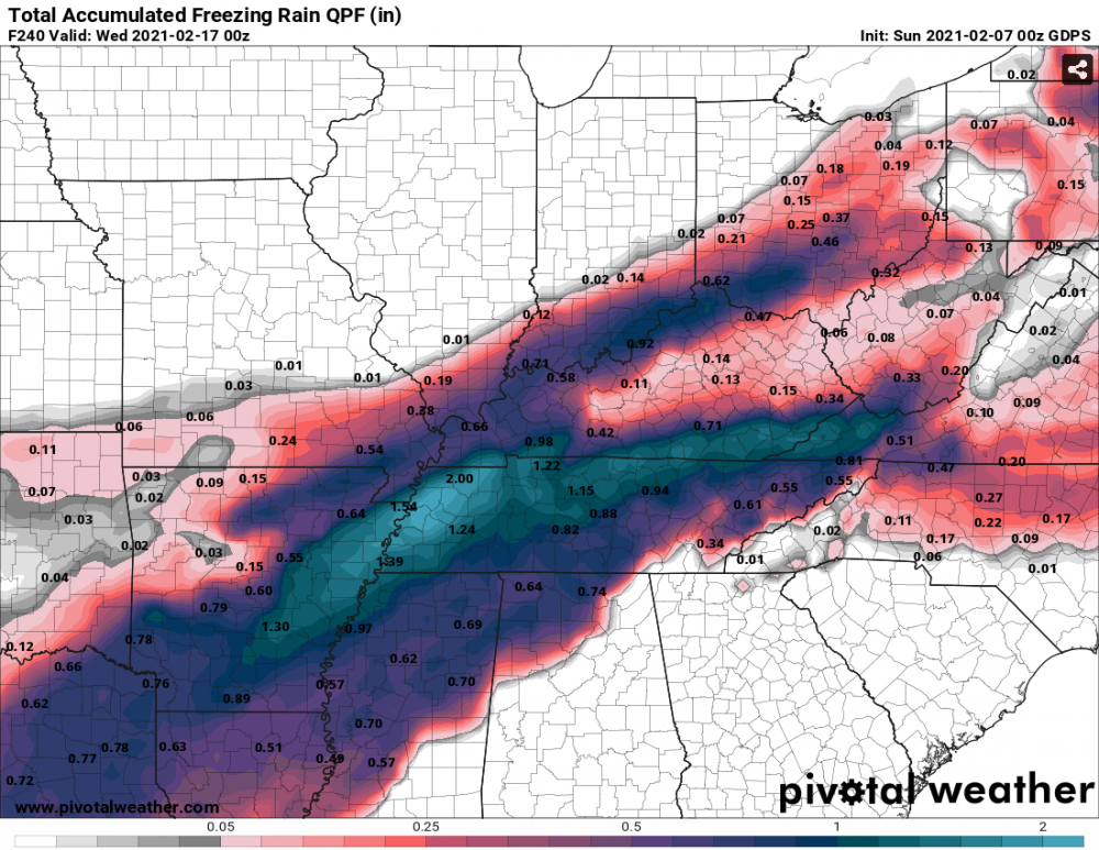
CMC just killed the power across all of TN again.There is still freezing rain coming down in west/middle TN at 240!
-
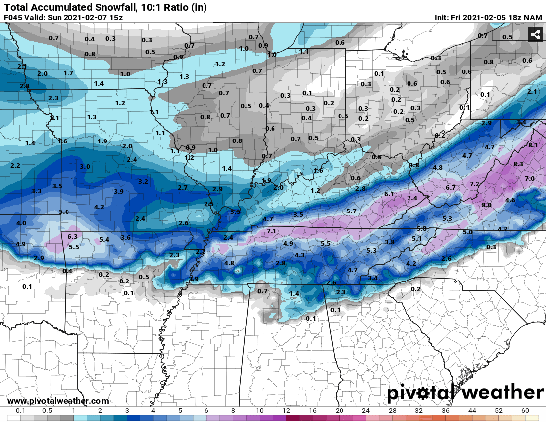
NAM still showing pretty good snow. Looks like an initial thump, and then some backside snow.

-
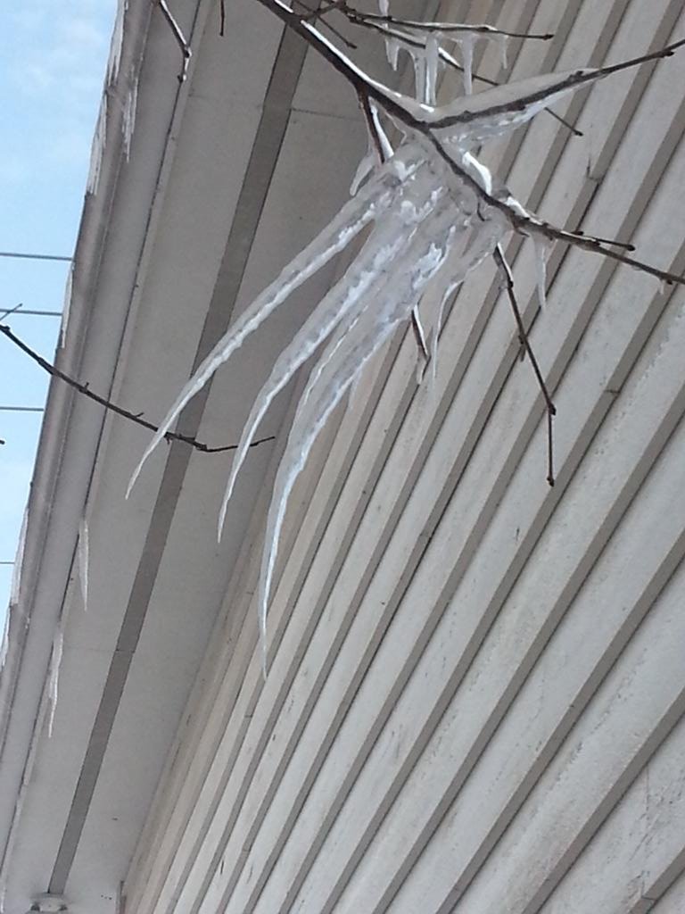
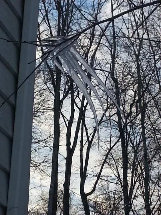
If the upcoming potential ice storm does happen, it reminds me a lot of the storm we had back in Feb 2015, at least IMBY. We had ice and snow, followed by very cold weather and it hung around for awhile. Now the one being modeled on the CMC is much worse. Also, I had an ice, wolverine claw form over several days next to my house back then.

-
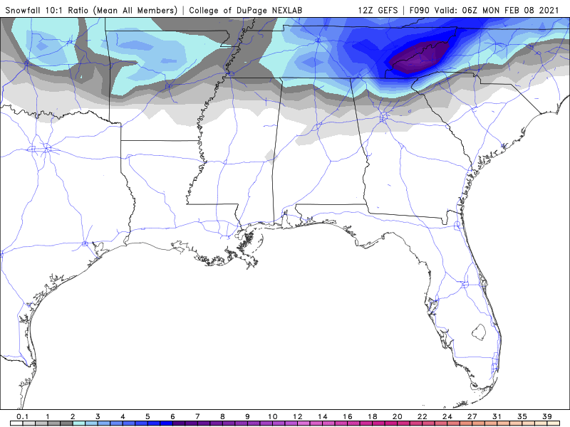
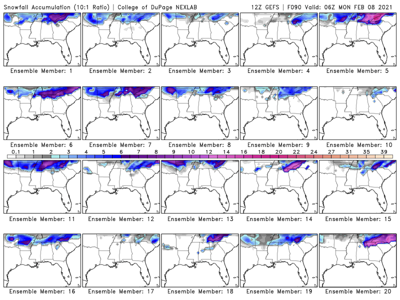
Lots of pick and purple on the GEFS members as well toward the end of next week, so definitely a lot of support for a lot of ice for someone in the forum area.
-
Luckily, we still have a ways to go and watching each model run feels like the ups and downs of a basketball game. Euro had all the ice in south Georgia and SC on last night's run, so we will see where it goes on this upcoming run.
-
Single digit and teens for temps as well afterward. That ice won't be melting anytime soon.
-
Icepocalypse. Nearly the whole state gets involved over the run!
-
Nice color coded chart of East/Middle/West TN
-
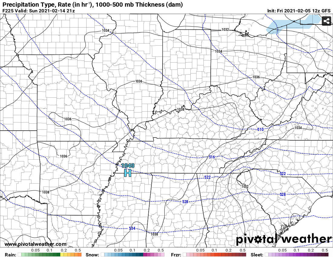
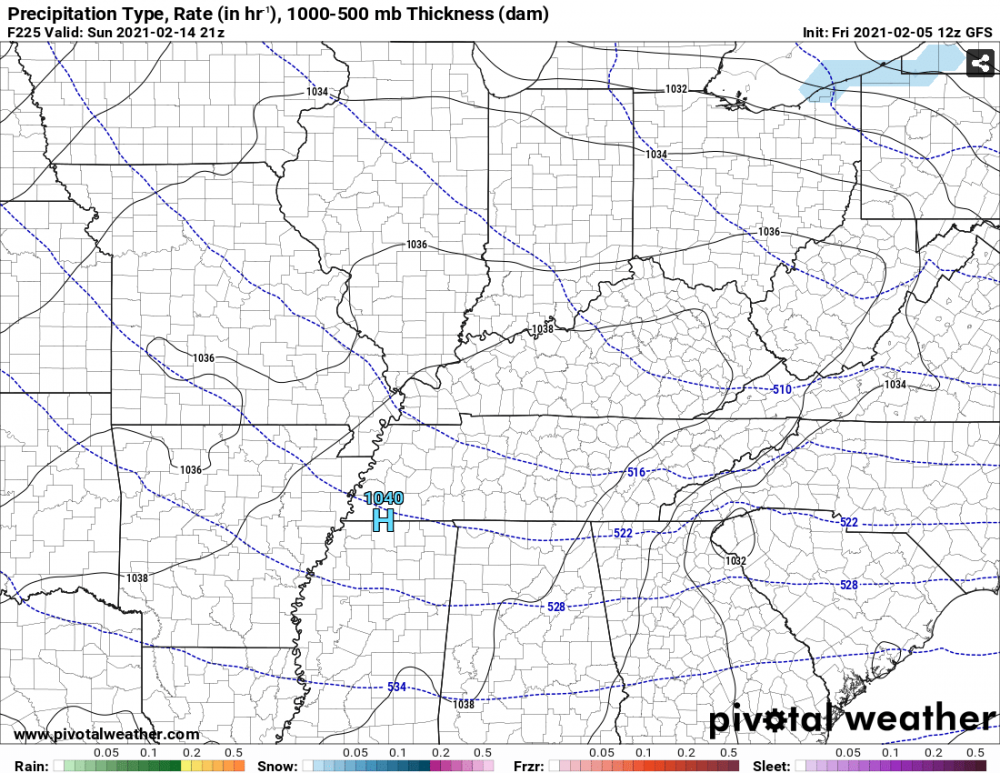
Y You don't see a 1040 HP sitting over Memphis everyday.....
-
It is no joke. Just looking at Knoxville, we are in the single digits and negatives for 30+ hours. Nashville was pushing 40 hours.
-
Yeah, looks like it could possibly be single digit highs and lows in the negatives for much of the region!
-
Those ice maps have to be beyond epic in Georgia. Looks like ice for 36+ hours in some spots.
-
Euro more suppressed and colder toward next weekends 1st storm. Not as amped. 2nd storm appears to have more energy and hass one hell of an ice storm in south Georgia. Starts at 204 and is still going at 222. Some moisture is starting to reach TN by 216. I don't have any ice maps, but I'm sure it would be devastating in that area. East TN does get some snow toward the end of the run from the 2nd system. Probably 3-6 inches for all of East TN.
-
-
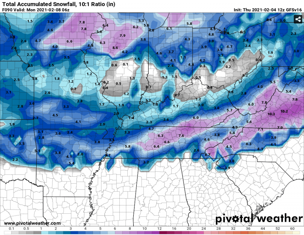
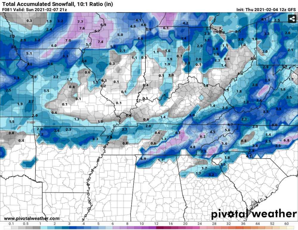
Another good Nam'ing. Looks to start Saturday evening, so the timing should be good.

-
Most GEFS Members are on board with something as well.
-
Looks like CMC precip shield is a bit more north compared to 00z, but the moisture still doesn't reach the TN valley. Fascinating to see these 2 different camps right now on each run. I think Carvers mentioned a few days ago that the phasing was just hours apart and I think that is what we are seeing with these model runs.
-
Para-GFS GFS
-
RGEM says what weekend storm?