

Eskimo Joe
-
Posts
24,697 -
Joined
-
Last visited
Content Type
Profiles
Blogs
Forums
American Weather
Media Demo
Store
Gallery
Everything posted by Eskimo Joe
-
-
The worst part is that it's gonna rake New England. Oy.
-
Watching this slide just east of us is utterly maddening.
-
Looks like that heavy rain from Mason-Dixon on north wasn't picked up by any of the short term guidance.
-
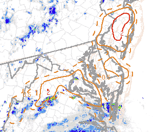
Tornado Watch coming out for lower Maryland and parts of Delmarva. You can see why...on SPC meso analysis shows decent non-supercell tornado risk. You can find this on the mesoanalysis page under 'Composite Indices' then click on the 8th option.
-
-
Unless I'm misreading the METAR, CHO appears to have gusted to 44 mph with that leading band.
-
Nice rogue cell near the Charles/Prince Georges County border.
-
Outside of a lucky few who have elevation, we really don't do well with winter here anymore.
-
This is totally not a weenie post, but so far there's some decent stuff firing over the I-81 corridor and there's several tornado warnings in NE North Carolina. I wonder if the western edge of the precip shield ends up being a tad further west and more robust than what the globals are showing.
-
Some of the meso/hurricane guidance still depicts a favorable setup for quick spin up tornadoes across Delmarva and lower Southern Maryland tonight.
-
Next week, big ole' 594dm ridge sets up. Yes please.
-
12z Fri, 995mb off ACY.
-
Through HR24, the 12z Euro appears to be west of it's 00z run. Next frame we'll know for sure.
-
NHC issues Tropical Storm Watch for: Calvert, Caroline, Dorchester, Inland Worcester, Maryland Beaches, Queen Anne's, Somerset, St. Mary's, Talbot, Wicomico.
-
-

2021 Atlantic Hurricane Season Tracking Thread
Eskimo Joe replied to WxWatcher007's topic in Mid Atlantic
This is what, the 3rd consecutive year where we missed tropical action? Terrible place to live. -
2021 Atlantic Hurricane Season Tracking Thread
Eskimo Joe replied to WxWatcher007's topic in Mid Atlantic
Euro and NAM are true heart breakers for I-95 and points west. -
Agreed. This area has the dullest weather.
-
-
Even though Elsa looks ragged on satellite and radar, it's a gulf storm. We've seen time and time again where storms go into the gulf bathwater and either spin up or can fight off relatively hostile conditions.
-
Just expect a disaster and be happy with what you get.
-
Looks like it may have nudged NW a bit since 18z?


