StormchaserChuck!
-
Posts
2,274 -
Joined
-
Last visited
Content Type
Profiles
Blogs
Forums
American Weather
Media Demo
Store
Gallery
Everything posted by StormchaserChuck!
-

February Medium/Long Range Discussion
StormchaserChuck! replied to snowmagnet's topic in Mid Atlantic
Pattern is opening up, based around general global warming (land/sea) trough becomes N.A. centered.. same stuff as '16 on. We need low pressure and anomalous low pressure for snowstorms, unless there is a volcano eruption or something that year. -
February Medium/Long Range Discussion
StormchaserChuck! replied to snowmagnet's topic in Mid Atlantic
I don't see any snowstorms coming, Pattern will revolve around event/noevent and it's dry. -
2020 vs 2021
StormchaserChuck! replied to StormchaserChuck!'s topic in Weather Forecasting and Discussion

-
2021-2022 ENSO
StormchaserChuck! replied to StormchaserChuck!'s topic in Weather Forecasting and Discussion
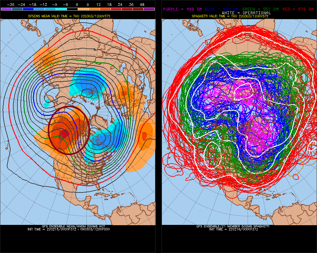
I had a -PNA signal in March. The same thing was November, where it was based on SSTs, and PDO stuff, roll-forward (-PNA), we know that Nov turned out like this^, but then December blasted -PNA, maybe we'll see that -PNA again in April? A -PNA April would be against a developing El Nino (subsurface warming), but based on what we saw last year it may just be a -wave in an otherwise +ENSO trend. (I think La Nina will be gone completely in 1-2 months.)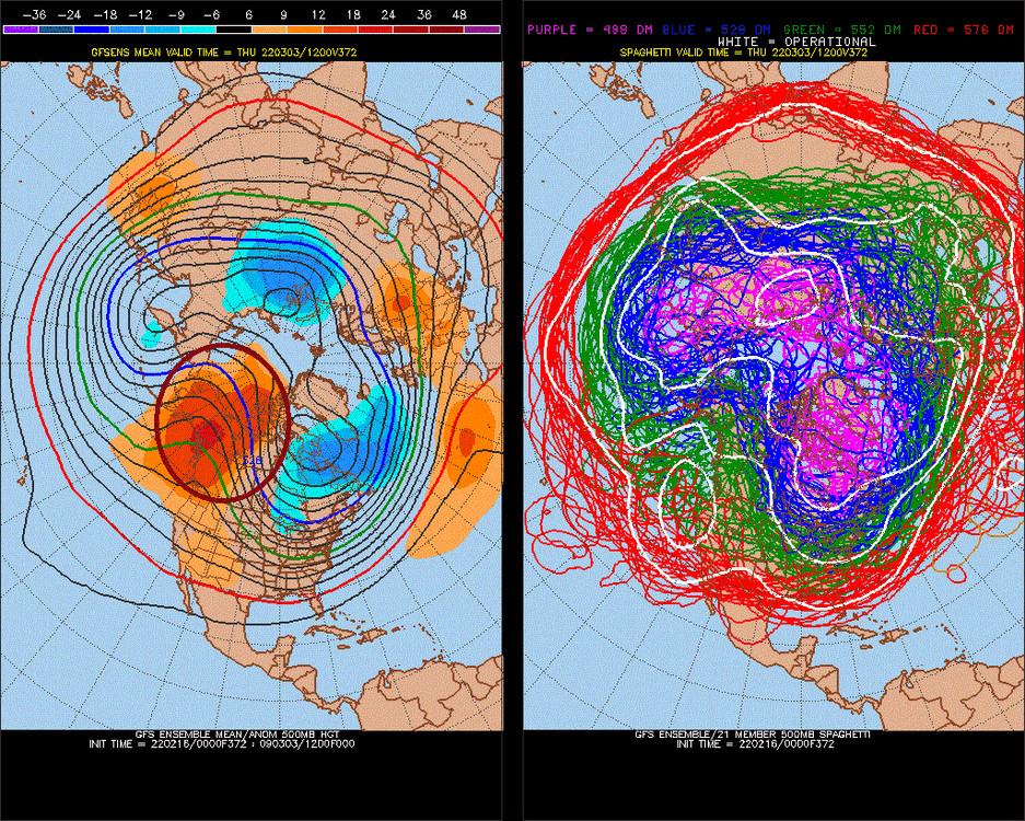
-
February Medium/Long Range Discussion
StormchaserChuck! replied to snowmagnet's topic in Mid Atlantic
I had a -PNA signal in March. The same thing was November, where it was based on SSTs, and PDO stuff, roll-forward (-PNA), we know that Nov turned out like this^, but then December blasted -PNA, maybe we'll see that -PNA again in April?
-
2021-2022 ENSO
StormchaserChuck! replied to StormchaserChuck!'s topic in Weather Forecasting and Discussion
Starting to think it would be more of a Weak event
-
^much more fun
-
February Medium/Long Range Discussion
StormchaserChuck! replied to snowmagnet's topic in Mid Atlantic
A little too much models changing for the now. -
14 degrees this morning, 16F now. snow was fluffy and teens yesterday.
-
15 lasers of crickets/birds from 200'+ away (now) right in the face <7gaps/skips3rd edit(after post, this has been ongoing).
-
There are just people/energy systems that track/separate like crazy. Like I said, it's not hard to map up scenarios, knowing everyone's mind.
-
February Medium/Long Range Discussion
StormchaserChuck! replied to snowmagnet's topic in Mid Atlantic
NWS scares me a little with the warning system. Doesn't everyone have access to these? -
Thanks, it's like gangster activity, being attached onto a gang. The taxpayer government can't handle military satellites or they just don't want to.. I'm more of a believer in letting things go or play out. It has to be bad information somewhere. Can't stop the satellites from watching you, but this sucks.
-
February Medium/Long Range Discussion
StormchaserChuck! replied to snowmagnet's topic in Mid Atlantic
Look how fast we transition.. 19F Now Pacific ridge/High pressure Wow, the whole Pacific is ridging. -
I thought that was temps.
-
February Medium/Long Range Discussion
StormchaserChuck! replied to snowmagnet's topic in Mid Atlantic
2nd burst of +NAO Feb 27 probably will try to be with -EPO/NE Pacific High vs west,-PNA(in trend).. -
February Medium/Long Range Discussion
StormchaserChuck! replied to snowmagnet's topic in Mid Atlantic
Actually we have a -AO for about 11 days, then it switches, graduation, east coast dominating. -
February Medium/Long Range Discussion
StormchaserChuck! replied to snowmagnet's topic in Mid Atlantic
I always thought established +NAO wouldn't insert itself quietly (without cold correlation) -
2021-2022 ENSO
StormchaserChuck! replied to StormchaserChuck!'s topic in Weather Forecasting and Discussion
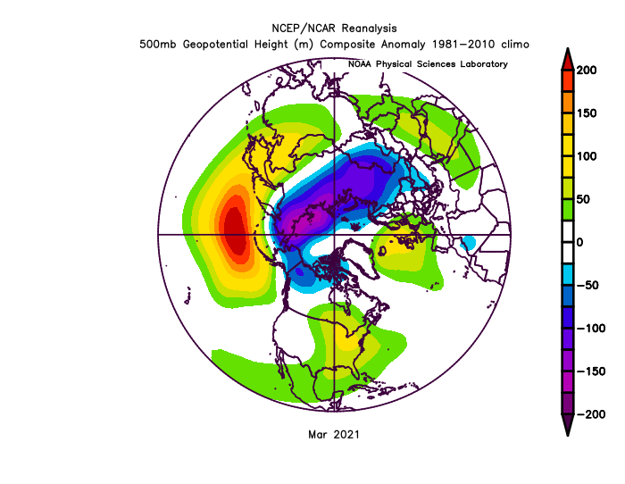
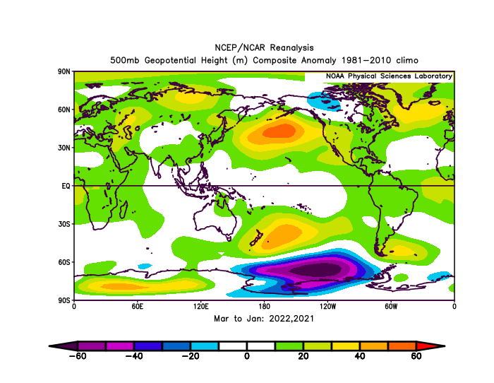
La Nina ridge has extended into the West Coast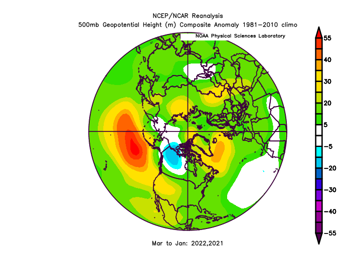
-
Yeah, 5 posts in 5 days. I've never had sex before, they keep hitting my computer with gb's of .exe's for anything expressive. because I met a guy named Quinn Eaker on 1-31-2013 and spok 8 words to him.
-
Occasional Thoughts on Climate Change
StormchaserChuck! replied to donsutherland1's topic in Climate Change
Next Winter will be year 7 of -PNA/reverse-El Nino. Makes you wonder about ENSO. -
Mid to Long Range Discussion ~ 2022
StormchaserChuck! replied to buckeyefan1's topic in Southeastern States
22-23, not good news guys if we flex -NAO next Winter it will be -PNA
-
Occasional Thoughts on Climate Change
StormchaserChuck! replied to donsutherland1's topic in Climate Change
Been tracking ENSO, it's gone into an anomaly warming with -PNA's, and actually more La Nina's. Didn't have to go that path. -
Nice!
-
Let's do March