StormchaserChuck!
-
Posts
2,274 -
Joined
-
Last visited
Content Type
Profiles
Blogs
Forums
American Weather
Media Demo
Store
Gallery
Everything posted by StormchaserChuck!
-
Yeah, the shark is getting speared. Ascending Solar Min, underperforming is hard to El Nino, 09-10 is a counter-example.
-

February Medium/Long Range Discussion
StormchaserChuck! replied to snowmagnet's topic in Mid Atlantic
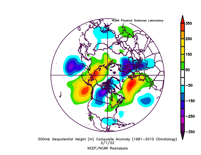
Nasty Pacific ridge with +NAO, model shows 2-3 SD below average temps, but it's not going to snow at all. -
2021-2022 ENSO
StormchaserChuck! replied to StormchaserChuck!'s topic in Weather Forecasting and Discussion
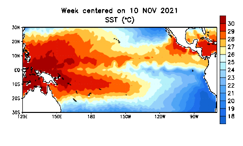
I keep saying it, we need a 2-3 year El Nino to even out. A strong El Nino, would in the 500mb pattern, be like 72-73 next Winter, alone. +2.8c-+3.0c> would be the only way we do that +PNA/GOA low like 97-98,etc. -
February Medium/Long Range Discussion
StormchaserChuck! replied to snowmagnet's topic in Mid Atlantic
+NAO is a strong pattern, lows rotate around it on the ensembles, this is a wetter than average pattern. -
February Medium/Long Range Discussion
StormchaserChuck! replied to snowmagnet's topic in Mid Atlantic
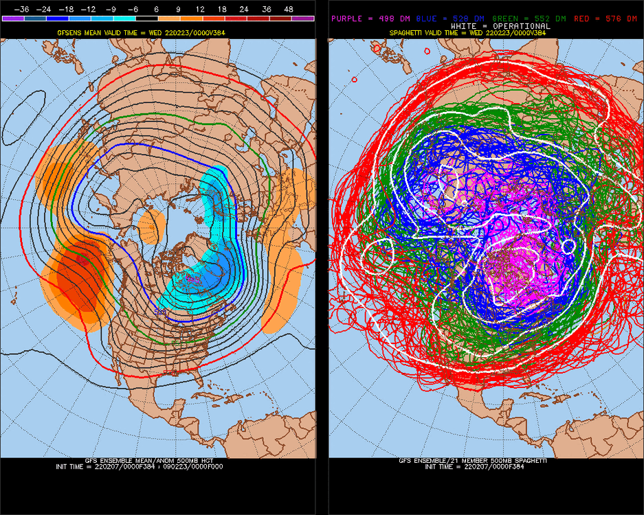
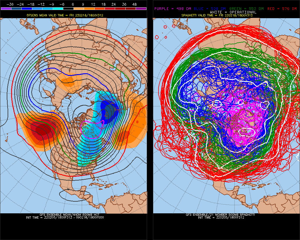
Yeah, this persistent +PNA Is really a force here. Notice how the +NAO maxes at 2SDs though. Then we have a window before next January-Feb23 is -PNA. -
February Medium/Long Range Discussion
StormchaserChuck! replied to snowmagnet's topic in Mid Atlantic
oh no!.thumb.gif.cbcbddd59bfae31a5c0bd6cb67d28697.gif)
-
Permafrost? Let's take down the satellites that look like stars. Broken me llamo. Scientific dimensions? It's all dream-like ontop of a reality.
-
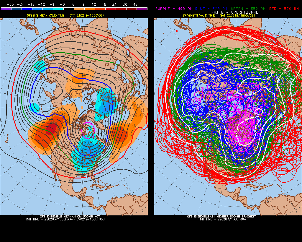
February Medium/Long Range Discussion
StormchaserChuck! replied to snowmagnet's topic in Mid Atlantic
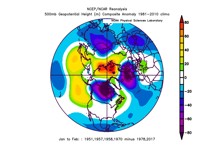
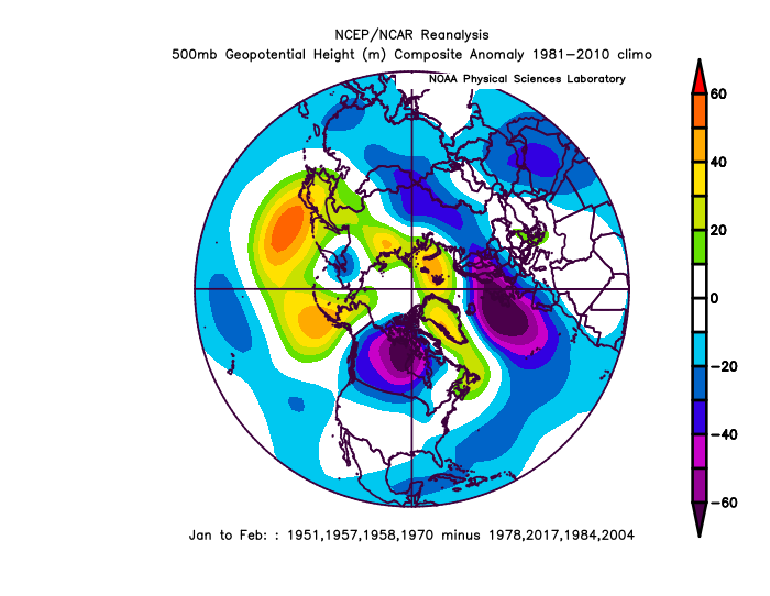
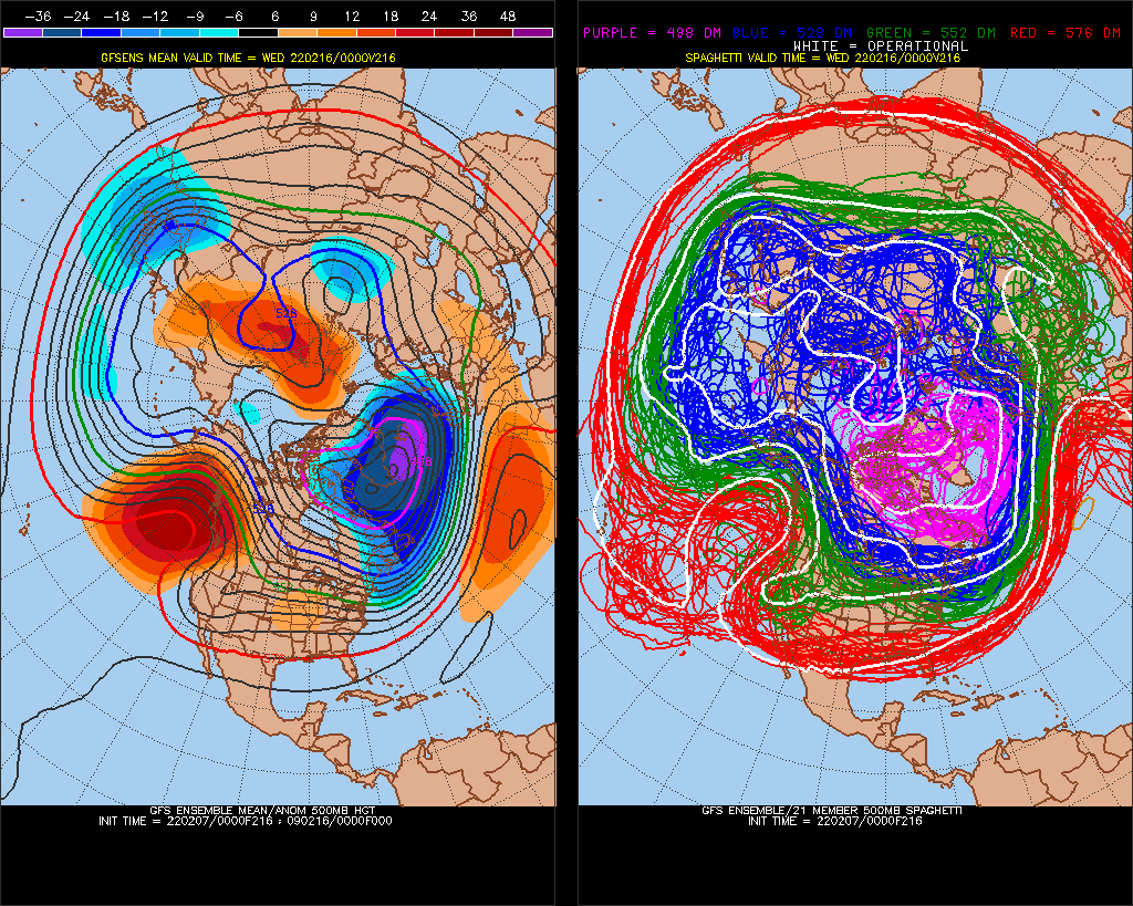
Extreme pattern here This is starting to show up the last 2 runs, -PNA-centered which we haven't had since December.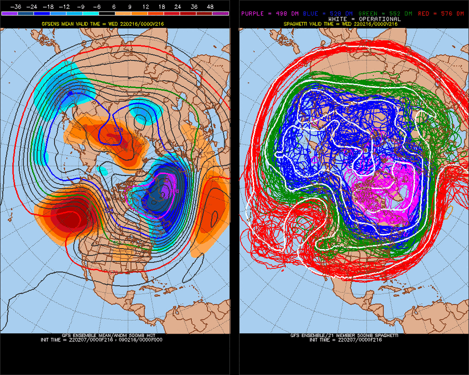
-
February Medium/Long Range Discussion
StormchaserChuck! replied to snowmagnet's topic in Mid Atlantic
medium range storm threat looks like the end of a La Nina Winter.. looks the same as 16-17, 17-18, 18-19, 19-20.. 20-21 -
2020 vs 2021
StormchaserChuck! replied to StormchaserChuck!'s topic in Weather Forecasting and Discussion
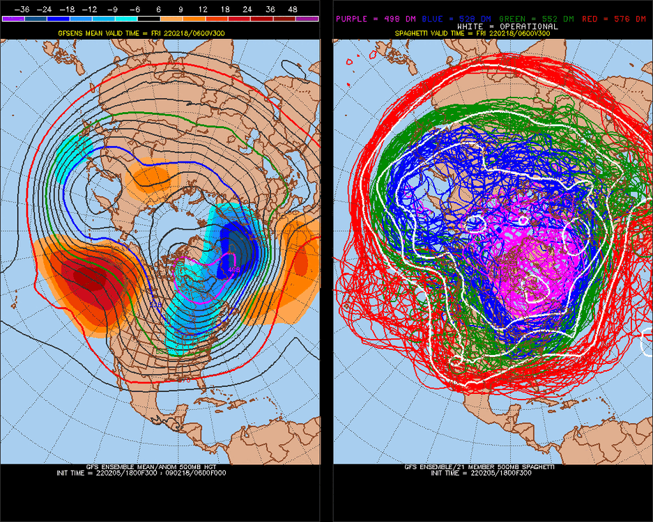
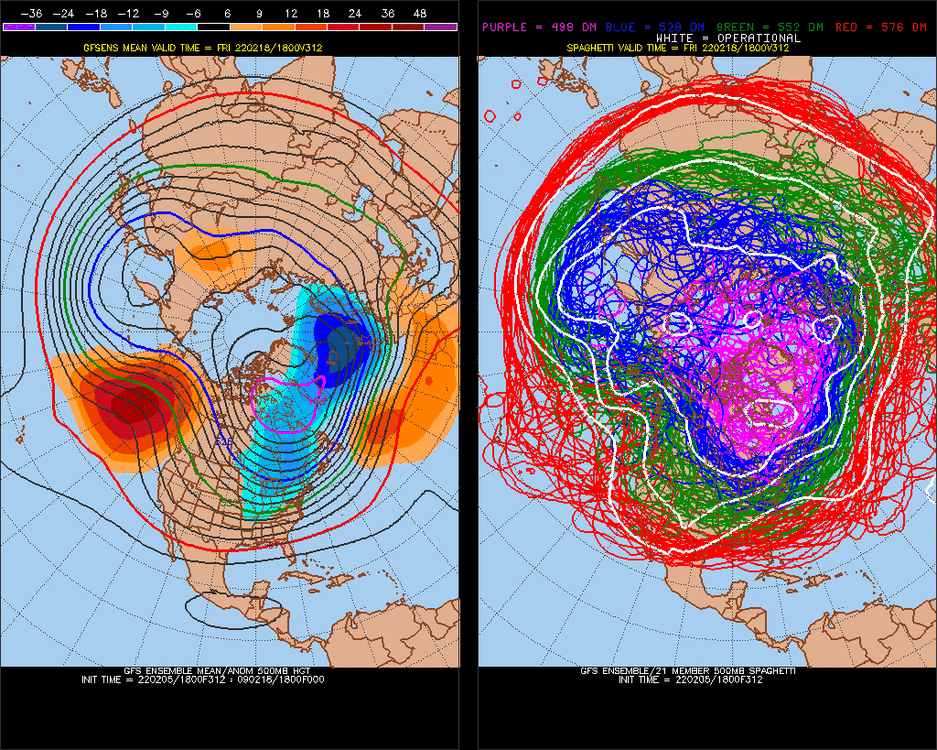
Not really going to verify at 384hr either(-PNA).thumb.gif.e3957b9d13495ee2d91b166daed8f862.gif)
-
2021-2022 ENSO
StormchaserChuck! replied to StormchaserChuck!'s topic in Weather Forecasting and Discussion
We'll do at best Moderate El Nino. I don't even know if it will be El Nino at all because of rising/ascending solar phase underperforming historically favors La Nina. April-May may see a blip in Nino 3,3.4 to +0.3/+0.4 something like that. If there is an El Nino wave it will happen in August.. 09-10 might be a good analog for next Winter, although it was an awkward Winter. -
2021-2022 ENSO
StormchaserChuck! replied to StormchaserChuck!'s topic in Weather Forecasting and Discussion
Well, there goes Strong El Nino chances for this year. Same rebuilding/cooling of the central subsurface.gif.b8fe8ee3619c3e4614dbab193395def8.gif)
-
February Medium/Long Range Discussion
StormchaserChuck! replied to snowmagnet's topic in Mid Atlantic
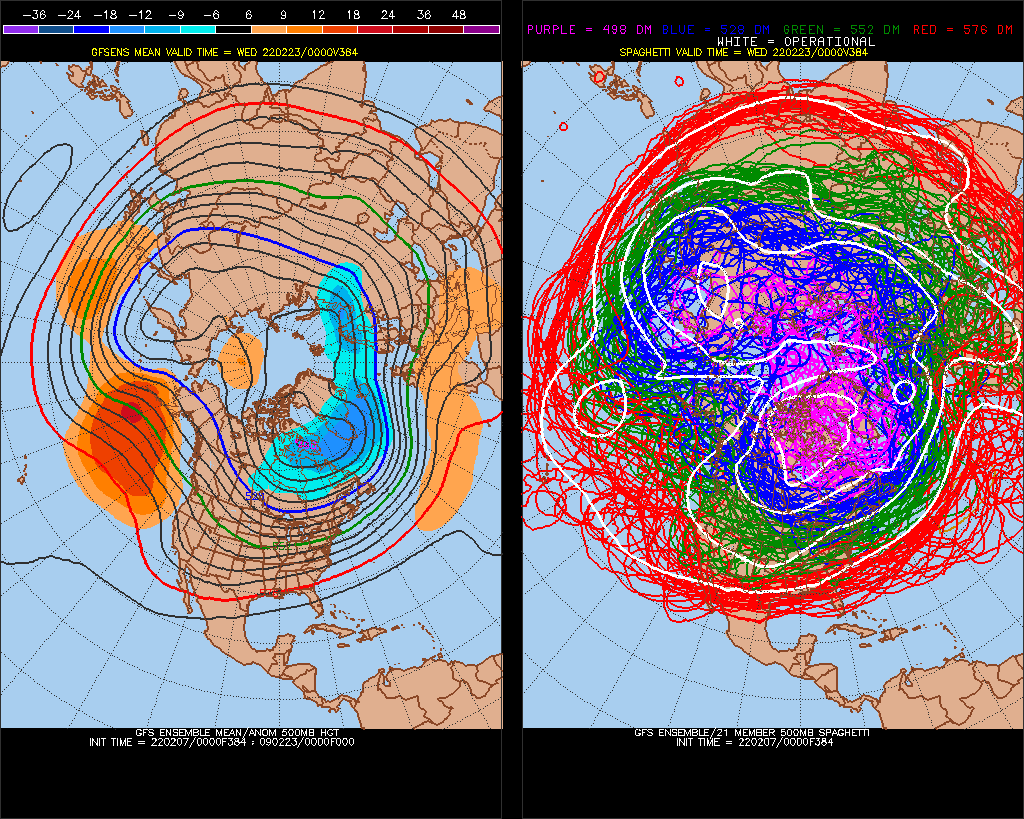
-PNA might not build as strong, but I'm excited for a good, healthy +NAO.. can't see it happening now with +PNA after 2 straight. maybe the whole modeled pattern will be wrong, or main indexes change. -
February Medium/Long Range Discussion
StormchaserChuck! replied to snowmagnet's topic in Mid Atlantic
Yeah, we had some good -NAOs build early in the season but it didn't last. I was noticing how 22 straight -NAO's, the mean for them was a + departure anyway. -
2020 vs 2021
StormchaserChuck! replied to StormchaserChuck!'s topic in Weather Forecasting and Discussion
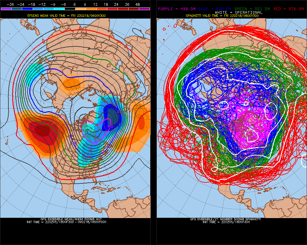
Expect this -PNA ridge to withdraw a little bit in future model runs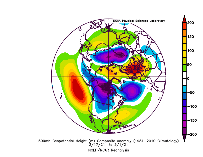
-
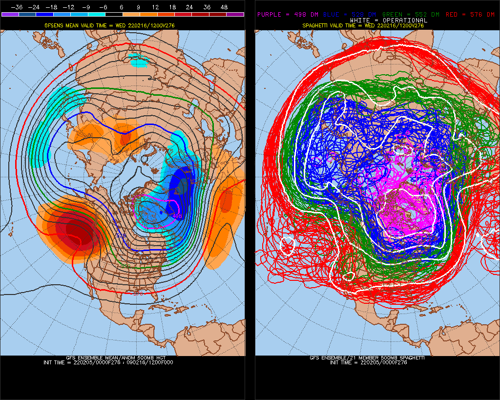
February Medium/Long Range Discussion
StormchaserChuck! replied to snowmagnet's topic in Mid Atlantic
We haven't had a +NAO in a while.. it might overperform -
February Medium/Long Range Discussion
StormchaserChuck! replied to snowmagnet's topic in Mid Atlantic
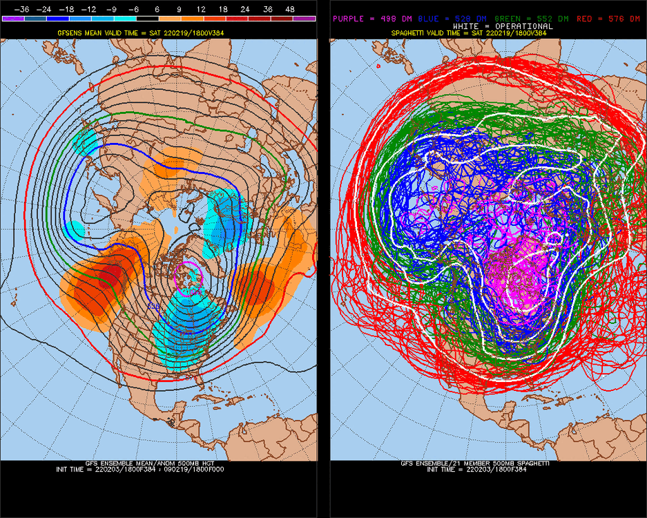
No chance of snow until March 1 probably.. 2SD +NAO here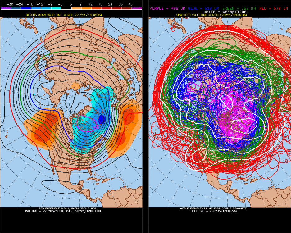
-
February Medium/Long Range Discussion
StormchaserChuck! replied to snowmagnet's topic in Mid Atlantic
Not really any chance for anything for a while here. This is really bad. +NAO/+EPO moving in tomorrow overperforms, then we flirt with 60s down the road it looks like..thumb.gif.8a2d9898d430374d51268646f2891c27.gif)
-
February Medium/Long Range Discussion
StormchaserChuck! replied to snowmagnet's topic in Mid Atlantic
-PNA crreeps upward next Winter same stuff -NAO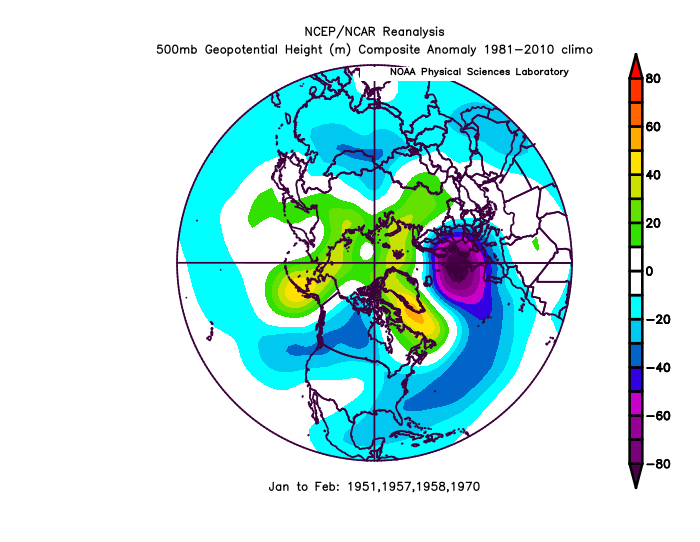
-
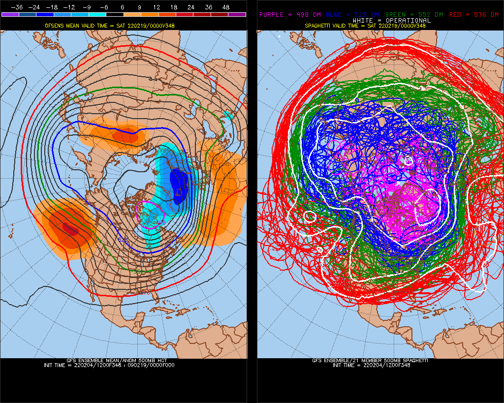
February Medium/Long Range Discussion
StormchaserChuck! replied to snowmagnet's topic in Mid Atlantic
Powerful +NAO here.. Im interested in seeing where we go after this.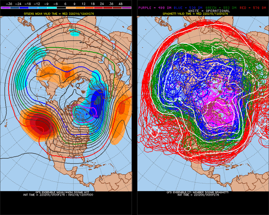
-
February Medium/Long Range Discussion
StormchaserChuck! replied to snowmagnet's topic in Mid Atlantic
+AO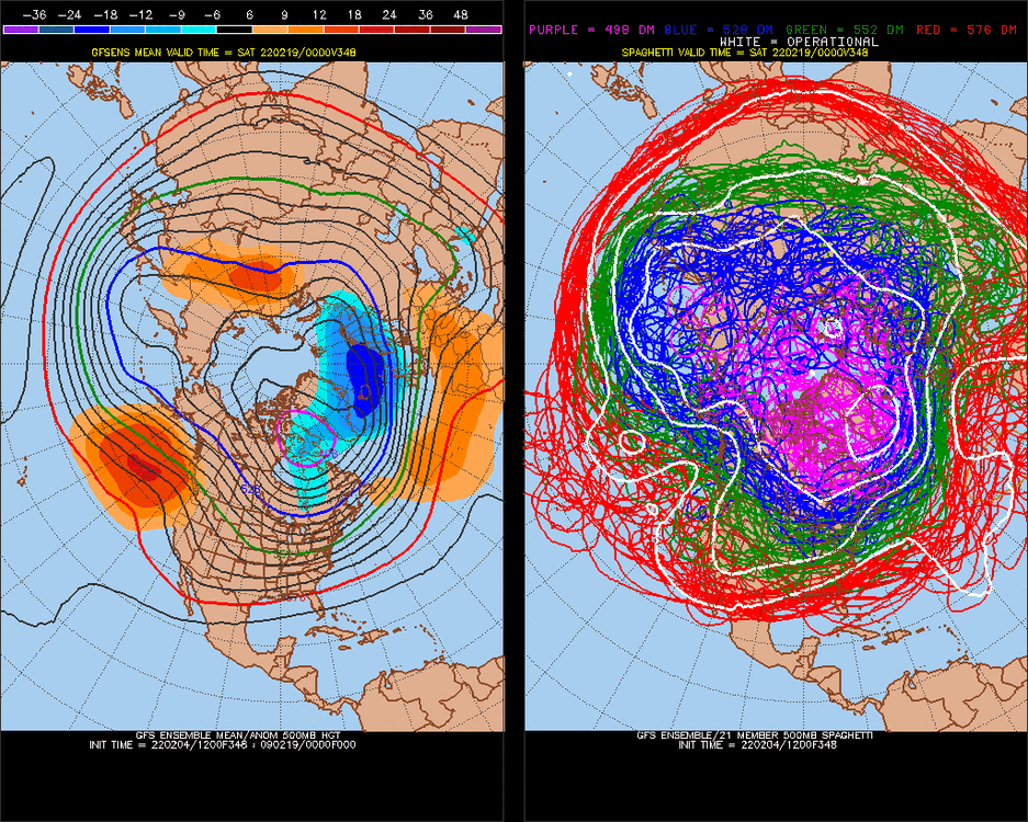
-
2021-2022 ENSO
StormchaserChuck! replied to StormchaserChuck!'s topic in Weather Forecasting and Discussion
This will be it for La Nina for a little while
-
February Medium/Long Range Discussion
StormchaserChuck! replied to snowmagnet's topic in Mid Atlantic
I'll make a deak with you , no more Euro eps -
February Medium/Long Range Discussion
StormchaserChuck! replied to snowmagnet's topic in Mid Atlantic
-
February Medium/Long Range Discussion
StormchaserChuck! replied to snowmagnet's topic in Mid Atlantic
We are kind of a dry pattern, because there is big +NPH/NOI to be evened out in March by -NOI.. keeps us dry.

.gif.78533efe67b338b4166032d05cdabab4.gif)


.gif.27277510f378630bda98523950a791dd.gif)

.gif.bf2400c58228c232112ae676b4382f2f.gif)