

StormchaserChuck!
-
Posts
2,274 -
Joined
-
Last visited
Content Type
Profiles
Blogs
Forums
American Weather
Media Demo
Store
Gallery
Everything posted by StormchaserChuck!
-
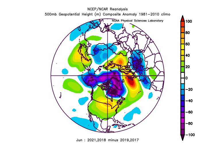
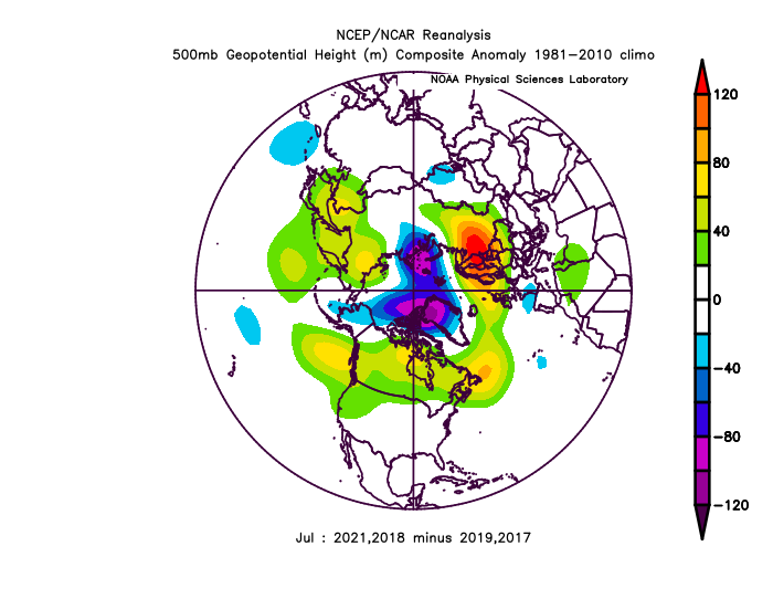
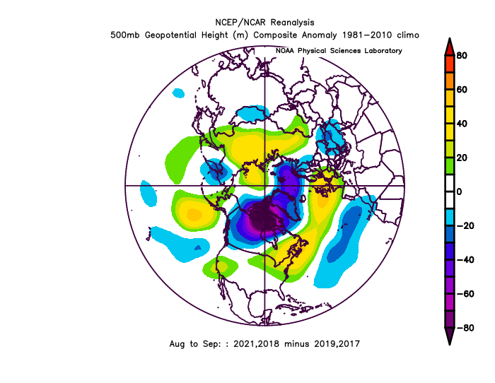
^Arctic ice can't help but melting Aug-Sept
- 1 reply
-
- 1
-

-
re: the thunderstorm threat
-
It starts in the Pacific...
-

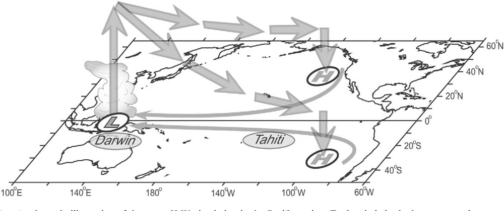
2021-2022 ENSO
StormchaserChuck! replied to StormchaserChuck!'s topic in Weather Forecasting and Discussion
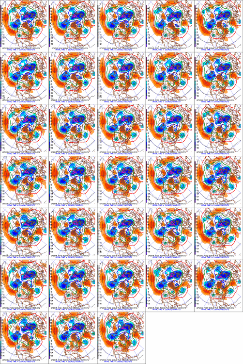
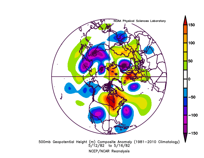
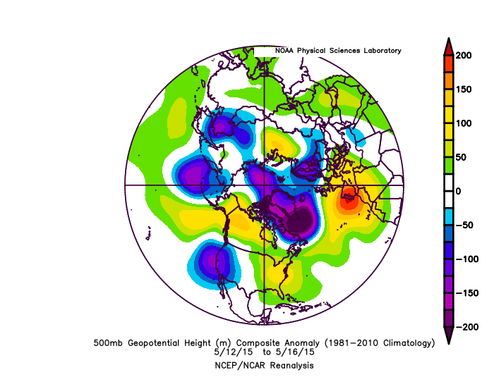
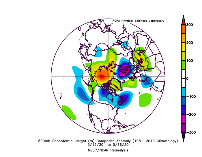
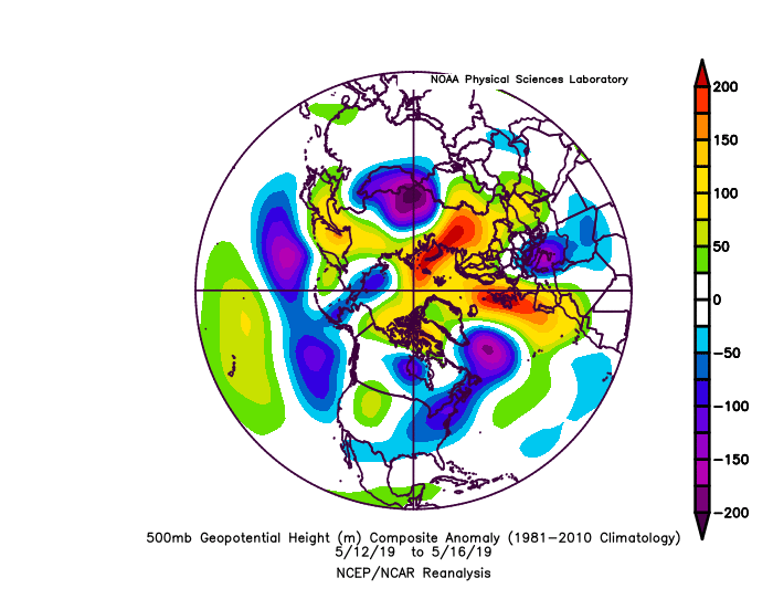
Pacific High pressure/-PNA/positive anomaly May12-16 Minus 1997 Minus 1982 Minus 2015 (Pac net neg 3/3) Plus 2021 Minus 2020, 2019, Plus 2016, 2017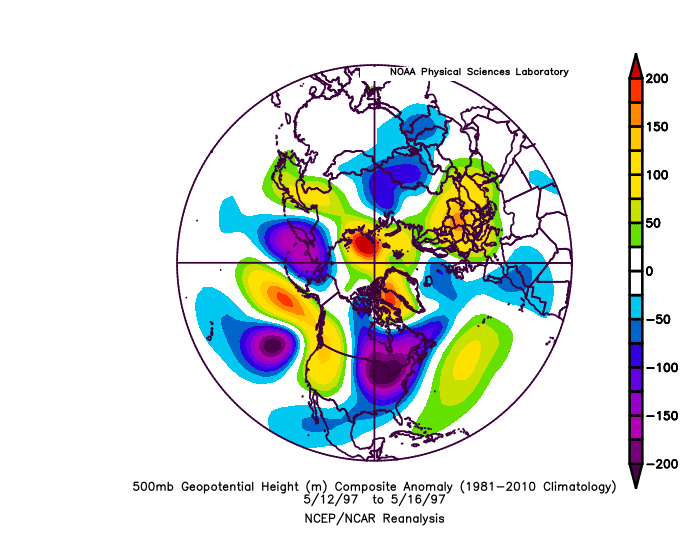
-
It won't verify as cold.
-
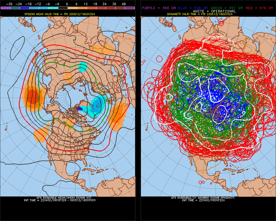
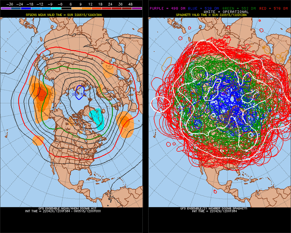
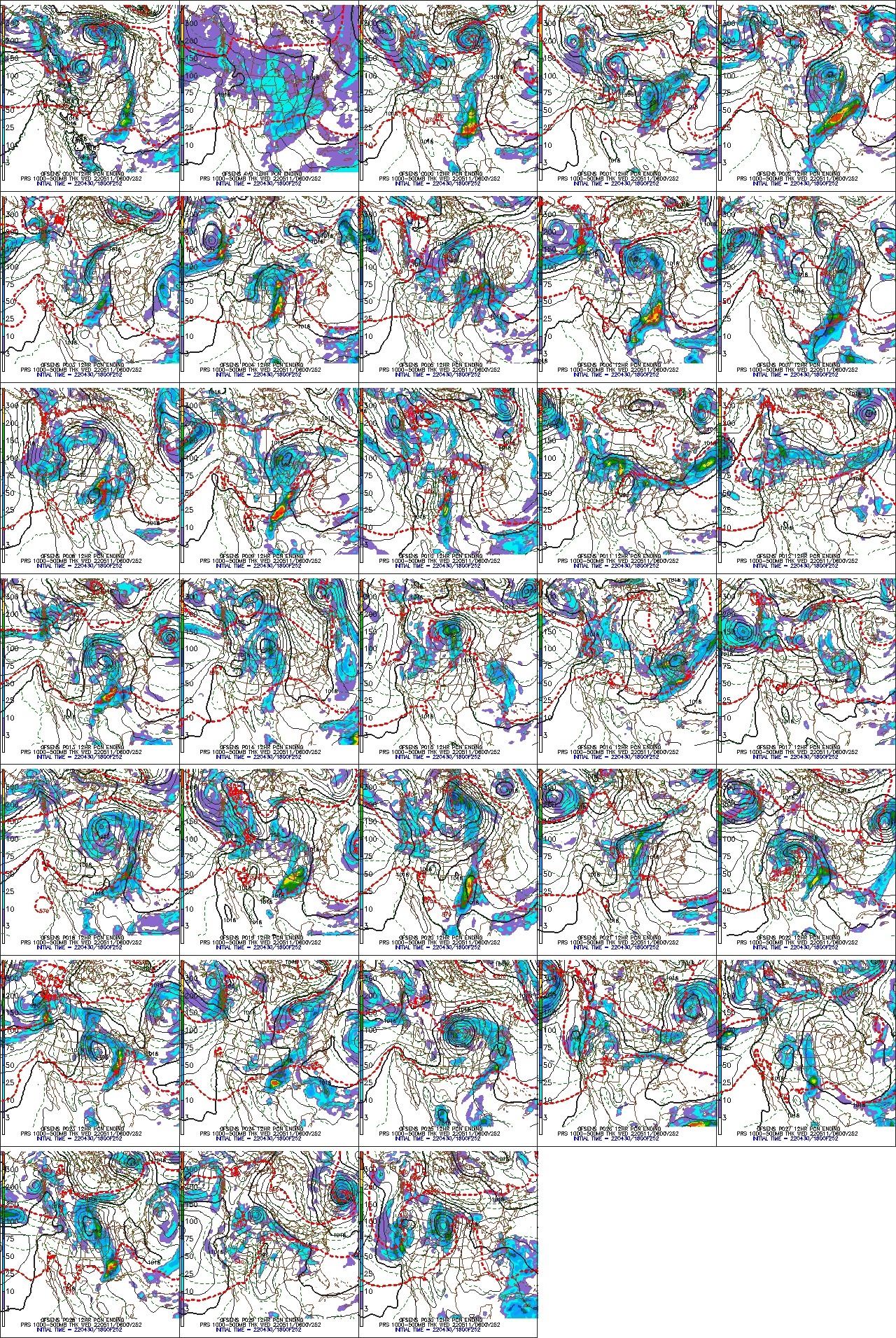
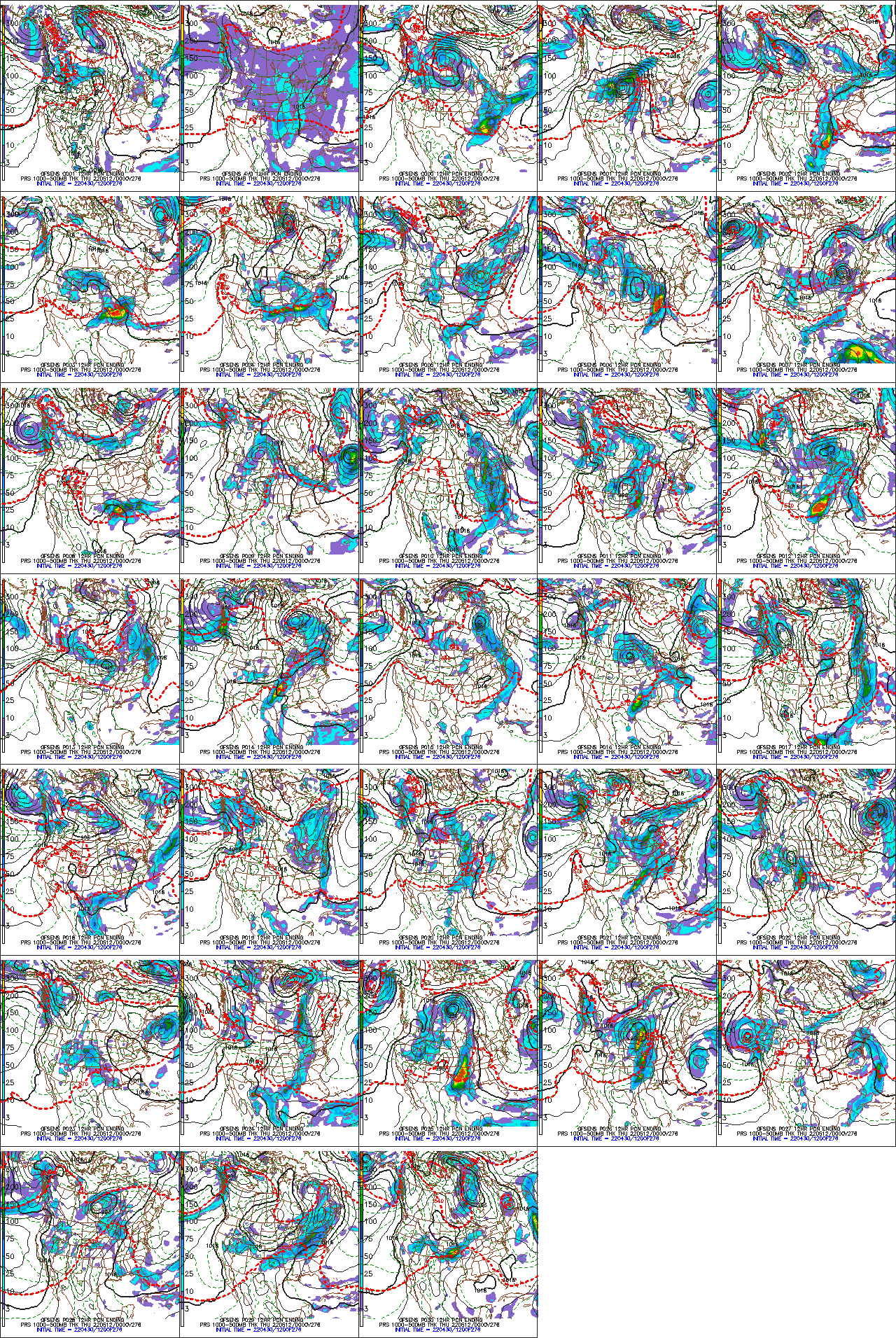
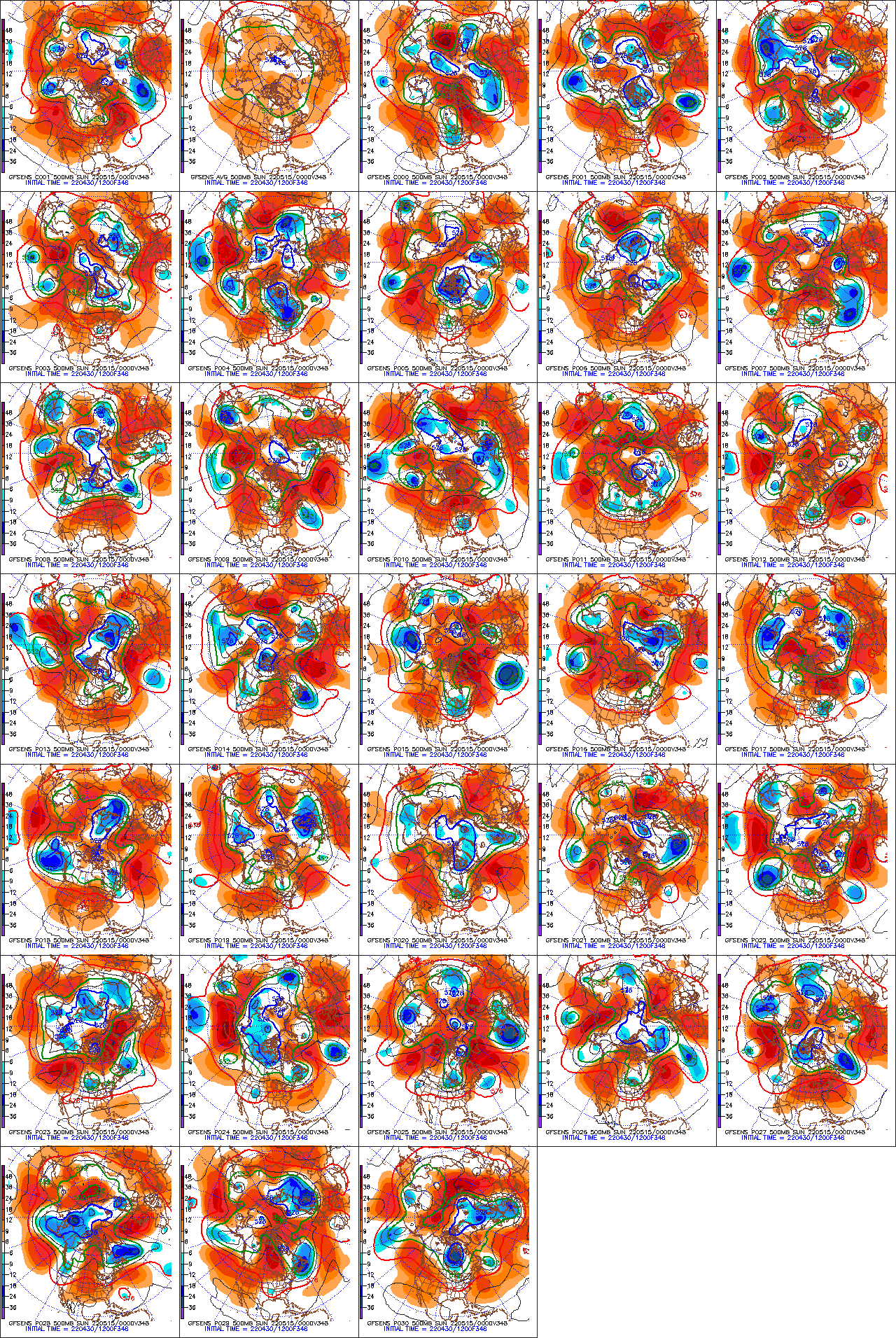
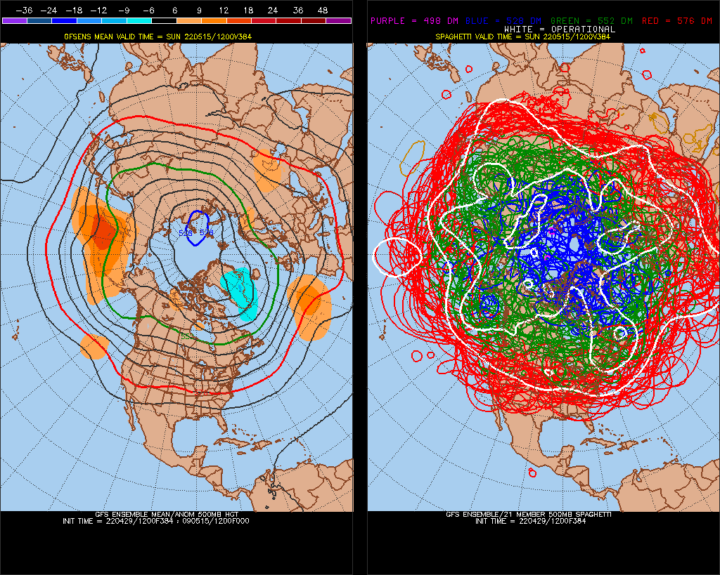
T-storm threat, heavy rain around May12th-13 3 ensembles have a TS at 384 T-storm threat probably extends-May12-16
.thumb.gif.6d82fb65b041e81295e5aecfff466c8c.gif)
-

-
The last 4 February's
StormchaserChuck! replied to StormchaserChuck!'s topic in Weather Forecasting and Discussion
High-Low pressure-Pacific-Atlantic, 1/4, 1/16, 1/64, 1/256, 1/1,024 .. 1/1024 is random right now.
-
The last 4 February's
StormchaserChuck! replied to StormchaserChuck!'s topic in Weather Forecasting and Discussion
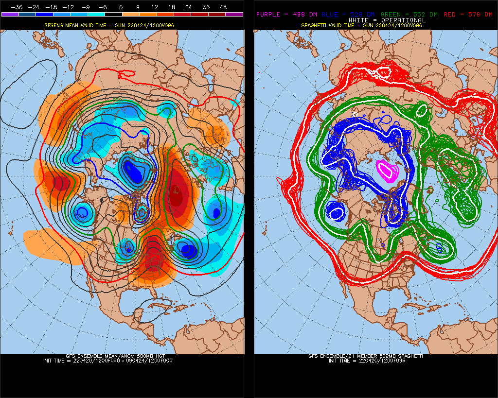
artificial cooling of the north pole?

-

.thumb.gif.abb663033ba9a3d846c3cf9c18f13287.gif)
-
2021-2022 ENSO
StormchaserChuck! replied to StormchaserChuck!'s topic in Weather Forecasting and Discussion
^The next few La Nina's might not act like La Nina's. -
2021-2022 ENSO
StormchaserChuck! replied to StormchaserChuck!'s topic in Weather Forecasting and Discussion
That 170W/-200m is +3c is significant, this El Nino tendency has been around since November. This hasn't broke though
-
2021-2022 ENSO
StormchaserChuck! replied to StormchaserChuck!'s topic in Weather Forecasting and Discussion
El Nino tendency kind of taking over here recently. -
Middle of the month
-
Enjoy these warmer days, the SW US High pressure is a building-consistent entity/feature these days.
-
May 2022 temperature forecast contest
StormchaserChuck! replied to Roger Smith's topic in Weather Forecasting and Discussion
DCA +2.0 NYC +1.5 BOS +1.5 ORD +3.0 ATL +2.0 IAH +2.0 DEN +2.5 PHX +2.5 SEA +1.5 -
Problem is actually land vs water, and how its modeled, and how it seperates right now.
-
2021-2022 ENSO
StormchaserChuck! replied to StormchaserChuck!'s topic in Weather Forecasting and Discussion
Did I dance in the rain before? -
2021-2022 ENSO
StormchaserChuck! replied to StormchaserChuck!'s topic in Weather Forecasting and Discussion
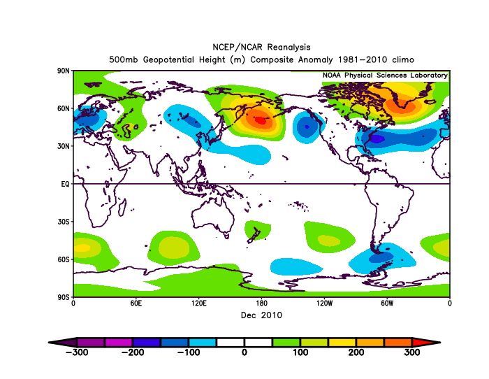
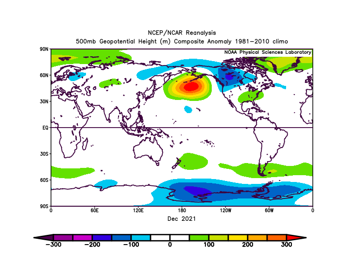
^To reiterate my point further, Dec 2010 (300dm vs #2 230dm -PNA) was followed by 10/11 years of -PNA or +NOI. THIS December beat it by 30dm- 330dm, 300dm, 230dm. I think we will see something like 3/8 next Winter's of +PNA, or even 5/10 +PNA, but there will be 5/8 +super-PNA, weighing us to a +anomaly -PNA vs globe. -PNA/+PNA skew difference, could even, even out over 10-15+ years. -
2021-2022 ENSO
StormchaserChuck! replied to StormchaserChuck!'s topic in Weather Forecasting and Discussion
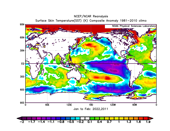
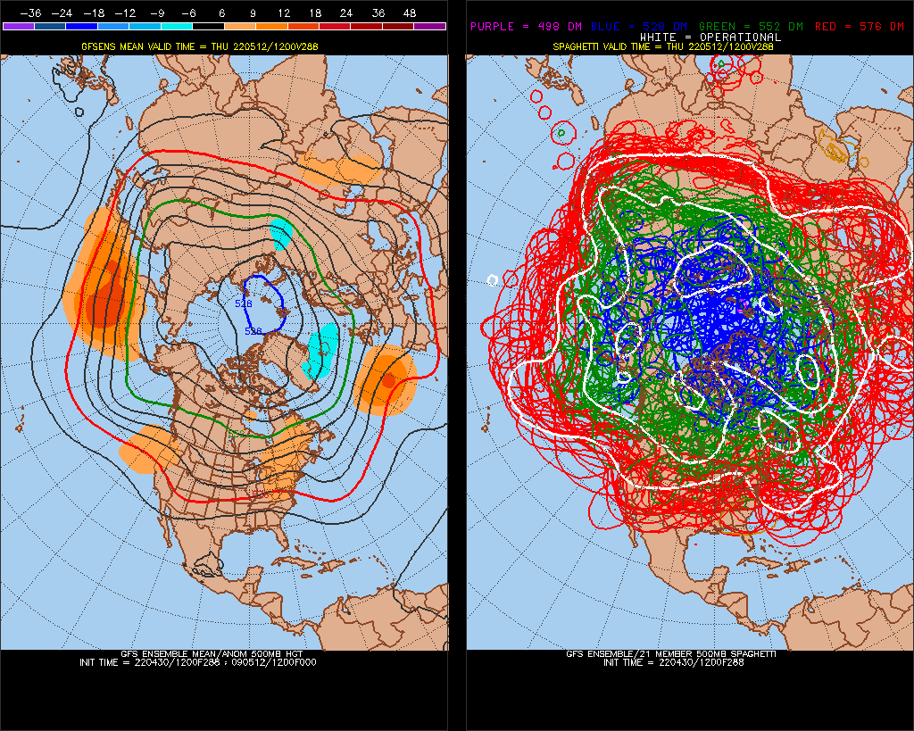
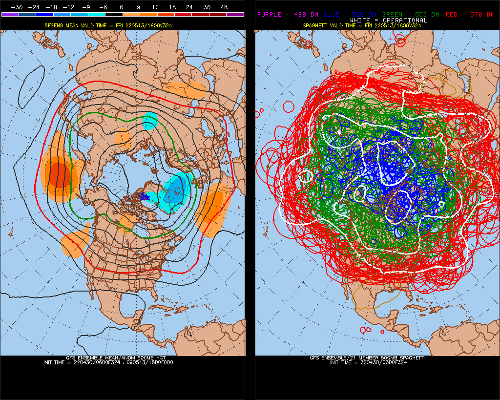
I bet we get a nice subsurface cold push here ^+4c appearing, I think we will go +ENSO later, central/eastern cold not as cold today, whatever
.thumb.gif.2eac873b1625d9b3b59f6f3ee54b1941.gif)
.thumb.gif.1ff5df5ca2abb2ab4c21e8819db5567a.gif)
-
2021-2022 ENSO
StormchaserChuck! replied to StormchaserChuck!'s topic in Weather Forecasting and Discussion
NOI is really only thing that matters in ENSO /evenout after Dec 2010,2021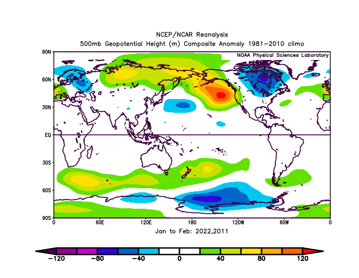
-
2021-2022 ENSO
StormchaserChuck! replied to StormchaserChuck!'s topic in Weather Forecasting and Discussion
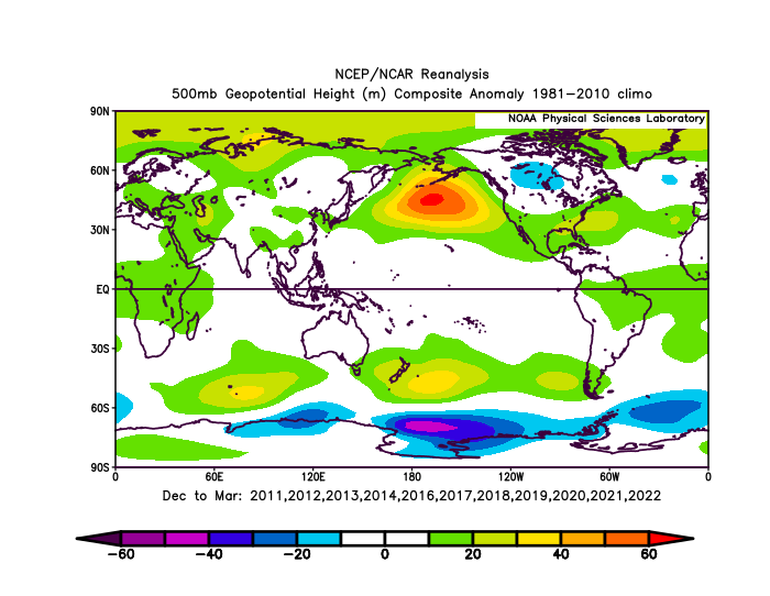
10/11 recent Winter's After this (300dm, #2 since 1948 is 230dm) Beaten this Dec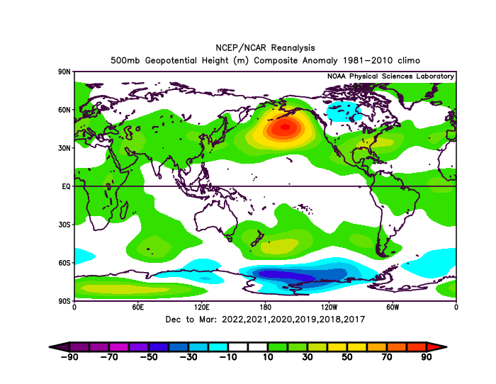
-
2021-2022 ENSO
StormchaserChuck! replied to StormchaserChuck!'s topic in Weather Forecasting and Discussion
yeah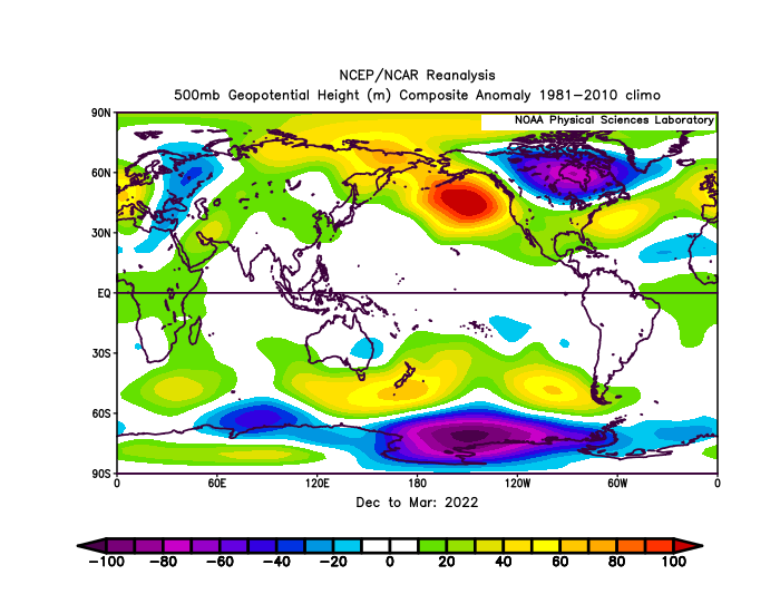
-
2021-2022 ENSO
StormchaserChuck! replied to StormchaserChuck!'s topic in Weather Forecasting and Discussion
It evens out, it was a slightly -NAO Winter. positive QBO and La Nina have been some of our worst Winter's by a lot. 10mb vortex is like -1000dm mean. Going to be hard to get a -NAO next Winter if there is La Nina I think. It's like 65%/35 +NAO in +QBO/Nina vs 65%/35 -NAO in -QBO/Nino, 10mb vortex is strongest correlator. -
2021-2022 ENSO
StormchaserChuck! replied to StormchaserChuck!'s topic in Weather Forecasting and Discussion
Unfortunately, we have +QBO upcoming, which with a La Nina will be a disaster, but an El Nino this year in deep -QBO would have been great I think, (09-10)
.gif.e500fe22f9baff4130a54da8368e9c8c.gif)
.gif.3ecfdd79a189925abbeb1c6c8e5a4fb9.gif)


.gif.b13180935918360154c2026c93f307d9.gif)
.gif.3e830c5e9d28352bae40a262978845bb.gif)
