thunderbolt
-
Posts
840 -
Joined
-
Last visited
Content Type
Profiles
Blogs
Forums
American Weather
Media Demo
Store
Gallery
Everything posted by thunderbolt
-
National weather service at the Juno tweet :Juneau Forecast Office has been taking snowfall observations in the back of the valley since 2001. As of 12/7, the office has picked up 56.8" of snow since Nov 1st! This is the second highest snow amount recorded this early in the season at the office. #akwx Juneau Alaska tweet
-
December 2021 Medium/Long Range Discussion Thread
thunderbolt replied to North Balti Zen's topic in Mid Atlantic
Who’s ready to hit the panic button on November 29
-
First flakes of the year Langhorne PA
-
Since you and I live in the same area I’ll go With December 20
-
And check out Alaska the total opposite
-
When and how strong?
-
-
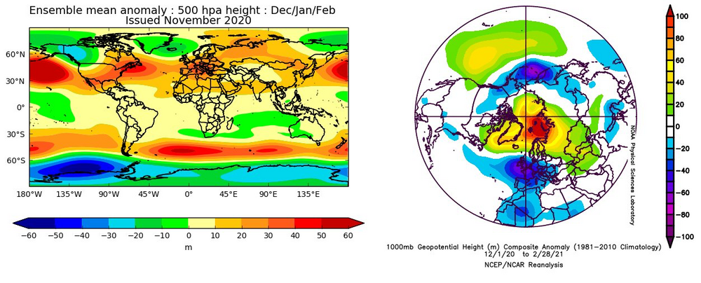
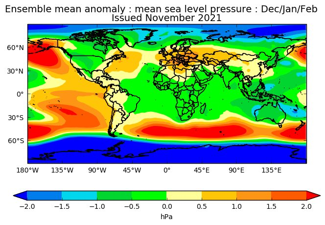
My Winter Outlook 2020-21
thunderbolt replied to Isotherm's topic in Weather Forecasting and Discussion
I guess Tom’s not doing a winter outlook I checked his website and it is shut down -
And this was its prediction last year for December January February
-
-
-
My Winter Outlook 2020-21
thunderbolt replied to Isotherm's topic in Weather Forecasting and Discussion
Tom are you doing a 2021/22 winter outlook? -
What about the -PDO
-
Just curiosity what storm did GFS hit on and how far in advance was it
- 306 replies
-
- 1
-

-
- heavy rain
- damaging wind
- (and 1 more)
-
That’s not true if it was more east and There was blocking this would definitely be snow And then hence that’s why I Said January the odds of it being colder are a lot greater
-
It’s funny how we’re all rooting for closer to the coast but we all know damn well if this was in the middle of January we would all be on Suicide watch
- 306 replies
-
- 4
-
-

-
- heavy rain
- damaging wind
- (and 1 more)
-
So another words put a fork in winter already
-
And
-
Amen to that brother I just locked into a year contract at $3.08 a gallon compared to last year which was $2.25 a gallon
-
Conversation ECMWF @ECMWF We have just added more than 50 new products to our #OpenCharts catalogue! These forecast charts are free for anyone to access, redistribute and adapt - even for commercial applications - part of our open data Strategy for 2021-2030. Dive in & explore... https://apps.ecmwf.int/webapps/opencharts…
-
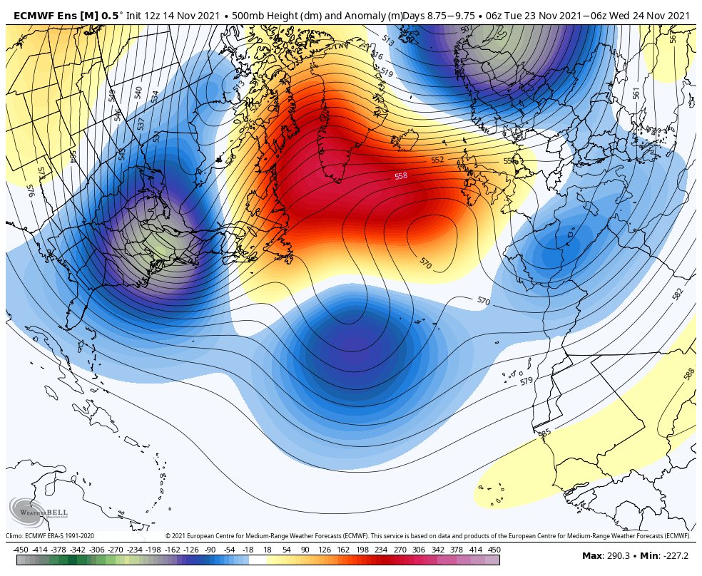
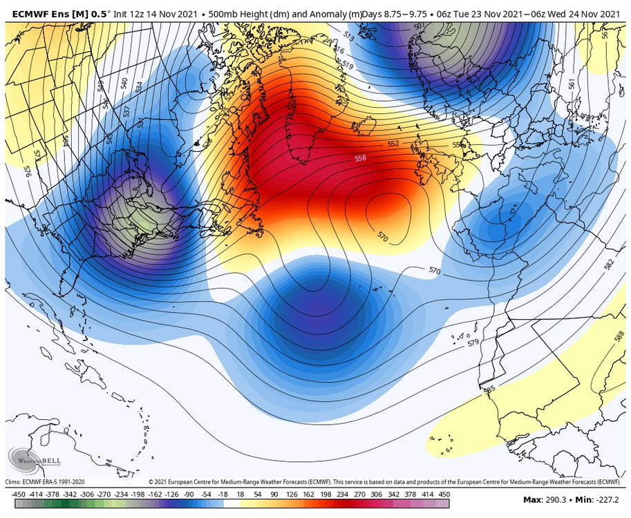
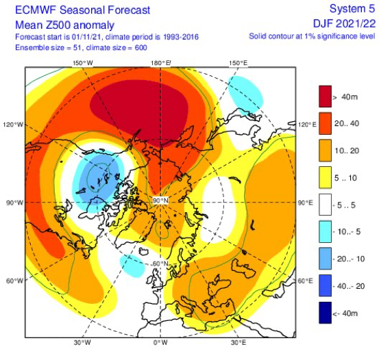
I’m Starting to keep my eye on the stratosphere at this present time some of the models that I saw have The stratosphere relatively week until roughly the beginning of December and then have it strengthening which if it does come to fruition would not be good for blocking down the road if the PNA is negative you could keep your shorts out in the middle of January
-
2021 Atlantic Hurricane season
thunderbolt replied to StormchaserChuck!'s topic in Tropical Headquarters
Please do -
2021 Atlantic Hurricane season
thunderbolt replied to StormchaserChuck!'s topic in Tropical Headquarters
Ok -
2021 Atlantic Hurricane season
thunderbolt replied to StormchaserChuck!'s topic in Tropical Headquarters
I believe we are at 105.2 for the north Atlantic -
Just by looking at the animation if I were to guess A hi end cat 4 possibly cat 5