

RIC Airport
-
Posts
1,766 -
Joined
-
Last visited
Content Type
Profiles
Blogs
Forums
American Weather
Media Demo
Store
Gallery
Posts posted by RIC Airport
-
-
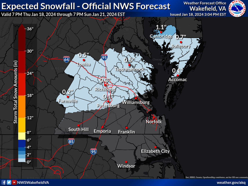
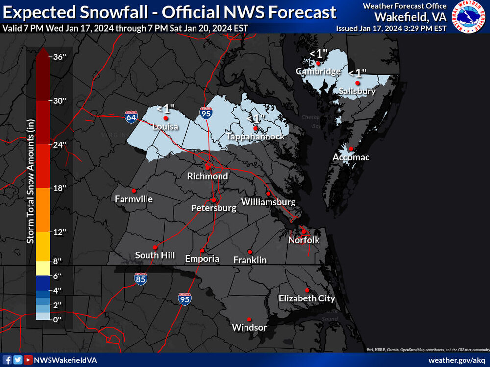
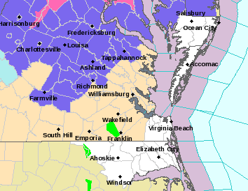
Here are the latest maps from AKQ.

-
 1
1
-
-
1 hour ago, JFLETCHER said:
Maybe western caroline can get a half-inch to an inch up here.
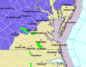
Wakefield just issued an advisory for areas north of RIC and over towards the Northern Neck 1 inch, maybe 2" in spots. I hope Ladysmith can score!
URGENT - WINTER WEATHER MESSAGE
National Weather Service Wakefield VA
310 PM EST Thu Jan 18 2024

VAZ509>511-190415-
/O.NEW.KAKQ.WW.Y.0003.240119T0900Z-240119T1800Z/
Western Louisa-Eastern Louisa-Western Hanover-
Including the cities of Louisa, Mineral, and Ashland
310 PM EST Thu Jan 18 2024

...WINTER WEATHER ADVISORY IN EFFECT FROM 4 AM TO 1 PM EST
FRIDAY...

* WHAT...Snow expected. Total snow accumulations of up to one
  inch, with up to 2 inches possible.

* WHERE...Western Louisa, Eastern Louisa and Western Hanover
  Counties.

* WHEN...From 4 AM to 1 PM EST Friday.

* IMPACTS...Plan on slippery road conditions. The hazardous
  conditions could impact the morning commute.

PRECAUTIONARY/PREPAREDNESS ACTIONS...

Slow down and use caution while traveling.

For the latest road conditions in Virginia or Maryland, please
call 5 1 1.
-
 1
1
-
-
@RVAman, @eaglesin2011The 12Z Euro was actually similar to the GFS and tries to put a heavier band of snow between 4am and 10am over the Richmond metro area. But, challenges with respect to QPF amounts and surface temperatures remain. Interestingly, the Euro does have RIC right at freezing from 7am to 9am so that would increase the odds of getting that coating to half inch in more areas if this is correct.

-
1
-
-
3 hours ago, wasnow215 said:
@RIC Airportspecific question and need your help please regarding a meeting near short pump for tomorrow very early. It’s looking like there could be an inch of snow according to the GFS right around 3 AM-5am. We may cancel or do online only? Thoughts?
2 hours ago, RVAman said:There will not be an inch or anywhere close to it. We may not even see any snow at all. Meeting will be fine buddy.
2 hours ago, eaglesin2011 said:May not have anything at all but still could get snow in this area.. Its far from certain at this point but either way its shouldnt be anything major, since temps are expected to be right around freezing or above for most of this event in this area .....
2 hours ago, RVAman said:HRRR is showing that snow doesn't happen and rain to start. We'll see but I really don't think a meeting needs to be cancelled due to this. Just an opinion, of course.
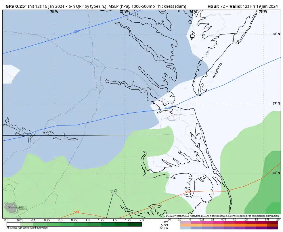
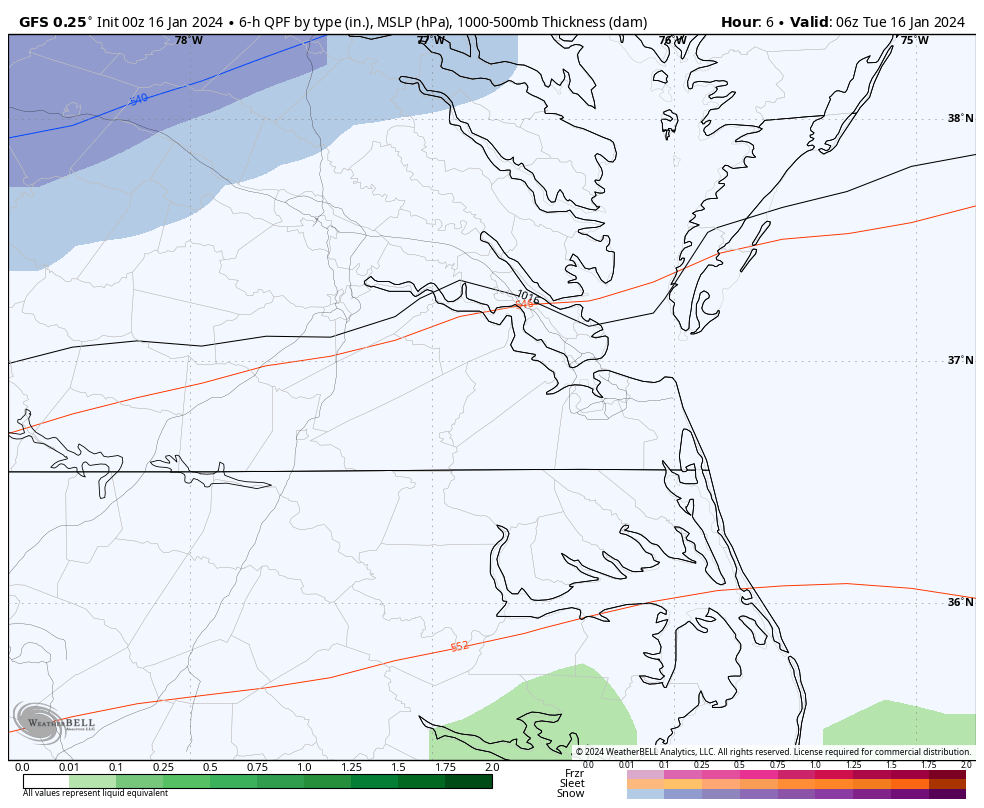
The issue for us is limited moisture (Trace to 0.20”) and borderline surface temperatures (32°F-35°F). The GFS is the most aggressive and farthest south with the precip shield compared to other guidance. While I admit the GFS did great identifying the placement of Monday’s snow band, I have low confidence snow will accumulate this far south. But other areas north and northwest of the city have a shot, especially north of Ashland toward Fredericksburg, where more moisture will be available.
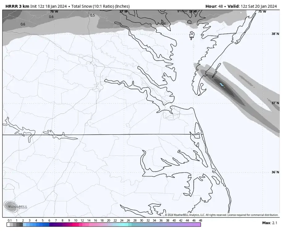
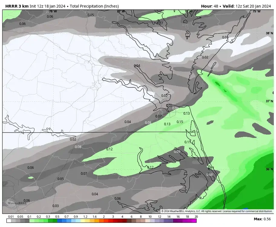
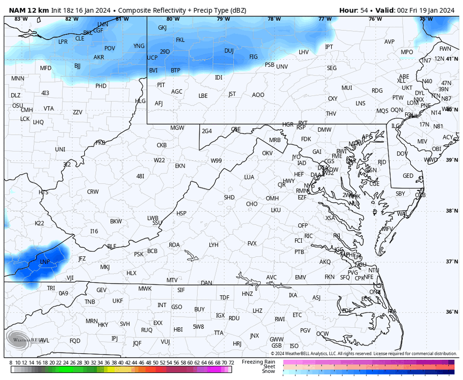
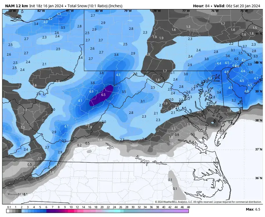
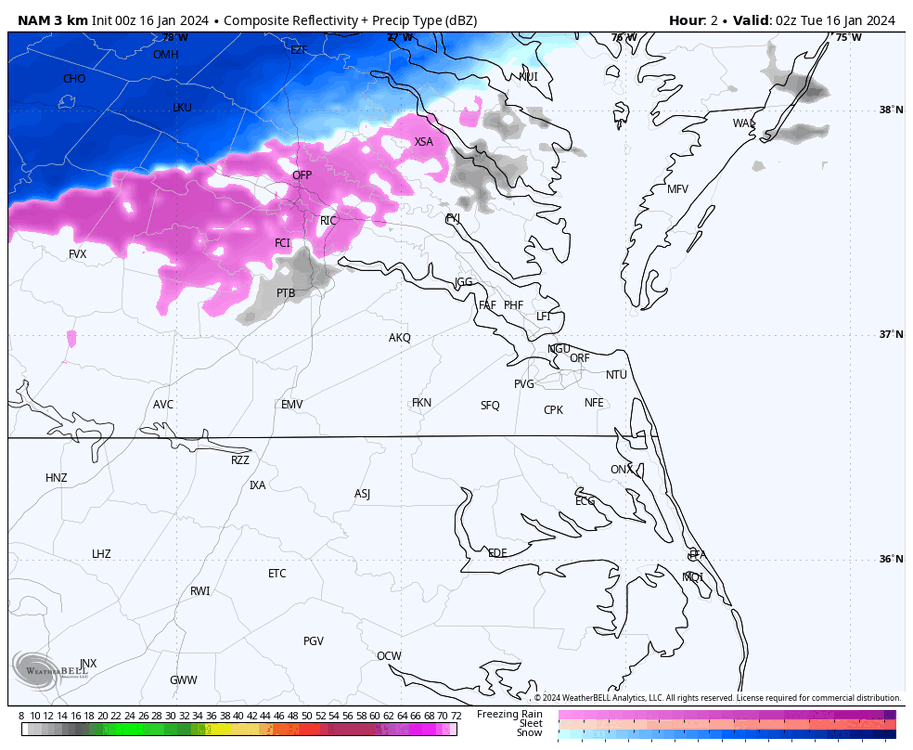
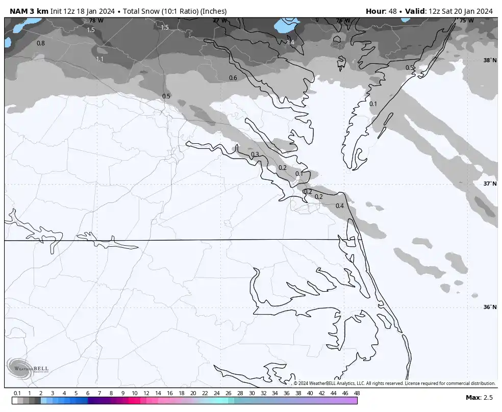
The 12Z 3K NAM (below) depicts this thinking, although its radar simulation does clip areas as far south as Short Pump and Ashland with snow between 4 am and 7 am, while the city and points south might be warm enough for rain, at least for a portion of the precip. It also tried to bring some snow/rain showers on the back side of the low tomorrow evening as colder air is rushing in.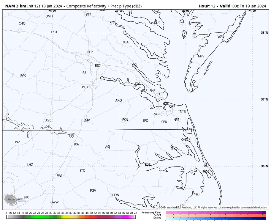

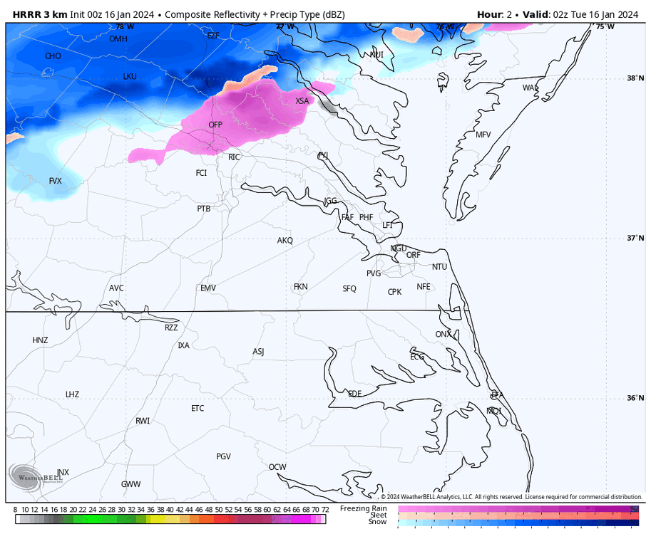
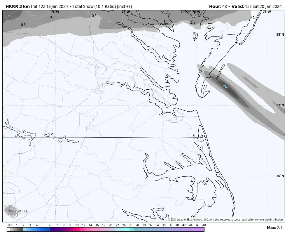
The 12Z HRRR, on the other hand, didn’t have much precip south of Fredericksburg.
@wasnow215That said, I still would not rule out a period of light snows farther south, including the city, between 4 am and 10 am, with 4-7 am being the best chance for anything to stick since temperatures will be closest to freezing. I don’t believe it will be widespread or long-lasting enough to wreak havoc, though. The absolute worst-case scenario is probably a coating to a half-inch, IMO.
All models warm us rapidly as the morning progresses, with RIC getting into the low or mid-40s by afternoon. -
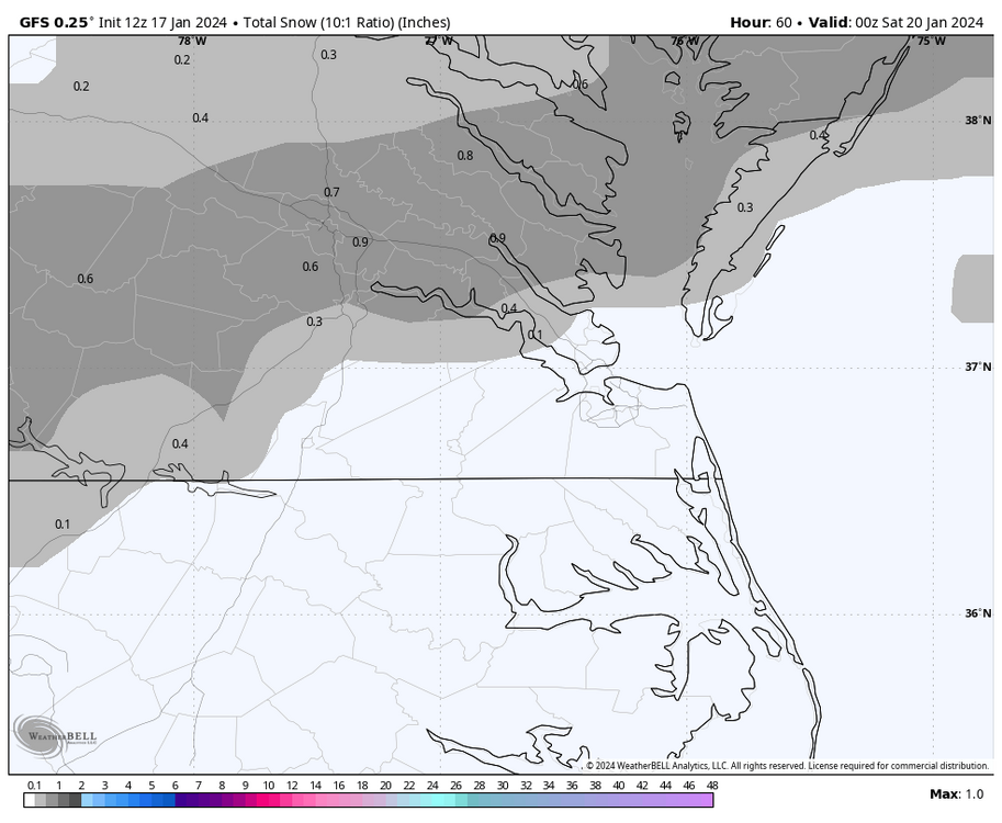
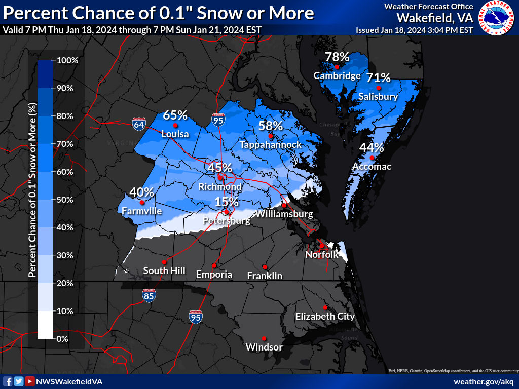
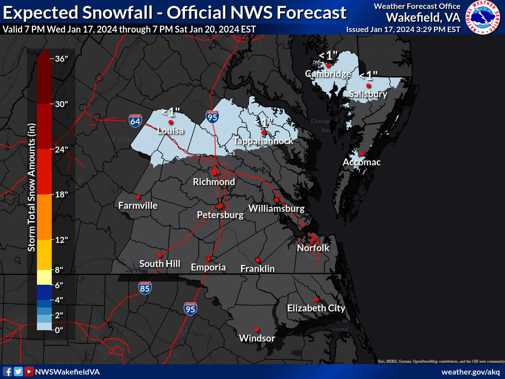
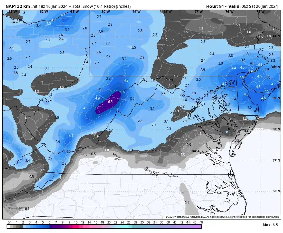
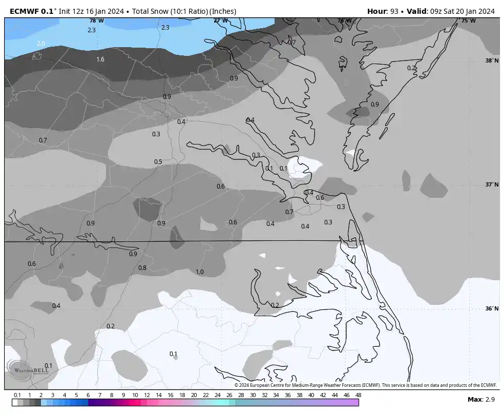
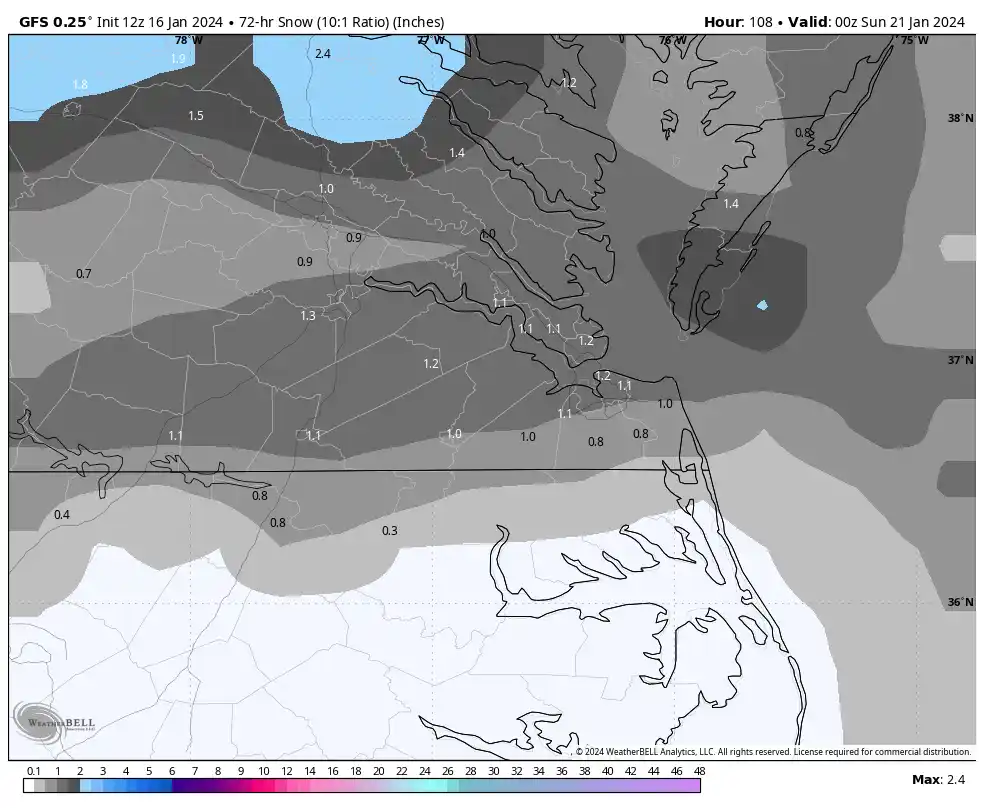
Fwiw, here is the map AKQ put out this afternoon. From what I've seen with my own eyes and overall gut feeling, I feel this is appropriate although that doesn't mean flakes won't fall south of Kings Dominion.
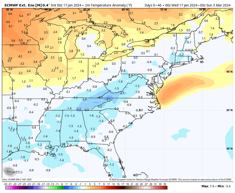
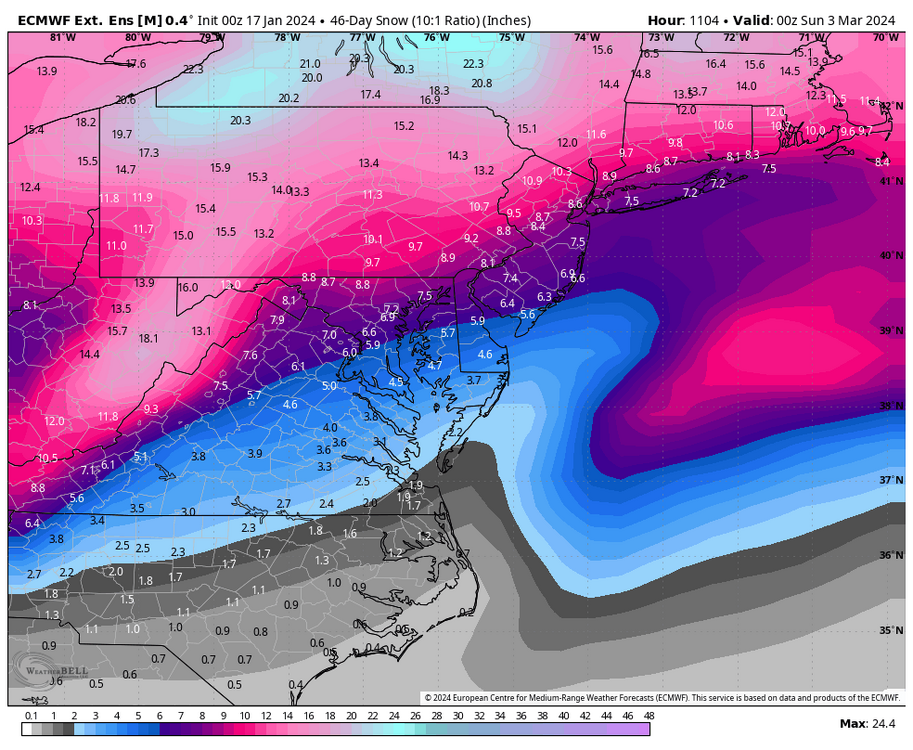
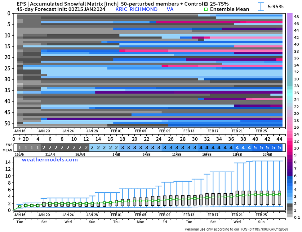
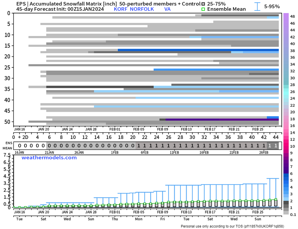
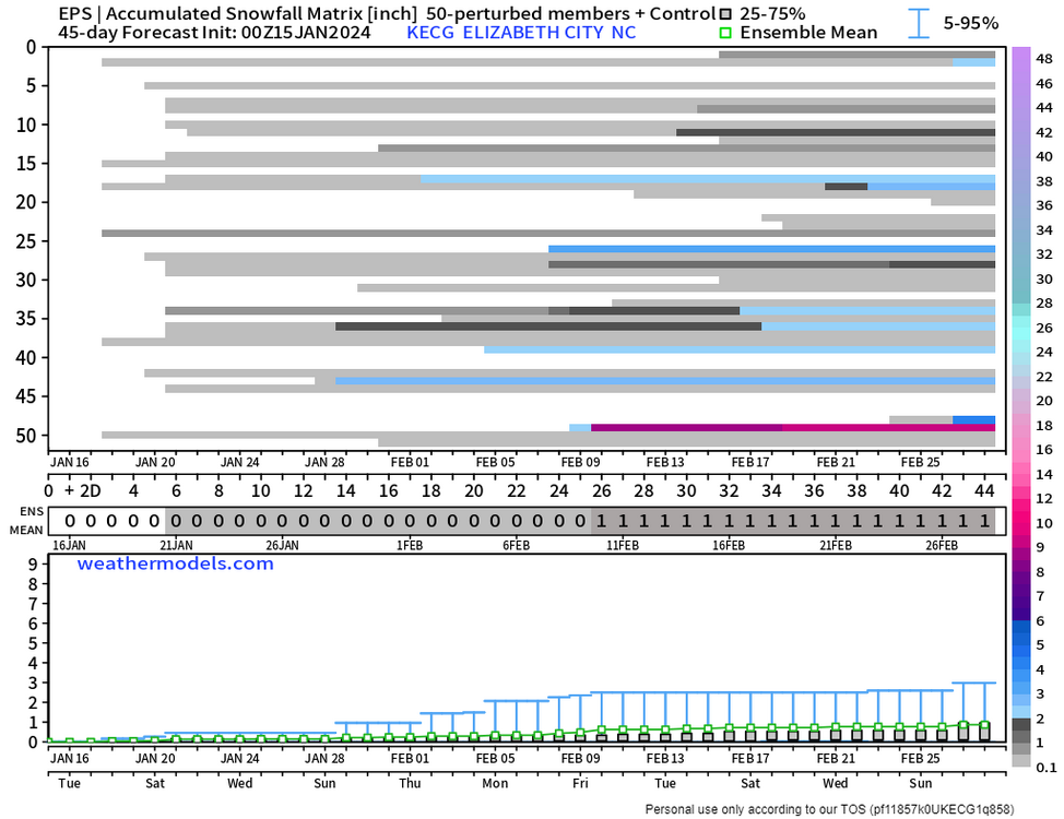
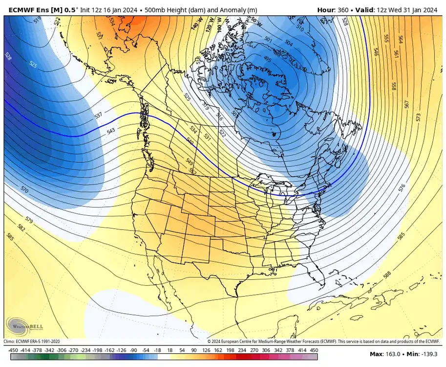
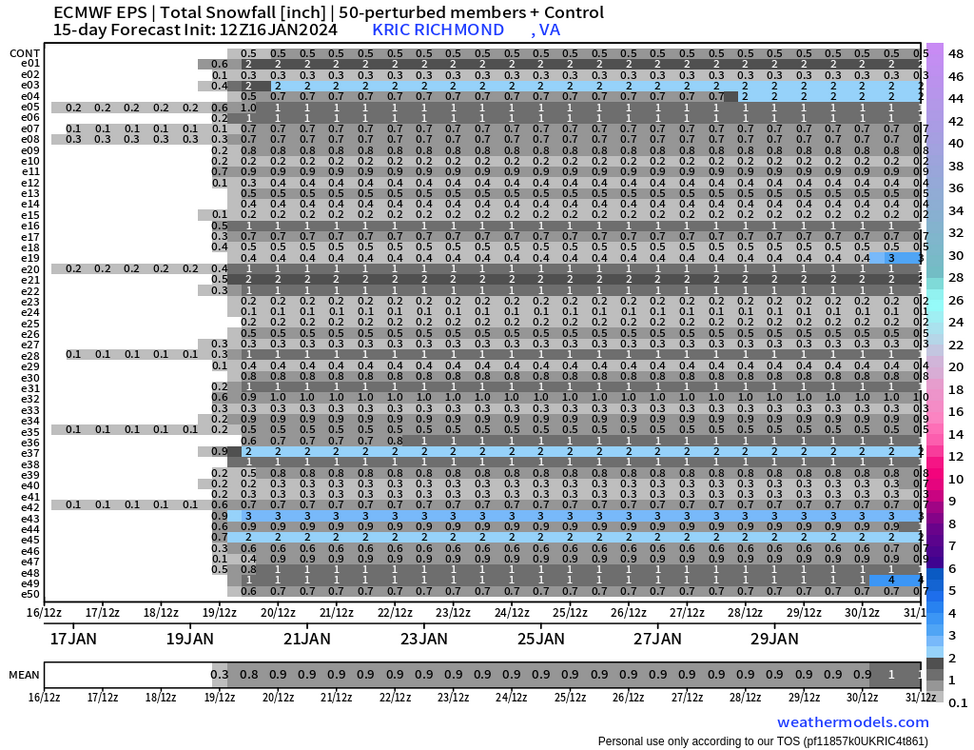
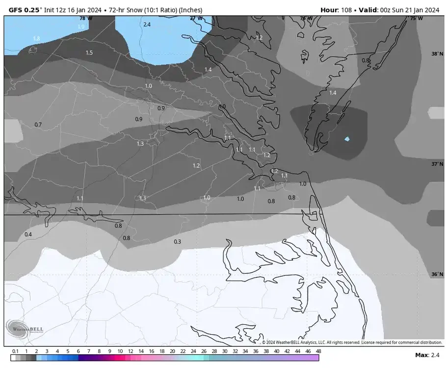
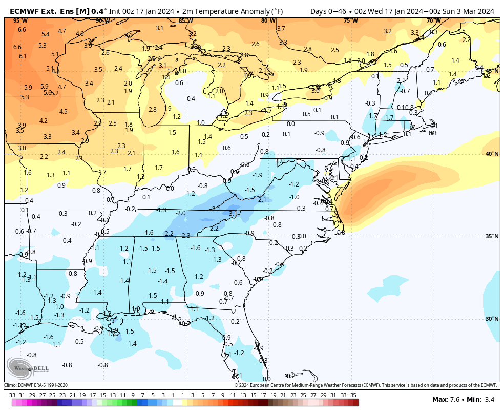
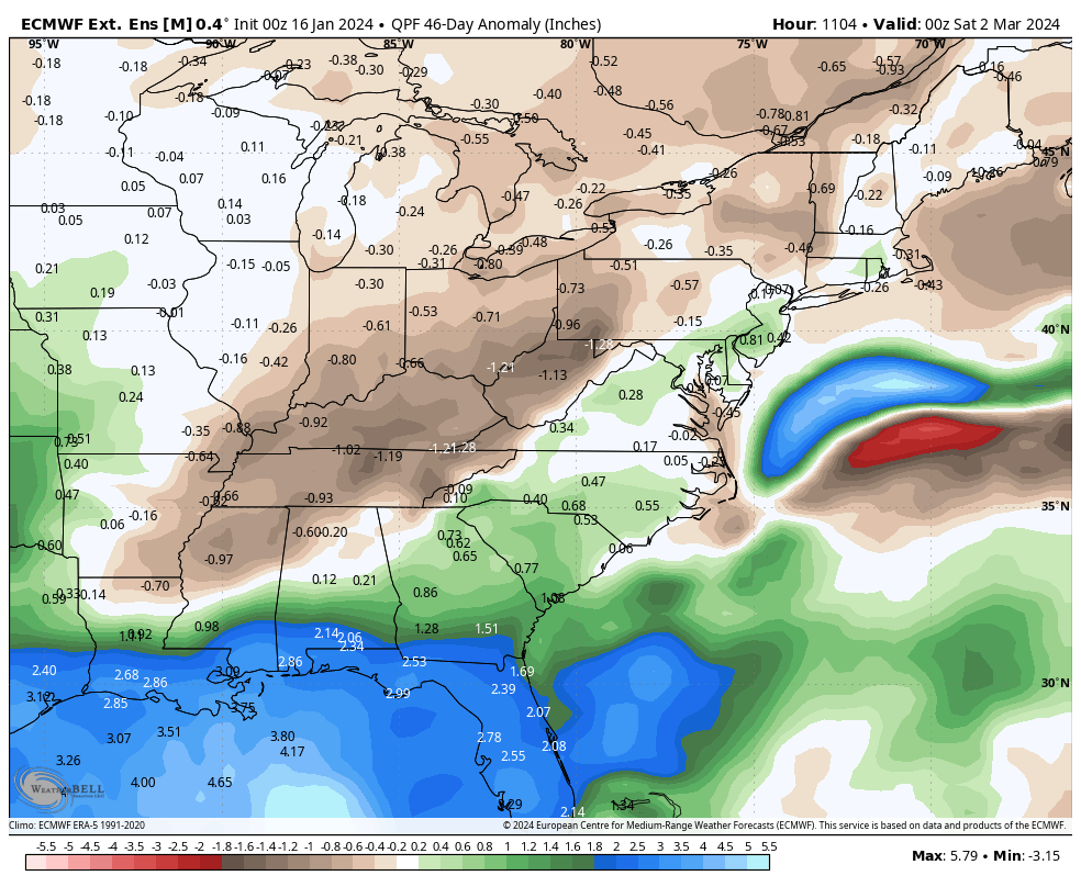
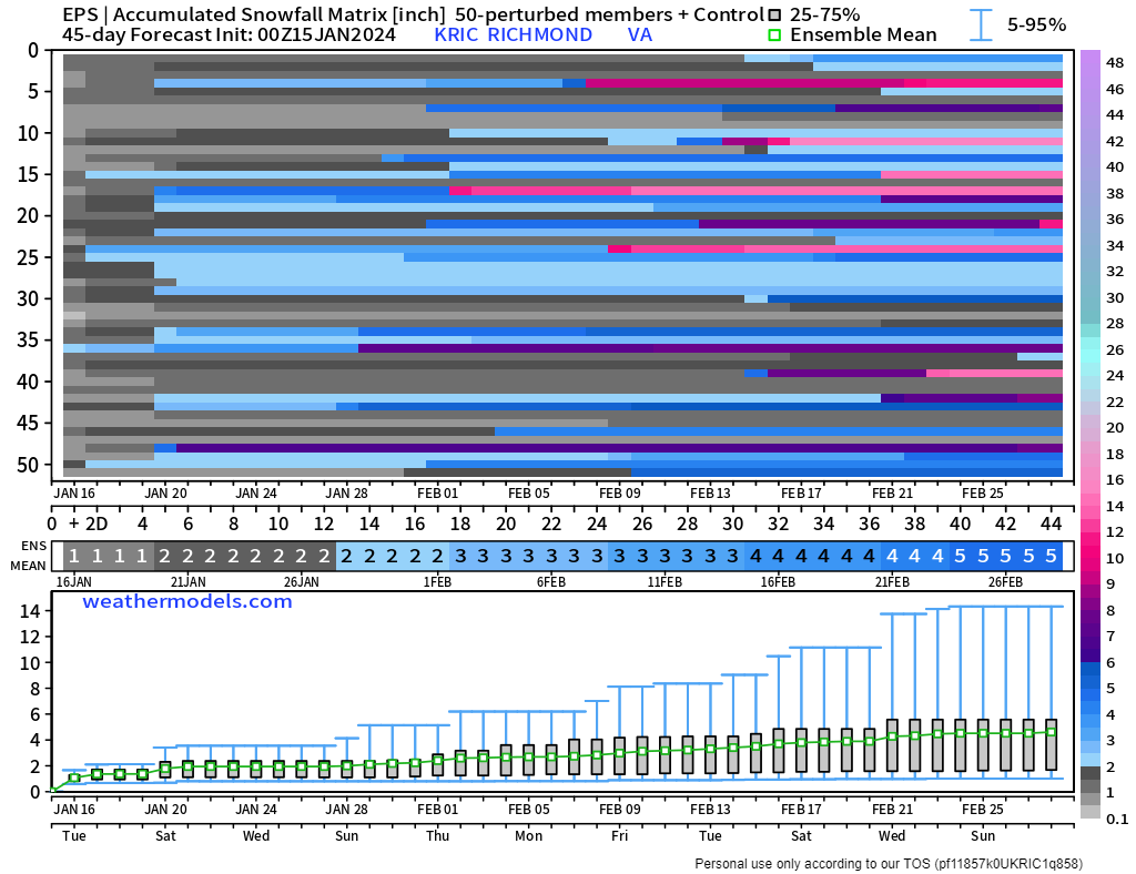
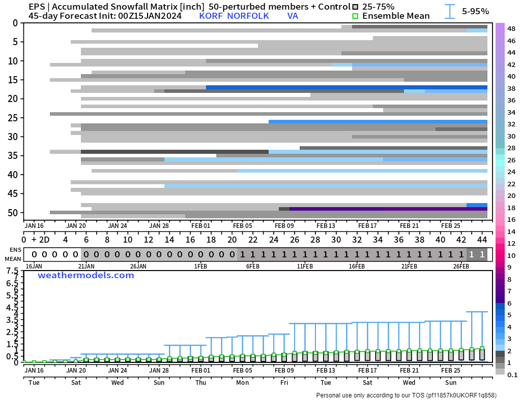
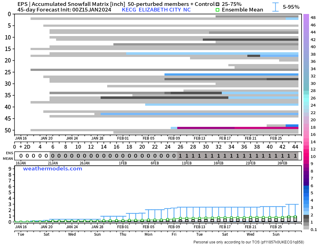
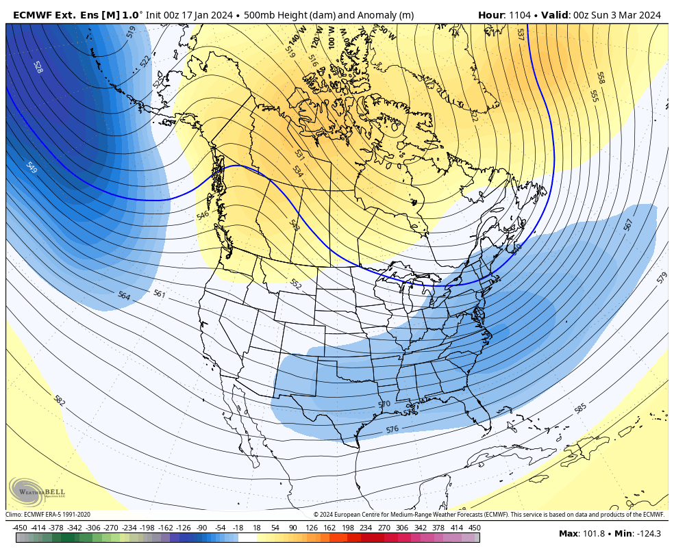
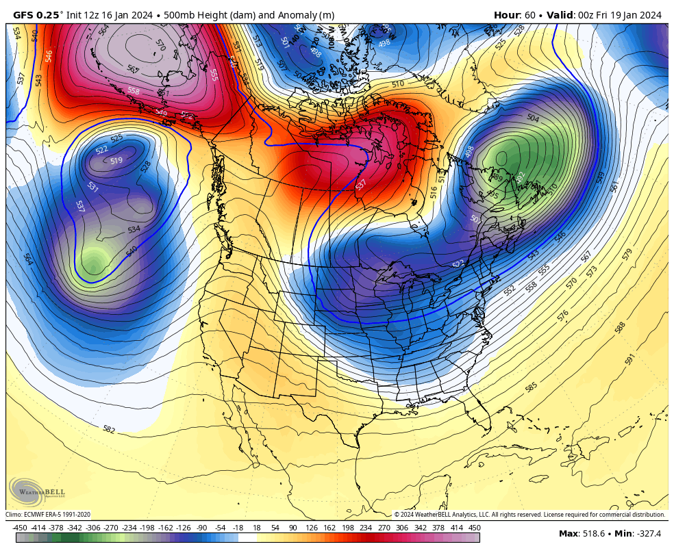
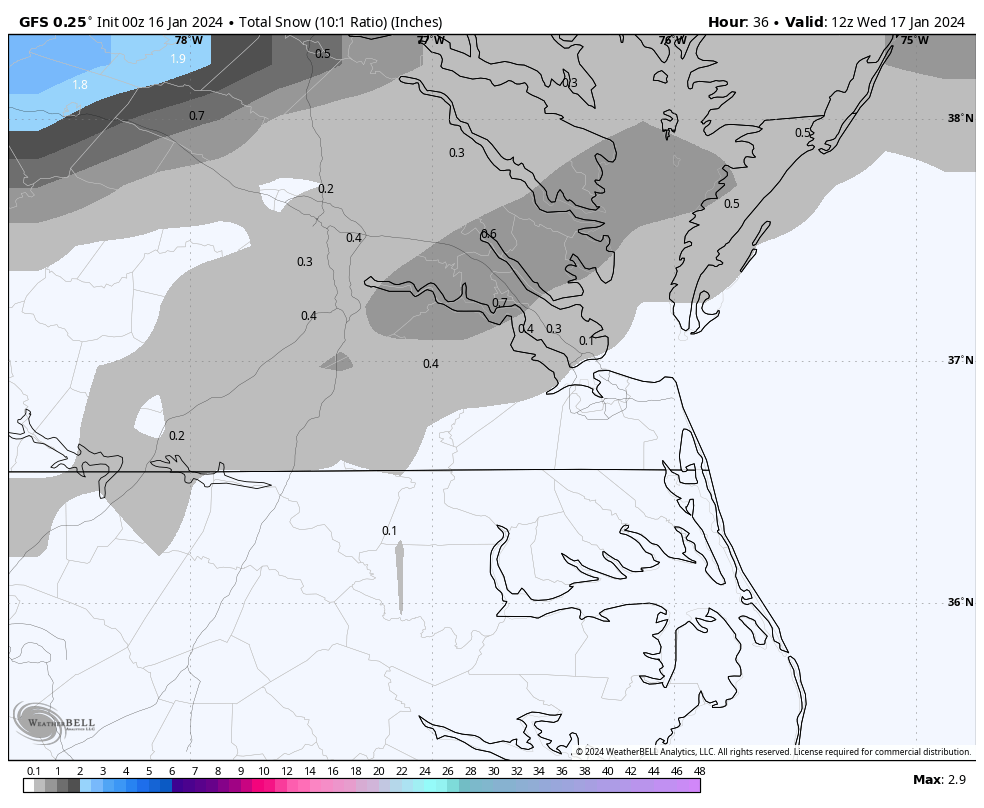
I also peaked at the Euro weeklies from this morning, and early February was pretty "meh." But, the pattern started improving after about the 10th through the end of the month and into March. I posted the 500mb height map ending at 00z on March 3rd. Once the pattern improved, it looked similar to how it looked much of the winter on the weeklies. Nonetheless, I'd rather gamble with February than December since it tends to be colder, so hopefully, it produces even if it takes until March for something good. Some other mechanisms, such as the MJO, can hopefully provide additional help. Truthfully, I was not impressed with the snowfall output, but at the same time, they've provided false hope all winter. The city snowfall charts are from the run two days ago, but the regional snowfall mean map is from today, btw.

-
2
-
-
2 hours ago, ldub23 said:
06 gfs doesnt even have a snow flurry for se va on friday. Hopefully by feb 28 2025 we will have an accumulating snow
12Z nada
Its snow map had a strip from Farmville through Richmond to Tappahanock and the Northern Neck. But QPF amounts are only around a tenth of an inch. If THIS GFS run is correct, the best time at RIC is between 4am and 10am. But, it did try to bring moisture into the state after 7pm with a band of moisture around RIC between 10pm and 1am. But I wonder if that's virga. The best chance for any stickage, if there will be any, would be between 4am and 7am when temps are around freezing. GFS has RIC's temps rising to 35°F by 9am and 44°F by noon. Either way, this still looks very minor.

We can enjoy the cold that comes behind it. GFS had almost all of us staying below freezing for highs on Saturday. Then it's time to focus on identifying the next opportunity after the upcoming pattern change. Last night, several EPS members continued to signal a chance for the last few days of the month.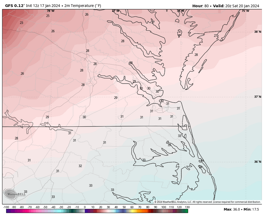
-
1 hour ago, ldub23 said:
18Z euro was a bit interesting for friday
1 hour ago, wasnow215 said:Care to expand? Haha
The GRAF model is really aggressive for Friday. MT, obviously is a DC TV met, but you can see what the model does in our area. Let's hope it's right!
-
1 hour ago, Conway7305 said:
Thanks for the update! I don’t mind a brief warmup. May play a round of golf end of next week. Rooting for a cold/snowy Feb-March. Hopefully the MJO can also swing back to 8-1-2 in Feb
Yeah, I agree. I could use a break from tracking snow. A lot of late nights staying up for the Euro and being glued to every model suite with curiosity and seeking the big one can get exhausting after about 2 weeks. It's too bad we didn't get a HECS to make it worthwhile, but this is my hobby, and I'll be right back at it at signs of the next legitimate threat.
")
I am not as versed in things like SSW events and the MJO, but I know those are the phases we want to be in.-
3
-
-
18 minutes ago, Stormpc said:
This thing looks more like a Clipper than anything else now. Rounding the base further south, which is nice but needs to slow down to get us Coastal folks some action. Good luck up north....another one missed for us down south and east. Still be watching.
I am hoping for a miracle because although we have a nice stretch of cold the next 5 or 6 days, snow chances look bleak for a while after Friday.
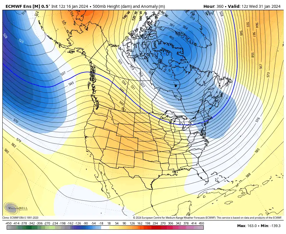
We just have to push through a pattern change, which will significantly increase our temperatures. It could get very warm in about ten days as we lose the -NAO/-AO and ridging develops in the east. Temperatures could go as high as the mid-upper 60s, maybe even the 70s in spots, before it gets better.
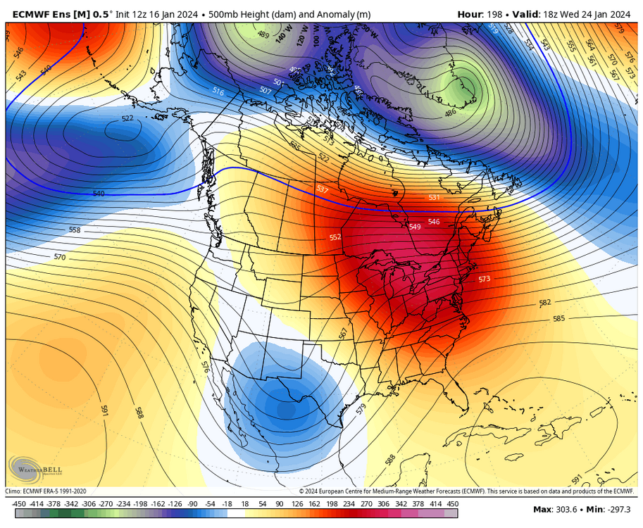
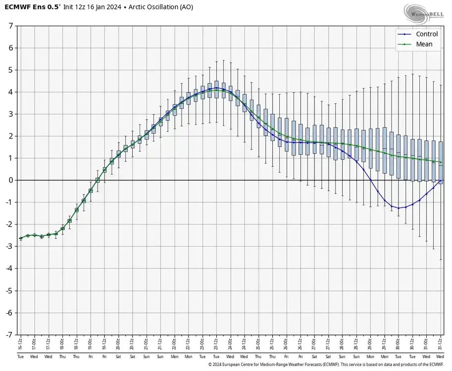
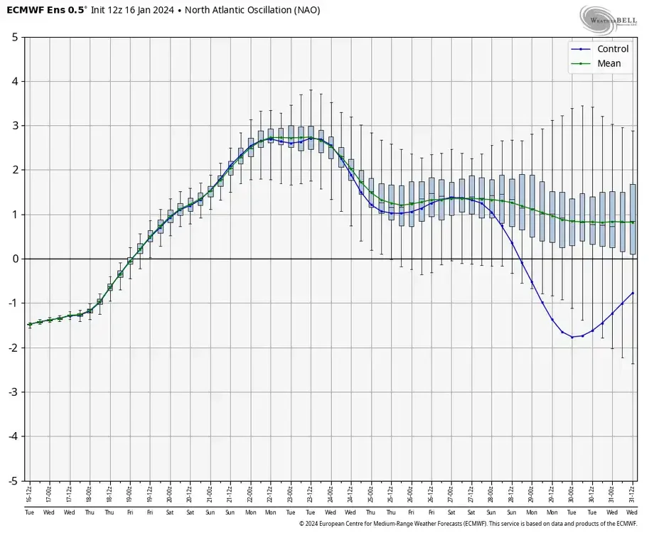
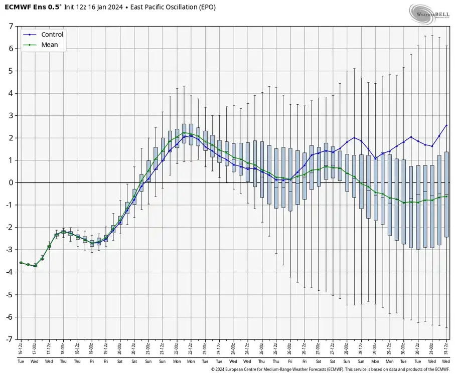
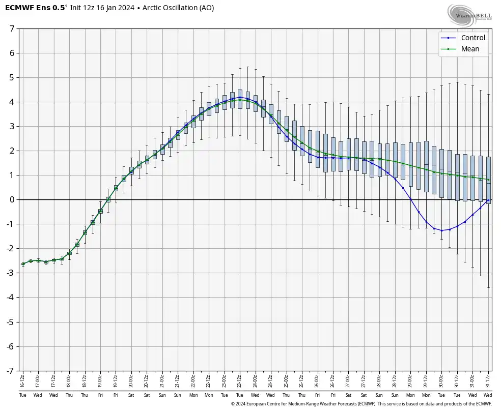
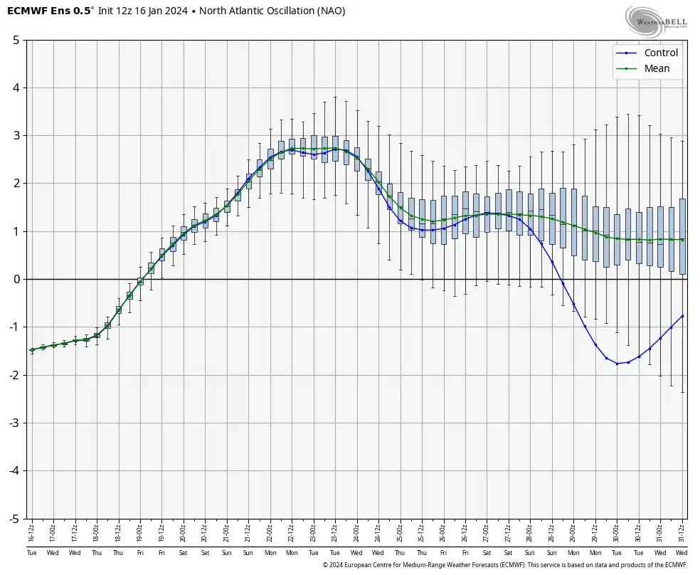
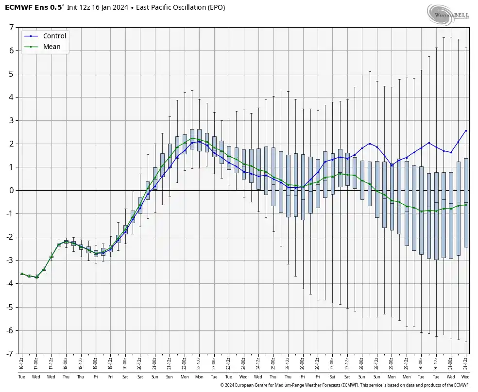
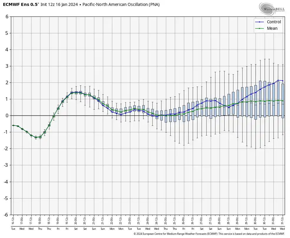
@Conway7305the good news is there are signs this warmer pattern will be short-lived. The EPS shows troughing developing in the east after about 1/27, with the PNA trending positive, the EPO turning neutral to somewhat negative, while the AO and NAO trend toward negative. That should help transport cold into the east as the pattern (hopefully) shuffles into an even more favorable pattern as we get into February.

Also, some of the EPS members are already signaling a snowstorm threat the last few days of the month. So, we'll see.
-
2
-
-
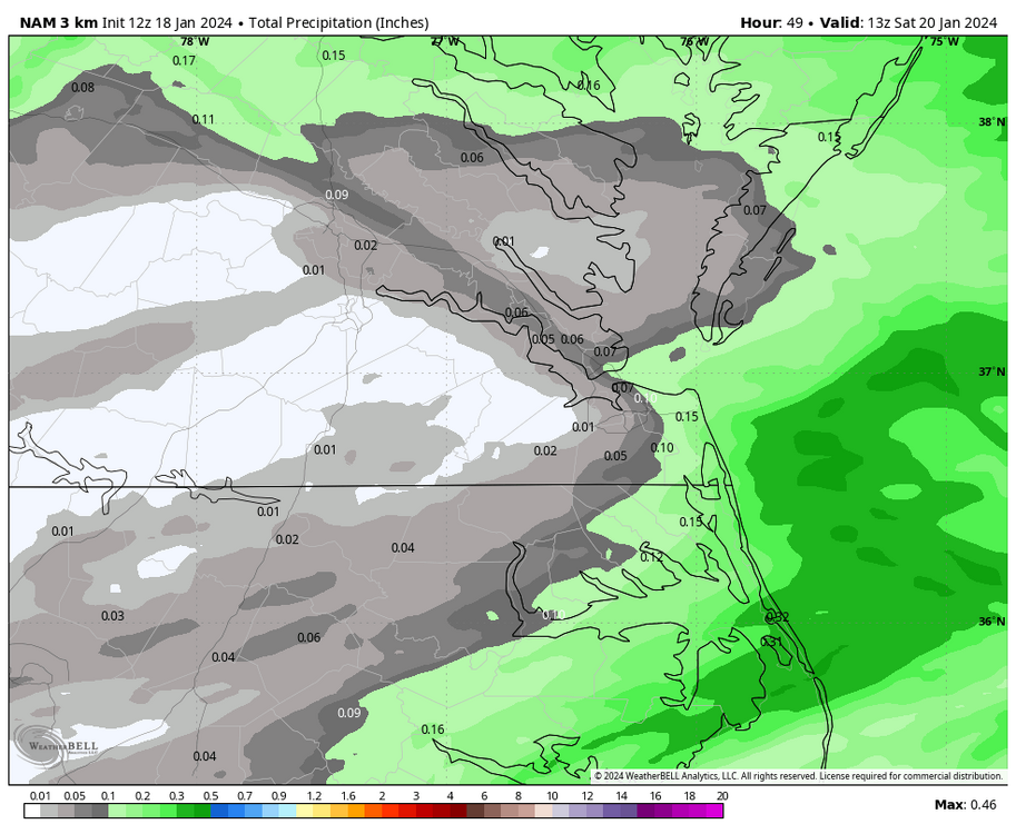
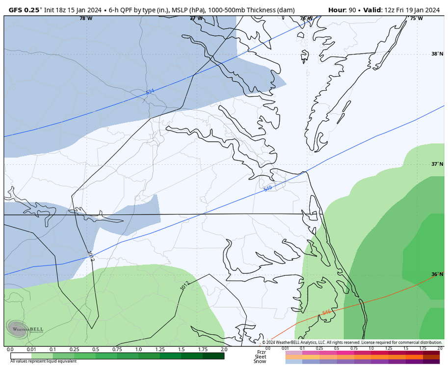
The short-range models are getting closer within range and the 18z 12k NAM is coming in more aggressive for the Richmond area and points north. This model has the best chance of snow between 7am and 1pm Friday morning, which is a great window if you want snow to stick. If this is a trend, we would want this to trend farther south over time.
-
1
-
-
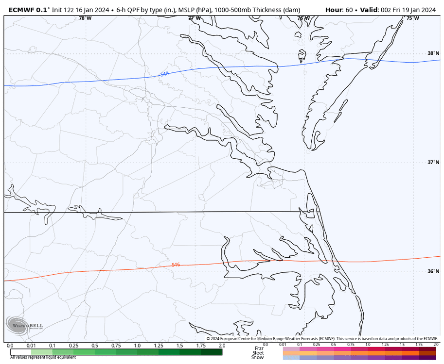
1 hour ago, RIC Airport said:
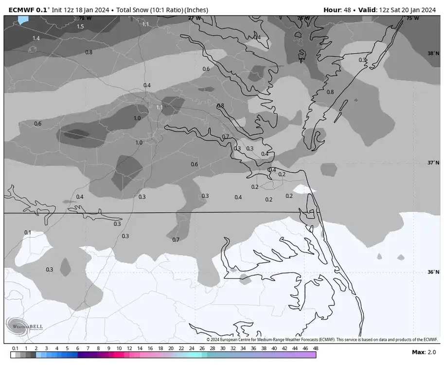
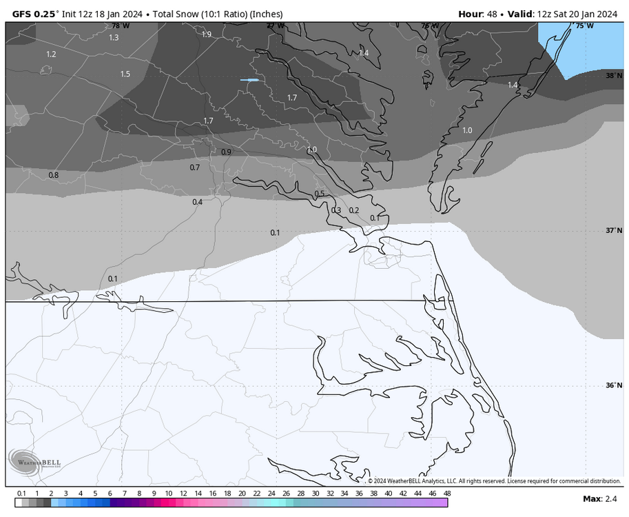
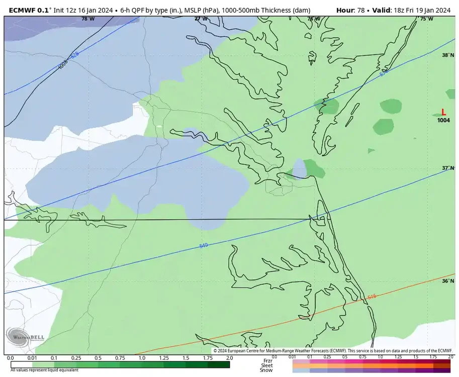
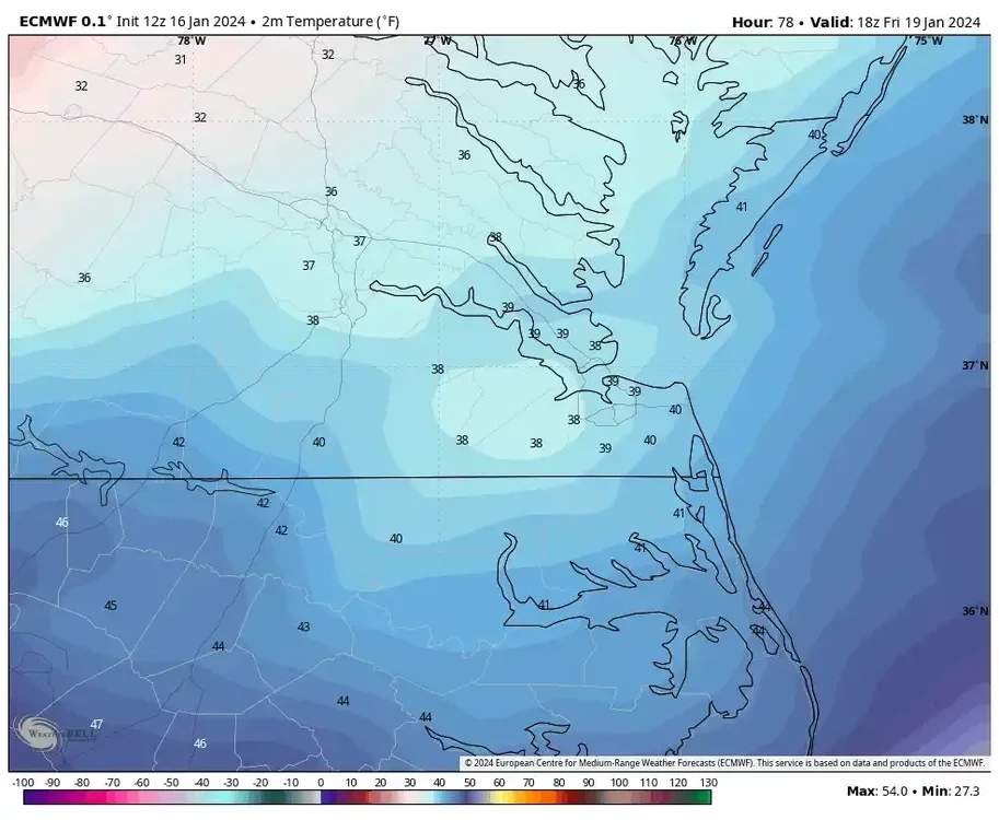
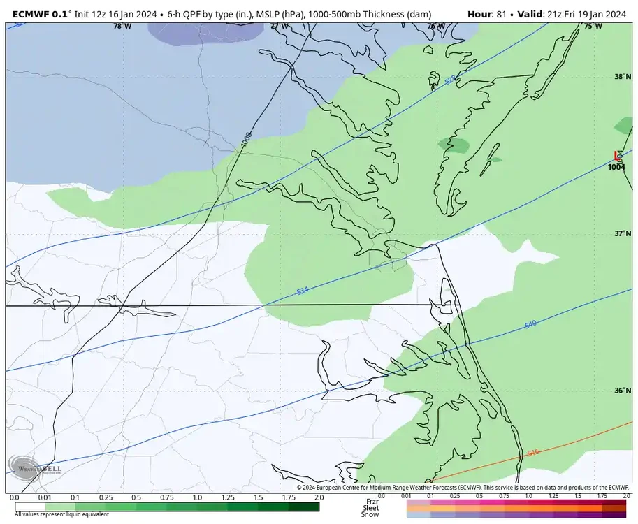
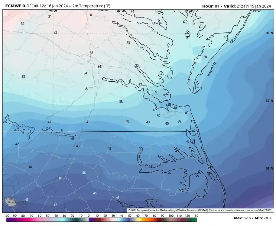
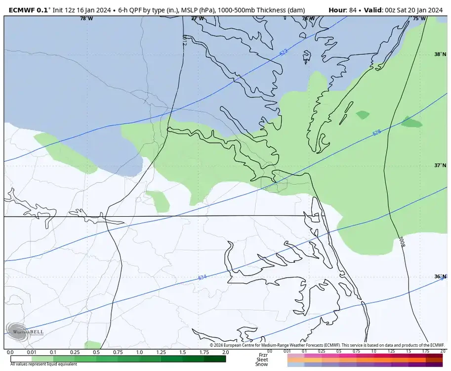
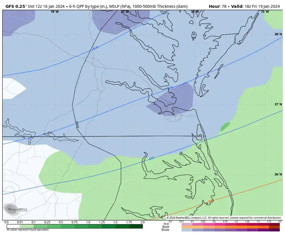
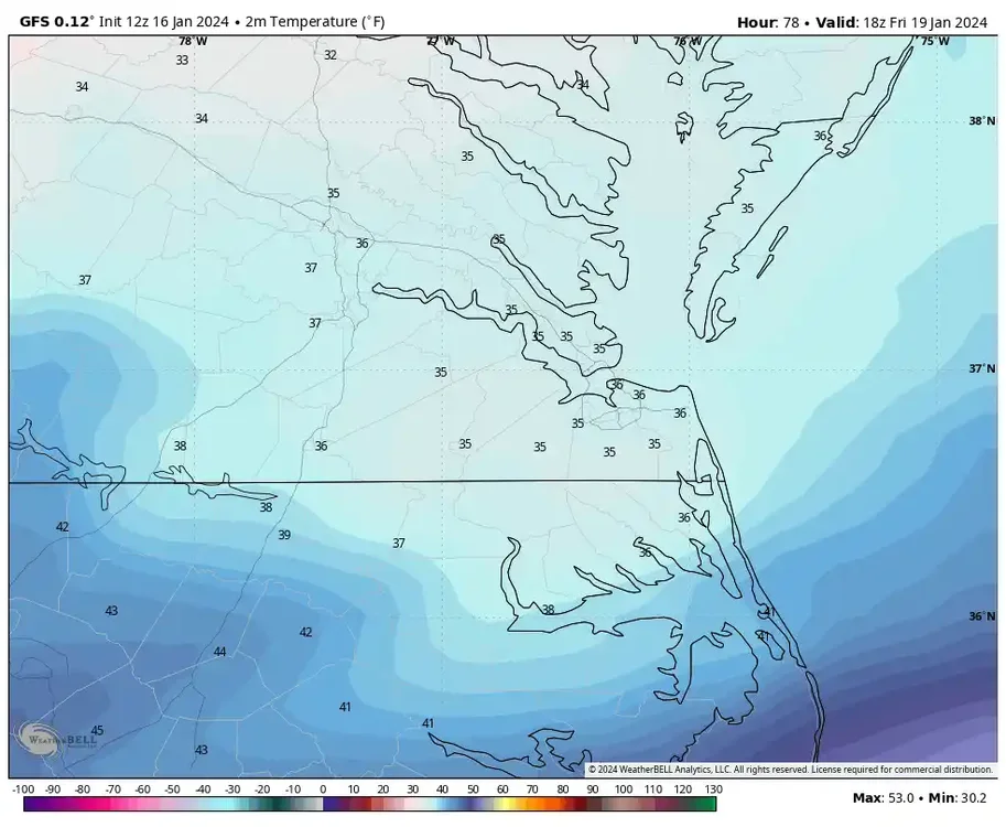
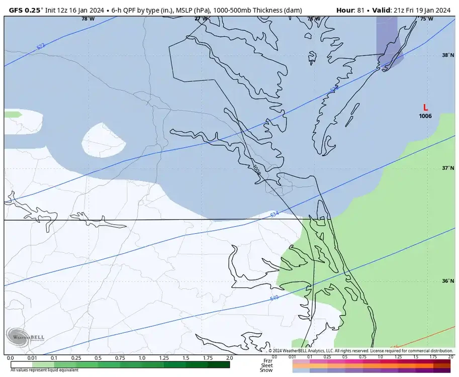
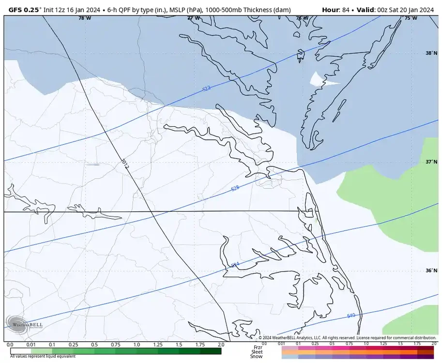
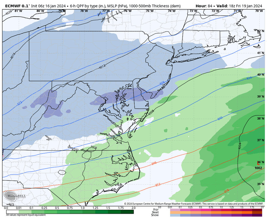
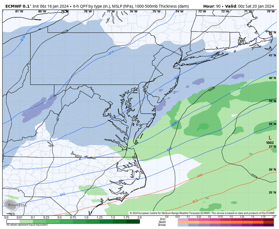
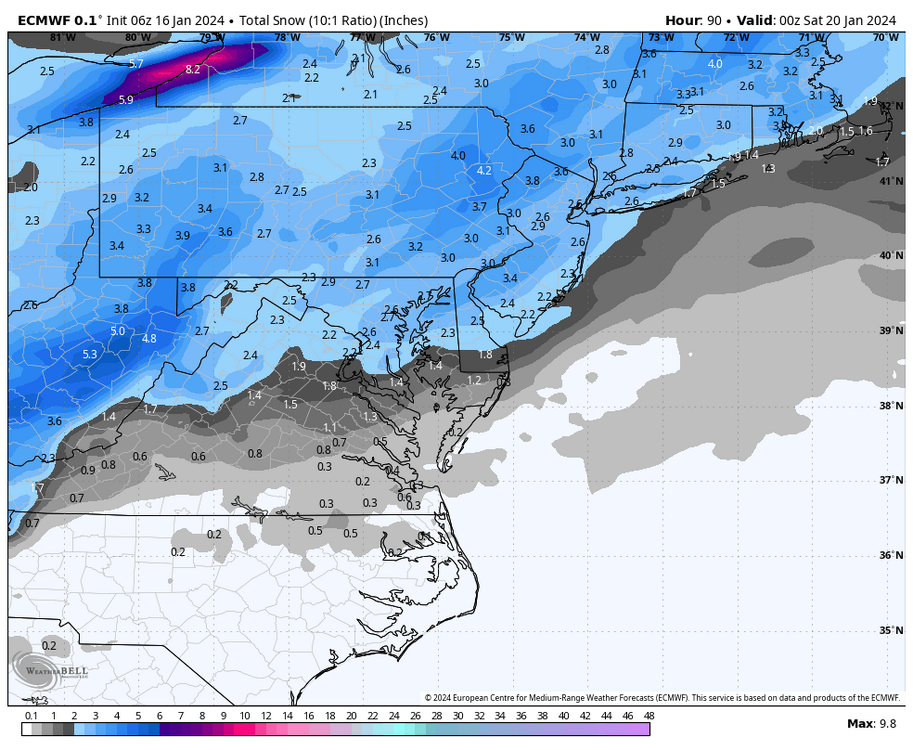
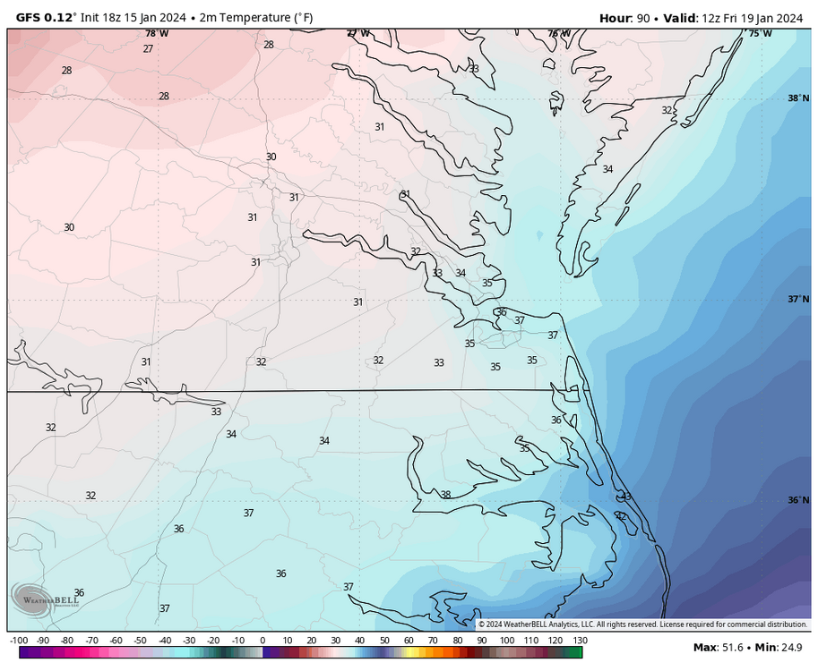
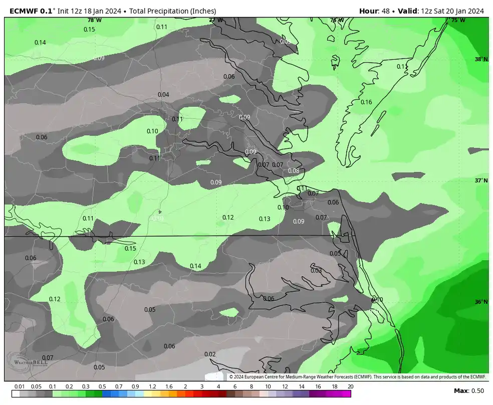
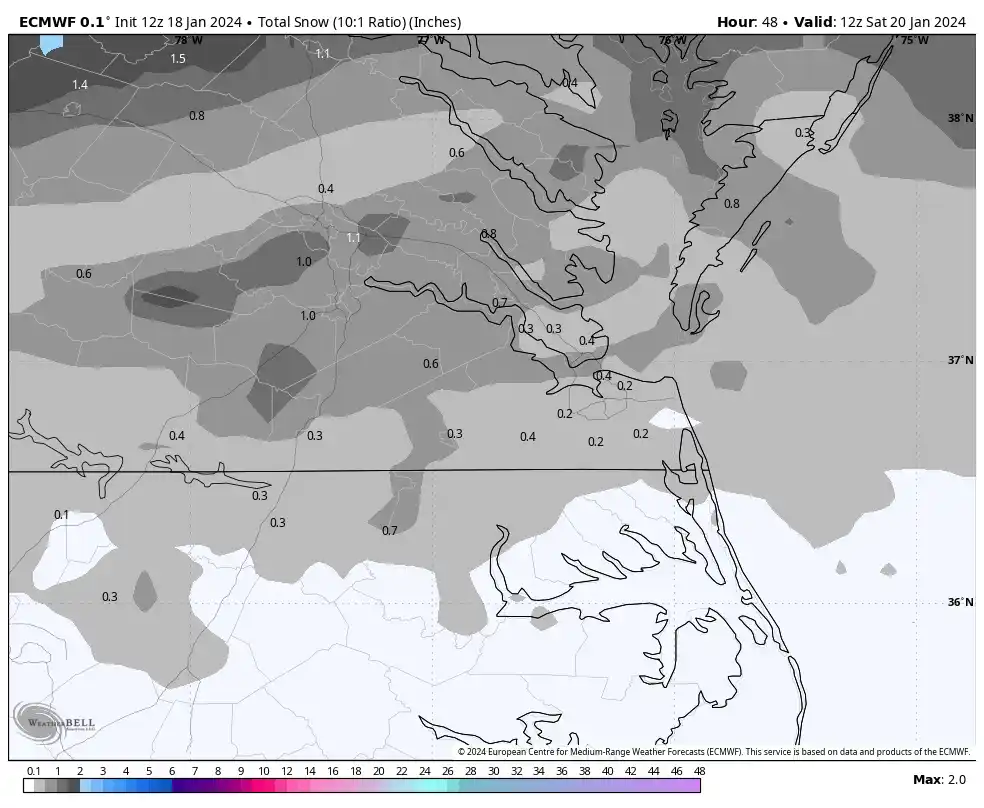
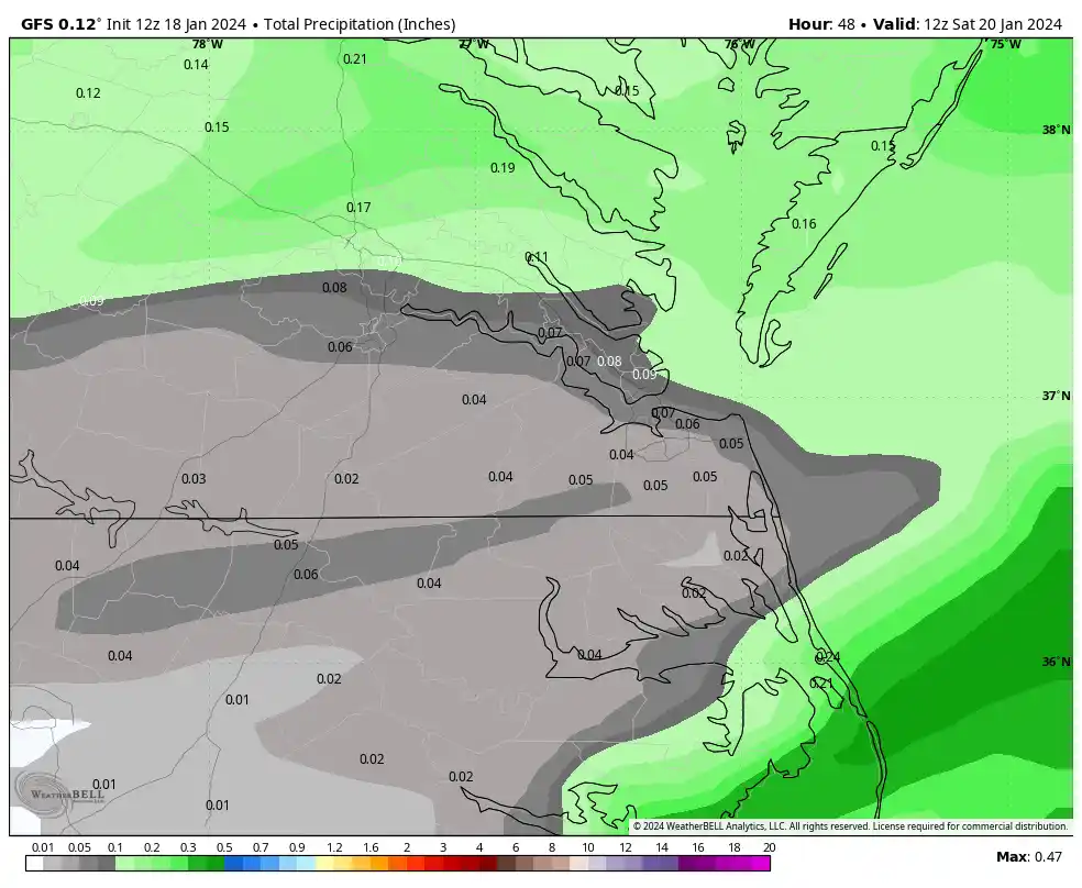
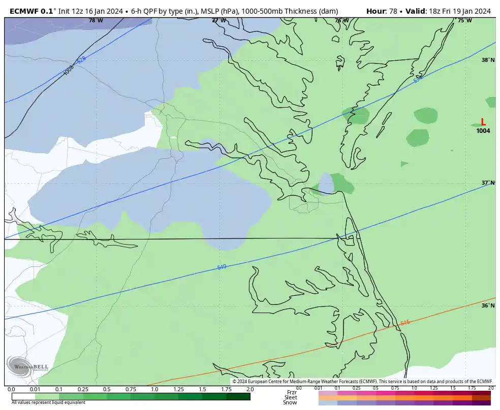
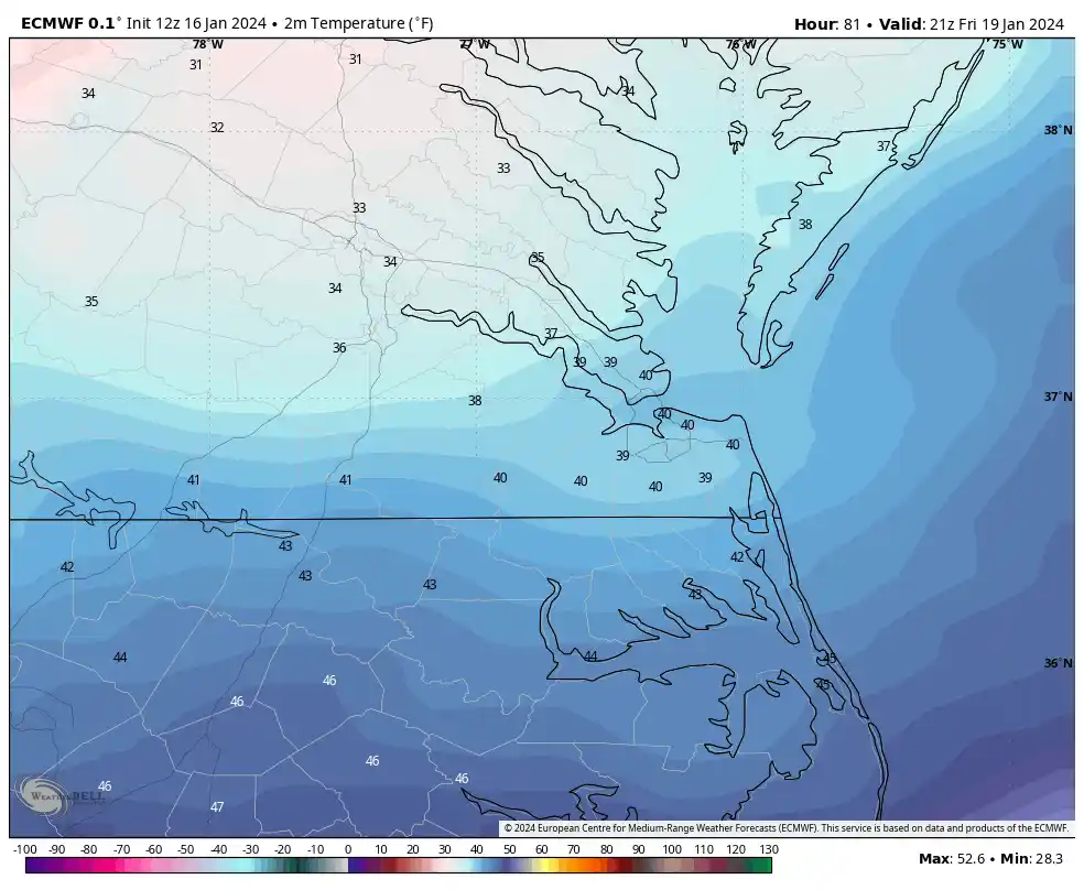
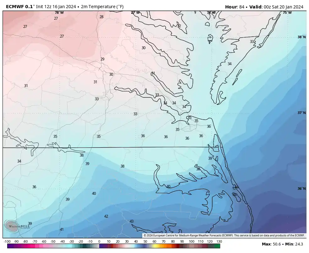
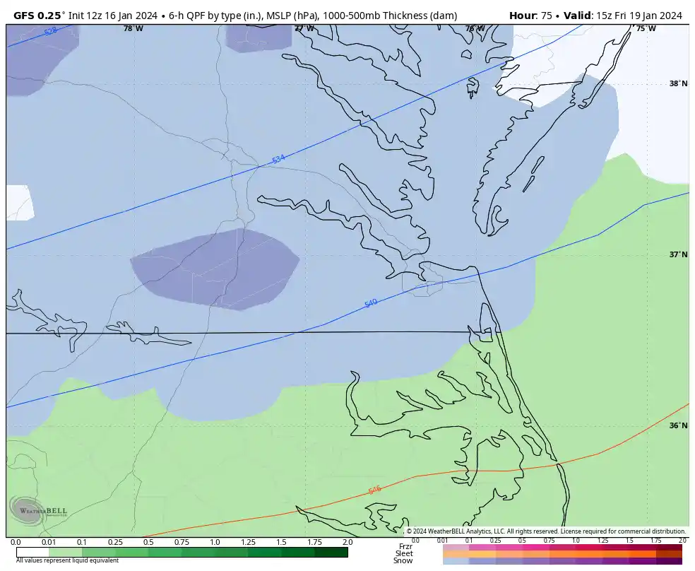
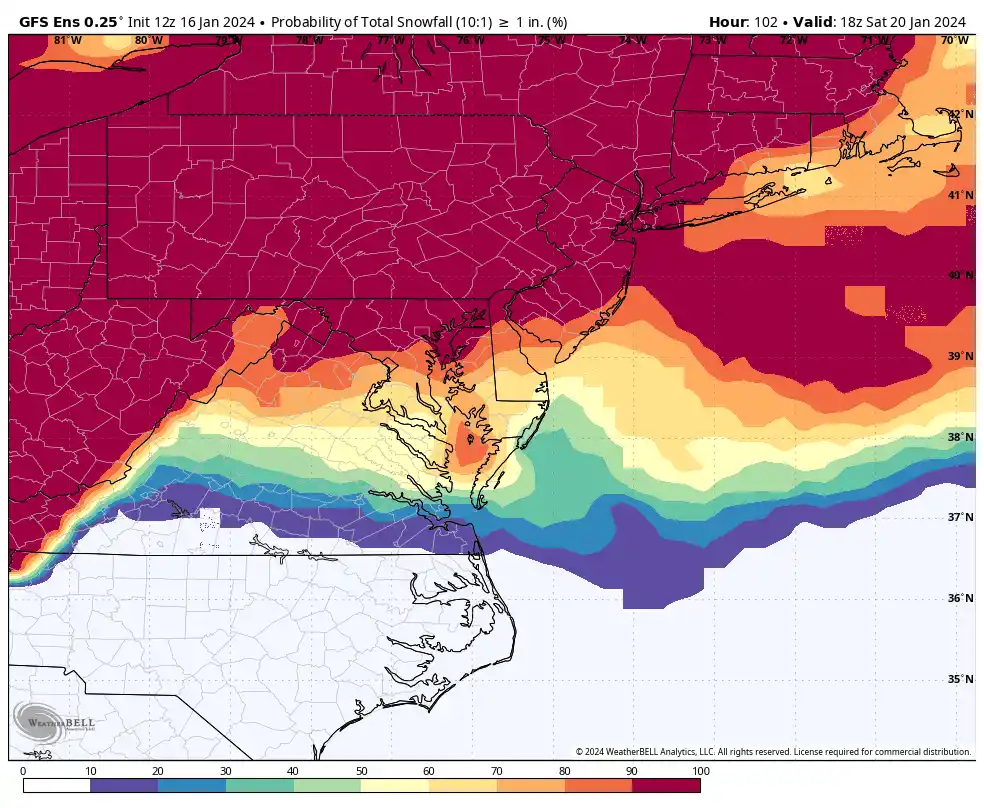
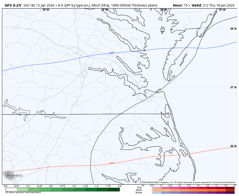
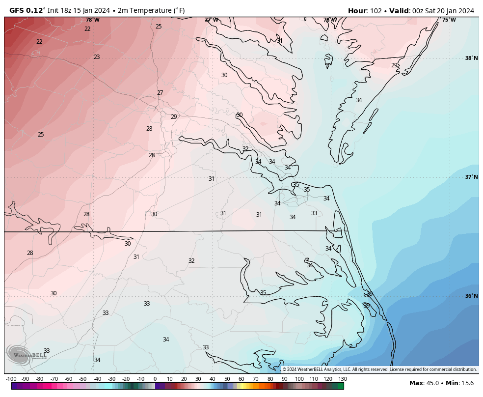
The 12Z GFS has snow possibly creeping into the area late Thursday evening and becoming more widespread between 4 am and 7 am Friday. It has the highest snow chances from 10 am to 4 pm, including the Hampton Roads area.
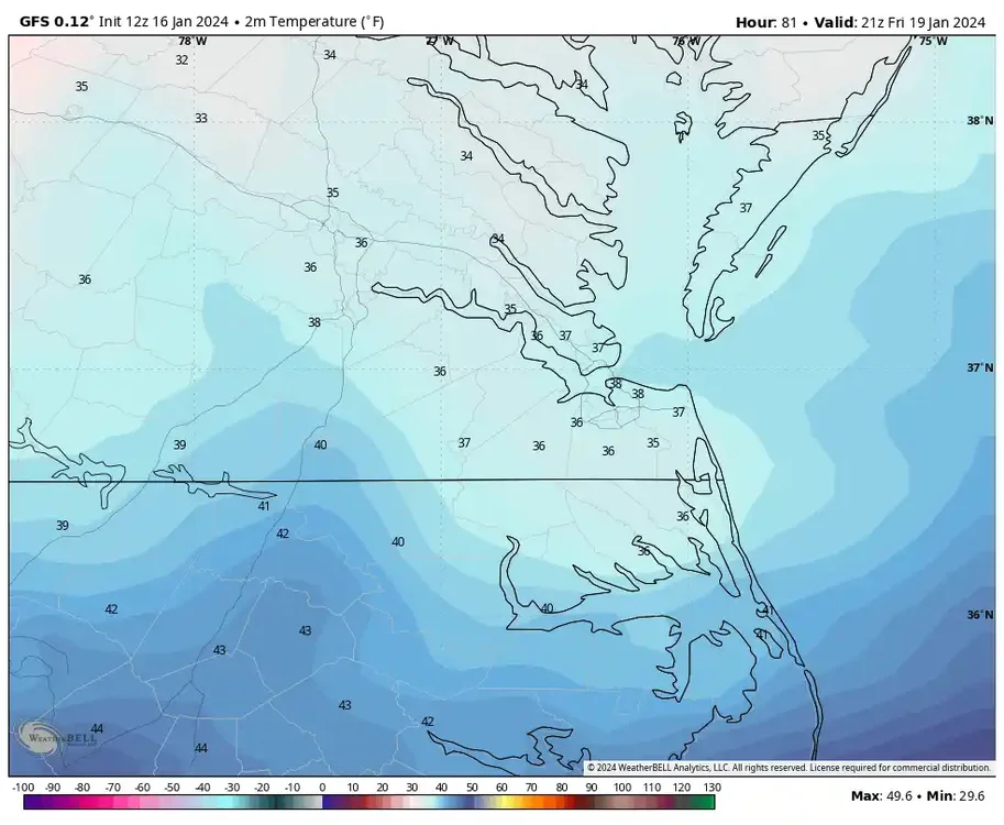
Surface temperatures look marginal. Verbatim, GFS has RIC at 31°F at 7 am Friday, but by 9 am, the temp is at 33°F peaking to 37°F at 2 pm before falling and not reaching freezing again until 8 pm. Most of Hampton Roads is in the mid-30s during the event. 850mb temps are below 0°C for all areas, so any precip that falls should be snow, but may struggle to accumulate. However, the GFS snow map does indicate minor accumulations across our region.
As stated previously, the challenge for us is we needed a deeper trough so that the energy goes south of us, allowing the trough to become negatively tilted, which would pull the storm closer to the coast around our latitude. Unfortunately, with the current setup, by the time this happens, the storm is already too far north and east of us. But, there is enough energy nearby that will still generate moisture in our area, especially as the low forms and deepens offshore as it pulls away.
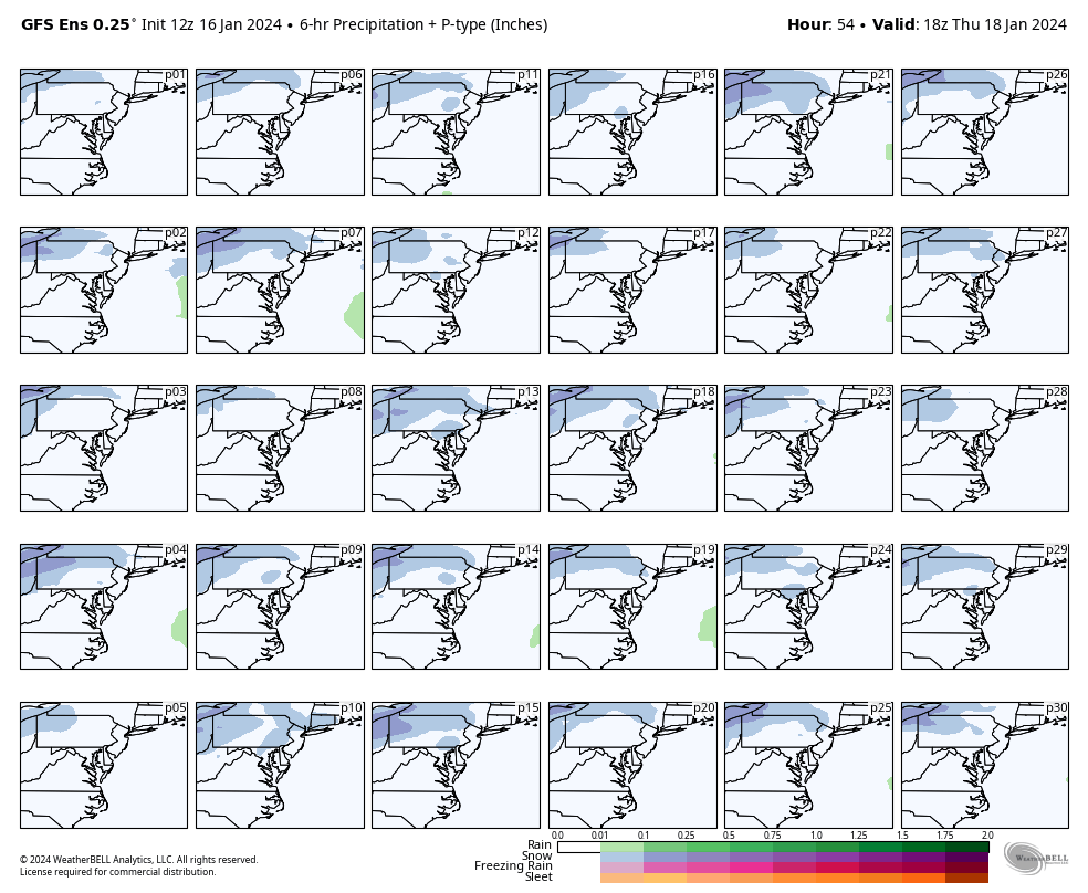
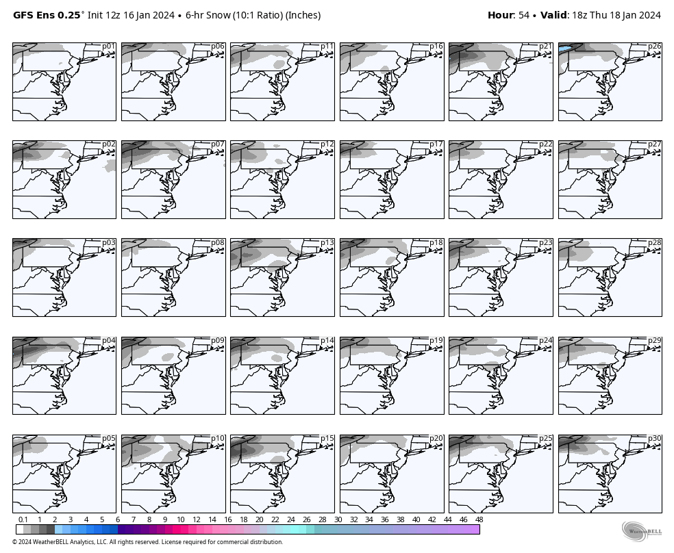
The signal is also there on the GEFS, but the mean for all 30 members shows about a 30-50% chance of an inch or more of snow in the Richmond area and only a 10-20% chance for Hampton Roads.
The Euro was not as aggressive with Friday's snow for our region. Timing is similar to the GFS and surface temperature challenges remain. In fact, Euro even paints that some of the precip from Richmond and points south and east could fall as rain.
It's becoming apparent that the best places to be for this event are toward CHO and north of Caroline County toward DCA.


-
1
-
2
-
-
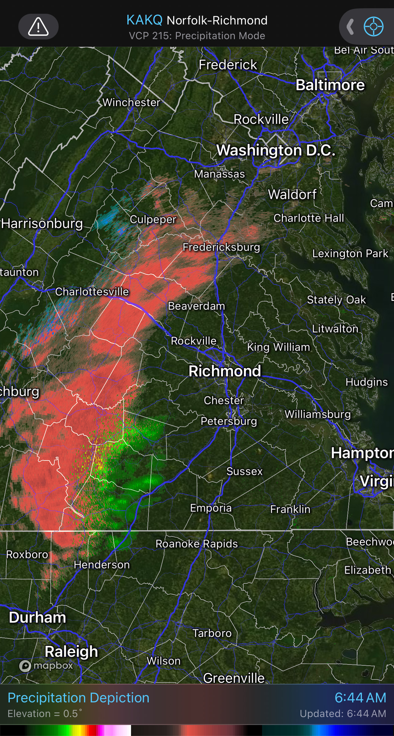
6 hours ago, RIC Airport said:
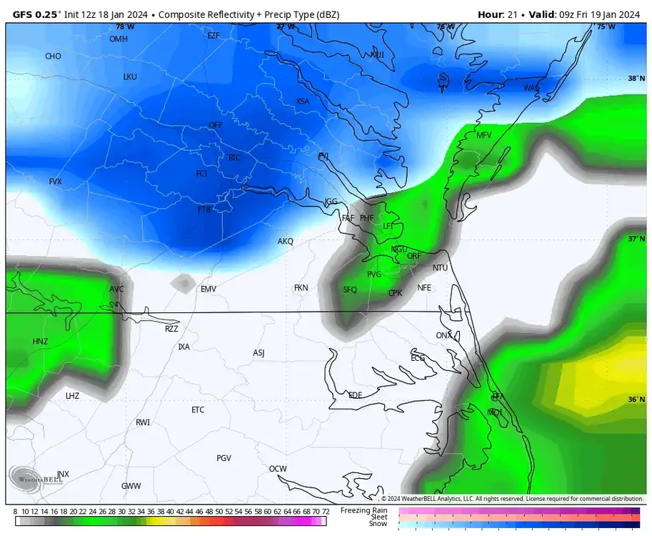
Radar has that next batch of precip to the west.
Richmond is still 31°F. Wakefield extended the advisory for RIC N & W until 11am.
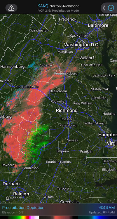 5 hours ago, eaglesin2011 said:
Probably will warm up just enough to avoid any more snow (except possibly on the very back end of that precip)
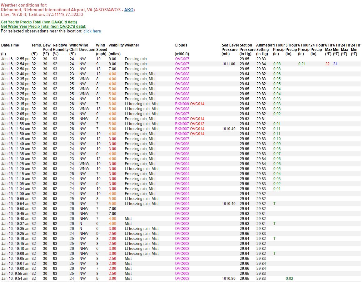
I am impressed with the batch of freezing rain that came through the Richmond area the last few hours. RIC has not been above freezing since about 2:20pm yesterday.
The 00Z 3K NAM from last night (see earlier post) did a remarkable job seeing this.

-
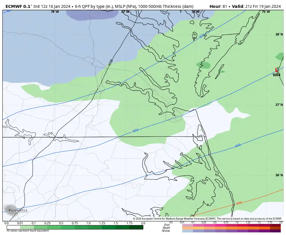
The 12Z GFS has snow possibly creeping into the area late Thursday evening and becoming more widespread between 4 am and 7 am Friday. It has the highest snow chances from 10 am to 4 pm, including the Hampton Roads area.
Surface temperatures look marginal. Verbatim, GFS has RIC at 31°F at 7 am Friday, but by 9 am, the temp is at 33°F peaking to 37°F at 2 pm before falling and not reaching freezing again until 8 pm. Most of Hampton Roads is in the mid-30s during the event. 850mb temps are below 0°C for all areas, so any precip that falls should be snow, but may struggle to accumulate. However, the GFS snow map does indicate minor accumulations across our region.


As stated previously, the challenge for us is we needed a deeper trough so that the energy goes south of us, allowing the trough to become negatively tilted, which would pull the storm closer to the coast around our latitude. Unfortunately, with the current setup, by the time this happens, the storm is already too far north and east of us. But, there is enough energy nearby that will still generate moisture in our area, especially as the low forms and deepens offshore as it pulls away.

The signal is also there on the GEFS, but the mean for all 30 members shows about a 30-50% chance of an inch or more of snow in the Richmond area and only a 10-20% chance for Hampton Roads.

-
1
-
-
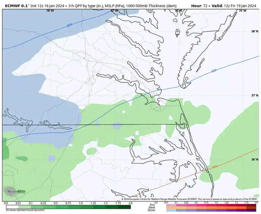
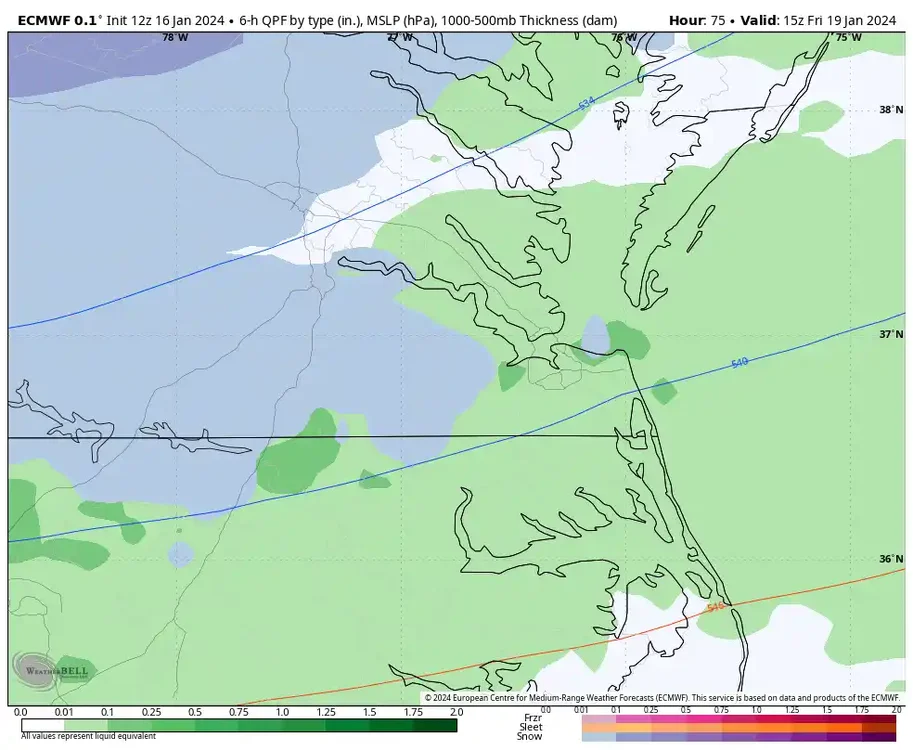
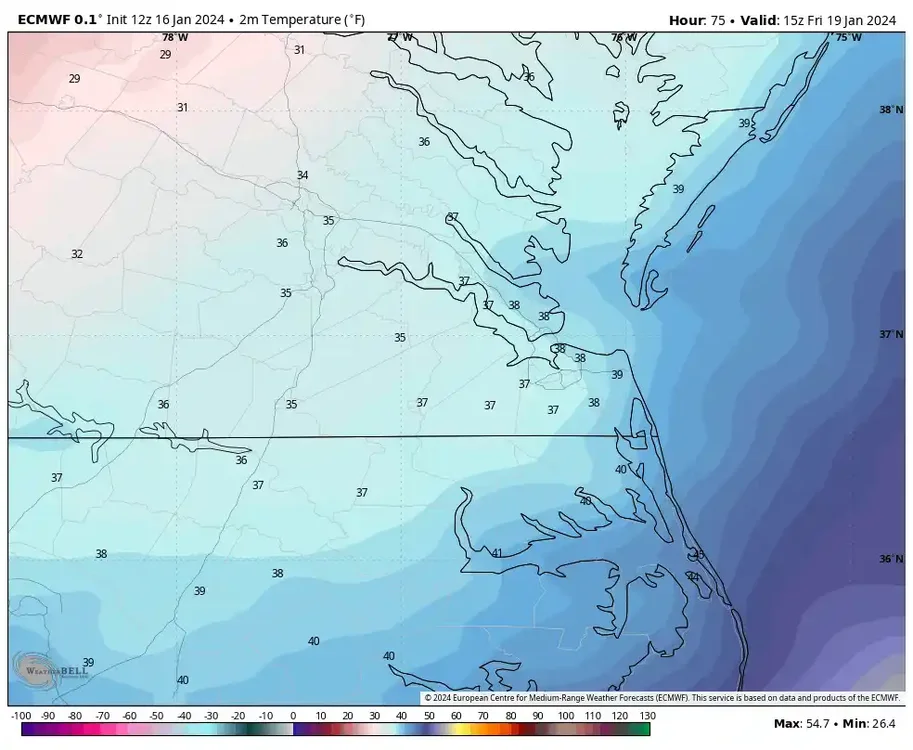
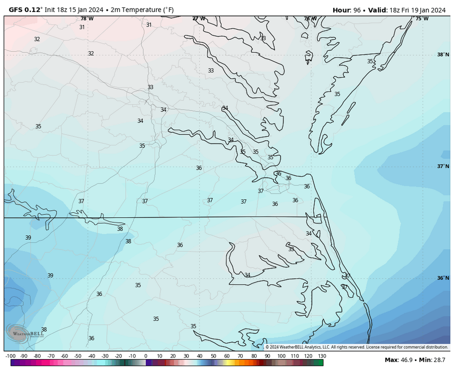
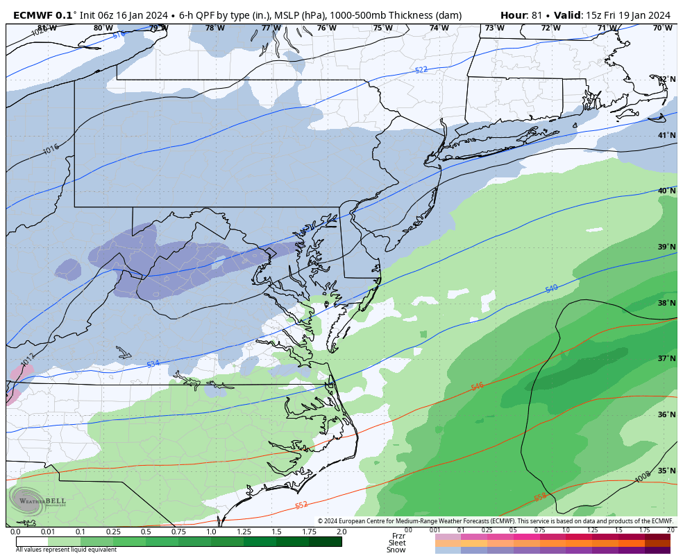
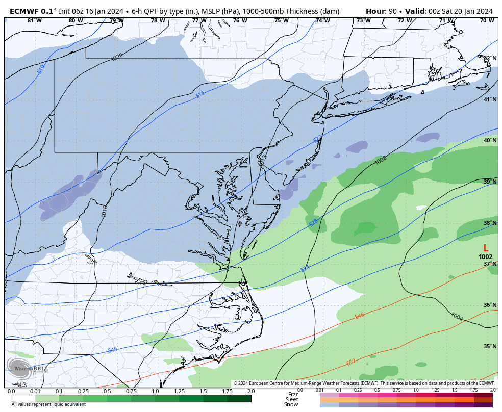
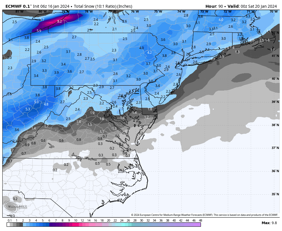
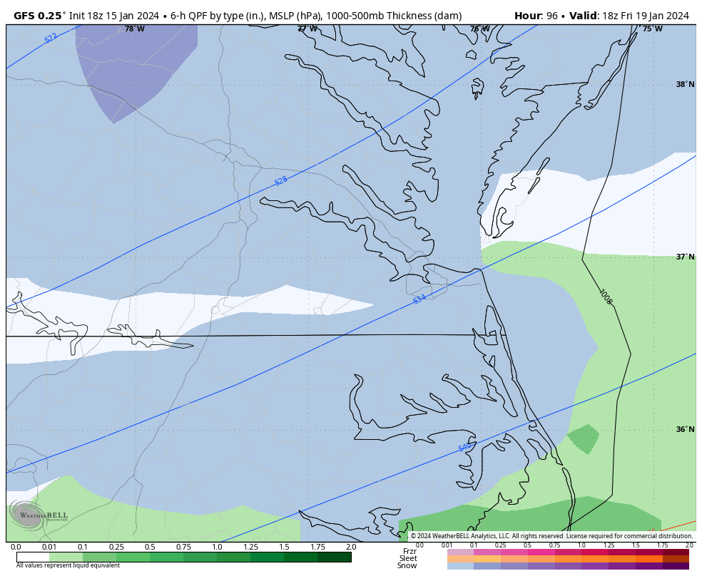
Friday still has decent support for additional snow, but we are on the southern end once again, and temperatures are around freezing or slightly above.
The 6Z Euro only goes out to 90 hours, so there may be more snow afterward this hour. But this is how it looks, just something to monitor in later runs.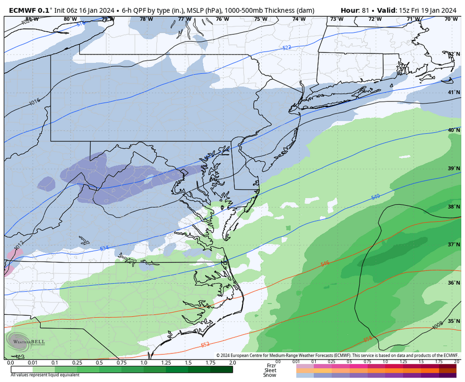
-
9 hours ago, RIC Airport said:
The 3K NAM has the next heaviest batch of precip moving into the Richmond area between 8 am and 9 am and ending around 2 pm. Hampton Roads thereafter, but the 3K NAM wasn't as aggressive with a transition to mix or snow for the eastern areas.
Radar has that next batch of precip to the west.
Richmond is still 31°F. Wakefield extended the advisory for RIC N & W until 11am.
URGENT - WINTER WEATHER MESSAGE
National Weather Service Wakefield VA
614 AM EST Tue Jan 16 2024

VAZ060-061-068-069-512-513-515-516-161600-
/O.CON.KAKQ.WW.Y.0002.000000T0000Z-240116T1600Z/
Prince Edward-Cumberland-Amelia-Powhatan-Eastern Hanover-
Western Chesterfield-
Western Henrico (Including the City of Richmond)-Eastern Henrico-
Including the cities of Farmville, Angola, Guinea Mills, Hawk,
Raines Tavern, Reeds, Stoddert, Earls, Mannboro, Scotts Fork,
Amelia Courthouse, Chula, Denaro, Jetersville, Fine Creek Mills,
Flat Rock, Goodwins Store, Subletts, Worshams, Clayville, Genito,
Mechanicsville, Bon Air, Midlothian, Richmond, and Sandston
614 AM EST Tue Jan 16 2024

...WINTER WEATHER ADVISORY REMAINS IN EFFECT UNTIL 11 AM EST THIS
MORNING...

* WHAT...Freezing rain. Additional ice accumulations of a light
  glaze.

* WHERE...Portions of central Virginia.

* WHEN...Until 11 AM EST this morning.

* IMPACTS...Very slippery sidewalks, roads and bridges are
  possible. The hazardous conditions could impact the morning
  commute.

PRECAUTIONARY/PREPAREDNESS ACTIONS...

Slow down and use caution while traveling. Prepare for possible
power outages.

For the latest road conditions in Virginia or Maryland, please
call 5 1 1. For the latest road information in North Carolina, go
to http://DriveNC.gov.
-
58 minutes ago, ldub23 said:
GFS is more aggressive with the changeover than 18z
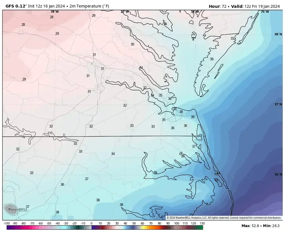
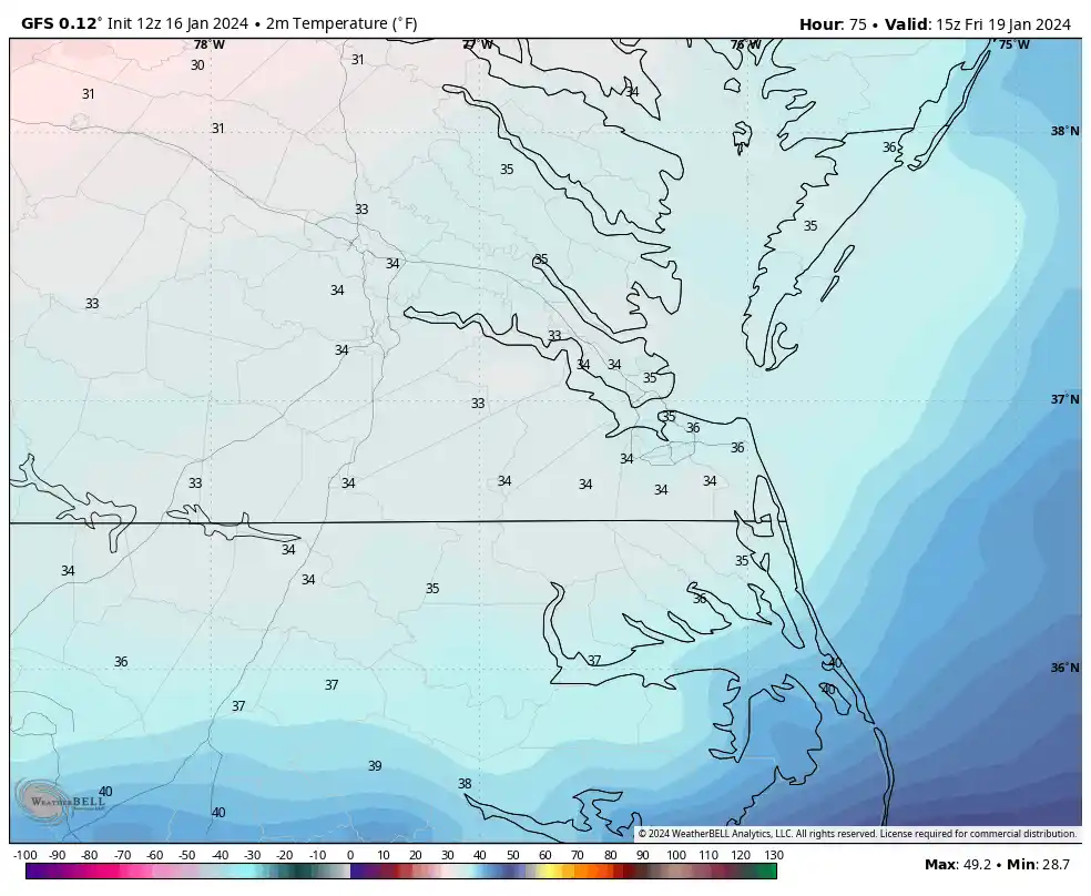
Frozen precip chances look better on the 00z GFS for areas east and SE of RIC. The challenge for Hampton Roads will be surface temperatures and fighting warm air aloft at 850MB. Both eventually fall as the afternoon progresses, but I wonder whether anything will be meaningful there.
The GFS has RIC rising to 33°F by 1am (it's 31°F at 11pm), rising to 35 by 6am, and remaining above freezing until 2pm. So unlike the 00Z HRRR and 3K NAM I showed, it keeps any frozen precip confined to areas north of RIC until about 1pm when both surface and 850mb temps fall below freezing. 850s cool to 0°F at Norfolk by 4pm, but surface temperatures throughout Hampton Roads are still in the mid-upper 30s. Norfolk does not even drop to freezing on the GFS until 9pm. The model does try to accumulate snow between Richmond and Williamsburg and up to the Northern Neck.This is just one model depiction, as we know things can and probably will change.


-
35 minutes ago, Sernest14 said:
HRRR has been awful with this storm so far (at least for our area). it has wanted to continue to push the precip more due north than a more ENE direction which is what we saw all day. I feel like every run they had precip out of our area within the hour
Yeah, I agree it hasn't been great, especially when I was looking yesterday and comparing to what happened today.
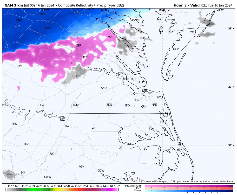
FWIW, the 00z 3K NAM followed a similar theme, although it seems slower than the HRRR with the snow band's northward movement. Also, it's far more aggressive with overnight mixed precip from the Richmond metro and points north and west. Unfortunately, it will be mixed precip because the low-forming offshore pushes in warm air at 850 MB. The 0C line gets as far north as PHL by sunrise, so even DCA, BWI, and such will eventually mix. The 3K NAM has the next heaviest batch of precip moving into the Richmond area between 8 am and 9 am and ending around 2 pm. Hampton Roads thereafter, but the 3K NAM wasn't as aggressive with a transition to mix or snow for the eastern areas.
-
1
-
-
The 00Z HRRR continues to lift the snow band toward the DC metro area. However, mixed precipitation continues to develop periodically as far south as the Richmond metro area throughout the night and into tomorrow morning. Temperatures look to remain steady around freezing. It has areas SE of Richmond, including Hampton Roads, that are mostly dry, but you could still see spotty light rain since temperatures in this area stay well above freezing.
Around 10 am tomorrow, HRRR has a more widespread band of precipitation developing across the Richmond Metro and then moving SE toward Hampton Roads. Verbatim, the temperature at RIC is around 34°F-35°F, so it’s rain when it begins. Still, temperatures drop to around freezing during the precip, so it transitions to a mix and finally snow before ending and moving east between 2 pm and 3 pm. This transition to a mix and snow could occur as far east as Williamsburg, the middle peninsula, and the northern neck. Areas east and SE of Williamsburg see just rain with this precip patch.
Should the temperatures stay 2-3 degrees colder than the model indicates, there could be more widespread frozen precip around Richmond tomorrow morning into the afternoon with this development.
-
1
-
-
1 hour ago, Sernest14 said:
Looks to be filling back in around Danville but a dry slot between there and Lynchburg opening up
1 hour ago, Sernest14 said:Currently at 3”- definitely better than models were showing!
I'm glad it worked out. It's always great when events overperform.
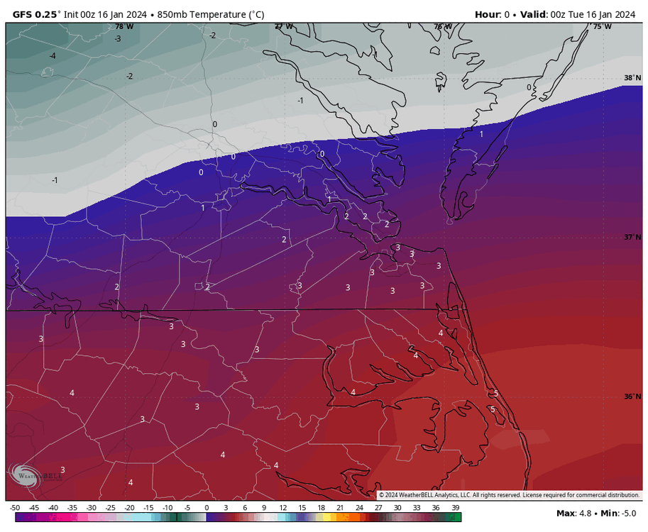
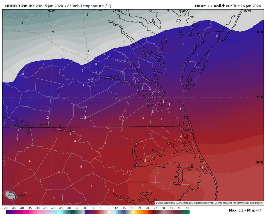
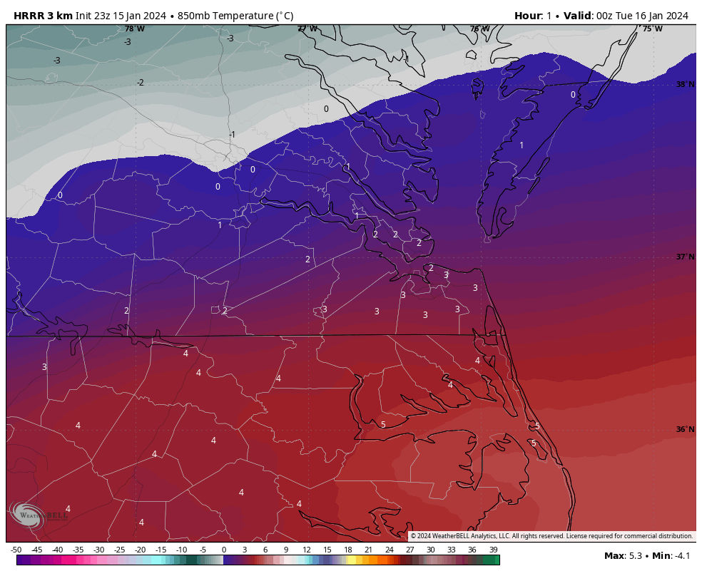
At 7pm, the temperature was still 32°F at RIC, and no model yesterday had it that cold this late. It's too bad there is no precip, but even if there had been and based on the 850mb temp map below, that pesky sleet line would still be somewhere near the city thanks to the developing surface low off the coast and pushing warmer air northward.
-
1
-
-
13 hours ago, eaglesin2011 said:
Getting close to 2 inches here in Glen Allen 295 /Staples
breaks the streak at least
Nice! You were lucky to be in the right spot with how the band set up.
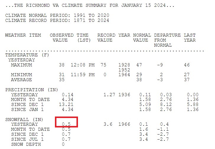
RIC officially came in at 0.5", so unless some miracle happens and another half-inch falls between now and midnight, the streak with less than 1.0" continues.
-
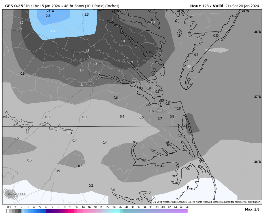
GFS and Euro maintain the idea of an additional snow chance on Friday during the day, with the GFS more aggressive with its depiction.
The 18Z GFS had a 12-15-hour snow window on Friday from 7am to 10pm. Temperatures look to be around 31-34°F around Richmond for most of the event but fall as the low deepens offshore to our NE and draws in colder air. Obviously, we are still a few days away, and the details could change, but based on what I mentioned earlier, this is not looking to be a big event. Also, Hampton Roads and NE NC could see some, too, @Stormpc, @ldub23, @Topher, et. al.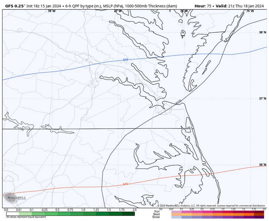


-
1 hour ago, SoCoWx said:
On the bright side, it has already snowed more this winter than last—not that that was a high bar or anything. You can only go up from nothing.

I agree. I really hope this is not it for the winter. It's too bad the band didn't set up a bit farther south before moving north.
-
2
-
-
Wakefield extended the advisory until 8am.
URGENT - WINTER WEATHER MESSAGE
National Weather Service Wakefield VA
349 PM EST Mon Jan 15 2024

VAZ060-061-068-069-512-513-515-516-160500-
/O.EXT.KAKQ.WW.Y.0002.000000T0000Z-240116T1300Z/
Prince Edward-Cumberland-Amelia-Powhatan-Eastern Hanover-
Western Chesterfield-
Western Henrico (Including the City of Richmond)-Eastern Henrico-
Including the cities of Farmville, Angola, Guinea Mills, Hawk,
Raines Tavern, Reeds, Stoddert, Earls, Mannboro, Scotts Fork,
Amelia Courthouse, Chula, Denaro, Jetersville, Fine Creek Mills,
Flat Rock, Goodwins Store, Subletts, Worshams, Clayville, Genito,
Mechanicsville, Bon Air, Midlothian, Richmond, and Sandston
349 PM EST Mon Jan 15 2024

...WINTER WEATHER ADVISORY NOW IN EFFECT UNTIL 8 AM EST TUESDAY...

* WHAT...Mixed precipitation. Additional snow accumulations of
  up to one inch and ice accumulations of a light glaze.

* WHERE...Portions of central Virginia.

* WHEN...Until 8 AM EST Tuesday.

* IMPACTS...Plan on slippery road conditions. The hazardous
  conditions could impact the morning or evening commute.

PRECAUTIONARY/PREPAREDNESS ACTIONS...

Slow down and use caution while traveling.

For the latest road conditions in Virginia or Maryland, please
call 5 1 1.
-
1 hour ago, mikeeng92 said:
Hopefully this band stalls a bit before pulling north.
Yes, that would be great if it stayed long enough to give everyone at least an inch or two. Maybe all it takes is another hour at these rates. KRIC actually reached freezing with moderate snow about 30 mins ago, and no model, at least since 00z, has had it this cold this late in the day. Remember the HRRR sounding I posted?
At some point, you just have to nowcast and not look at the models.
-
1
-


Richmond Metro/Hampton Roads Area Discussion
in Mid Atlantic
Posted
I had time to look at the 18Z suite, and the idea of snow or rain streamers (snow most likely) developing behind the low tomorrow afternoon and evening as the next Arctic airmass penetrates the area is gaining traction.
Below is a slowed down 18Z 3K NAM radar simulation, which goes in motion from 1am Friday to 7am Saturday. The precipitation begins entering our region between 2am and 4am and moves out by noon. The 18Z Euro and 18Z GFS were even more aggressive with snow around Richmond in the morning.
Also, around 4pm, you can see where the 3K NAM has snow entering the region northwest of RIC and moving through Hampton Roads and the Eastern Shore between 6pm and 10pm. It looks limited, but the models are beginning to pick up on this idea of snow, even in Southside Hampton Roads, @SnowBeach@ldub23.
I froze the radar at 8pm below where it shows a snow squall moving east between Norfolk and Virginia Beach. The temperature at ORF is 34°F, and it's very cold aloft (850mb temps ~-10°C), so it should be snow with this approaching airmass.
It will be interesting to see whether the 00z suite maintains this, even for your area, @Stormpc.