

RIC Airport
-
Posts
1,766 -
Joined
-
Last visited
Content Type
Profiles
Blogs
Forums
American Weather
Media Demo
Store
Gallery
Posts posted by RIC Airport
-
-
17 minutes ago, RIC Airport said:
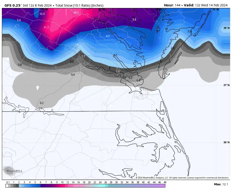
GFS crushes us for PD
11 minutes ago, Shad said:FOLKS....check out the GFS is you havnt.....wow
10 minutes ago, RIC Airport said:Yup, waiting on the next couple panels before I post the maps.

-
 1
1
-
-
Just now, Shad said:
FOLKS....check out the GFS is you havnt.....wow
Yup, waiting on the next couple panels before I post the maps.
-
1
-
-
GFS crushes us for PD
-
1
-
-
I am not believing the 12z GFS for next week until the Euro is on board. Just saying.

-
1 hour ago, RIC Airport said:
So looking at the 00z GEFS/EPS and the 6z GEFS, I am please to say that I are now seeing the ensemble mean approaching where we were heading toward the mid-January threats. So, my confidence about this pattern producing something of substance has increased since yesterday afternoon.
The 6z GEFS snowfall mean was high. Hopefully the 12z EPS continues to catch up. We are headed in the right direction.


-
5
-
 1
1
-
-
So looking at the 00z GEFS/EPS and the 6z GEFS, I am please to say that I are now seeing the ensemble mean approaching where we were heading toward the mid-January threats. So, my confidence about this pattern producing something of substance has increased since yesterday afternoon.
-
56 minutes ago, wasnow215 said:
6z GFS somewhat more south for both 2/13 and 2/18-19.
6z map for 18th-19th.

-
24 minutes ago, RIC Airport said:
I will disengage from run-to-run monitoring until we see consistency.
The 00z GFS introduces the idea of two storms. 18-19 and then another the 21st-22nd. The 1st storm is rain, but the second is a rain to snow scenario.


-
2
-
-
3 hours ago, ldub23 said:
Hopefully it will improve tonight
I will disengage from run-to-run monitoring until we see consistency.
The 00z GFS introduces the idea of two storms. 18-19 and then another the 21st-22nd. The 1st storm is rain, but the second is a rain to snow scenario.
-
18z GEFS is a nice improvement. It's not over, there are some nice hits, best looking chart of the day.


-
1
-
1
-
-
33 minutes ago, Conway7305 said:
18z GFS PD storm threat went from snow at 0z to rain at 60 degrees for 18z. lol. Cold just vanishes. Let’s see what the overnight models say.
As I mentioned earlier, it may not even be THE storm. When you look at the ensembles, if you believe they are useful, there appears to be more than one opportunity for snow around PD day and then beyond that around the 21st or 22nd, which is when the -NAO is slated to start weakening.

.thumb.png.ce77677298abe64aa51e4d5674b06682.png)
 28 minutes ago, ldub23 said:
The pattern change advertised since mid dec still not happening especially with another big storm coming into California. Im still on board with a perfect winter storm pattern change occuring in late March when it doesnt matter. Hopefully the 18 gfs is just a blip.
It has been a frustrating winter for many. We are running out of time.
-
1
-
-
45 minutes ago, wasnow215 said:
@RIC Airportdidn’t the Dec 9 2018 big snow come after some pretty warm early Dec temps or no? I thought it was.
Highs were in the 40s for five days before that storm. And don't forget, RIC reached 72°F on 1/2/2022 before 3-5" fell the next day.
One of the best examples of extreme warmth here before a snowstorm was the 3/3/2014 storm when RIC reached 73°F on 3/2/2014 and recorded 3.0" the next day. It was a solid 4-8" event for most of the state, then RIC hit 11°F the following day.
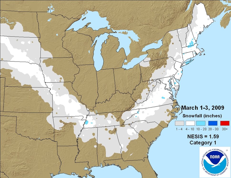
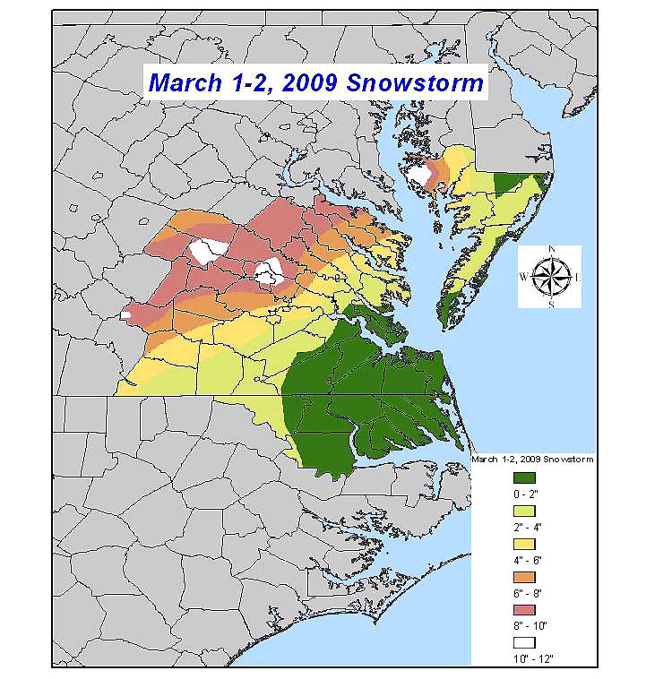
It was also 69°F two days before the March 1-2, 2009 storm, just as arctic air was pressing down. It was also a Miller A storm that even brought snow to Atlanta. So, those types of situations have had success.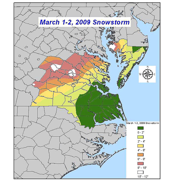
-
1
-
-
-
46 minutes ago, Conway7305 said:
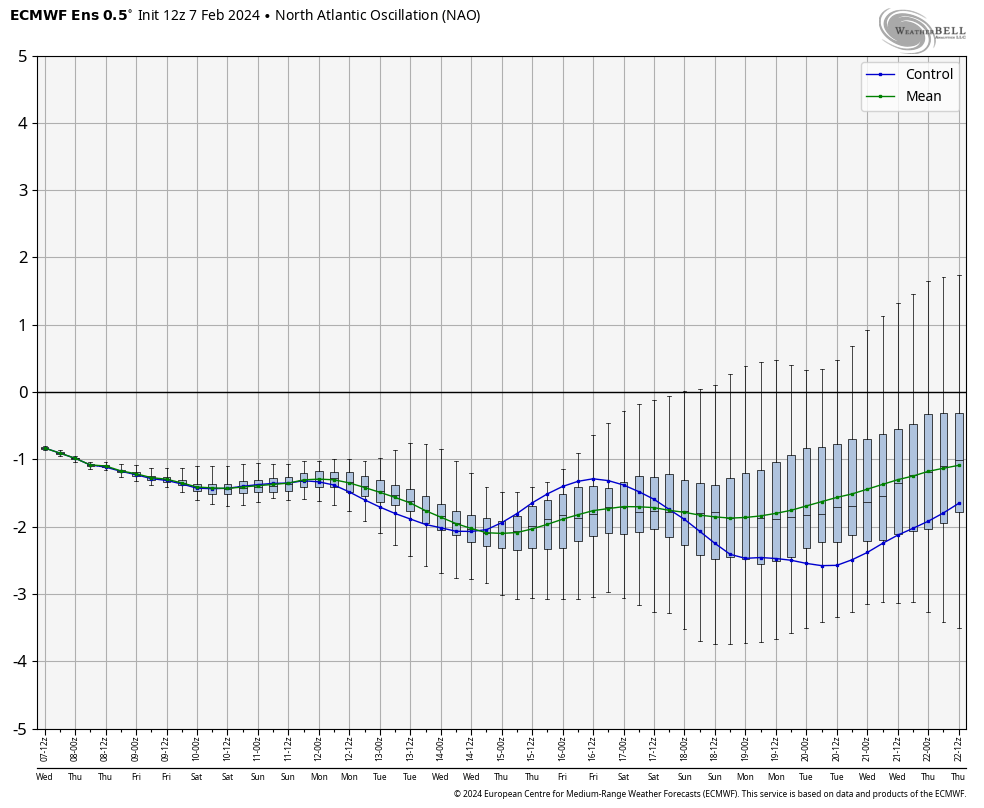
Good news is both GFS and EURO show a storm (Potentially BIG) with juiced up STJ. We don’t want too much of a block, otherwise supression. To little of a block is a cutter or rainstorm. Hoping we find middle ground. NAO block has weakened a little past few runs but still there so that’s good news. Lots of waves coming on shore so no shortage of storms. We just need good timing.
I like the optimism, and I am trying to remain positive.
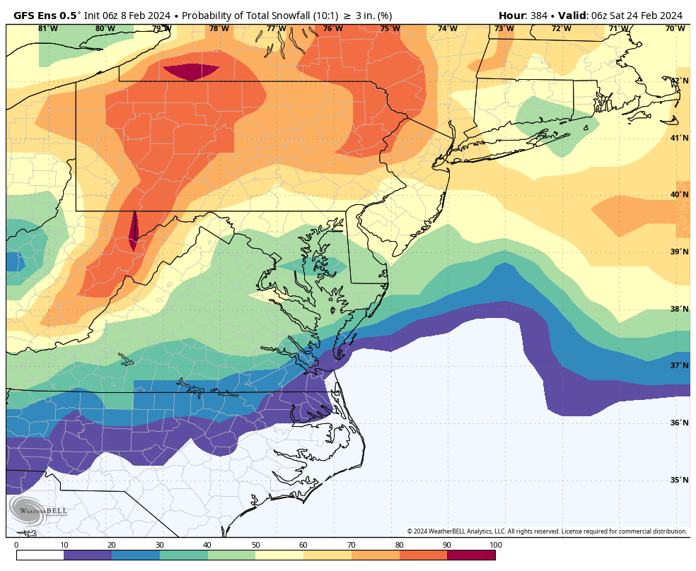
While I understand that even the ensembles are subject to fluctuations, we had better looks going into the mid-January threats. I am not yet seeing that level as both the EPS/GEFS continues to look rather bleak as we approach mid-late February. I want to see a solid hit on at least 10 of 30 ensembles on the GEFS before I get confident. But, we've been maxing out at around 5 or so. For EPS, I think 18-20 hits would probably be ideal.


-
1
-
-
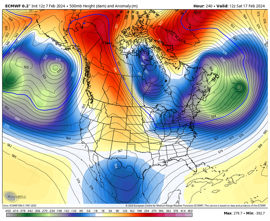
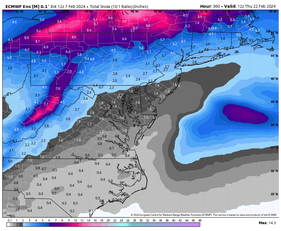
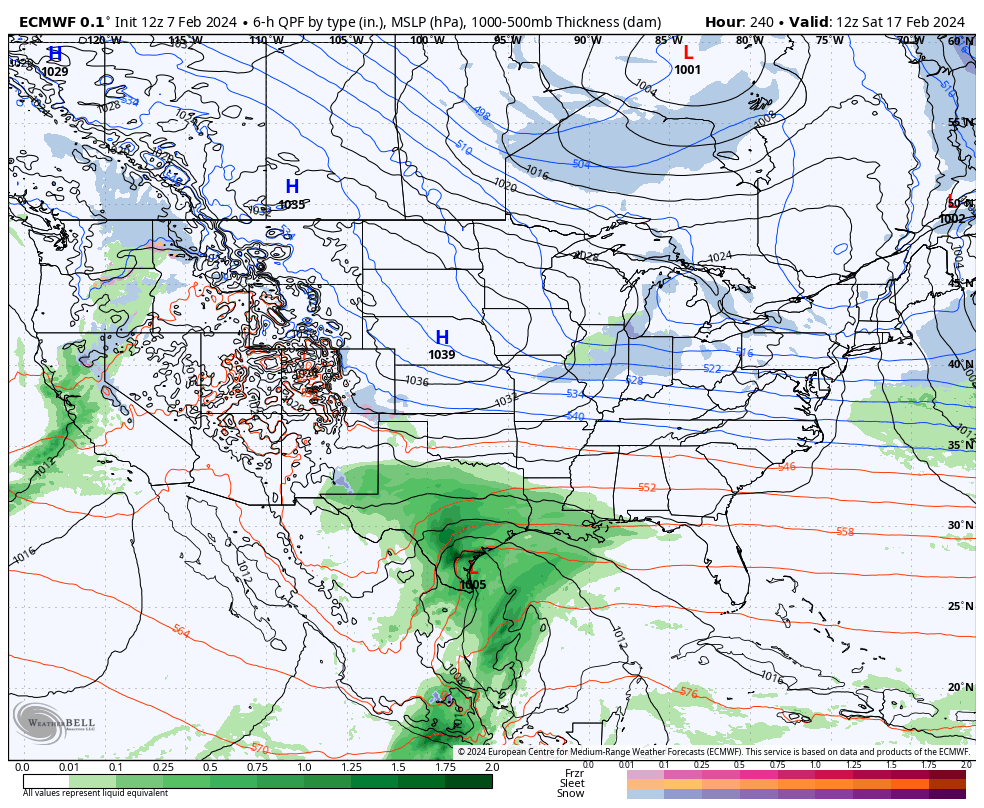
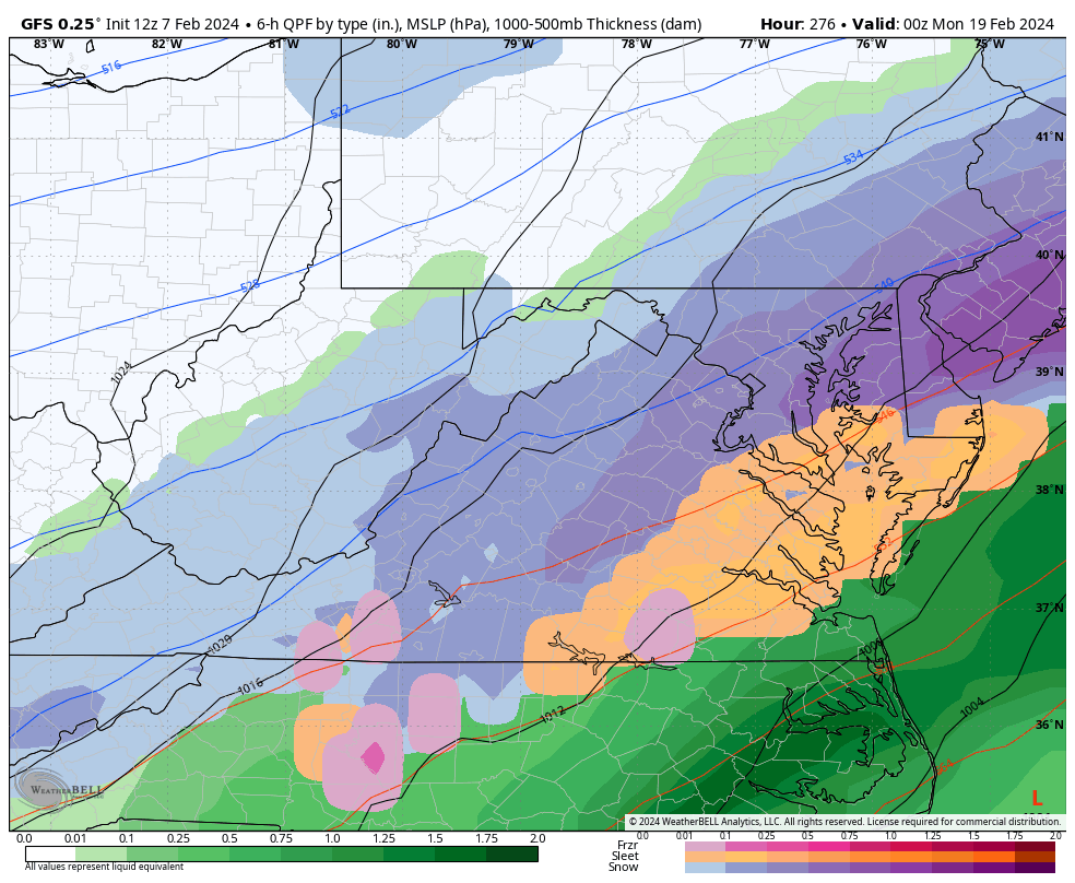
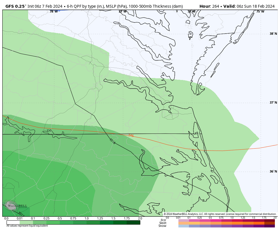
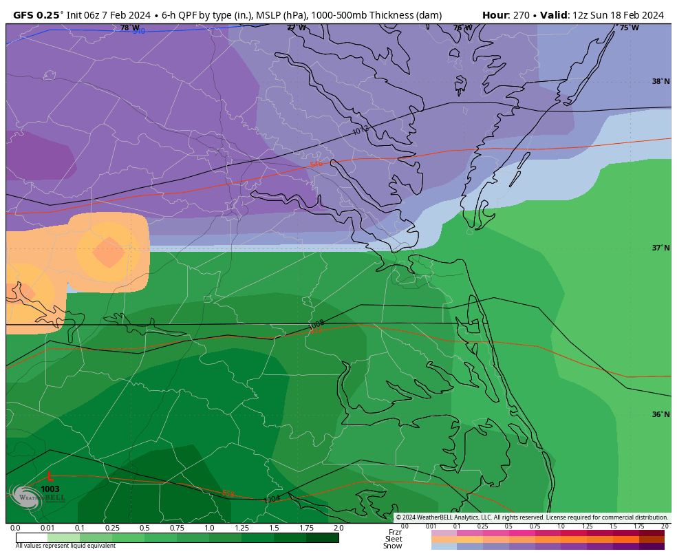
There is the storm at Day 10 on the Euro. EPS will be interesting with this look. The flow is flat looking so hopefully it doesn't track too far south of us. But, verbatim this looks suppressed.

-
5 hours ago, Shad said:
nothing like being in the bullseye 11 days out.....what could go wrong?
A lot can go wrong, but there were better hits up your way on the 12z GEFS, fwiw.
-
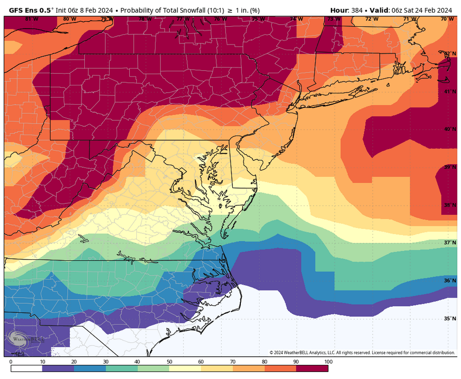
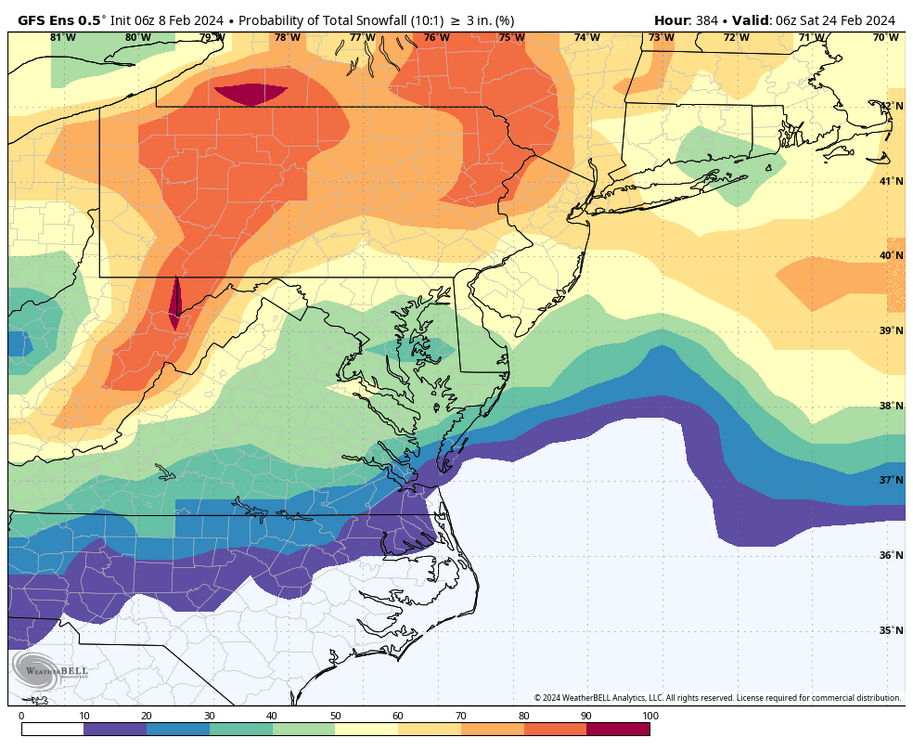
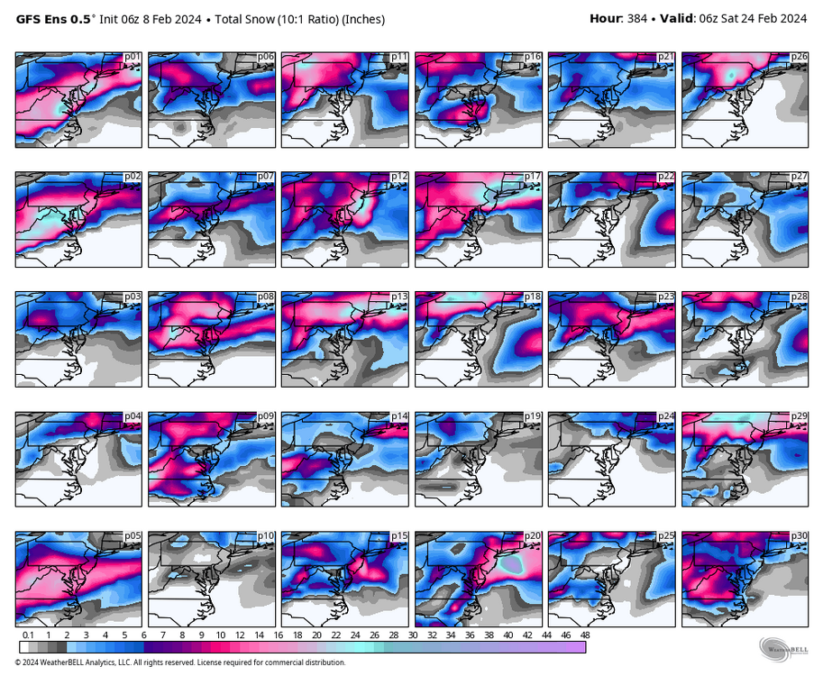
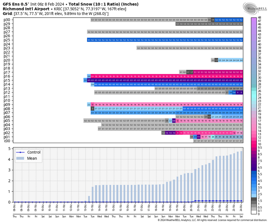
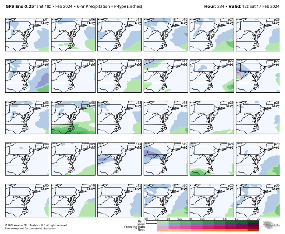
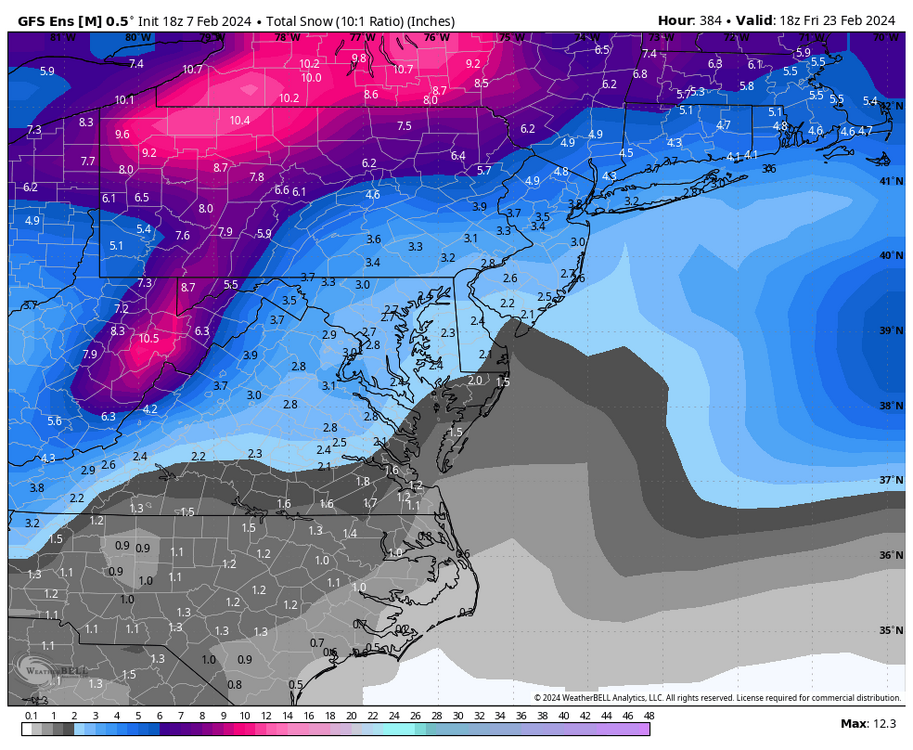
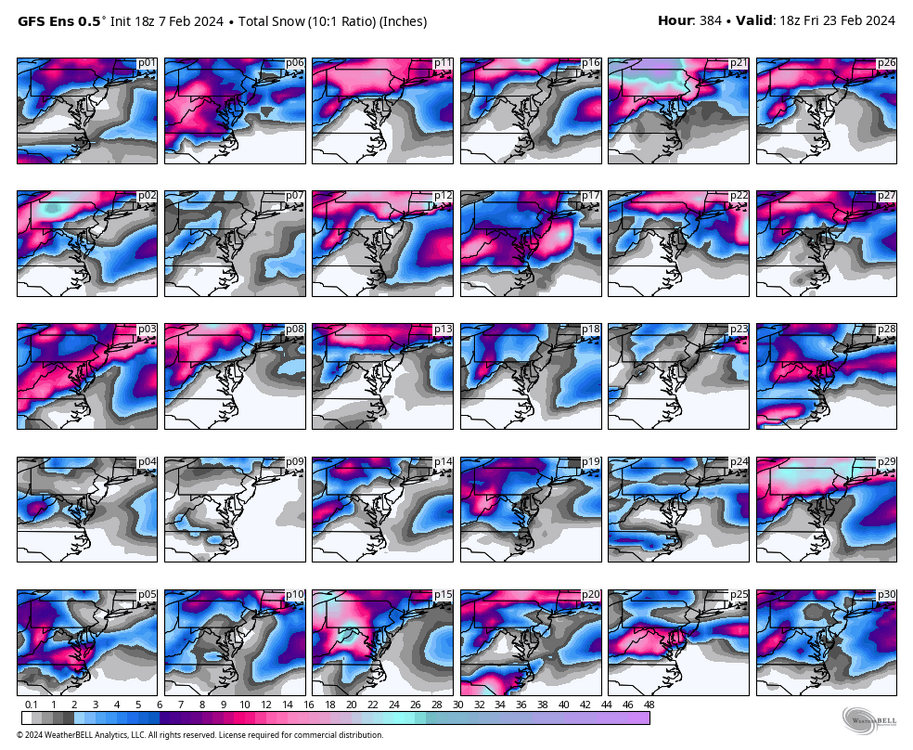
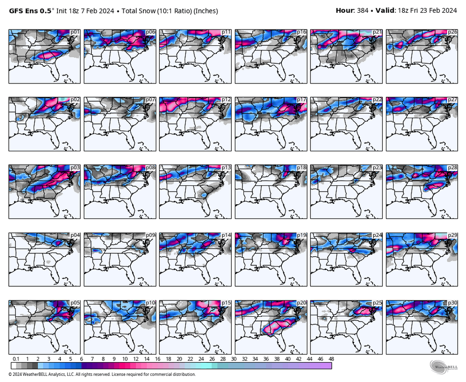
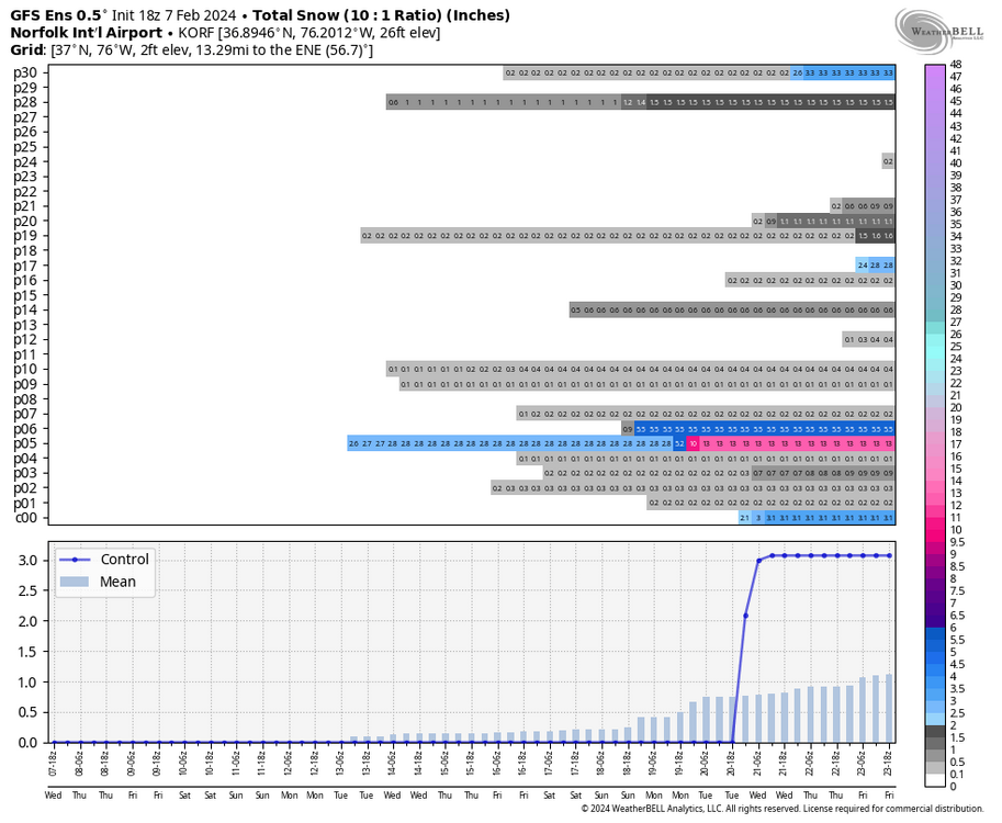
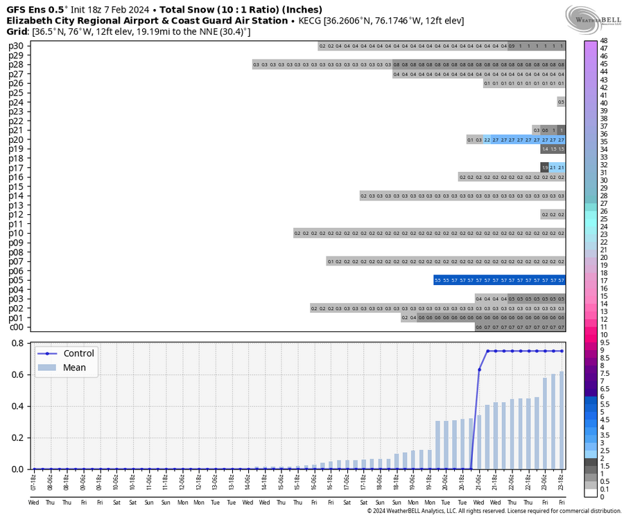
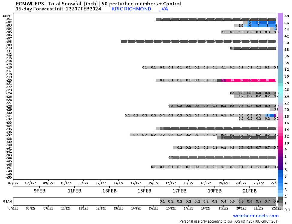
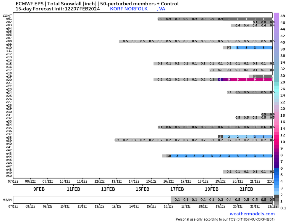
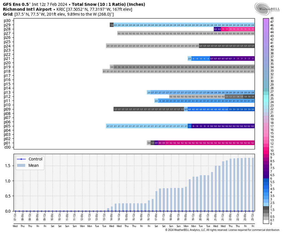
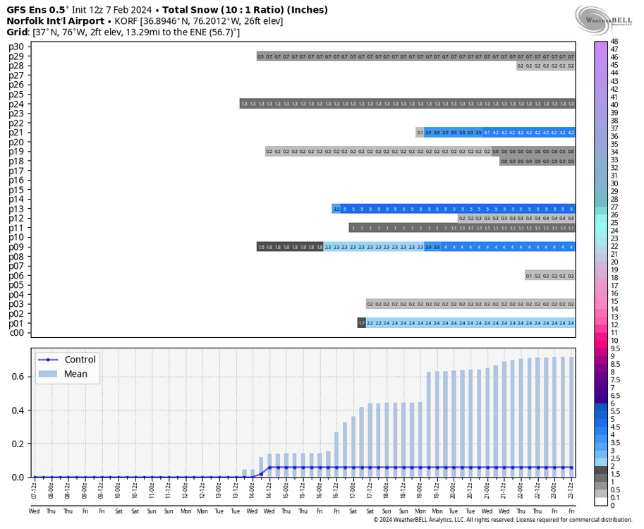
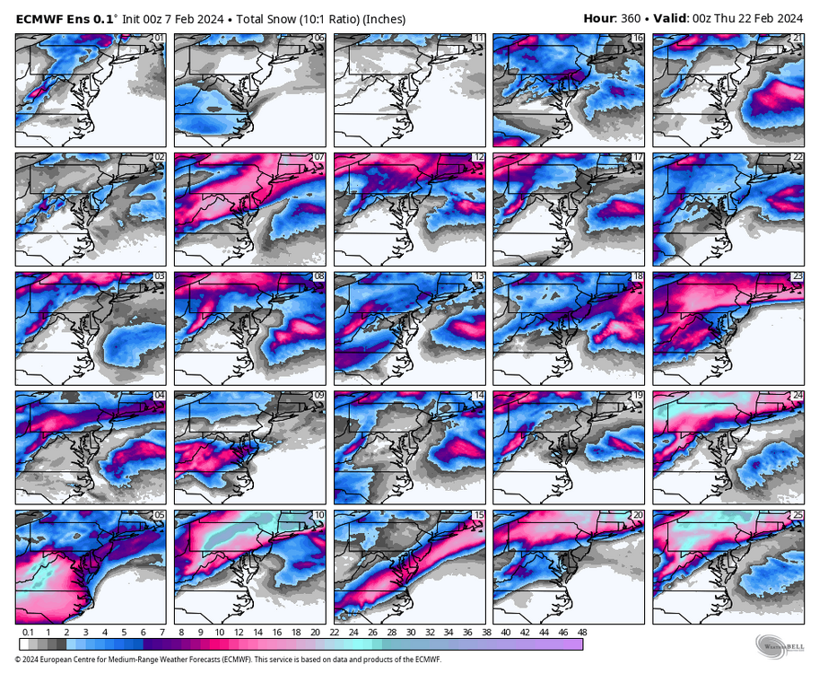
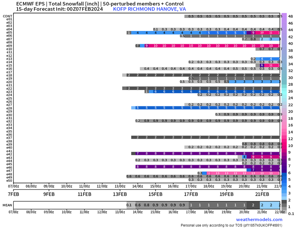
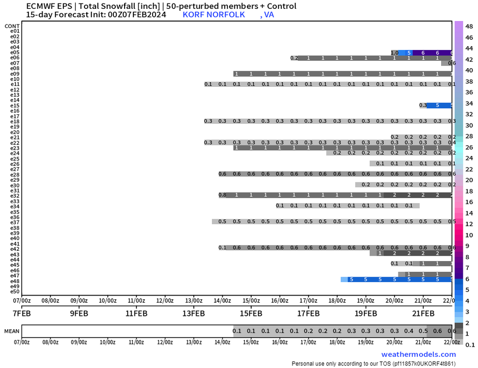
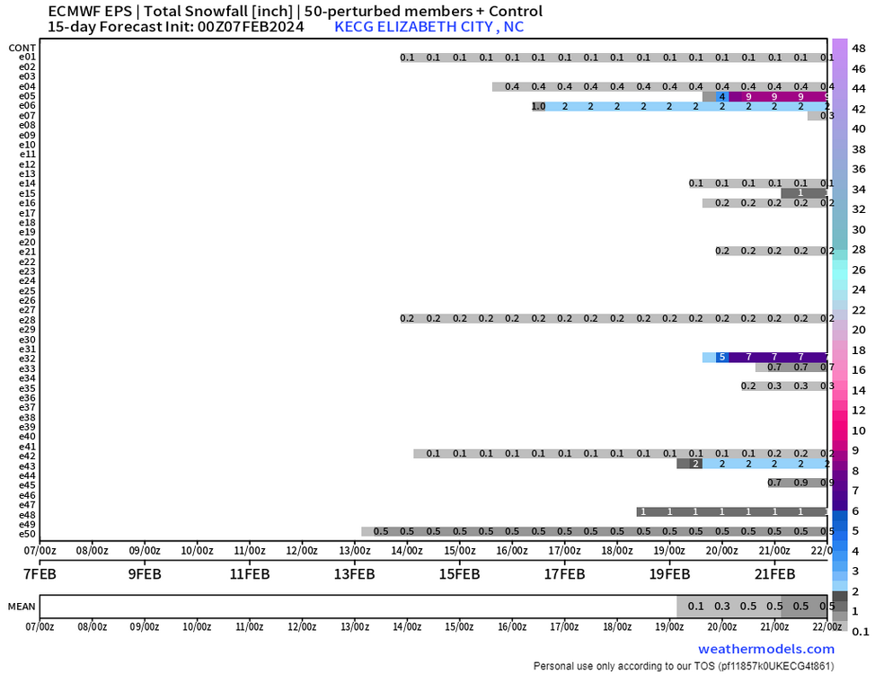
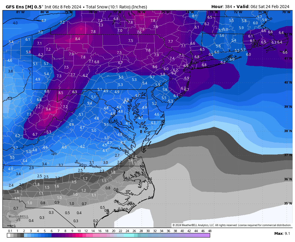
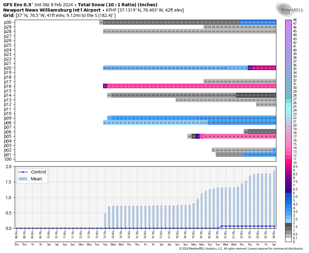
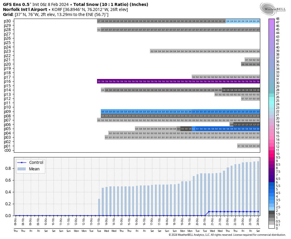
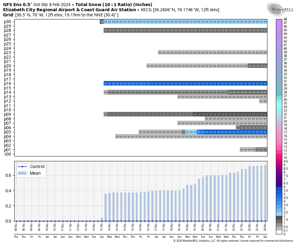
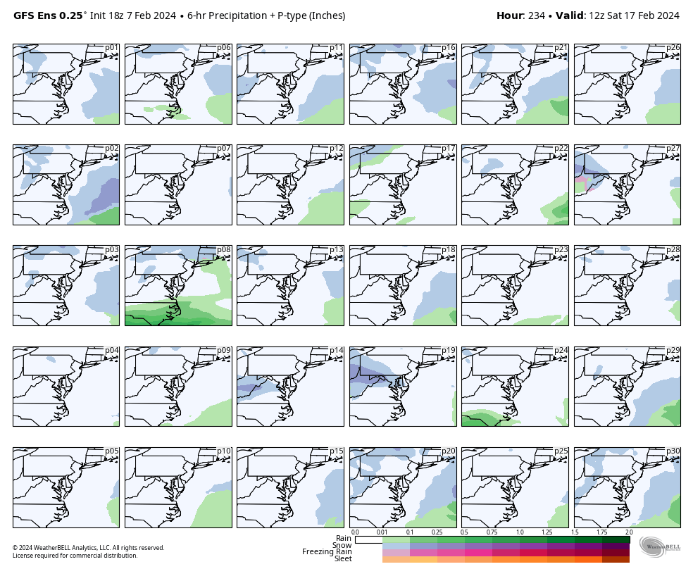
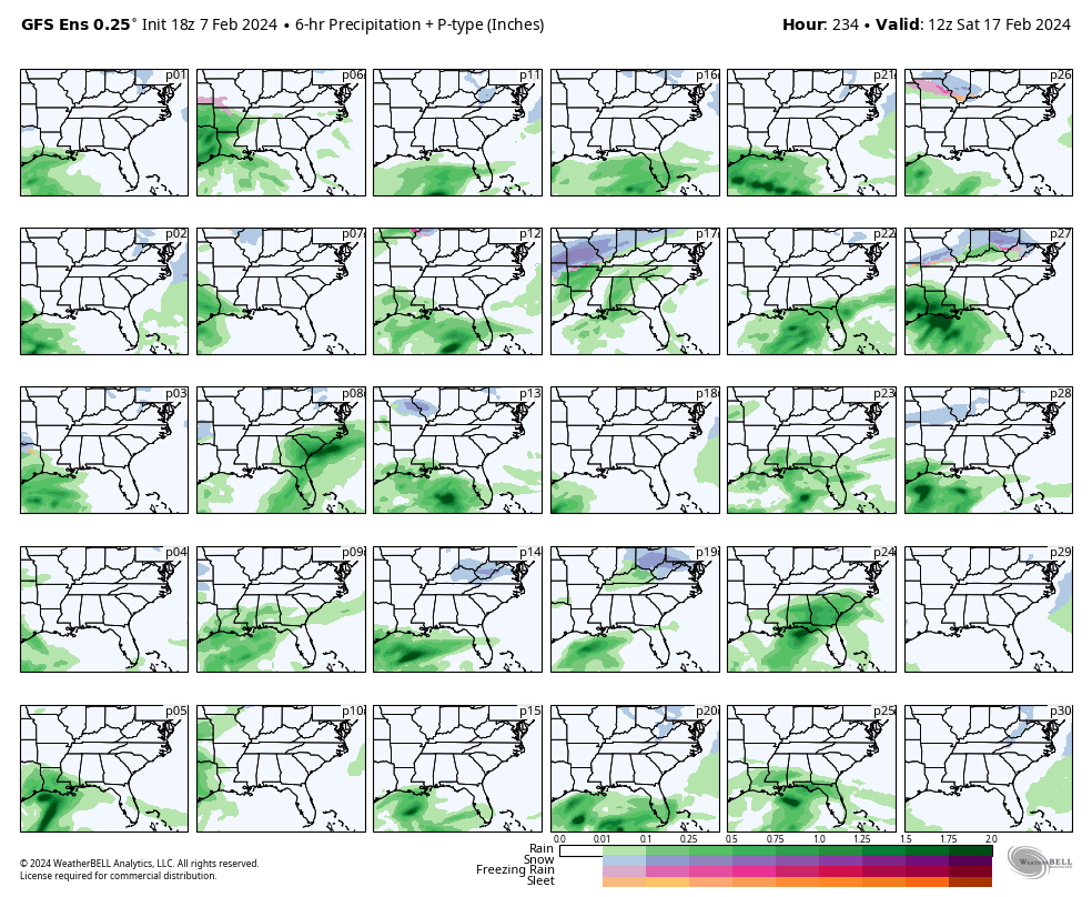
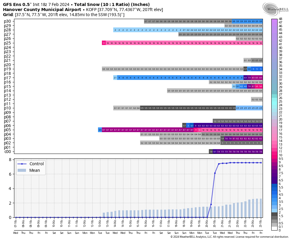
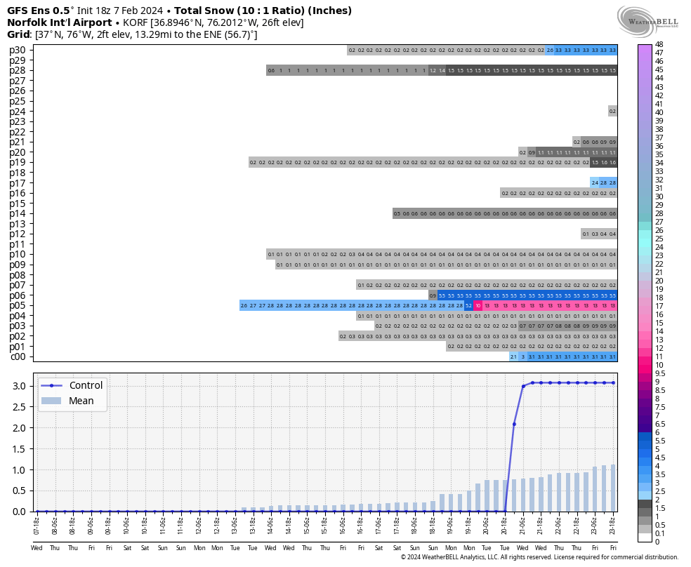
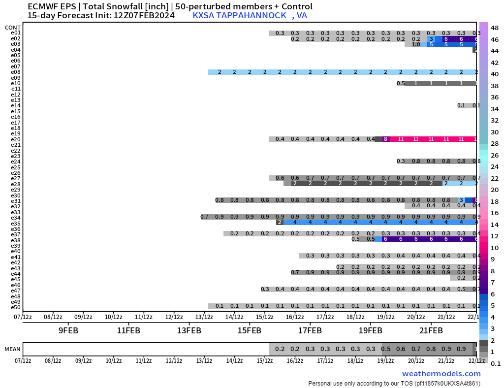
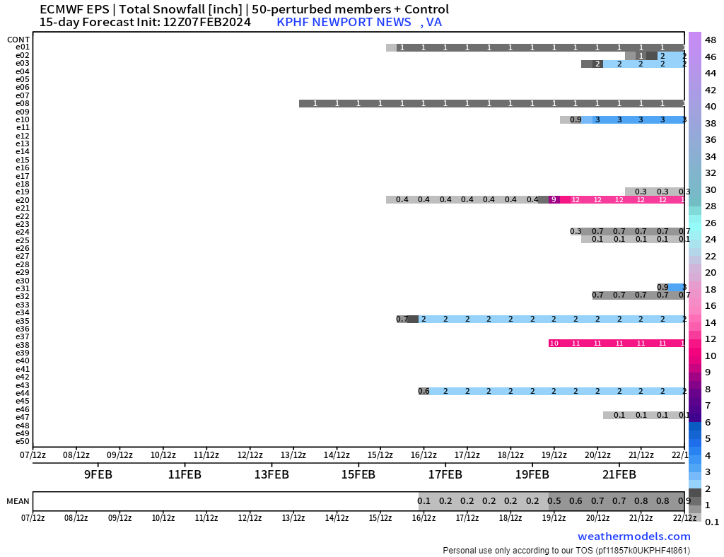
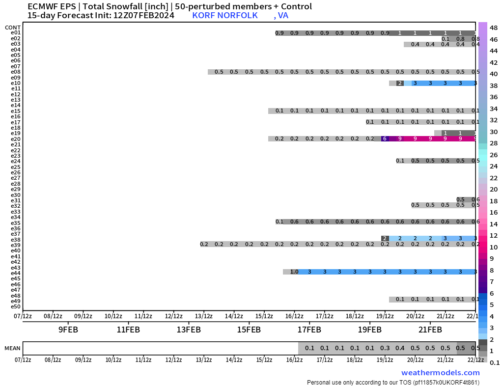
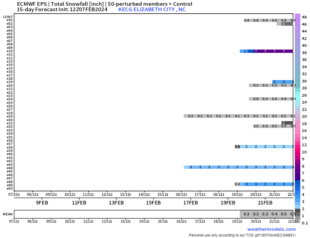
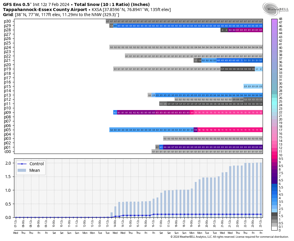
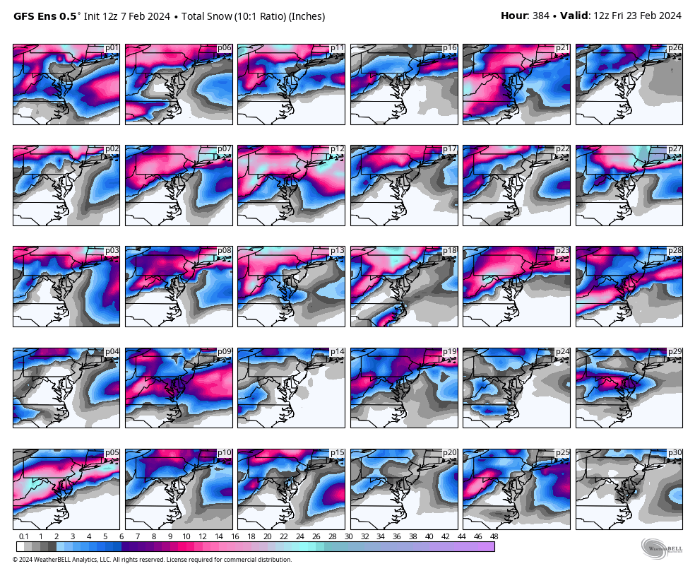
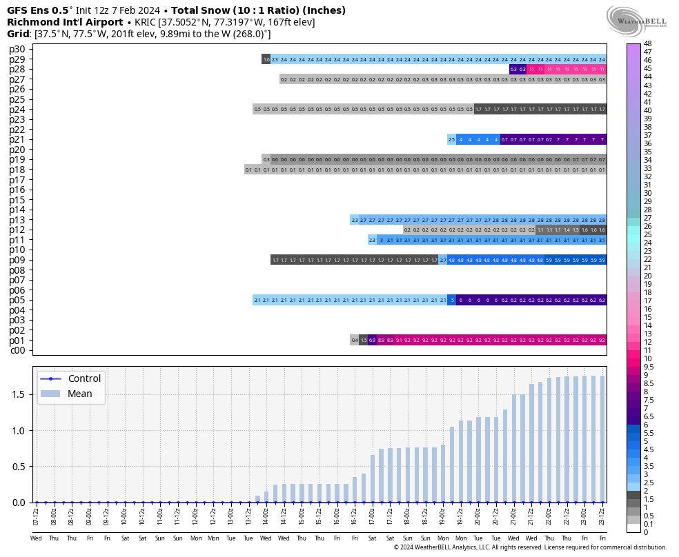
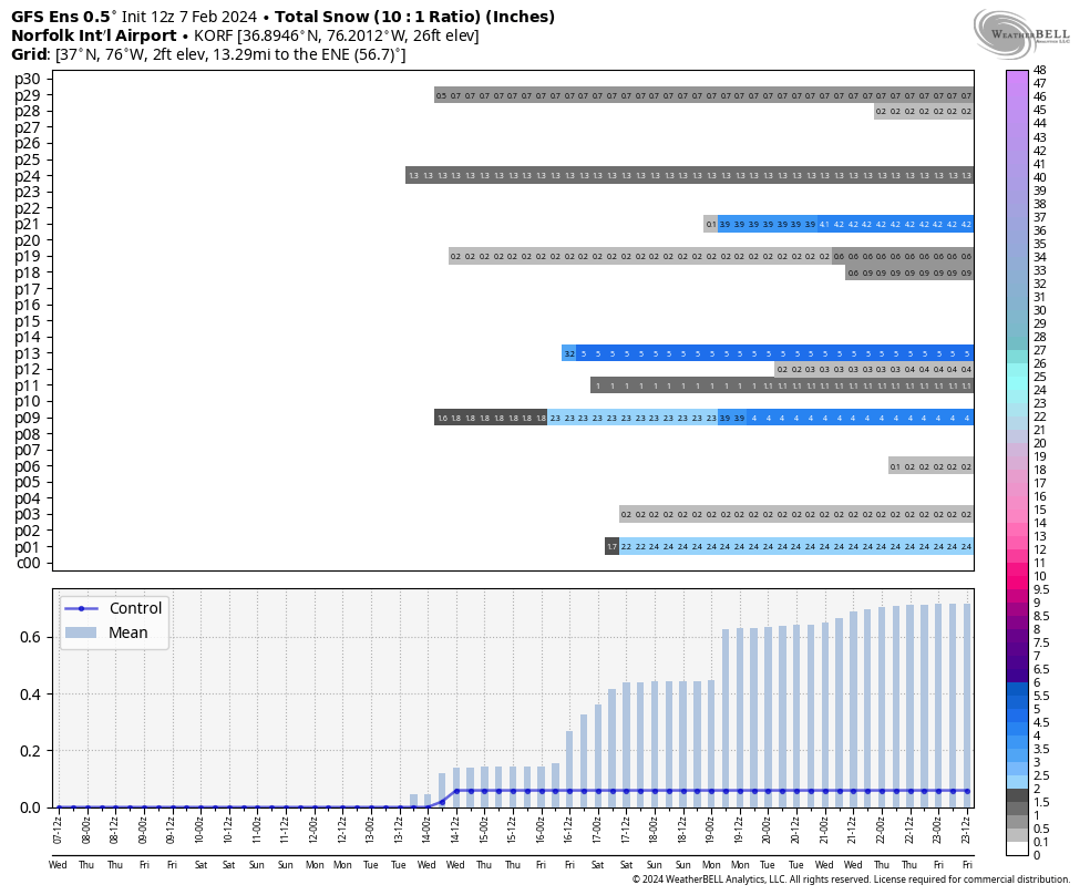
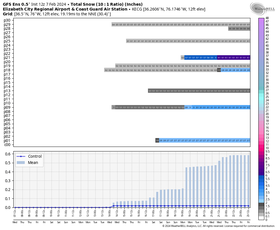
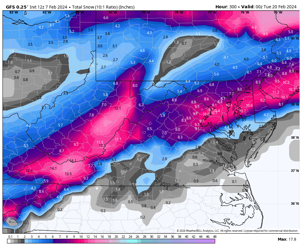
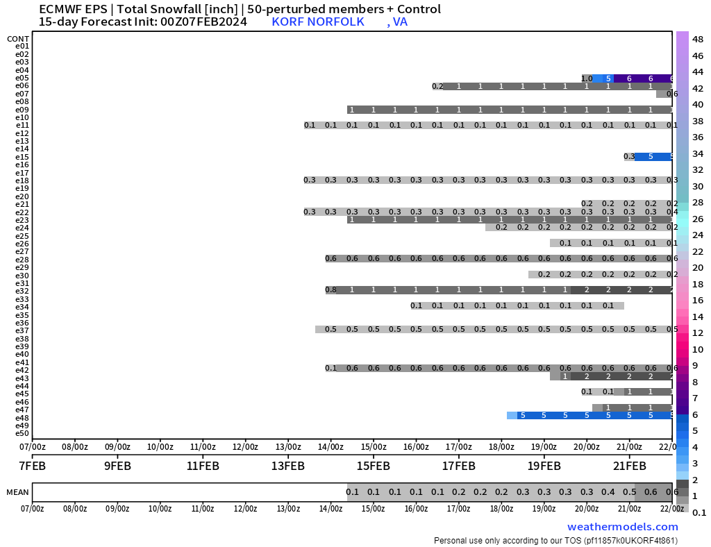
I was not overly impressed with the 12z GEFS. The below loop starts at 00z 2/16 and ends at 12z 2/23. Some hits, some misses, and quite a few rainy members for that period.
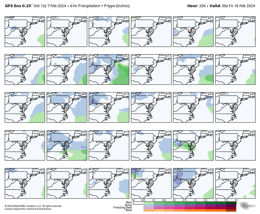
p28 was the most snow for RIC with 11", and p13 dropped 5" at ORF, but there were just as many misses, if not more, than hits.

-
16 minutes ago, RVAman said:
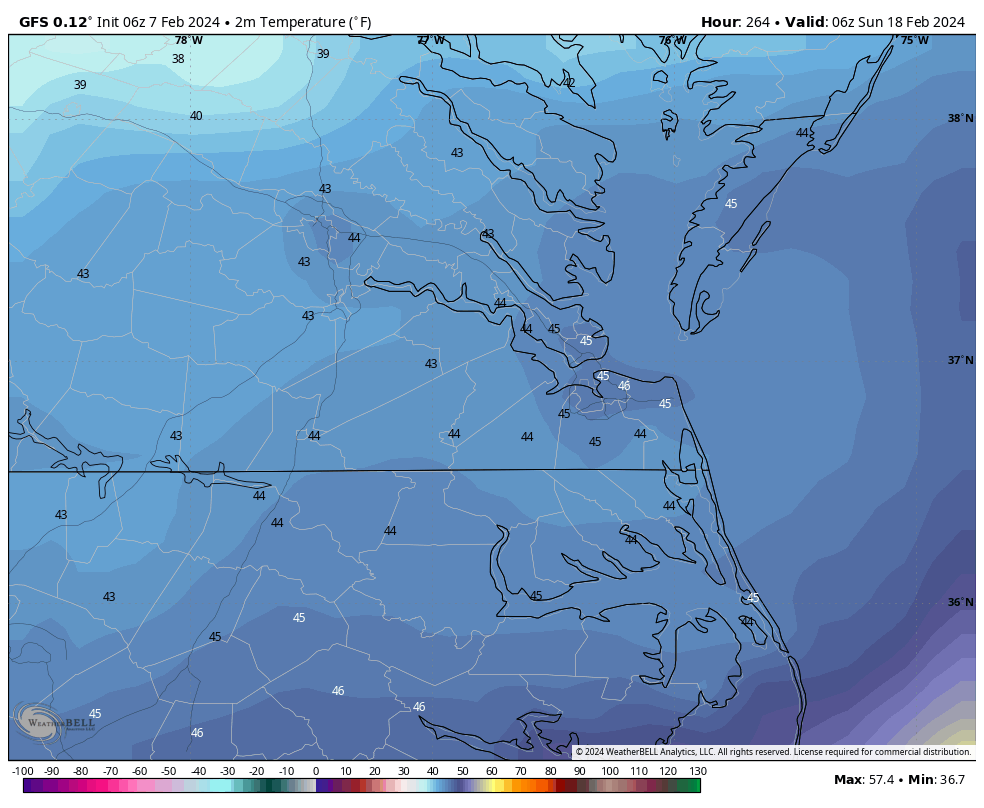
Still concerned there is no warm air. This PD storm could end up just like the VD storm.
I'm not going to lie and say I'm not concerned, given the persistence of this winter and the core of the coldest air staying just to our north and west. But, as @eaglesin2011 mentioned, we probably will know how the models will handle the storm around PD day when the VD storm passes. In the coming days, I'll look for clues at the 500 MB level. I try not to get into the nitty gritty details until closer to the event, like around Day 7.
-
33 minutes ago, JFLETCHER said:
I think that is the one to watch. Not taking it verbatim. But for a while, Presidents Day weekend through the end of February has been the timeframe for potential storms. I like the look for now, just continue to monitor.
I added a few maps to my post after you quoted me. And as the saying goes, the models usually sniff out the big ones early.
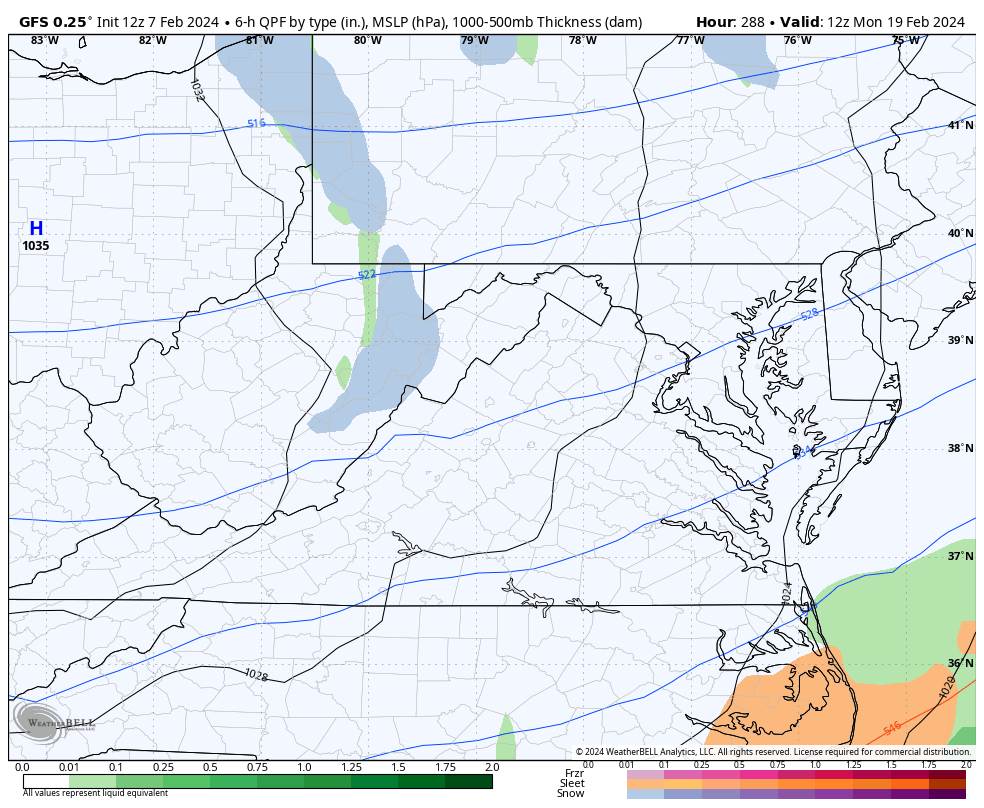
The GFS has shown this storm at our latitude for the last seven runs since yesterday's 00z run. This is how the 18z Tuesday GFS looked when it and earlier runs had the storm well south of us. So, I agree with everyone that things can change since we are still talking 300 hours out. Just hoping we aren't on the fringes and most of us are solidly in the game for 6"+ of snow.
-
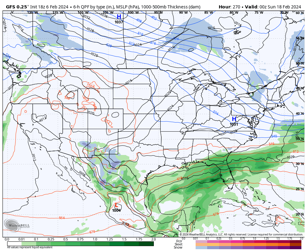
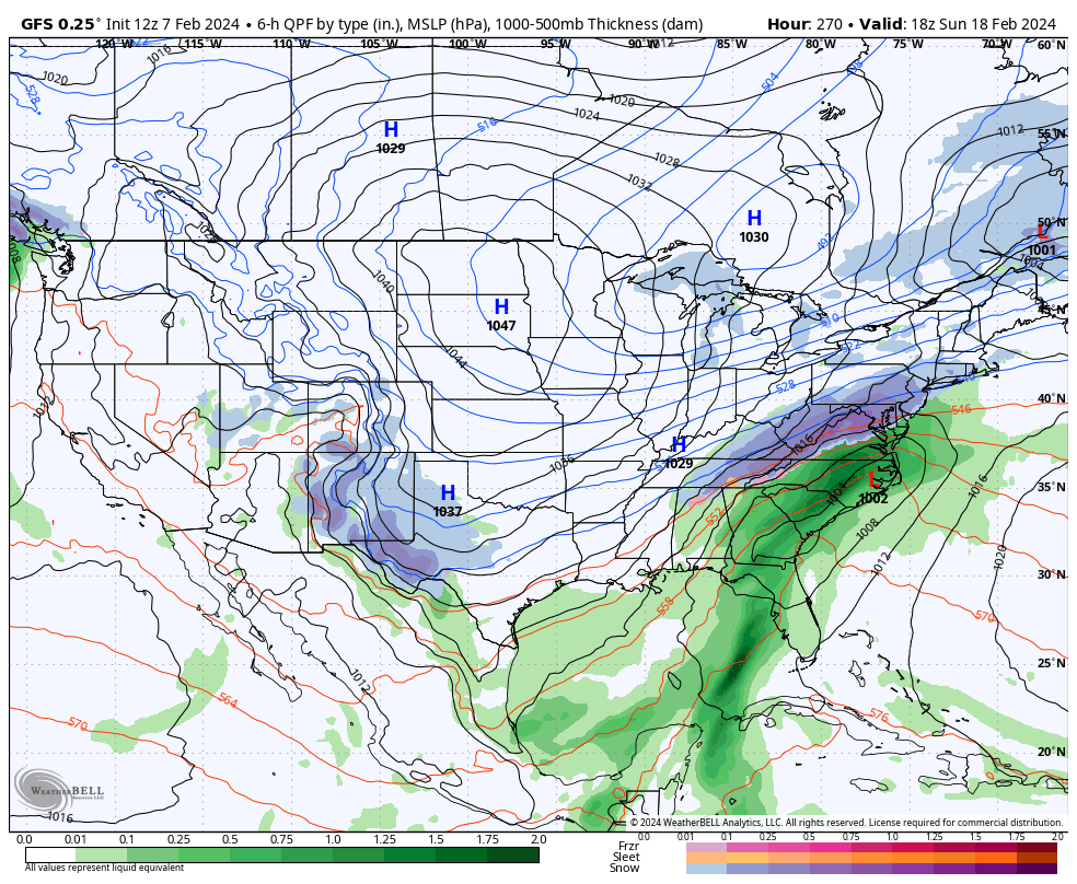
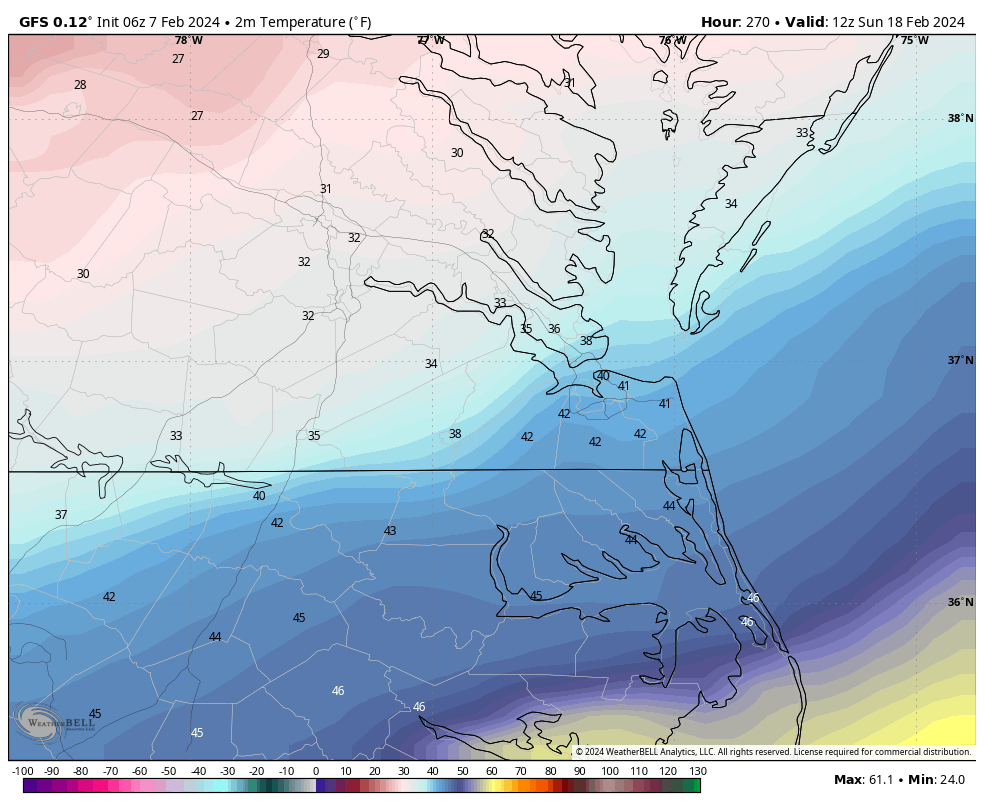
12z GFS is back north for 2/18/ to 2/19. This will continue to fluctuate since it's so far out. The last 10 days of the month are still the window. There are different pieces of energy around, and who knows which one will even be the storm.


-
2 hours ago, wasnow215 said:
Good news is many of us have seen this multiple times in different places, where it’s in the 50s and even lower 60s one day, and a big snowstorm the next day.
Every setup is different; I can recall quite a few that had warm temperatures before. On 2/19/2012, RIC had 4" of snow, and the high reached 61°F on 2/18/2012. Also, on 12/5/2005, RIC recorded 4.2" of snow, and it hit 64°F the day before that. There are other examples.
But, there have been quite a few cases where it hasn't worked out, such as 2/11/2006 and 2/16/2003. We had accumulations from these events, but those storms were far below expectations because of a delay in cold either at the surface, or we got screwed because of warm air at the 700mb level.48 minutes ago, eaglesin2011 said:Problem is the cold air just hasn’t set in & may not completely for any of these storms…
The V Day storm is pretty much certain to be all rain here. Hopefully it will start to pull the cold air down after it.. Then set up the storms starting next weekend…
We also don’t want the 20th storm to go too far north .. could start & then end as rain if that happens..
Hate to say it but probably won’t know allot more until after the V day storm passes…
At least there looks to be a few more chances in the upcoming weeks…lol
The VD storm is rain on the 12z GFS. I'm still surprised it was getting so much support on the ensembles. We've seen last-minute shifts, such as 1/3/2018, 12/9/2018, 12/26/2010, 1/25/2000, and 2/16/1996, but I'm not feeling that.
We are in deep trouble if the end of the month doesn't pan out. I always tell people snow season isn't over until March 31st, but relying on March to save the winter isn't a great predicament to be in. That said, March has rivaled December, at least historically, for snowfall averages. It can produce.
-
1
-
-
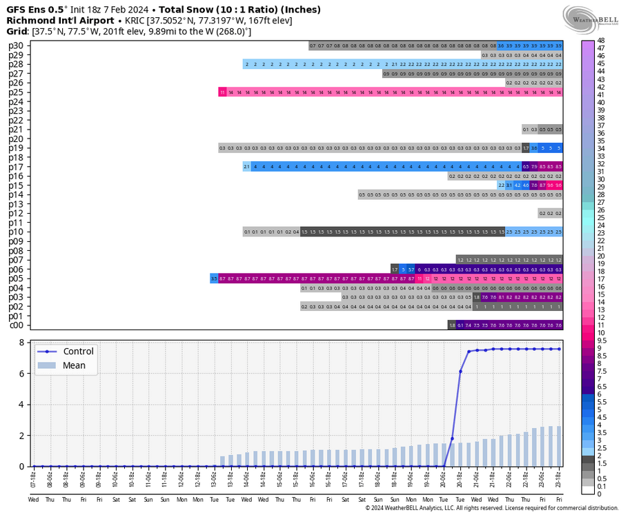
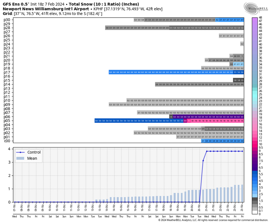
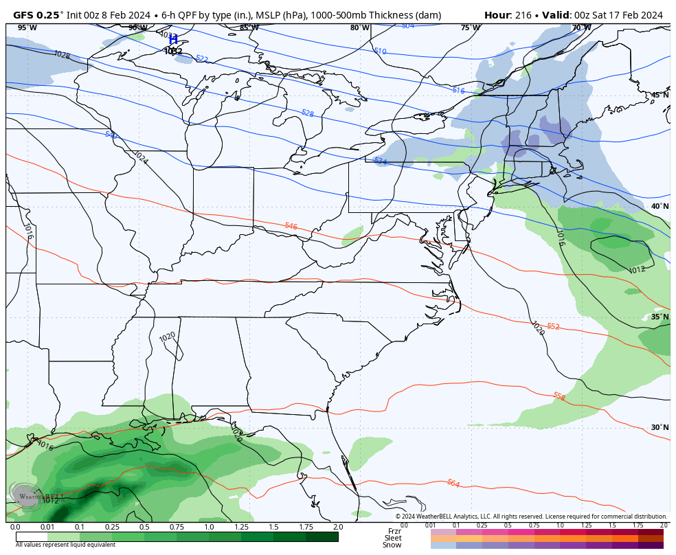
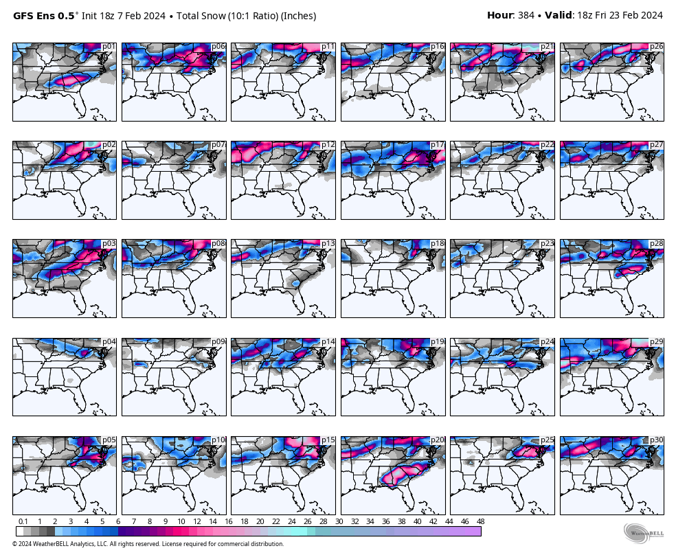
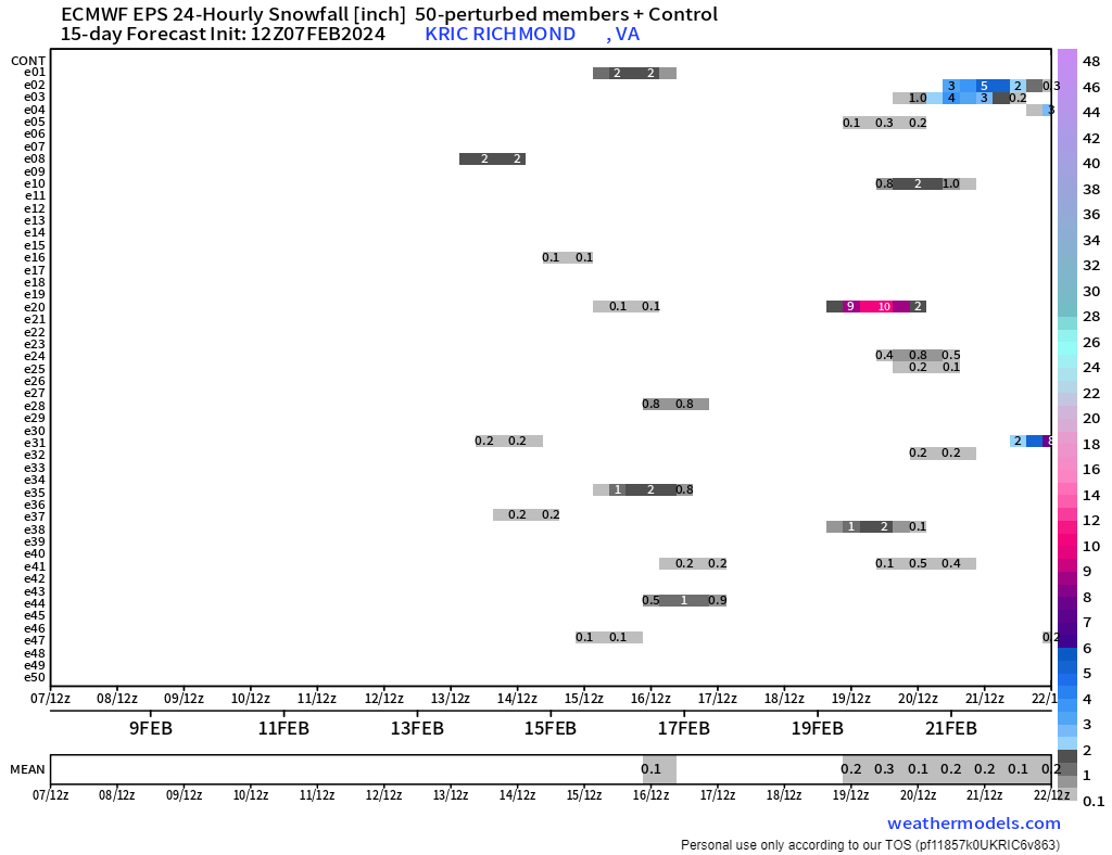
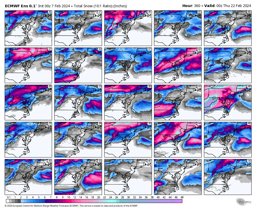
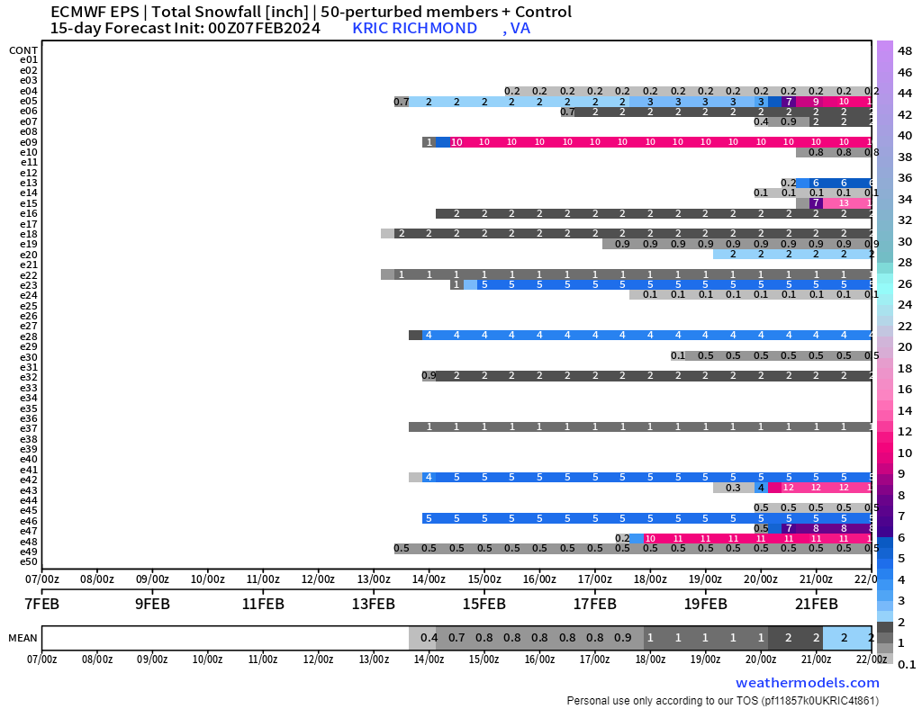
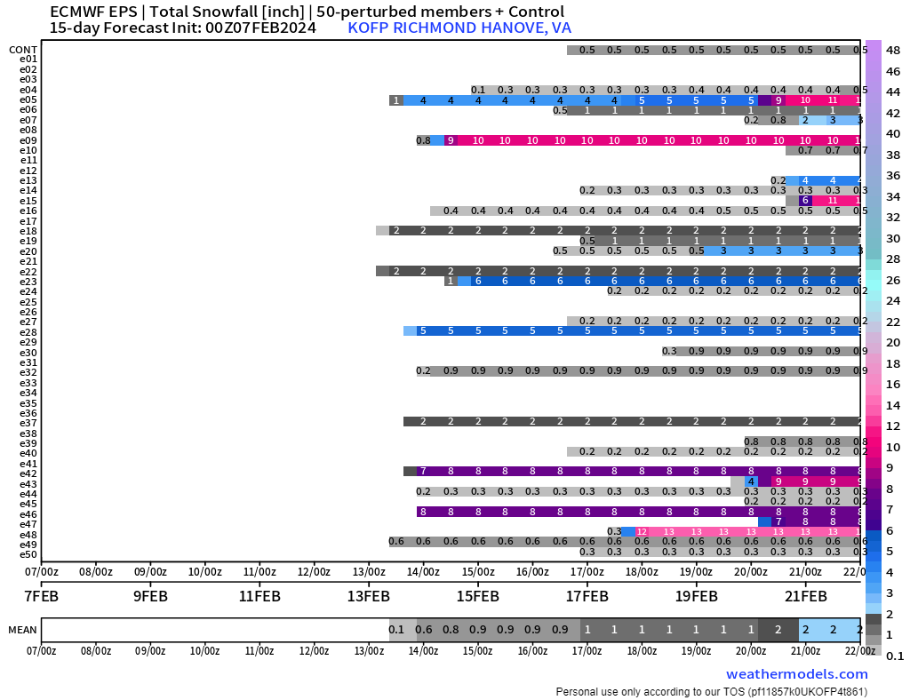
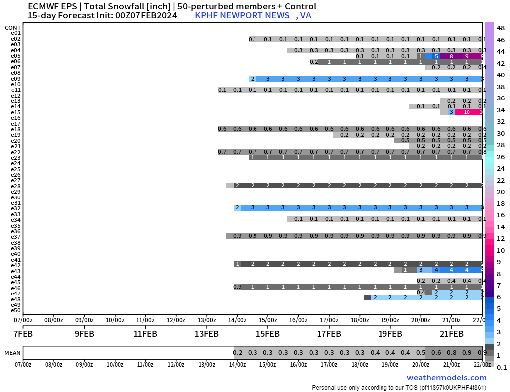
Last night's EPS was quite an improvement as well. I guess next week's threat isn't quite dead in the water.
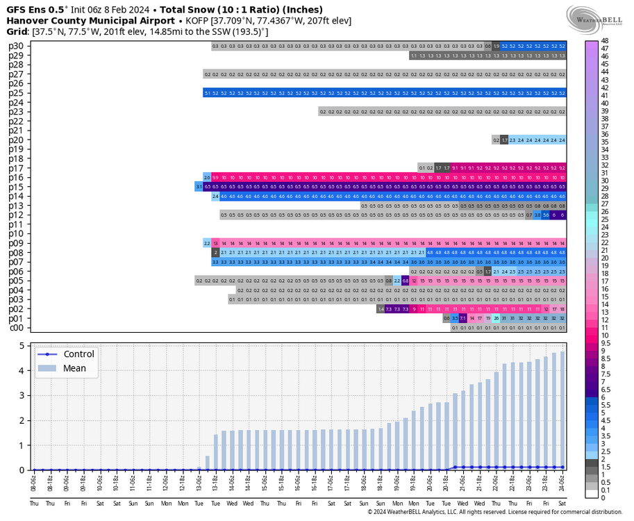
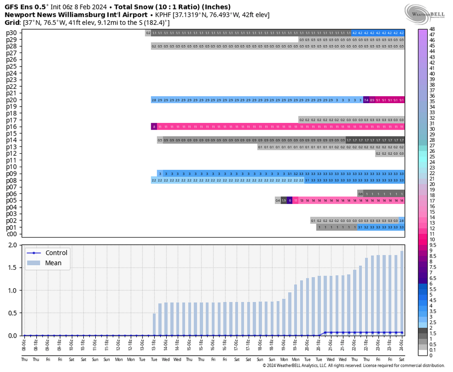
I added OFP and PHF charts as well.


-
2
-
-
25 minutes ago, eaglesin2011 said:
Yep…A bunch of teaser systems now showing up on the models starting the night of the 17th through the 22nd. Would still like to see more cold air move in.. Especially if one of these develop more into a coastal as depicted above.. We rarely ever avoid a mix/ changeover when that happens..
Yup, verbatim we are in the low-mid 50s the day before. By 1am, as the precip is moving, we are raining with temperatures still in the mid-40s and waiting for colder air.

6 hours later, temperatures are at freezing from about Williamsburg north and west with snow falling. Ideally, we'd be cold enough from the start.

-
1
-
-
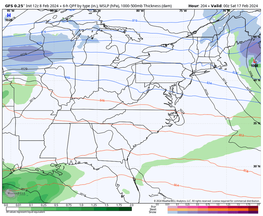
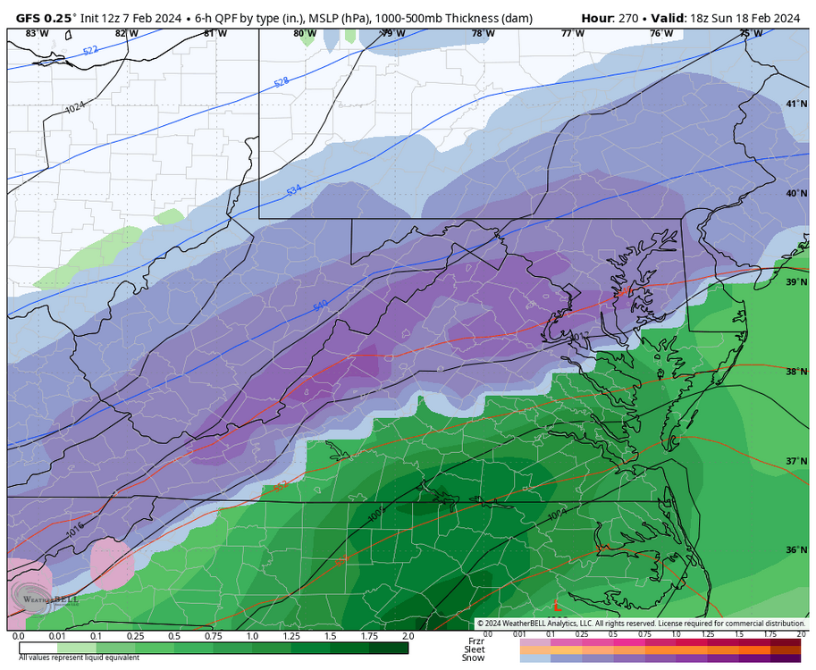
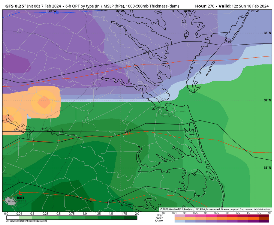
13 minutes ago, ldub23 said:
RIC jackpot
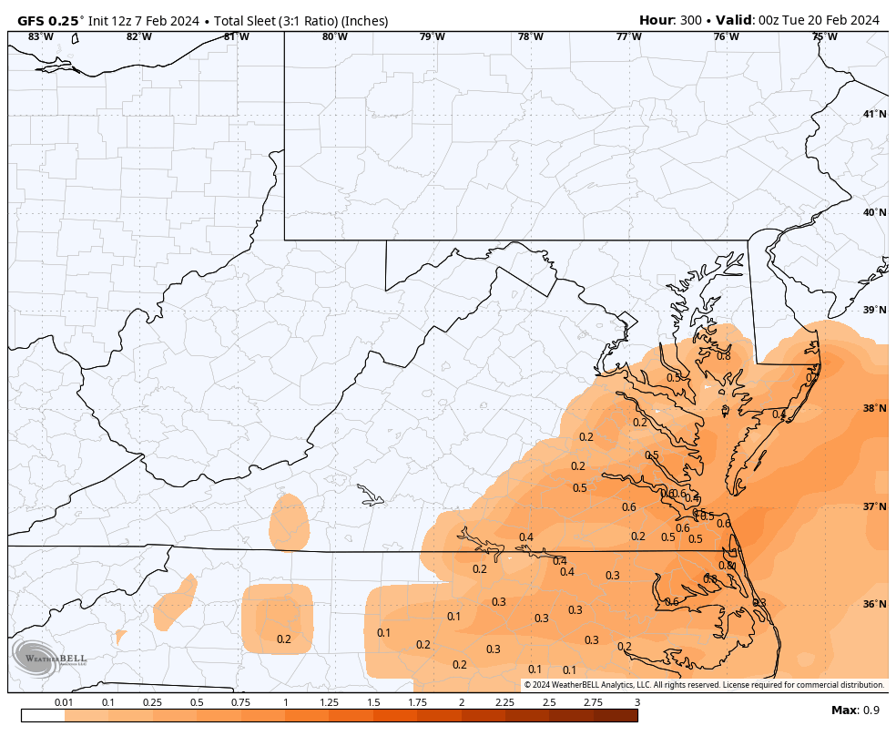
It's too bad it's 300 hours away, but this is the outcome we need, even if there is a little bit of IP/ZR to deal with.
-
1
-
1
-


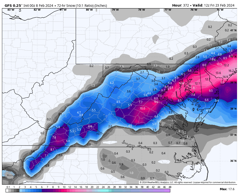


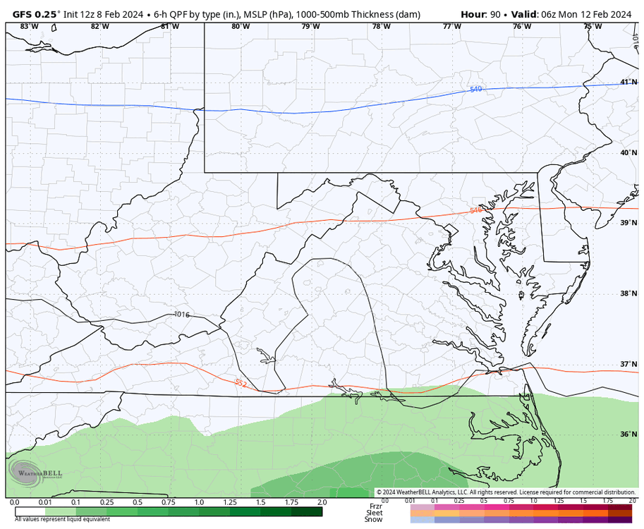
.png.98788412df076c8607ba95dcb5aa2480.png)


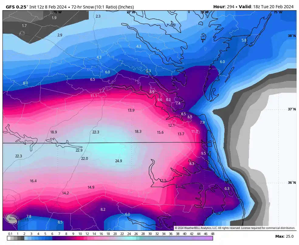
Richmond Metro/Hampton Roads Area Discussion
in Mid Atlantic
Posted
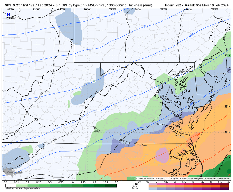
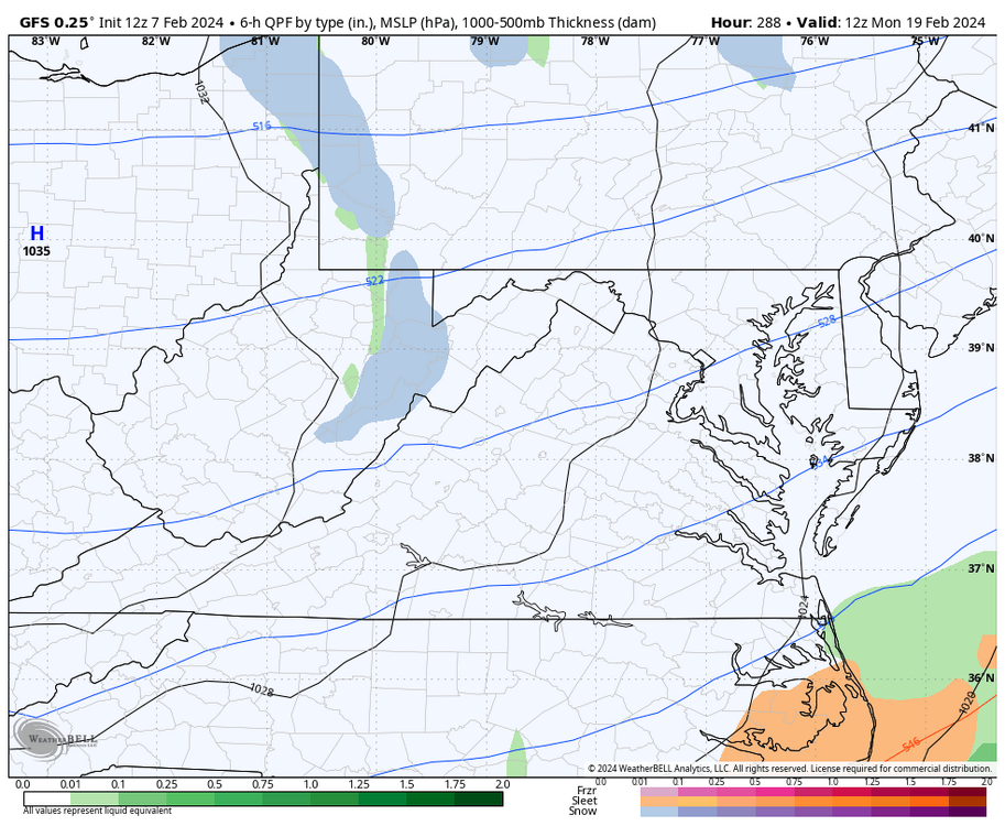
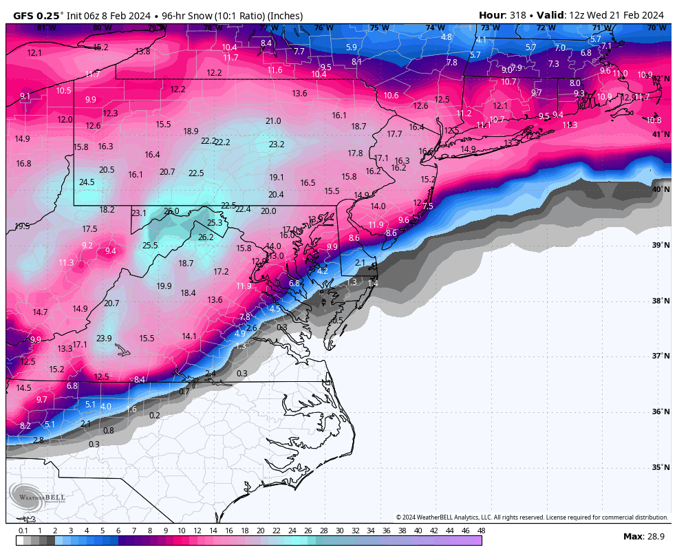
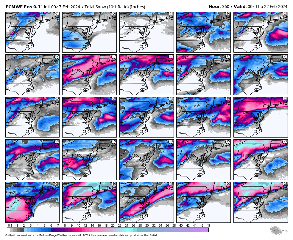
I just added the full loop and removed the snow the GFS showed for the storm next week to my earlier post. This is a great sign for our area. Too bad it's still so far away.