

RIC Airport
-
Posts
1,766 -
Joined
-
Last visited
Content Type
Profiles
Blogs
Forums
American Weather
Media Demo
Store
Gallery
Posts posted by RIC Airport
-
-
3 hours ago, Stormpc said:
It's a very odd area down here. Southern Hampton Roads Northeast North carolina. I had between 8 and 9 inches of snow from that January event in 2022. Actually Shoveled the driveway. Stuck to the road and pavement very well. So it does snow here. And it can happen. I don't remember the last time DCA had 8 inches of snow during one event. Probably not since I moved out of that area in 2019. Very narrow stripe though. A good 6 inches was still prevalent down to Grandy but once south of Grandy (like a mile) there was basically nothing. Up to Moyock and into Chesapeake a few inches less as well. Most of the times during marginal events my neighborhood gets nothing while just a quarter mile inland can have a few inches. I got lucky or unlucky depending on how you look at it. A few times I've had nothing at my house while the front of the neighborhood, which is just a few hundred yards away, has had a dusting. I need the winds coming off the land. Any part of the Sound and I'm toast.
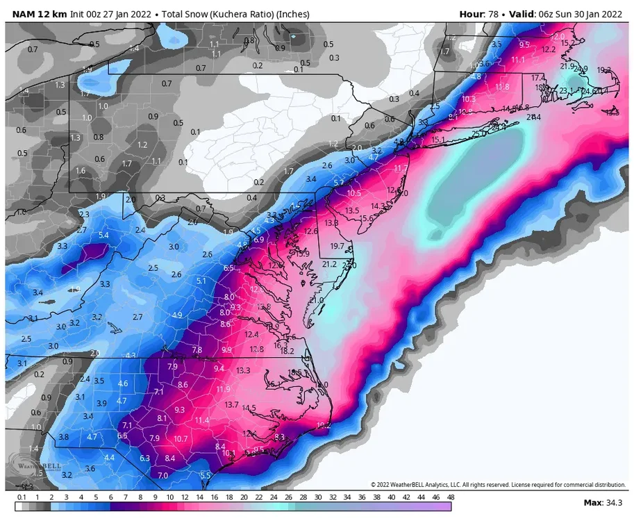
The winter of 2021-22 was frustrating, but there were numerous opportunities. I remember us tracking legit threats every week that were all happening on the weekends that January, from the 1/3/22 storm that trended too far north at the last minute to the two storms that tracked too far east barely giving coastal areas snow, but not enough in Richmond. Also, the 1/16/22 storm tracked up the Piedmont while we were in the upper teens to low 20s at the start but managed to reach the 50s six hours later.
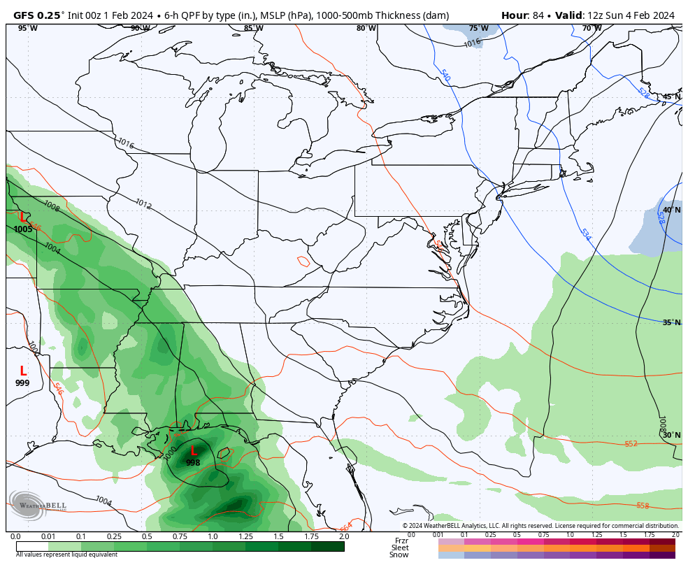
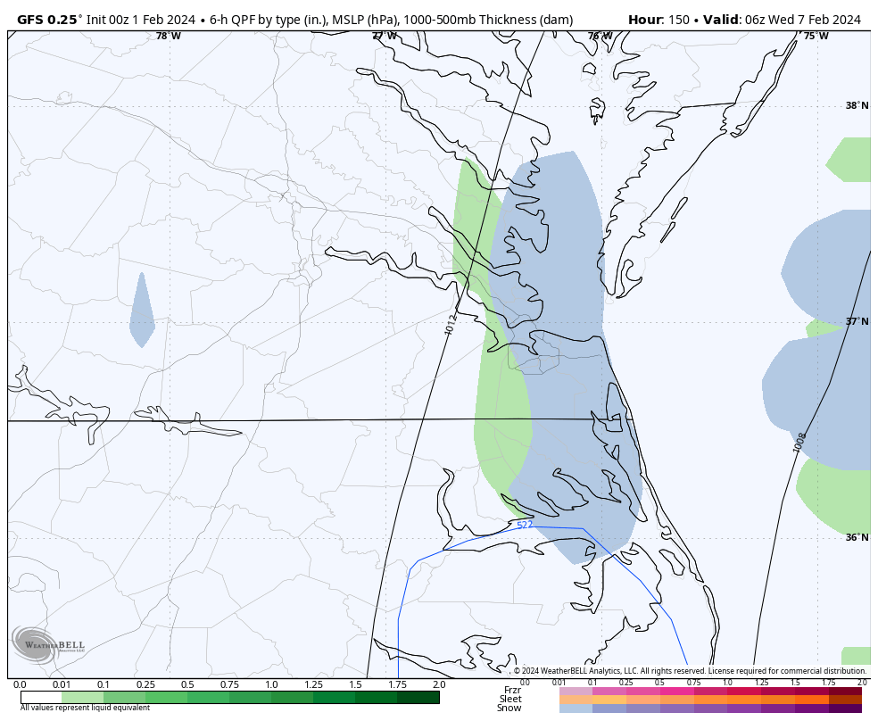
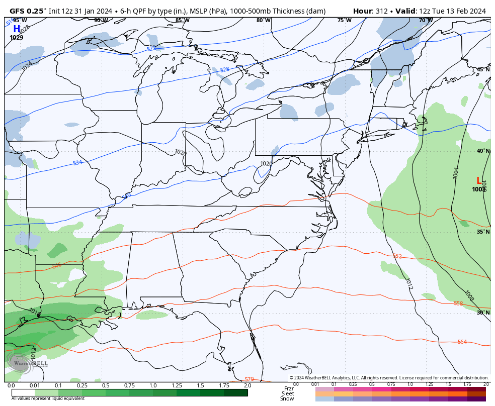
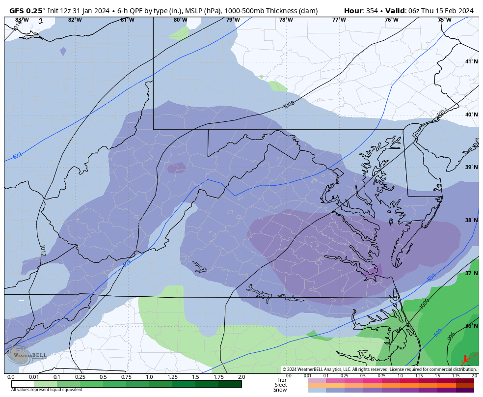
A couple maps I saved from that event.
-
19 minutes ago, Conway7305 said:
LR snow maps are looking better
Yup, and new hits popped up on the 12z EPS. Hopefully, these charts light up in the coming days.


-
 1
1
-
-
1 hour ago, PrinceFrederickWx said:
I'm not from the area but was reading through this list and I'm shocked at those 1989 numbers. I had no idea Norfolk had all that snow that year! There wasn't any up here. Anyway, interesting list, I enjoyed reading it and hope you post the March ones. I've been curious about climo there.
Yeah, it can be a weird place. I know that was just the February list, but there seems to be a greater return in La Nina winters than at Richmond, where there is clearly an El Nino correlation to higher snowfall. Looking at 2021-22, 2017-18, and 2010-11, and 1988-89 as just several examples. ORF was also one of the few stations that had an increase in its average when the 1991-2020 30-year climate data was published.
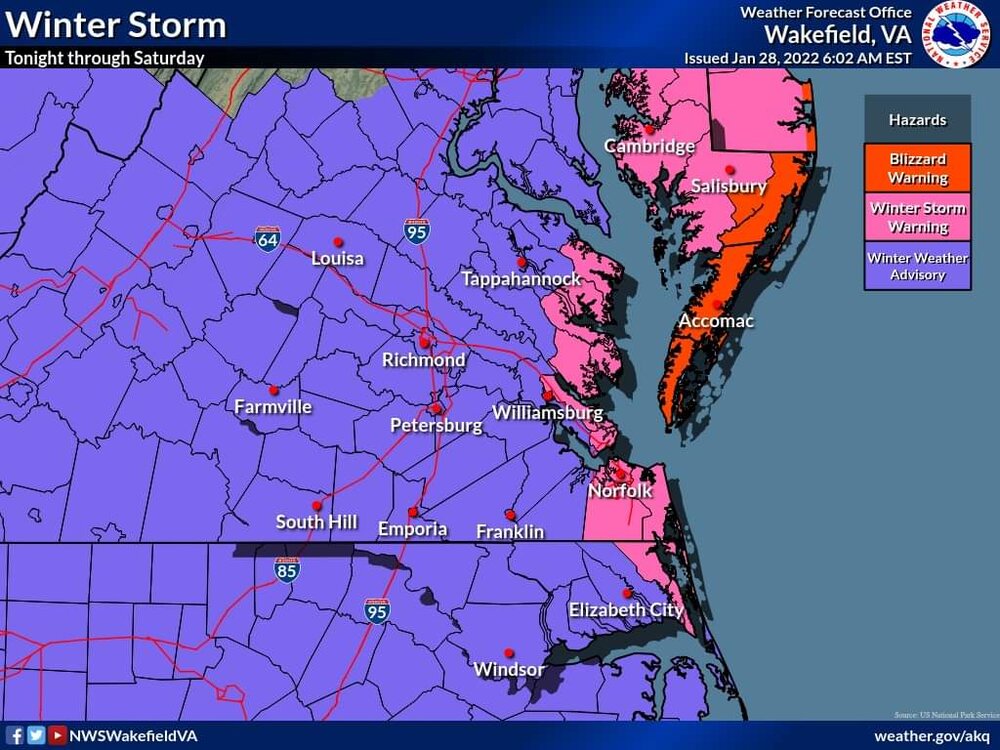
Also, many in this forum probably didn't realize that ORF got about as much snow in January 2022 as DCA did. Not to mention getting two blizzards two years in a row and close to getting a third at the end of January 2022, as AKQ only included the Eastern Shore in the 1/28/2022 Blizzard Warning.
1/3/2018
.png.eb2b175b71365d10679b3c1bd1ac6f0e.png)
1/7/2017
-
1
-
-
Wakefield just sent out the January Summary. February may deliver way more snow, at least we hope.
")
-
On 1/31/2024 at 5:55 PM, RIC Airport said:
There have been quite a few decent events mid to late month. I haven't gone through Norfolk's data yet, but here are Richmond's February snowstorms that delivered 4 inches or more since 1898. Quite a few events were close to making the list, so this doesn't exactly tell the whole story. I will post the Norfolk events at some other time and look at March as well.
February Snowstorms 4" or more at Richmond (since 1898)
5.0” February 26, 2015
7.2” February 16-17, 2015
5.8” February 12-13, 2014
4.0” February 19-20, 2012
6.6” February 5-6, 2010
8.3” February 16, 1996
4.0” February 26-27, 1993
5.3” February 23-24, 1989
7.6” February 18, 1989
5.3” February 16-17, 1987
17.7” February 10-11, 1983
6.6” February 27-28, 1982
4.2” February 13-14, 1982
4.7” February 9-10, 1980
10.9” February 18-19, 1979
6.4” February 7, 1979
4.4” February 19, 1972
4.0” February 17, 1972
5.3” February 2, 1972
4.9” February 17-18, 1967
6.4” February 9-10, 1967
5.6” February 6-7, 1967
6.6” February 14-15, 1965
7.3” February 28, 1964
5.3” February 26, 1963
8.9” February 13-14, 1960
6.3” February 15, 1958
5.6” February 26-27, 1952
5.4” February 24, 1952
4.5” February 10, 1948
10.1” January 31-February 1, 1948
9.2” February 19-20, 1947
12.6” February 7, 1936
8.0” February 25, 1934
4.7” February 4-5, 1933
4.6” February 20, 1914
4.7” February 13, 1914
4.1” February 7-8, 1909
4.2” February 27, 1906
6.1” February 10-11, 1904
9.7” February 15-17, 1902
5.4” February 16-18, 1900
16.3” February 11-14, 1899
4.0” February 6-7, 1899As promised, here is the Norfolk list, beginning with the most recent. I did 2 inches or more since 4 inches + was shorter than Richmond's. I'll probably do 2" or more for both cities for March, which I'll post in the coming days. Data was less kind after about 1990, and neither city has had much snow in February since 2015.
February Snowstorms 2" or more at Norfolk (since 1891)
5.6” February 25-26, 2015
2.1” February 24, 2015
3.6” February 16, 2015
3.8” February 9-10, 2011
2.2” February 15-16, 2004
3.9” February 16, 1996
7.1” February 3-4, 1996
9.0” February 24, 1989
15.4” February 17-19, 1989
5.2” February 5-6, 1984
6.5” February 9-10, 1980
12.4” February 6-7, 1980
7.0” February 18-19, 1979
5.1” February 7, 1979
6.2” February 2, 1978
3.9” February 10, 1973
2.1” February 4-5, 1971
2.6” February 3-4, 1970
2.0” February 29, 1968
5.1” February 9-10, 1967
3.9” February 14, 1965
3.6” February 11-12, 1964
6.3” February 26-27, 1963
3.9” February 13, 1960
2.1” February 3, 1951
12.4” February 10-11, 1948
5.8” January 31-February 1, 1948
4.2” February 23, 1947
5.8” February 27-March 1, 1941
6.0” February 28, 1937
11.0” February 7, 1936
6.0” February 25, 1934
2.0” February 9, 1934
2.9” February 13-14, 1929
3.0” February 27, 1924
2.0” February 5, 1923
6.0” February 15, 1922
2.8” February 5-7, 1922
5.1” February 13-14, 1916
3.0” February 24, 1914
3.7” February 13-14, 1914
4.0” January 31-February 1, 1910
2.5” February 20, 1907
3.1” February 26, 1904
7.0” February 10-11, 1904
8.8” February 15-17, 1902
6.0” February 23-24, 1901
13.5” February 11-14, 1899
2.8” February 16-17, 1895
5.6” February 7-8, 1895-
2
-
-
2 hours ago, JFLETCHER said:
I wasn't trying to be rude or anything. I truly appreciate all of the posts you are making. I was just referring to the models in general and how poor they have been as of late. Do I think there is a good pattern coming, I do. I just hope that we can all feast down here in Central Virginia and get a good one to go our way.
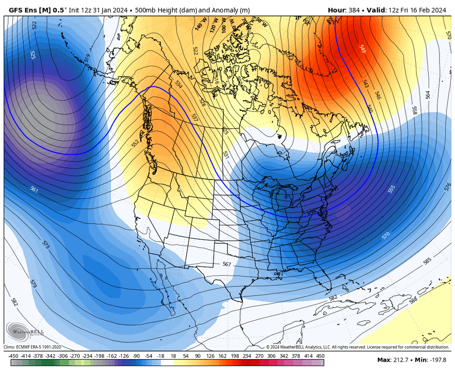
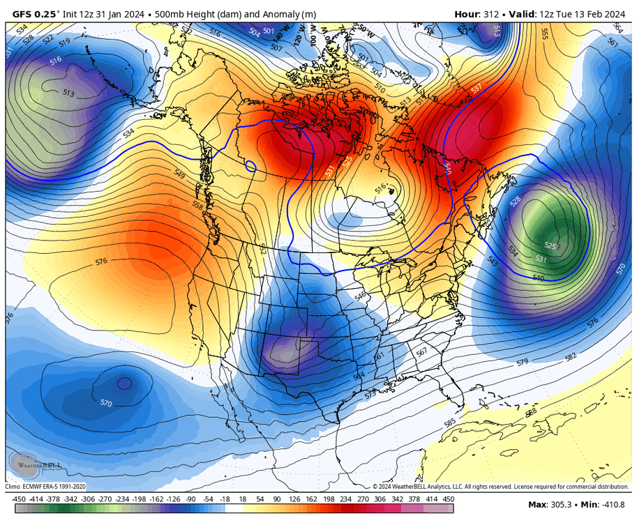
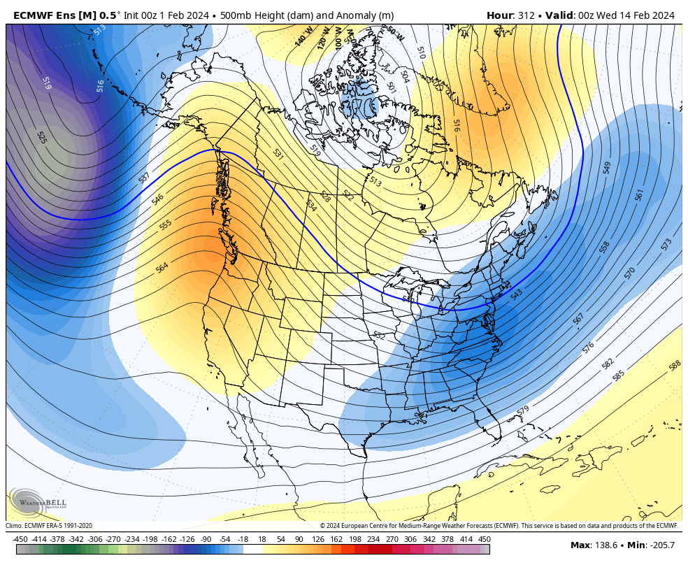
@JFLETCHER, no worries, and I didn't mean to come across that way. Admittedly, this winter has been a disappointment, and yes, the weeklies have overpromised and have underdelivered. But it's hard to see the day-to-day details when looking at the 500 MB anomaly maps. Anticipation is mainly from what history has told us, but sometimes things don't work out. So far, the PHL to DCA corridor has been the best place to be relative to average. Outside of that, most places are still struggling with snow.
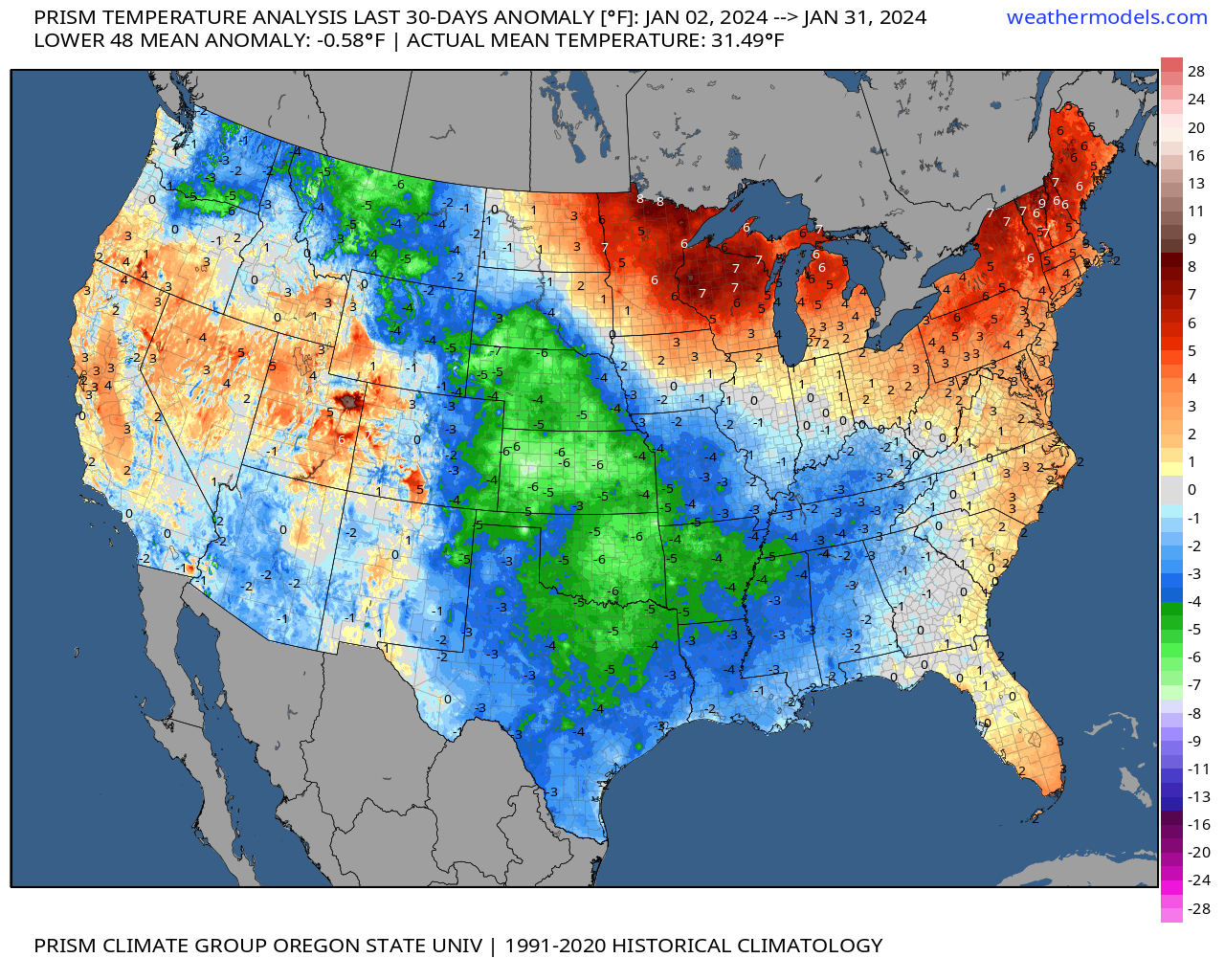
Look at the precip anomalies since early November. It's a shame we've had so little snow with all the moisture we've seen. But, the cold has been displaced in the central and southern plains while we've been skewed warm so far.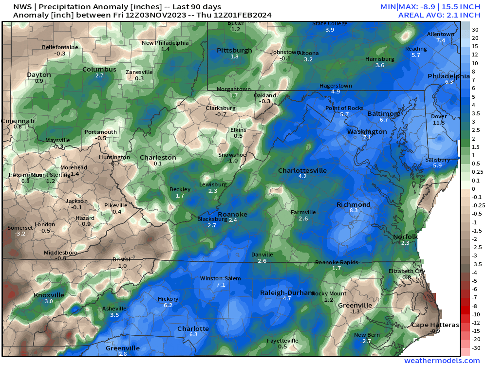

-
33 minutes ago, wasnow215 said:
Lol I don’t get offended by that kind of stuff. Too many other things more important in life.
There has always been that rivalry, but its gotten pretty bad over the years and sometimes it can get pretty toxic as if it can't possibly snow down here. And yes, that is why this thread exists, @Stormpc, @RVAman, @JB Fins.

 30 minutes ago, wasnow215 said:
100% @RIC Airport! Pattern changes and fantasy clown maps 16 days away have virtually nothing to do with each other.
Thank you. Besides, this is a snow board. That's what drives most of the traffic. If people are gonna be negative and not get into the day to day tracking of snow then I'm not sure you're gonna like it around here. Just look at your phone app or out the window every day to check the weather.
-
3
-
-
1 hour ago, ldub23 said:
Pattern change better get going. Virtually no snow in the eastern 2/3rd of the nation
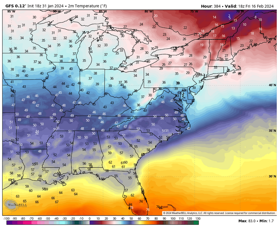
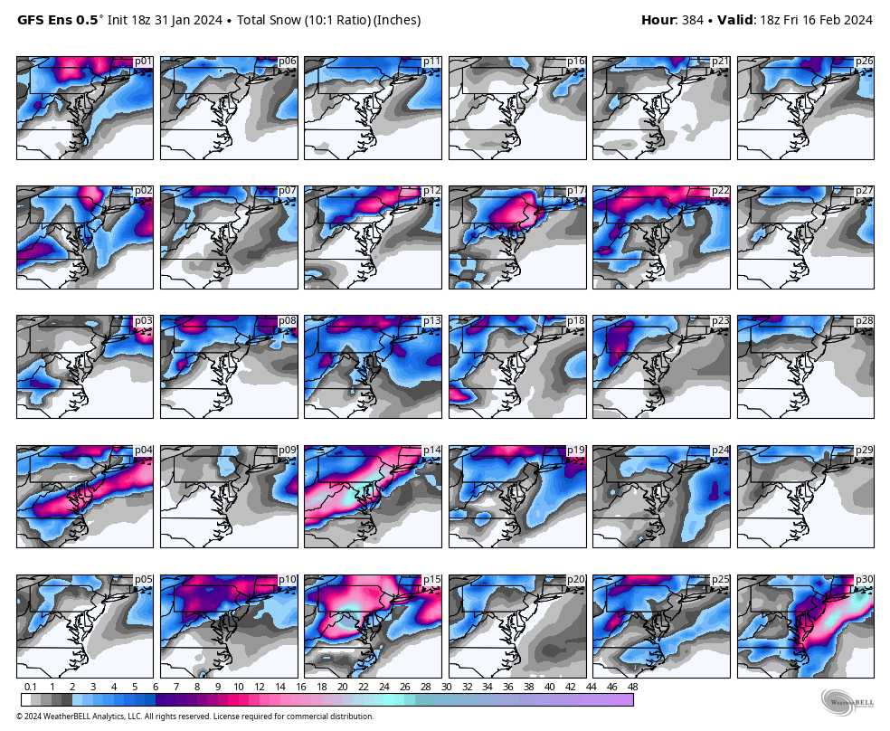
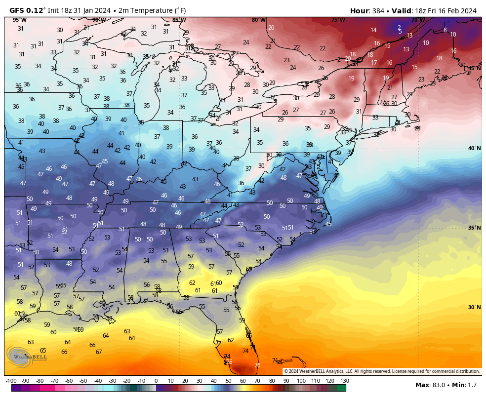
@ldub23why do you keep posting the 384hr GFS and using that as justification to inject negativity into the thread? I've told you numerous times, both publicly and privately about why this isn't a best practice and you keep doing it.
1 hour ago, JFLETCHER said:Good call. I'm very skeptical of this "epic" pattern. You can have the setup all you want but if the STJ isn't producing, you may get a minor event here or there. But the models keep teasing folks and some keep buying in.
The STJ has been producing all winter, hence the record rainfall we've seen since the week before Thanksgiving. The STJ isn't the issue. There are other mechanisms to learn about before making such declaration.
I also don't think people are "buying in", many of us have been at this long enough to know how things work. Personally, if I didn't want to see what the models showed a week or two in advance, I wouldn't be a part of this community and would either look at the forecast on my phone app or simply look out the window every day to see how the weather is. But, that isn't fun.
-
1
-
-
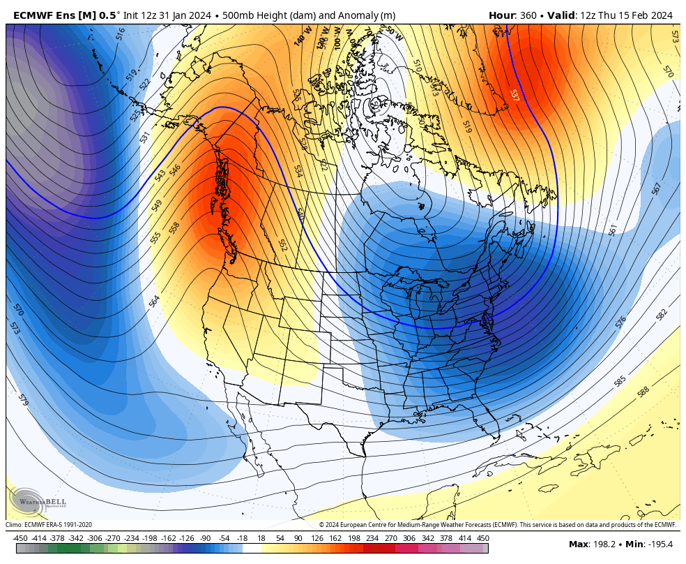
The 00z EPS showed the next bona fide threat window toward mid-month, primarily for Richmond. 1-2 members DO show the snow shower possibility next week on the back side of that coastal storm.
Hopefully, these charts will light up like a Christmas tree in the coming days as the pattern continues to look favorable for snowstorms.


-
1
-
 1
1
-
-
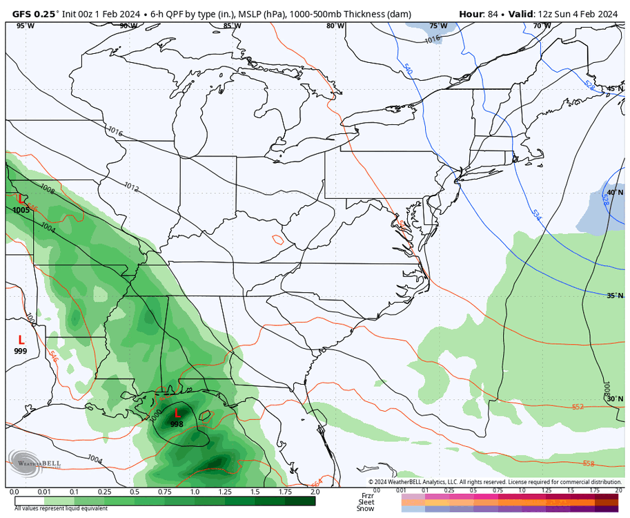
00z GFS has next week's storm still too far south and east, but tries to introduce snow showers for coastal areas, maybe even some bay effect snow for southside Hampton Roads as it pulls away.

-
1
-
1
-
-
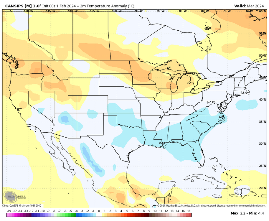
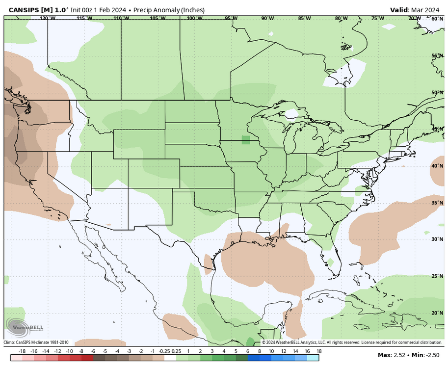
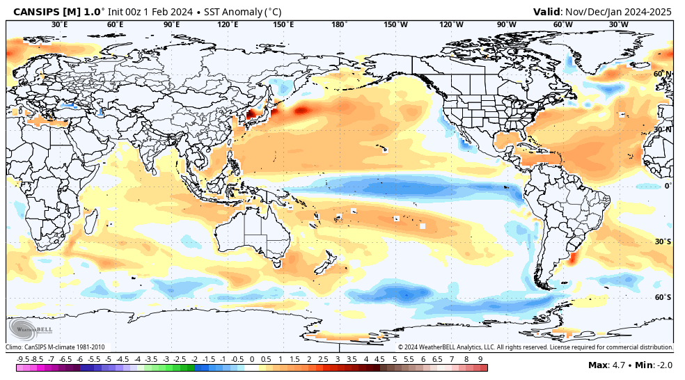
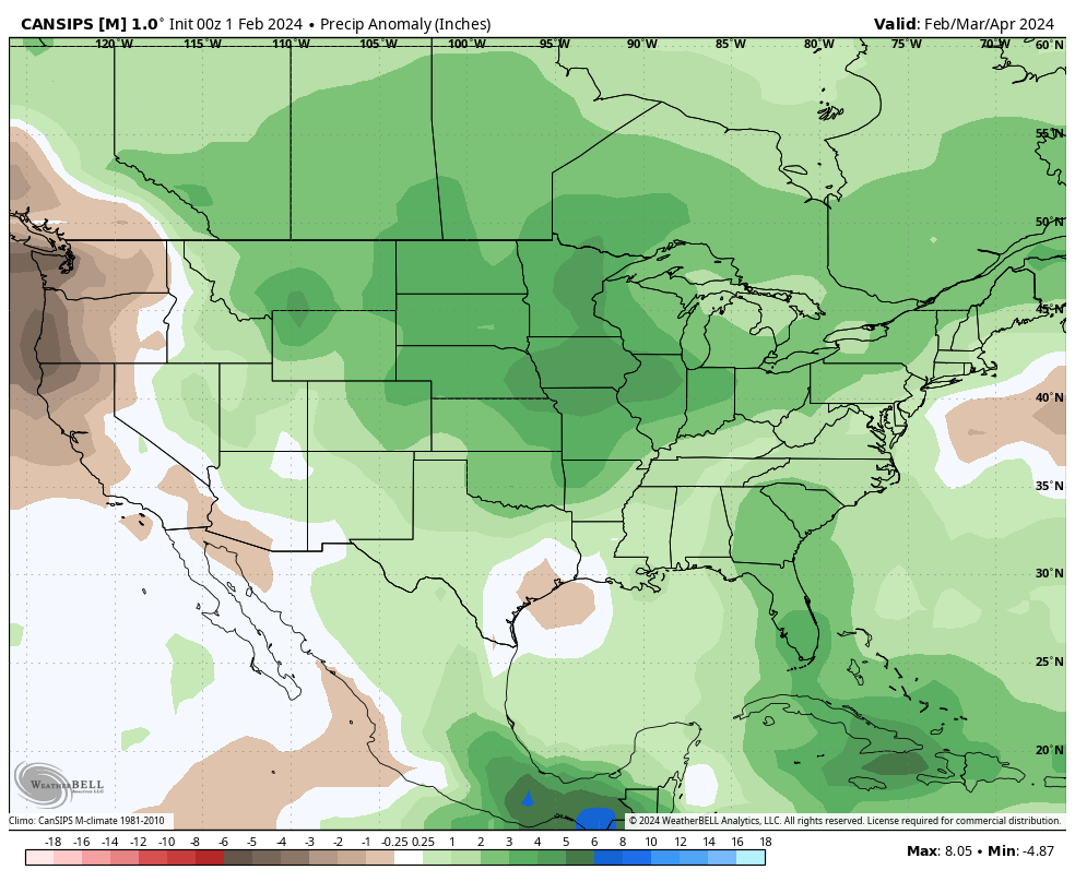
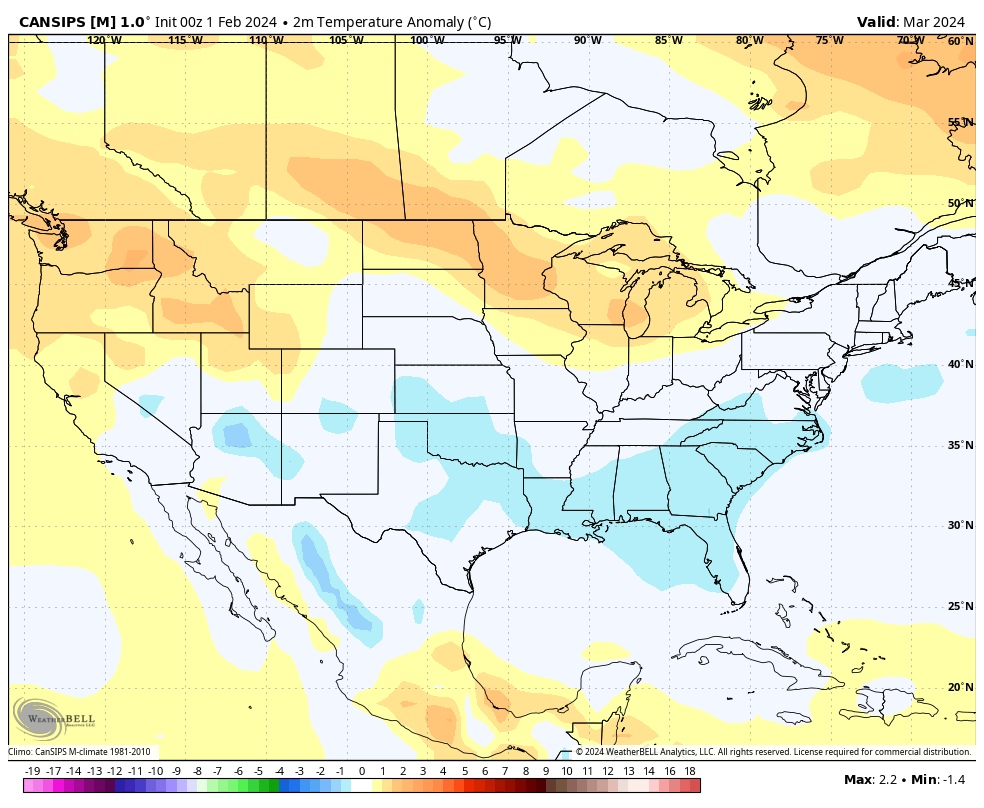
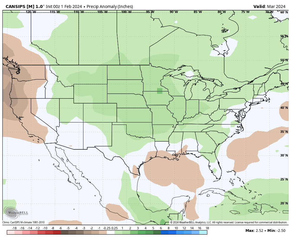
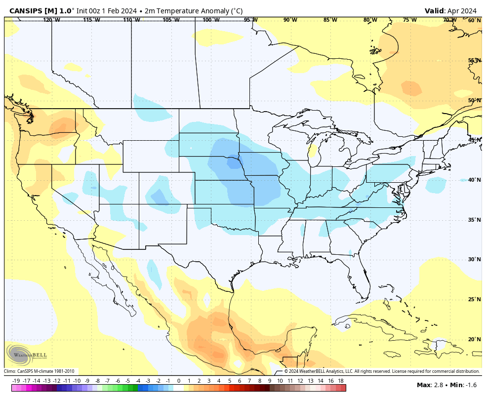
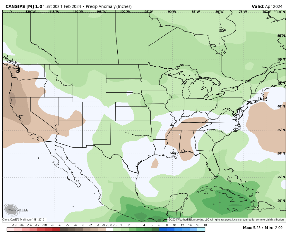
Fwiw, the updated CANSIPs just dropped. Seems to be on board with us staying on the cooler and wetter side for the next few months and @ldub23's cold and wet April prediction could come true.
Also, it still likes the idea of a La Nina for the 2024-25 winter.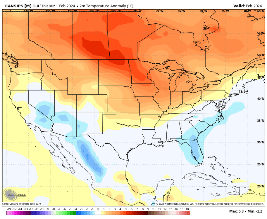


-
1
-
-
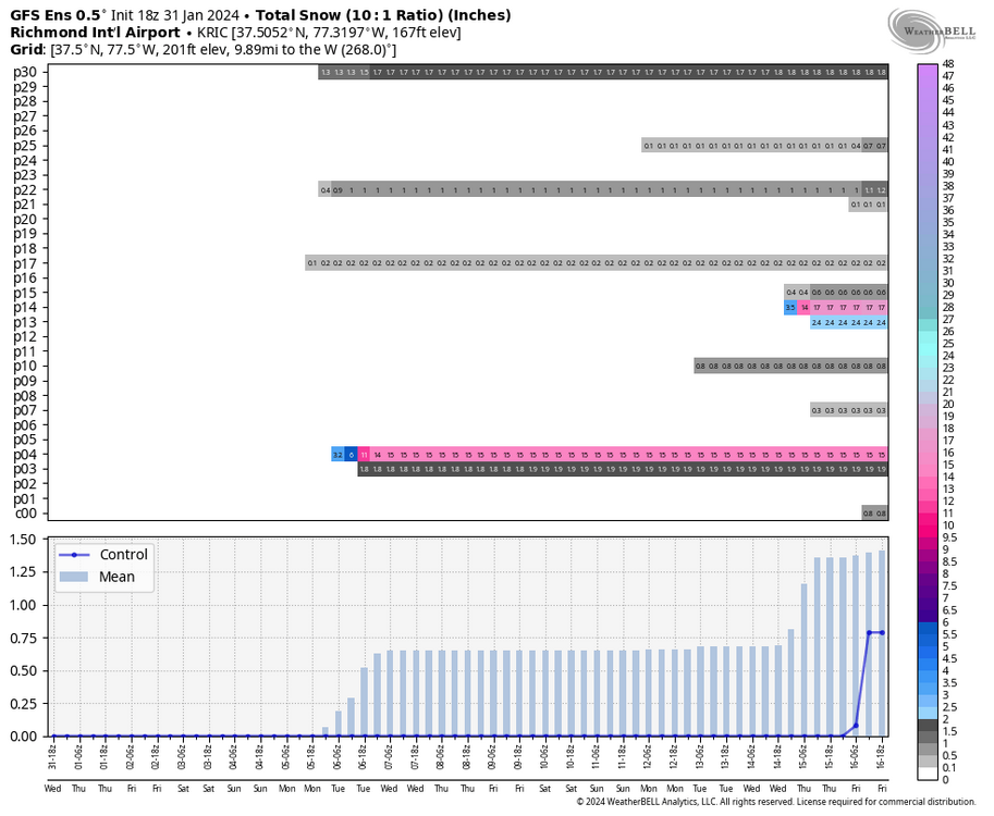
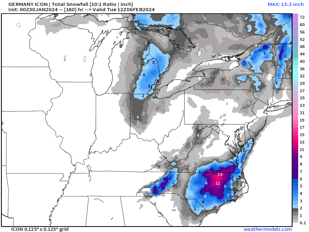
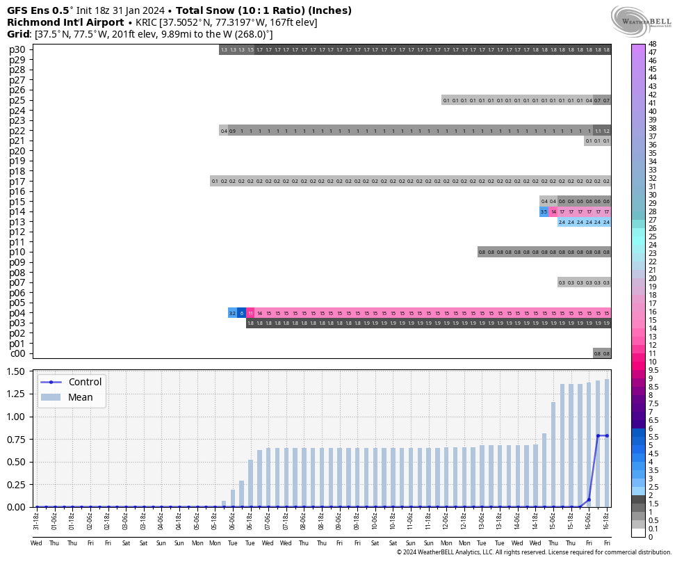
1 hour ago, Conway7305 said:
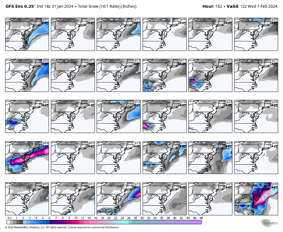
P4 please!
That one dropped 15" at RIC.
-
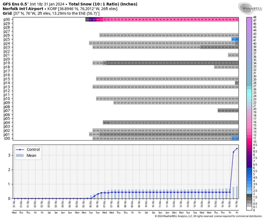
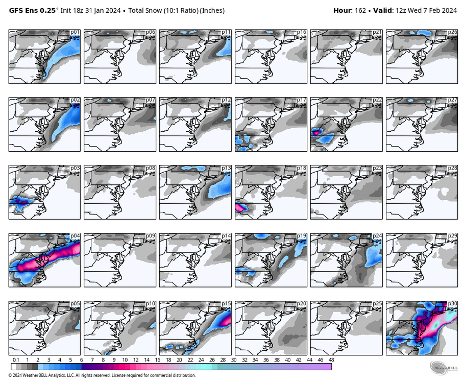
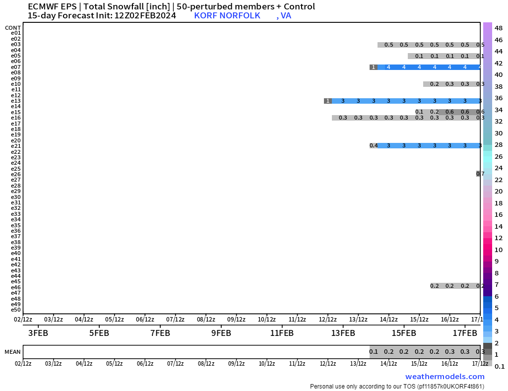
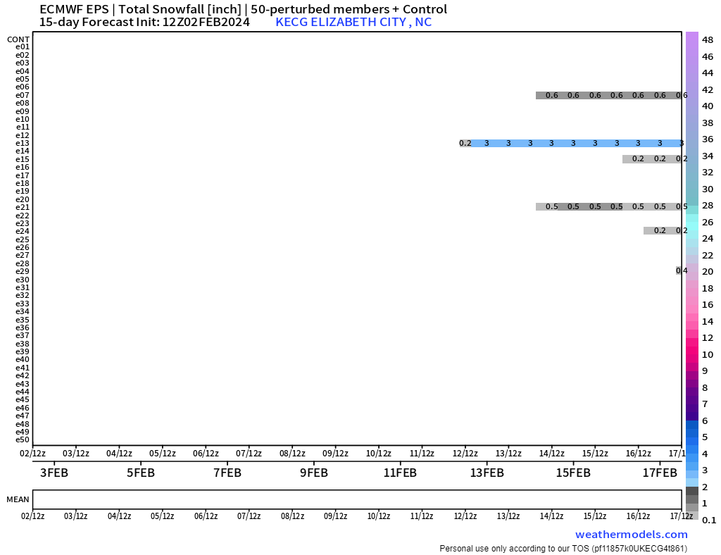
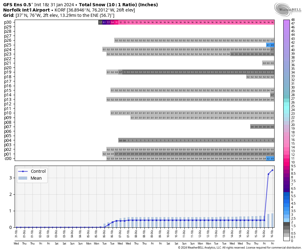
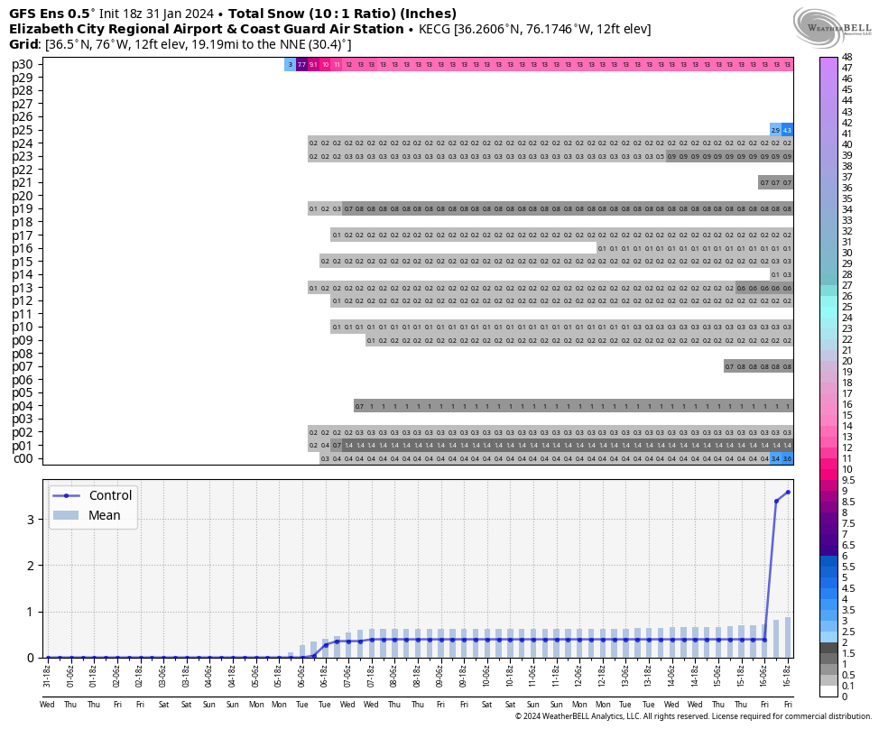
The 18z GEFS still has a few hits around the 5-6th, including one member that gives RIC 15" of snow. However, there were more hits, although small, for ORF and ECG. After that, there is an uptick toward mid-month.

-
1
-
-
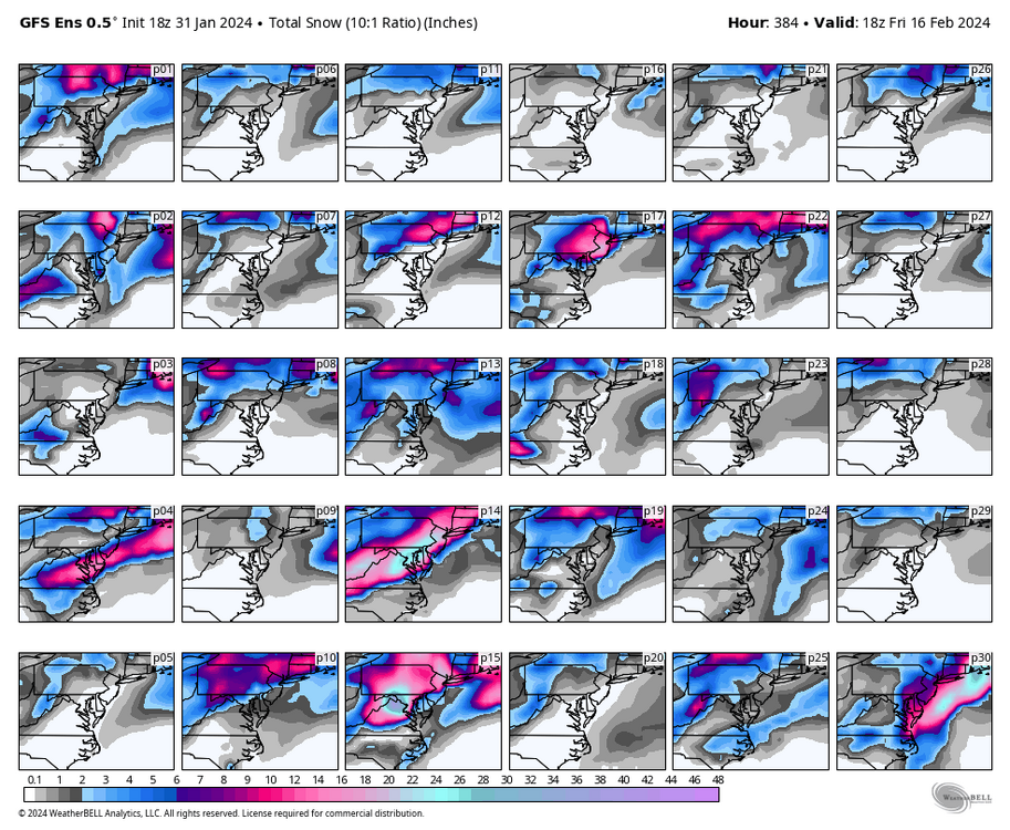
19 minutes ago, ldub23 said:
No arctic air anywhere. Very mild with no sign of any below normal temps
Doesn't look THAT bad to me. And this is at 1pm.
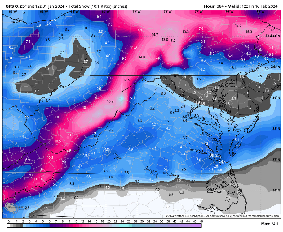
But, again.....it's hour 384.
The 00z run could have us at 25°F or a full fledged torch 70°F+. So, while no arctic cold, you can't really glean much from that range.
-
I know I said I lost interest, but the 2/5 to 2/6 threat is not dead in the water. There are still several ensemble members that have us getting snow next week. Also, the 18z GFS was farther north with enough cold air, so it was something to monitor. We've seen some weird last-minute hits before.
-
1 hour ago, Conway7305 said:
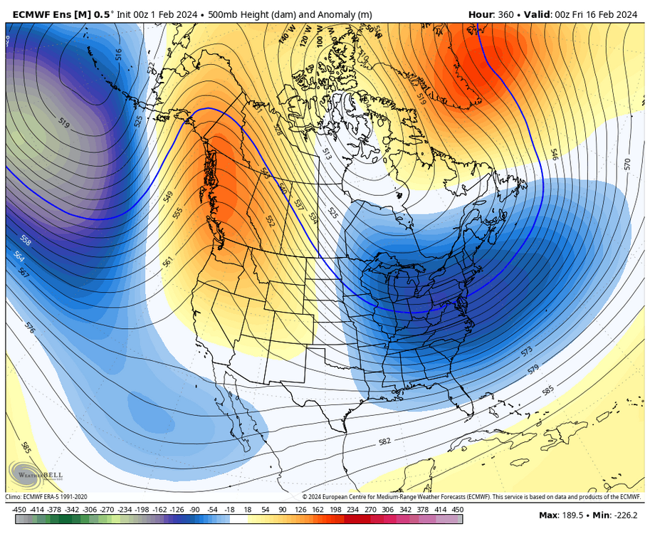
Weeklies showing favorable pattern continuing through March 15th. Looks like we may get a month of opportunities after pattern change occurs on or shortly after Feb 15th. I feel like our best window is going to be between Feb 18th-28th but March could also be good. All ingredients are there Split Flow, -AO, -NAO MJO in Phase 8, +PNA, Active STJ in a moderate/strong NINO. It is rare to get all these Oscillations in right places at the right time.
There have been quite a few decent events mid to late month. I haven't gone through Norfolk's data yet, but here are Richmond's February snowstorms that delivered 4 inches or more since 1898. Quite a few events were close to making the list, so this doesn't exactly tell the whole story. I will post the Norfolk events at some other time and look at March as well.
February Snowstorms 4" or more at Richmond (since 1898)
5.0” February 26, 2015
7.2” February 16-17, 2015
5.8” February 12-13, 2014
4.0” February 19-20, 2012
6.6” February 5-6, 2010
8.3” February 16, 1996
4.0” February 26-27, 1993
5.3” February 23-24, 1989
7.6” February 18, 1989
5.3” February 16-17, 1987
17.7” February 10-11, 1983
6.6” February 27-28, 1982
4.2” February 13-14, 1982
4.7” February 9-10, 1980
10.9” February 18-19, 1979
6.4” February 7, 1979
4.4” February 19, 1972
4.0” February 17, 1972
5.3” February 2, 1972
4.9” February 17-18, 1967
6.4” February 9-10, 1967
5.6” February 6-7, 1967
6.6” February 14-15, 1965
7.3” February 28, 1964
5.3” February 26, 1963
8.9” February 13-14, 1960
6.3” February 15, 1958
5.6” February 26-27, 1952
5.4” February 24, 1952
4.5” February 10, 1948
10.1” January 31-February 1, 1948
9.2” February 19-20, 1947
12.6” February 7, 1936
8.0” February 25, 1934
4.7” February 4-5, 1933
4.6” February 20, 1914
4.7” February 13, 1914
4.1” February 7-8, 1909
4.2” February 27, 1906
6.1” February 10-11, 1904
9.7” February 15-17, 1902
5.4” February 16-18, 1900
16.3” February 11-14, 1899
4.0” February 6-7, 1899 -
55 minutes ago, ldub23 said:
Hopefully the cold will actually show up. The last so called pattern change had 2 days of winter temps and no snow.
I agree. But, had the 2/5 threat not shown up on the models, that had been expected. That we'd have a brief cool down, followed by a moderation before things got good for mid-late month into March.
-
1
-
1
-
-
15 minutes ago, wasnow215 said:
Perfect split flow. Couldn’t draw it up any better.
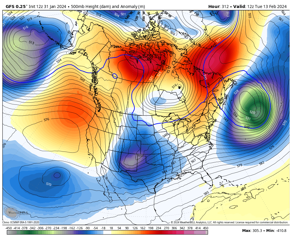
Yup, and the higher heights in the NAO/AO domains. But, more importantly, this time around, we have a bona fide western ridge. Both the EPS and GEFS look favorable for a snowstorm, I hope WE can score and the snow isn't displaced north and west of us. It's hard to see why we couldn't.

-
1
-
-
Posting to save @ldub23 time.
Certainly a good look. But I'm definitely NOT getting reeled in this soon. Need to get to around 10 days before I begin investing time. But the signals are great to see.
-
1
-
1
-
-
20 hours ago, Conway7305 said:
The upcoming pattern looks very favorable starting on Feb 15th. There hasn’t been any can kicking. Long wave patterns looks pretty darn good with split flow and developing NAO block. Folks in main thread are going nuts over it today, even the regular skeptics on that thread are bullish. Will see.
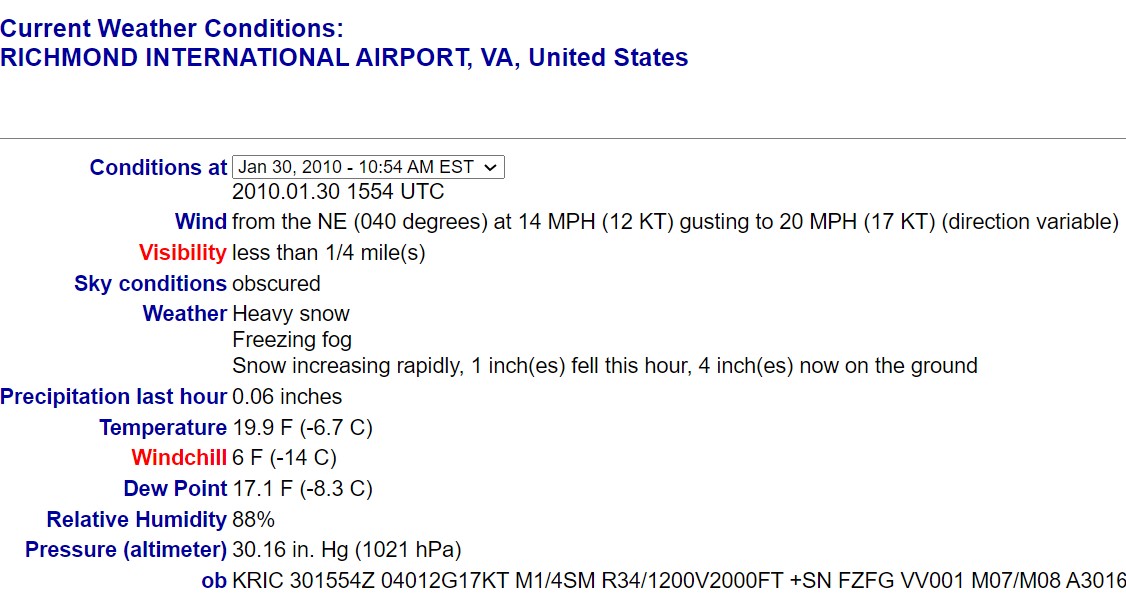
50 minutes ago, JB Fins said:Those were the days.
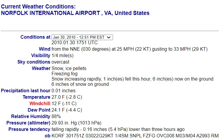
Those were the days, @JB Fins. Wish we could get a cold storm with high ratios like that again soon. Look at that RIC 10:54am ob and that visibility! That was as the best rates were starting to happen.
Also, @Conway7305, @ldub23 et. al, the GFS still has a storm around 2/15. It's way out there so not worth getting into the details because we know it's going to change. Also, the end of today's 12z run was encouraging for the 2/15 period and beyond. Hopefully it has a clue, it's too early to give up on the winter.
-
2
-
-
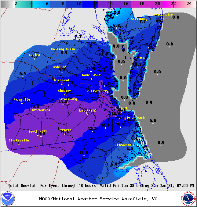
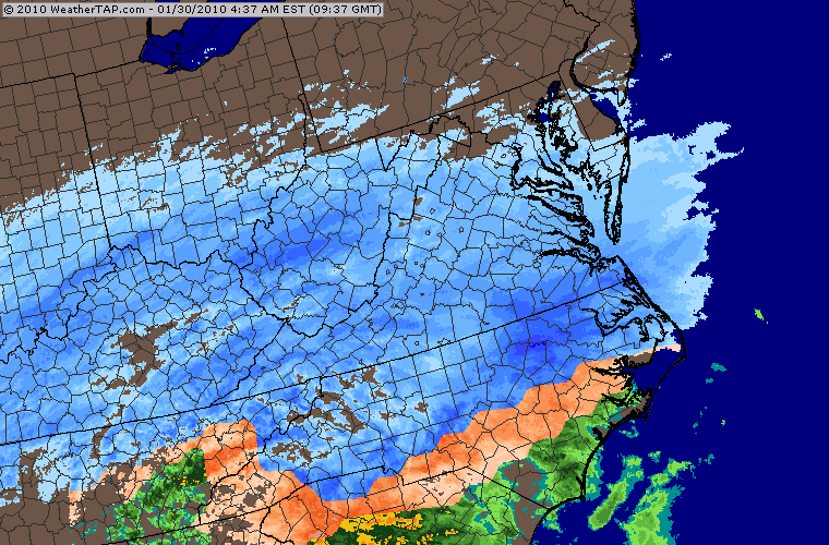
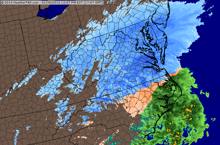
14 years ago today, a really nice snowstorm was winding down in our region. What was so nice about it was that it was a daytime event accompanied by very cold temperatures and low visibilities. Snow started around 4am, with the heaviest rates (1-2" per hour) between about 8am and 4pm. Temperatures at Richmond were only in the upper teens to around 20°F during the event. It was one of the coldest snowstorms of this magnitude since the Blizzard of 1996. Official accumulations were 10.0" at RIC and 6.5" at ORF, but some places in the RIC area had as much as 14-15".
A map with the event summary from NWS Wakefield can be found at this link.
Below is a 24-hour summary for RIC for 1/30/2010, and a couple of obs and saved radar images from that day.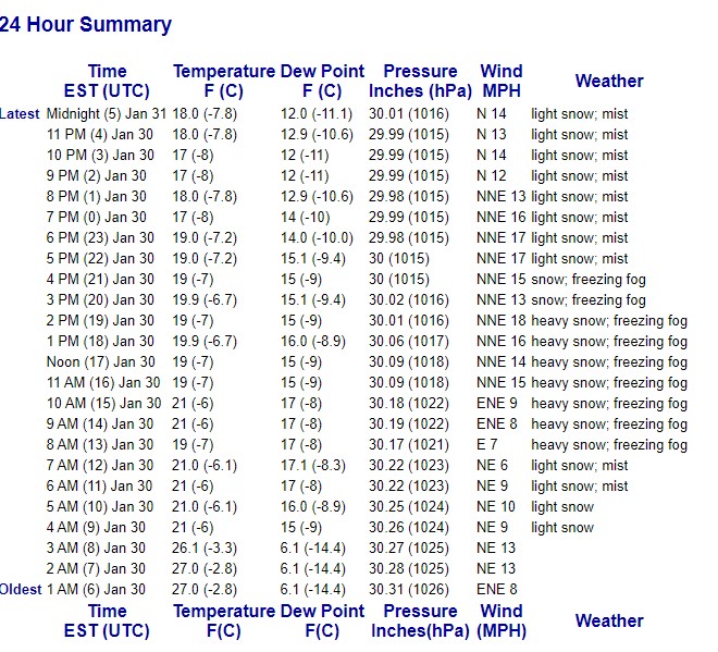

-
4
-
1
-
-
6 hours ago, ldub23 said:
This year is done. The pattern isnt going to change till late march when we can enjoy well below normal temps and rain till mid may. Will se va get an inch of snow next winter?
I disagree, snow season goes through the end of March. ORF even had accumulating snows (2.0") as late as 3/12 back in 2018.
Richmond had a 4" event on 3/24/2013 and a 2.0" on 3/21/2018. Not including at least a handful of events in early March since 2013.
Just because the models propped an unlikely event on 2/5 has no bearing for the rest of the season.
-
1
-
-
00z GFS was still south.
I posted the ICON map, but I am not able to see what @ldub23posted. Not sure if it's an image or a link, but this is what I see all the
time.

-
ICON, fwiw, @Conway7305, @ldub23
-
1
-
1
-


Richmond Metro/Hampton Roads Area Discussion
in Mid Atlantic
Posted
1/29/2014 is another SE VA/NE NC snowstorm that often gets overlooked, @Stormpc.