

RIC Airport
-
Posts
1,766 -
Joined
-
Last visited
Content Type
Profiles
Blogs
Forums
American Weather
Media Demo
Store
Gallery
Posts posted by RIC Airport
-
-
4 hours ago, RIC Airport said:
18Z Euro was a step back for us. Limited QPF and marginal temps persist.

00z GFS came in the best yet. But it is still a nail-biter situation around RIC due to marginal surface temps. Will need good rates to bring the cold down. Otherwise, we will waste the limited QPF we have. Verbatim, most of the precip stays north of RIC, at least this run of the GFS.

-
 1
1
-
-
The latest GRAF model looks legit.
Just look at what the model does vs what he tweeted since he is a DC TV Met. But it's the model that the TV stations use. I like it.")
-
18Z Euro was a step back for us. Limited QPF and marginal temps persist.


-
1 hour ago, Conway7305 said:
New LR weeklies look great for last week of March…lol
1 hour ago, wasnow215 said:Long range weeklies have been awful in the winter for the past 6 years. I’m not trying to start a big disco but why is that part of weather science going backwards seemingly?
The models seem to behave differently yearly, but they've not been good this year. I can't trust the weeklies next year.
 I don't know if we've seen a pattern go poof so fast, especially when almost everyone harped it up, even the usual skeptics. It's disappointing that Richmond has had over 18" of rain since the Tuesday before Thanksgiving and only 0.7" of snow out of it.
-
1
-
 1
1
-
-
This is from AKQ's afternoon disccussion.
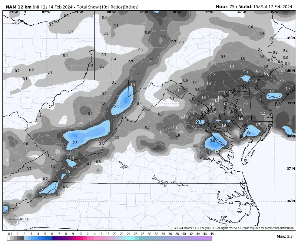
.SHORT TERM /7 AM THURSDAY MORNING THROUGH SATURDAY/...
As of 300 PM EST Wednesday...

Key Messages:

-The potential for accumulating snow early Saturday morning has
increased across northern portions of the area (roughly from Louisa
to Salisbury), where 1-2" of snow is in the forecast.

-There is the potential for a light accumulating snow as far south
as the Richmond Metro, but confidence in this is lower.

-There is still some uncertainty regarding the track and
 strength of the system, so expect changes in the forecast in
 the coming days.

The surface high becomes suppressed to our SE on Thursday while a
fast moving clipper system tracks well to our north. This system
will drag a cold front through the area Thursday night. Return
southerly flow will allow temps to rise into the upper 50s-lower 60s
in most areas west of the Ches Bay...although it will struggle to
get out of the upper 40s-lower 50s on the ern shore. While there
will be an increase in clouds on Thu in advance of the front, no
precipitation is expected. Clearing Thu night with winds becoming W
then NW behind the front. Lows will fall into the mid 30s-mid 40s.

The main focus of the period is the increasing potential for
accumulating snow across the northern half of the area Friday night
into Saturday morning...as a fast moving shortwave in zonal flow
aloft tracks over the area. No wx concerns ahead of the system on
Fri with increasing clouds and highs in the 50s in most areas (mid-
upper 40s on the ern shore). The GFS/ECMWF and GEFS/EPS
ensembles are in much better agreement than they were yesterday
with respect to the track of the system. At this time, model
consensus shows the system tracking across southern VA, with the
most likely timing for precip between 10 PM-6 AM (before ending
by sunrise as the system moves offshore). While the system will
be fast moving...there will likely be a 3-6 hour period of
light to moderate snow north of the low track, with light rain
(with amounts under 0.10") in SE VA and NE NC. Despite
temperatures falling to 32-33F, the snow will likely come down
at a decent enough rate (thanks to fairly strong 850-700mb
frontogenesis to the N of the low track). Also, the fact that
this event will occur at night will help a bit with accums
despite the marginal temps. Right now, the forecast calls for
1-2" of snow in areas from roughly Louisa-Salisbury...to less
than 1" in the RIC Metro...with no snow at all south of a
Farmville-Hopewell line. There is the potential for localized
amounts greater than 2" in the most persistent bands...but too
early to reflect this in the forecast. Of course, there will be
changes in the forecast track and strength of the system during
the next couple of days.

Any travel issues Sat AM will be short-lived as the snow will
quickly melt on Saturday with highs rising well into the 40s.
-
-
1 hour ago, wasnow215 said:
Ty!
It's why this thread exists so we don't have to rely on finding Richmond or even Tidewater on the maps often posted in the forum's LR thread, because it's DC centric. Some posters recognize there are posters that live outside of the DMV, but most don't or care.
-
4
-
-
42 minutes ago, RVAman said:
That's a SHARP cut off line. Maybe we'll cash in. No chance we see 3-4" with the marginal temps. Like RIC said, 0.5-1 inch on grassy surfaces more than likely the best bet. Hope I'm wrong.
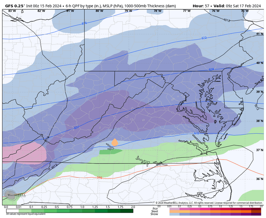
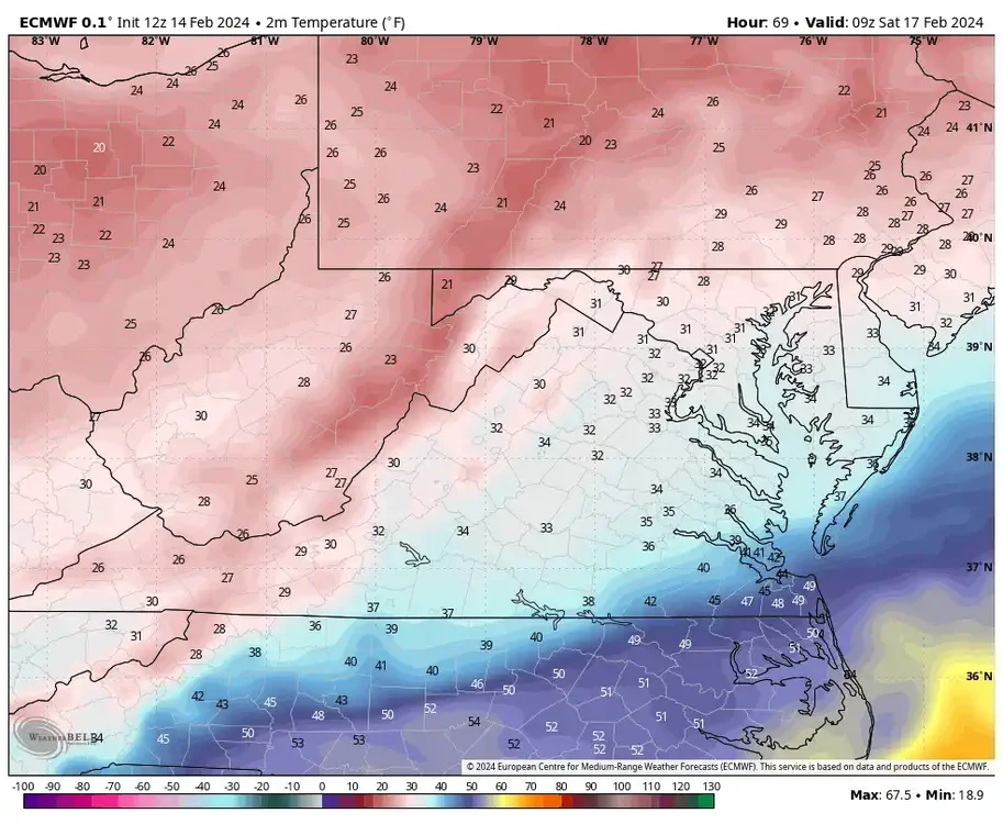
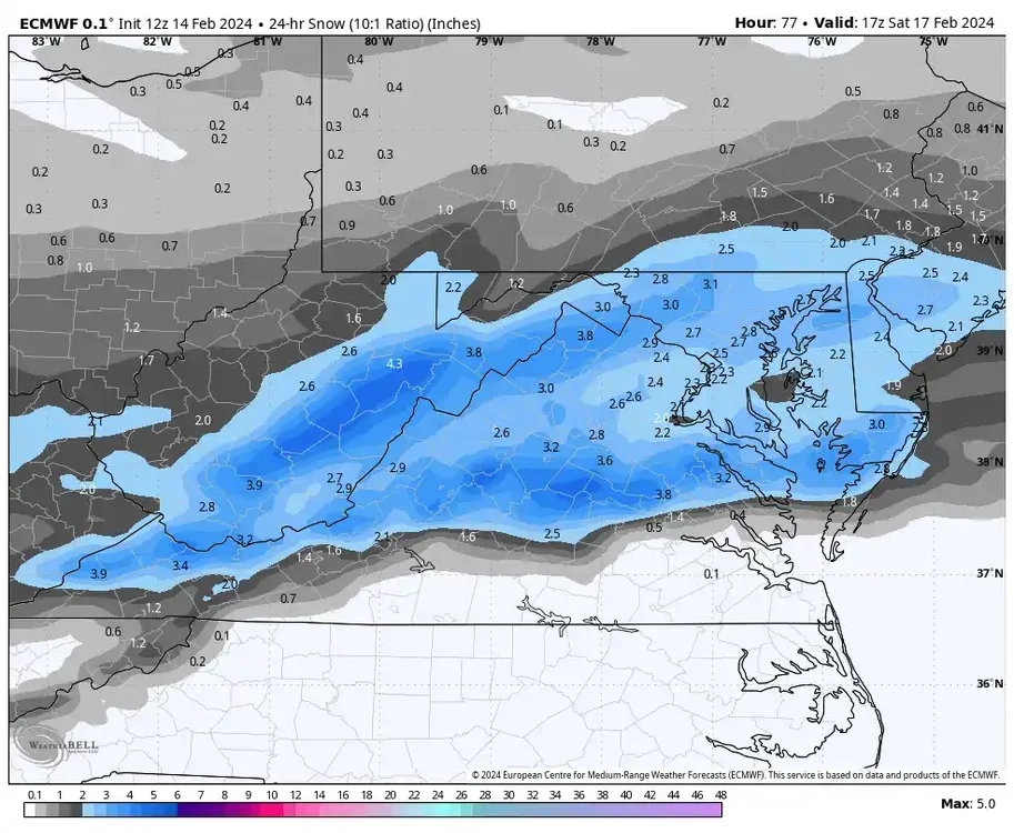
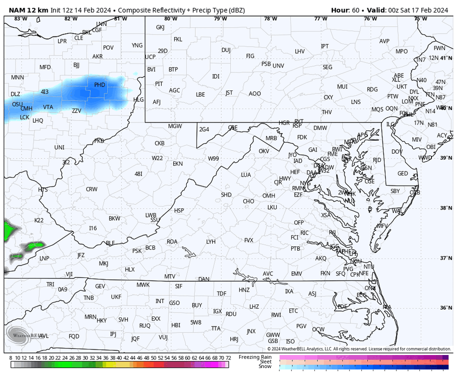
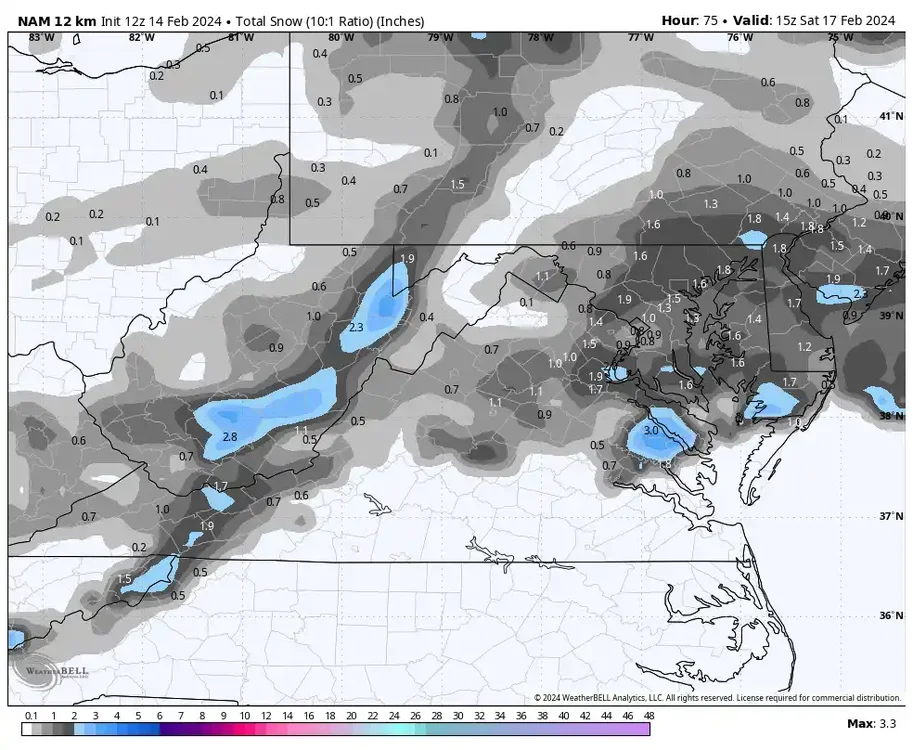
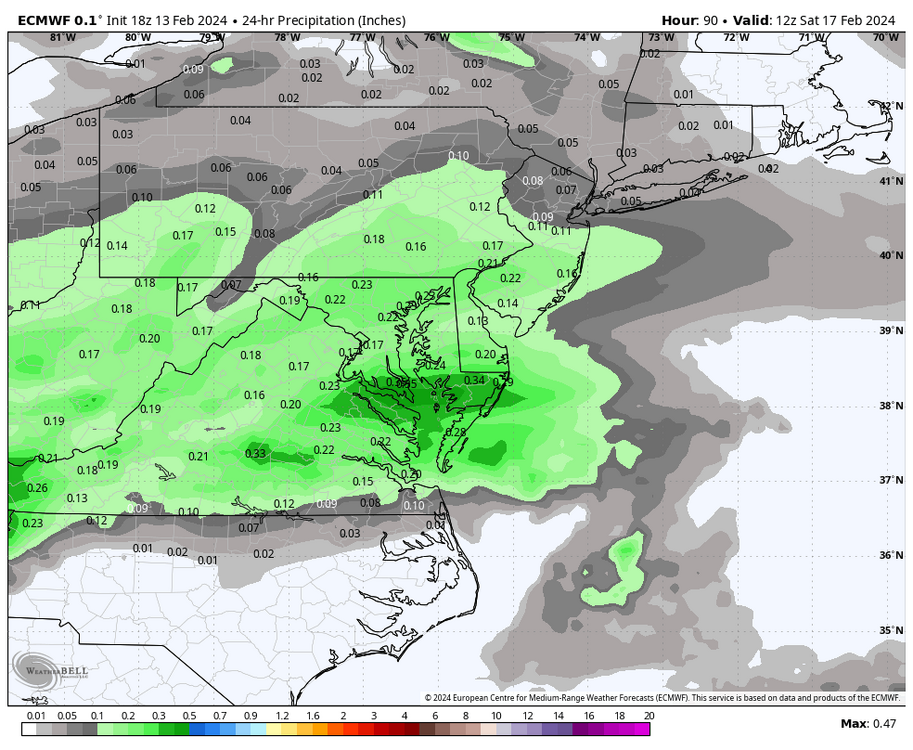
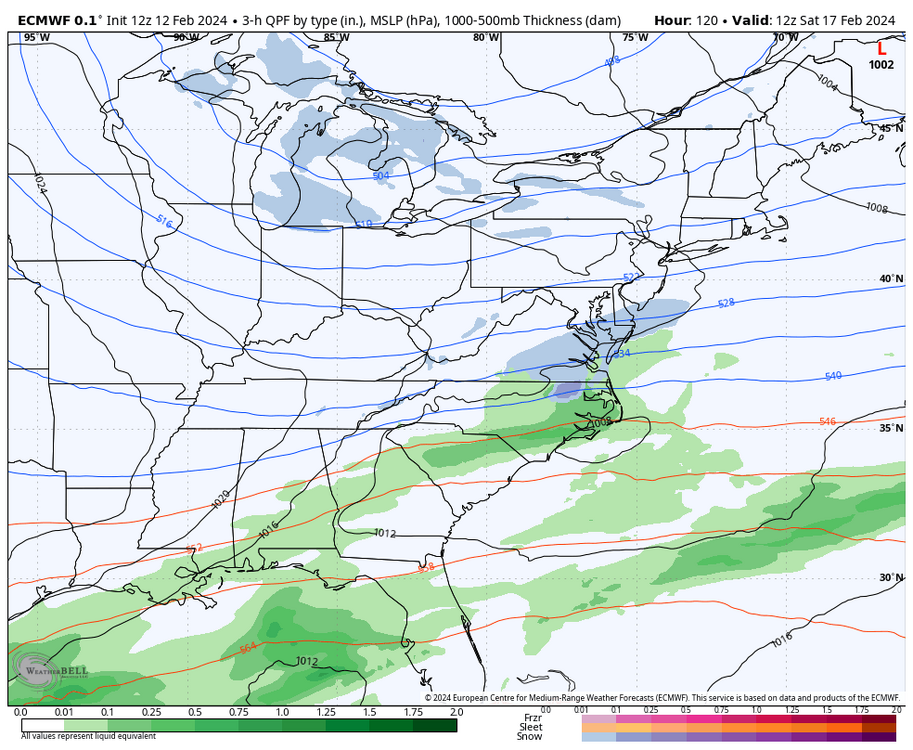
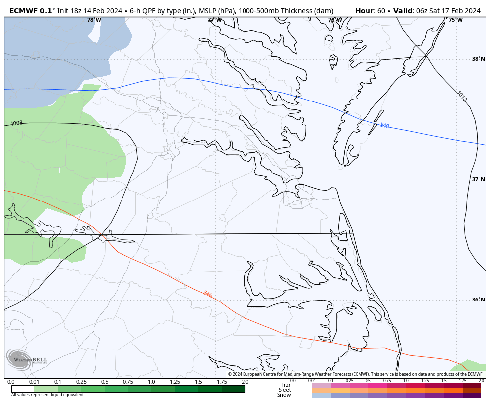
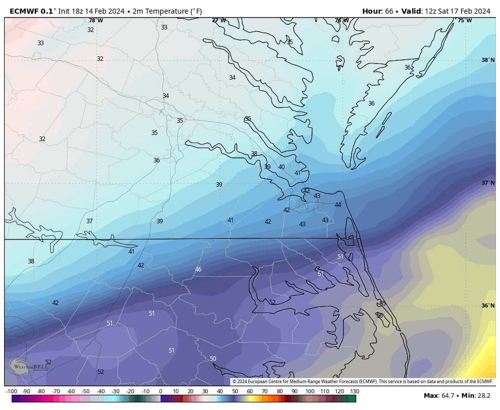
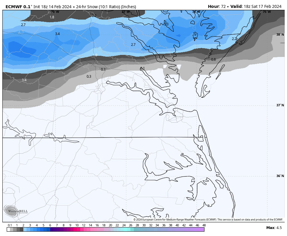
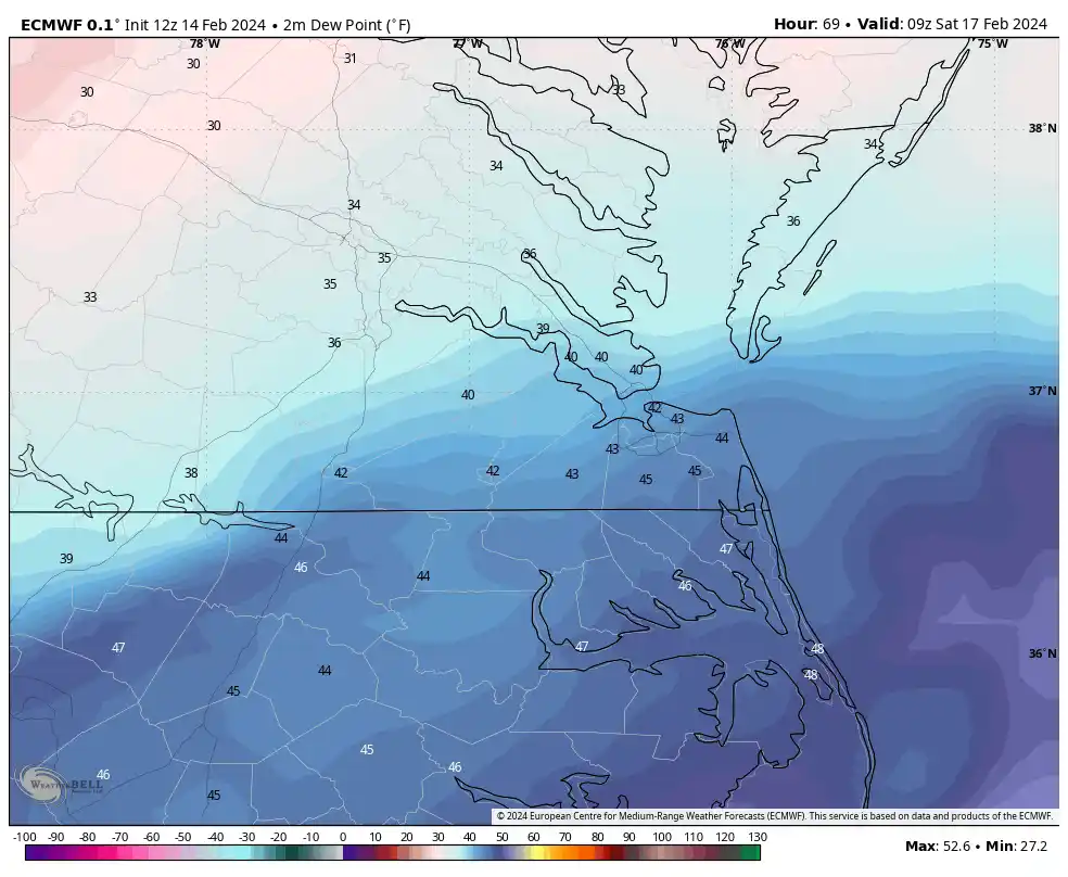
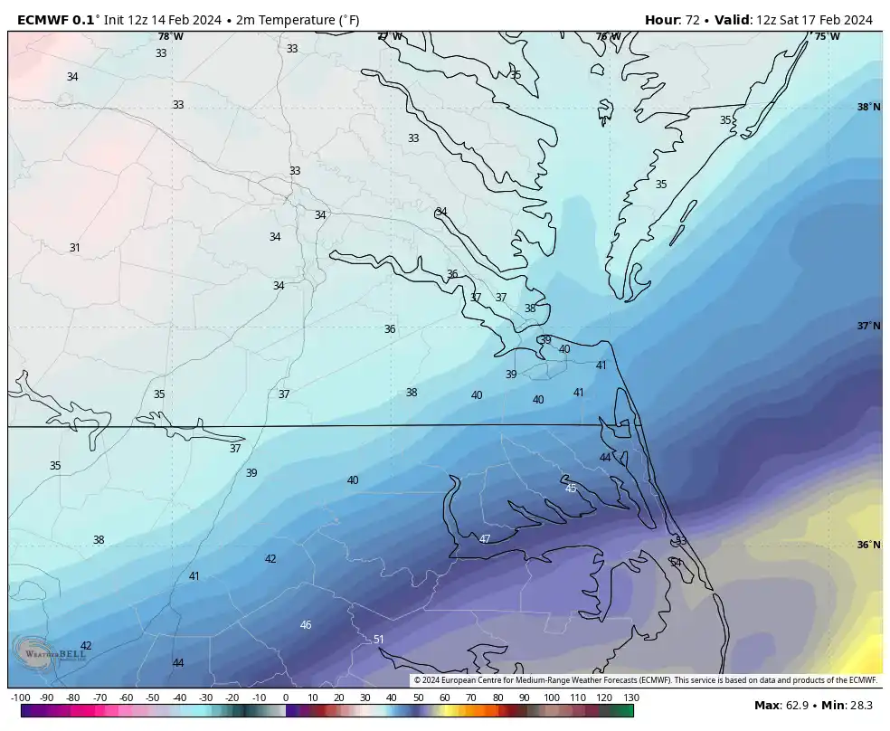
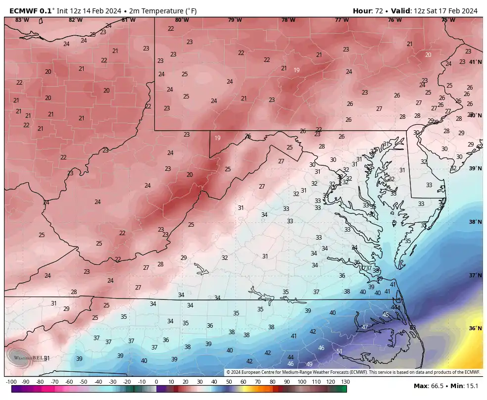
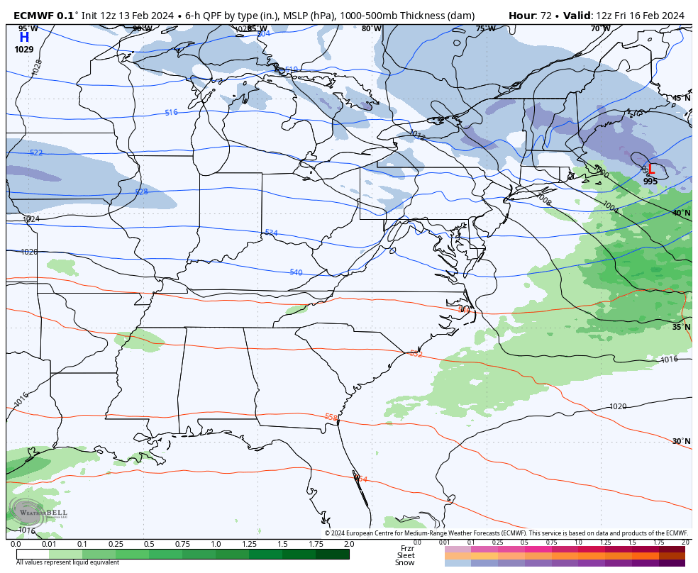
This is a rain to snow scenario. For the immediate Richmond area, surface temps are above freezing, but since it's below freezing at the 850mb level the precip should fall as snow after about 10pm Friday for areas north of about Petersburg. With good rates, the snow could still stick especially with the time of day, but the surface temps won't make this a 10:1 ratio like the snow maps show. Best rates look to be (per Euro) between 2am and 4am. Precip could be over before sunrise.
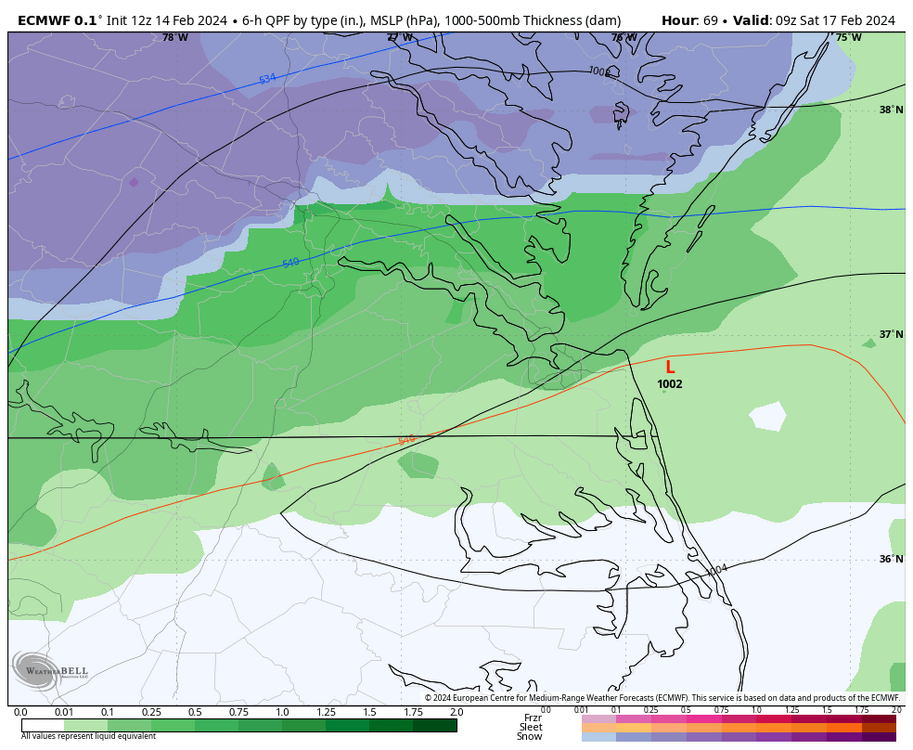
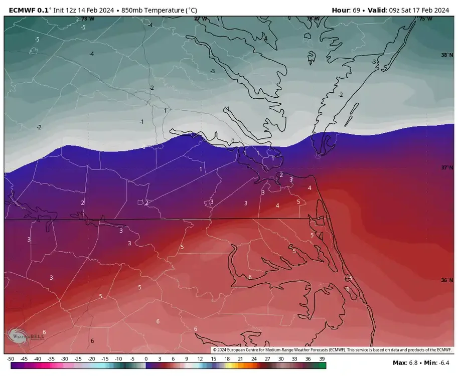

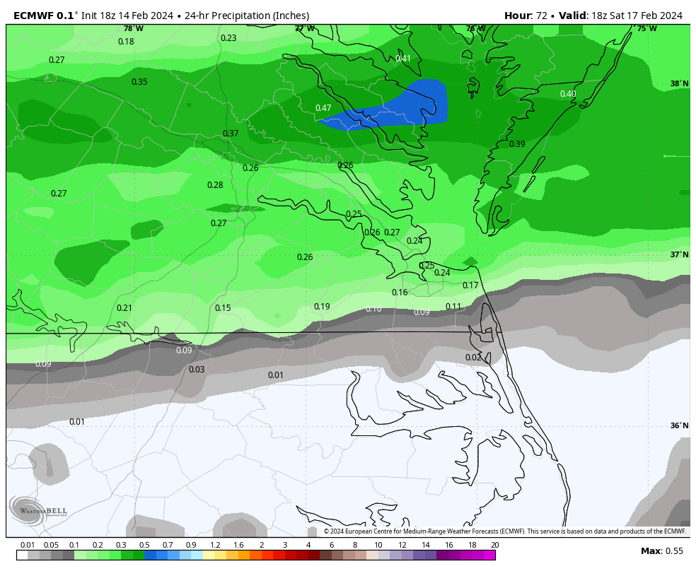
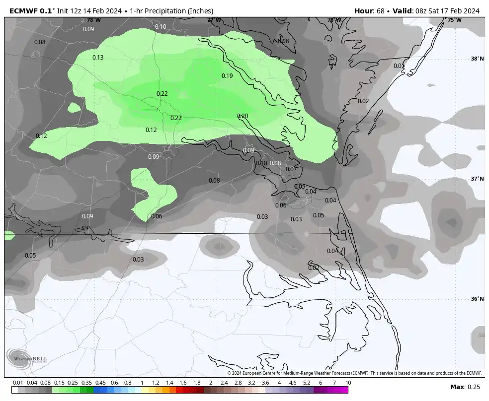
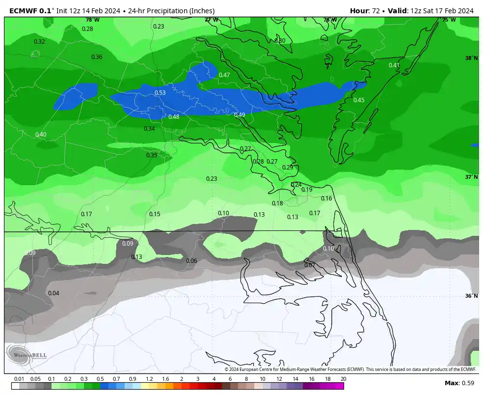
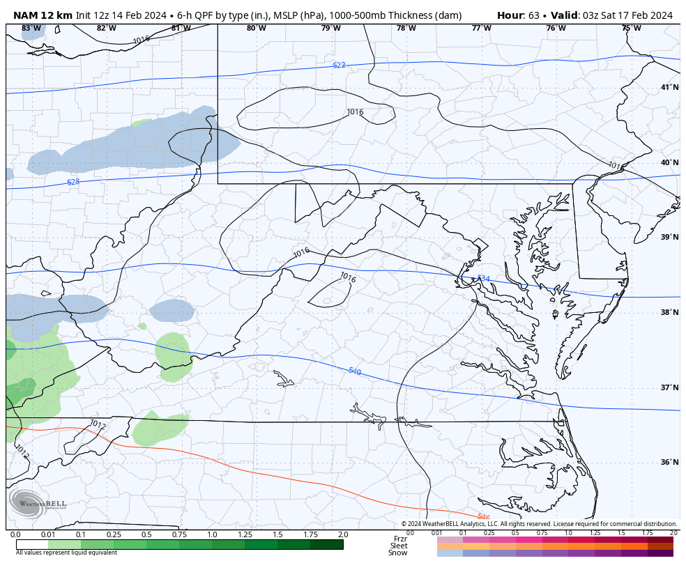
This is the ONE hour QPF amount, heaviest is between 3am and 4am.


-
9 minutes ago, Stormpc said:
HELLO....RICHMOND!! This is your event. Overnight. Cold enough at the surface. Decent track. On the edge but always room to go further south as we've seen recently. Of course can go the other way but liking the trends for Central virginia. Bring it home.
We can afford an even more southern shift and maybe your area can see some flakes, hopefully for us that would also mean colder surface temps. Won't be a 10:1 ratio unfortunately for Richmond based on current data, but even a quick 0.5" to inch on the grass would be awesome though.
-
10 minutes ago, wasnow215 said:
Hello Short Pump! Lol
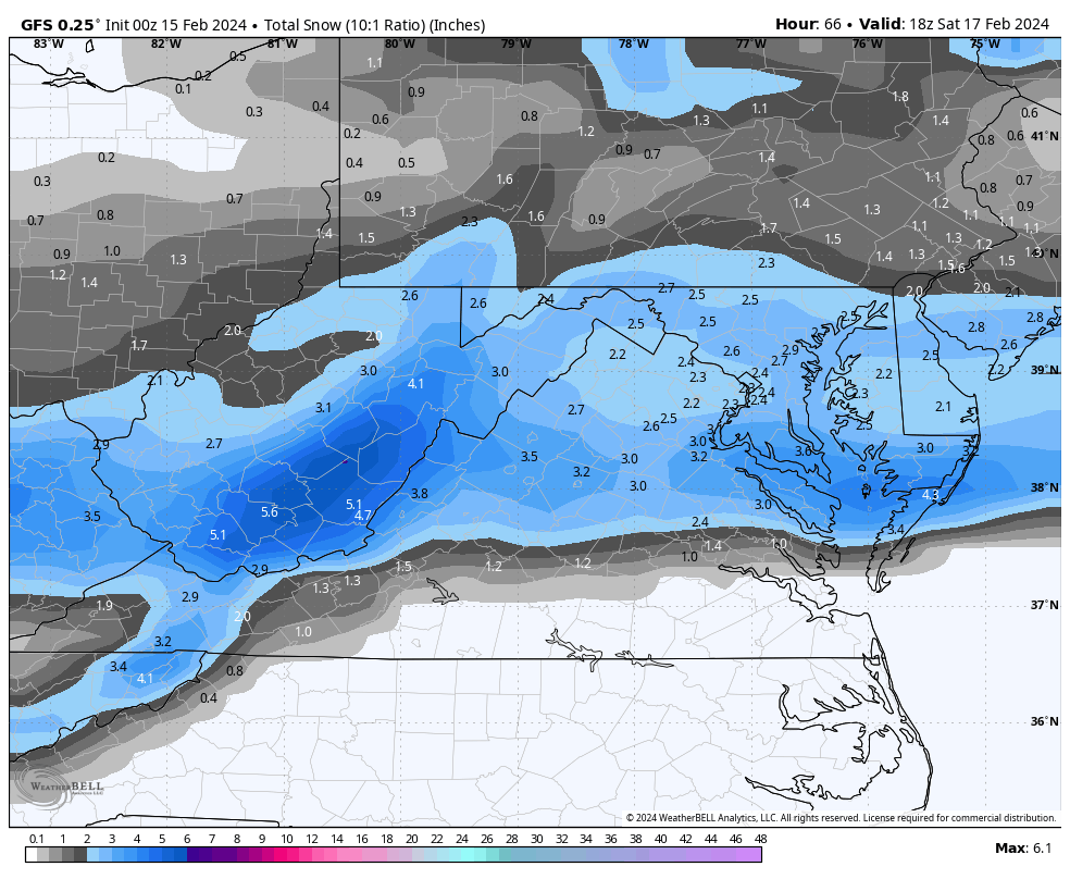
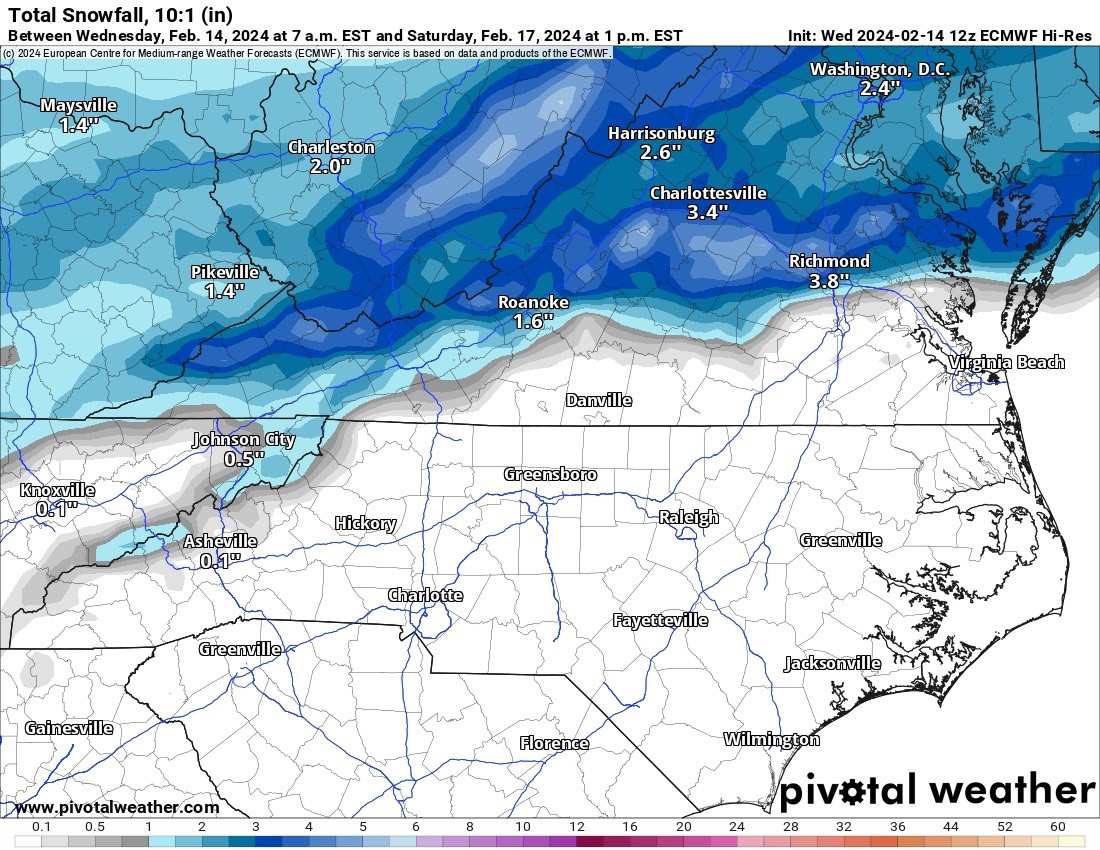
There is our local map, from pivotal.
-
1
-
-
Euro looks even better to me.


-
1
-
-
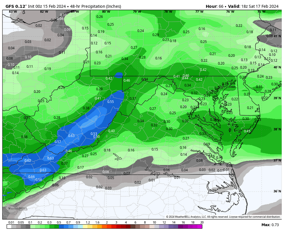
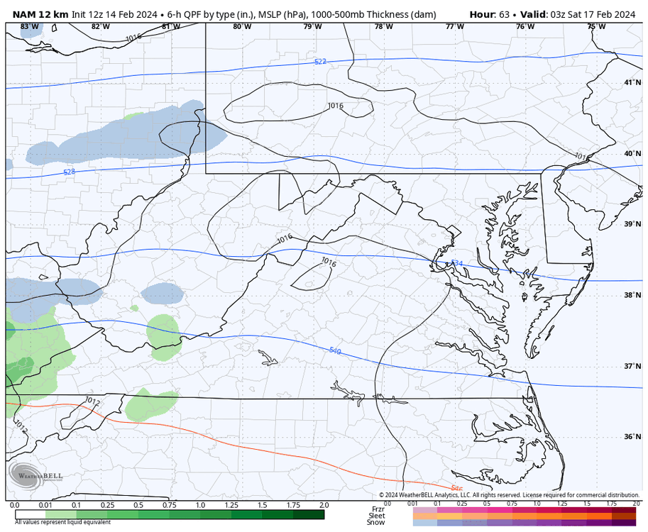
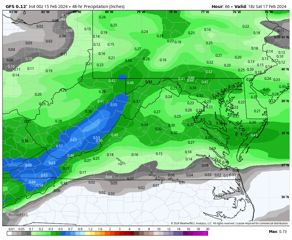
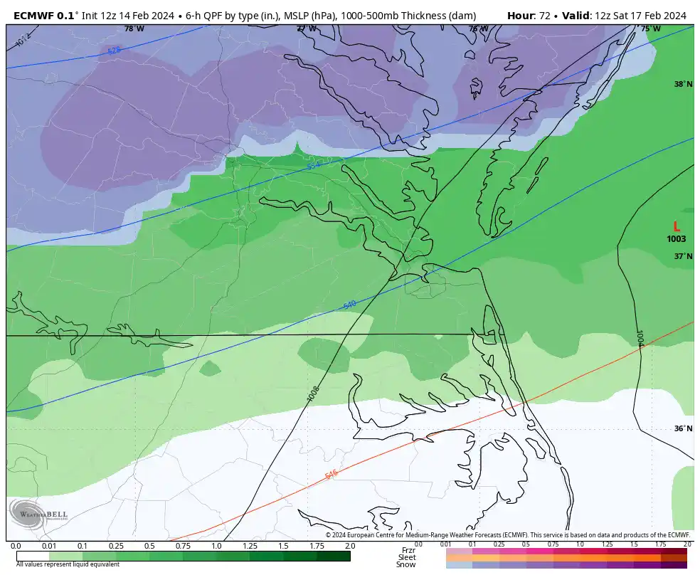
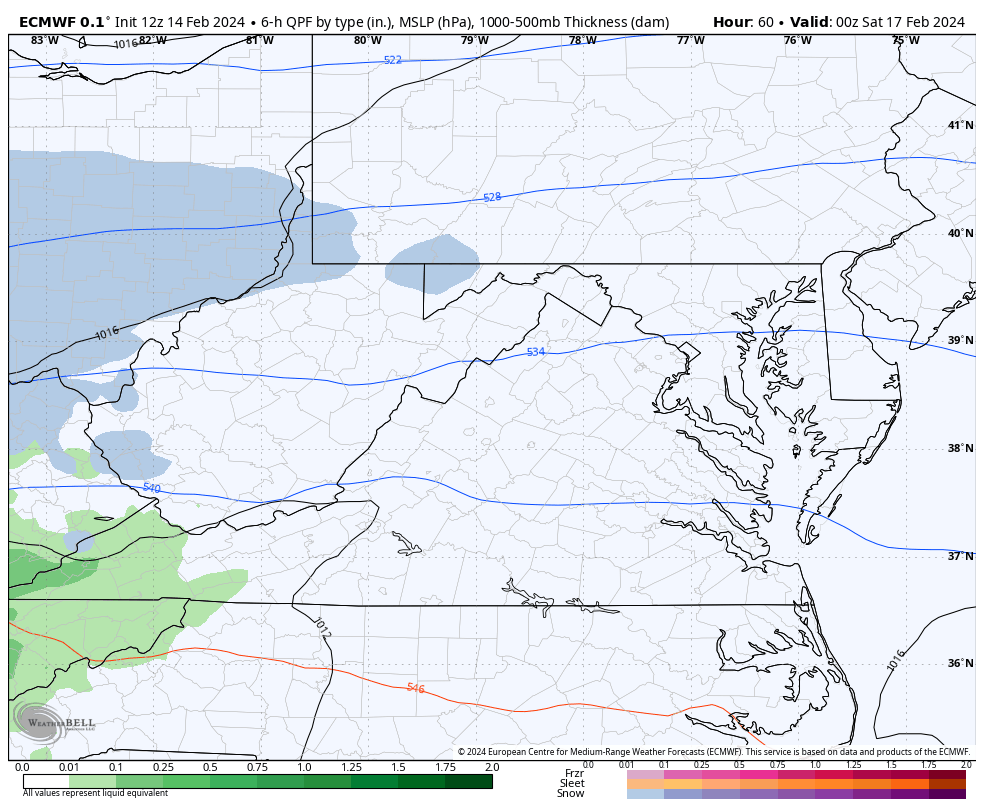
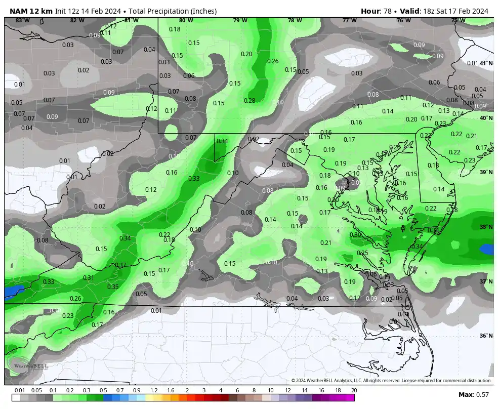
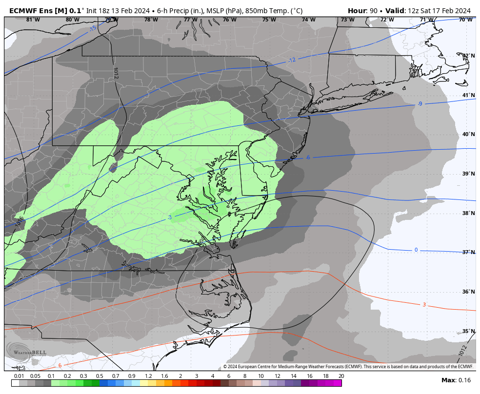
12Z NAM did appear a bit drier for NoVA/DC, but seems to be aligned with other models for our area with generally 0.20" to 0.30" of QPF. This run has a precip jackpot around Tappahanock, Northern Neck area.

-
1
-
-
43 minutes ago, RVAman said:
Even IF it does snow on Saturday (unlikely in my opinion for accumulation) it will all be melted away by noon.
I remain optimistic either way. We'll take anything we can get, even if it's something like that one morning back in December, that melted within a few hours. There is a boundary layer issue, but there still should be a 2-3 hour period where 850s are cold enough for it to snow, thereafter depends on the rates. It'll be a tough call because the window is so brief, but at least the timing of the day is favorable.
-
 1
1
-
-
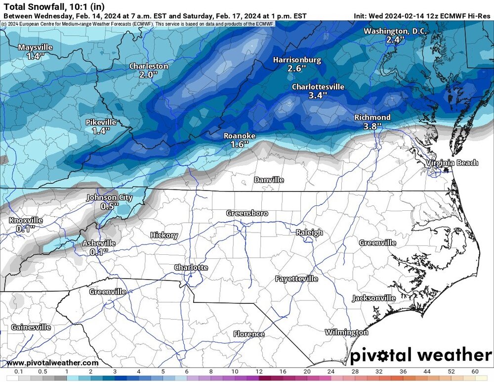
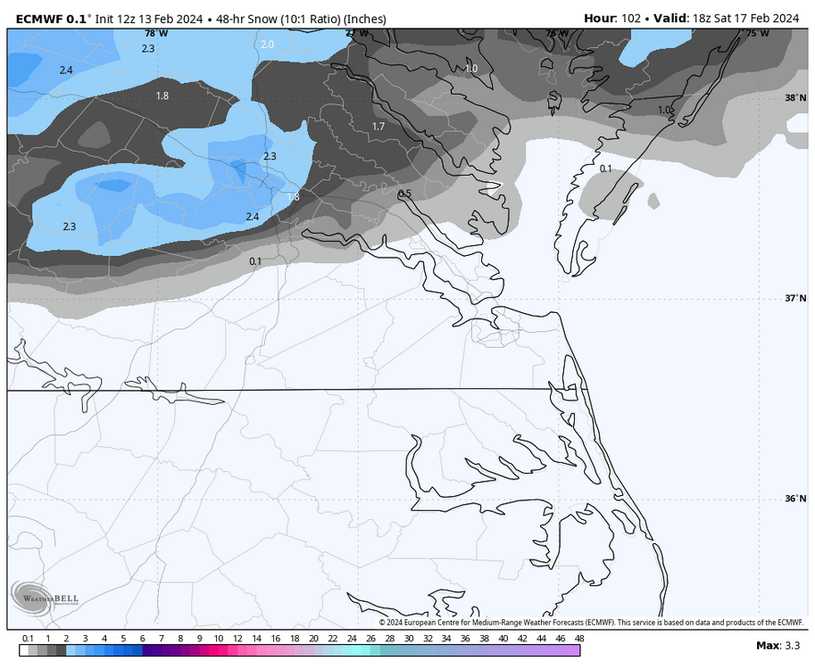
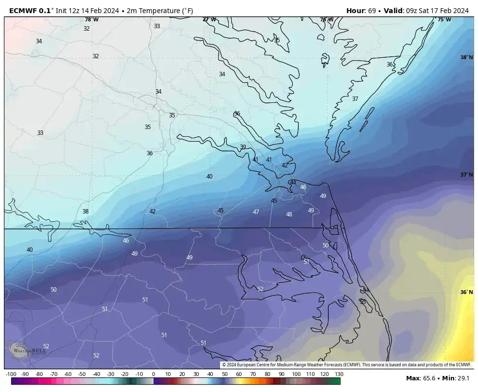
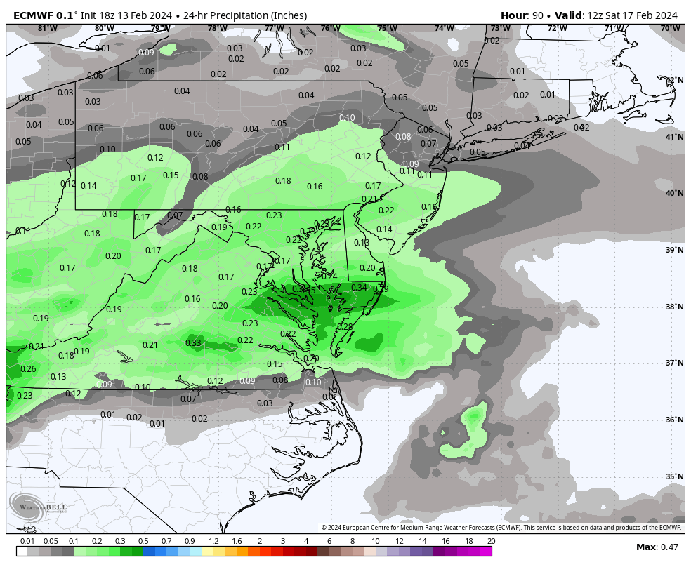
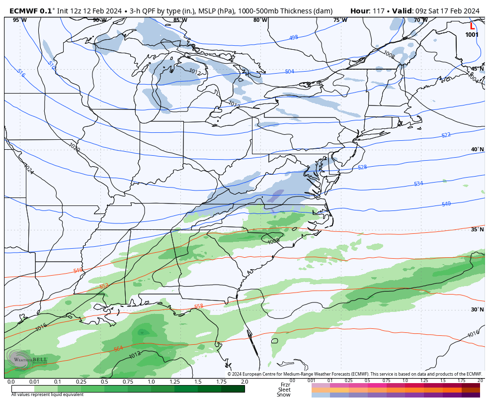
The 18z Euro was a tick north of 12z with the Saturday morning snow. The timing still looks to be 1am to 7am. There is not much QPF anyway, but we'll take what we can get. For RIC, all the airport needs is 0.3" to reach 1.0" for the season.

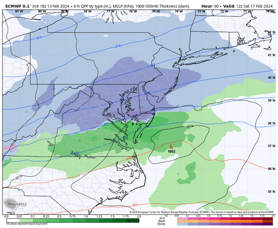
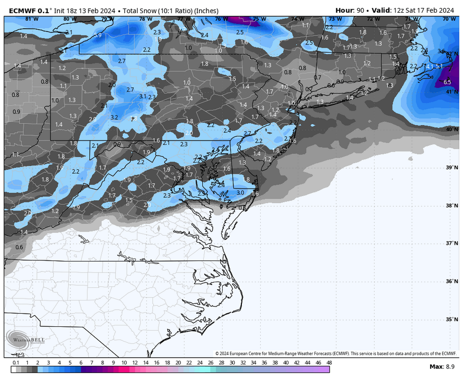
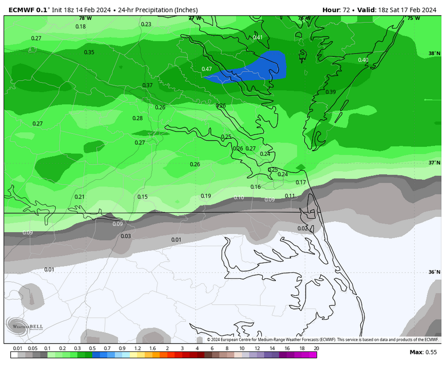
As mentioned, QPF is limited only about 0.20" to 0.30" on average, but we'll take anything we can get if it's snow.
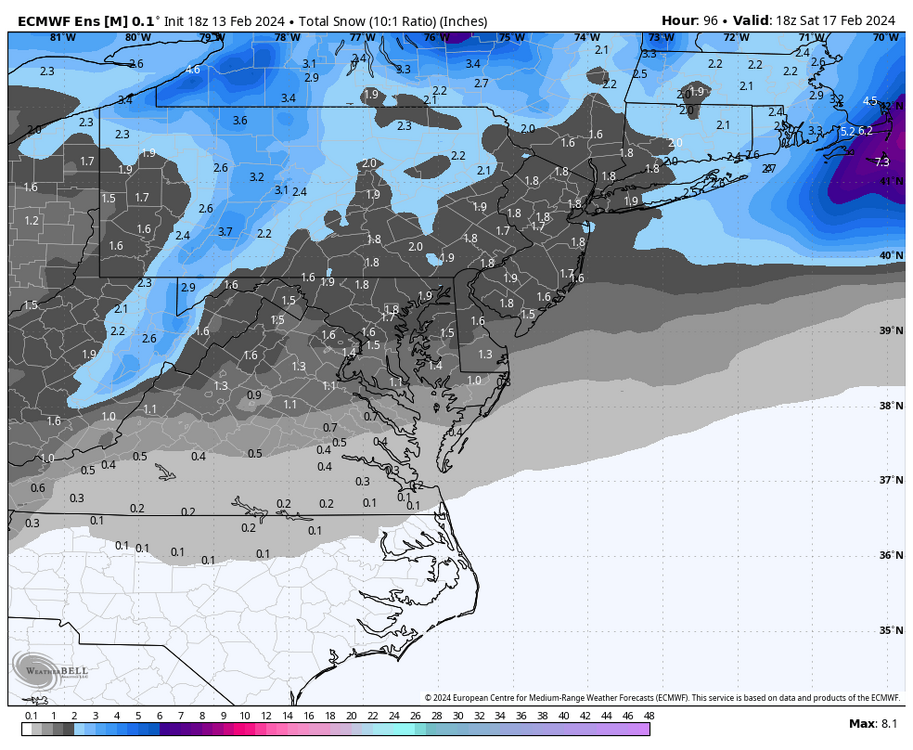
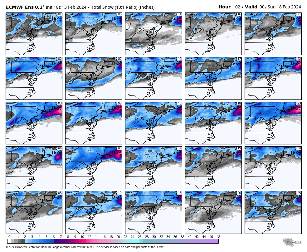
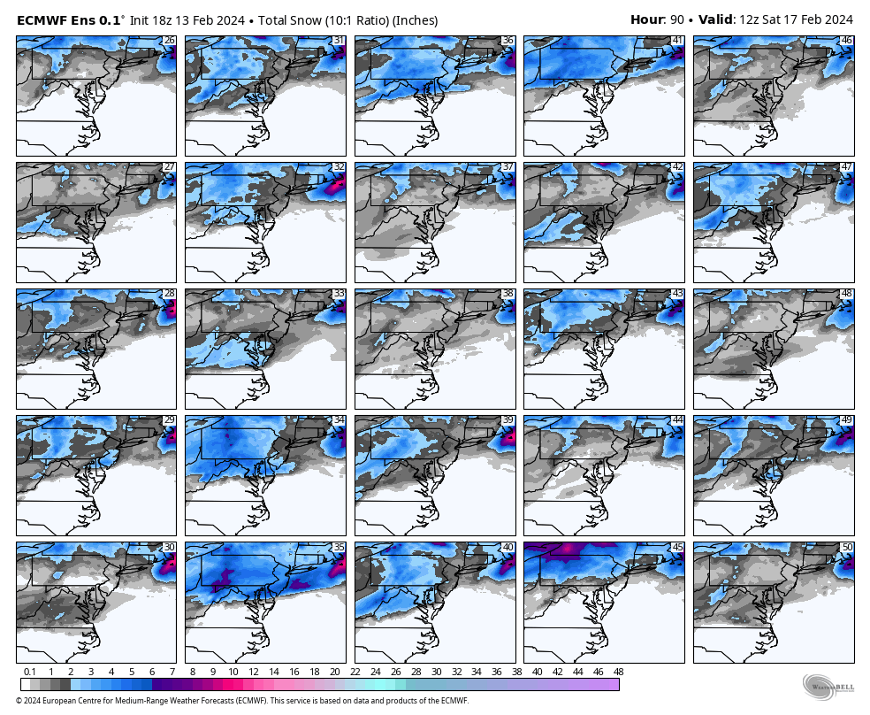
I wasn't too impressed with the 18Z EPS, most members have an accumulation tendency (assuming a 10:1 ratio
") ) north of us. But, this is still something to monitor.
) north of us. But, this is still something to monitor.

-
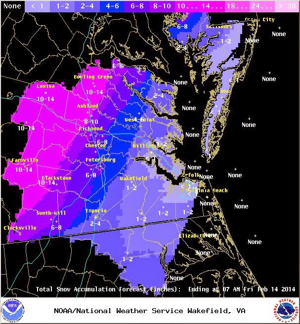
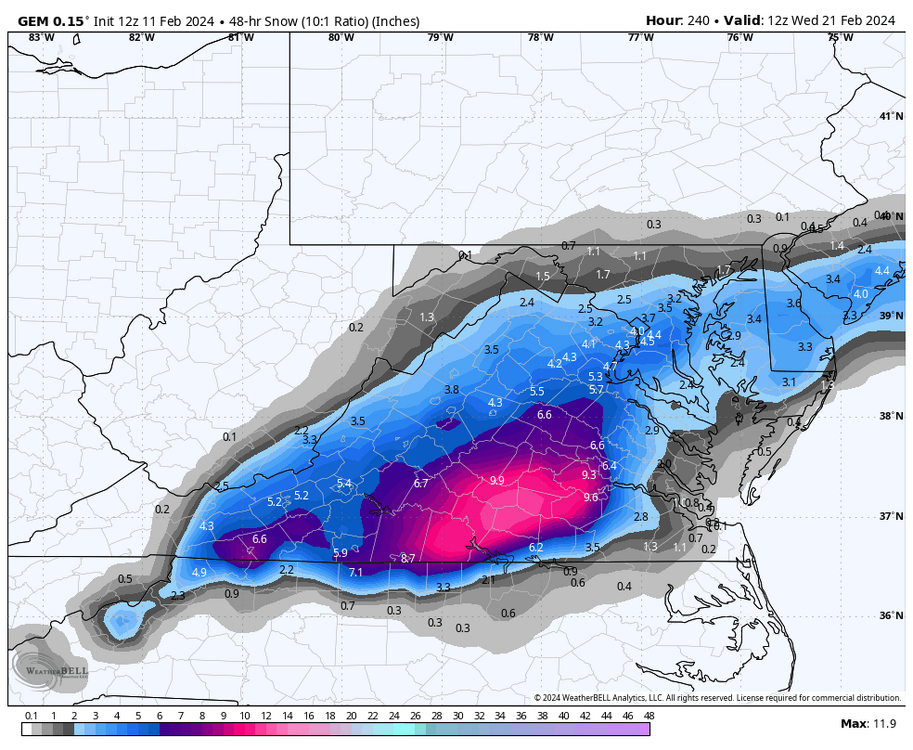
Anyone remember this storm?
This map was from exactly 10 years ago, a storm that took the more old-school Miller A track up from the Gulf. We were lucky with this one because it wasn't a textbook setup, and, in fact, the NAO was positive. But we did have an arctic airmass driven by the -EPO that dominated the 2013-14 winter pattern, and this storm developed as the arctic airmass was retreating. Snow started in the afternoon of 2/12/2014, with temperatures in the mid-20s. After about 4-5" of snow had fallen, areas around Richmond began mixing to IP and ZR before a dry slot, and an extended lull began after midnight as temperatures rose to around freezing. The second half of the storm started in the afternoon of 2/13/2014 with a few hours of +SN where another 2-4" had fallen. Richmond officially recorded 5.8" of snow, but many areas west of US HWY 15 had 15-20" as they avoided the dry slot and was able to hang on to cold longer as the storm moved up the coast.
-
On 2/12/2024 at 6:22 PM, ldub23 said:
This is the one
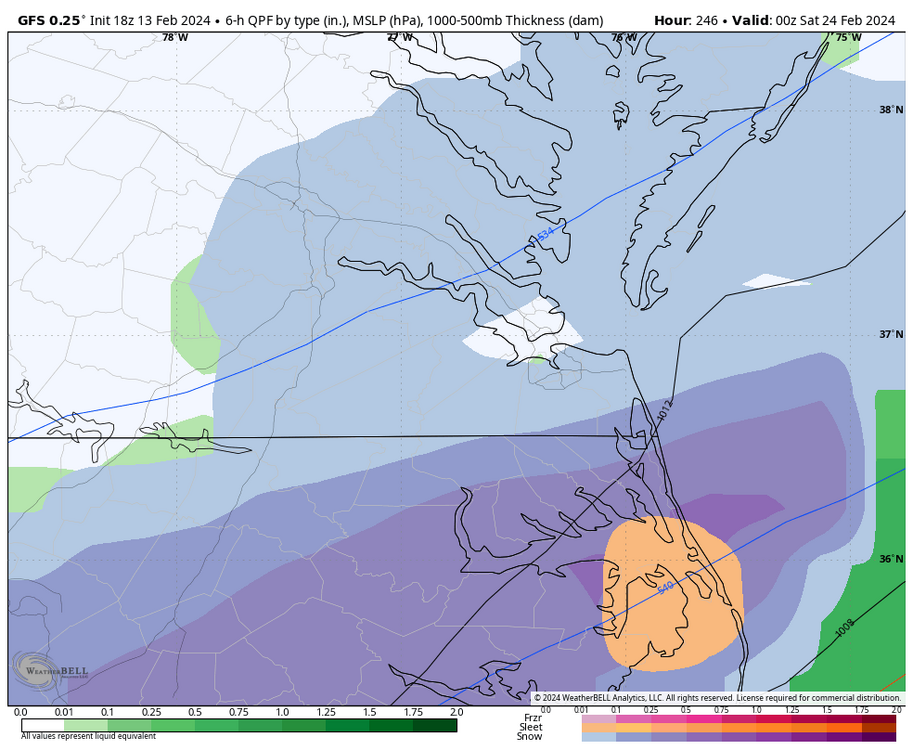
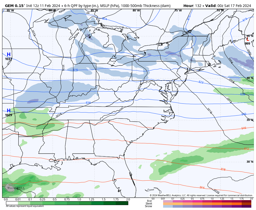
No change on the 18z GFS for Saturday morning. Keeps the snow north of us with some passing showers here. Also, the GFAF model being shown on the TV stations looks pretty bullish for the Saturday morning snow threat.
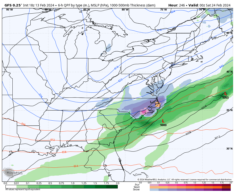
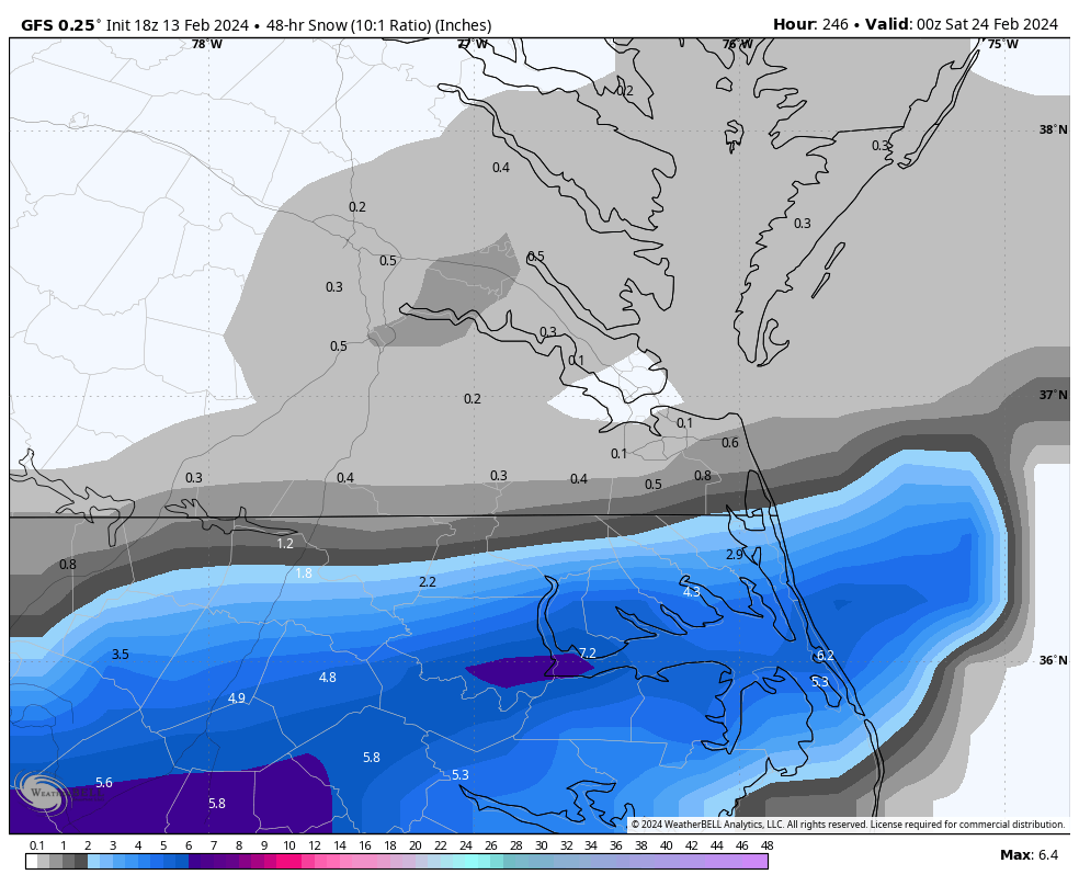
The GFS does, however, revive the threat around the 24th. Right where we want it, right?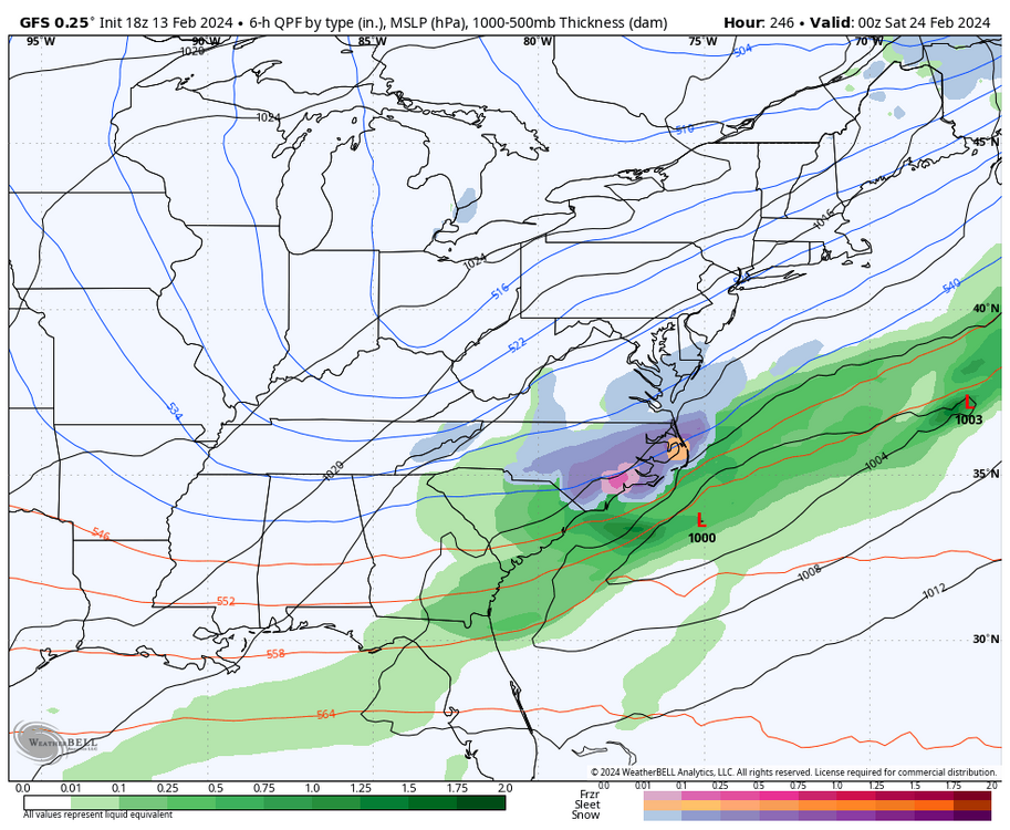

-
2
-
-
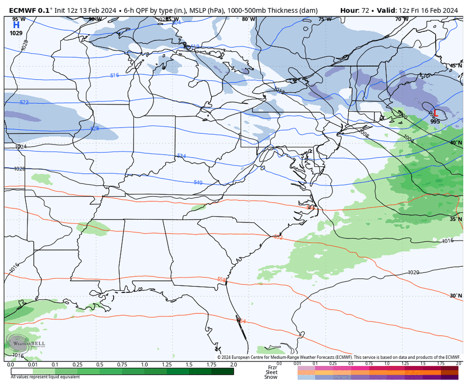
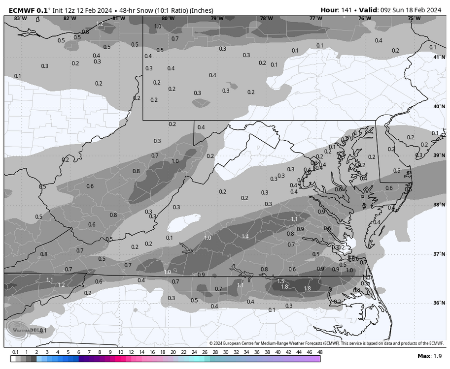
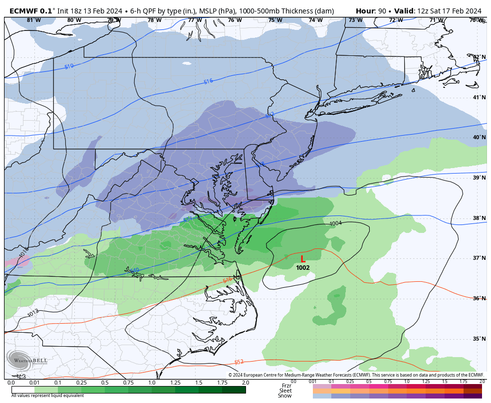
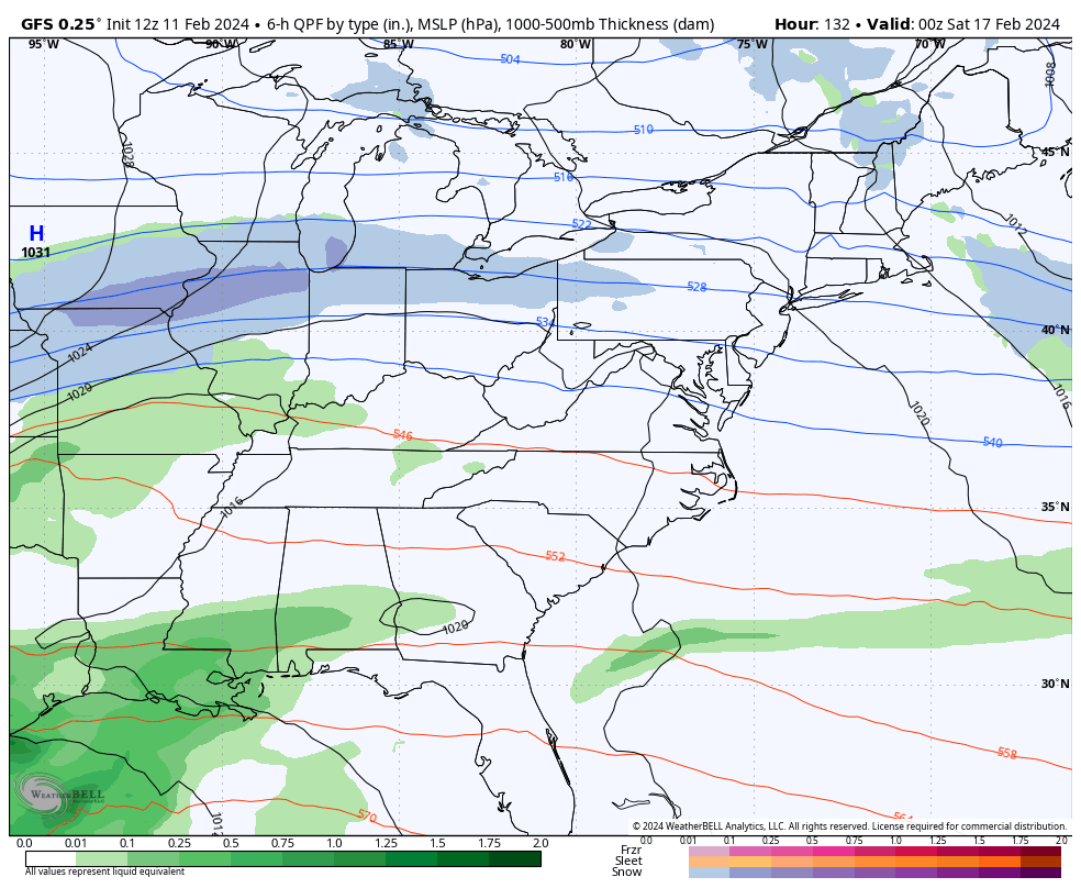
Well, the Euro continues to revive the weekend storm. Looks like a 3-6 hour window on Saturday morning from about 1am to 9am. Temperatures around RIC fall from the mid-upper 30s to around freezing before the precip lifts out around 8am or 9am. It's not looking like a 10:1 ratio, so keep that in mind when looking at the snow map. Also, as we've seen with recent storms, there is still plenty of time for fluctuations on the track. I would not get my hopes up; GFS had practically nothing.
-
2
-
-
18 GFS just picked up on the next threat around the 24th.
-
3
-
1
-
-
8 minutes ago, RVAman said:
I'm fairly positive it's over. What another pathetic winter.
Euro provides hope for this weekend and the EPS still has that signal around the 24th, fwiw. We have to hang in longer, especially with what is happening now in the NE, where models shifted dramatically over the last couple of days.

-
1
-
-
EPS had a signal around the 24th so if there is a glimmer of hope, that is it. But only a handful of members so take that fwiw.
-
Looking at the Euro, it might be time to close the blinds. It was similar to the GFS in handling the n/s and s/s energy.
-
1
-
-
24 minutes ago, RVAman said:
This still just doesn't look good for us. Some time out, sure. Cold air just still isn't there.
We are grasping at straws. As long as the models show different solutions, I think there is still a chance. But I wouldn't bet on it with how this winter has gone.
-
2
-
-
The Canadian is faster with the n/s wave and tries to give us snow showers with that next Saturday. It's much slower with the s/s wave so it amplifies and comes up the coast as a Miller A storm next Tuesday into Wednesday before sliding off of Hatteras.

-
2
-
-
4 hours ago, RVAman said:
6z has digital blue for our area, not a bad look but not a major snow storm by any means.
2 hours ago, wasnow215 said:A nice trend tho. Maybe we can score a 2-4 haha.
2 hours ago, ldub23 said:Im still hoping for 1 inch
12z GFS tries to give us a little snow from the n/s wave, but the s/s wave doesn't really amplify and stays south of us before moving out to sea. Looks more like a cold front now, that gives all our precip.


Richmond Metro/Hampton Roads Area Discussion
in Mid Atlantic
Posted
Sketics and anyone else worried and concerned, well that's why the panic thread exists.
Meanwhile, thee 12Z HRRR, has a nice bad of snow between 2am and 4am Saturday morning across the Richmond metro area.