

RIC Airport
-
Posts
2,586 -
Joined
-
Last visited
Content Type
Profiles
Blogs
Forums
American Weather
Media Demo
Store
Gallery
Posts posted by RIC Airport
-
-
Looks like they just came in, making a gif.
-
 1
1
-
-
2 minutes ago, Rsheely88 said:
Yea i can’t get the maps on WB to load either.
I'm specifically referring to the 6hr precip panels. Snow maps already posted.
-
1
-
-
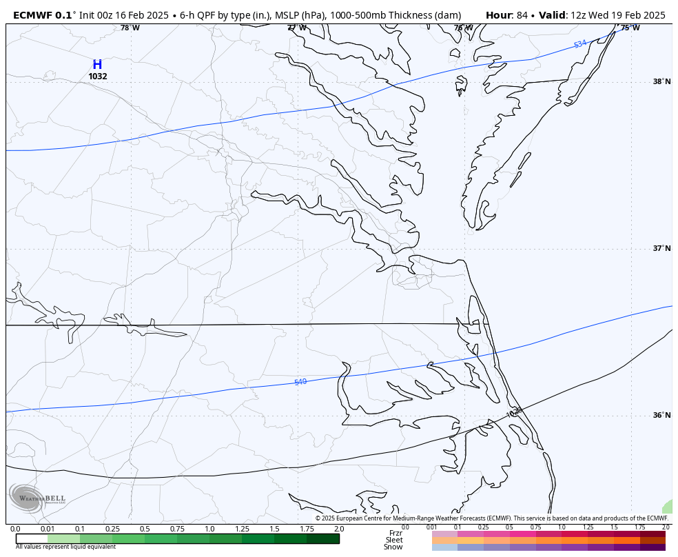
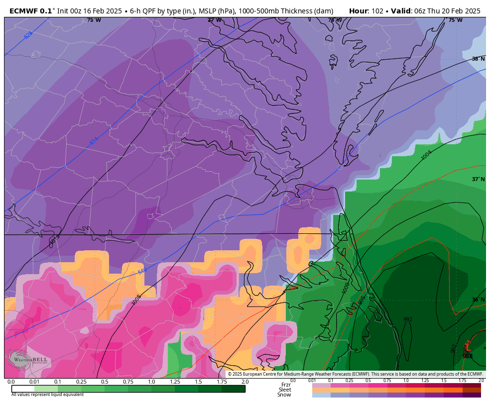
@jlewis1111Somehow the snow maps are finished through hour 360, but for everything else, the Euro on wxbell seems to be stuck around hour 51, so I can't see all the panels. Might have to go on other sites to see whether there is any mixing in Hampton Roads or how close it gets.
-
10 minutes ago, jlewis1111 said:
start and end times in ric with current euro run?
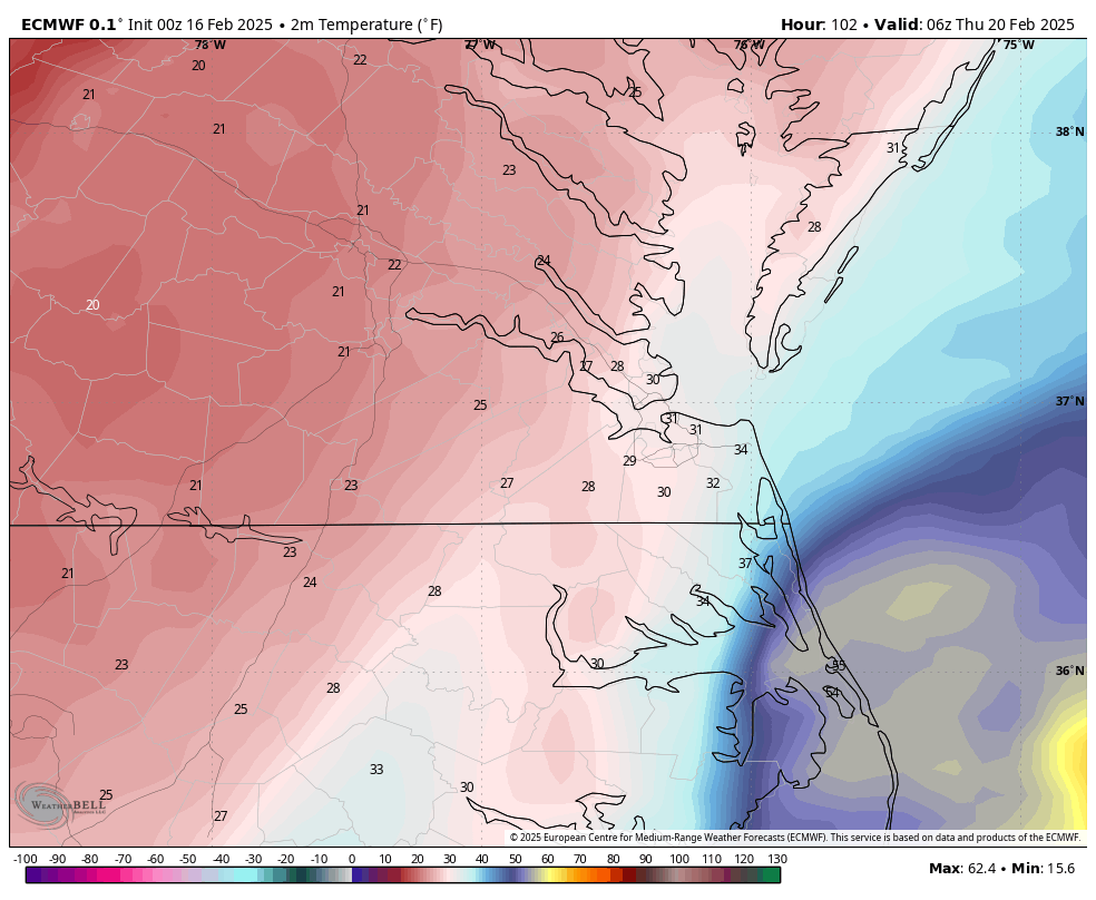
Still looking at a mid/late Wednesday morning arrival. Ending about the same time Thursday.
-
1
-
-
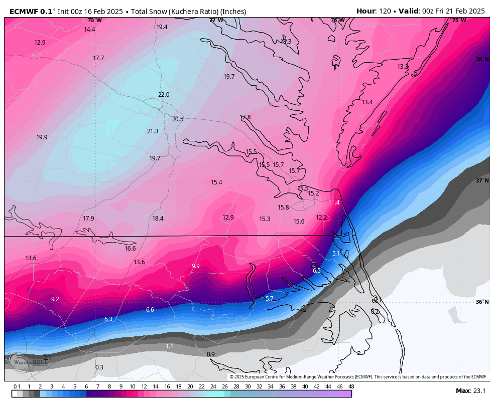
Might have to increase my totals for Hampton Roads, lol
-
3
-
-
21 minutes ago, Conway7305 said:
I’m hugging the Euro until 48 hours then look at the NAM and HRRR.
-
2
-
-
2 minutes ago, RVAman said:
Hopeful / yet very skeptical for obvious reasons. RIC saying 6-10 is big deal.

-
1
-
-
2 hours ago, Lowershoresadness said:
hows the mood today boys
Hopeful
-
17 minutes ago, RVAman said:
What’s everyone’s first guess?
6-10" for RVA Metro
4-8" Peninsula/Interior SE VA
3-6" Southside
14 minutes ago, Conway7305 said:I’m hugging the Euro until 48 hours then look at the NAM and HRRR.
My guess is 7 inches for RVA.
Although the Euro has fluctuated with this one, I'm also hugging it because I feel it's been the most consistent, even with other storms this year.
-
2
-
-
Just now, Stormpc said:
GFS looks about the same perhaps slightly Southeast but negligible.
.thumb.png.f2fe98739a78a49978b3bbf3e8fa1ae6.png)
-
1
-
-
1 minute ago, wasnow215 said:
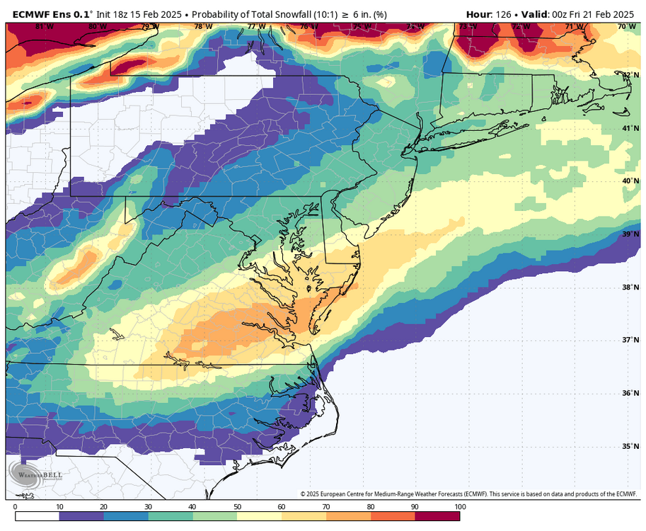
I've never seen a double digit Ens before. Let's all throw in 50$ to keep it right here! Hahahahaha!

-
 1
1
-
-
2 minutes ago, RIC Airport said:
EPS already an uptick since 18z.

-
1
-
 1
1
-
-
10 minutes ago, Conway7305 said:
Great now I’m awake again after that fabulous HECS run and can’t sleep, go figure. Will be curious to see EPS
EPS already an uptick since 18z.
-
4 minutes ago, jlewis1111 said:
so euro for ric is what like 3pm start time on wed and 3pm end on thursday?
Looking roughly like 8-10am Wednesday to 8-10am Thursday.
-
2
-
 1
1
-
-
-
Just now, chris624wx said:
I'll take my measly 16 inches all the way to the bank!
Here's a closer view.
-
1
-
-
Time to go to sleep!
-
 1
1
-
-
17 minutes ago, chris624wx said:
God Save the King!
-
2
-
1
-
3
-
-
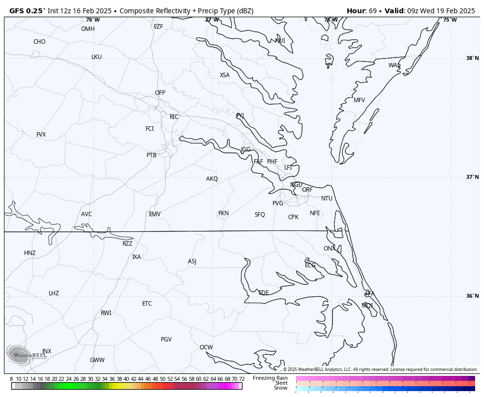
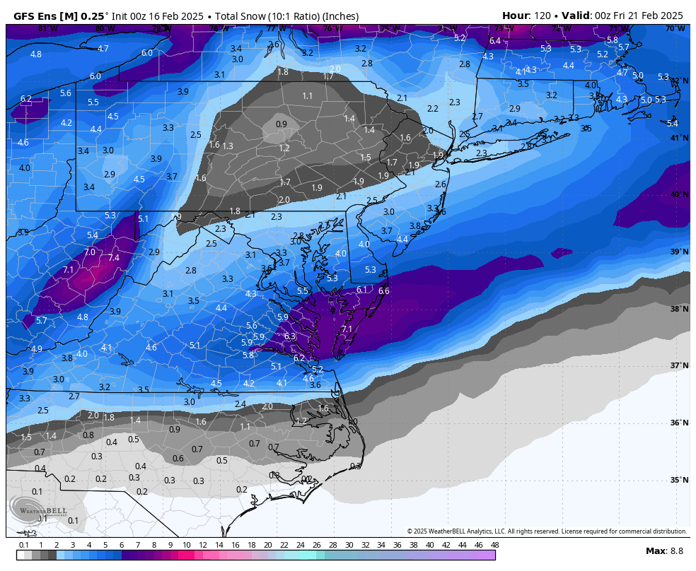
2 minutes ago, RIC Airport said:
Looks like a solid hit for Hampton Roads.
2 minutes ago, Ephesians2 said:UKMET is losing most of the northern component to the low - it's a weaker and further south storm for sure. Surface low in the Gulf of Mexico at 96. It'll be a moderate hit for Richmond and Hampton Roads though.

-
1
-
-
1 minute ago, Ephesians2 said:
UKMET is definitely less amped than 12z (which was the furthest north and west, so that might not mean much). Also seeing the PV significantly south of 12z at 81.
Looks like a solid hit for Hampton Roads.
-
1
-
-
2 minutes ago, AlexD1990 said:
Lol I'm getting old in that I can't automatically remember. I do remember getting stuck at my parents house after checking up on them in 2018, and I had a Jeep. I do believe both storms were 10"+
I was also one of the few that made our really well in the Boxing Day Storm, that was also 10-12"+
Those were huge events from ORF and up the Delmarva. I think ORF got 14-15" from the 12/26/2010 storm.
2 minutes ago, chris624wx said:Is this where I mention that my day job is a GIS Analyst?

That was my study in college, but somehow got into logistics and supply chain. Then got a MBA because I still had no idea what I wanted to do.
-
1
-
-
1 minute ago, AlexD1990 said:
I'm certainly not kicking it out of bed, fringed lol
How much did you get from the January 2022 and January 2018 coastal blizzard?
-
7 minutes ago, AlexD1990 said:
You really provide some quality analysis and graphics in this thread. Thank you!
I'm moving to Chicago the end of next month. Thread members need to nominate a new leader for next winter.
")
-
2
-
1
-
-
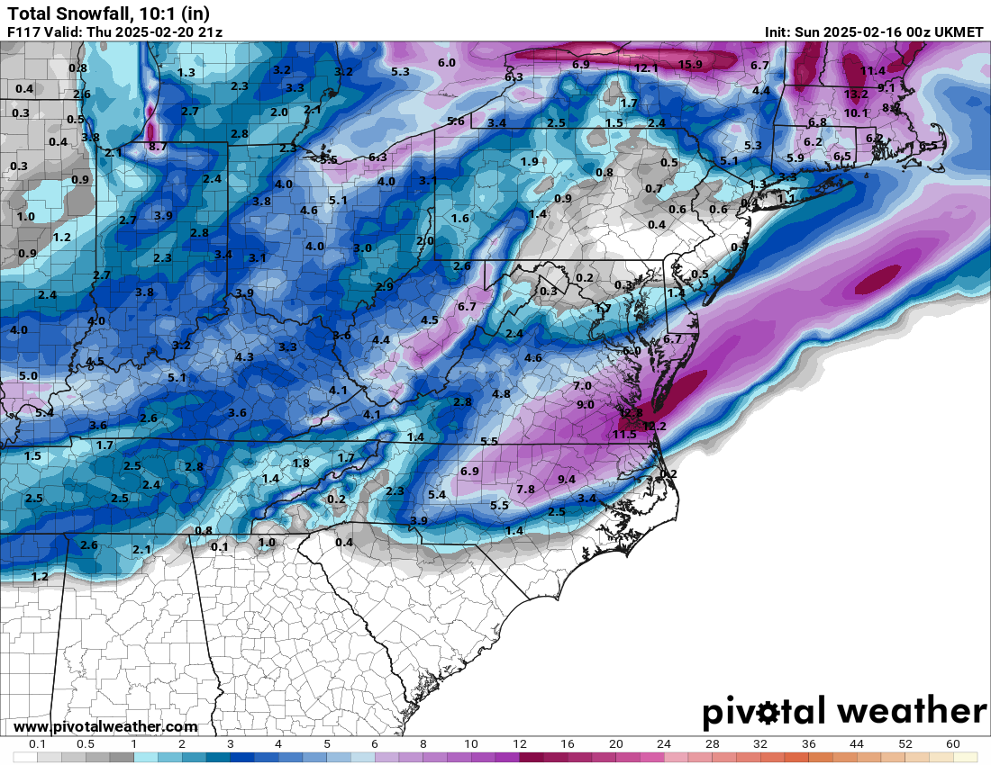
Just now, AlexD1990 said:
You really provide some quality analysis and graphics in this thread. Thank you!
Just now, wasnow215 said:My gut tells me south and east is still good at this point. Gives wiggle room with temps. To @AlexD1990's point what I don't like is those runs were drier also. That trend needs to stop.
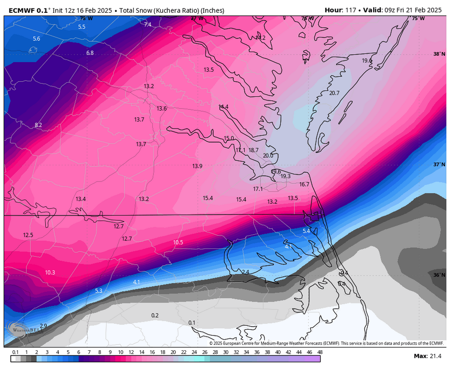
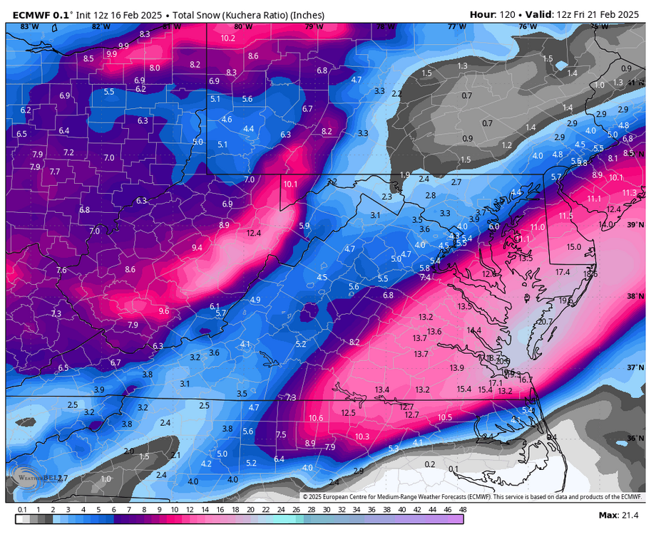
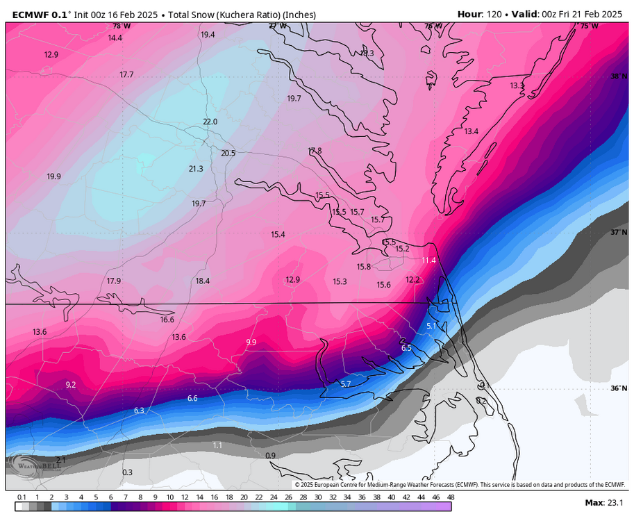
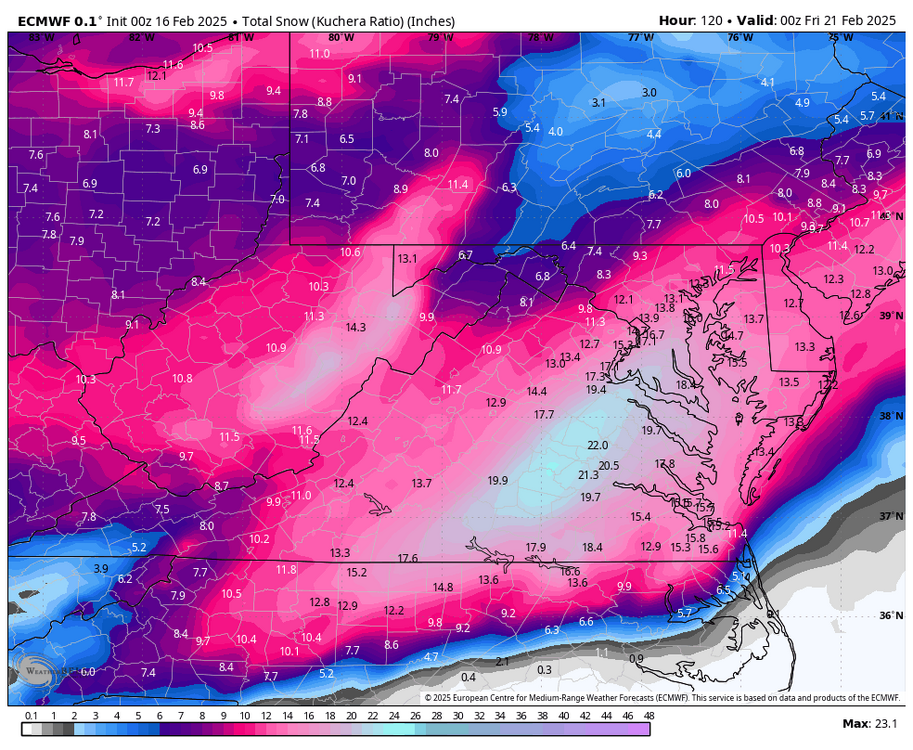
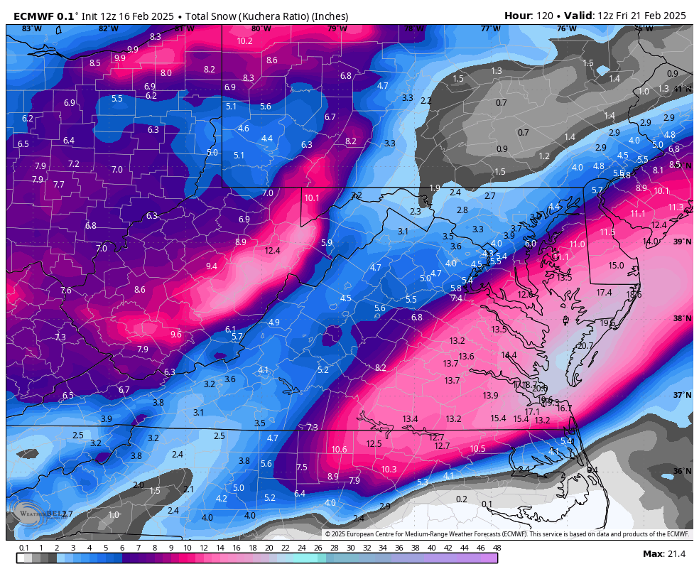
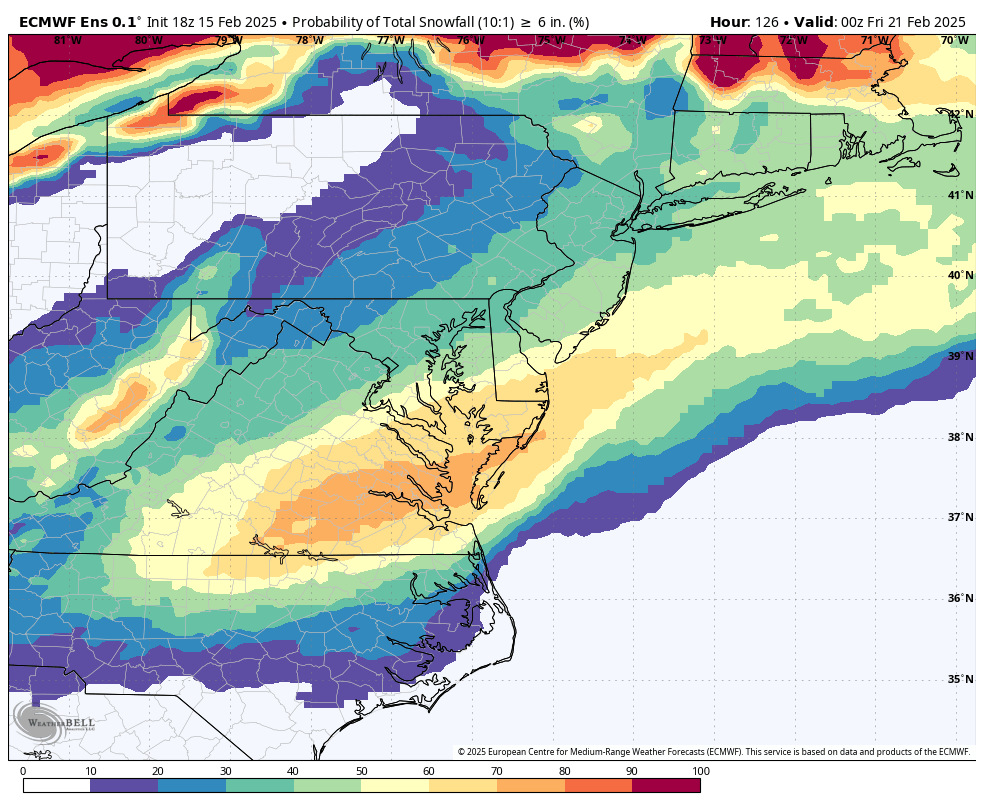
Thank you, @AlexD1990 Here is an updated map, @wasnow215. This should cover the entire event.

-
2
-

.png.5eb5ec0841359f91a9cbfa8d39a2665e.png)

Richmond Metro/Hampton Roads Area Discussion
in Mid Atlantic
Posted