

RIC Airport
-
Posts
1,766 -
Joined
-
Last visited
Content Type
Profiles
Blogs
Forums
American Weather
Media Demo
Store
Gallery
Posts posted by RIC Airport
-
-
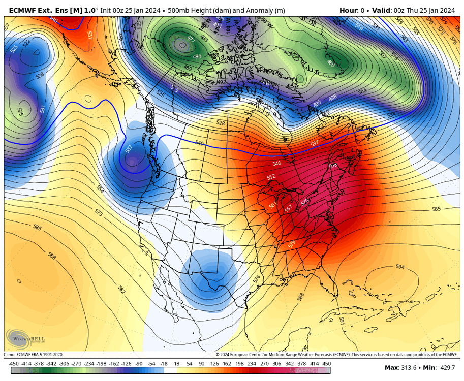
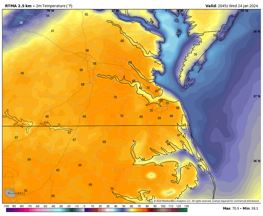
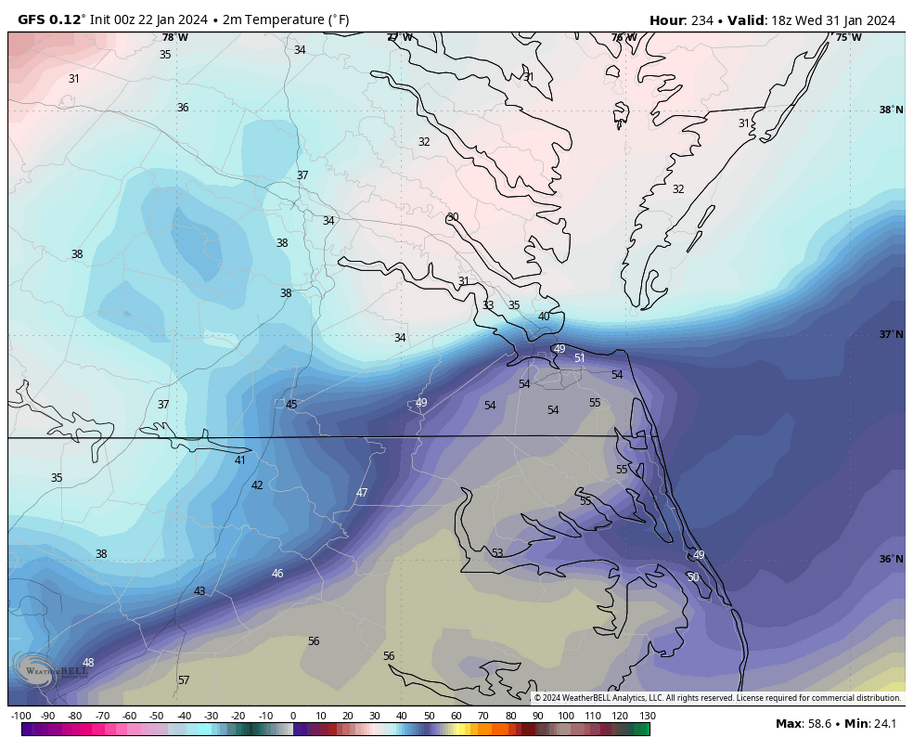
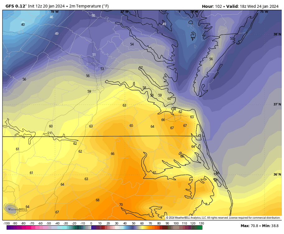
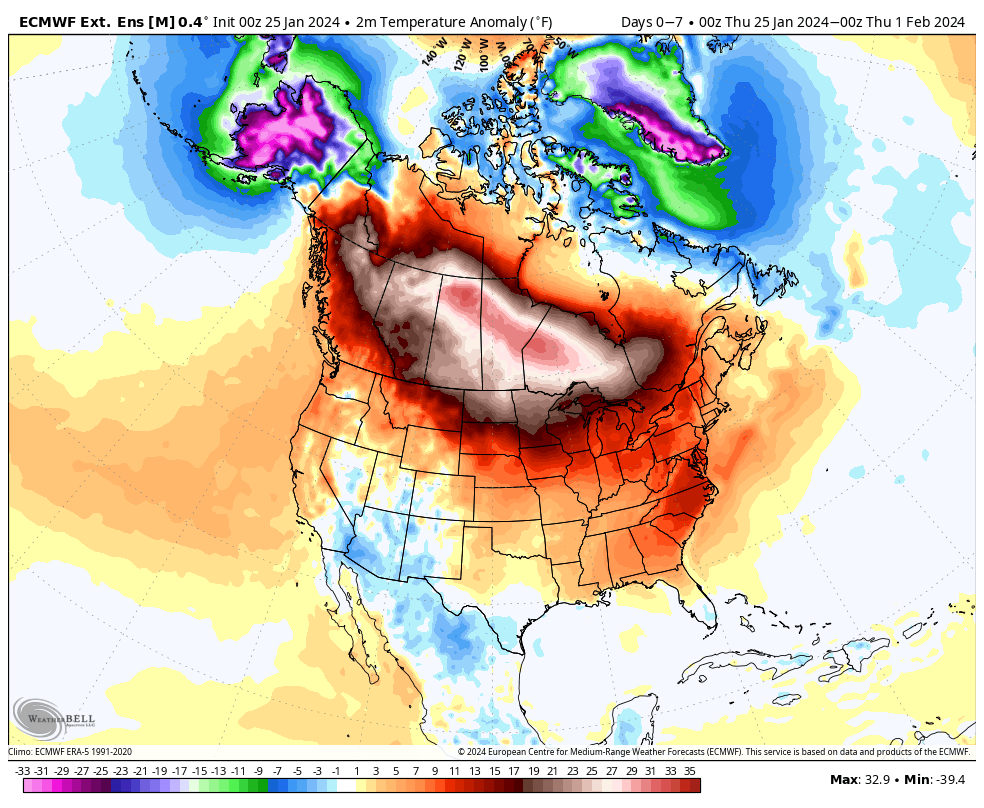
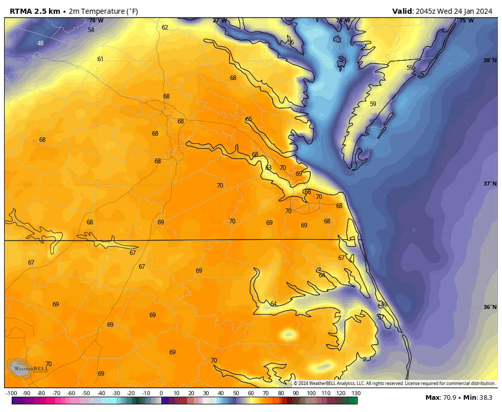
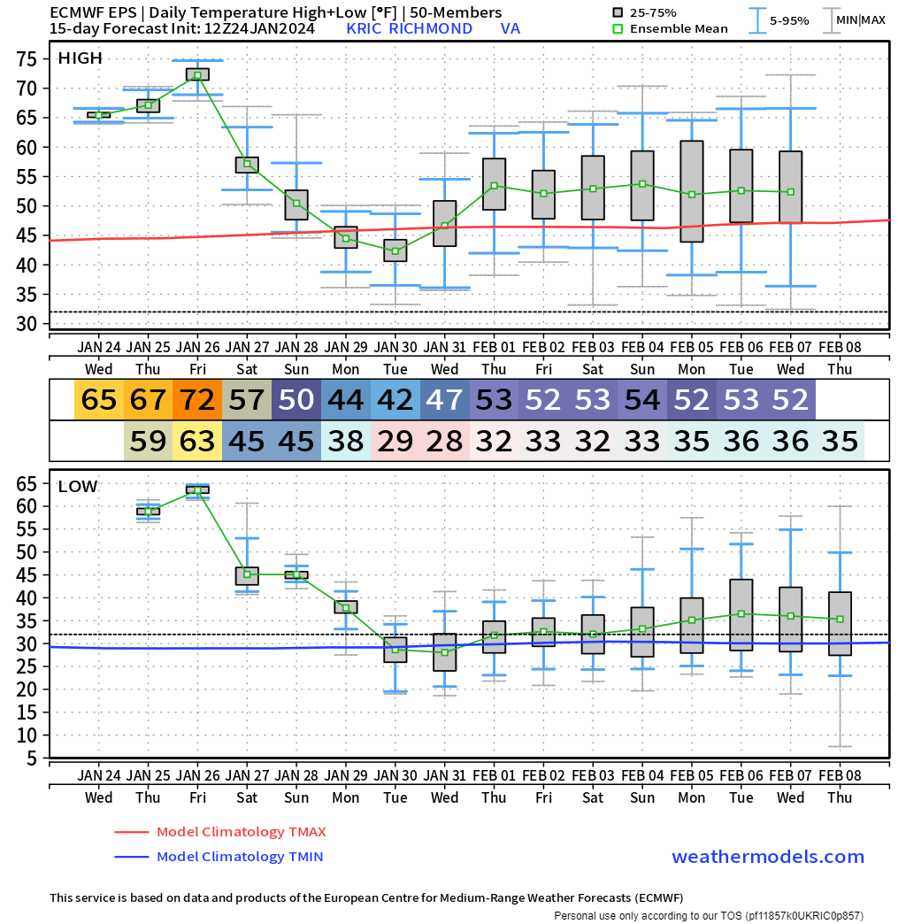
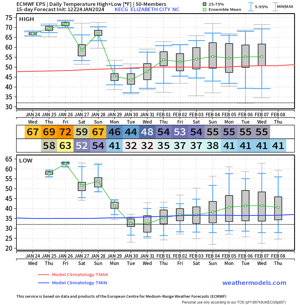
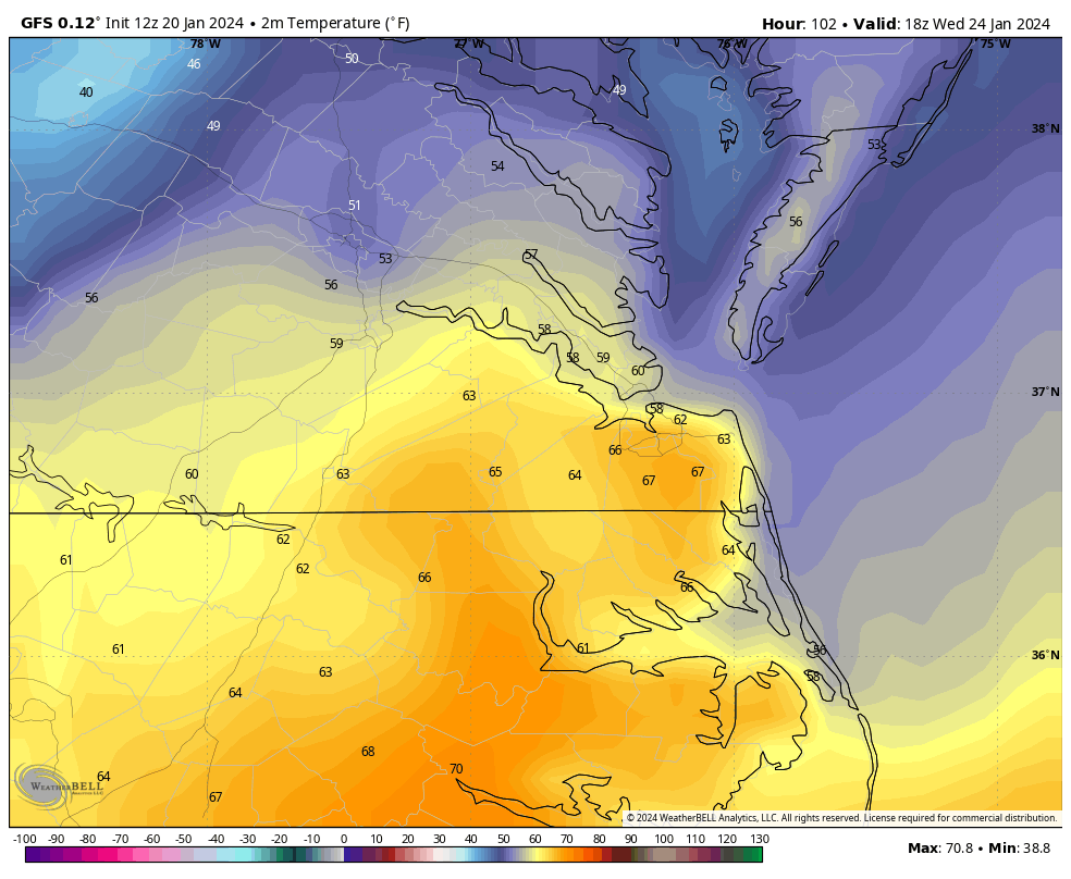
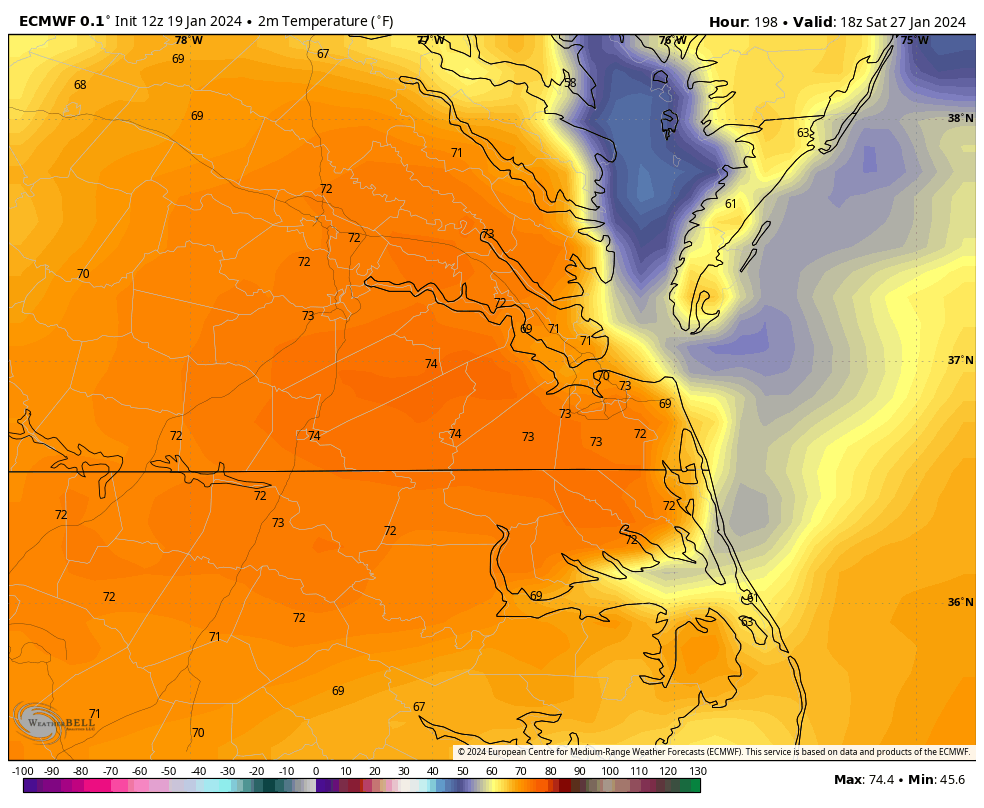
Meanwhile, we are torching. The high today at Richmond was 71°F, and the low was only 62°F, which ties the highest low temperature recorded in January. That puts the daily average at 67°F, which is +29 degrees above average for the date.
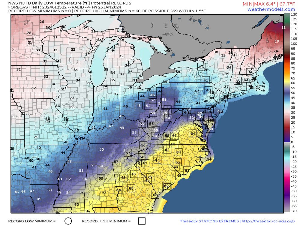
All the stations in boxes have their record high minimums in jeopardy for today and tomorrow.
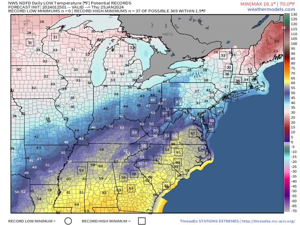
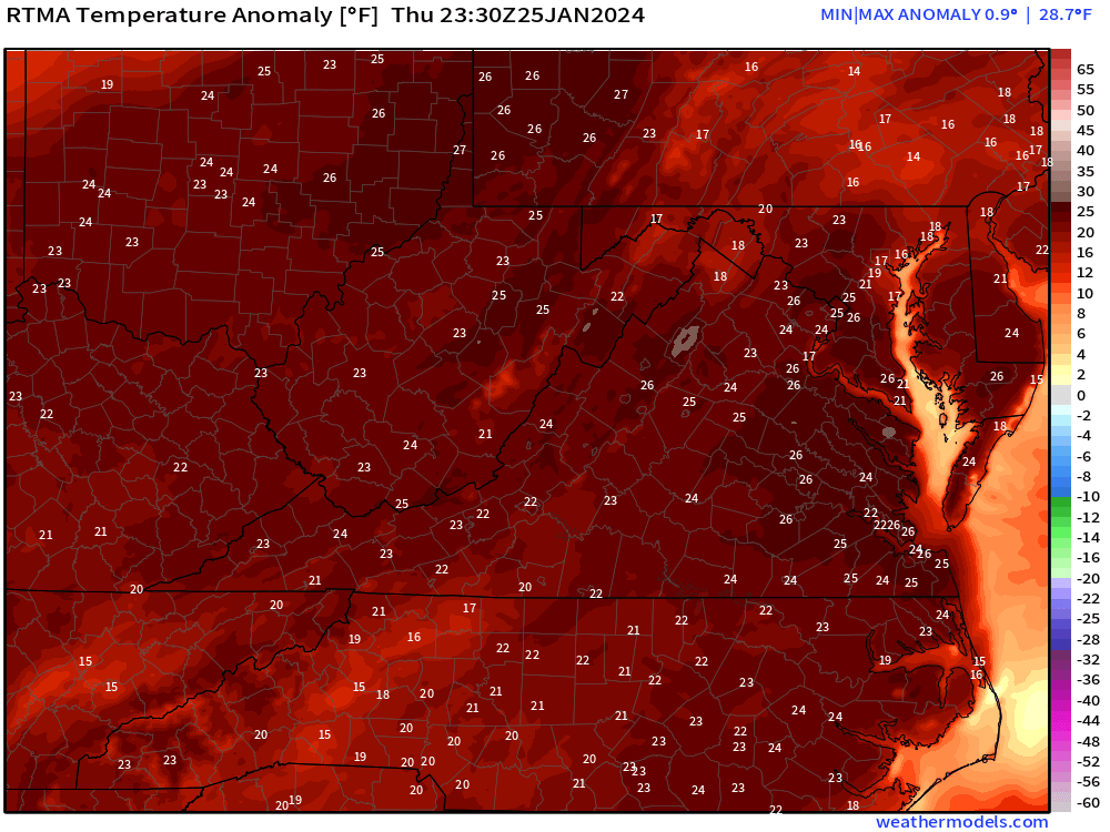
Even at this late hour, temperature anomalies are around +25.
-
1 hour ago, ldub23 said:
The gfs taketh away and the gfs once again giveth
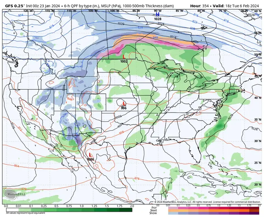
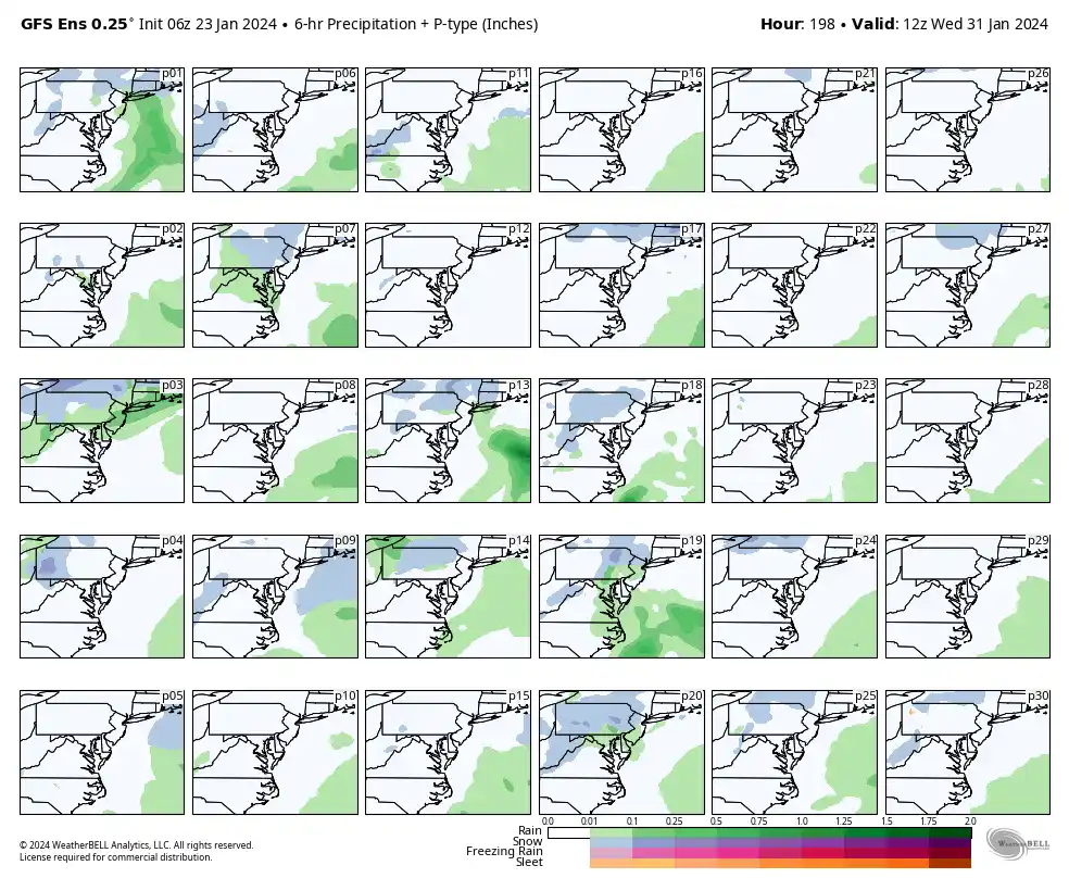
The GFS will continue to fluctuate beyond 200 hours from run to run. But, as discussed, the signals are nice to see. The 18z GEFS did show some support, the below goes from the 3rd thru the 8th.
-
 1
1
-
-
1 hour ago, RIC Airport said:
Snow charts are still processing.

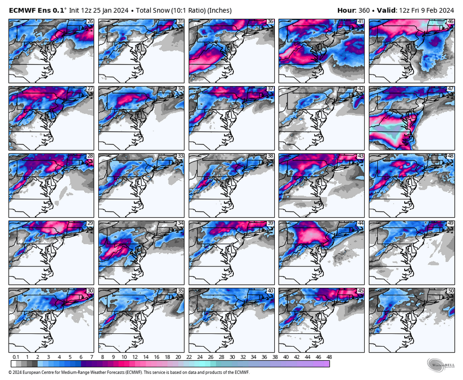
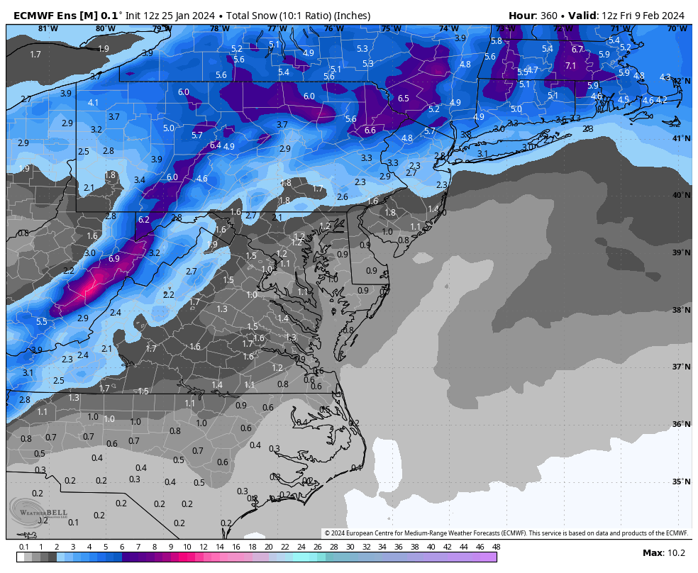
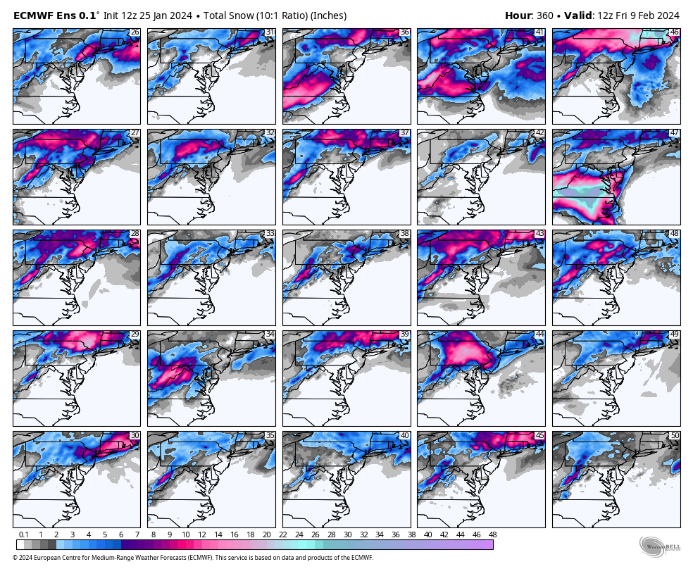
Updated charts as promised, mostly 15th and later with hits.

-
2
-
 1
1
-
-
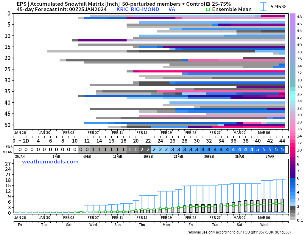
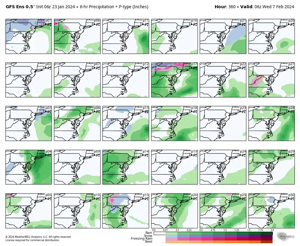
Things still look on track, with the ~10th and beyond being the most favorable. The snow mean is a slight tick down, but it's typical for slight fluctuations from run to run. Snow charts are still processing.
-
BTW, the euro weeklies are running now, new maps and snow charts I'll post them when it's done.
-
1
-
-
14 minutes ago, Conway7305 said:
Some HECS hits in there, nice!! I know it will change but good to see some big outputs being so far out. That trim frame is before the pattern change really occurs.
Yup, and you know I had to look at #47.

-
1
-
-
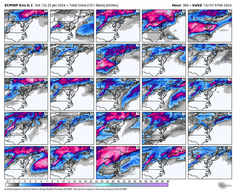
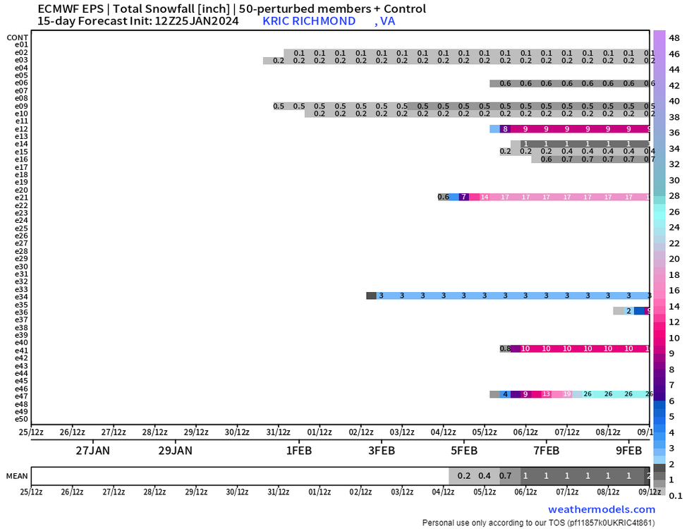
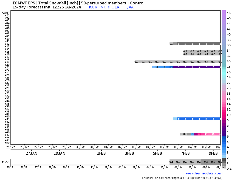
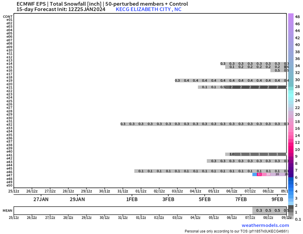
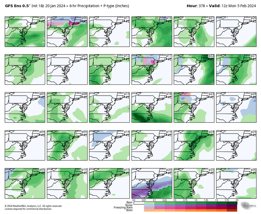
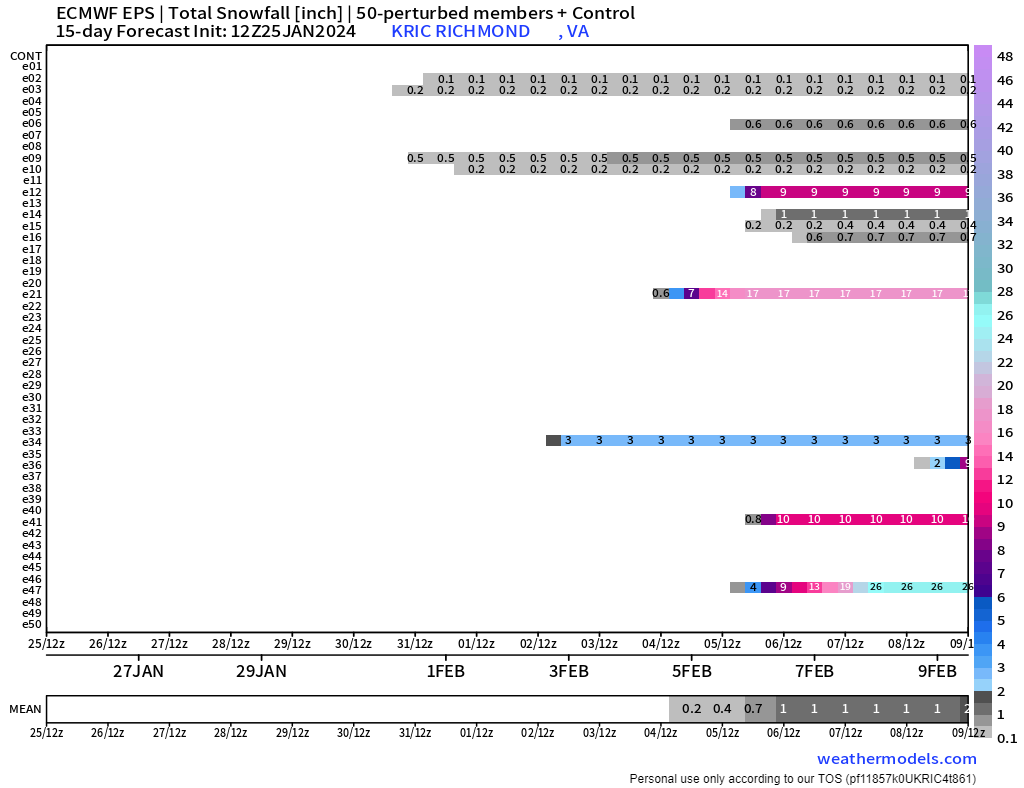
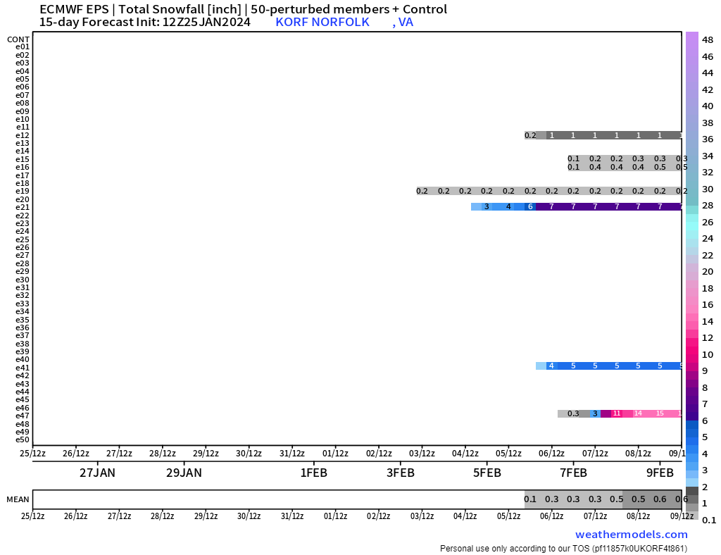
So, looking at the 12Z EPS, we can see why February 5th to 10th is a period of interest. There were a few hits, but mostly nothing. Hopefully, the hits increase in the days ahead, particularly as we get later in the month.
Interestingly, a couple of the hits were HUGE. But, that's also why the 50th percentile map showed nothing, because only a couple of the members (looking at #47
 ) are responsible for why the mean is as high as it is.

-
The 6z GFS was great, but I only get excited when I see consistency and ensemble support. And it was night and day from its 00z run, which I was up for, but I didn't notice anything remotely interesting.
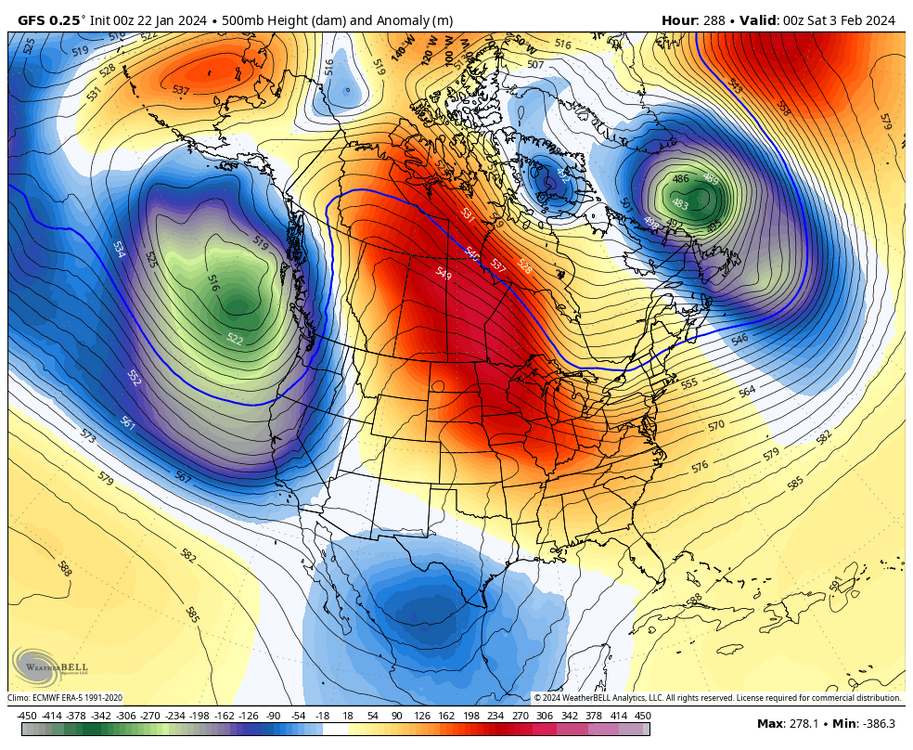
As I said yesterday, the 5th to 10th period must be watched more closely, but it's still too far out to take anything seriously. I am happy we "see" signals for February because the Euro weeklies/GEFS extended are nice and we want to start seeing the operational and ensembles transition to the advertised mid-February to March pattern soon.
Also, @ldub23, we already established that the 31st/1st is not our storm. When you look at the flow and the track of that energy, along with a marginal airmass, it just makes sense. Plus, there was never any ensemble support for that event. And lastly, I personally put little faith in models like the ICON and CMC, they don't have a good track record for leading the way with snowstorms.-
1
-
-
39 minutes ago, Conway7305 said:
It’s actually really enjoyable now. Love the warm break. Calm before the big pattern change. Weeklies look absolutely fantastic for cold and stormy from about Feb 15th all the way to March 10th. I couldn’t draw up a better pattern.
Very happy to see they are consistent. I think we are also on the verge of witnessing the operational runs head in that direction.
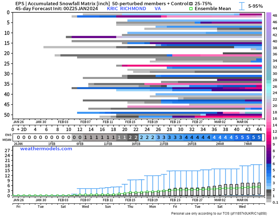
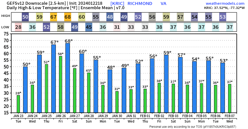
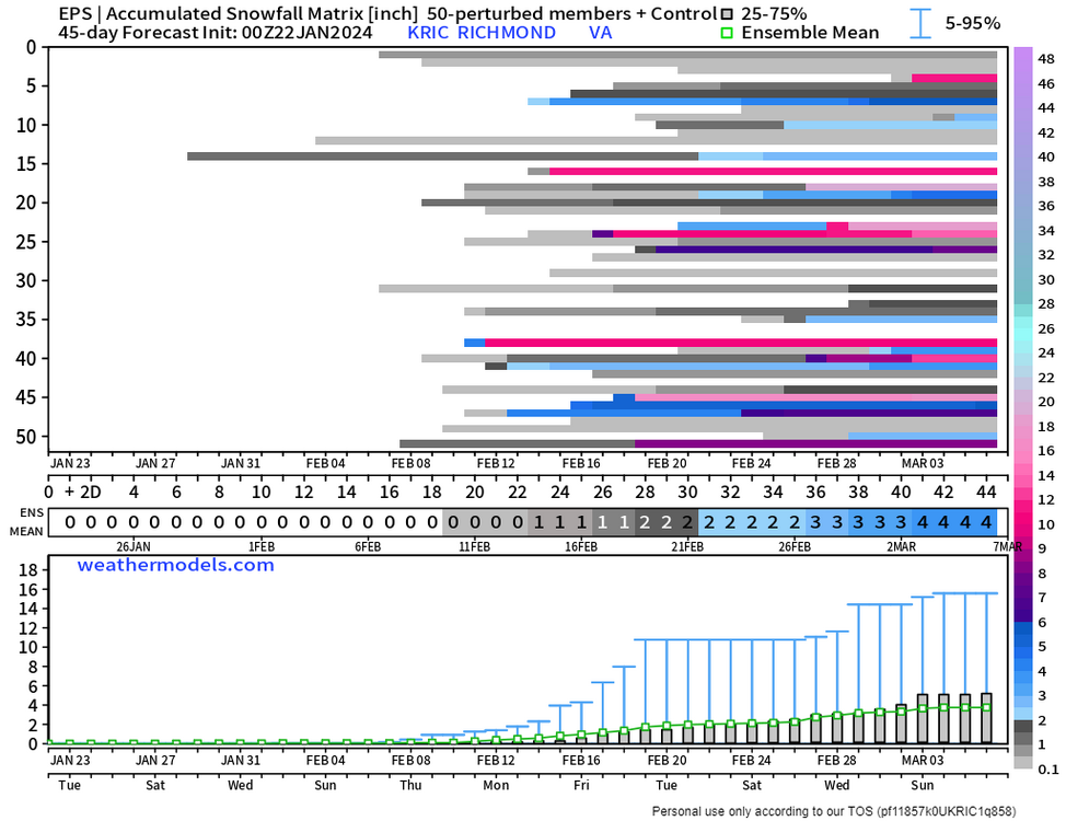
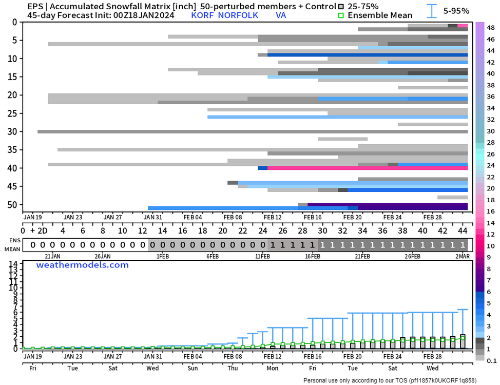
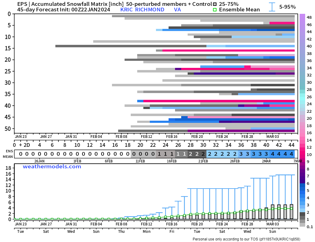
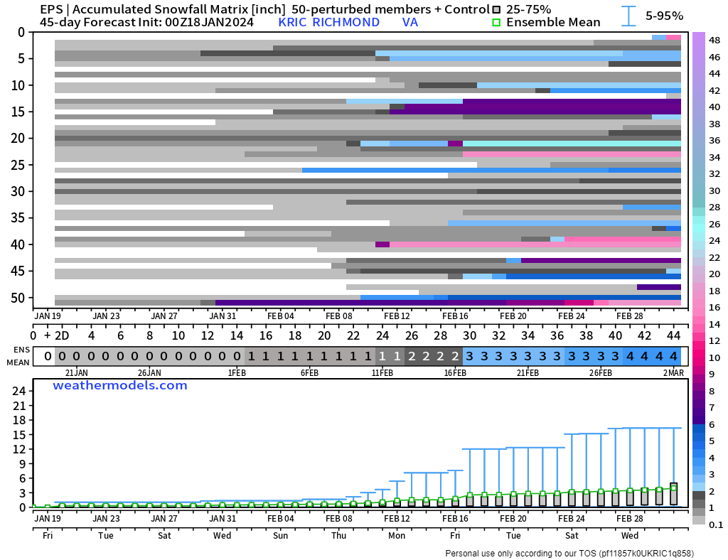
There was also a nice uptick in the snowfall in the last couple of days. Richmond was at 4.4" on Monday, 5.6" now, and I suspect it will continue to increase. There will be an updated snow chart tomorrow.

-
2
-
-
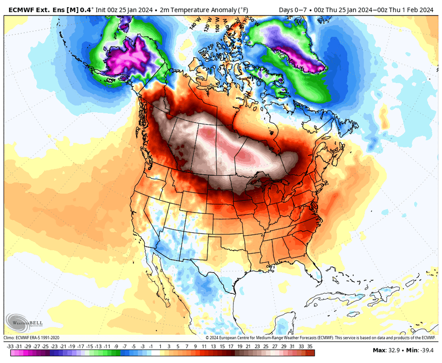
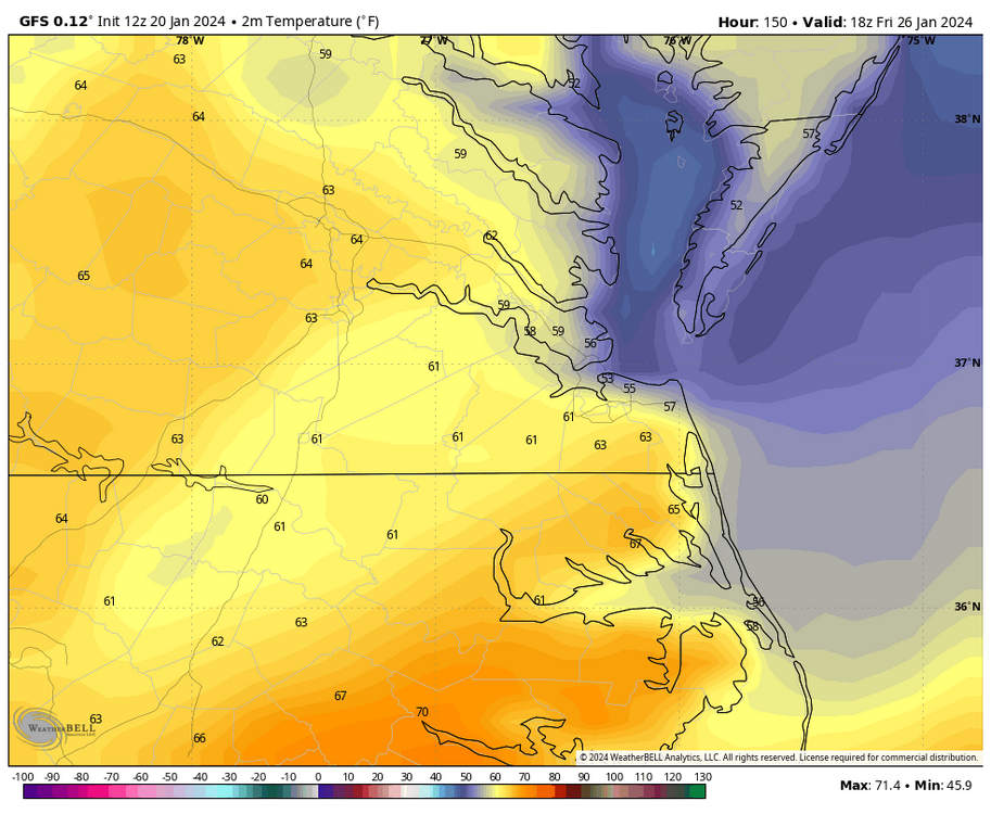
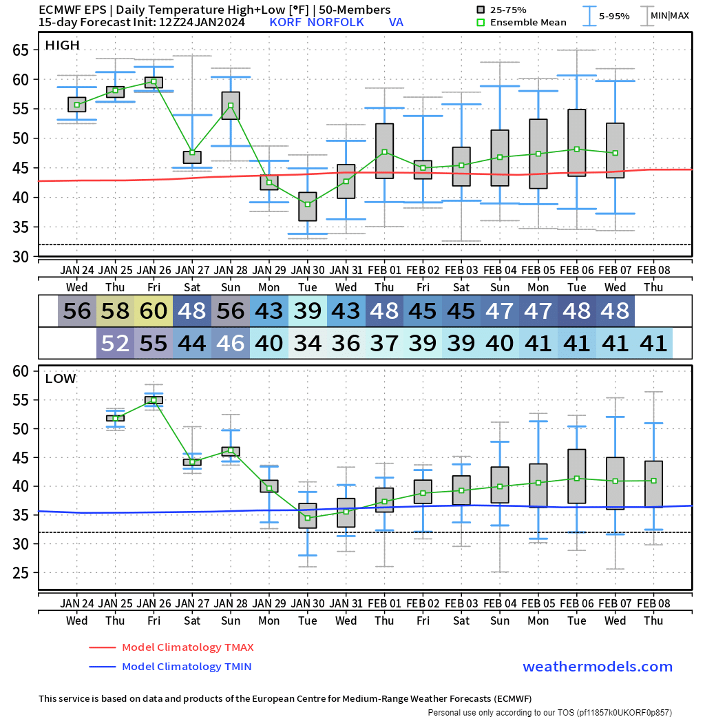
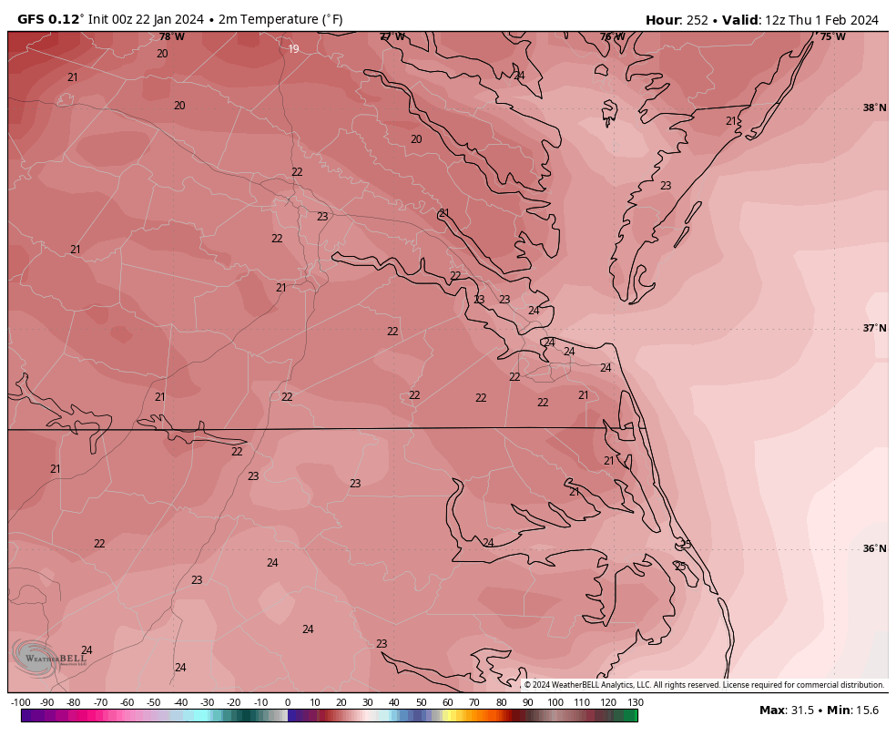
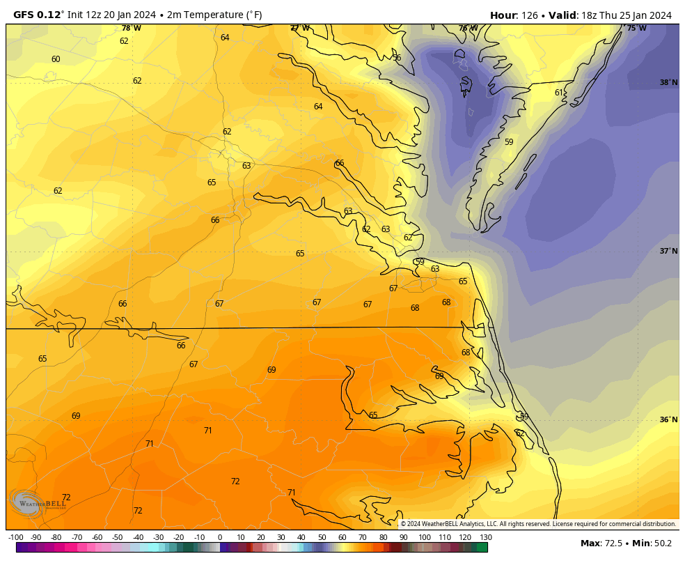
Well, it hit 70°F at RIC and ORF today. We certainly got way more sunshine than even I expected. I would argue today through Friday is a torch even though record highs are in the mid-upper 70s. However, the low temperature at RIC will struggle to drop below 60°F the next couple of nights, which will easily break the record-high minimum for the dates and also rival the highest ever observed in the entire month. This will also drive the daily departure from average to the +20 to +25 range.
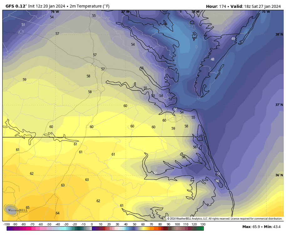
EPS still has us going back to more reasonable temps after Saturday. I am not sold on snow the 30th-1st, even though there have been some signals. Meanwhile, the period between the 5th and 10th must be watched more closely.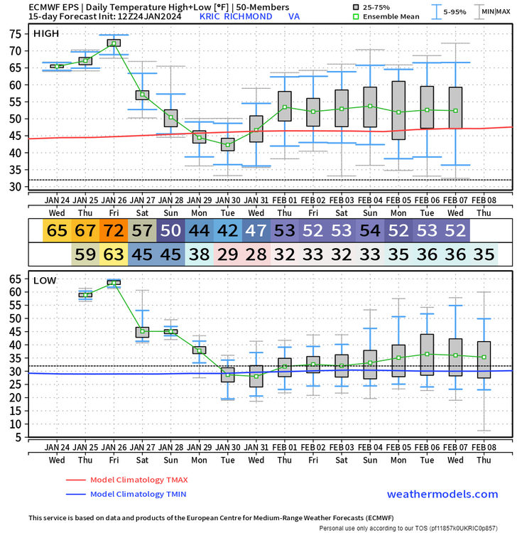

-
1
-
-
1 hour ago, Stormpc said:
My fear every year living down here is there's never a cold enough stretch to totally kill the bugs. These last 6 days should do the trick. Anything else after this for me down on the coast is gravy. As you see my bar is very very low. Not many wish for a cold enough winter period to kill bugs. Any snow is a bonus. Looks like mid-February through mid-march will be active. March these days is much better than December and we can now start talking about severe season soon. I know. Depressing to many. Nothing scientific in my post. Obviously we are in the doldrums of midwinter with not much going on for at least 10 days.
I also suspect it was cold enough to kill them off, which I agree is a good thing. It will certainly feel like spring this week and it will turn humid, too! Really hoping we can score in February and March with some good cold and snow, it's been disappointing for our area and it sucks we were so close to seeing decent snow last week.
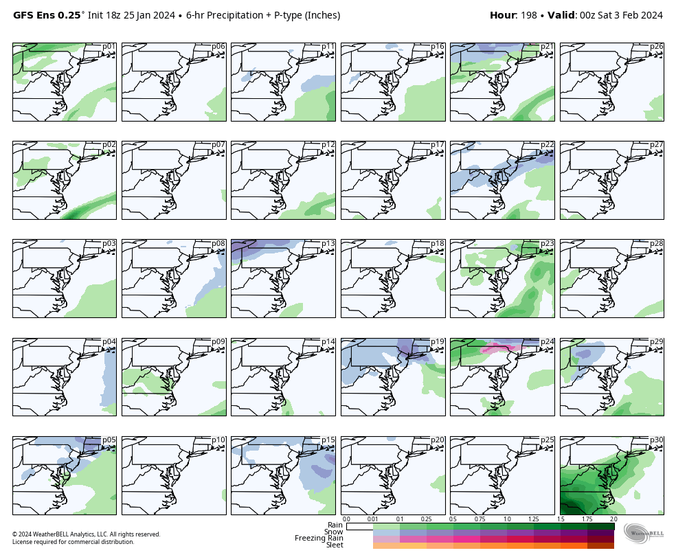
1 hour ago, ldub23 said:GFS has 2 possibiities but they both die out before they get here.
198
360
For hour 198, while there's been a few operational GFS runs showing snow around the 31st, I would not bet on it with the set up. Also, it doesn't have ensemble support nor has the Euro/EPS consistently supported it.

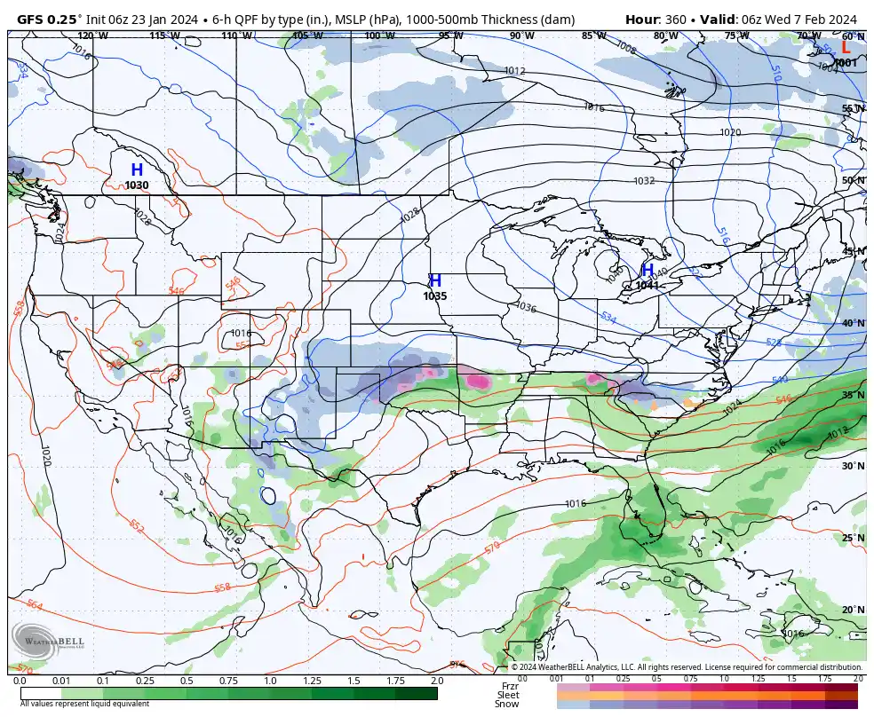
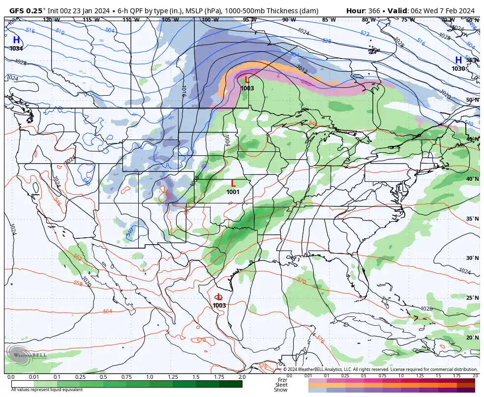
@ldub23, I like this set up between hour 348 and 360 on the 6Z GFS. There is a strong high over the Great Lakes with moisture overrunning to the south. The problem I see right now is, it's way out there (300+ hours), it's also a completely new scenario from the 00Z run, which you can see in the 3rd and 4th map below, and it did not have ensemble support (they look rainy). Obviously we hope later runs have this set up, but we need more consistency before we take it seriously.
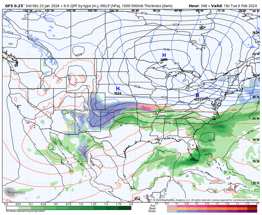

These are those two maps from the 00z GFS, there is hardly any cold air east of the Rockies and completely different set up from 6z GFS.

Also, there was no ensemble support on this morning 6z GEFS. But, this is meaningless with it being so far out.

-
1
-
1
-
-
So, looking at the temperatures on the 18z GFS ensembles, it's still a pretty mild look through the first seven days of February. Yes, we cool down after this weekend, but it's only for a few days before we begin a slight moderation again. It's not a torch, but it still would yield slightly positive departures from the average. So, today's Euro weeklies are on par with expectations that the 9th to 15th is (hopefully) the transition period to a colder pattern with legitimate snow chances.
.png.50232d0ec08f677c583a68e16469214e.png)
.png.30c824fd25c71af686ade2c946a07d3d.png)
-
1
-
-
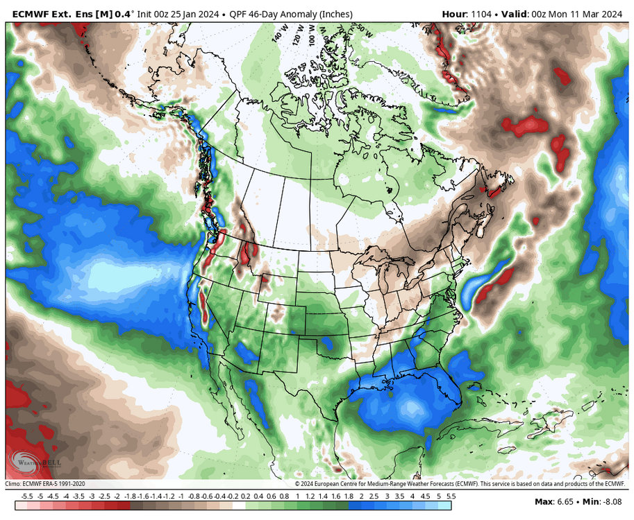
Doesn't exactly jive with how the last 24 hours of the GFS depicted the first week of February, but the updated Euro weeklies continued to paint the theme of a warm early February followed by a cold 2nd half of the month and into March, which you can see in the animation below.
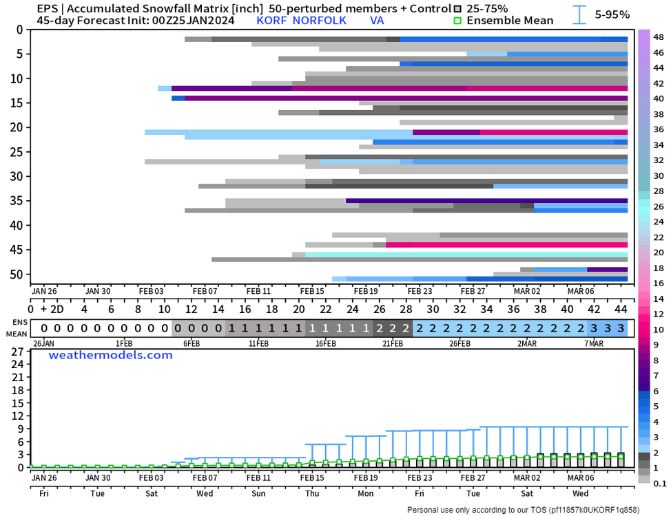
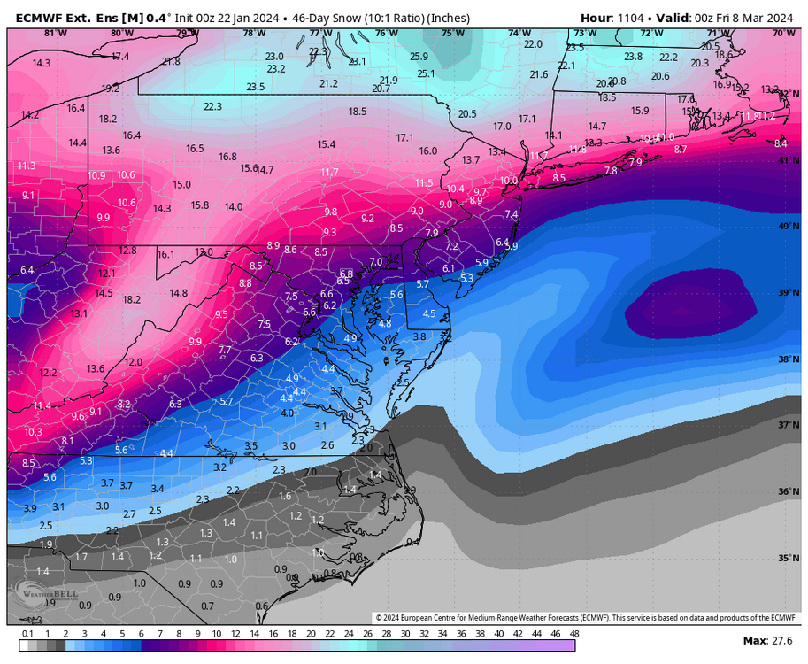
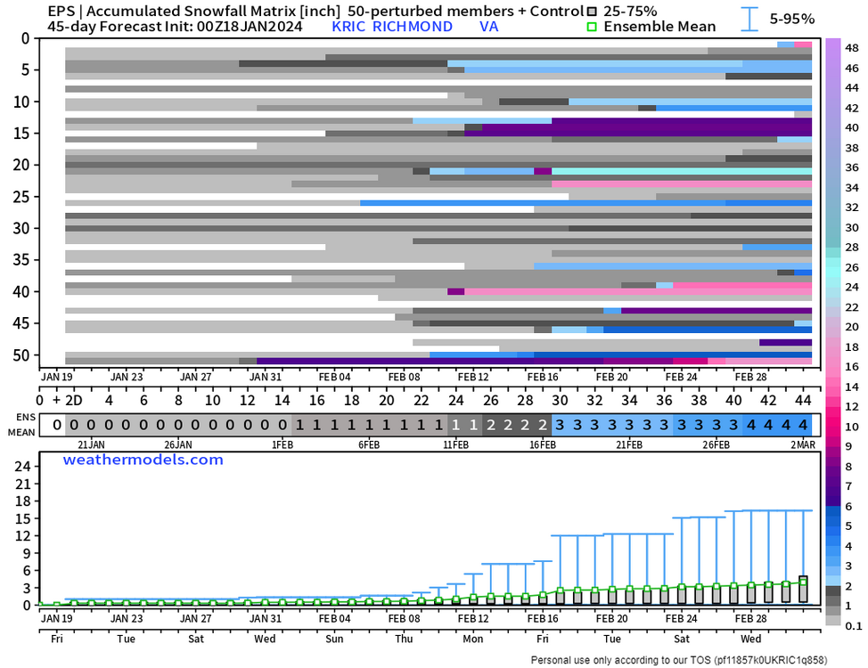
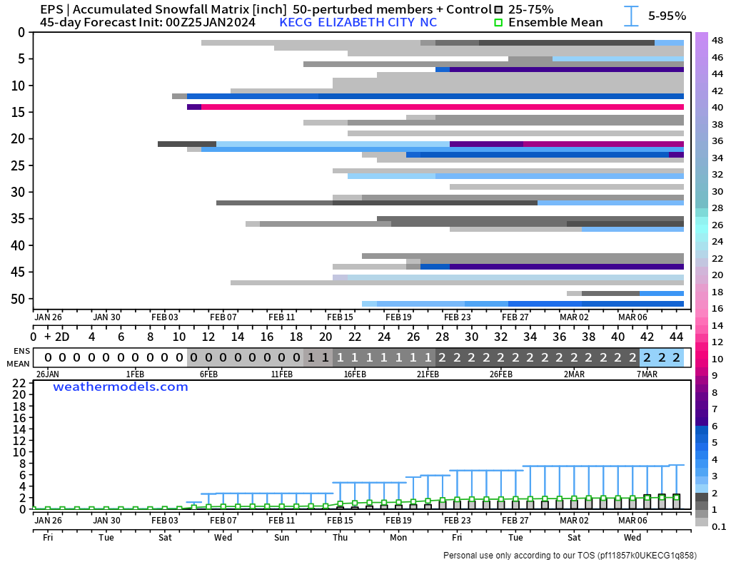
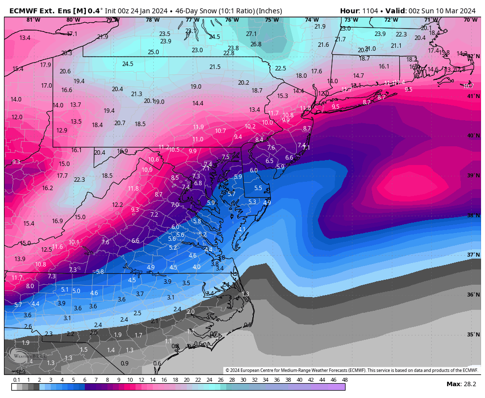
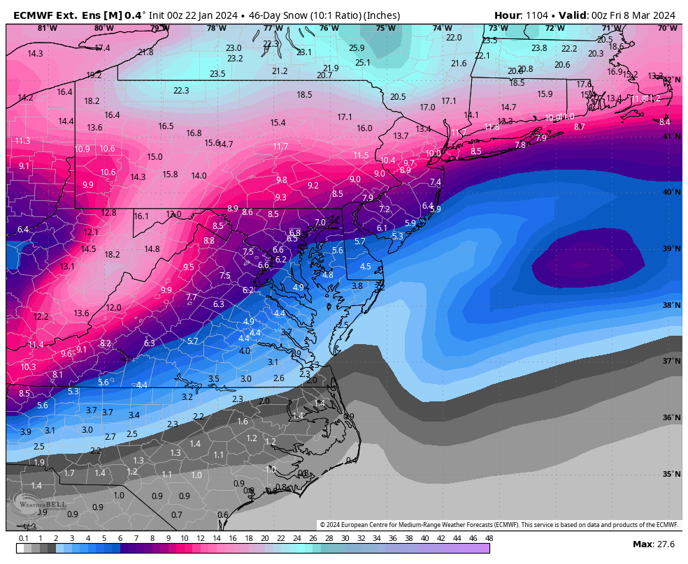
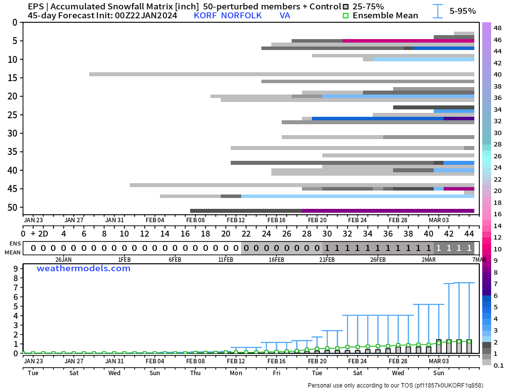
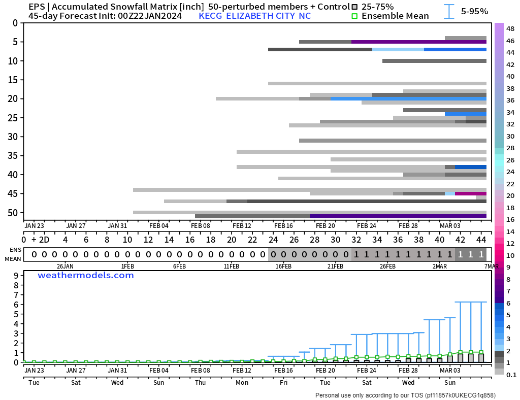
Also, the snow mean ticked up from the other day. Although there are still some shutouts, quite a few members have > 10" of snow at RIC, some even around 20"+, through the period ending March 8th. There are more shutouts for Norfolk and Elizabeth City, but there still appears to be some hope.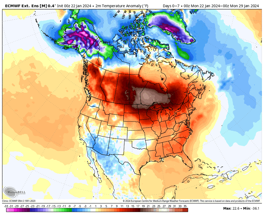


-
1
-
-
57 minutes ago, ldub23 said:
0Z Temps
18z
It looks to be a fairly potent shot of cold. It also tried to bring snow with the passage of the cold front on the 31st.

Then ridging returns to the east, and we moderate for at least several days, but it probably won't be as mild as what we'll see later this week. But, even the warm-up in early February looks temporary because the pattern is reshuffling into what looks to be something more favorable somewhere around the 10th and later. This window could still shift to the left or right, but something more wintery for the east is what most long-range models agree on. Hopefully this time our area can score.
-
2 hours ago, ldub23 said:
I wish that was right. On the other hand these are the temps at 384hrs at midnight i think. Very warm. Feb 07 is when normals start rising.
The low that did have a little promise as some snow is now just way too warm.
I posted that only to increase hope, not to say I genuinely believed it. Plus, as was shown, only one member had it, while others were warm and rainy. Also, later runs of the GEFS took it away, so it's not surprising the operational GFS you posted didnt match that one snowy member from yesterday's 18Z GEFS. So, as I've shared with you, look at the ensembles and identify trends rather than posting the 384-hour operational GFS and taking it as gospel.
I highlighted earlier that the pattern should become more favorable as we progress in February, particularly after about February 10th, based on what I see now. But, it's beyond that, probably mid to late February into early March when it looked the best. Until I begin seeing the ensembles trend earlier, that's what I'll be sticking to. And while it's past peak climate, it can still snow in our region in late February and early March. -
3 hours ago, ldub23 said:
We can still hope
The end of the 18Z GEFS indicates an earlier change. Let's hope there is an earlier shift. Also, one ensemble member obliterated NC and SE VA from the 4th to the 5th of February with 14" of snow falling at Norfolk and 18" at Elizabeth City. Only one member, but it could be a sign we could be back in the game sooner than we think.

-
Unless somehow that shortwave around the 28th-1st turns into something (which is a long shot for us this far south), it's still looking like ~2/10 and later for any significant chance of snow opportunities.
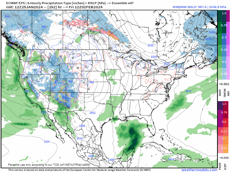
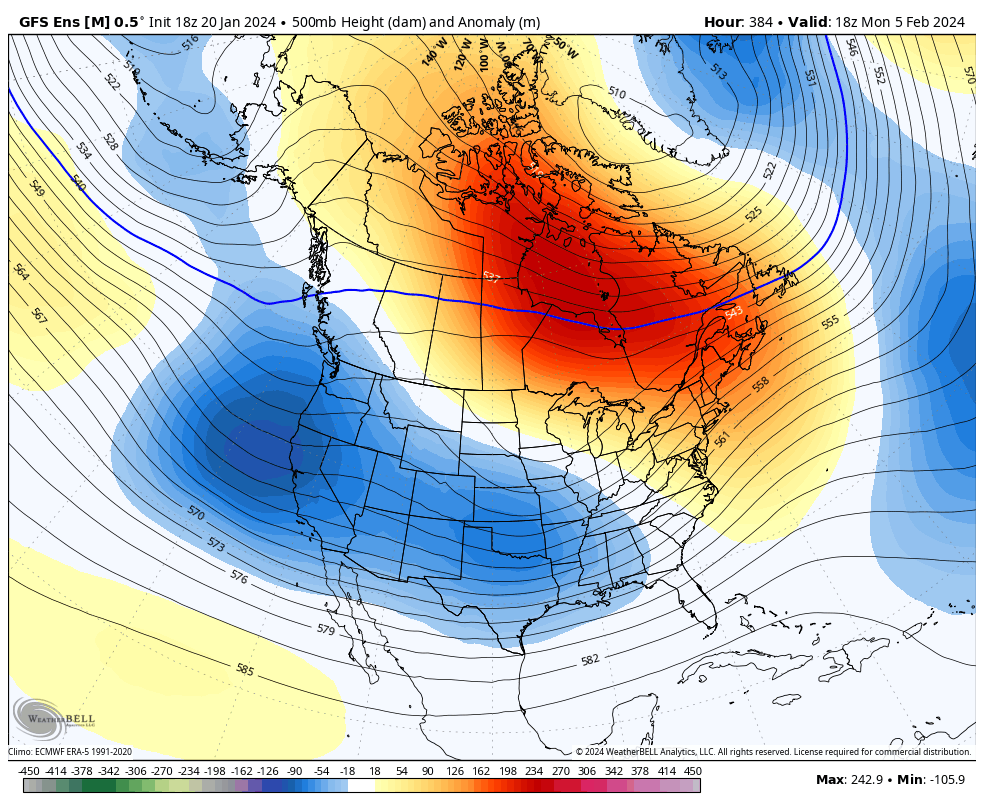
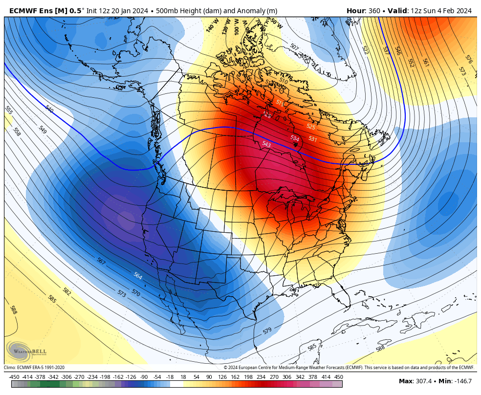
Below are the H5 maps from today's 12Z GEFS (hour 384) and EPS (hour 360). After the storm around the 28th-1st moves away, a couple days of cold follow it before there is ridging building back into the east, and we moderate.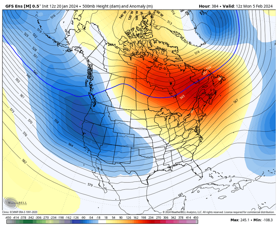

_______________________________________________________________________________
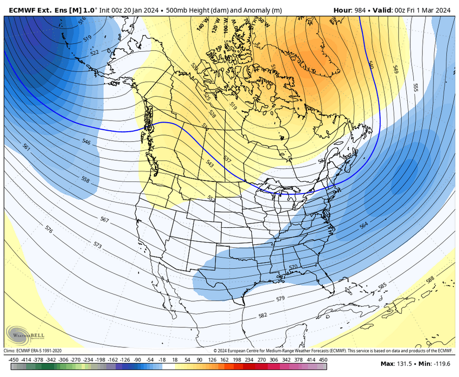
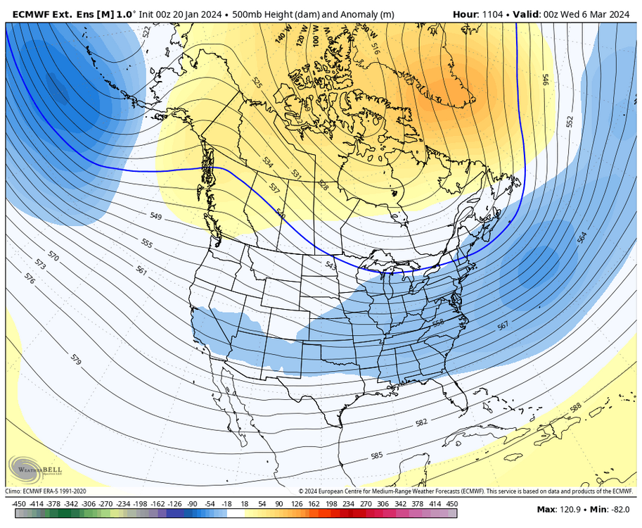
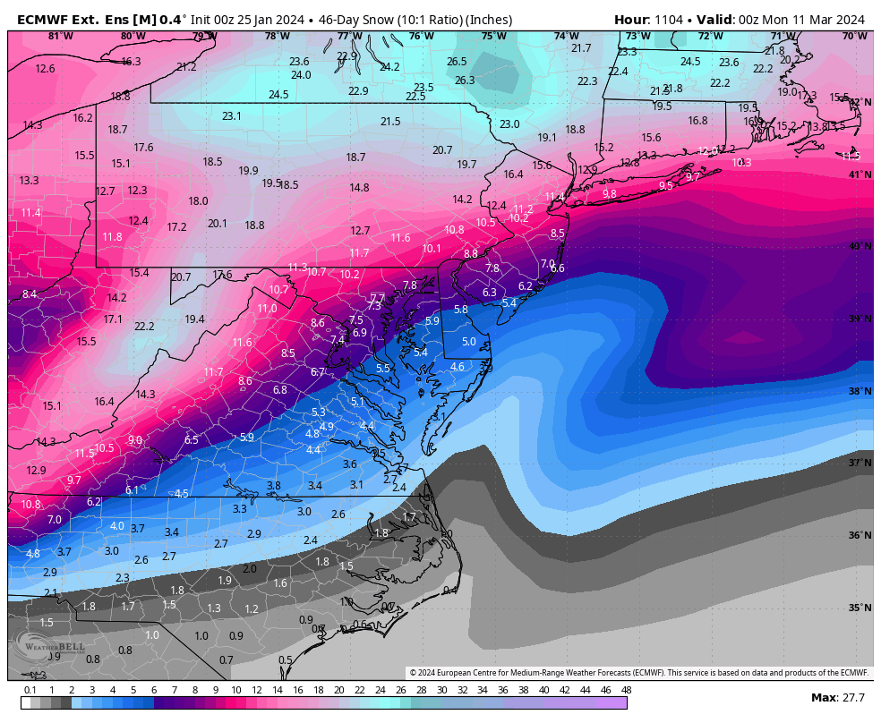
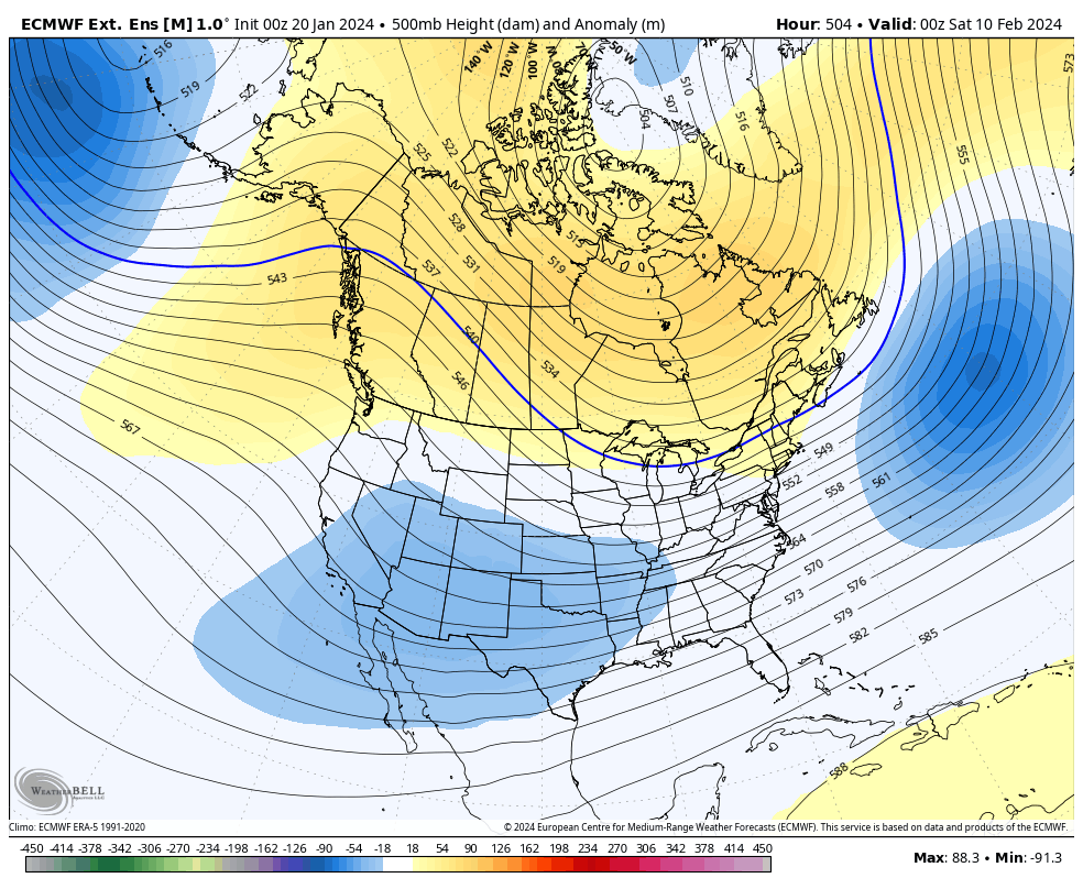
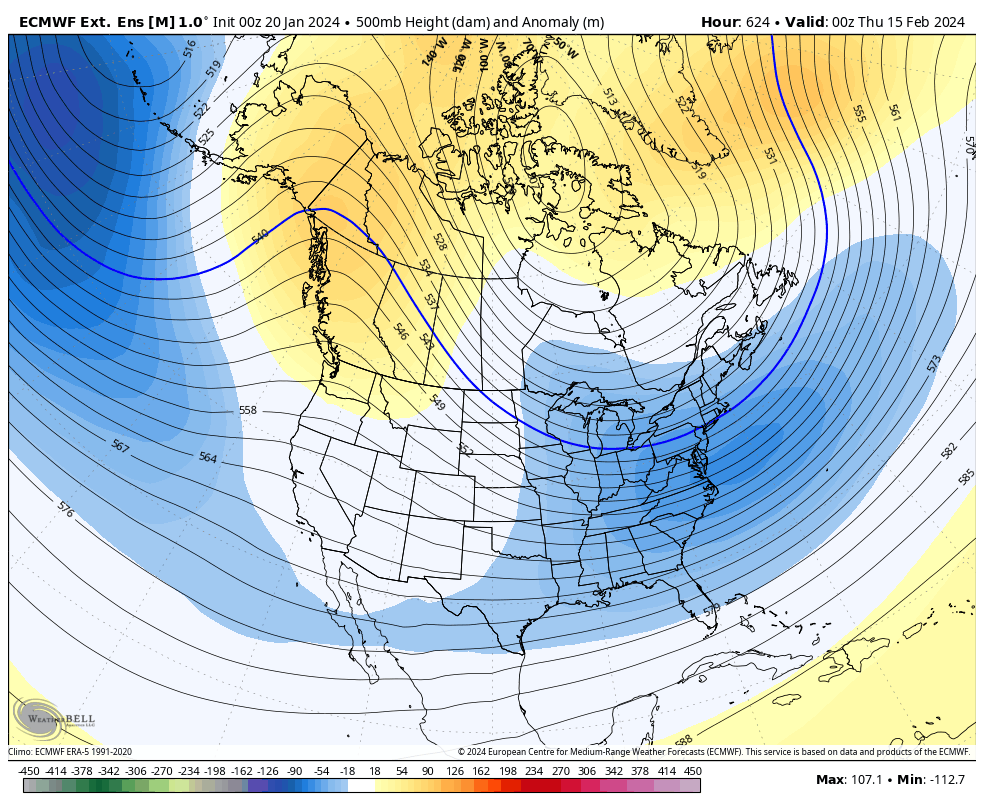
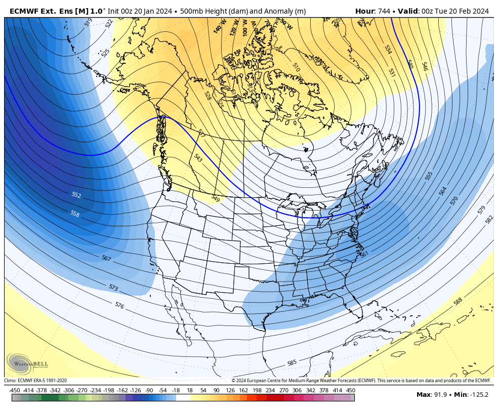
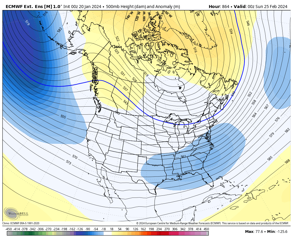
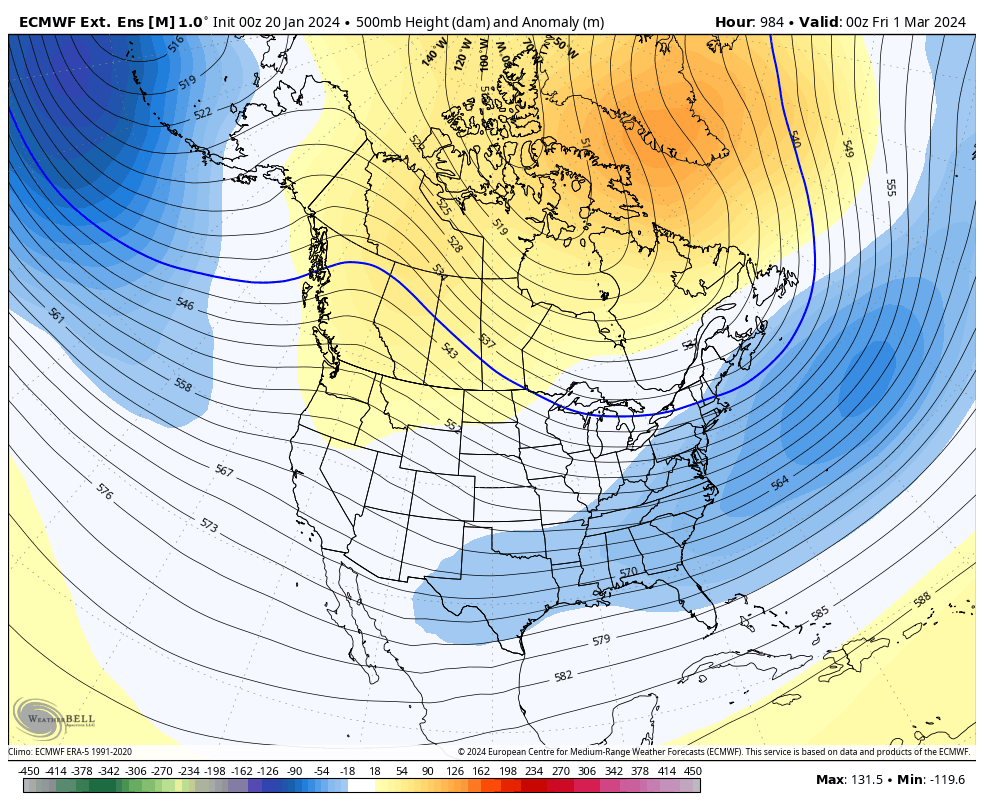
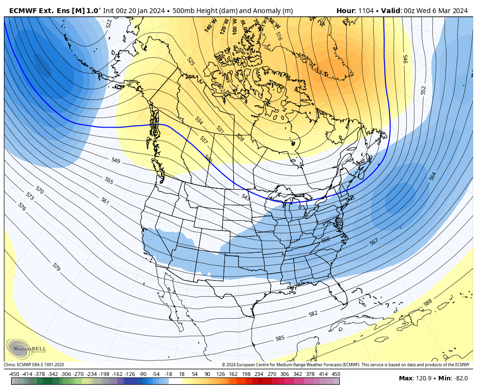
Today's Euro weeklies show the change around the 10th. Here is the look on 10 FEB as the trough is beginning to move back toward the east coast with increasing heights in the EPO, AO, NAO domains. The only teleconnection that doesn't look great continues to be the PNA (lack of a west ridge), but the euro weeklies do show it neutral to slightly positive.
FEB 10th

FEB 15th

FEB 20th

FEB 25th

MAR 1st
MAR 6th
_______________________________________________________________________________
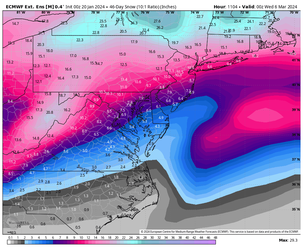
After the 10th is when the snowfall mean begins to increase, with the period from about the 15th to March 1st being the highest.

_______________________________________________________________________________
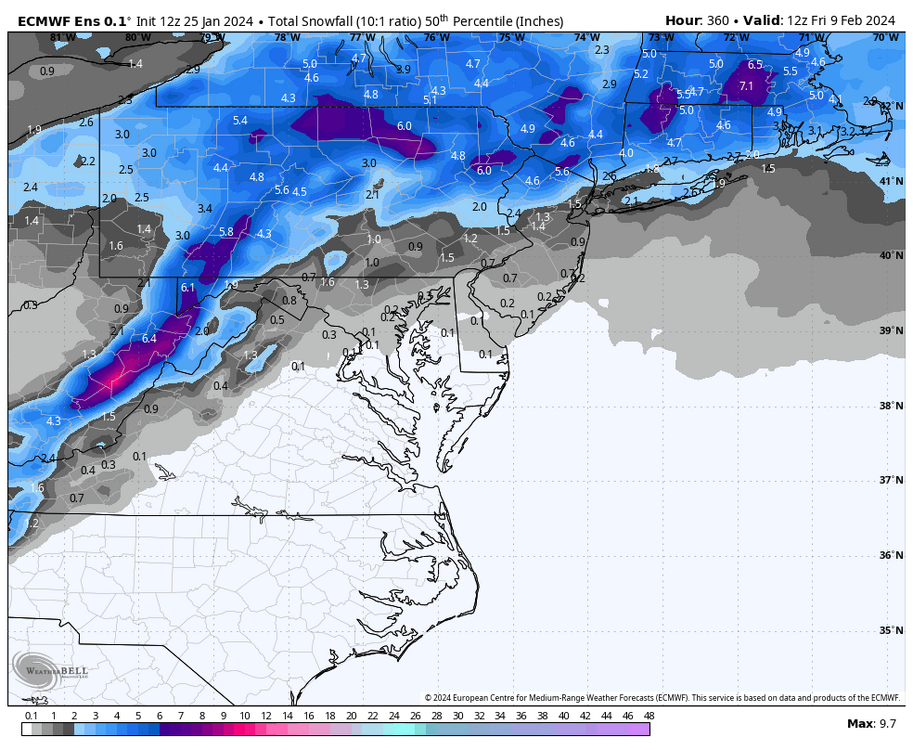
The below snow charts take longer to update, but these are from the run two days ago, and you can see snow hits begin to increase in earnest after about the 10/12th at Richmond and Norfolk.
-
2
-
1
-
-
4 hours ago, ldub23 said:
06 GFS not as bleak as earlier runs
The other day in this post, I mentioned how some of the ensembles were showing a snow threat in the last couple of days of the month and how, after next week's ridge, a trough was building back into the east after about 1/27. It's something to monitor, but at the very least, we get sharply colder for a couple of days before higher heights begin building back into the east. It's beyond that where things become uncertain as the pattern continues to reshuffle.
Also, the GFS is trending slightly cooler with next week's temperatures. There looks to be rain opportunities from about Wednesday through Sunday. The timing of the clouds, rain, and passage of the front next weekend will determine whether there can be widespread low 70s or just mid-upper 60s, especially for Richmond and points north and west, as C VA could be influenced by what looks to be a CAD signature for part of that stretch.
Below are the 1pm temperatures for next Wednesday through Saturday on today's 12Z GFS.

-
1
-
-
37 minutes ago, ldub23 said:
Looks like its moving more east than se.
Yeah, seems to have waned some, too. But we won't escape the cold. Below are the Euro temps for 3pm tomorrow. Almost all stations are below freezing.
But, if the Euro is correct, we are torching a week later with widespread 70s next Saturday at 1pm. This pattern change will be brutal, hopefully, we don't verify that warm and we get back to cold and snow. We get 70°F+ most of the year.
")

-
49 minutes ago, JB Fins said:
Snow flurry downtown. I think I'll wet my pants
It made it in the official ob, too!
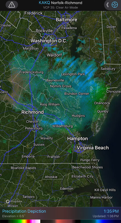
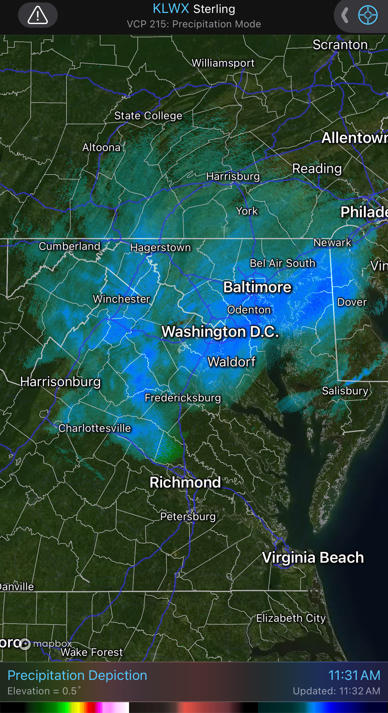
 1 hour ago, Stormpc said:
Per radar, that little appendage down the peninsula looks like it's starting to develop. The models have had that arm trailing the exiting storm for several runs now. I suspect there will be some convective snow showers with grauple moving from Northwest to Southeast across the area this afternoon. Won't get down to me but maybe Newport News can get in on some of the goods.
It's moving SE near Williamsburg and will be across Hampton Roads, soon. Actually, I'd say the 3K NAM I posted last night did pretty well today.
-
1 hour ago, ldub23 said:
More rain here. Maybe a flurry later but Alaska has gone into the freezer so a big warm-up is coming here.
This is fairbanks and they are way below normal. We need a real pattern change if anything is going to happen in Feb
It was expected and also lined up with what the ensembles have shown. The pattern is changing, and this next one will likely last about 3 weeks before it improves again. Hopefully, it's more favorable for us before we run out of time.
-
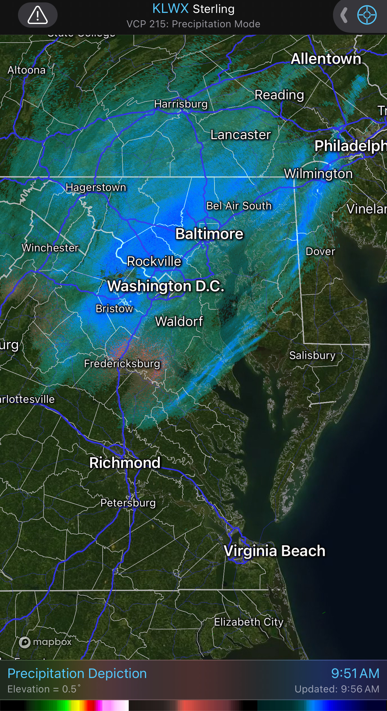
47 minutes ago, eaglesin2011 said:
got a very light dusting in my part of Glen Allen ... could get another flurry/ snow shower later but wouldnt count on anything more then that...
Nice! It looks like there is a redevelopment to the north. It's just a matter of how far south it gets, but there is a good chance of some snow showers, it's just that not everyone will see them.
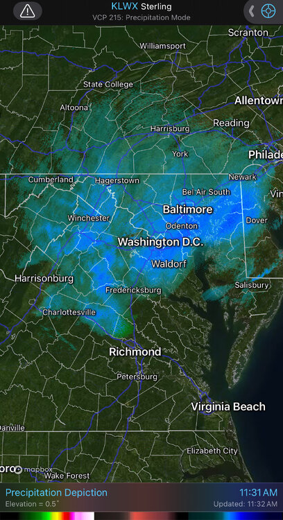
Wakefield has also mentioned the afternoon snow shower chance.
-
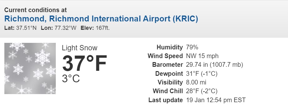
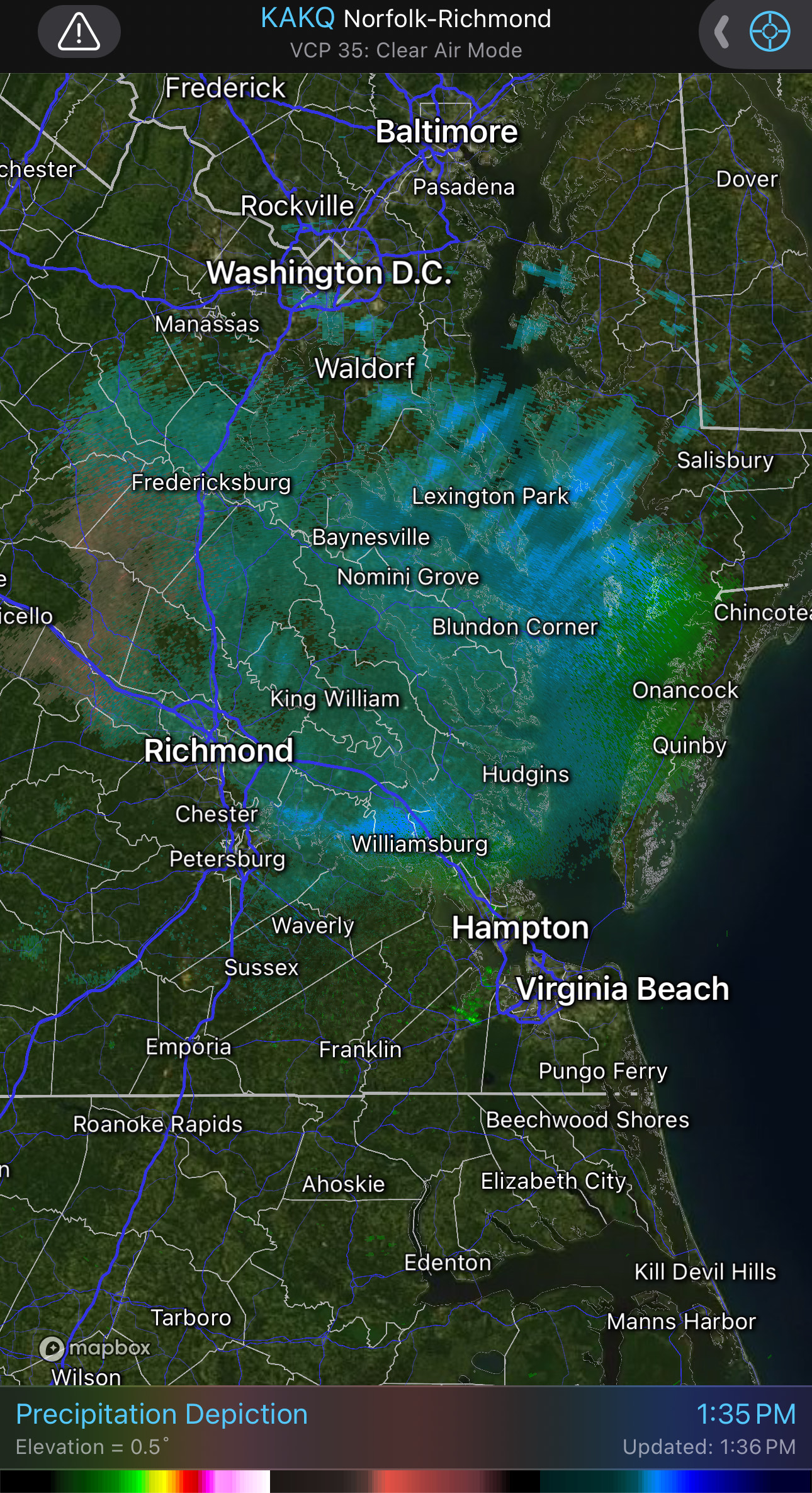
Did anyone see snow this morning?
RIC recorded 0.05" of rain between 5am and 6am. Also, temperatures were 3-4 degrees higher than what the 00z 3K NAM model I posted last night had.
Also, it might've been too far south with the 2nd batch of precip. But maybe the snow streamers will verify this evening and maybe even overnight and tomorrow morning for parts of Hampton Roads.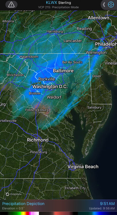
-
2
-
-
1 hour ago, Stormpc said:
@RIC AirportThe RGEM has that feature as well for Hampton Roads. The inverted V look. Nothing crazy exciting but something to watch. Be interesting to see where that dry slot sets up...in Central Virginia or up further in the Fredericksburg area? Then the pivot thru the DMV and whatever scraps get caught in the flow of the departed low. There could be some instability to give those snow showers a boost with sunshine and tanking upper levels. That may be fun before the Frozen weekend begins. Anyway good stuff. Lots happening.
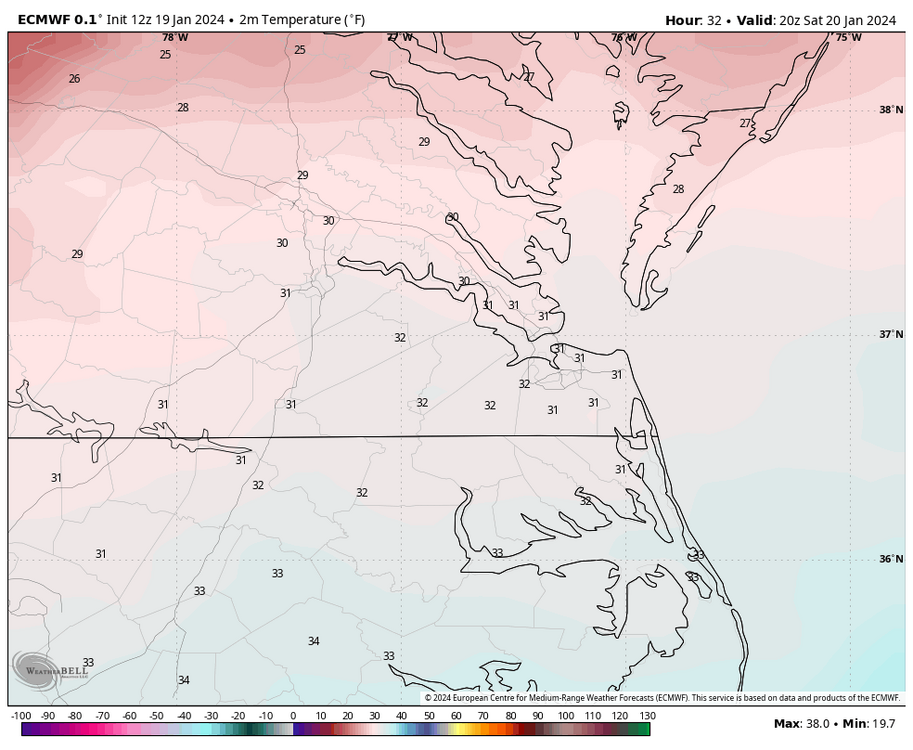
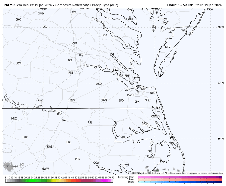
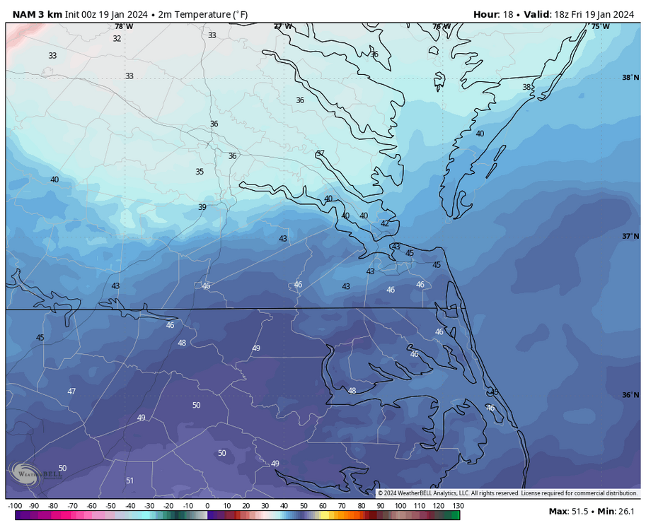
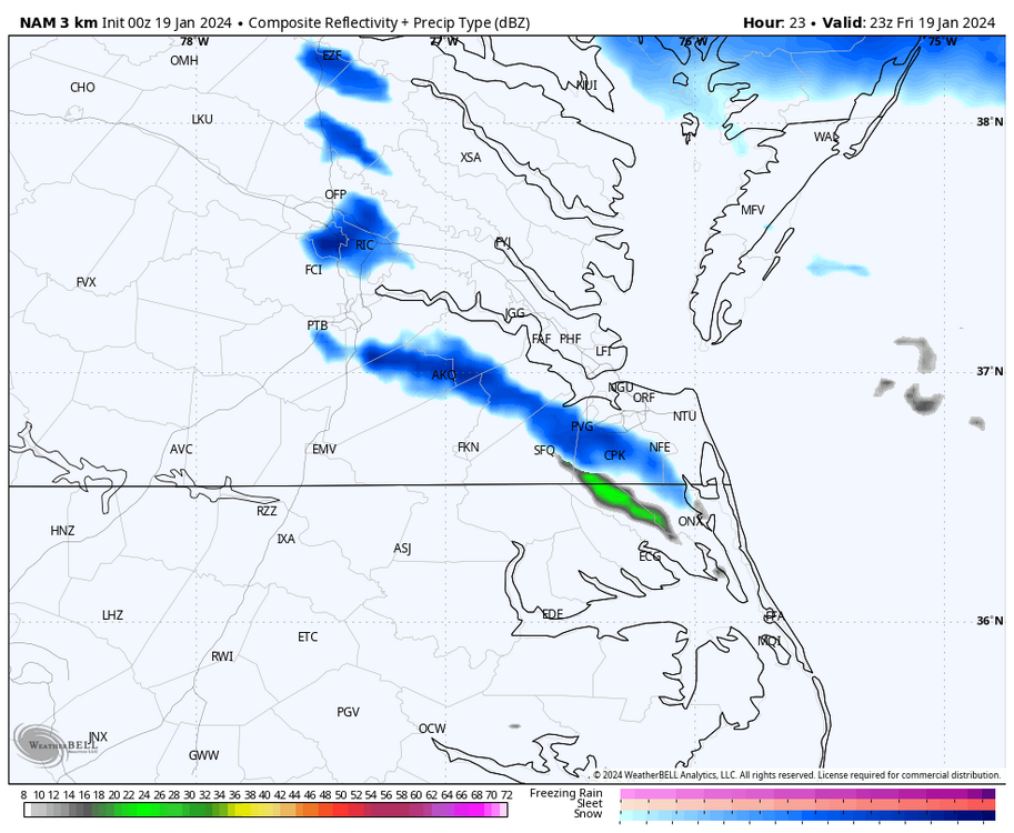
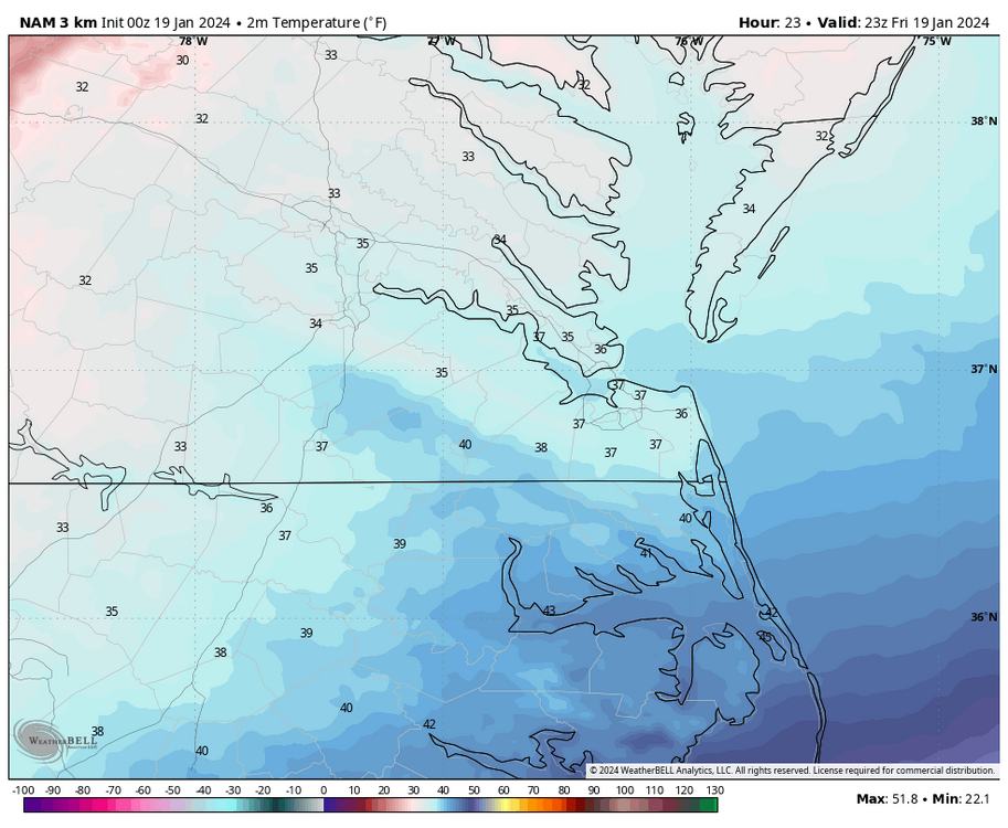
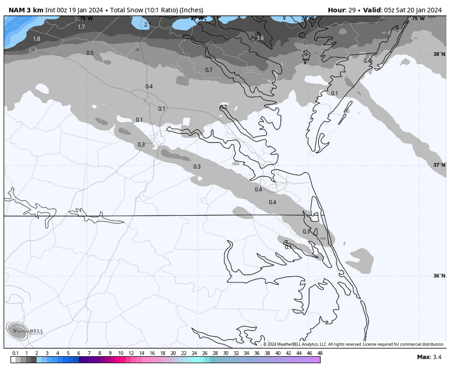
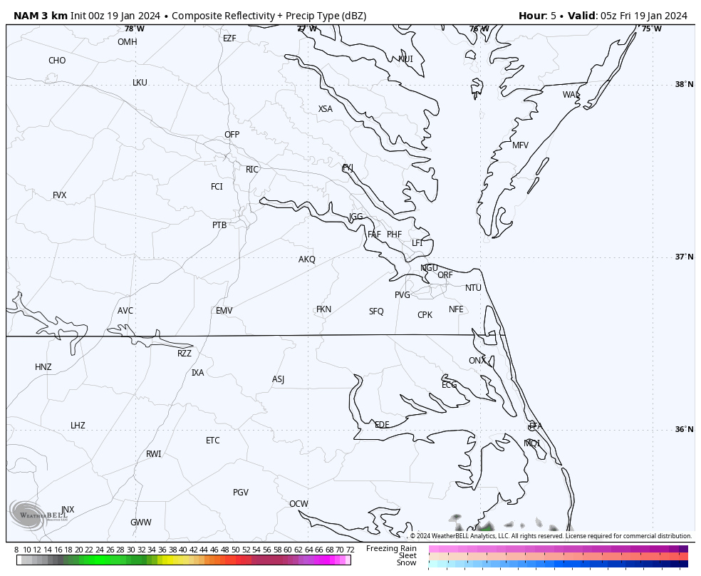
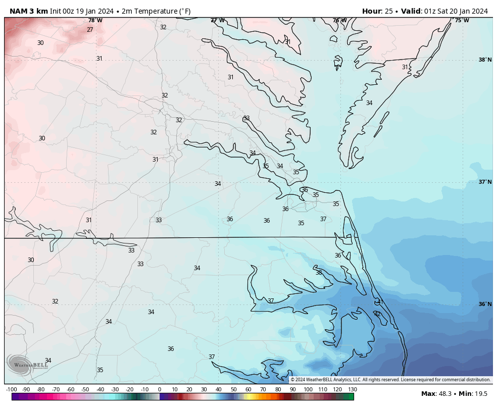
The 00z 3K NAM only has spotty precip moving through the region between 2am and 9am. Temperatures around Richmond are 32°F-35°F while this swings through, so the model tries to depict a mix or rain from about Ashland to Tappahanock and points southward. At the same time, an area of rain is developing across Hampton Roads with temperatures around 40°F. Meanwhile, a more widespread area of snow is occurring north of about Caroline County up to DCA, so the dry slot has won according to this run, @Stormpc.
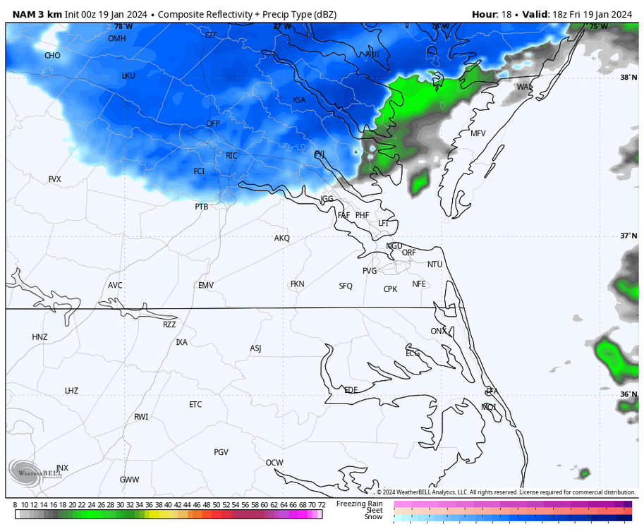
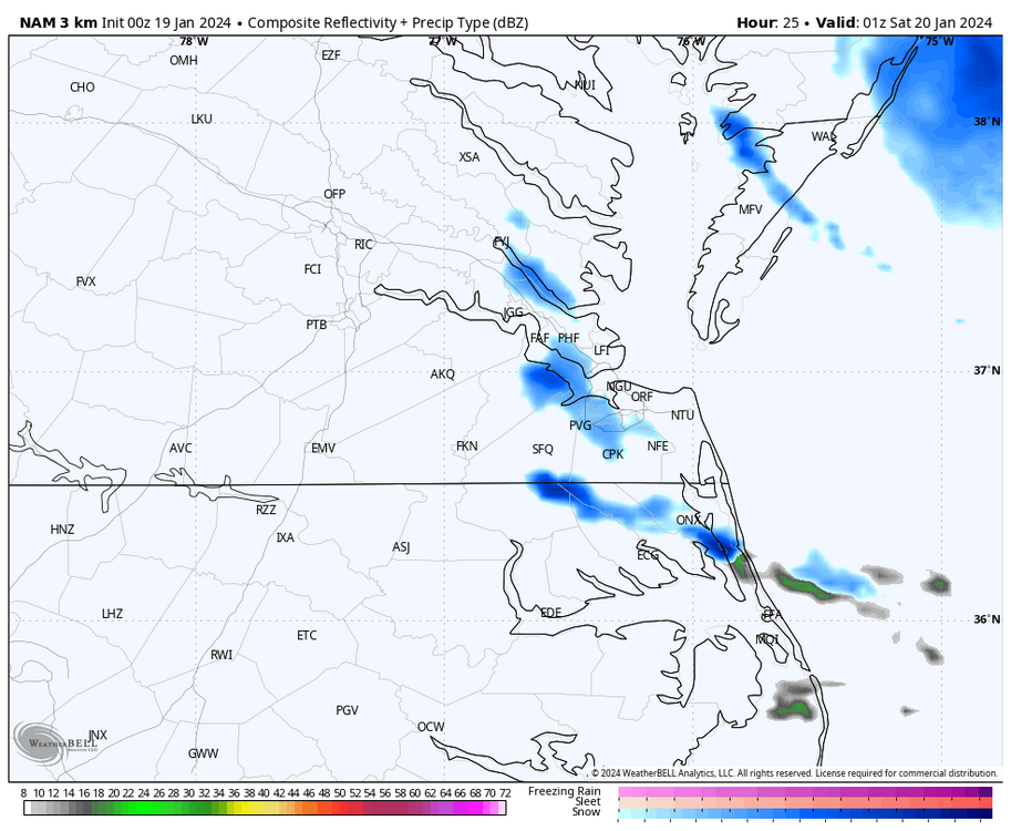
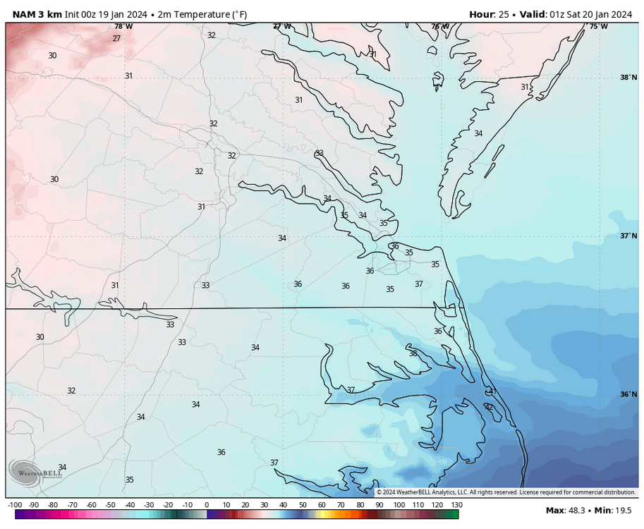
As the low pulls away to our NE, the 3K NAM tries to develop a 2nd batch of snow between 10am and 11am, which swings through the Richmond area and onto the Northern Neck between 12pm and 3pm. Temperatures are in the mid-30s, so it will probably not be easy to accumulate given the time of day.
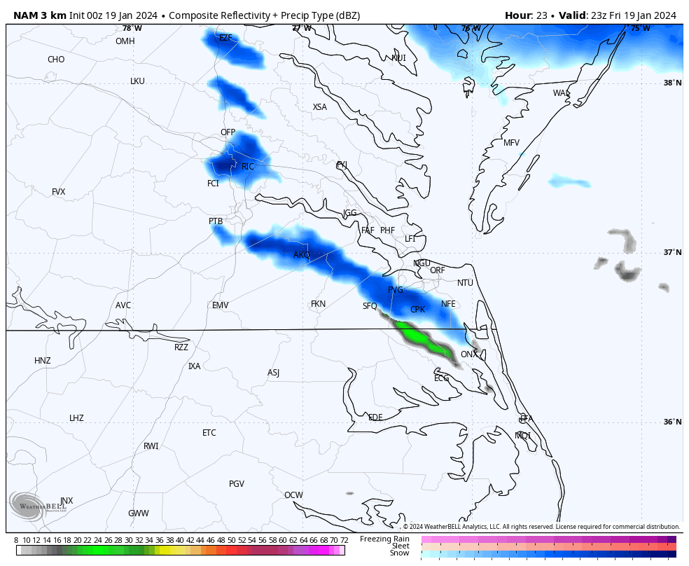
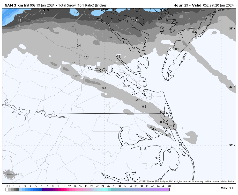
After this, the model tries to develop snow squalls/streamers that move through the Richmond area between 4pm and 6pm and between 5pm and 10pm across Hampton Roads. I think the window over Hampton Roads is longer due to the possibility of river/bay enhancement. Not everyone will see them, and the models probably can’t pinpoint exactly where any bay enhancement will be set up if any does at all, so the location may fluctuate in later runs. Even though it’s very cold aloft, surface temperatures at the time are still just above freezing, so there would be little, if any, accumulation from these, but will be fun as you mentioned. Also this phenomenon rarely happens. NAM even has a streamer coming down the Chesapeake Bay overnight Friday, but only reaches the west coast of the Eastern Shore.
-
1
-


Richmond Metro/Hampton Roads Area Discussion
in Mid Atlantic
Posted
Yeah, it's a shame. I would rather have what we had on this date 24 years ago. One of my favorite snowstorms, RIC had 7-8 consecutive hours of +SN FZ BLSN and there was one hour where the wind gusted higher than the 2016 storm. A very dynamic storm and an all snow event from beginning to end.