Chinook
-
Posts
10,674 -
Joined
-
Last visited
Content Type
Profiles
Blogs
Forums
American Weather
Media Demo
Store
Gallery
Everything posted by Chinook
-
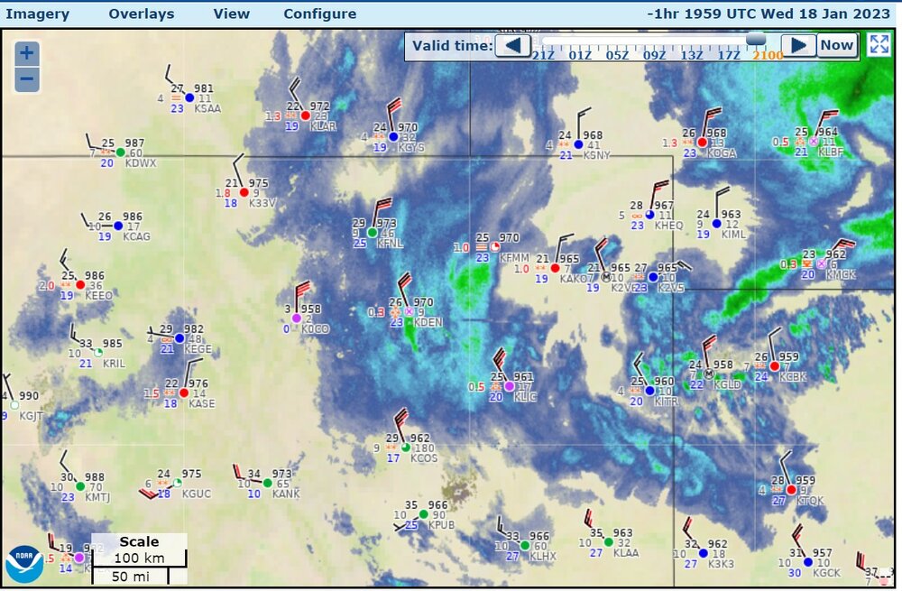
These images are from somewhat earlier. There have not been a lot of new storm reports

-
snapshot of higher winds that lasted for about 1 hour
-
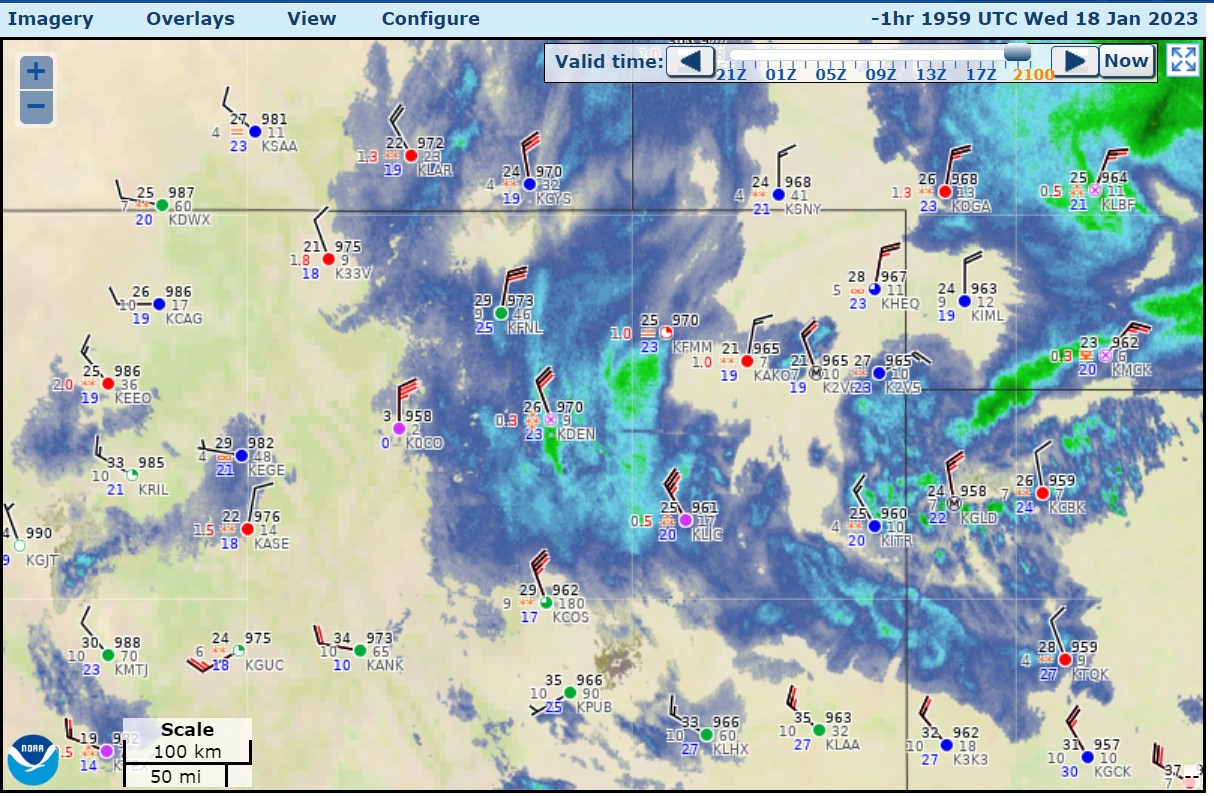
a lot more windy at DIA right now with wind gusts to 34kt (39mph), with almost all other airports less windy though.
-
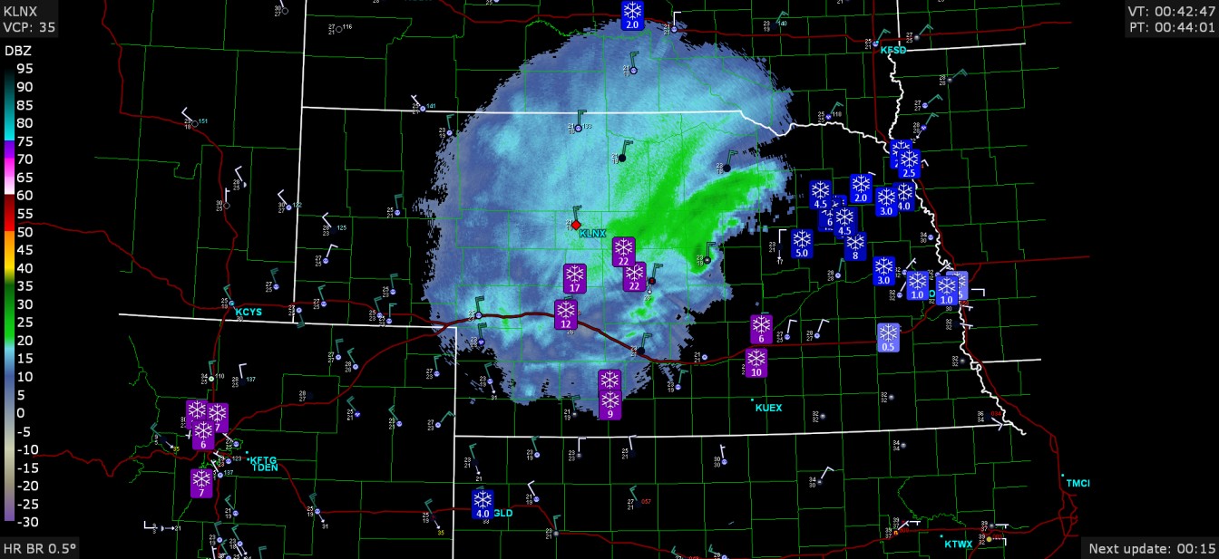
They've got 7" in Loveland and 7-8" around DIA right now. Maybe other spotters will measure 7" soon.
-
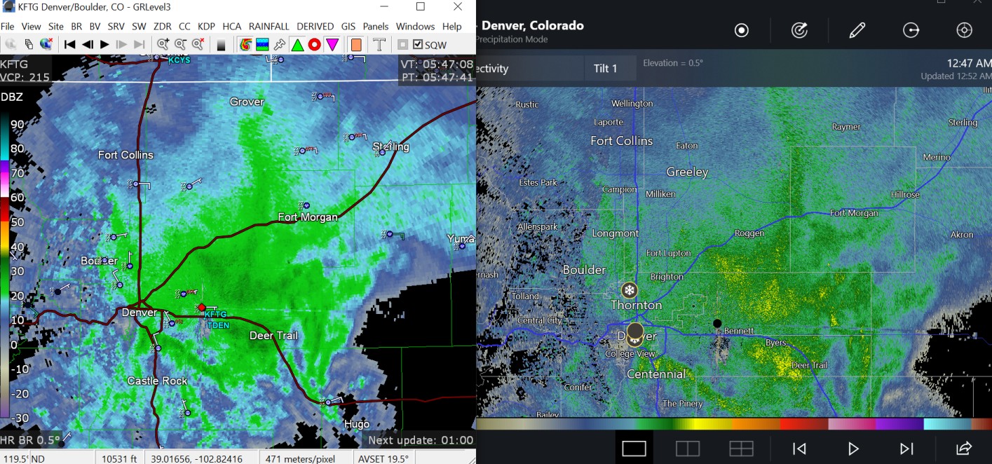
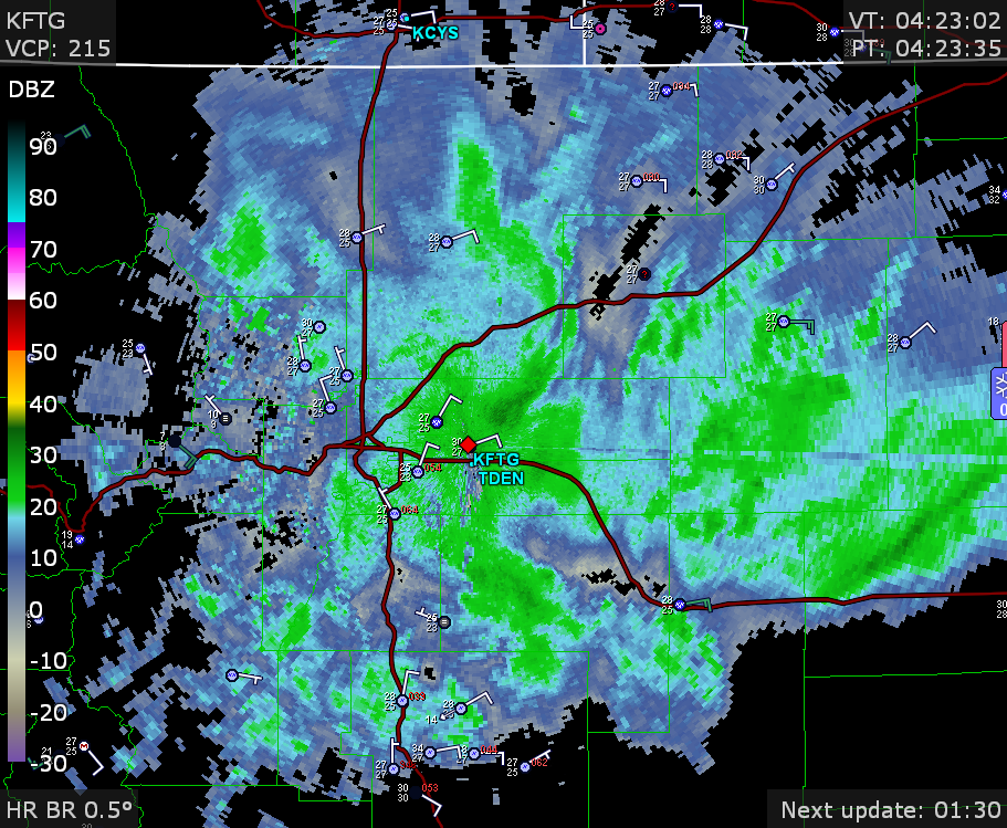
radar is a solid area

-
snow bands getting going around Denver
-
I feel like this is a WetNina rather than a WhiteNina.
-
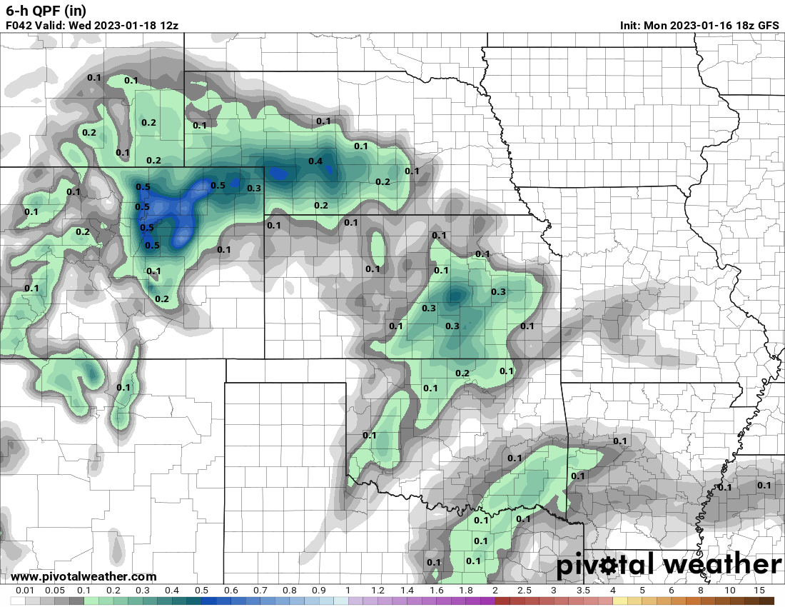
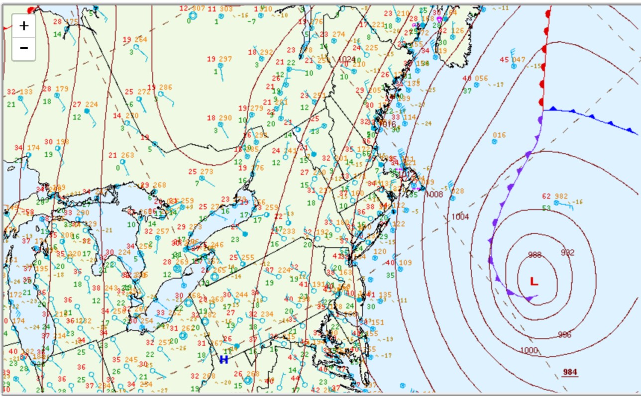
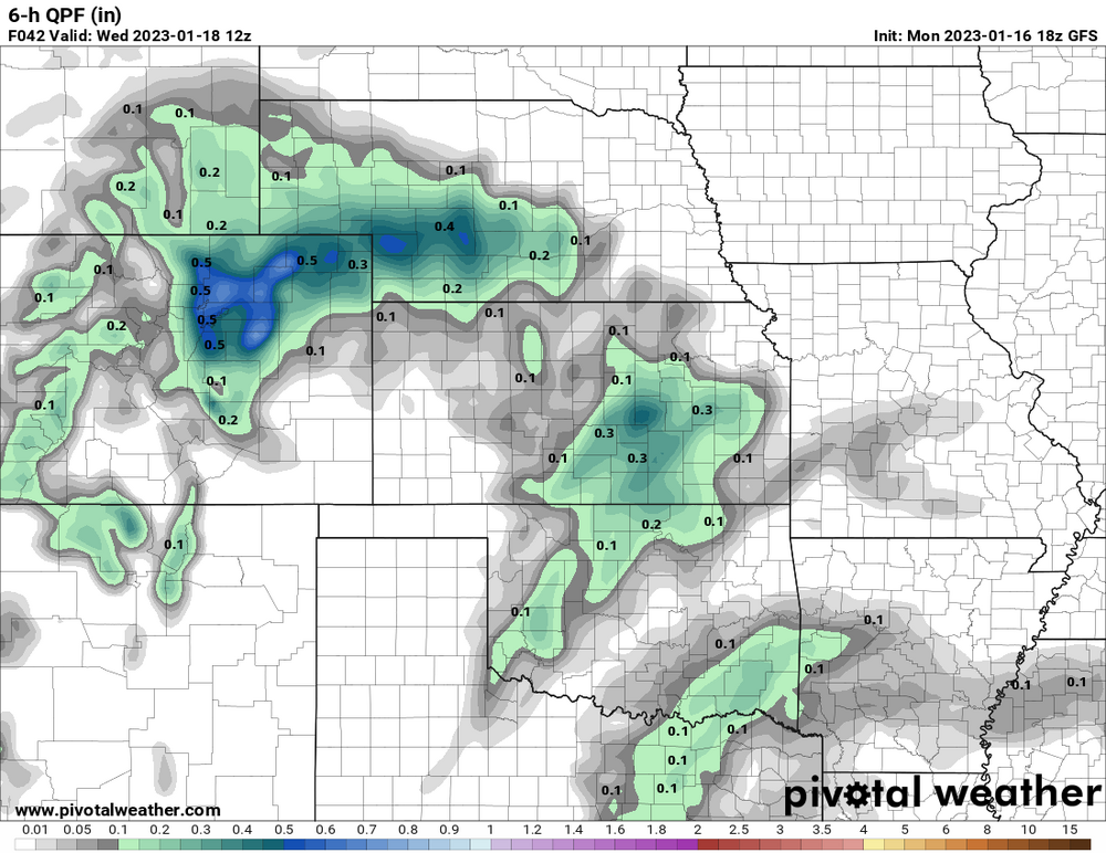
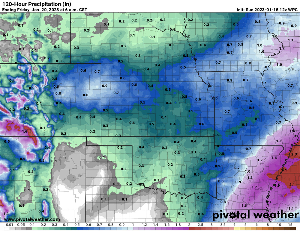
The GFS has 15-20 knot easterly winds at 700mb during the height of the storm with -8C up there and maybe 30F at the surface, which is strangely warm. That's always a sign of a heavy snow band at the foothills. (see attached image) as QPF is quite high for just 6 hours there. The 18z GFS and 00z GFS have some different areas that have 11" of snow in 12 hours! Not exactly the highest confidence on that, but hey, it's a lot of snow. As mentioned, the 18z NAM had kind of a weird forecast. It has kind of been that way for years. When this model switched its name from the Eta to the NAM in 2007 or 2008. Then around 2008, they replaced the core of the model with the WRF software. It was, and is, considered the premier mesoscale model for the USA, but the snow forecasts for the Front Range have been kind of wonky for a long time. Check NWS Boulder for official snow forecast and Winter Storm Warning details.
-
Is this a warm seclusion?

-
On Tuesday to Wednesday, it seems like this could be a longer-lasting storm with several inches of snow. The GFS, Canadian and UKMET have pretty decent QPF of over 0.6" for metro areas, and the 00z ECMWF has lower values. Edit: 12z ECMWF is pretty snowy.
-
Today's models have some agreement for Colorado on Wednesday (96 hours). They have a 500mb closed low and surface upslope winds and snow.
-
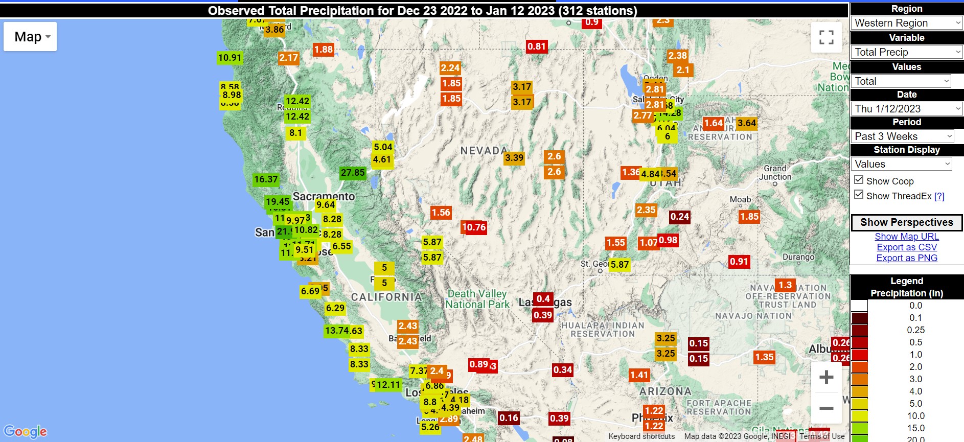
 Measured precipitation for past 3 weeks. San Francisco, Sacramento, Reno, Bishop CA, Elko NV, and Ogden UT had the #1 highest precipitation compared to the historical record (considering the same calendar days)
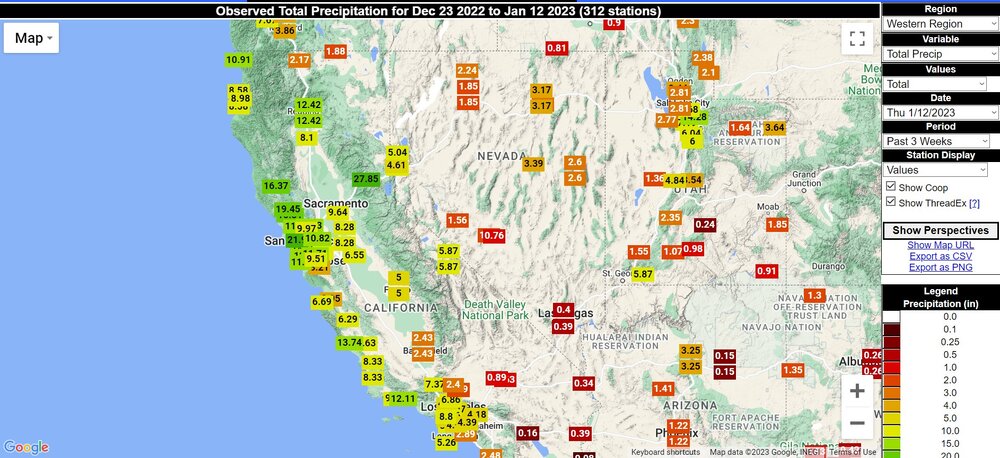
-
January 2nd and 3rd Severe Weather Threat
Chinook replied to DanLarsen34's topic in Central/Western States
we are hearing this was a hit in the center of town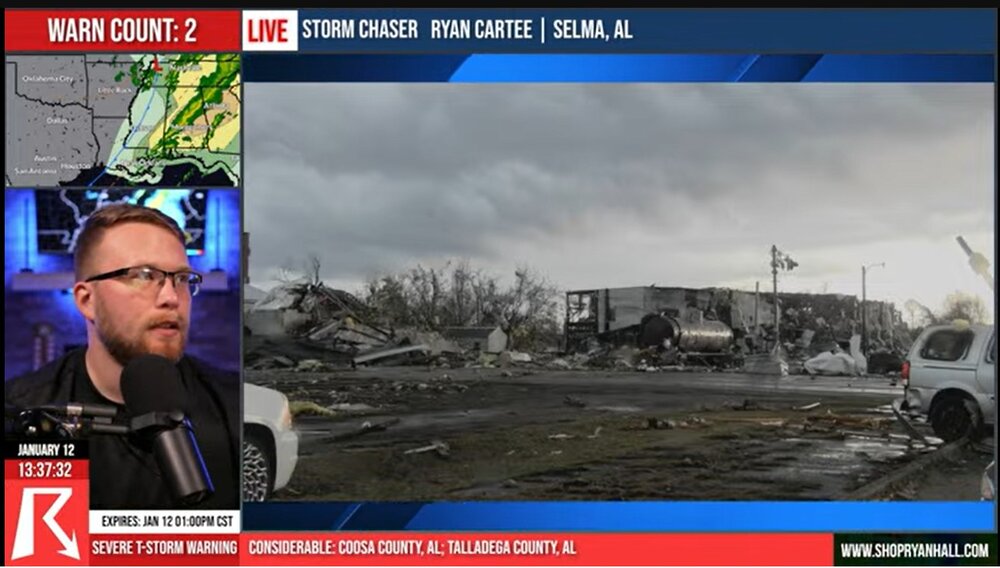
-
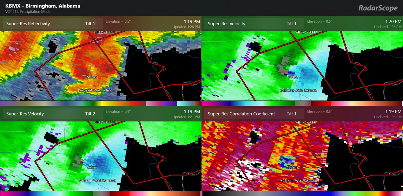
January 2nd and 3rd Severe Weather Threat
Chinook replied to DanLarsen34's topic in Central/Western States
update: possible large tornadoes have occurred today in Alabama, Jan 12th, with this, minutes ago in the city of Selma Alabama. Up to now, there have been 13 preliminary tornado reports in Alabama.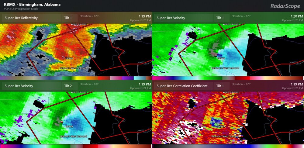
-
Winter 2022/23 Short/Medium Range Discussion
Chinook replied to Chicago Storm's topic in Lakes/Ohio Valley
The GEFS members have temps above freezing for much of this time frame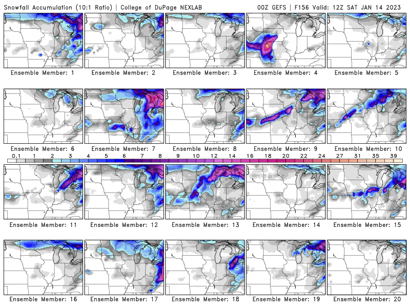
.png.994c665d2c705d9d6059e4bbaca3b422.png)
-
Winter 2022/23 Short/Medium Range Discussion
Chinook replied to Chicago Storm's topic in Lakes/Ohio Valley
The 00z GFS changes the look of the system in the late week. It moves up the low pressure timing at Toledo to Friday, 03z (really, Thursday, 10:00PM). It with a stronger low pressure, at 996mb. It has the rain/snow transition in Michigan/Indiana, with something like 11-14" of snow at Howell, Michigan, depending on 10:1 or Kuchera snow ratios. Kucheras are lower than 10:1. I know, it's at 5 days out or maybe 6 days out, which means that it will trend in some direction. It almost certainly will trend towards less than 11-14" of snow for any area in the Midwest. And the Canadian global model says, "what storm?" As of right now, some ECMWF and GFS ensemble members have a pretty high QPF for southeast Michigan. -
I have heard reports of rivers flooding massively in California in these past days, in response to 5-15" of precipitation in northern California.
-
January 2nd and 3rd Severe Weather Threat
Chinook replied to DanLarsen34's topic in Central/Western States
two rotations
-
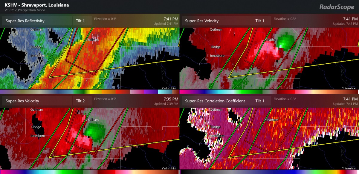
January 2nd and 3rd Severe Weather Threat
Chinook replied to DanLarsen34's topic in Central/Western States
possible strong rotation next to Chatham, LA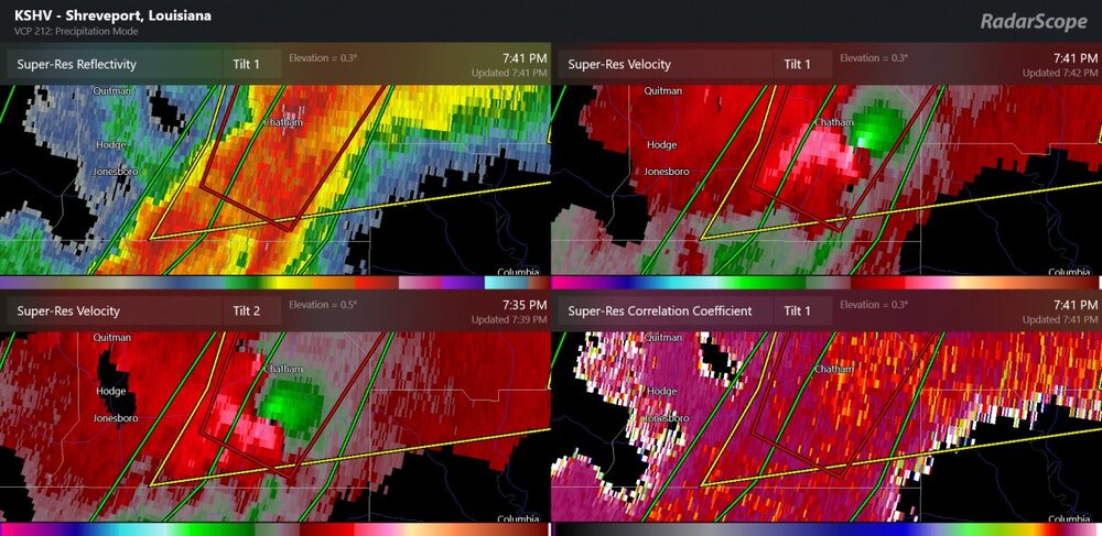
-
January 2nd and 3rd Severe Weather Threat
Chinook replied to DanLarsen34's topic in Central/Western States
this is from Andy Hill, assisting Ryan Hall on his ongoing youtube stream. Unfortunately, I can't figure out what radar this was.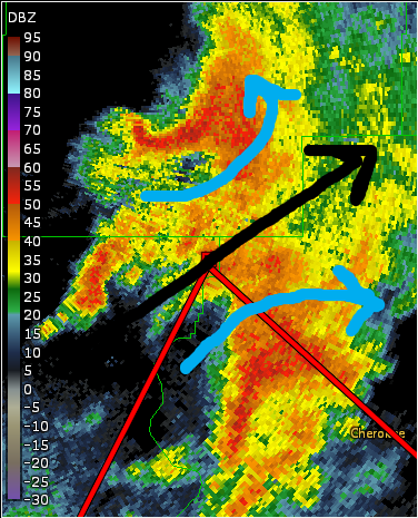
-
January 2nd and 3rd Severe Weather Threat
Chinook replied to DanLarsen34's topic in Central/Western States
I think there's very strong rotation between Farmerville, Marion, and Sterlington. It's at the point where the storm is far from any radar. -
January 2nd and 3rd Severe Weather Threat
Chinook replied to DanLarsen34's topic in Central/Western States
It's always amazing that such a tiny cell could be a tornado producer on a day like today, but normally it would be a passing rain shower. -
January 2nd and 3rd Severe Weather Threat
Chinook replied to DanLarsen34's topic in Central/Western States
interesting note: dew points may be 23 to 28 degrees F above normal in the Louisiana-Arkansas area, as well as 20+ above normal along the Mississippi and Ohio Valleys. -
January 2nd and 3rd Severe Weather Threat
Chinook replied to DanLarsen34's topic in Central/Western States
I think there was a tornado really close to this area last month. Certainly a chance there's a tornado happening here. -
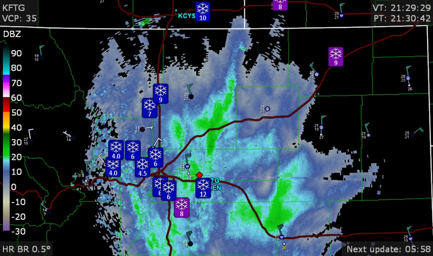
The Denver NWS web site shows every type of thing you might be expected to see, and an avalanche warning. What's not shown: a winter weather advisory above 6000 ft for Larimer County and Boulder County. I guess they will decide if the north areas are worthy of a winter storm warning or a winter weather advisory later.