Chinook
-
Posts
11,160 -
Joined
-
Last visited
Content Type
Profiles
Blogs
Forums
American Weather
Media Demo
Store
Gallery
Everything posted by Chinook
-

Mountain West Discussion- cool season '23-24
Chinook replied to mayjawintastawm's topic in Central/Western States
I think they said 2ft-4ft for the Sierra summits. It has mostly already happened. -
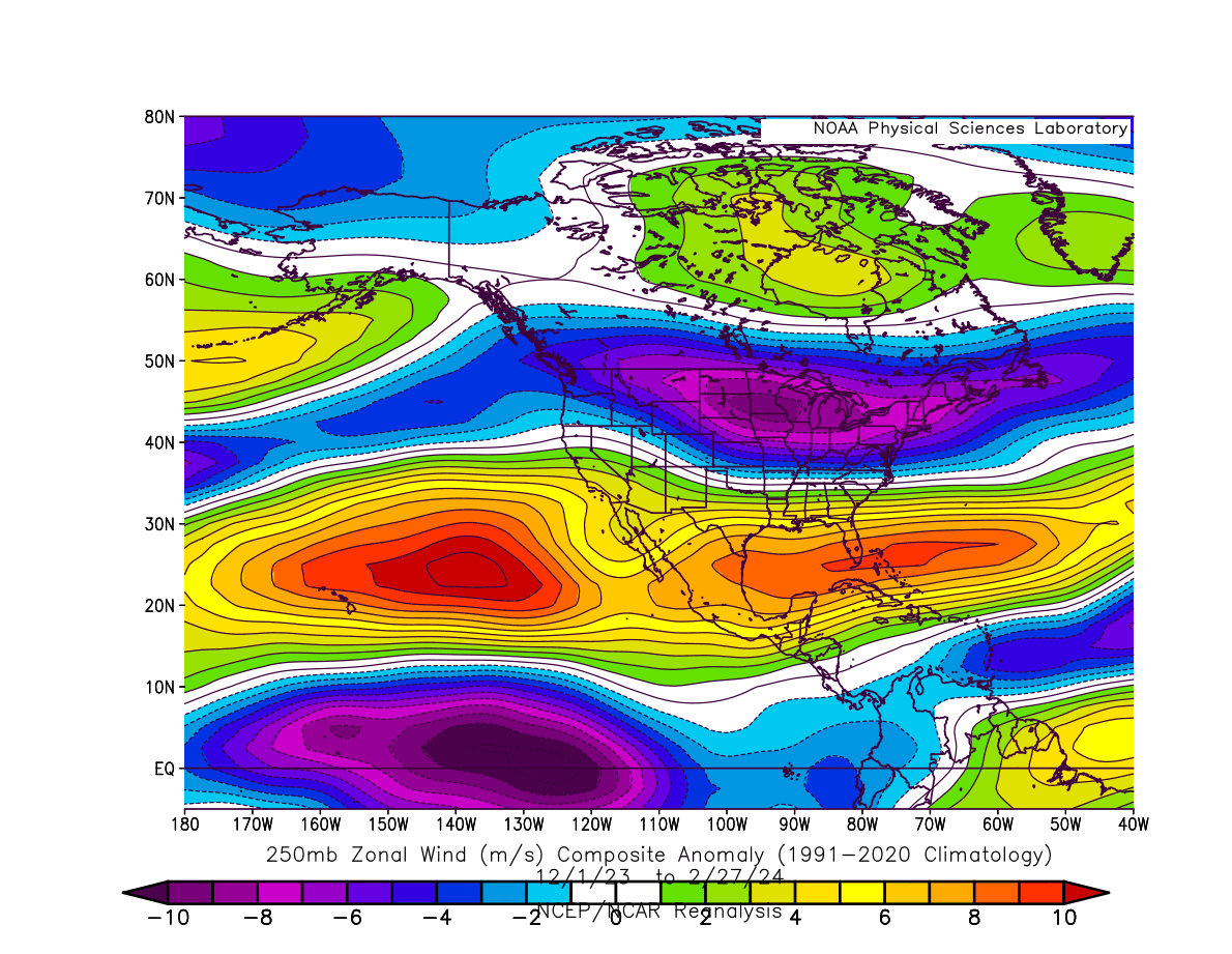
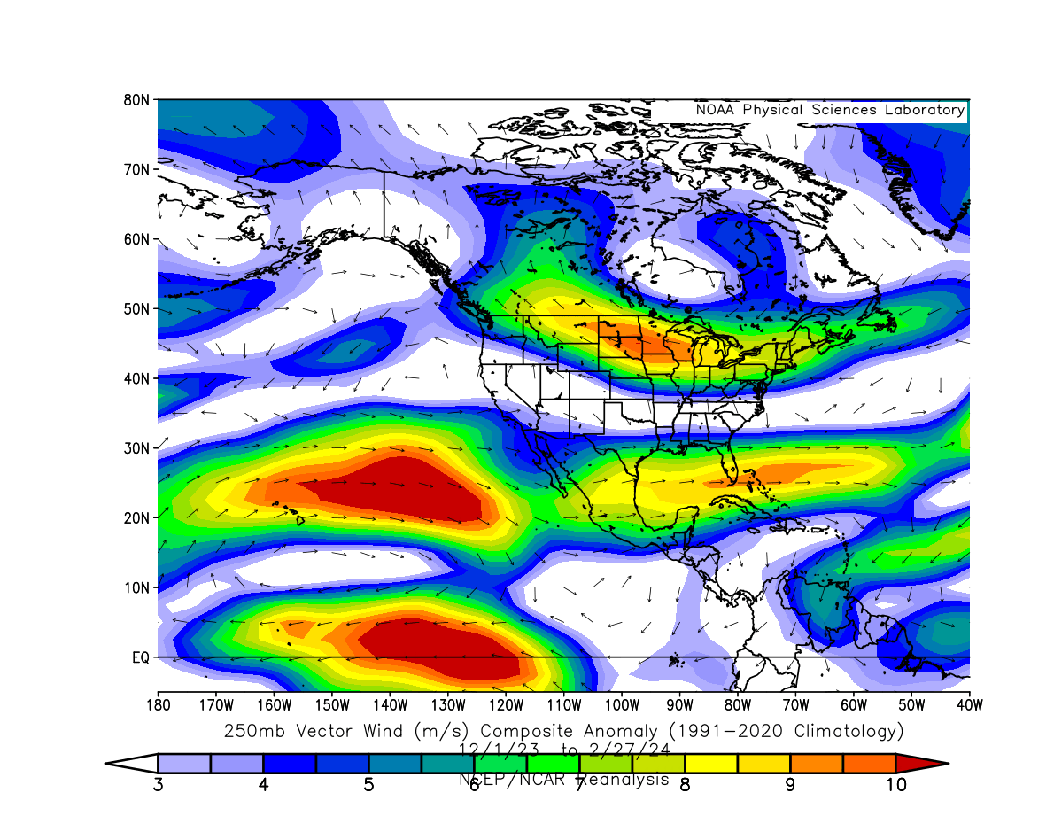
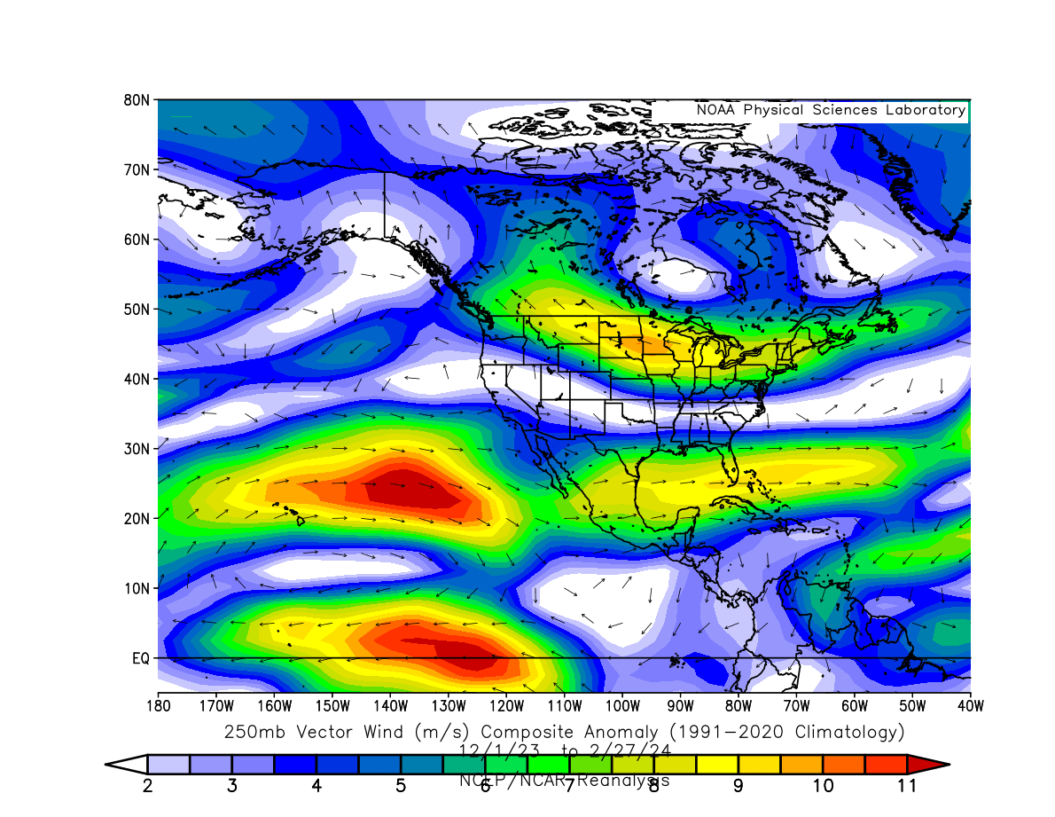
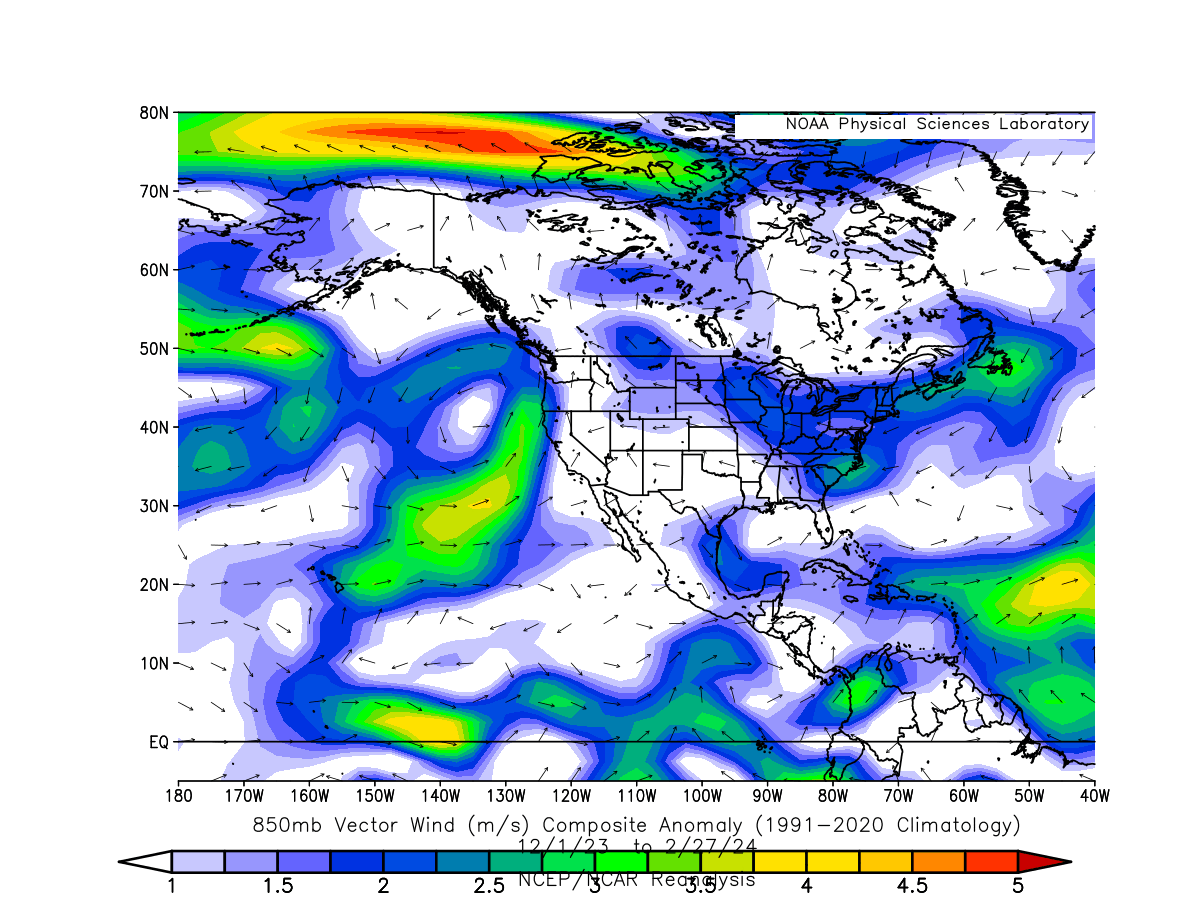
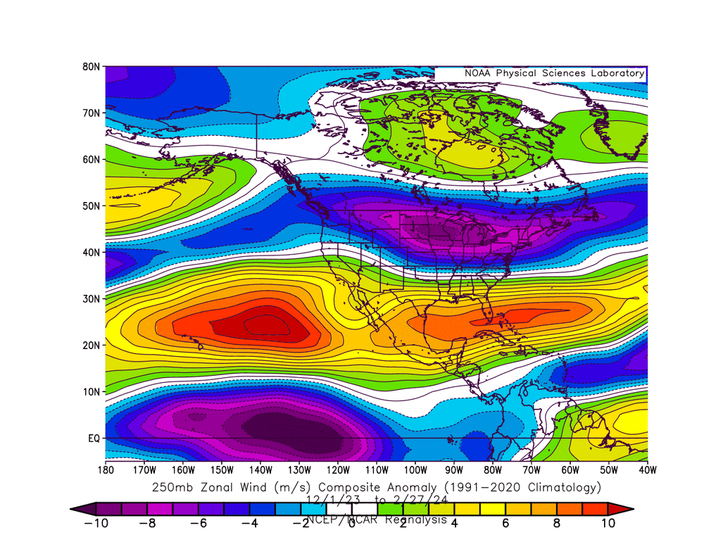
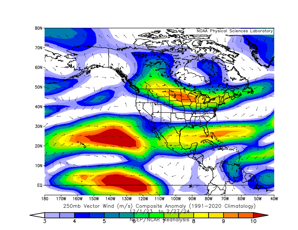
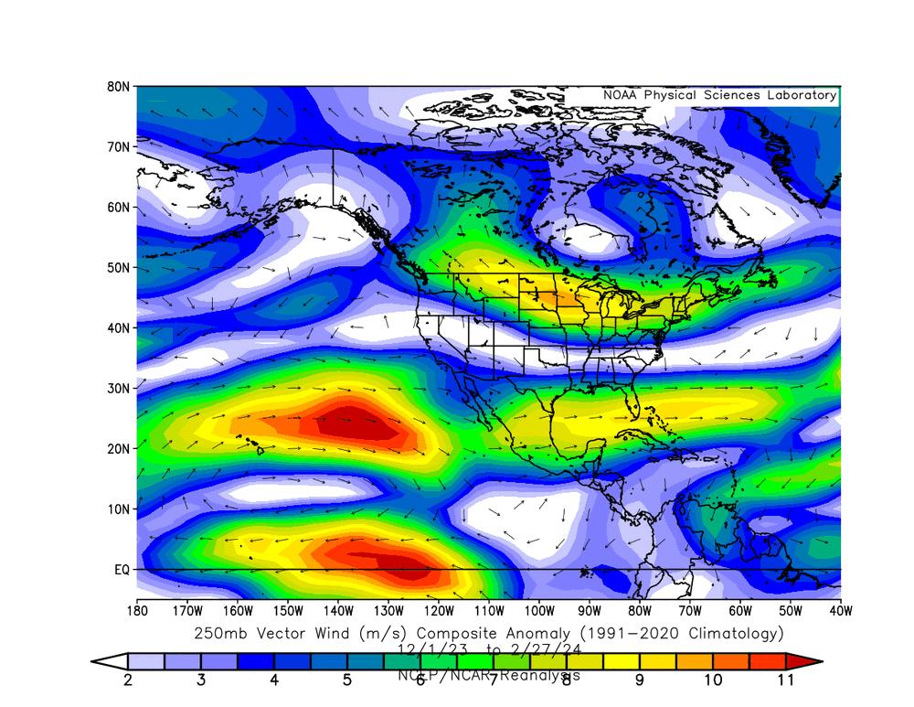
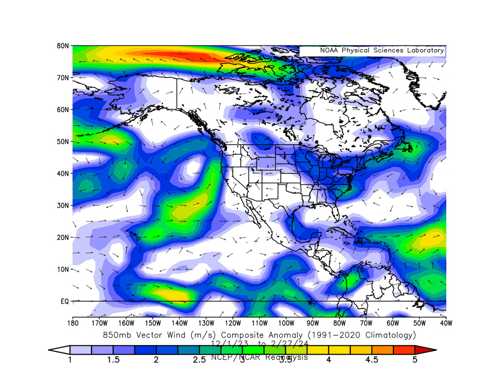
Here are my 250mb wind loops for fall/winter. https://great-lakes-salsite.web.app/Sep_1_18_2023_250mb_loop.html https://great-lakes-salsite.web.app/Sep_17_30_2023_250mb_loop.html https://great-lakes-salsite.web.app/Oct_1_15_2023_250mb_loop.html https://great-lakes-salsite.web.app/Oct_16_31_2023_250mb_loop.html https://great-lakes-salsite.web.app/Nov_1_15_2023_250mb_loop.html https://great-lakes-salsite.web.app/Nov_16_30_2023_250mb_loop.html https://great-lakes-salsite.web.app/Dec_1_10_2023_250mb_loop.html https://great-lakes-salsite.web.app/Dec_11_20_2023_250mb_loop.html https://great-lakes-salsite.web.app/Dec_21_31_2023_250mb_loop.html https://great-lakes-salsite.web.app/Jan_1_17_2024_250mb_loop.html https://great-lakes-salsite.web.app/Jan_17_31_2024_250mb_loop.html https://great-lakes-salsite.web.app/Feb_1_15_2024_250mb_loop.html https://great-lakes-salsite.web.app/Feb_16_29_2024_250mb_loop.html I made all the loops because I wanted to know what was happening far out in the Pacific, and I wanted to organize it so that others can learn from it. Here are 250mb and 850mb wind anomalies for nearly all of meteorological winter up to a couple of days ago. It looks like the 850mb winds were more likely to transport moisture towards California and Oregon. Otherwise, I think the 250mb wind anomalies are pretty standard for El Nino, but you guys can comment if you want to.
-
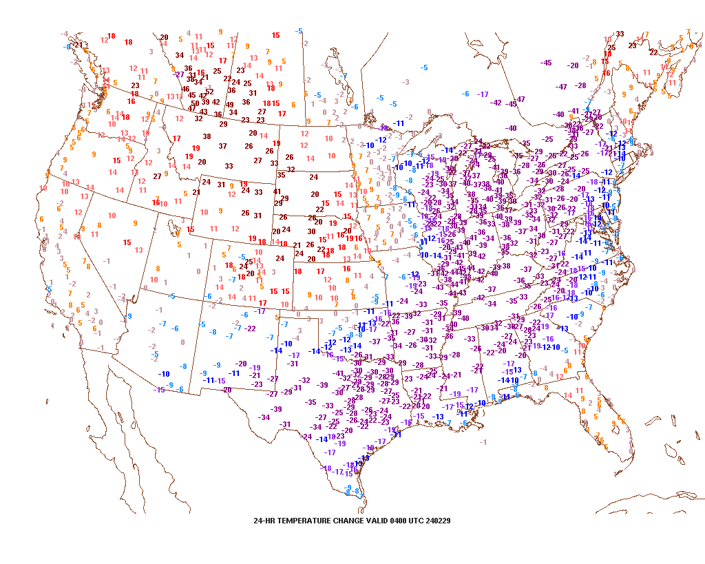
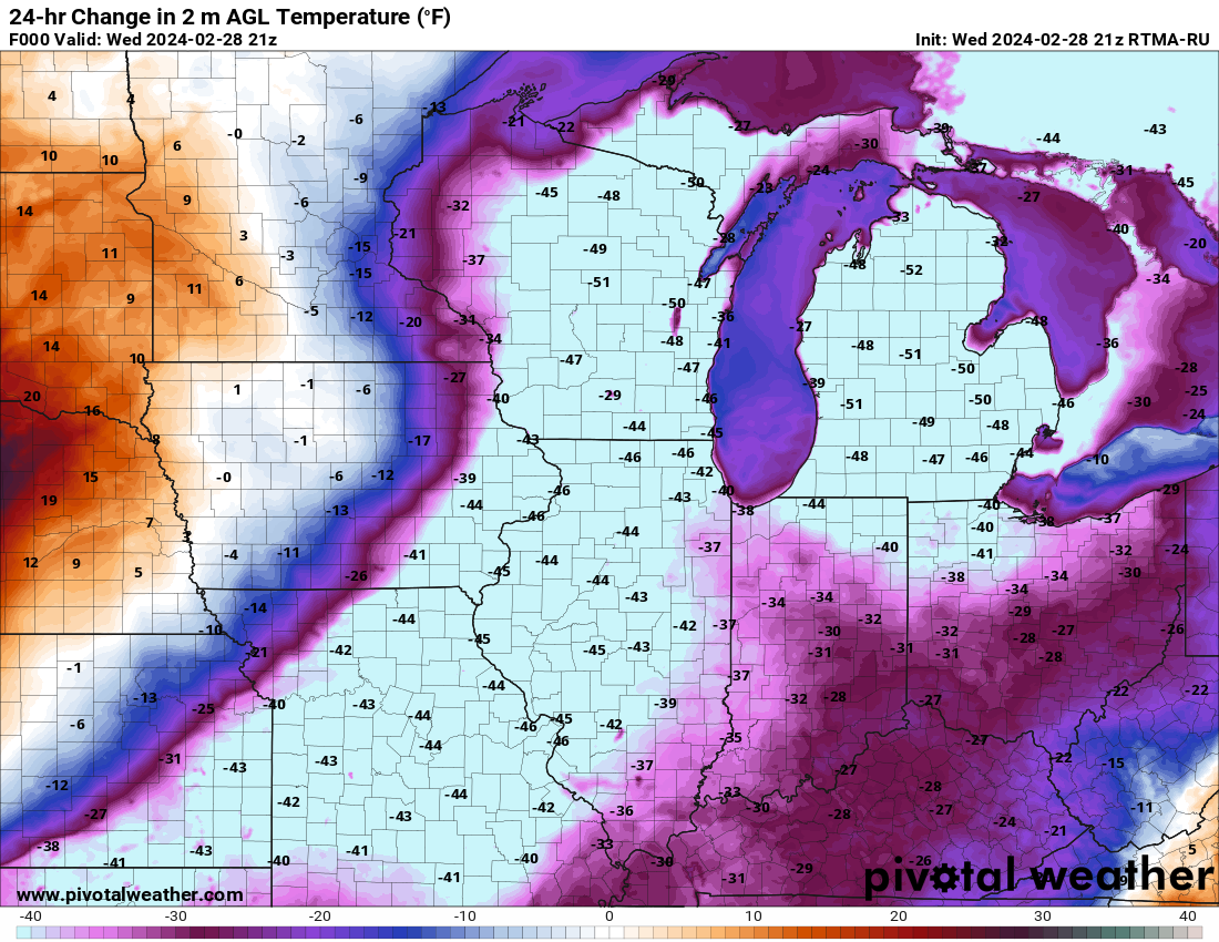
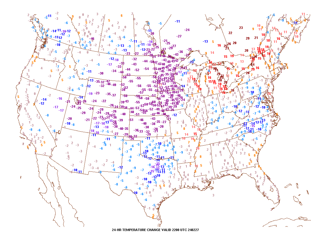
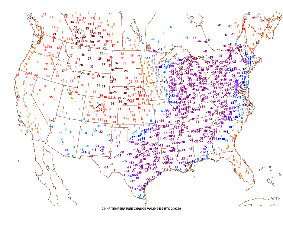
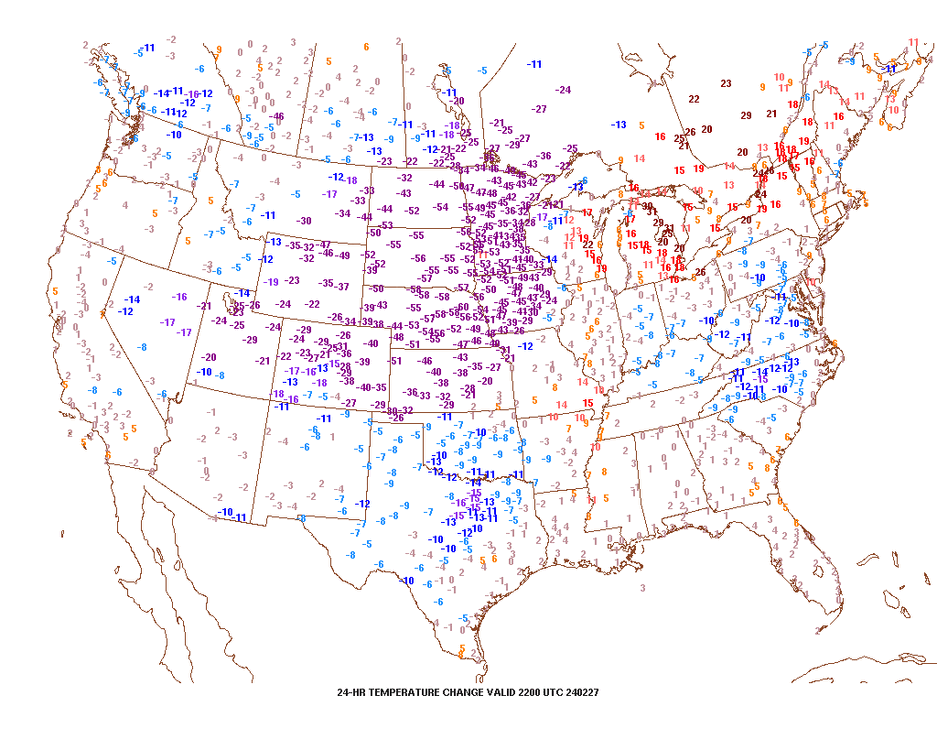
wow, didn't realize it got to 70 degrees north of Lansing. current 24 hour temp change. As for yesterday, I posted one of these that had a 60 degree temperature drop in Nebraska. For all I can remember, a value of 60 degrees downwards is close to the max I've seen in Wyoming and such areas.
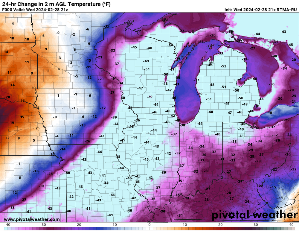
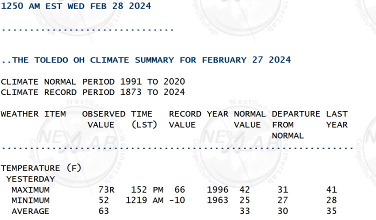
-
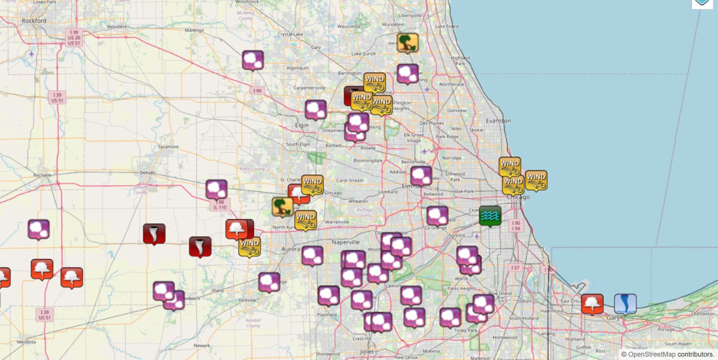
local storm reports (also including non-severe hail, non-severe wind) for Chicago
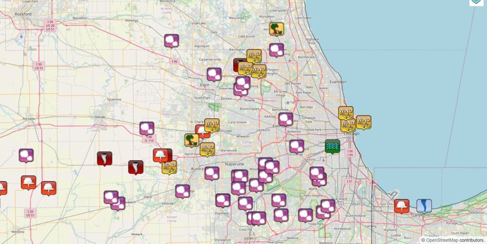
-
tornado debris signature was a few miles north of Marshall
-
seems to be a strong delta-v of about 125 mph
-
I don't have any memory of seeing lightning in February, but now I do.
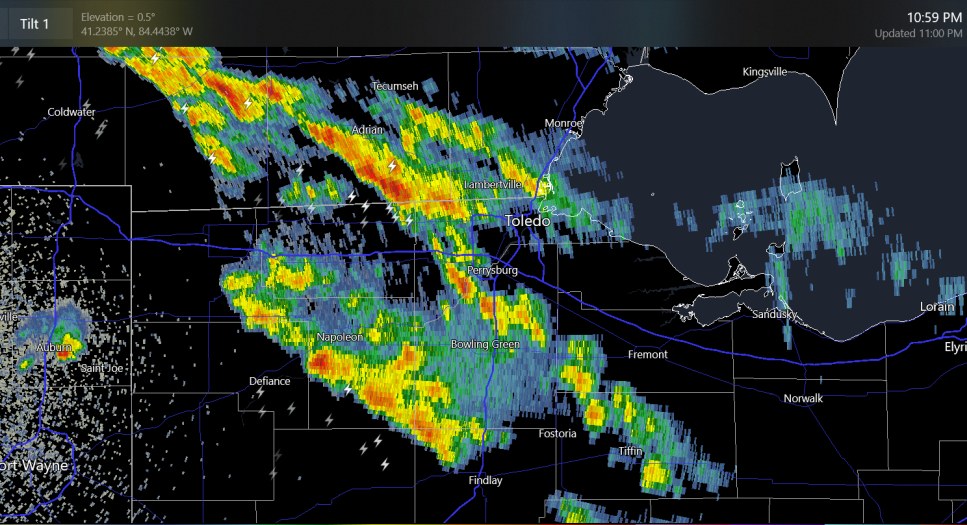
-
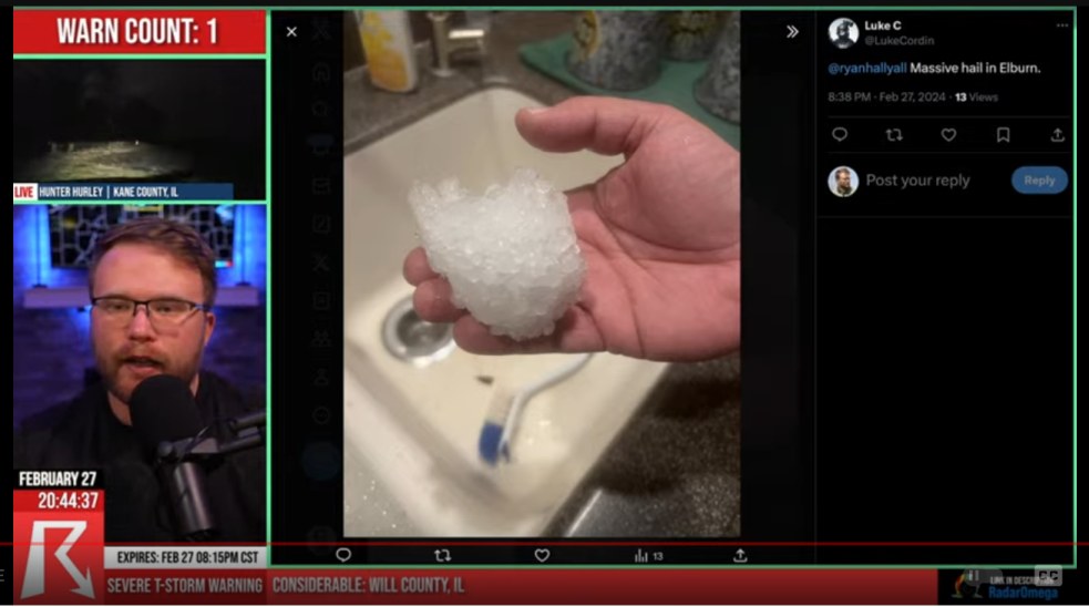
you know what? that looks fake, but it's tough to call out a random person on twitter.
-
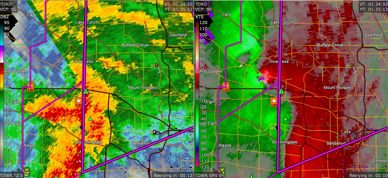
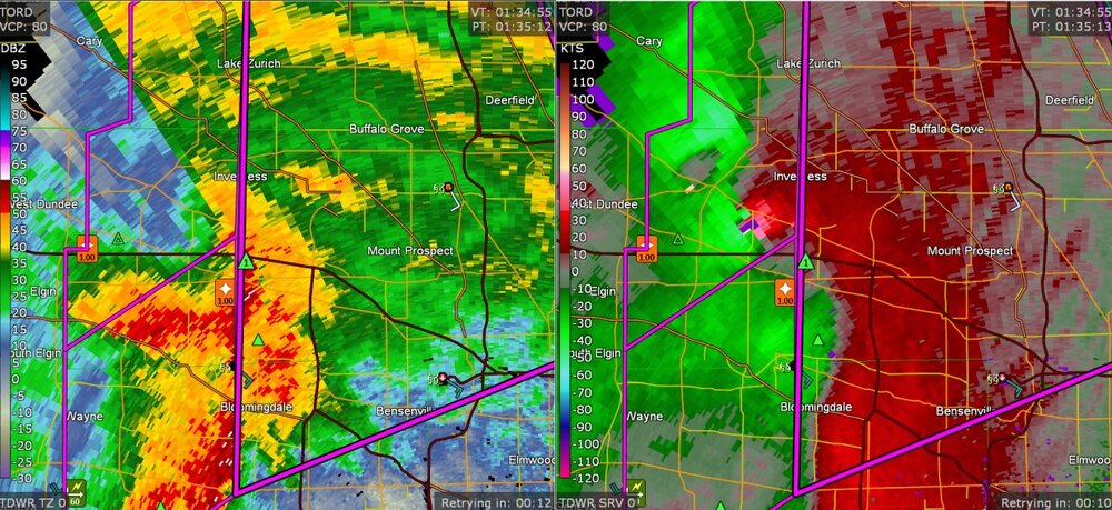
this is the "TORD" radar view of the Inverness tornado
-
anybody here see hail like this?
-
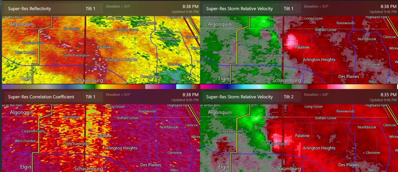
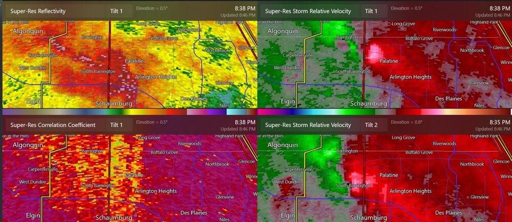
this may have been the best radar scan for the tornado at Inverness
-
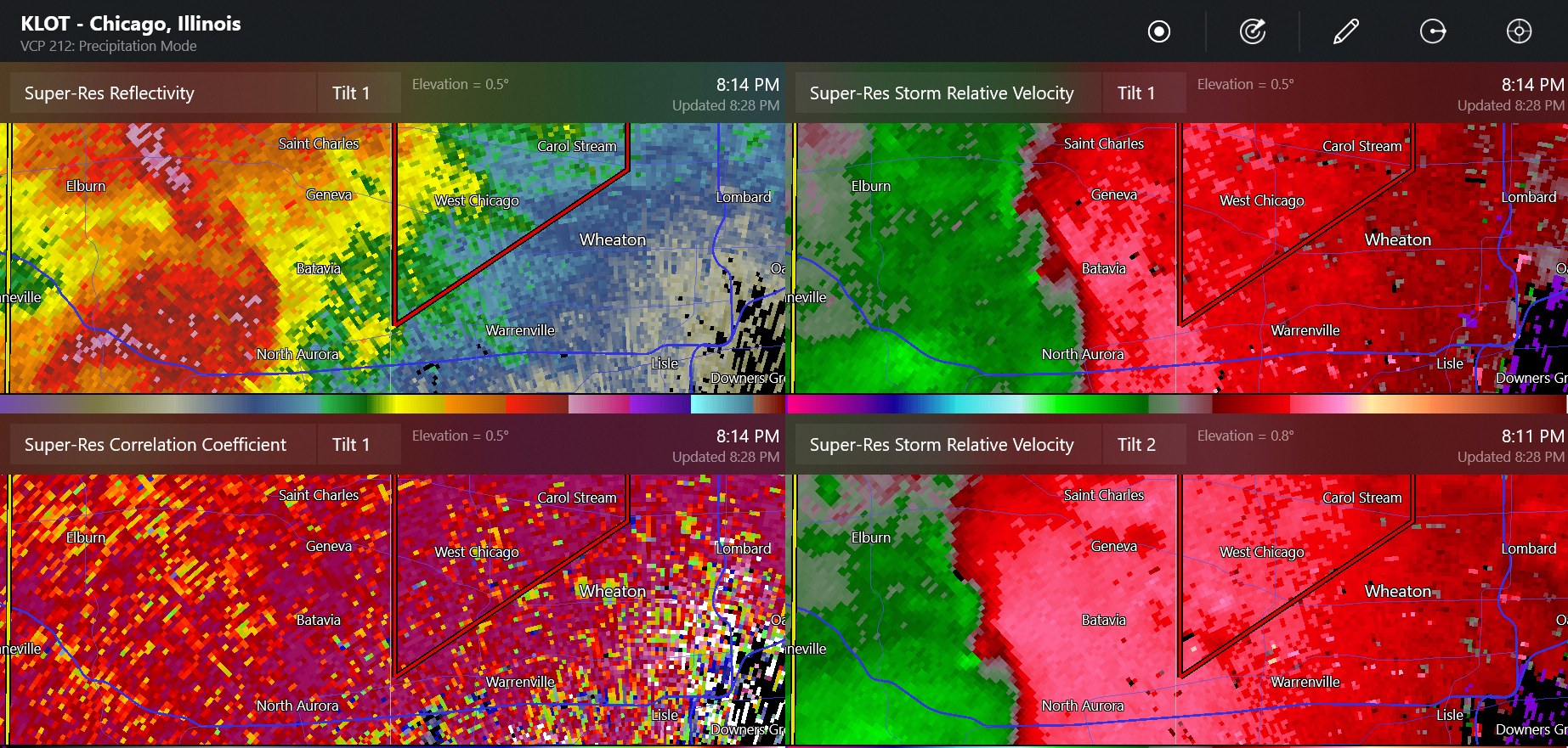
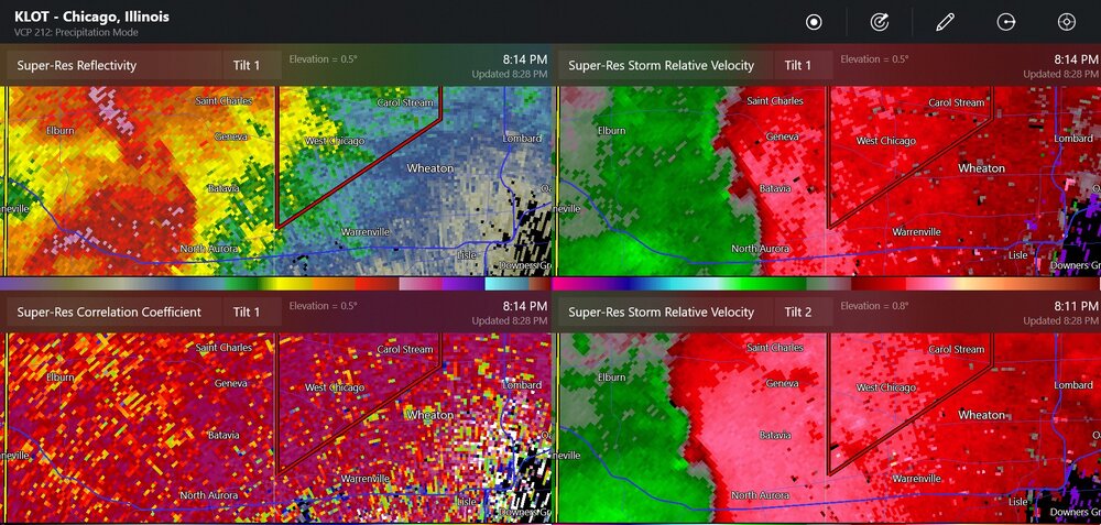
radar for possible tornado(es) at Geneva
-
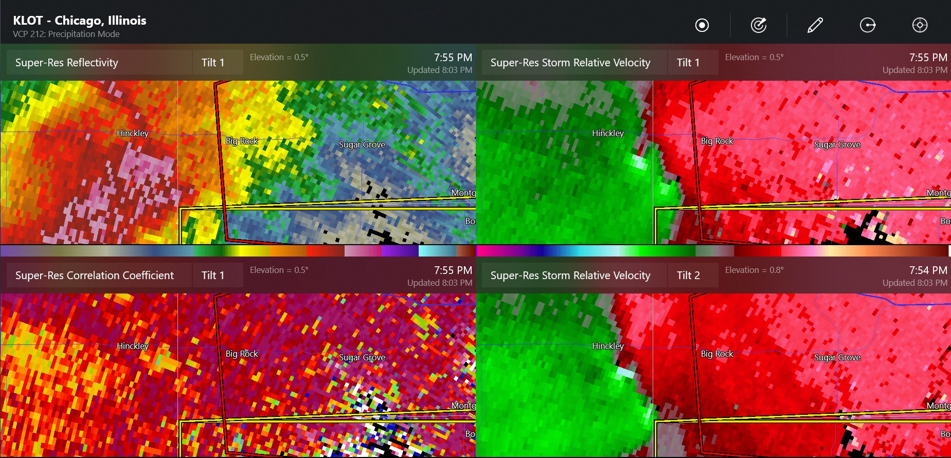
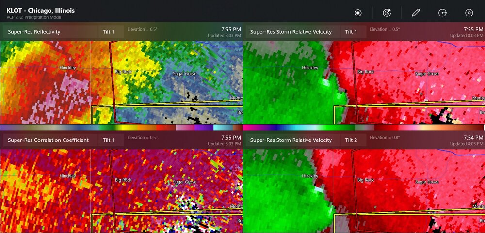
possible new confirmed tornado
-
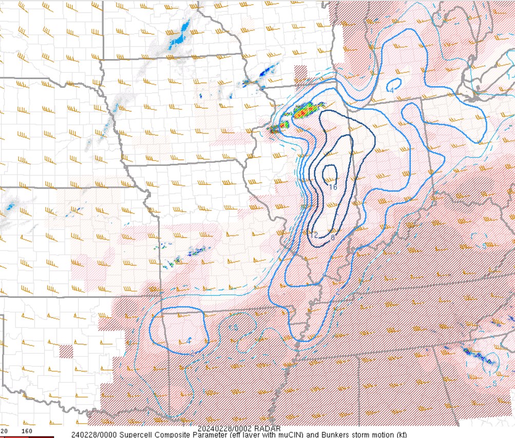
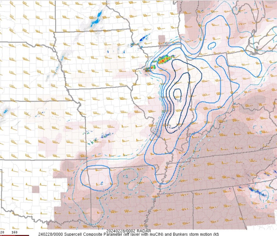
the supercell indices in February...
-
60 degrees colder
-
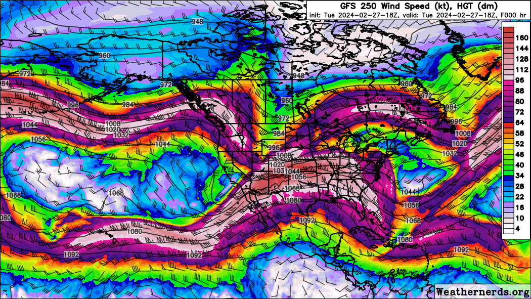
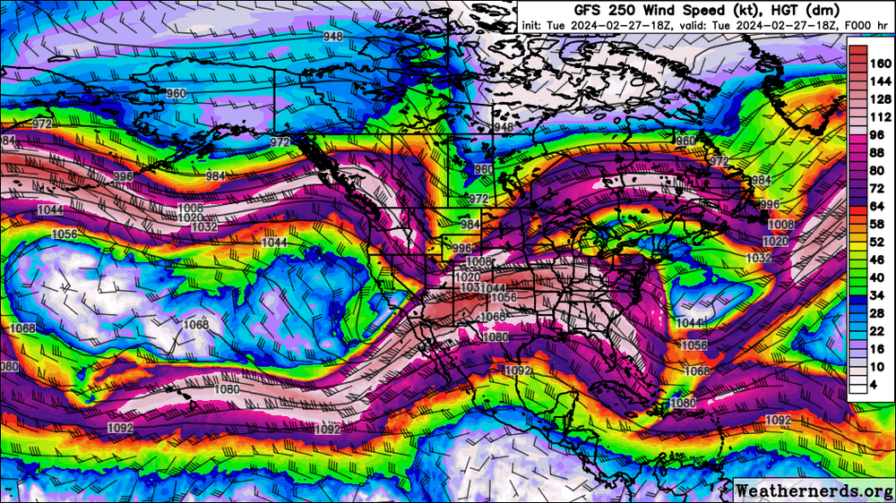
Now you can see the polar jet stream trough combining with the subtropical jet streak with lots of diffluence/divergence in the Midwest.
-
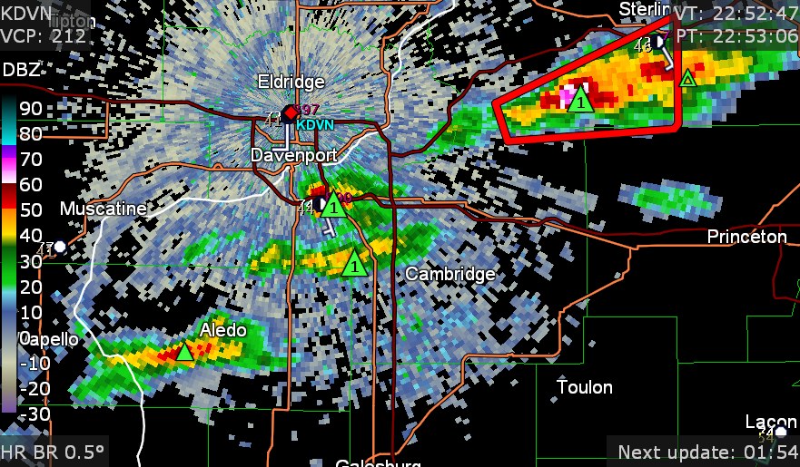
Grlevel3 already has hail information on the two new ones
-
Cyclone77 storm
-
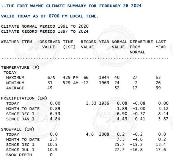
record high at Fort Wayne
-
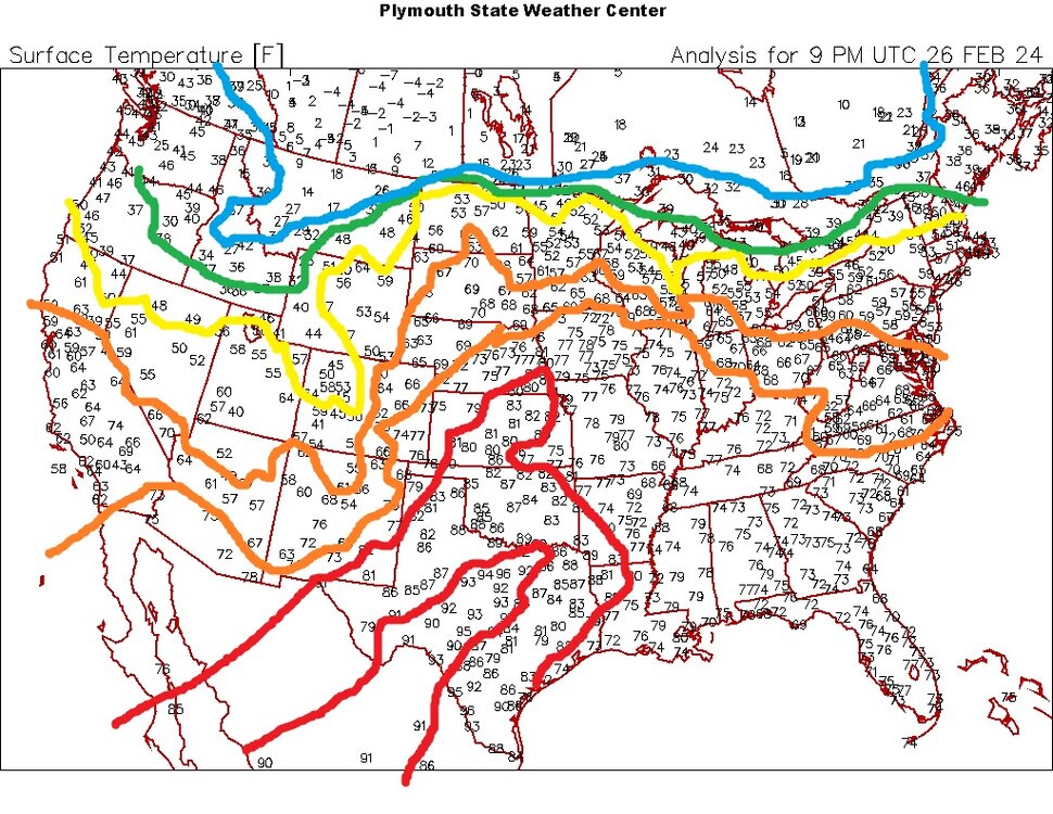
It's 96 in Texas
-
Mountain West Discussion- cool season '23-24
Chinook replied to mayjawintastawm's topic in Central/Western States
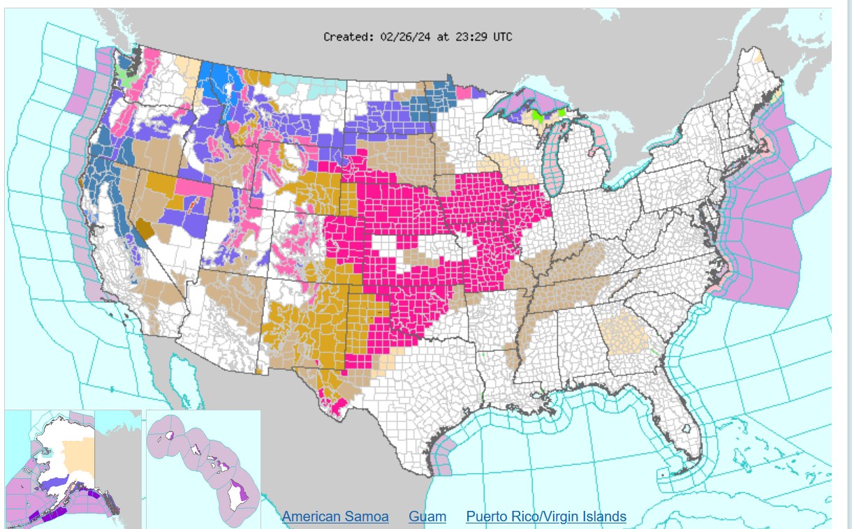
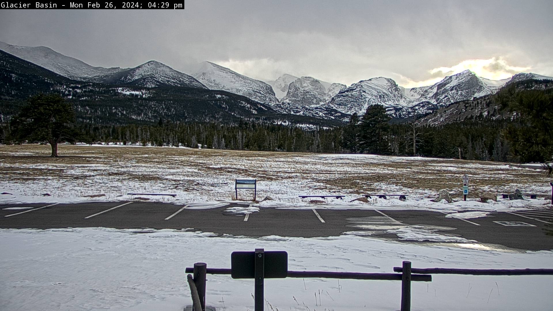
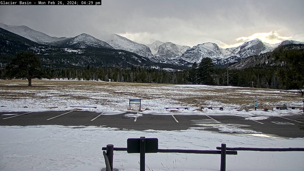
There are lots of watches warnings, and advisories. It is snowing, windy, or on fire. Maybe half the country is on fire. We are not sure.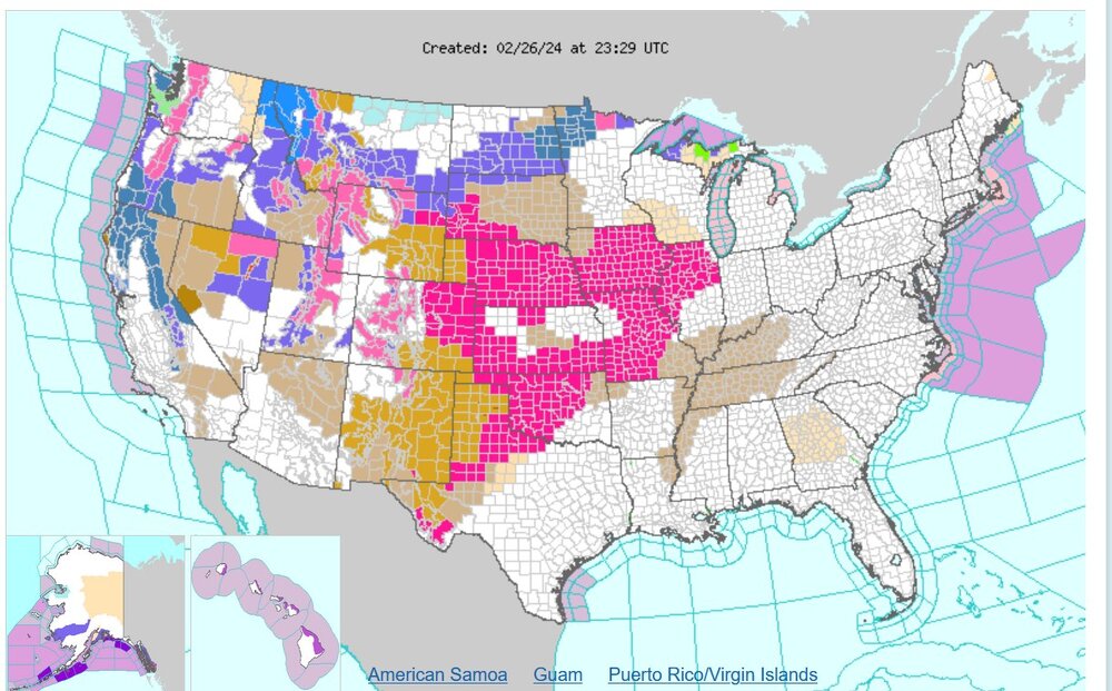
-
Mountain West Discussion- cool season '23-24
Chinook replied to mayjawintastawm's topic in Central/Western States
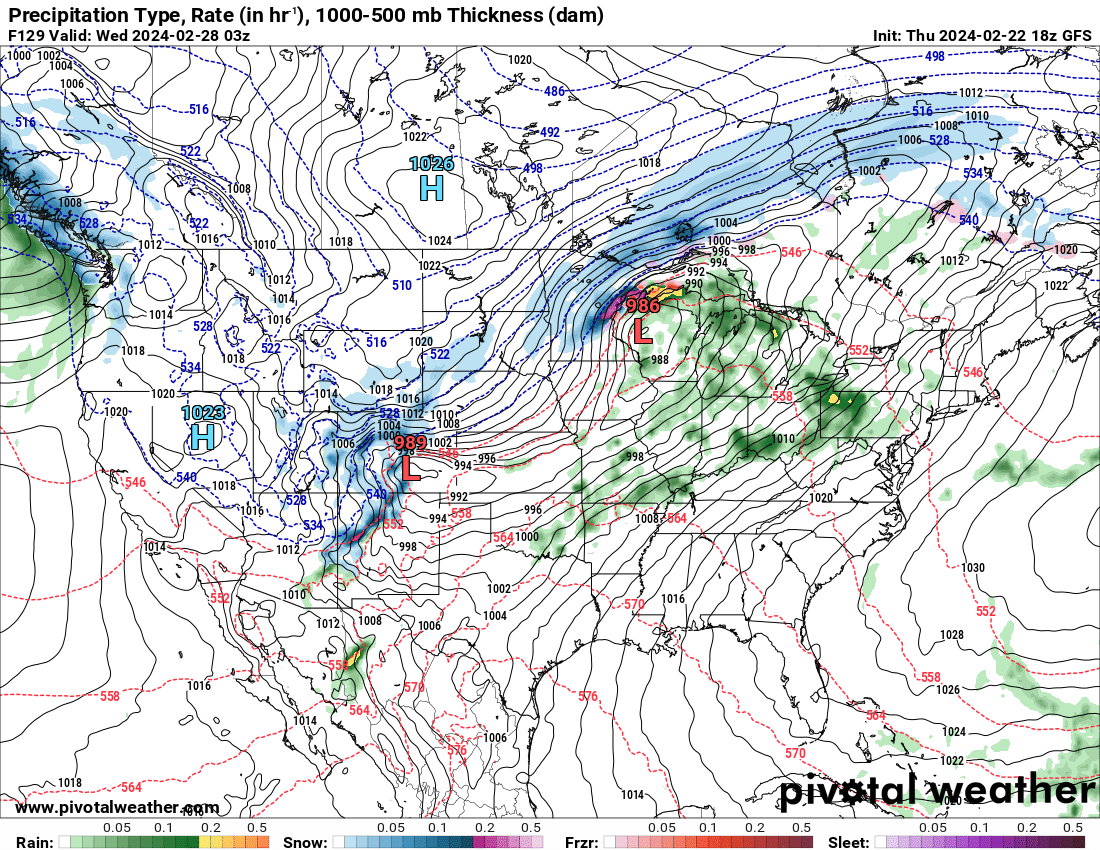
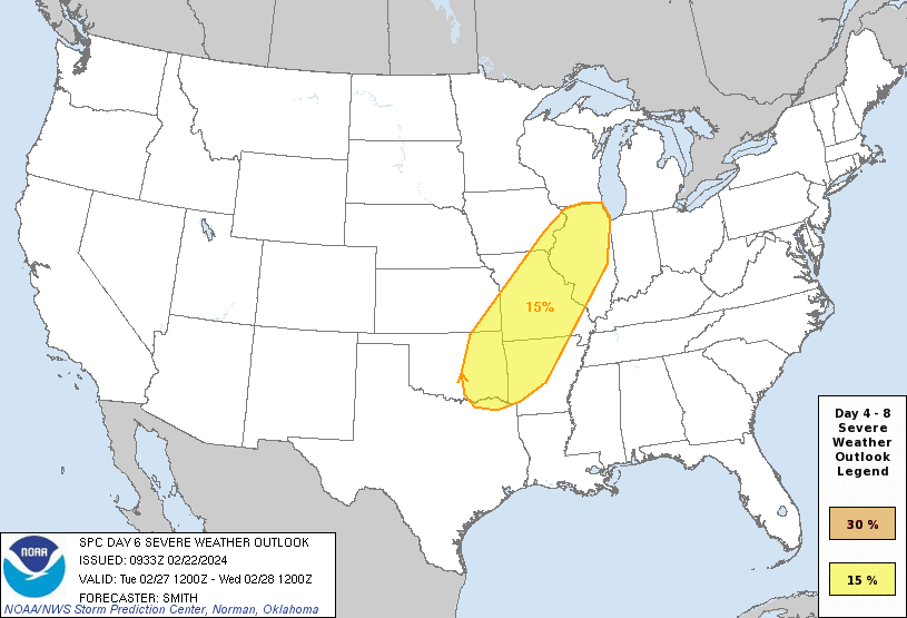
A large upper level trough will develop next week and one possibility is snow and cold temperatures in northern Colorado. The current models have a quick hit for the snow, but I suppose that could change. I think the trough may move too fast. On the severe weather side of things: The models have the 60 dew points from Texas into the Midwest. The SPC has given out an unusual Day-6 severe weather outlook, as shown. I figure the Illinois folks may eventually talk about this.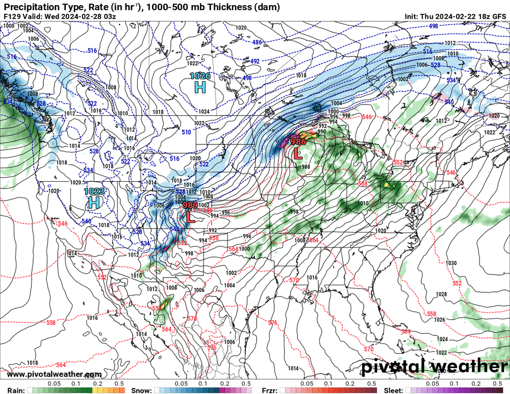
-
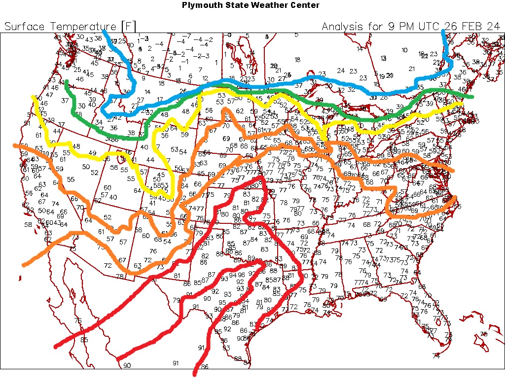
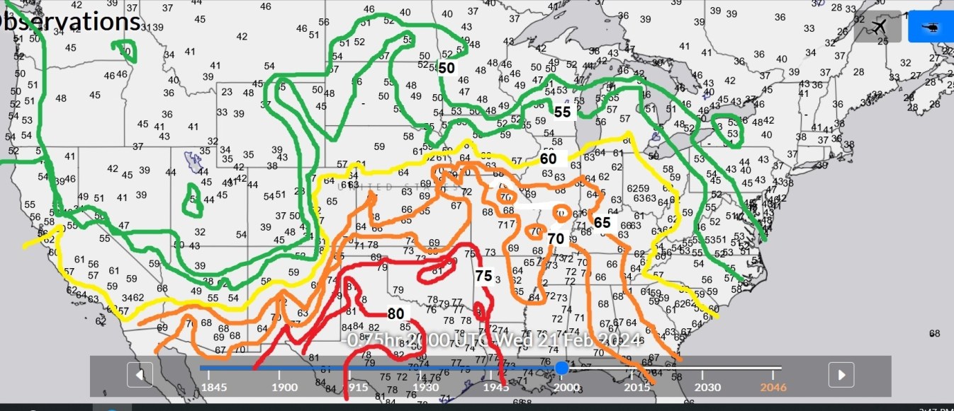
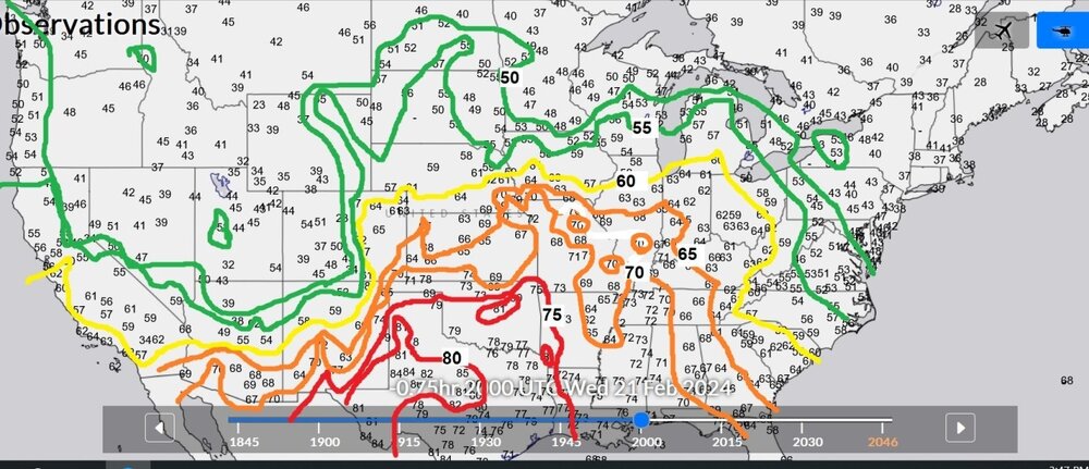
Here are the temps today at 20z, with contours from 50 to 80 highlighted. It feels nice to not be 30 and cloudy. I guess I might get cancelled by some snowlovers by saying that.
-
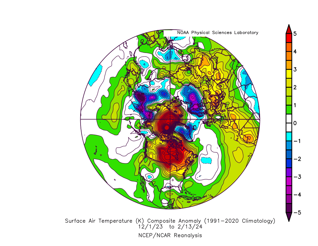
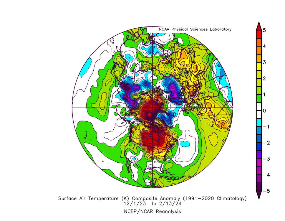
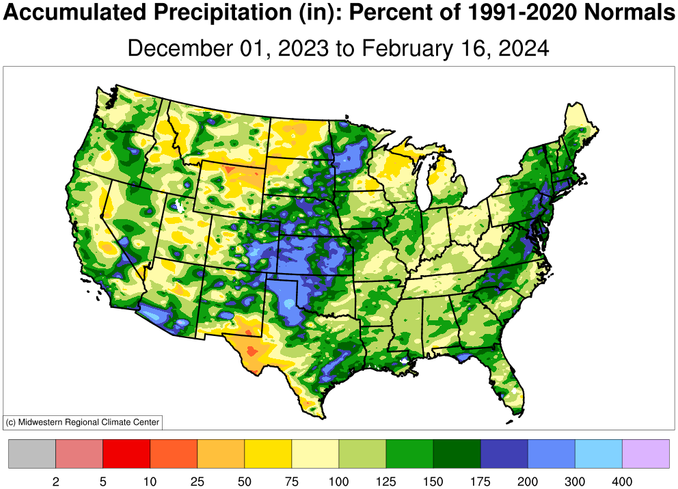
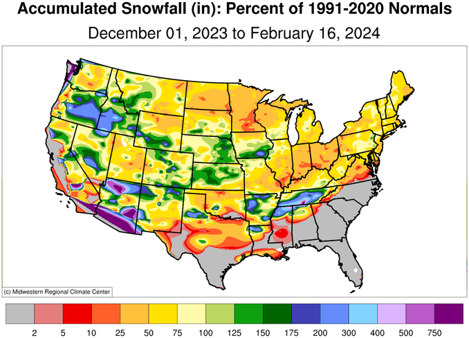
anybody getting cold this winter?
-
Mountain West Discussion- cool season '23-24
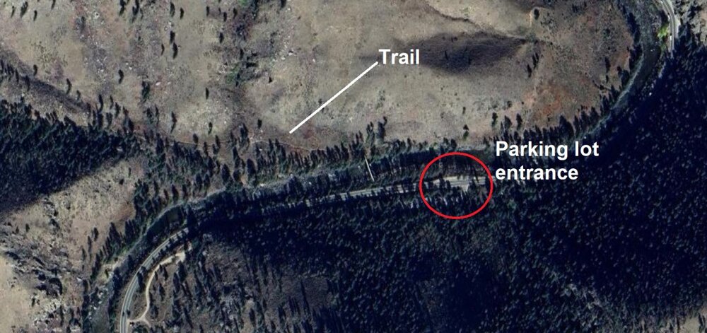
Chinook replied to mayjawintastawm's topic in Central/Western States
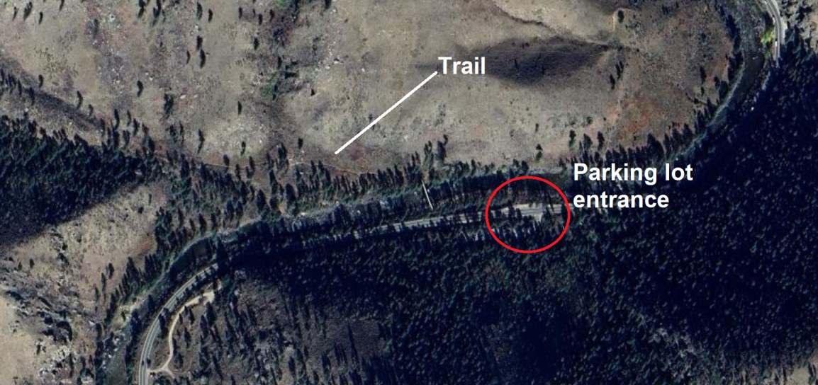
That sort of area always has an icy snowpack on the trail, as people walk on it and pack it down. I don't know if that helps. There's also another reason that I didn't go to Greyrock too much in the winter: the small parking lot has a mostly shaded area where you have to drive up a few feet. The slope may be icy. So, yes, you might get some icy stuff in exactly the places where you don't want. Hewlett Gulch has a road and parking lot that should be in the sun. Also, way less mountainous terrain at the trail. Still, might have some packed ice.