Chinook
-
Posts
10,674 -
Joined
-
Last visited
Content Type
Profiles
Blogs
Forums
American Weather
Media Demo
Store
Gallery
Everything posted by Chinook
-
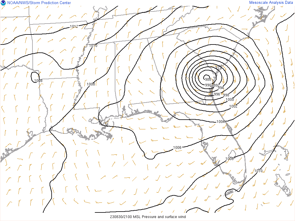
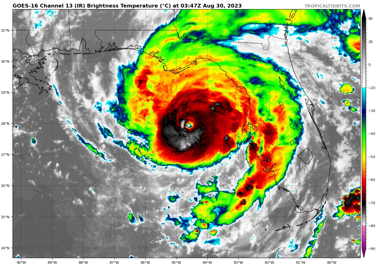
This isn't very circular very more. Rectangular hurricane. Honestly I said that because the gap in the observations is a long rectangle. Well anyway, 988mb is still pretty low but believable as it has gone up about 48mb as a result of landfall and convergence.
-
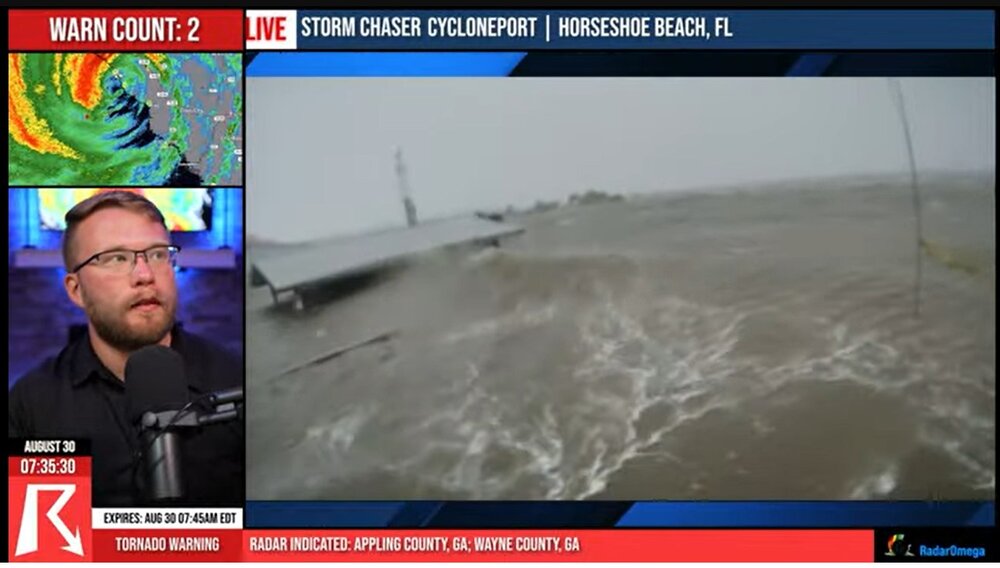
screen capture from Ryan Hall, with this wave at the roof of a small pavilion
-
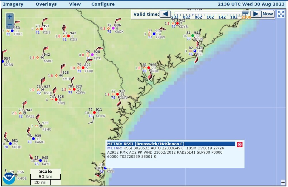
957.6mb measured, as the conversion of 28.28" on the altimeter
-
The hurricane must have gone very close to this buoy, but maybe not right on. Quick calculation says that this measured 972.5 mb.
.png.fe6158b475fa893b1464f3120e6a043e.png)
-
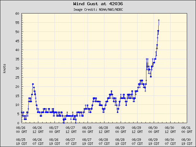
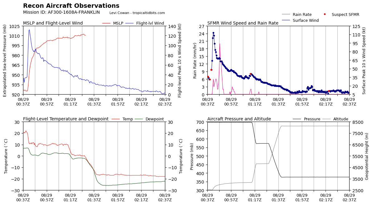
I wanted to post these before I fall asleep. The recon got over 101 kt at flight level, for three passes as shown on the time series. The last two passes show some asymmetry. One buoy north of the storm says (39 kt) 45mph gusting to (56 kt) 65mph (that's buoy 42036). So you might check this in about 1-2 hours to see if the buoy picks out the highest wind speeds or lowest pressures.


.thumb.png.1c1fd2b4ce00fcc24f88a7ebc1c7f5c1.png)
.png.58c72740e3086834ff90a8a0e785a73f.png)
-
tropical tidbits says the recon is still in progress. It seems like it has been going on since 8PM or something
-
recon says 957.6mb on the minute-by-minute plot
-
it says 960.6 on the minute-by-minute recon obs zoom-in as shown on Tropical Tidbits
-
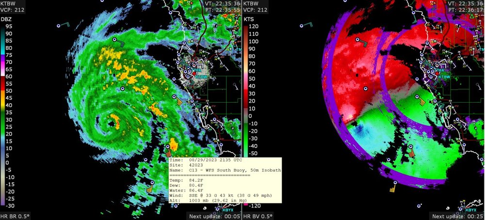
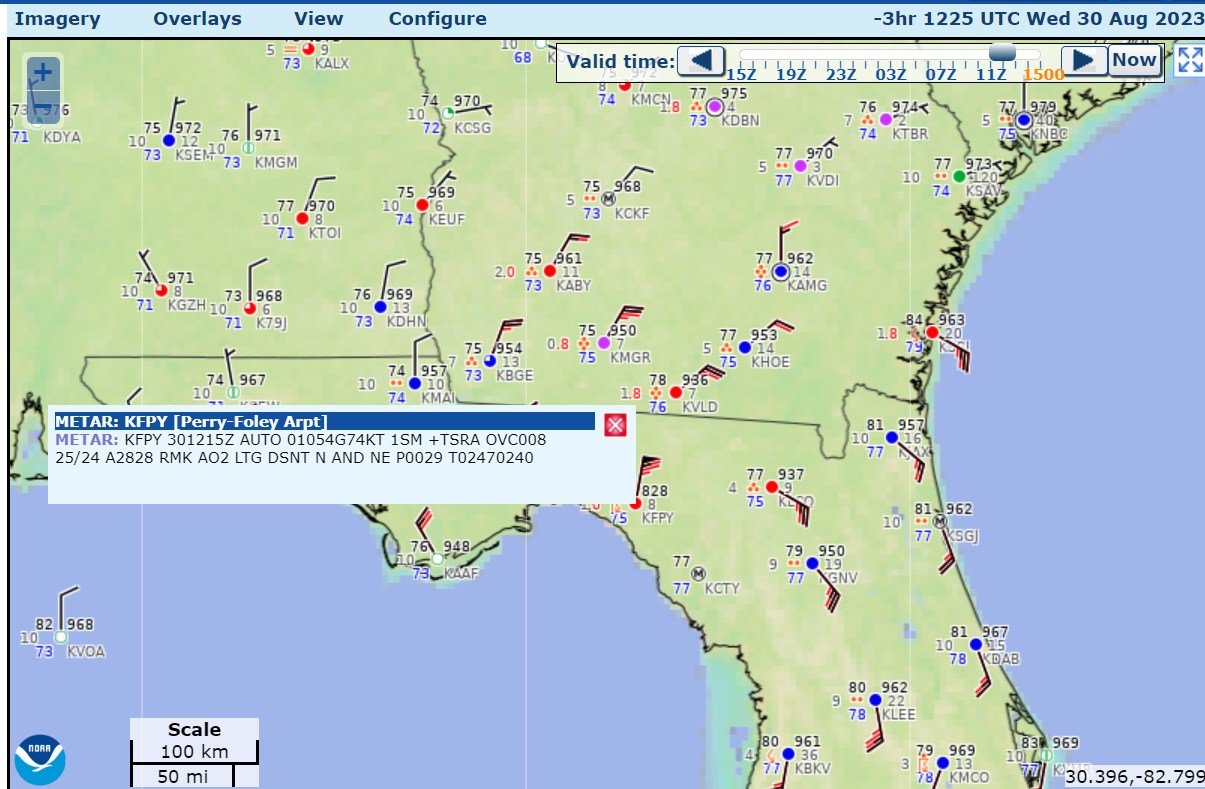
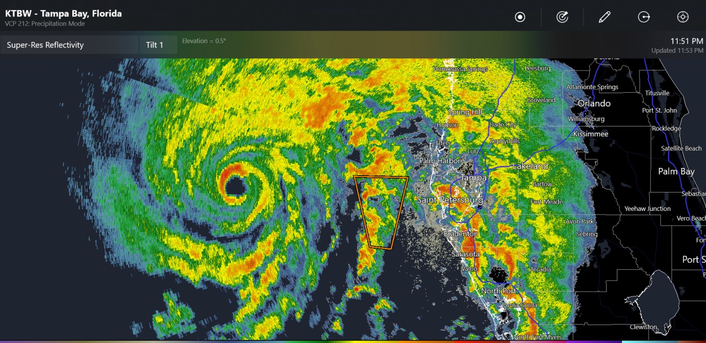
Here is the radar image, showing wind gusts measured up to 49mph in the last hour. Maximum radar base velocity of 87kt toward the radar and 69kt away from KTBW.
-
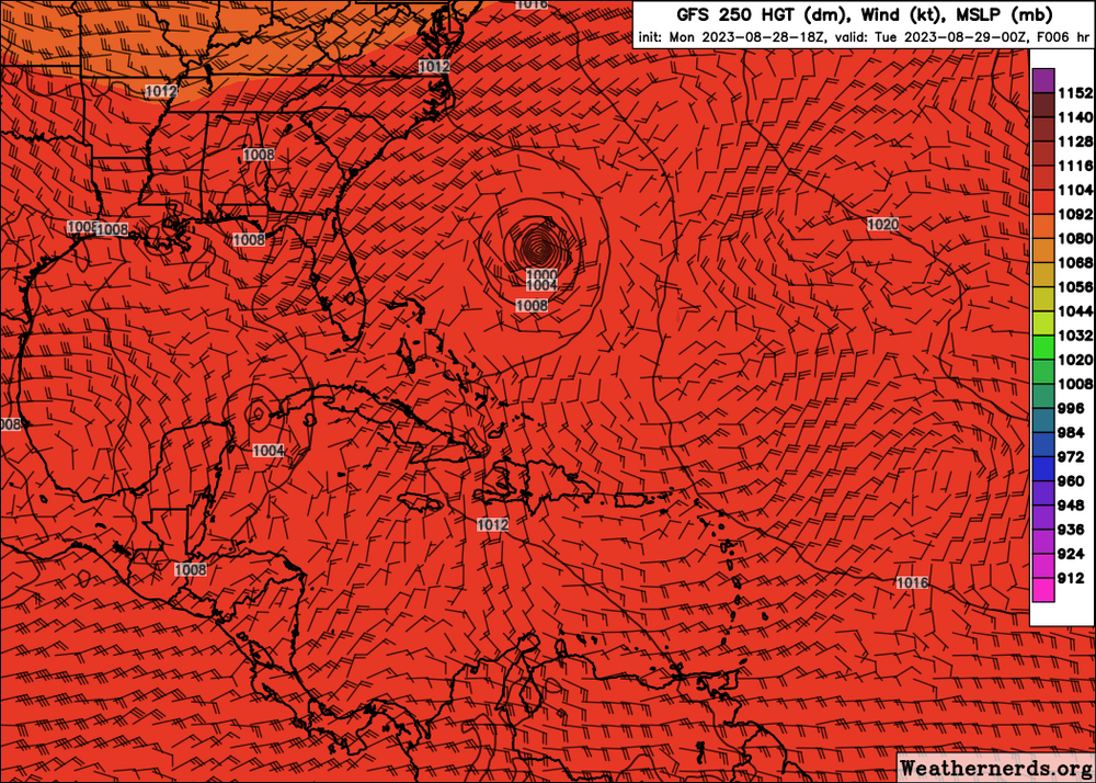
GFS 250mb winds (barbs) 250mb height (just the colors, that's pretty much all red) and MSLP (black contours)
-
Wow! It's 927mb as shown with the tropical tidbits graphic w/satellite. That is a low pressure. The tail end of the recon pass says 130kt approximately at flight level (Previously posted by Windspeed: early part of the recon pass) and maybe 113kt at surface. At some points in history, we have seen storms with category-5 status with pressure close to 920mb and below. Thanks BostonBulldog for posting incredible graphic that says 140kt briefly.

-
Here is an animation of the contoured of the heat index at 21z for the entire Midwest heat wave.
-
Low clouds hanging around in Forest Canyon
.thumb.jpg.5b362f29ae08104850eb3db50a93589b.jpg)
-
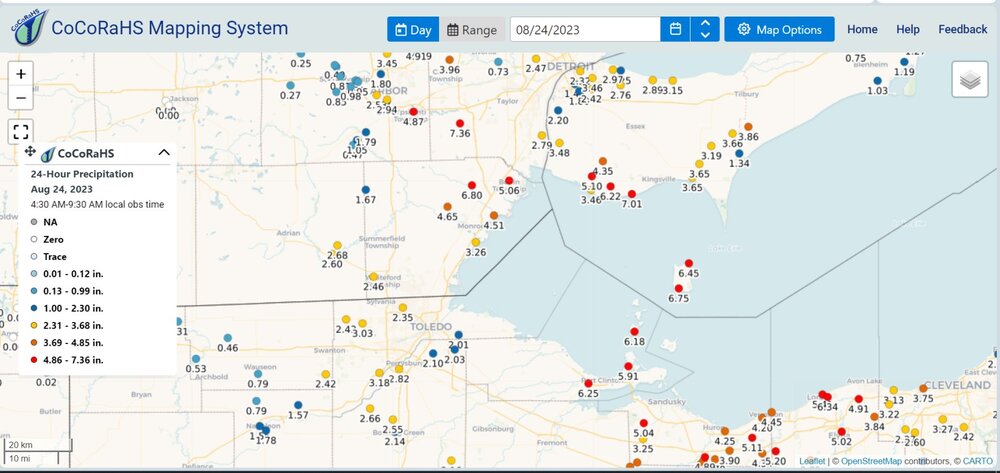
Today was, thankfully, a very normal day with partial clouds. It topped off at 82 with a dew point of 64. Yesterday was almost entirely cloudy and in the upper 70's for the high. The sunset tonight has some pink cirrus clouds and some gray cumulus clouds that are kind of blocking me from seeing the sunset. Also note: Toledo CoCoRAHS reports got 3.09" to 3.85" over 48 hours this week. I was able to stay up to watch a lot of lightning on the second one.
-
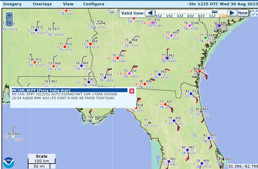
recent recon data says up to 73-74 kt at flight level, and something like 70-72 kt at surface level, sea level pressure 977mb
-
Fort Collins got 0.8-0.9" from last night. That's pretty heavy, considering it's just past the end of what I would call the monsoon. Comparatively, my place in Toledo beat Fort Collins this week, with rainfall and exciting late-night lightning. We need this stuff for the corn. I was missing the lightning for a lot of June when Fort Collins was getting way more rain.
-

2023 Short/Medium Range Severe Weather Discussion
Chinook replied to Chicago Storm's topic in Lakes/Ohio Valley
here's the radar from Cleveland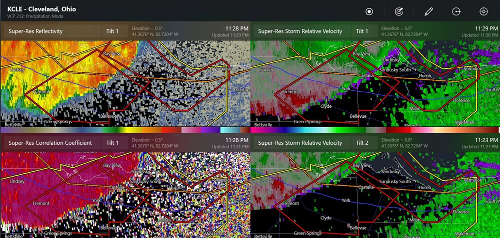
-
2023 Short/Medium Range Severe Weather Discussion
Chinook replied to Chicago Storm's topic in Lakes/Ohio Valley
marginally severe wind gust to Lambertville (Toledo) also power lines down -
2023 Short/Medium Range Severe Weather Discussion
Chinook replied to Chicago Storm's topic in Lakes/Ohio Valley
winds in the 40 knot range
-
2023 Short/Medium Range Severe Weather Discussion
Chinook replied to Chicago Storm's topic in Lakes/Ohio Valley
I think there are three rotations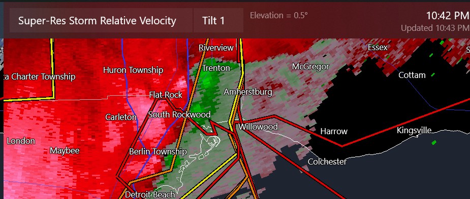
-
2023 Short/Medium Range Severe Weather Discussion
Chinook replied to Chicago Storm's topic in Lakes/Ohio Valley
actually a new rotation almost on top of Eureka Rd, which is the southern end of the airport -
2023 Short/Medium Range Severe Weather Discussion
Chinook replied to Chicago Storm's topic in Lakes/Ohio Valley
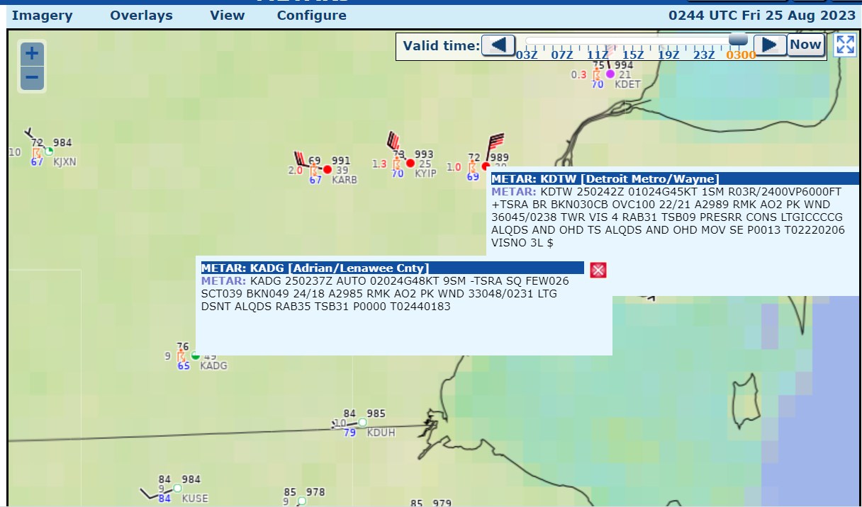
this is about 1 mile from DTW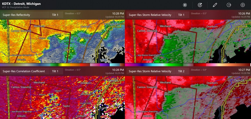
-
2023 Short/Medium Range Severe Weather Discussion
Chinook replied to Chicago Storm's topic in Lakes/Ohio Valley
that's tornado debris for sure -
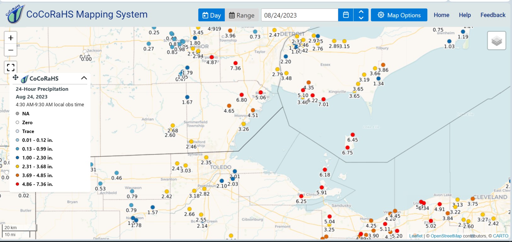
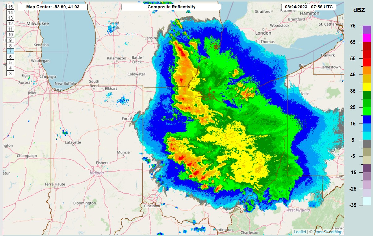
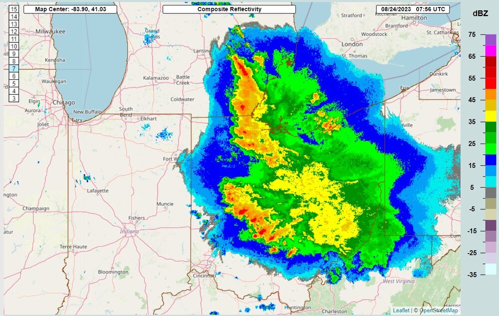
This group of storms hit my place hard at 0756z apparently, and moved west, slowly, and weakened. Toledo area got 2-3" . Areas west of Toledo had much less rainfall. The newest HRRR run shows the cap breaks big time in Michigan from hour 5 to hour 6.
-
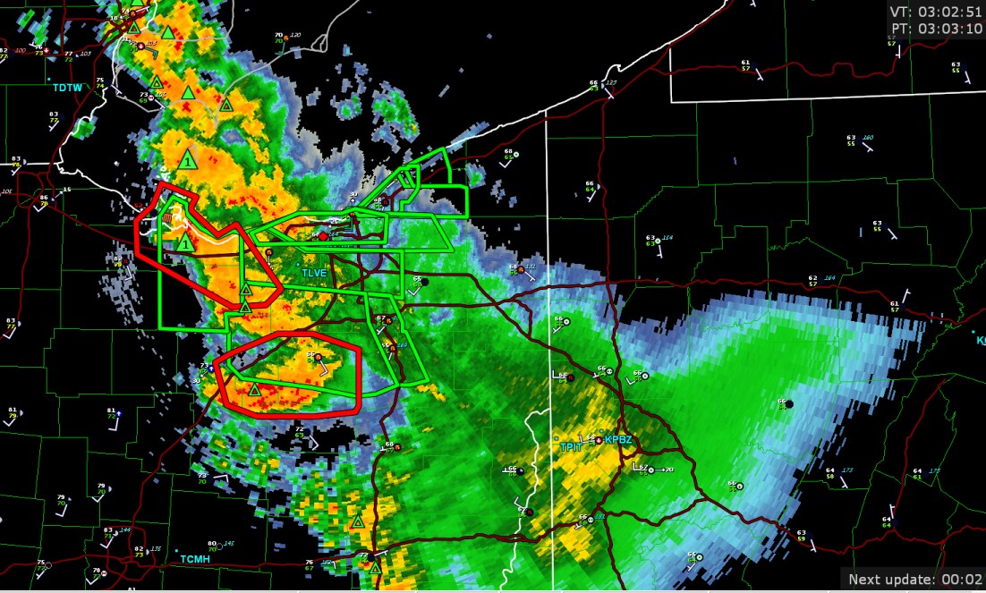
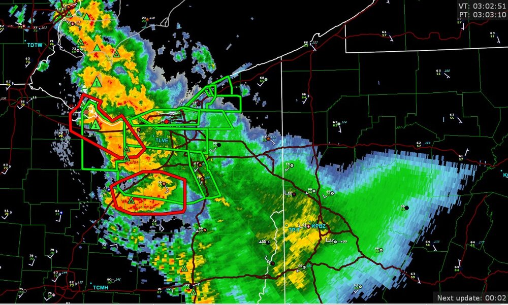
now, a tornado warning near sandusky


.png.d06184e871b76a224cbd7eebcaebc587.png)


.jpg.f77d664dd1f413bd921e8d76dc83e83f.jpg)