Chinook
-
Posts
10,674 -
Joined
-
Last visited
Content Type
Profiles
Blogs
Forums
American Weather
Media Demo
Store
Gallery
Everything posted by Chinook
-

Did Someone Say Clipper(Hybrid)!?! 1/18-1/19
Chinook replied to Frog Town's topic in Lakes/Ohio Valley
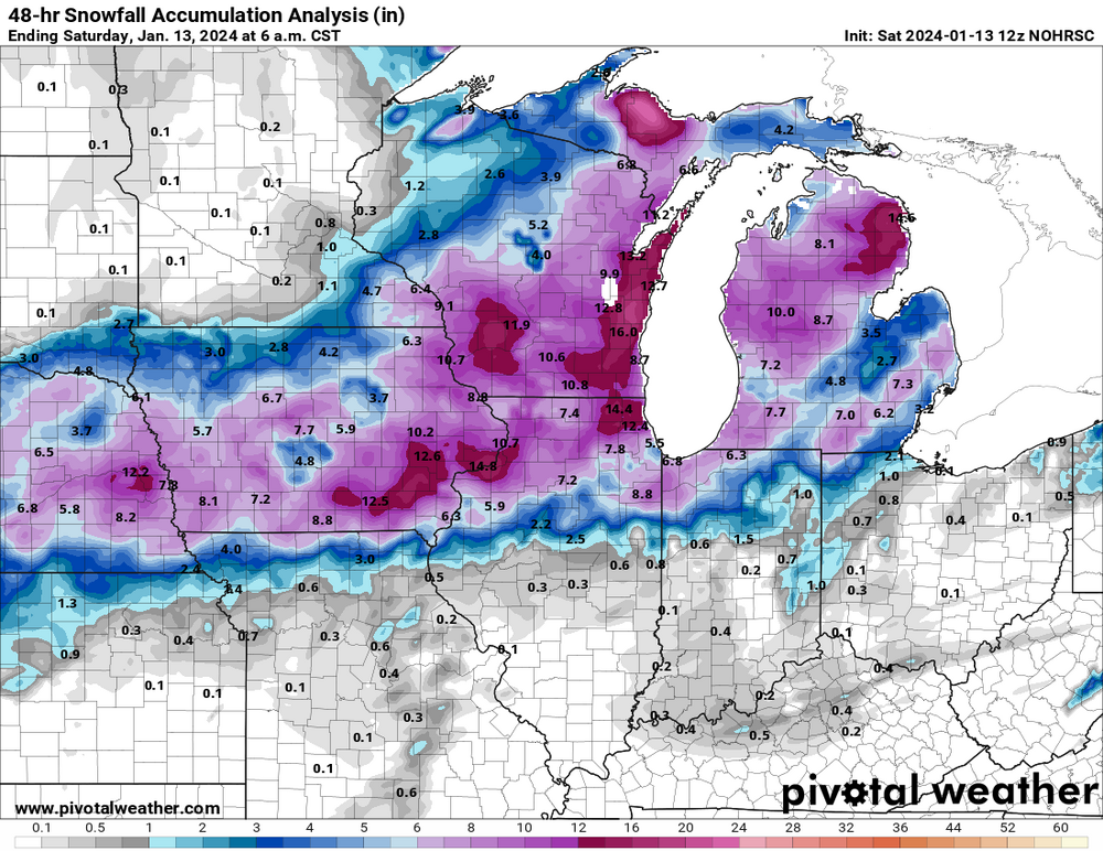
Here's the newest NWS snow map, which is sort of non-continuous around Toledo. It's much higher than the approximately 1" that last night's models were saying.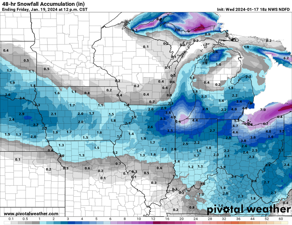
-
Mountain West Discussion- cool season '23-24
Chinook replied to mayjawintastawm's topic in Central/Western States
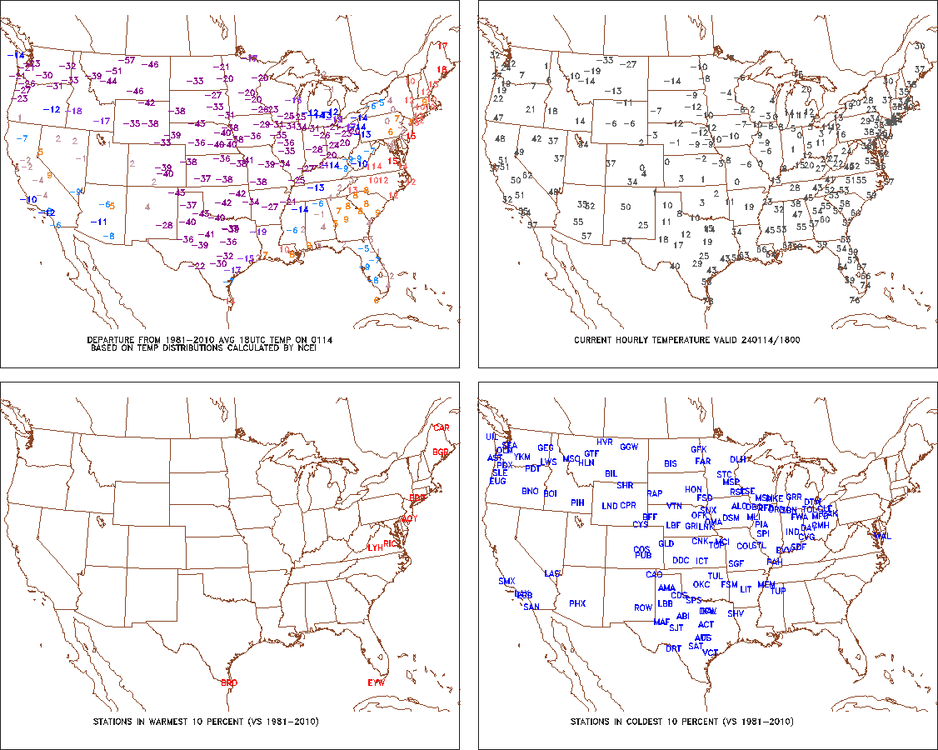
you guys were off the bottom end of the color-bar in January.
-
January 15th-17th 2024 Arctic Blast/Snow Event
Chinook replied to John1122's topic in Tennessee Valley
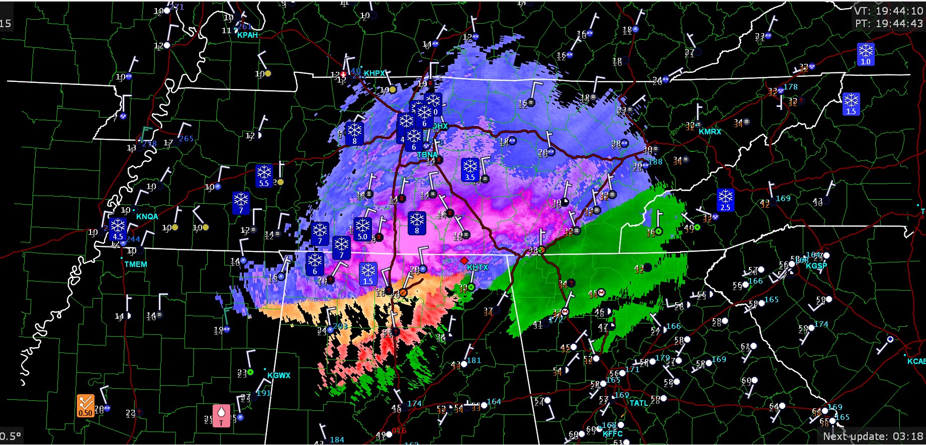
impressive amount of snow in the south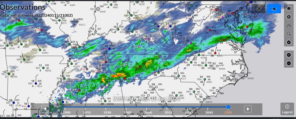
-
Mountain West Discussion- cool season '23-24
Chinook replied to mayjawintastawm's topic in Central/Western States
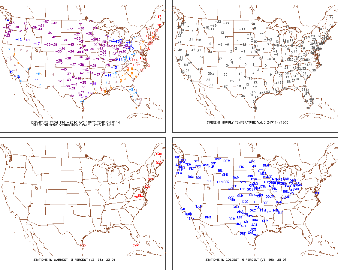
when -57 is a number that's not in Siberia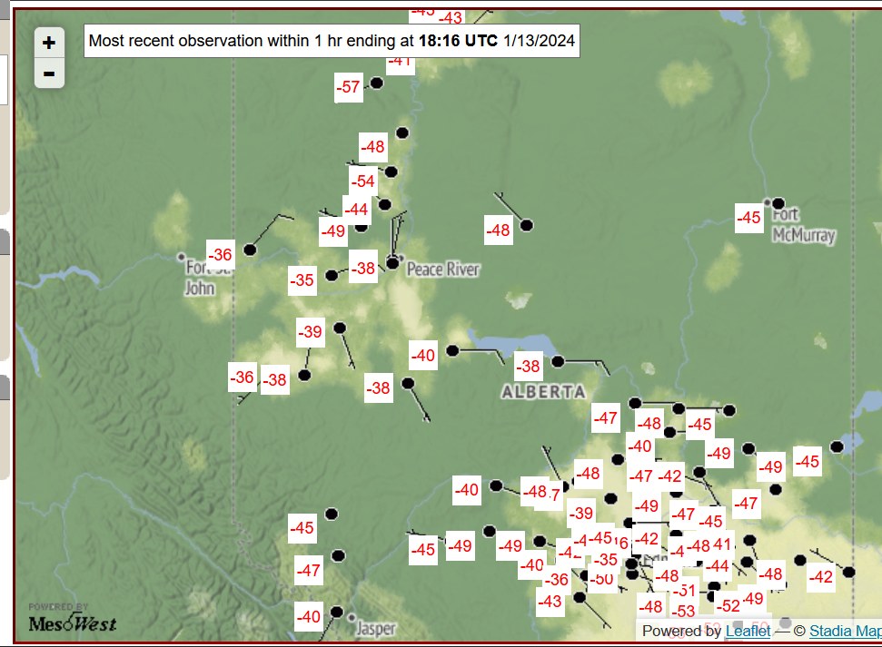
-
Mountain West Discussion- cool season '23-24
Chinook replied to mayjawintastawm's topic in Central/Western States
Here is what I was talking about with the Portland area, intermountain area snow, up to and including RMNP
-
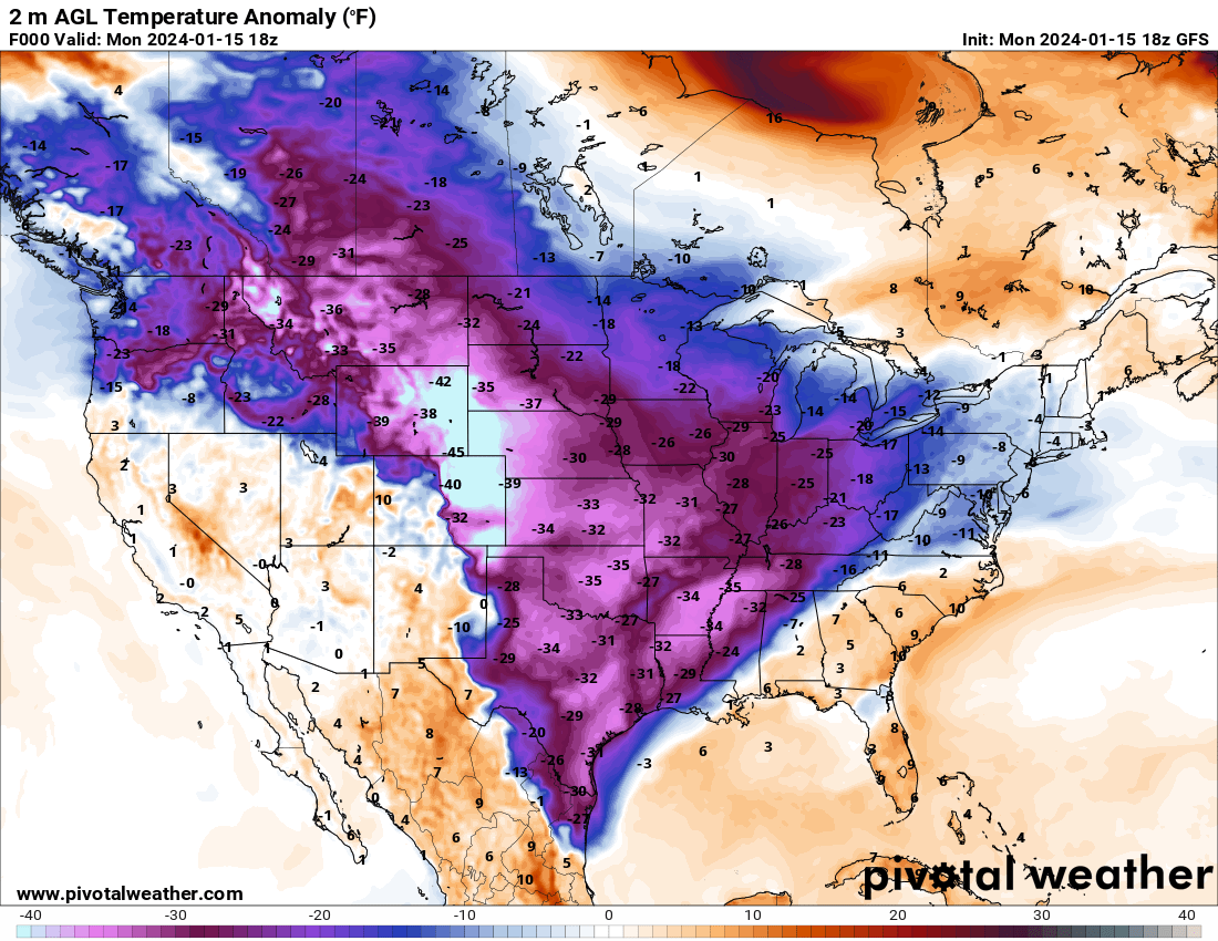
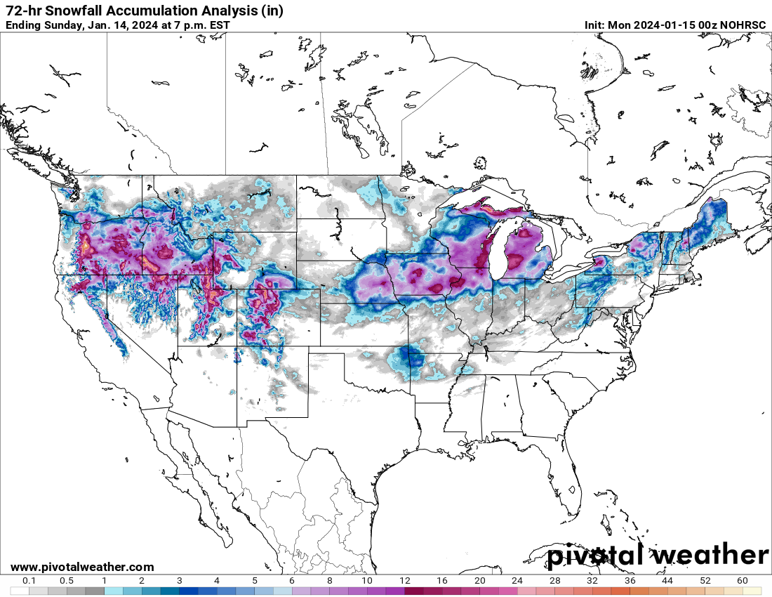
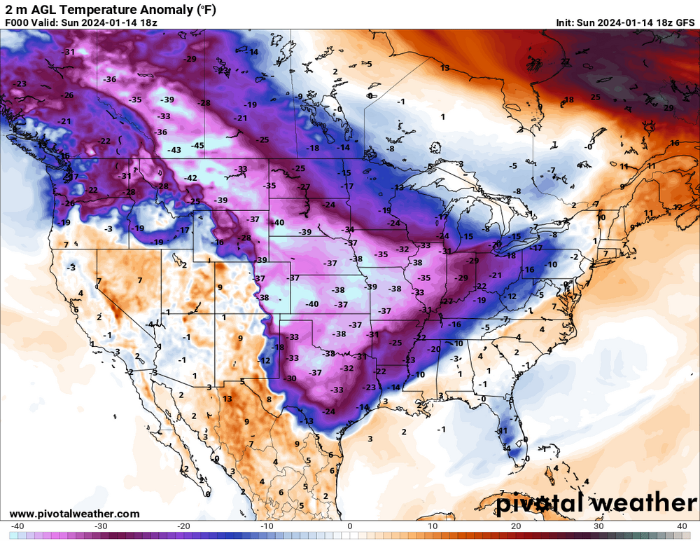
This has been pretty historic in the sense that you don't see a lot of -40F to -50F in North America, outside of Alaska. Also some large snowfall values from Oregon (also freezing rain there) to Idaho, Utah, and Colorado (in addition to what we've been discussing here)

-
January 15th-17th 2024 Arctic Blast/Snow Event
Chinook replied to John1122's topic in Tennessee Valley
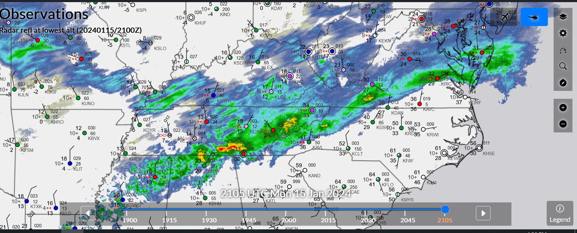
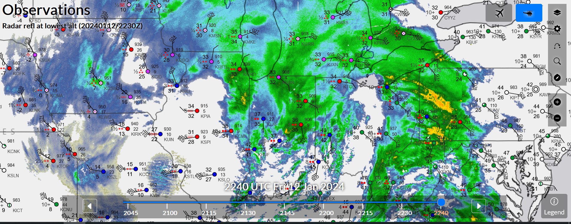
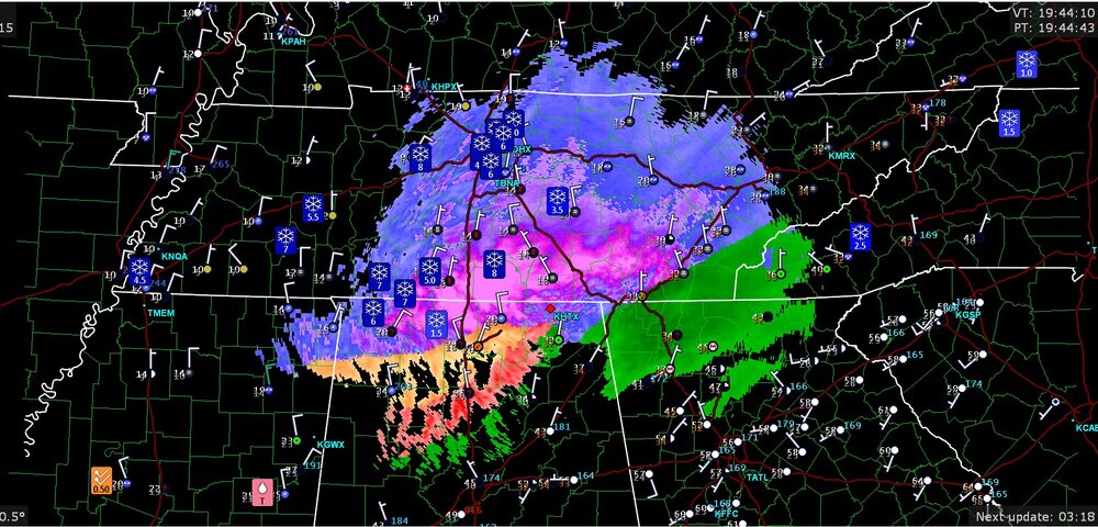
Nashville area: snow picking up to light but steady values, considering this radar and 1.5 mile visibility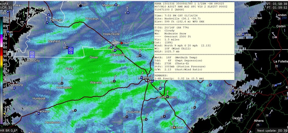
-
Mountain West Discussion- cool season '23-24
Chinook replied to mayjawintastawm's topic in Central/Western States
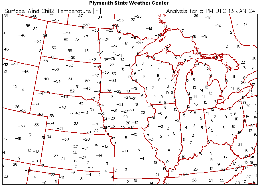
This is one of the nastiest storms that I could think of stretching from Portland well into the Snake River Valley, neither of which commonly have heavy winter precipitation. You can see rain, freezing rain, sleet, and snow on this map. Near zero degree temperatures east of the Cascades is uncommon, especially with these wind chills below zero with the 10mph-20mph winds.
-
I wonder if updated versions of this data set will include realistic spotter reports of.. well, maybe, however much you think Kankakee got.
-
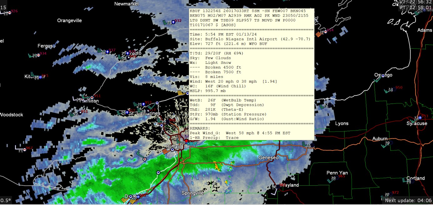
The super band has shifted a little bit from earlier in the day-- the buoy offshore has wind gusts to 46mph, and Buffalo airport to 58mph (severe level)

-
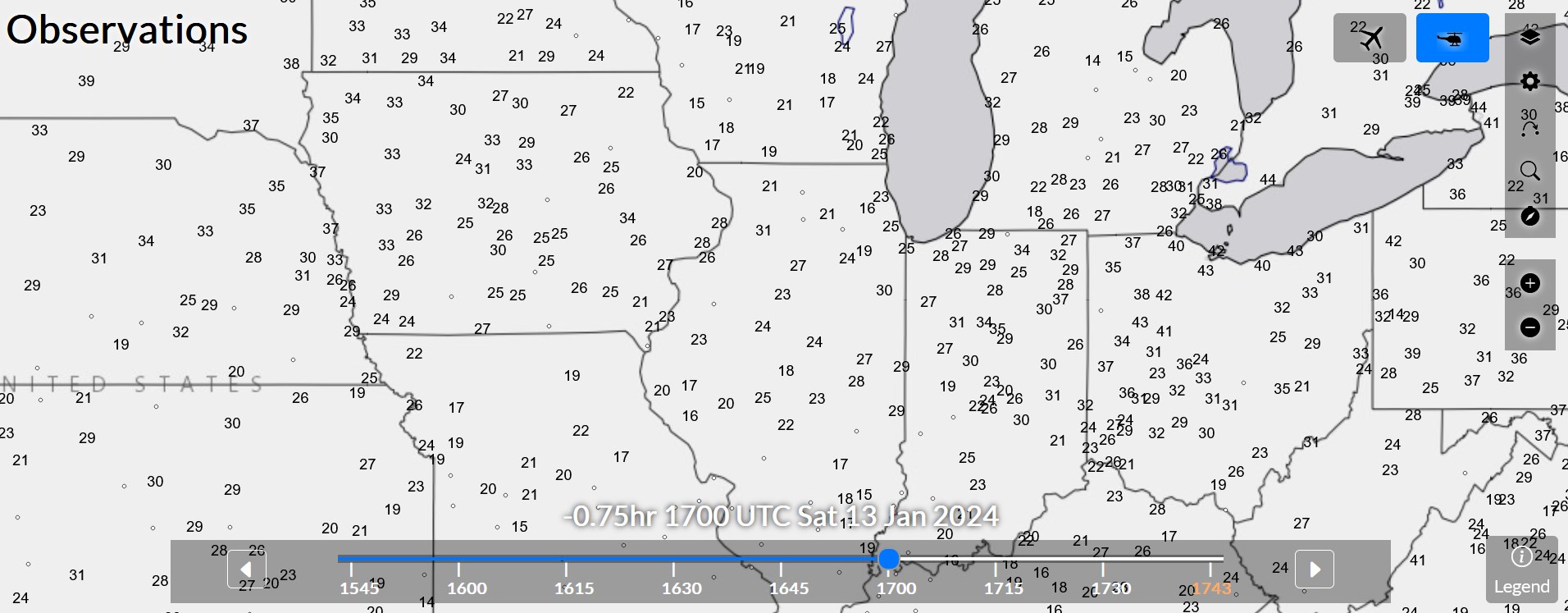
these are all gusts (knots)

-
there may be a wind chill warning for -60
-
so you say it missed part of Michigan? Like Flint?
-
Mountain West Discussion- cool season '23-24
Chinook replied to mayjawintastawm's topic in Central/Western States
new snow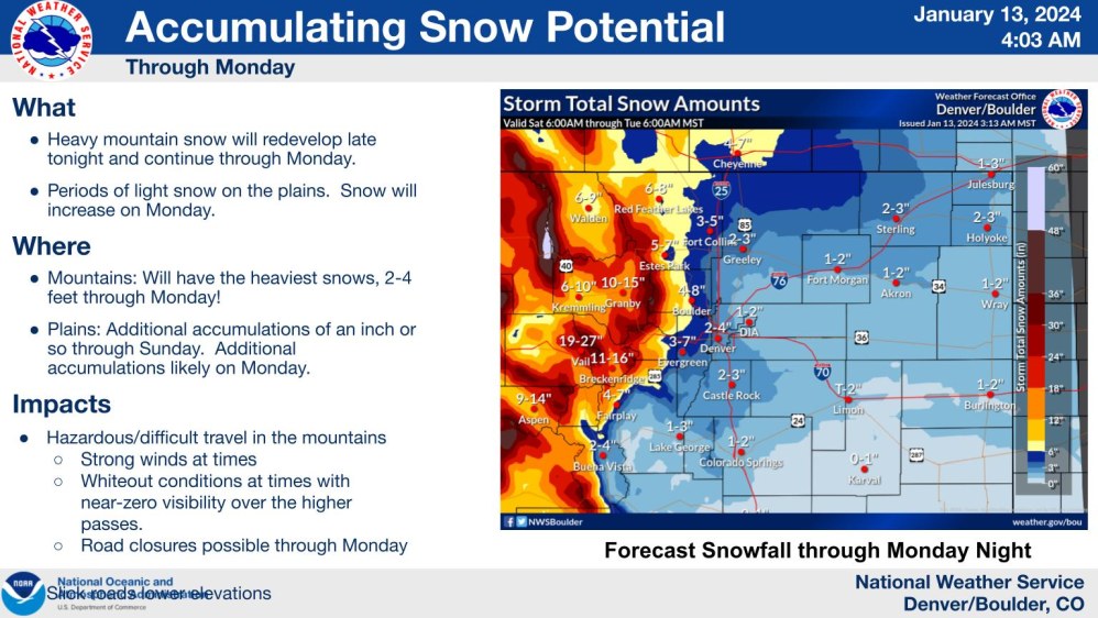
-
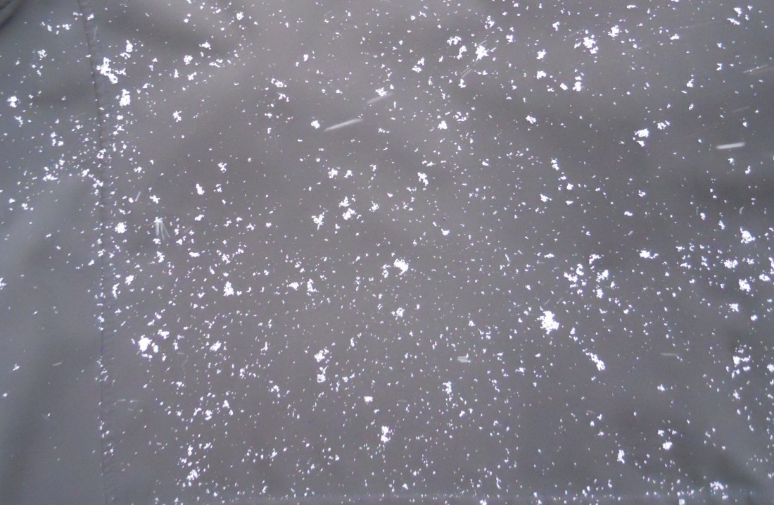
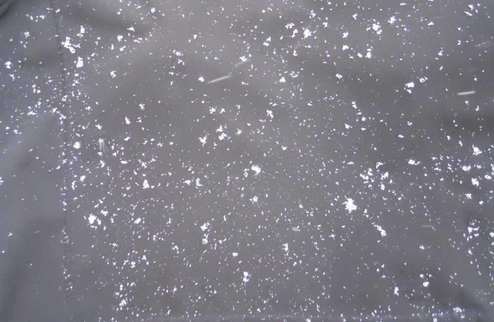
individual snowflakes my area got 1-2" on the grass with very bad snow ratios, and also changed to rain and 40 degrees this evening
-
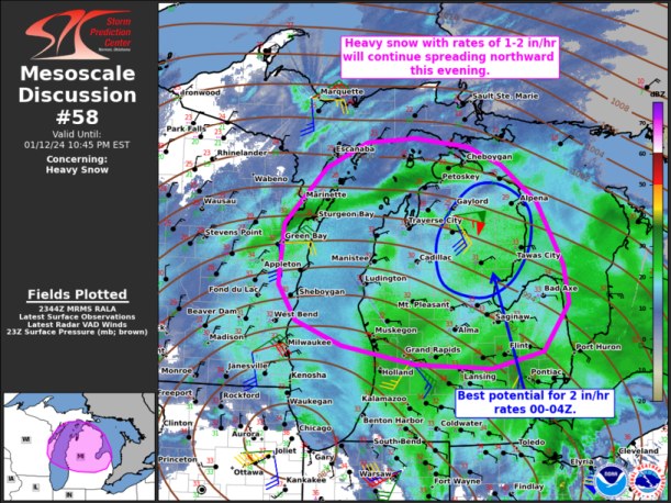
SPC discussing N Michigan
-
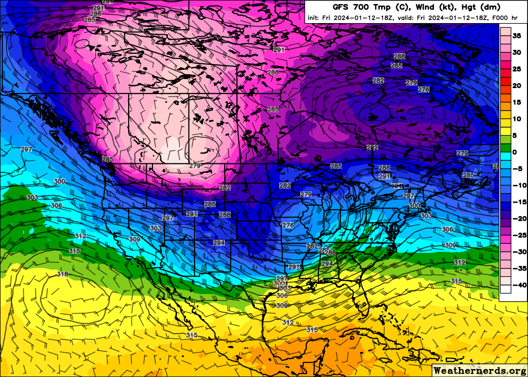
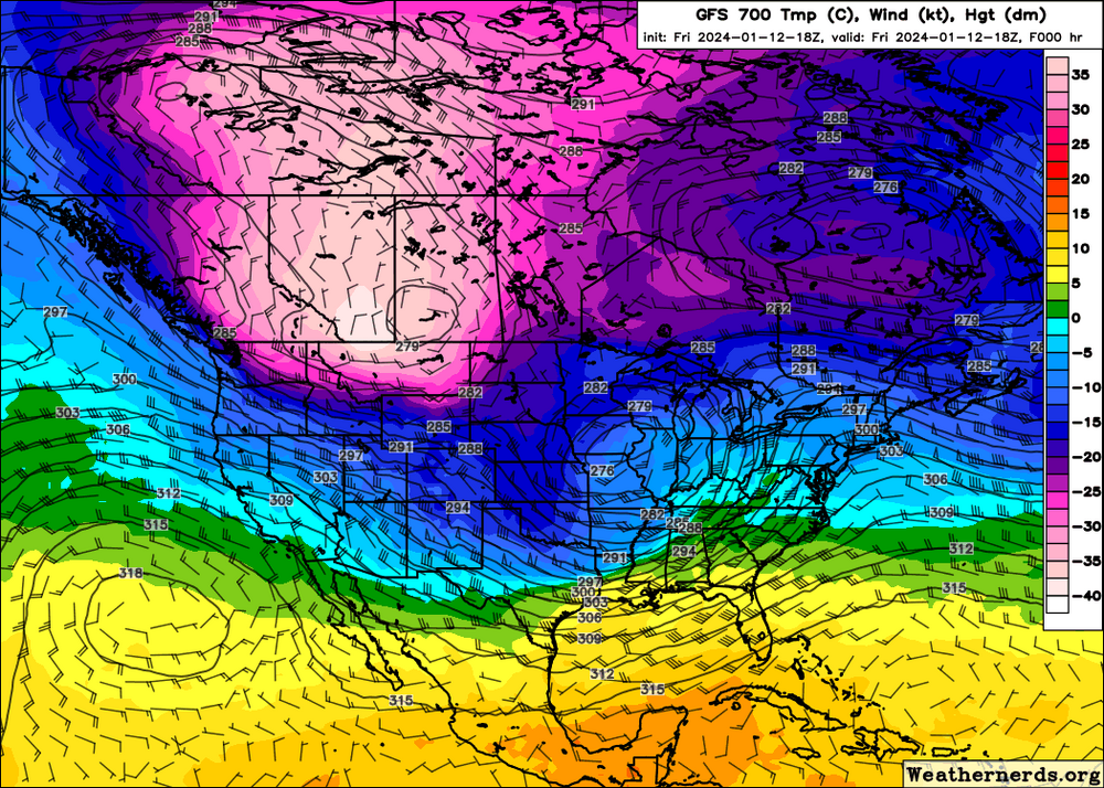
look at this crazy -37 to -40 degrees Celsius at 700mb over all of Alberta
-
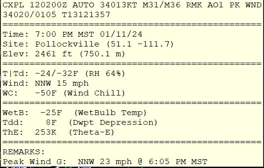
large view of the storm. By the way, I discovered that it was -51F at Edmonton this morning. You don't see that too much. I could probably go a few winters without seeing a -50 south of Alaska.

-
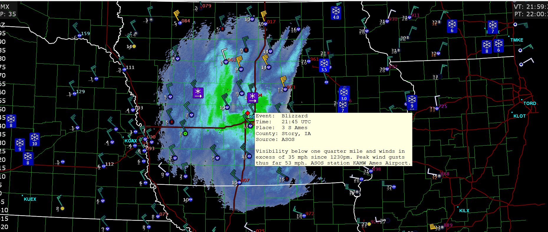
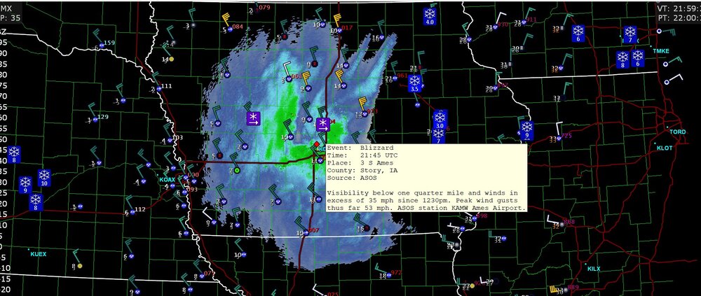
blizzard condition
-
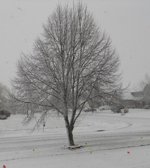
I'm just outside of Perrysburg. It's like 1" with a terrible snow ratio. but hey, large flakes. could be some rain/drizzle upcoming shortly
-
my place has had all snow
-
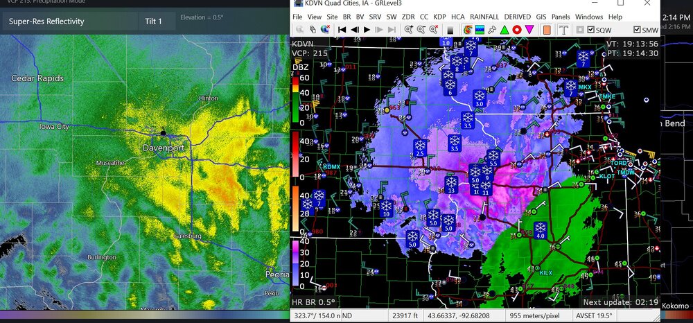
For the Illinois people out there
-
this is actually pretty amazing
-
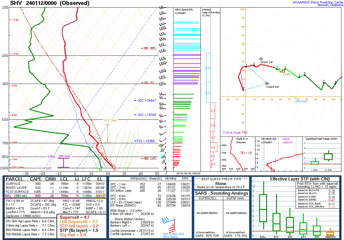
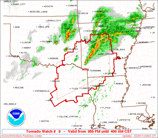
rare tornado watch away from the Gulf of Mexico at night in January
-
This is in Alberta, with -50F with the American wind chill system