Chinook
-
Posts
11,160 -
Joined
-
Last visited
Content Type
Profiles
Blogs
Forums
American Weather
Media Demo
Store
Gallery
Everything posted by Chinook
-
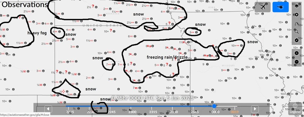
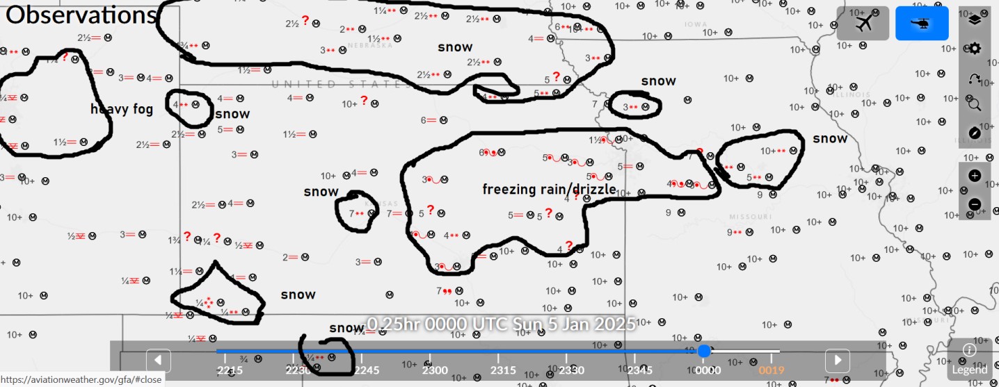
snow 0.1-0.25" ice accumulation in Kansas
-
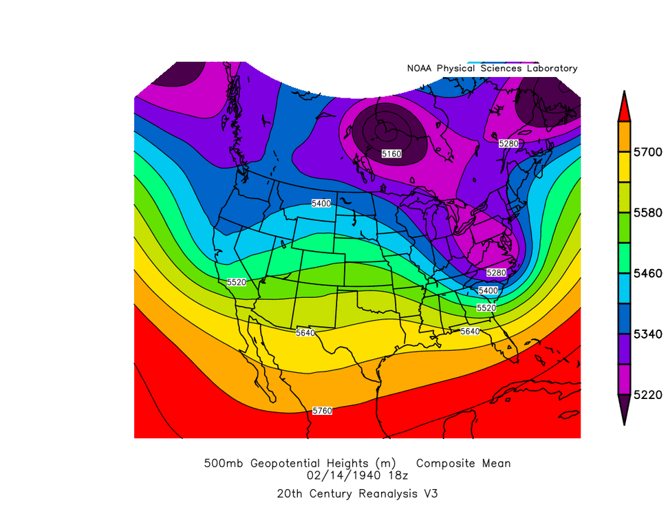
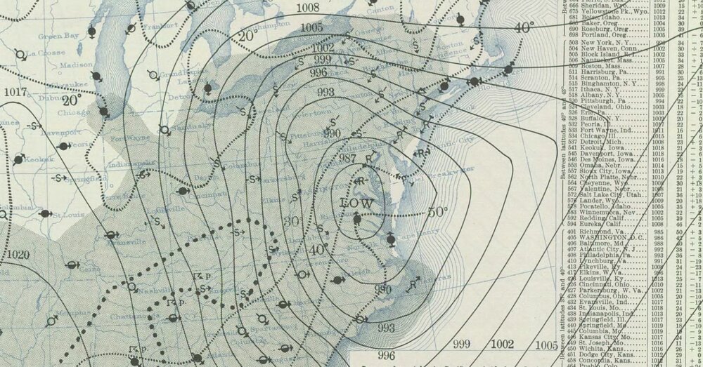
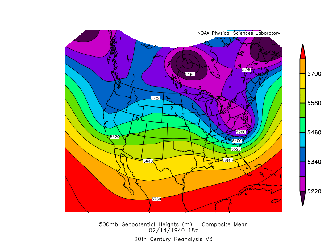
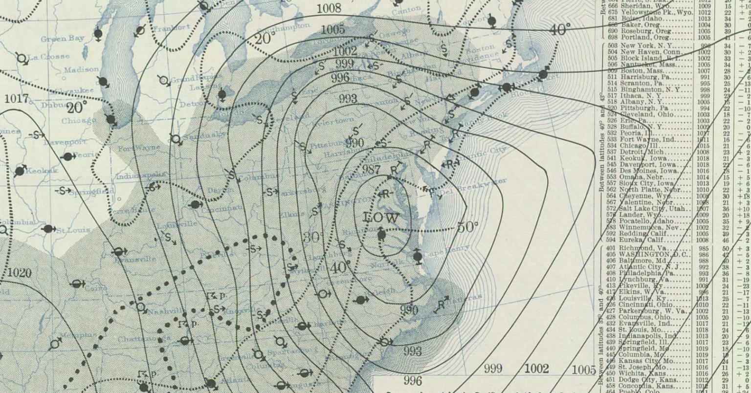
Don't you wish you could time travel to 1940 to see this bomb storm, went from 1011 to 987 and lower 15"-25" for PA to NY State (Susquehanna PA had 22") February 14, 1940
-
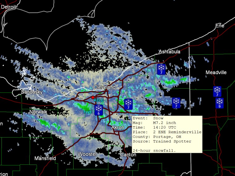
here's some radar from a little earlier (10:12)
-
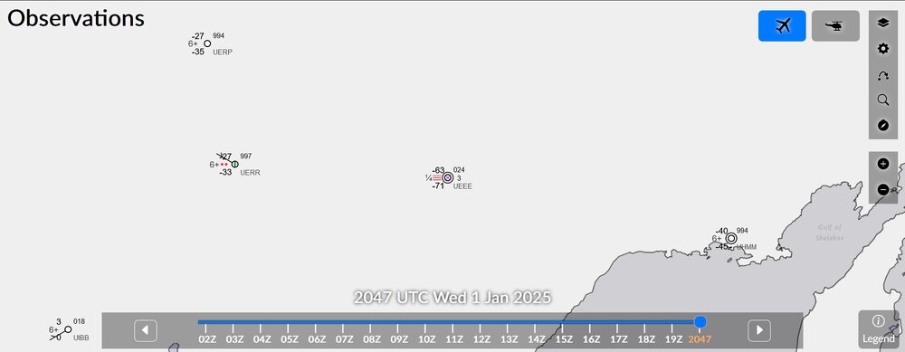
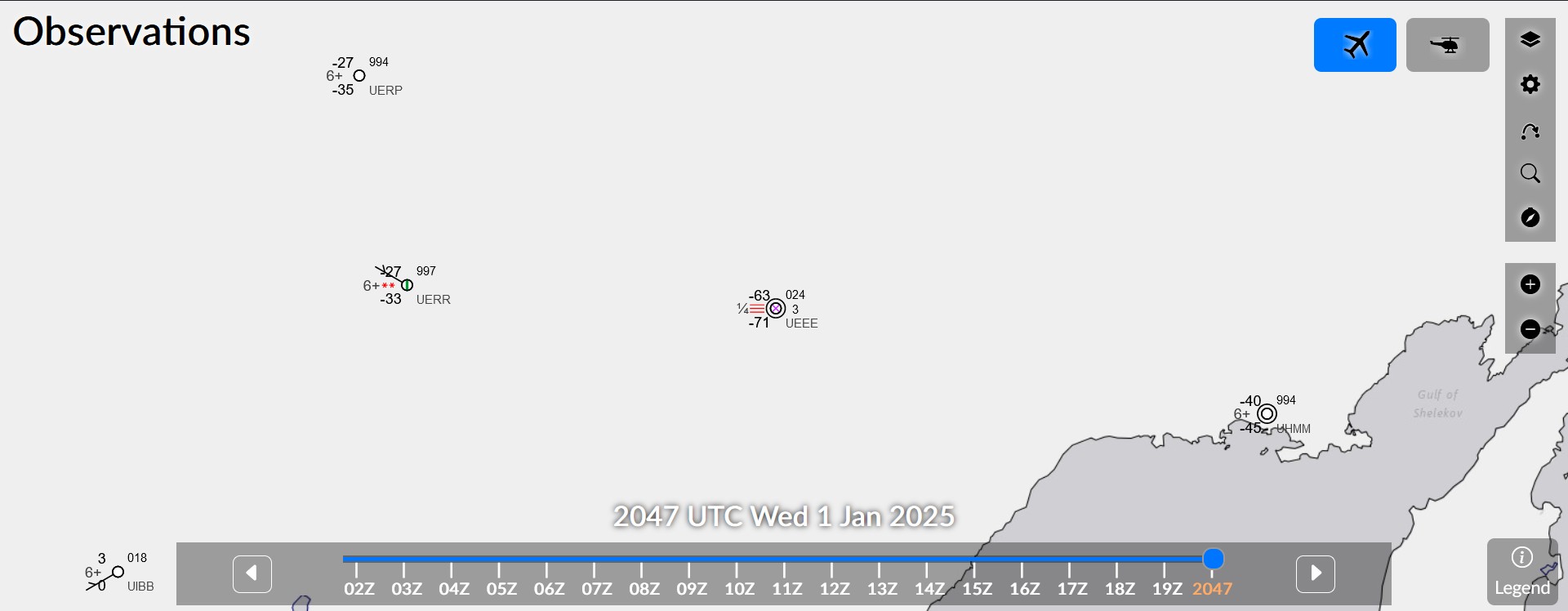
want to know something crazy? -63F in Yakutsk Russia
-
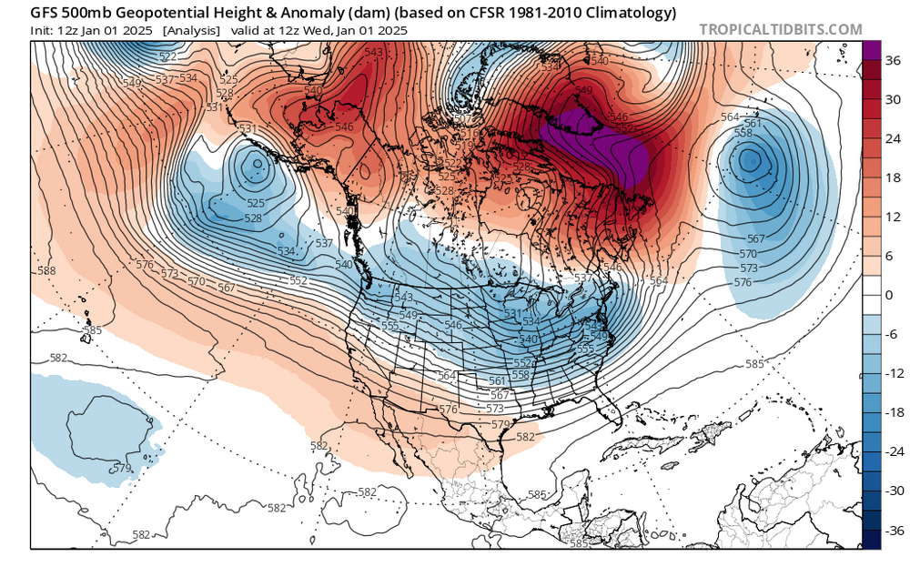
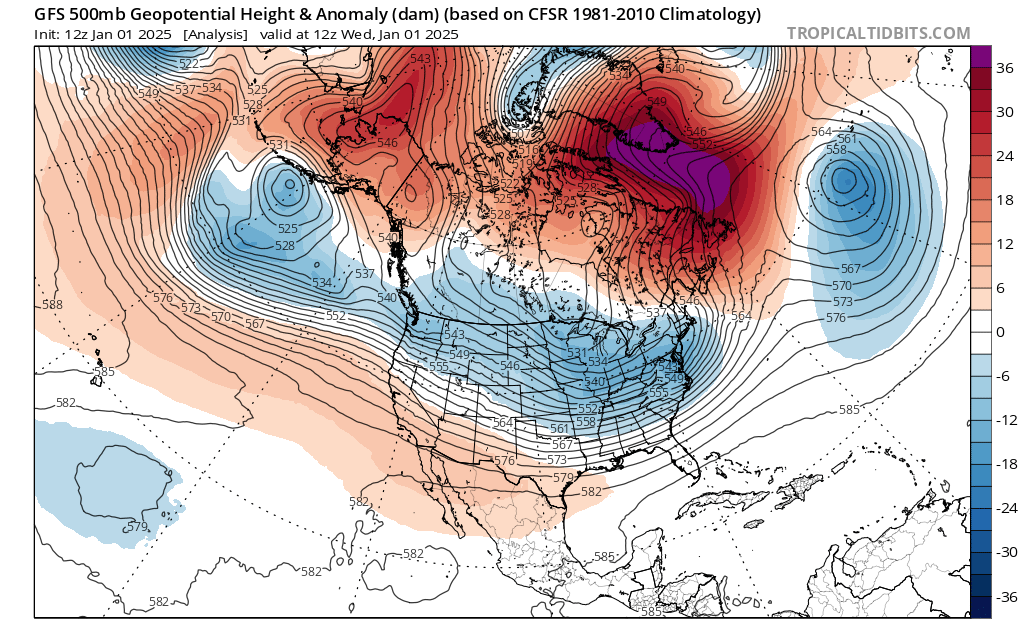
high latitude blocking to start the new year
-
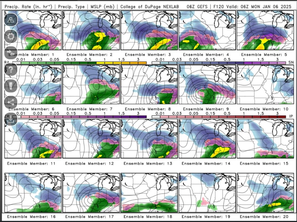
come on, ice storm!
-
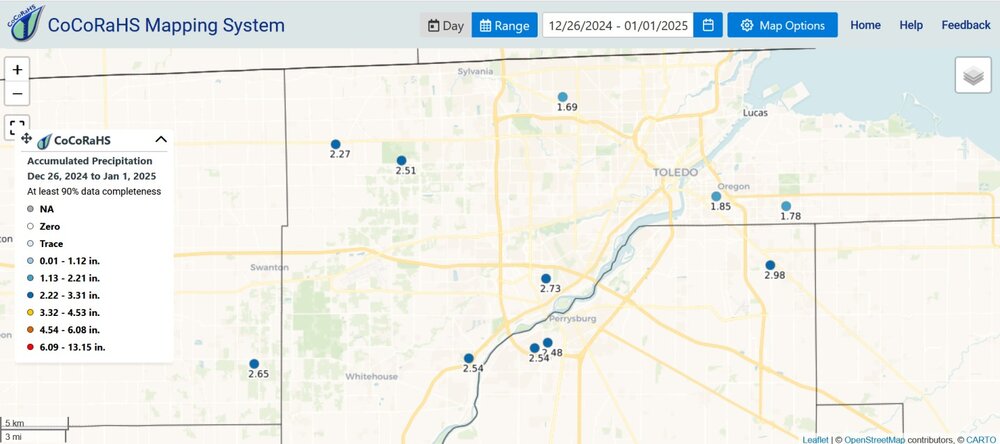
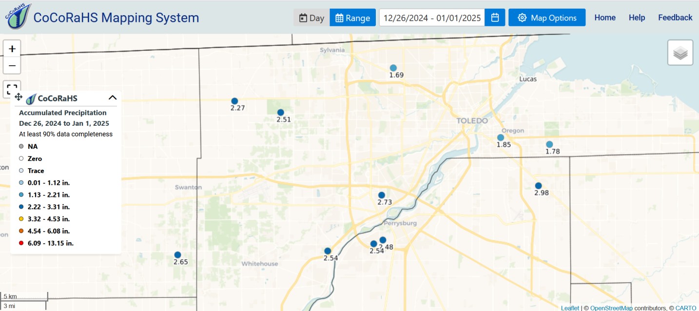
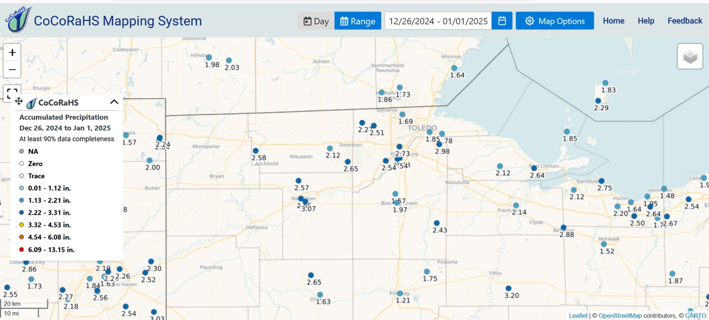
And then I had to drive 100 miles to go to my family Christmas party! (Not at 6:00AM though.) The end of December precipitation is like a month worth of precipitation. There were lakes in fields on my trip yesterday. Up to 3.32" (not shown) in two spots in NW Ohio over this time frame.

-
my place just got the warm front fog.
-
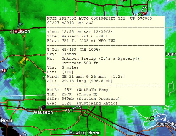
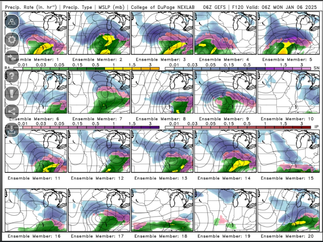
unknown precipitation? must be sleet. You're right. With colder air we would say that this low pressure position would bring a nasty snowstorm in Michigan and the Chicago area. The 850mb temps aren't close, though, really, as you would want a zone of -6C to -10C for the deformation zone and some -4C values for guaranteed snow. I would say that if things were 9degrees C cooler, we'd still manage to get rain right at Toledo, or possibly freezing rain.
-
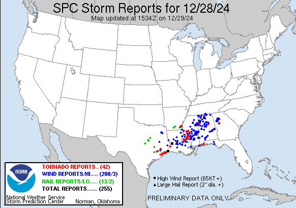
yesterday's storm reports list now has a lot more tornadoes and wind reports than I saw yesterday
-
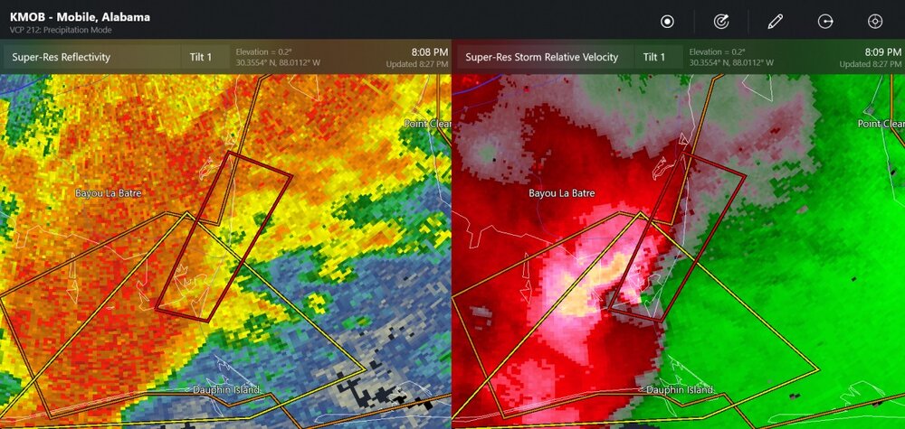
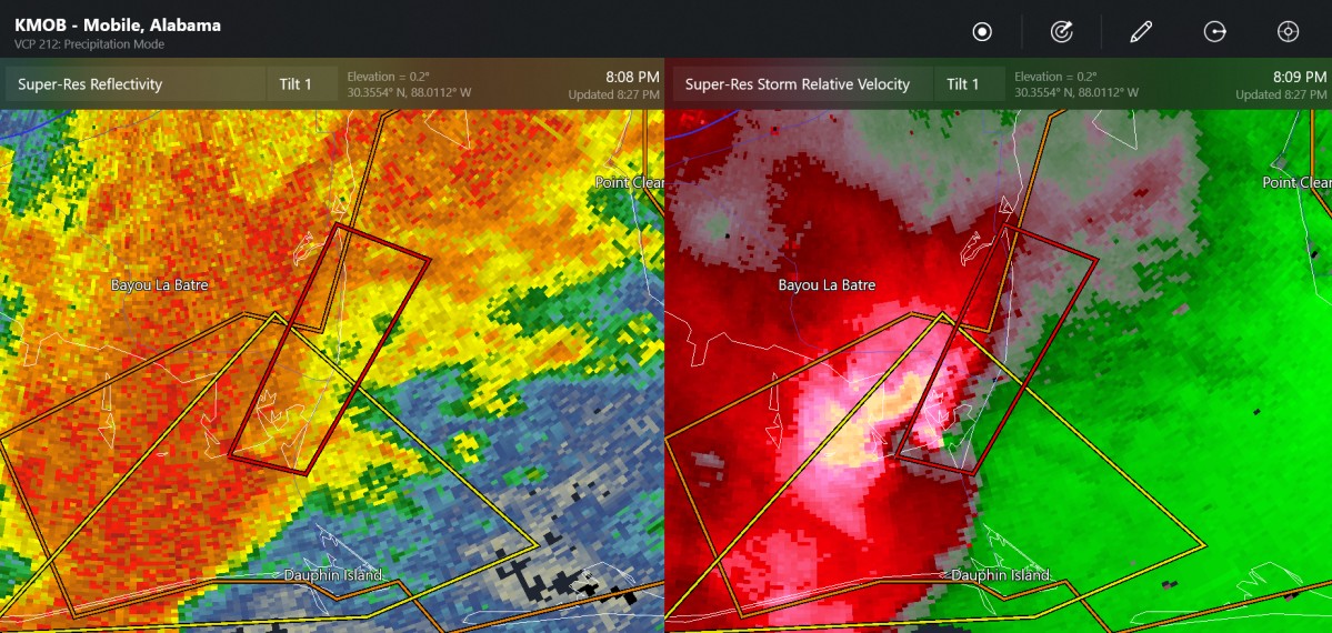
This storm didn't hit the city. I don't know if it was a tornado
-
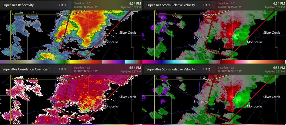
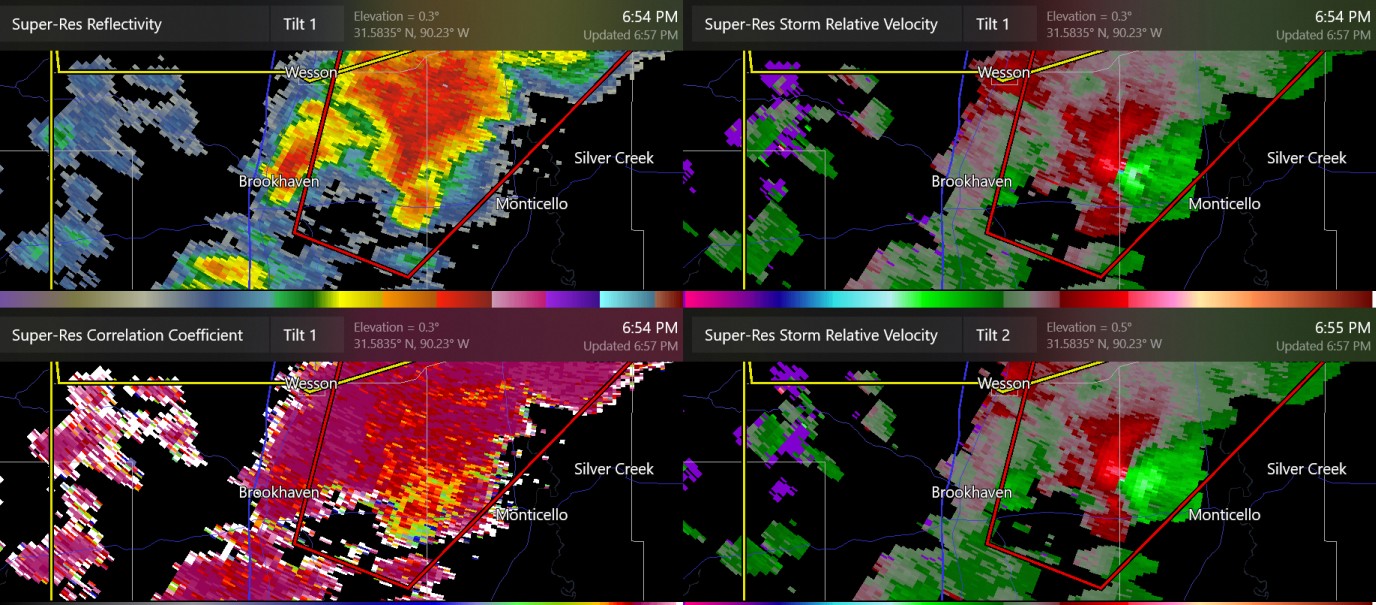
new confirmed tornado by Brookhaven MS
-
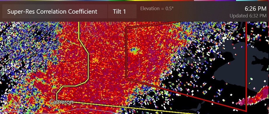
more tornado damage in the forests and swamps outside Cameron
-
this was apparently by Will (TornadoTRX) in Mississippi earlier (Bude area?)
.thumb.jpg.f675fdc482dc8c57e5ff9677a7b59a28.jpg)
-
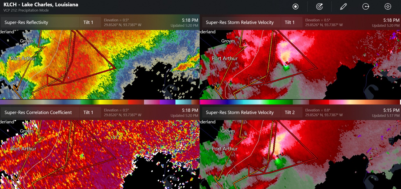
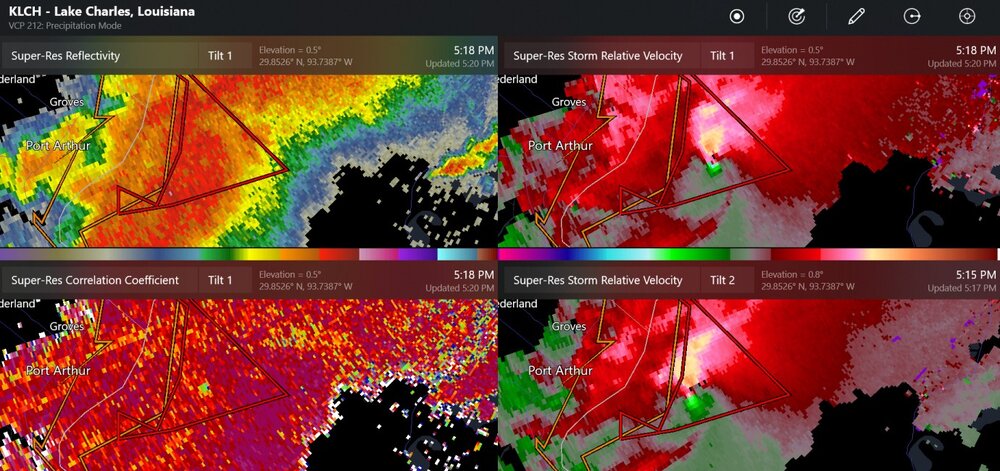
more debris showing up east of Port Arthur
-
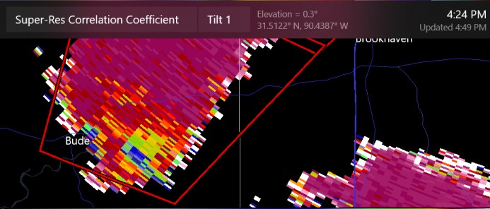
tornado debris close to Bude, Mississippi
-
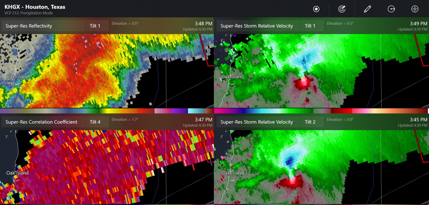
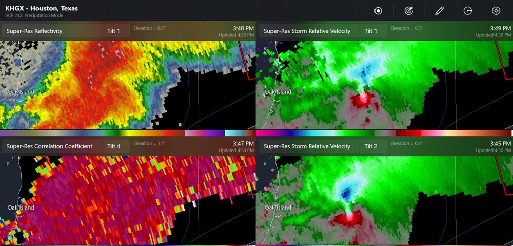
Oak Island from a while ago
-
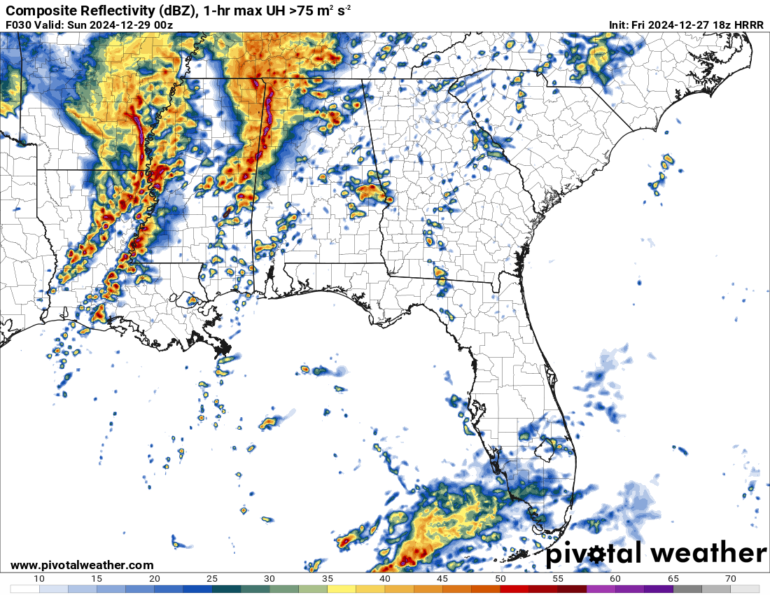
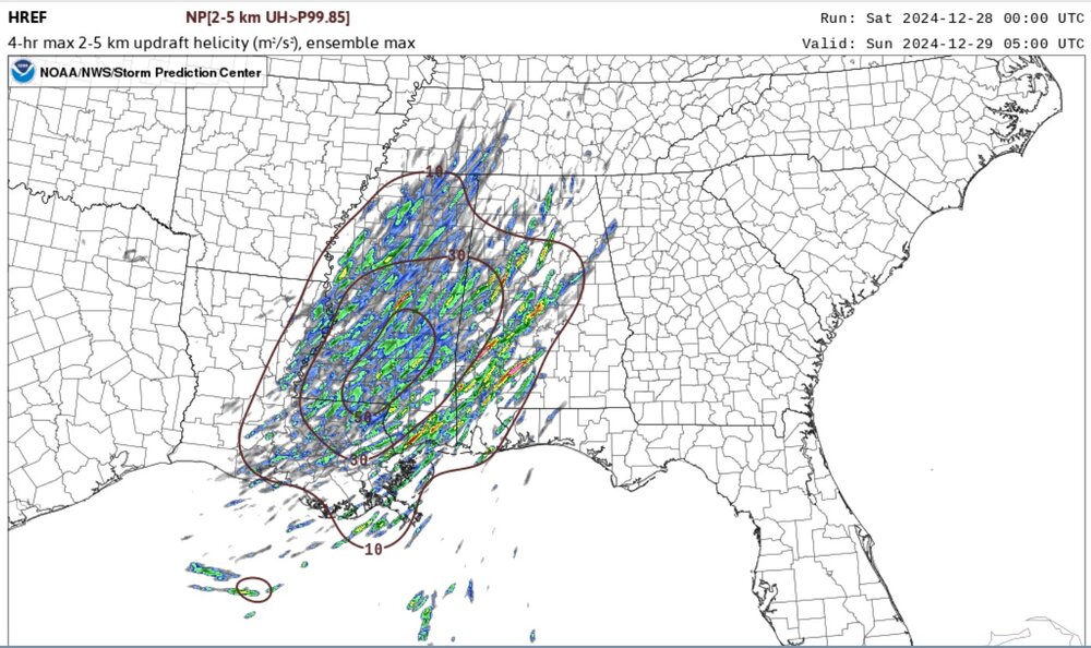
this looks like a lot of discrete storms, possibly with tornadoes
-
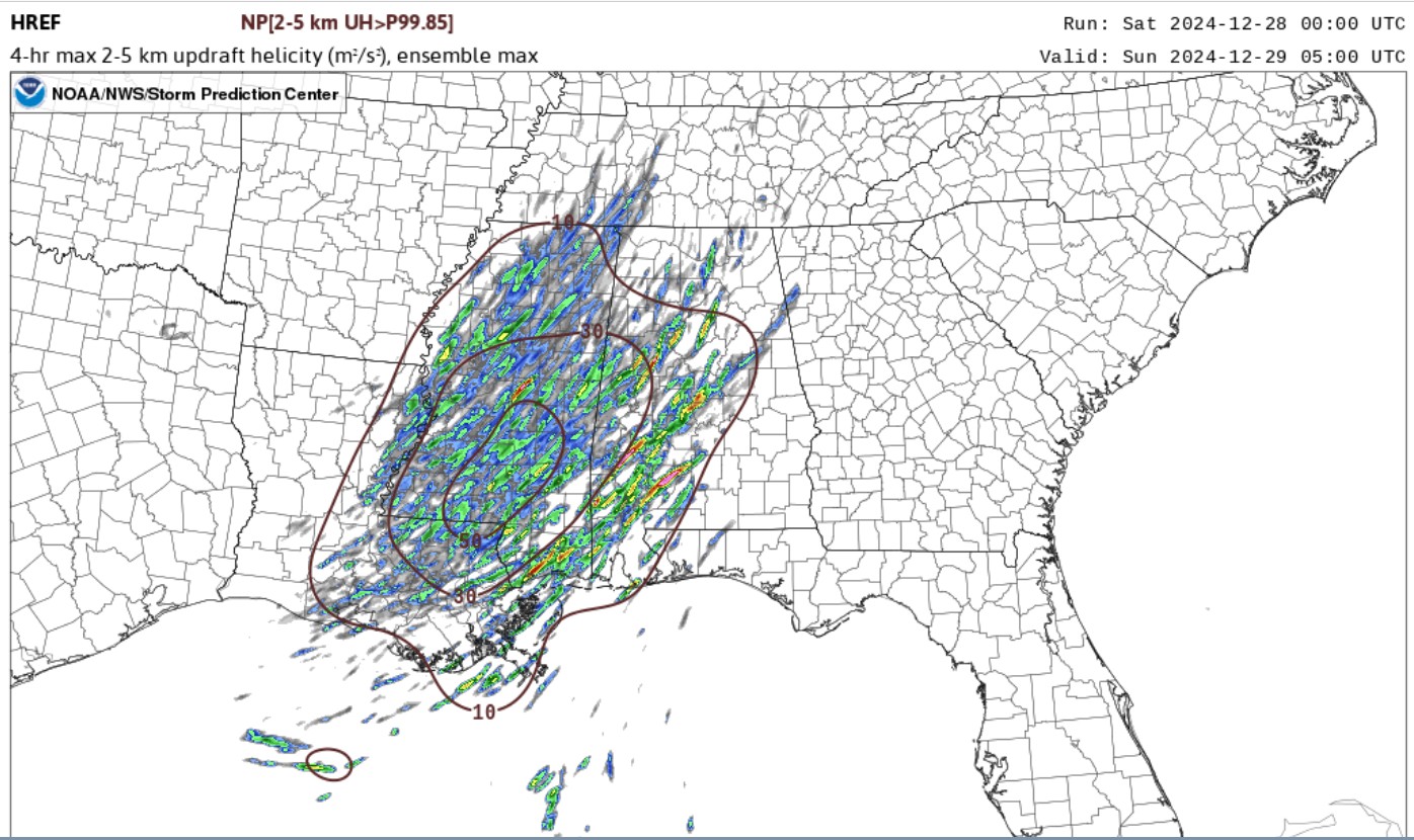
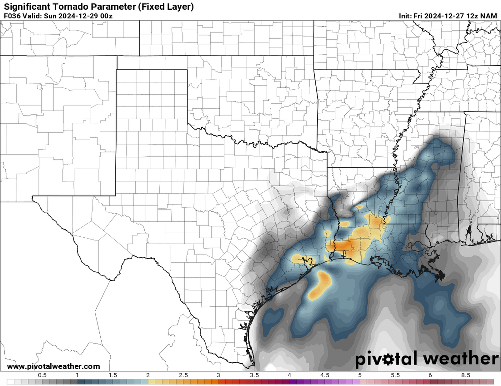
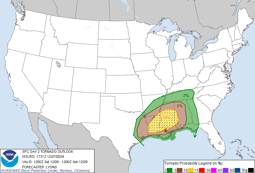
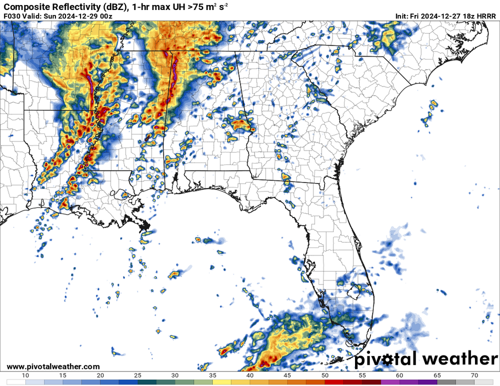
tomorrow should be a bigger tornado risk. The convection allowing models are showing a lot of discrete storms, in some cases.
-
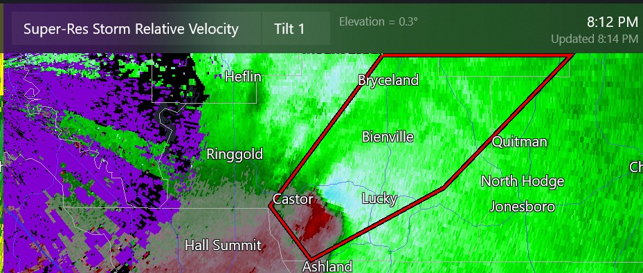
this is about 45 miles from Shreveport
-
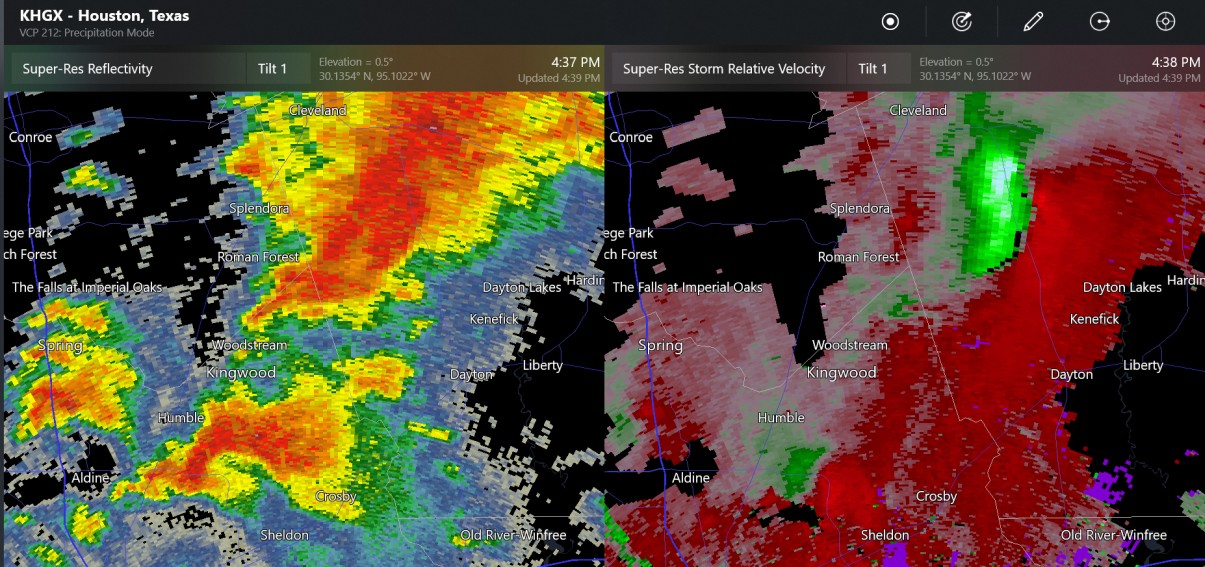
tornado reported near Dayton, TX
-
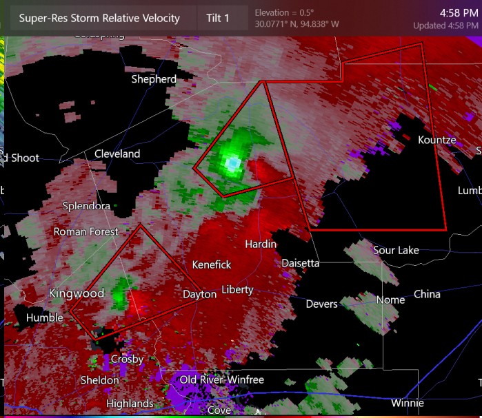
the north storm near Hardin has a PDS tornado warning
-
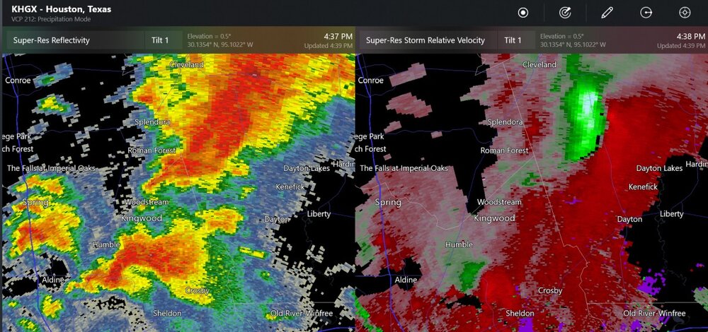
non-warned storms with shear/rotation
-
not a lot happening in TX, but still getting further discussion from SPC
-
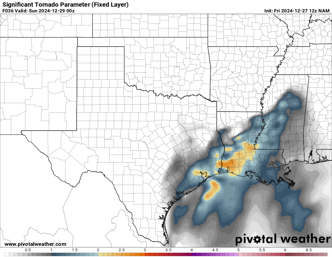
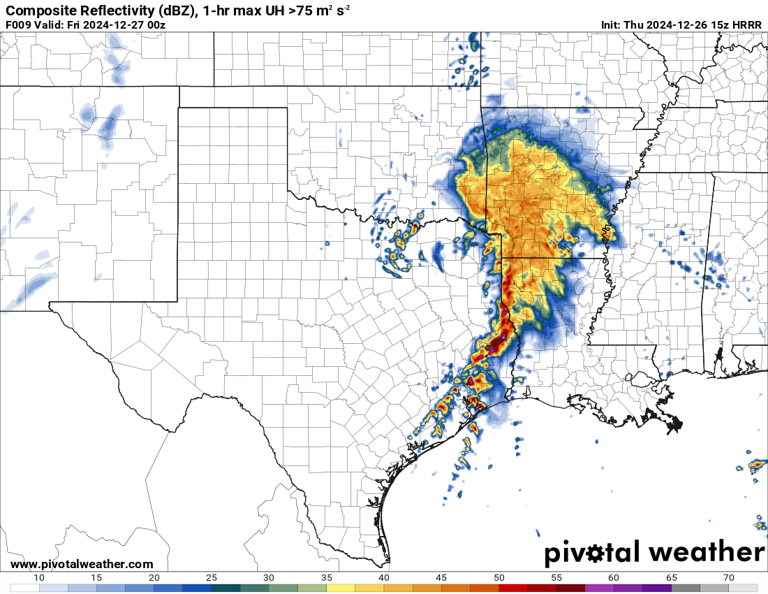
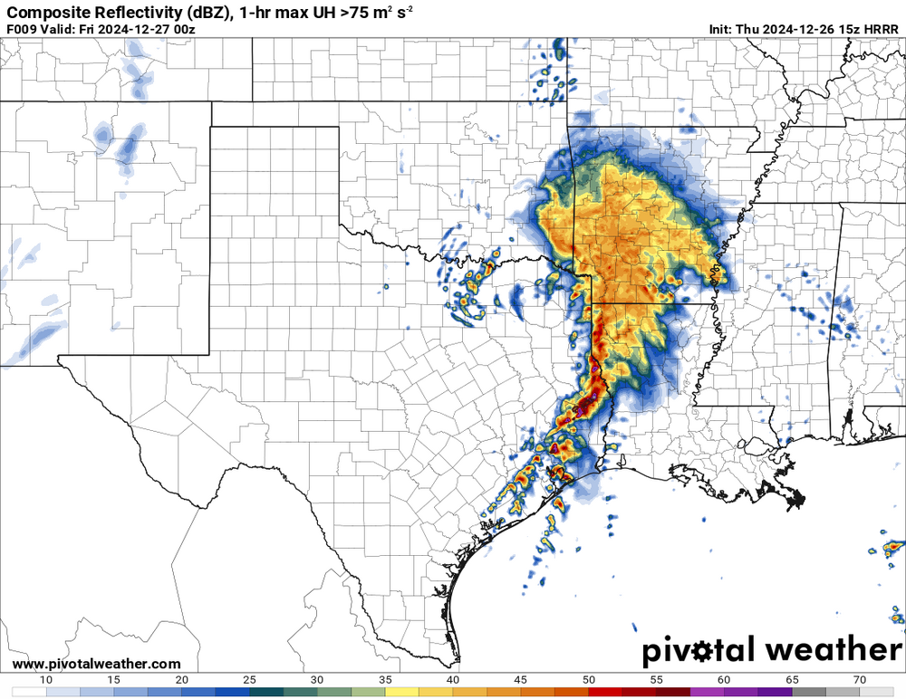
SPC has put up a 10% (enhanced) level of threat for tornadoes north Houston. It is mid-winter, so I don't know if this level of risk will work out.




.jpg.4704a58c814b42eb552a1ffe982c5242.jpg)