-
Posts
3,867 -
Joined
-
Last visited
Content Type
Profiles
Blogs
Forums
American Weather
Media Demo
Store
Gallery
Everything posted by osfan24
-
Ha, if that happened after Monday's debacle, I'd have to step away for a bit. Just give me some decent snow so I can take the kids sledding this weekend.
-
Canadian has the anti-snow hole for DC.
-
Had BWI at 12 last storm. Got half that.
-
Seems like it. Just have to go 500 miles north to find it.
-
I can't wait to see a map of the final totals. Will be really cool to see the different demarcation lines.
-
Varies widely based on location. North or west got almost nothing. South or east did pretty well. Guessing the city proper didn't get much. Edit to say that west, provided it was just a few miles west, did ok.
-
That's wild. Awesome morning for you.
-
Looks like it cut off here, as if that mattered given what had been falling. Eyeballing about 3, maybe if I give it the ole' slantstick? Given how close big totals were, this is one of the most painful storms I can ever recall. Probably a little easier to handle if it hadn't been for the past five winters of nothing, or a lot of the models showing I'd end up with at least double that, if not more. Oh well. Keep the pictures coming. Love seeing them. Hope you guys cash in as that final band sweeps through.
-
Not going to beat that.
-
I wonder if BWI will end up with a pretty good total from this one. Would be nice to see BWI pick up its second biggest La Nina snowfall ever. Anyone know what the runner-up is to the blizzard of 96?
-
It's flurrying here, lol.
-
Jealous. Crazy how different we are and you are probably five miles from me. What an interesting storm. Enjoy! How much you have on the ground so far?
-
Turf Valley. Moved here last fall from the northeastern part of the county and was hoping it would really make a difference. I'm sure it will in the long run, but so far, I haven't really noticed much difference with the few storms we've had. Old neighborhood is going to beat me today, and the long duration storm last year was probably the only one so far where it made a difference, but we didn't get much from that anyway.
-
If it can only snow like this for another 24 hours, I can tack on another inch.
-
Wow, good for you. Not seeing those rates here. Just being a little southeast of me, you are in a better spot. Looks like we will miss out on the heaviest rates either way.
-
Yeah it is brutal. You have ridiculous rates east of 95 down by Route 50. Then you have Frederick with snow and a super sharp cutoff line just northwest of me. It's snowing pretty lightly here. Unless I get a push of the heavy stuff into my area, probably going to end up with 2-4 at best. I'm not sure which model nailed the extremely sharp cutoff correctly, but they all nailed the fact that it would be extremely sharp somewhere. Good for the Southern MD folks. Pretty sure they have as much snow as me the past five years.
-
Ehh, that isn't all coming up here though. All of that down there is going to pivot almost due east.
-
I'm out by Turf Valley, so your location is a bit southeast of me, which should help you.
-
FWIW, I've got snow on the ground (not much), but the 3k NAM doesn't show it snowing at my location until later this morning. That said, just looking at radar, unless that stuff near DC can really push up here in the next hour or two, I'd lean toward the 3k and my area not getting very much over the HRRR and RAP showing close to 8 inches. It's crazy the differences in models and where the cutoff line is.
-
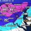
Razor's edge here in Hoco. I'm probably in the 3 inch range on that map, but oh so close to nothing or more than doubling that amount. Going to be so interesting to see how this plays out and who gets what and which model was best.
-
Yeah, I feel really badly for anyone in our area that ends up fringed with this one and gets a few inches while others get clobbered. We've all waited so, so long for this. Likely the best storm for a bunch of us since the 2016 blizzard.
-
But looking at just the BWI plume, for example, there are a few that are basically no snow, a couple with decent snow, and then pretty much 80 percent of them are below the mean, which is about a foot. So I'm not sure it's really being that skewed by the crazy high members when almost all members are pretty crazy high.
-
Yeah, toss out a few of the ridiculous low totals and the mean is more like 16.
-
Woah. Other thing that is interesting is that, other than a handful of low outputs, almost all of them are above the mean. That would be incredible.
-
What is he seeing, exactly? I'm baffled by the hesitation. If you want to talk about sharp cutoffs, fine. But the GFS/CMC/Euro blended are nowhere remotely close to what he is saying. Good luck pinning your hopes to the Icon.


