jbenedet
-
Posts
7,673 -
Joined
-
Last visited
Content Type
Profiles
Blogs
Forums
American Weather
Media Demo
Store
Gallery
Everything posted by jbenedet
-
I’d say at this stage put 12” in your head.
-
I could easily see this evolving to include a NYC metro jackpot. Makes sense. So overdue. And with how cold this winter has been it’s the year shit can’t break wrong last minute. You can stack it even more considering the calendar and peak climo.
-
Today’s a great day for a beer and “major snowstorm incoming thoughts”. Man it’s been a while…
-
That’s a good baseline right here. right now I’m thinking BOS is like 24-30” and I’m 12-18” That’s a low confidence game though at this stage, but gun to head guess right now, that’s how I’d roll
-
@40/70 Benchmark The PV block wins. Cheers.
-
NY and Boston gonna get dumped on.
-
Really good look with this storm at this hour and latest trends. I also don’t think the qpf amounts are done moving higher. Watching for a slowing trend…
-
SNE looks like sweet spot for this. I also think NYC comes back with much less mixing…
-
Actually no. If you’ve been paying attention SNE outside the immediate coast has been a sweet spot. Now I think the immediate coast is also in a great spot.
-
This now has the look of a classic DC to Boston MECS. I do think the megalopolis is all in game for 12”+
-
I think it’s done. I think it’s more likely to tick south than north from here.
-
That read with clear - NAO says “MJO 8” Or at least a lot more 8 than 7…to put it crudely… Interesting…
-
Do you have a good reference for NAO data? I’m thinking that’s the only way to have a good idea on which way this will register 7/8…
-
Not financial advice but… Check out Chevron $CVX Thank me later.
-

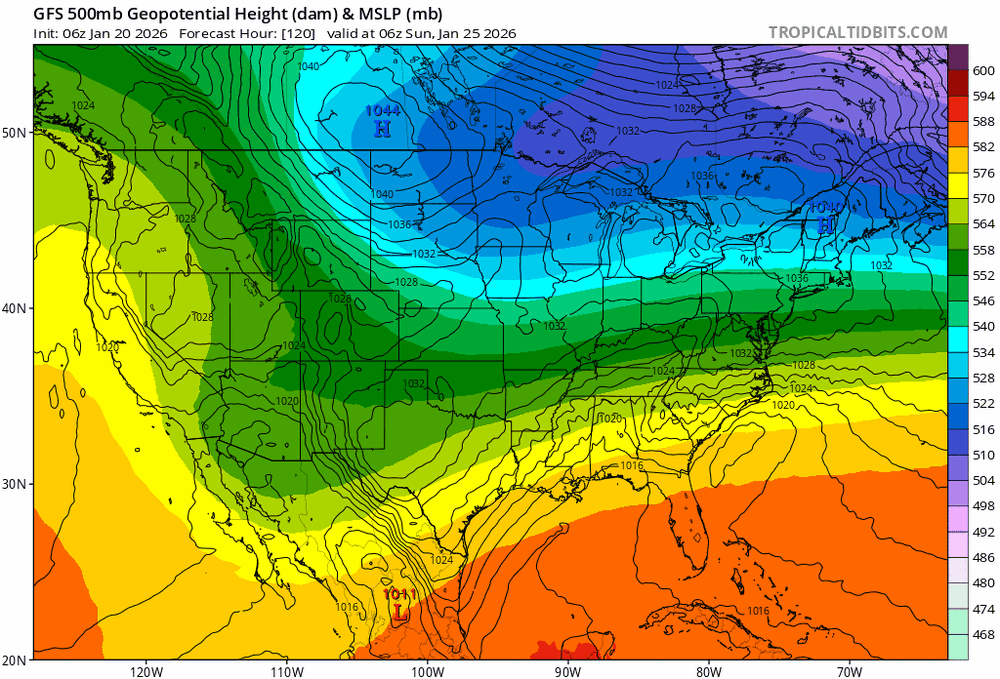
Extreme Cold, Snow & Sleet: SECS 1/24 - 1/26
jbenedet replied to TriPol's topic in New York City Metro
Anyone have a good NAO dataset they could share? Something more than the ncep teleconnection forecast. -
Not done gon’ north.
-
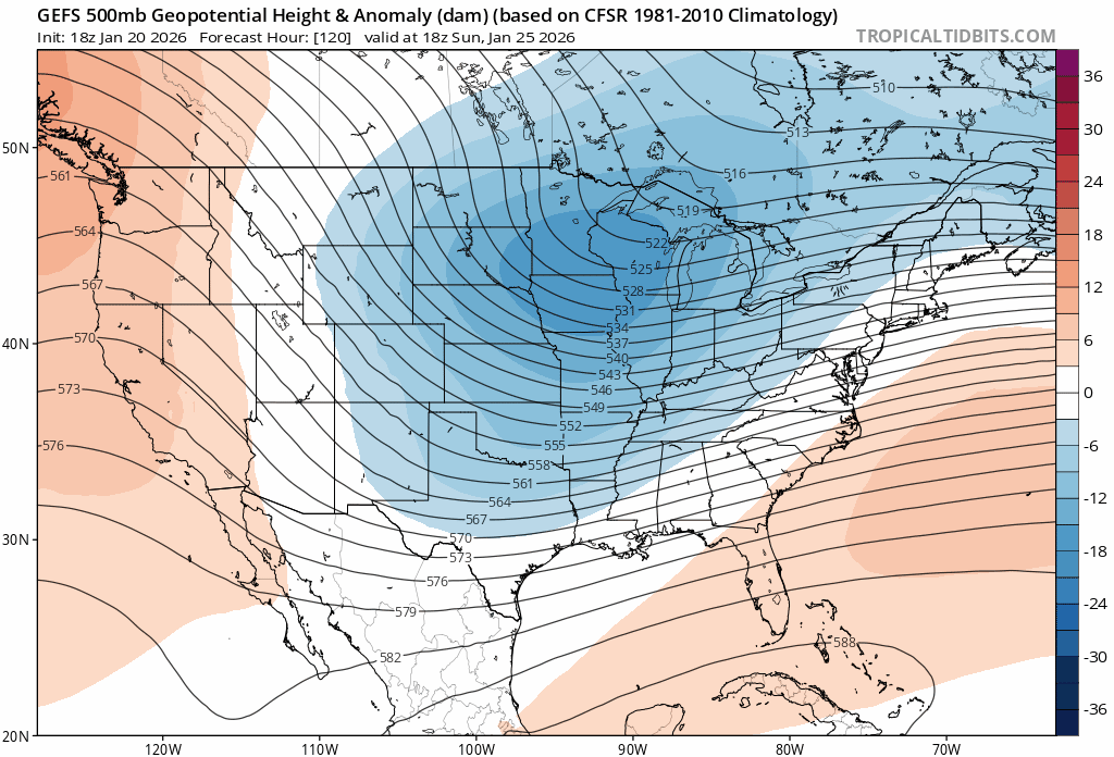
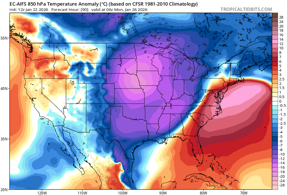
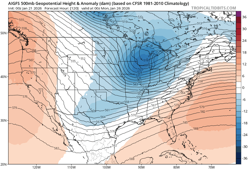
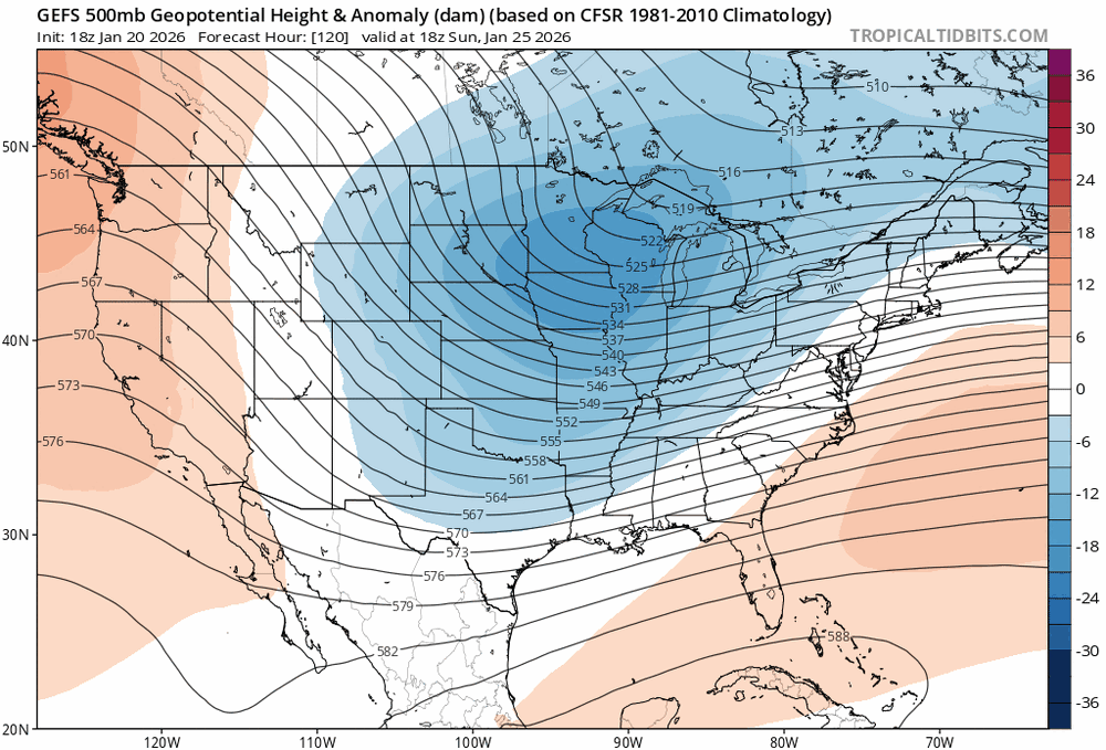
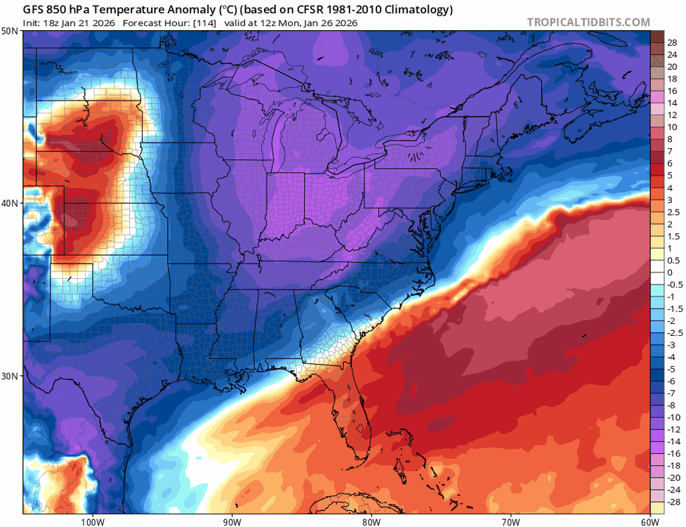
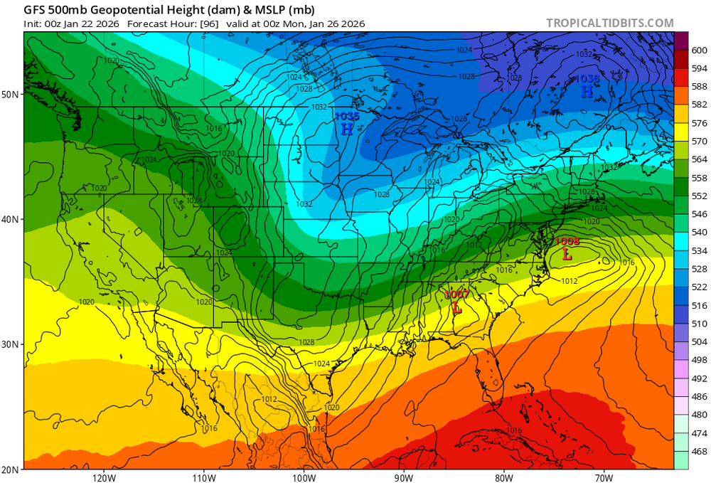
The 6z AI GFS has completely lost the mid level -height anoms in the east now. Also the long wave ridge axis is like 300 miles west of Washington state now..
-
To me the cold is dumping increasingly in the central conus and much less so in the east. The -AO is legit. That will also give fuel to the primary to hold on longer “bend back” than latest guidance.
-
It’s not done.
-
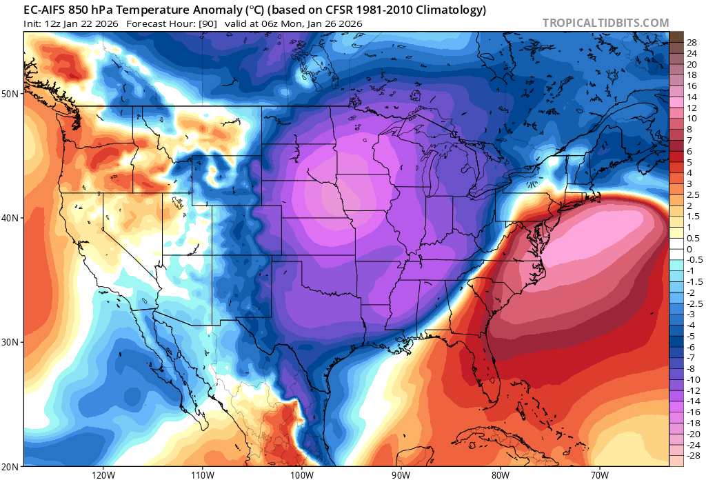
Yea agree that this willl be juicier in that regard The antecedent airmass is also warming…albeit from a very cold to cold in the east. Need to watch it closely… But the typical areas that can’t rely on just the antecedent airmass to stay all snow need to worry about a lot of mixing already. Cape/islands, coastal RI and CT.
-
That Canadian high position though…

-
GEFS is like 4 runs away from saying “what PV?”
-
100 hours to go…
-
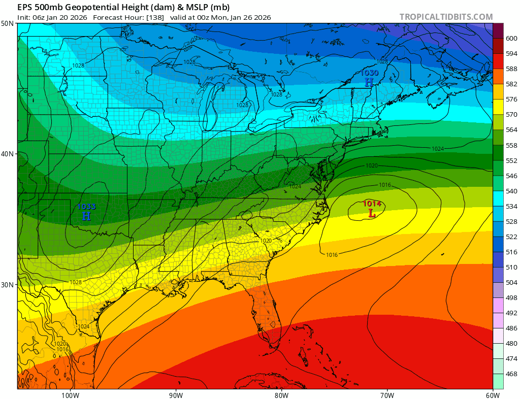
This is wonky. The dual surface lows.. What I’m thinking is more that the lead wave fizzles and the trailing surface reflection is our main storm up here… An how that would change the mid level evolution if that lead wave is dampened completely.
-
There is sooo much long wave spacing out west to get this further north. That ridge axis out west keeps inching west. It’s basically in general position where we open up inland runner risk…