

jbenedet
-
Posts
6,566 -
Joined
-
Last visited
Content Type
Profiles
Blogs
Forums
American Weather
Media Demo
Store
Gallery
Posts posted by jbenedet
-
-
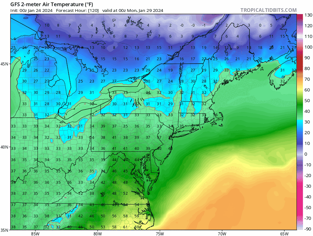
Temperatures busting low on guidance today.
37/35 @ PSM.
40's possible as we dry out.
-
 1
1
-
 1
1
-
-
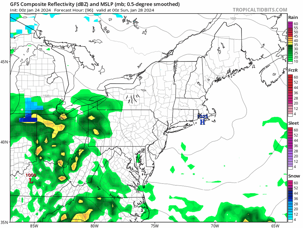
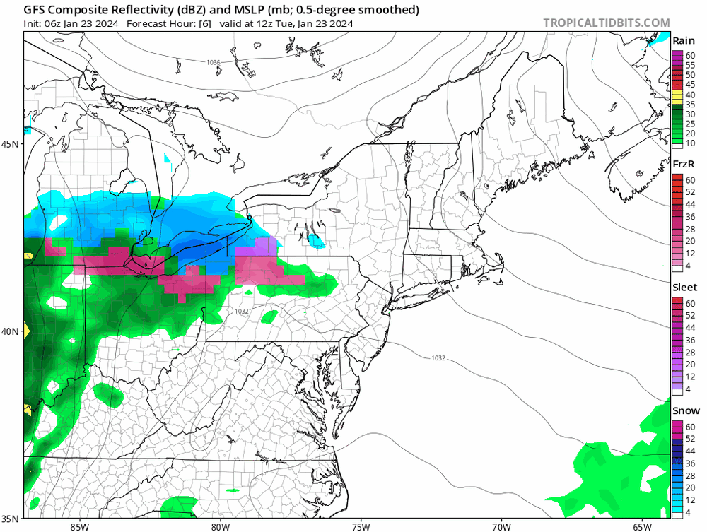
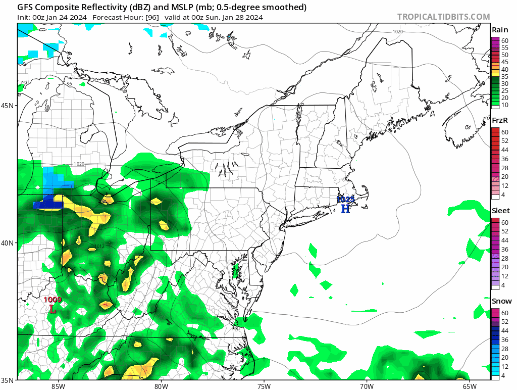
These clown maps are gonna cause snow weenie rage in SNE.
This bump north isn’t coming with better dynamics; it’s with a much weaker surface high and CP airmass has all but vanished.
last 10 runs of GFS - check out CanadaI didn’t think that would happen…
Result is less suppressed but still very weak storm, and more ptype/low ratio issues. Mostly the latter.
-
1
-
-
GEFS type solution makes the most sense.
Currently MJO warm phase state and PNA neutral and ++NAO but cold and suppression is still fighting very strong over northeast and SE Canada. Very El Niño esque. Can’t build a ripping WAR for shit.
Now, for this disturbance, jack up the PNA ridge allowing that CP airmass and UL height field to dip south over New England and western Atlantic and it’s major suppression. This is further compounded by the fact that there’s very limited baroclonity in the airmass which the disturbance originates, no countervailing forcing to build the downstream UL height field.
-
1
-
1
-
 1
1
-
-
About a coating here, with flurries now.
-
Weak forcing.
This won’t stack well.
Use lower ratios then 10:1, until/unless see improved dynamics.
-
2
-
-
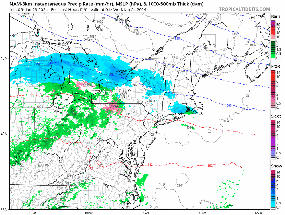
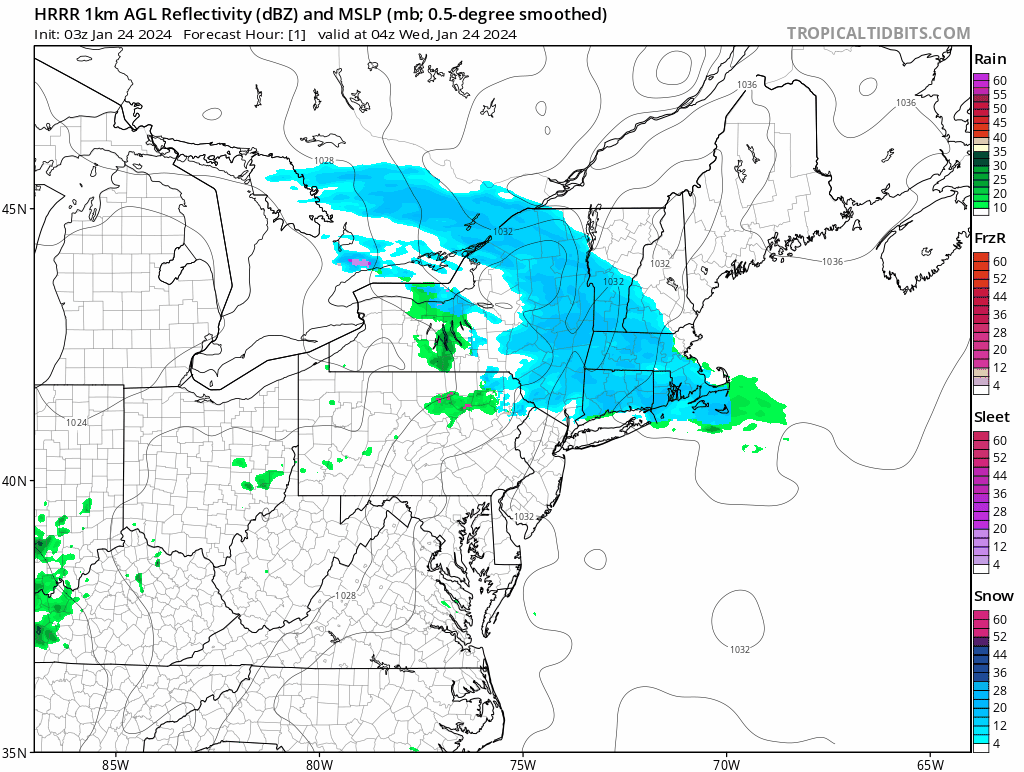
Looks like this is racing through on radar.
western CT over in under an hrHRRR showing the same.
Wondering if I’ll see even a flake here.

-
56 minutes ago, Sey-Mour Snow said:
Ya we have coating to 1" south of 84 .. 1-2" north to the pike that should do it .. although it does look like SE New England to the beaches could sneak in a lucky inch of snow before the rain .. almost all guidance likes the band producing a stripe from New London County into Rhode Island and the Islands overnight

Dislike this map south of 84. Adding total qpf for marginal temps and scattered light precip is a big sell in something like this.
-
1
-
1
-
-
13 minutes ago, Sey-Mour Snow said:
Not a big deal for New England yes but still 1-2" of snow/sleet for many North of 84, probably a slick AM commute ..
commuting sure. That’s timing and treating.
south of the pike I’d cut BOX map in half. Leave the rest. I’d tack on an inch to their map in the berks and extreme NW CT. But many south of 84 won’t see more than a dusting/trace. Just don’t see the precip for it.
-
1
-
-
Very shallow cold; very weak disturbance—> no isentropic lift.
Looks like a non-event south of the pike; east of the berks.
-
1
-
2
-
-
19 minutes ago, Modfan2 said:
Oddly, BOX doesn’t share your enthusiasm.
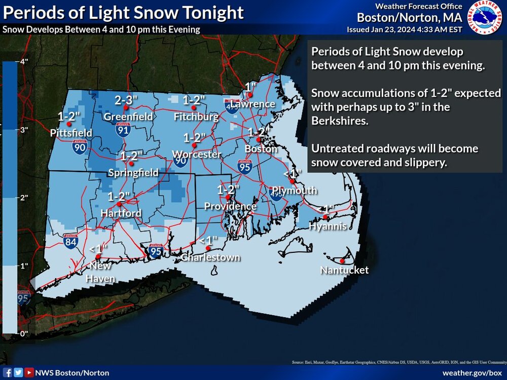
Sell.
This is the radar output.
Bottom half of that map won’t even see a coating.
-
1
-
1
-
 1
1
-
-
1 hour ago, Layman said:
These Popestradamus forecasts interest me because they're basically in my backyard. Is this a case of cherry-picking a station to get the needed temps?
This station is running around 3 degrees warmer than everything else around it. https://www.wunderground.com/dashboard/pws/KNHPORTS24
I can't help but think it's being influenced by the Service Credit Union corporate office that sits right across the street. It's literally a wall of glass facing that station.

No. It's a case of "I'm an imbecile and didn't look at surrounding obs."
Time well wasted.
But don't worry. You're in great company!
-
1
-
1
-
-
Since according to the snow weenie forum, the wundergound numbers I'm posting are specious:
per 12:50 obs at NWS.
ASH: 37
CON:35
DAW: 37
GFY clowns
-
1
-
-
2 minutes ago, ineedsnow said:
sucks that toaster didn't warm some places enough to reach 40 today
+5
We take.
Cheers.
-
Just in case you didn't know; blogspot is the medium you use when you're still in highschool.
Embarrassing.
-
1
-
2
-
-
November - wrong.
December - wrong.
January - wrong.
But read my free $hit at blogspot.

Can't forecast for $hit but don't worry he'll be sure to tell you he's wrong. You can count on that. What a service.
-
5
-
4
-
-
1 minute ago, 40/70 Benchmark said:
Only thing better than watching you forecast mid atlantic snow is watching it verify as either 3 feet for @dendriteor 19" for me.
What is it a week before you tell us all how you effed up January too?
Just quit guy. It's pathetic.
-
1
-
-
Next week looks like has mid atlantic written all over it.
Only thing better than a toaster is watching mid atlantic take SNE weenie's snow.
-
2
-
1
-
1
-
-
Man what a beautiful day out today.
Shorts and sweatshirt, NH style.
-
1
-
-
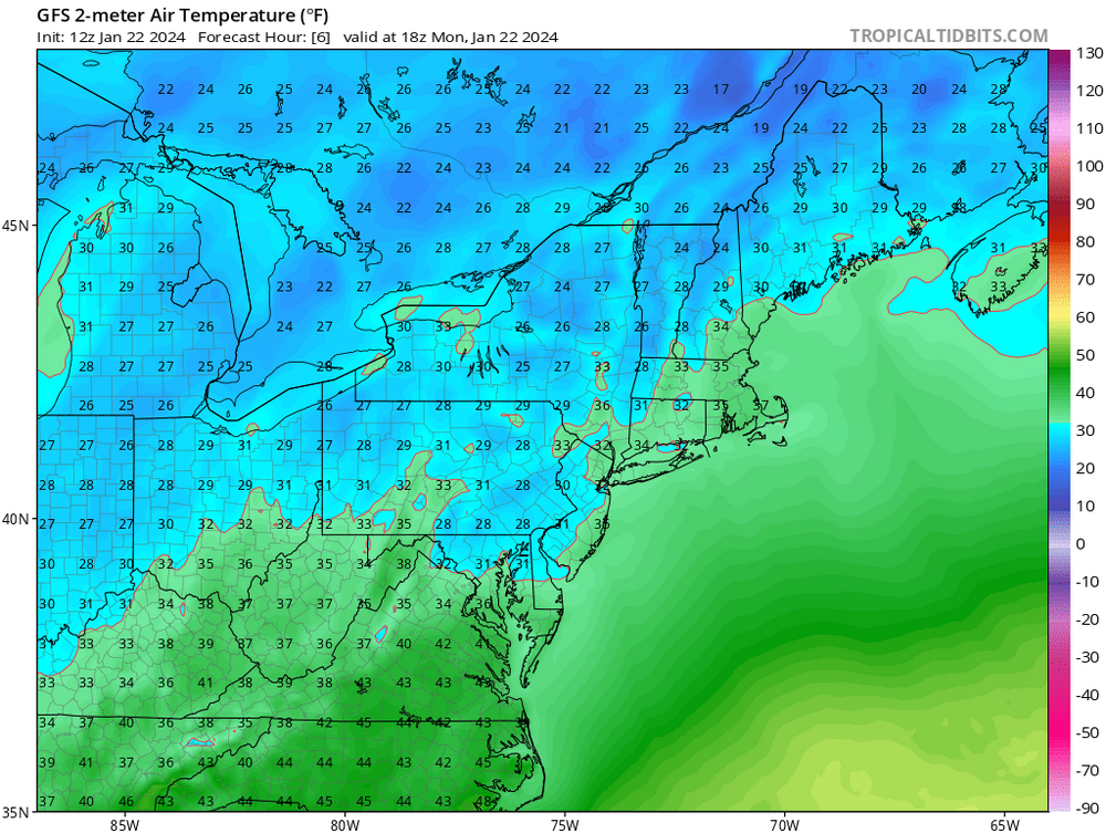
PSM: 33
Nice.

-
1
-
1
-
3
-
-
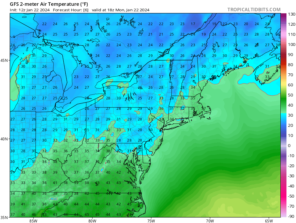
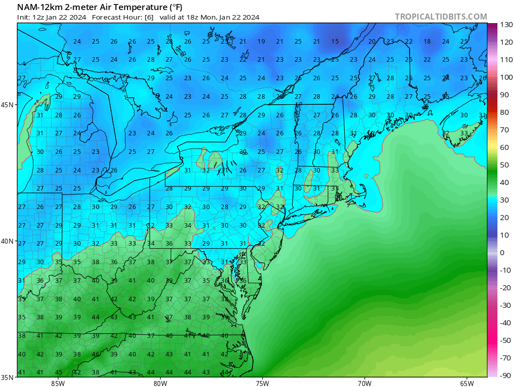
5 minutes ago, dendrite said:
2m temps usually are too cool with a mixed BL. Nothing really new there. But PSM hasn’t updated since the 25° at 15z so idk where you got 30°…unless you mean the NAM temp at 18z.
Wunderground updates every 10/15min. NWS temps will follow if they coincide with station location.
-
2
-
-
1 minute ago, ORH_wxman said:
He wasn't even posting about the cold tuck...he's posting about whether today's high will be 38F or 33F.
You guys are amazing.
Hmmm - let's read what our machine is saying today. It's wrong today in a stable atmosphere; 6 hours out - BUT it should be very accurate tomorrow and even more accurate when there's a storm. VERY reliable.
-
2
-
1
-
-
Just now, 40/70 Benchmark said:
Its a global model, which will not resolve a cold tuck adequately....but you (should) know this-
I'm talking about today. Like right now.
Read the damn timestamp.
-
1
-
2
-
-
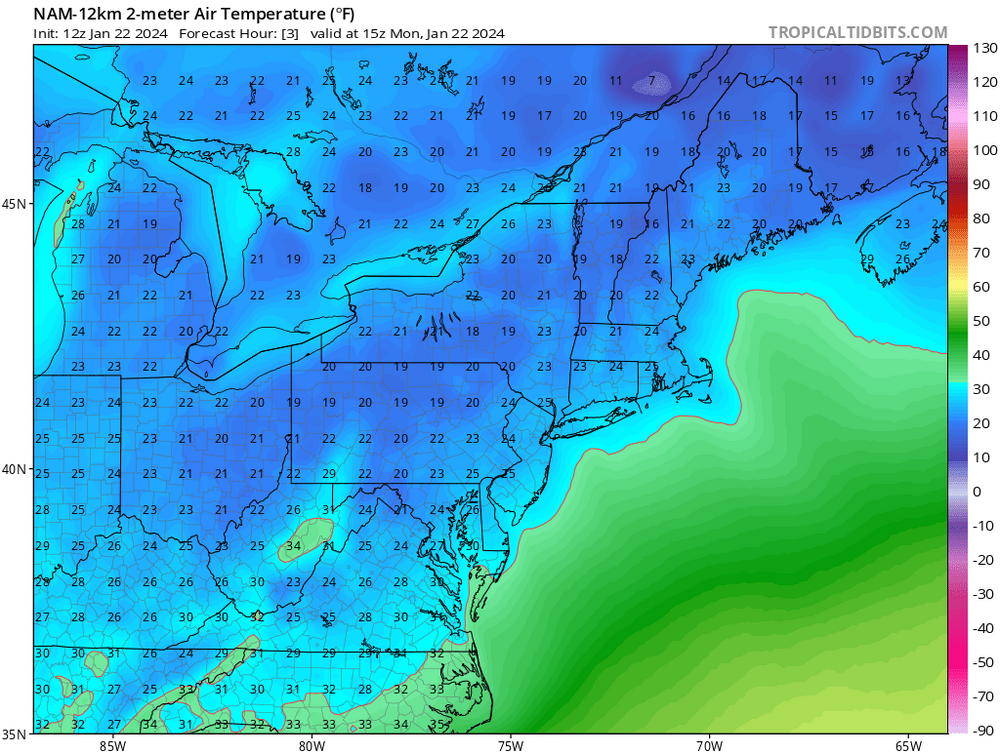
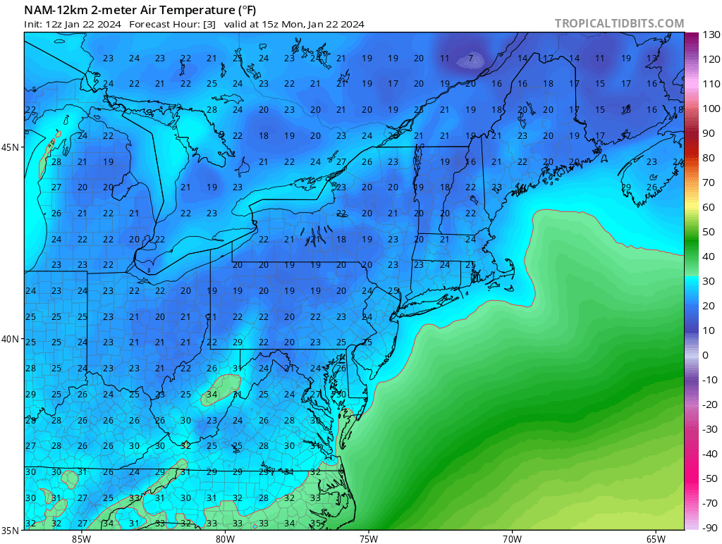
Even the cold-biased GFS is warmer than the NAM.
PSM current: 30F
Good luck

-
1
-
2
-
5
-
-
6 minutes ago, ORH_wxman said:
That's for 14z which was 50 minutes ago....PSM was still only 21 at that point and MHT was 16F...it doesn't look that bad.
Okay. Do 15z.
PSM 27.
It's about 5 degrees too cold.
Has a high here of 33. PSM will push 40 today.
-
1
-
6
-


January 2024 -- Discussion
in New England
Posted
Surprised to see low 40's into ALB. Warm sector making a much stronger push than guidance consensus.
ALB: 40/37
AQW: 39/33