

jbenedet
-
Posts
6,566 -
Joined
-
Last visited
Content Type
Profiles
Blogs
Forums
American Weather
Media Demo
Store
Gallery
Posts posted by jbenedet
-
-
18 minutes ago, dendrite said:
Lots of pretty colors aloft. We’ll see how that looks at the surface come verification time. The GFS looks wet and miserable. Hopefully it’s wrong. GEFS are definitely much warmer.
Eh. Yeaaa. We know how this works for your turf. All caveats apply.
Different world.
-
Thurs/Friday.
Take em up
-
 1
1
-
-
33 minutes ago, Ginx snewx said:
IDK you see a 1040 Scooter high in that position and WAA you would think we would get dumped on. But models race that warm front NE and with it the lift. I bet Hunchie scores again, surprise surprise
.png.5ff9cdeeb75060b96e638610a9af6573.png)

This has been rain for SNE for days; if you take off the weenie glasses.
Focus on another period. This is just punishment and embarrassing already.

-
2
-
 4
4
-
 1
1
-
 1
1
-
-
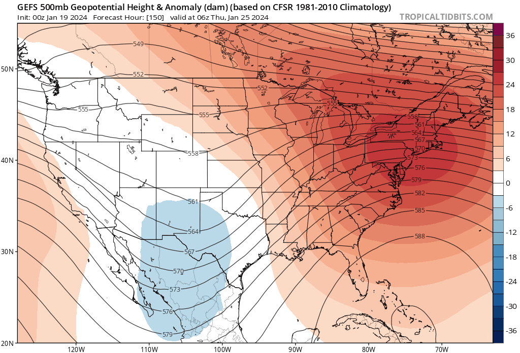
Sunday has a shot at being nice for late Jan at least.
I mean, the reason for any cold anoms at that point is the eroding stale arctic airmass...Atmosphere aloft is warming nicely by Sunday afternoon...
-
This weather sucks. Cold and dry is the worst.
Awful for the dog. Awful for just doing things, generally, outside of snowboarding/skiing.
-
2
-
-
The Tuesday/Wed illusory snow threat is about to disappear on the operationals.
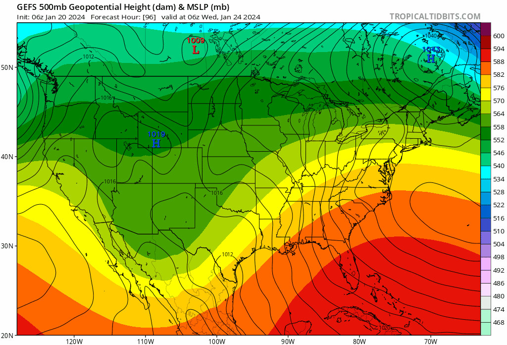
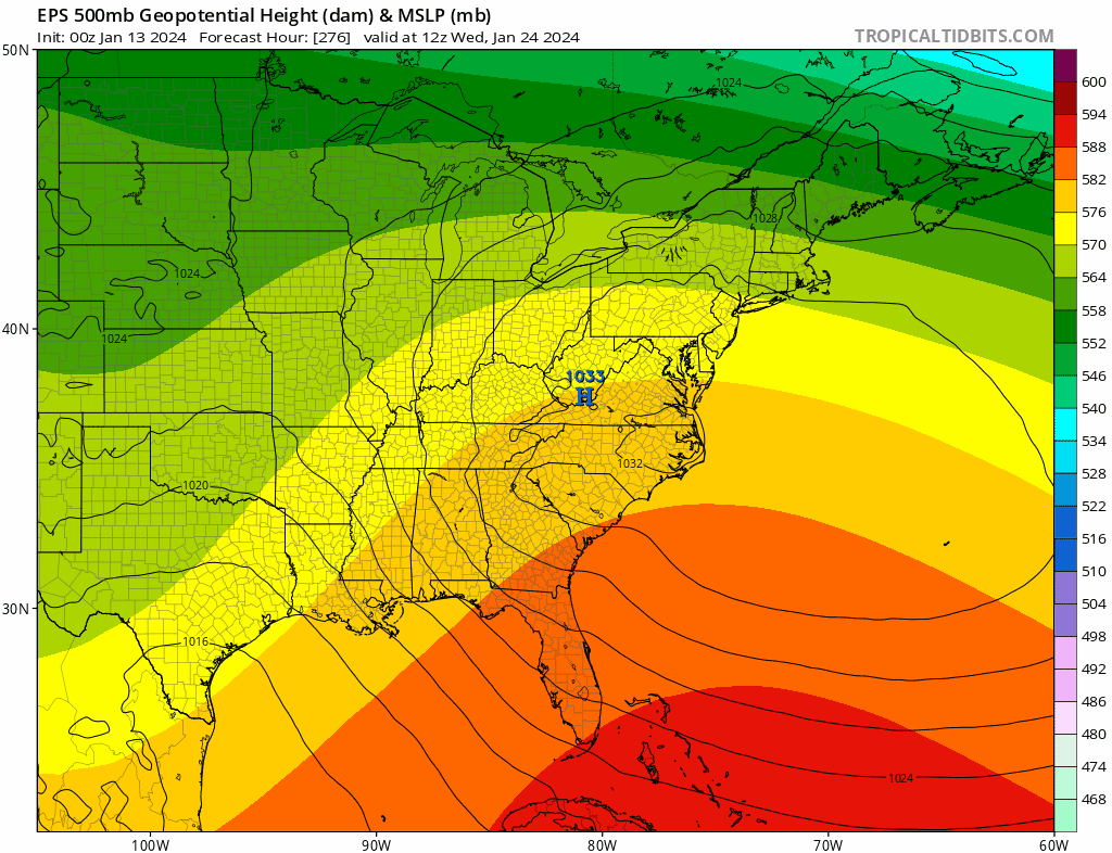
UL ridging builds highest over our heads—troughiness in SE Canada/NB, vanishing. Notice the ridge axis progression eastward over time…
SNE:

-
2
-
-
13 minutes ago, weathafella said:
Climatologically, there tends to be a few events like this every winter. In many, the wall is south of much of New England. Time will tell but there is potential for wintry qpf in a lot of places that should be torching. We'll see how it plays out.
Eh, north of the wall is where warm fronts go to die - that's around Winne's latitude. That line is very well established climatologically.
Yes there are patterns that prove exceptions but that area is rock solid winter; and that's where I'm referencing.
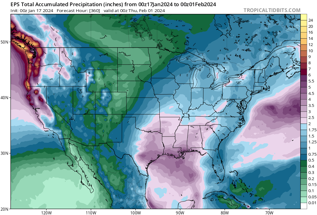
Being Dry is their #1 enemy to big snowfall seasons.
-
5 minutes ago, 40/70 Benchmark said:
Maybe you end up correct, but this latitude can do just fine with a +AO/NAO and cold Canada......December 2007 is a perfect example.
I think the better argument is if the MJO and forecasted teles are wrong....
If they're right and you bake this into the op runs with that general longwave pattern, it's ugly. Very much like that 6z EPS evolution.
-
Our "Canadian High"
"Eff you Cya"

-
1
-
-
2 minutes ago, dryslot said:
Nickels and dimes events can work like the GFS has, Better then the alternative.
Lewiston Maine. Sure.
But the op runs with the -NAO look, with snow potential into coastal SNE are just evil. The ops notoriously lag the teleconnection shifts, but this lag is likely especially pronounced given the unusual spike we're seeing in both the NAO and AO indexes.
It's a shit pattern that will produce shit, except north of the wall. The GEFS and EPS are much more reliable here, even at 5 days.
-
1
-
-
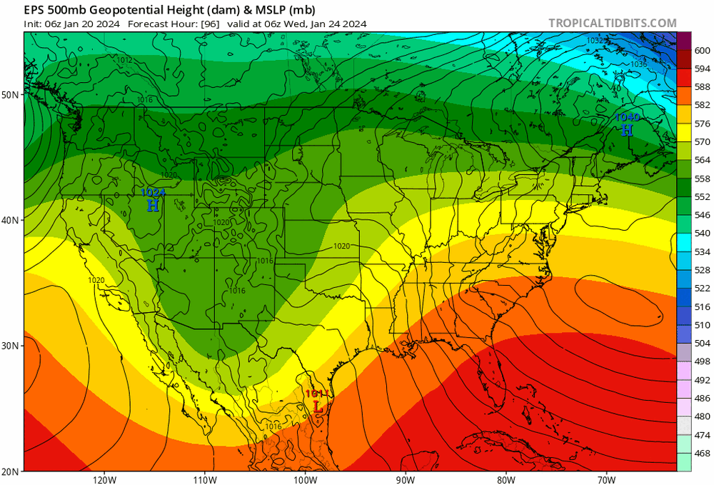
We're moving towards a PAC northwest oriented Jet. Maritime tropical --> Maritime Polar
Therefore, the modest increase in the PNA is not a cold-ish look for the CONUS, it's still heavily influenced by the pacific... On balance, it is broadly an AN factor.


-
2
-
-
Gonna finish here with about 3”. Mixing and slotting.
-
1
-
-
Just now, STILL N OF PIKE said:
Def underperforming thru noon there , I think you see good rates from 1-3pm (1”/hr) and well I guess we shall see if and when that sleet line finds resistance by then
That jump in rates is coming with the 850 mix line. It will rip snow right as it approaches, but not last too long - maybe an hour. That's what happened at all points south. Won't be any different here is my guess.
-
4 minutes ago, STILL N OF PIKE said:
I figure you have 4 hours to go
That's valid but at max 0.5"/ hr tops. It's flurrying out right now.
-
1
-
-
15 minutes ago, STILL N OF PIKE said:
Enjoy your 5”
I thought we respect NAM thermals.
That mix line is racing north now.
-
Expecting to underperform here. Guidance JP not panning out imby.
Dry air, and subsidence now, then turns to dry slot and 850 issues. Gonna put a hard cap on this at 3" tops...
-
1
-
-
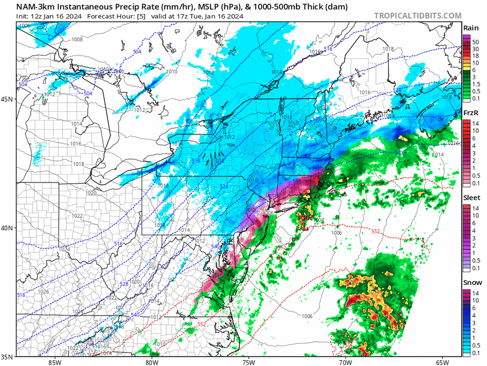
Mood snow. very light. Vis > 1.5 miles.
cold. dry. Too much of the latter..
Whatever flake falls counts but it's taking hours to add up.
probably 1.5" even though it started around 5 a.m.
Now fighting subsidence overhead.
-
Good baseline forecast is the part 1 of the Jan noreaster. Thump 2-4", warm-up/ "dry slot", end.
-
1
-
-
The warm/NW trend likely isn't done, based on the UL jet position. But tricky forecast seeing how far out ahead the precip moves in, before the warming at 850, and below.
-
2
-
-
The precip will outrun the mid level warming, so that's likely the big help (differentiator), accums wise..
-
2
-
-
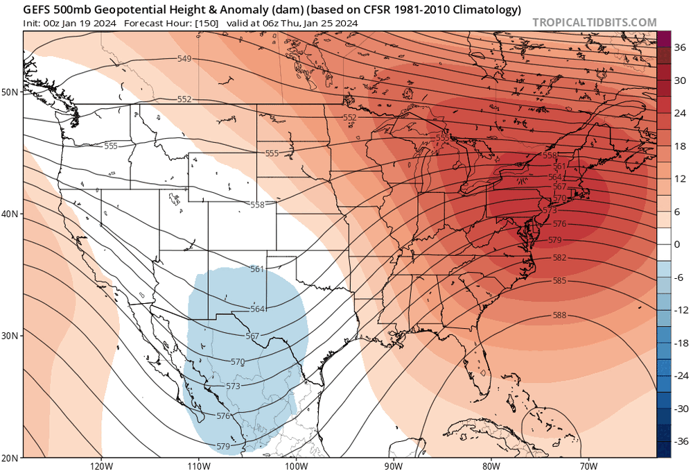
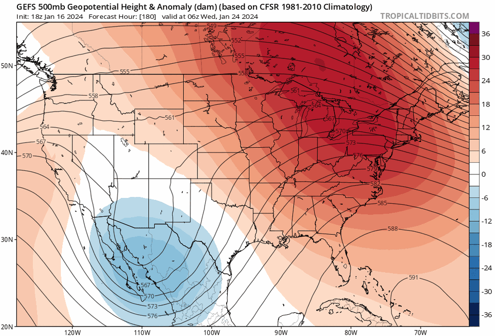
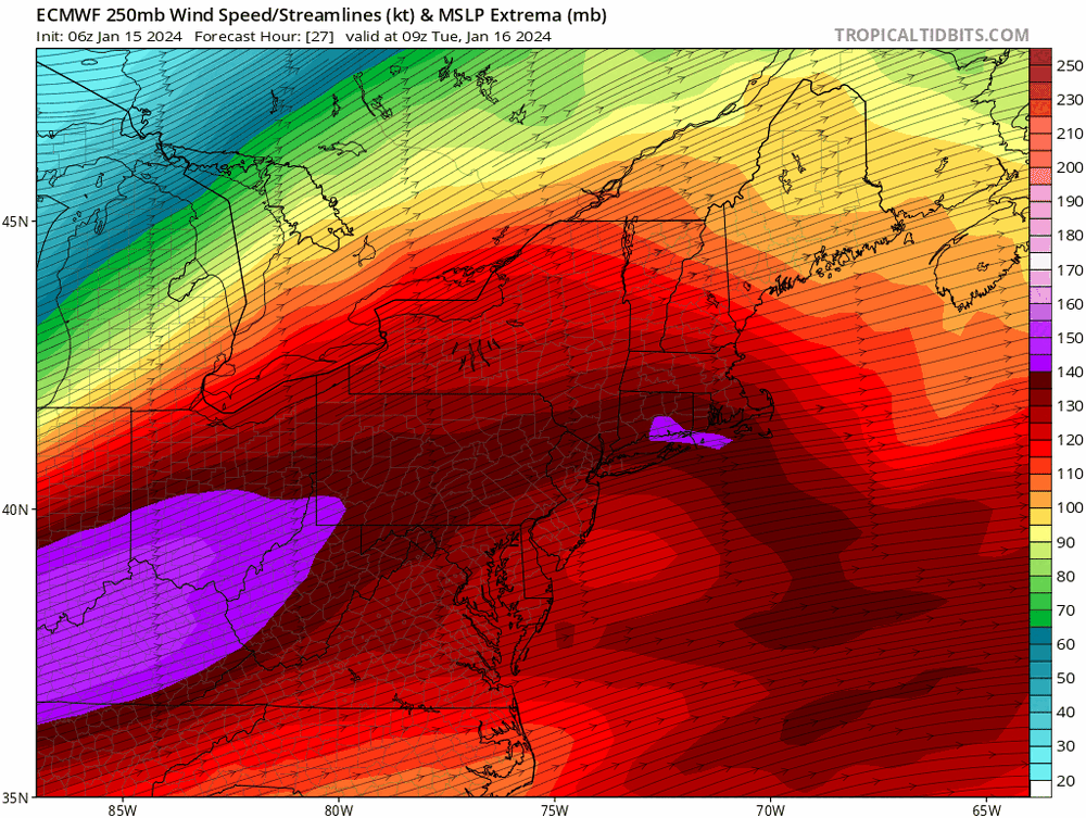
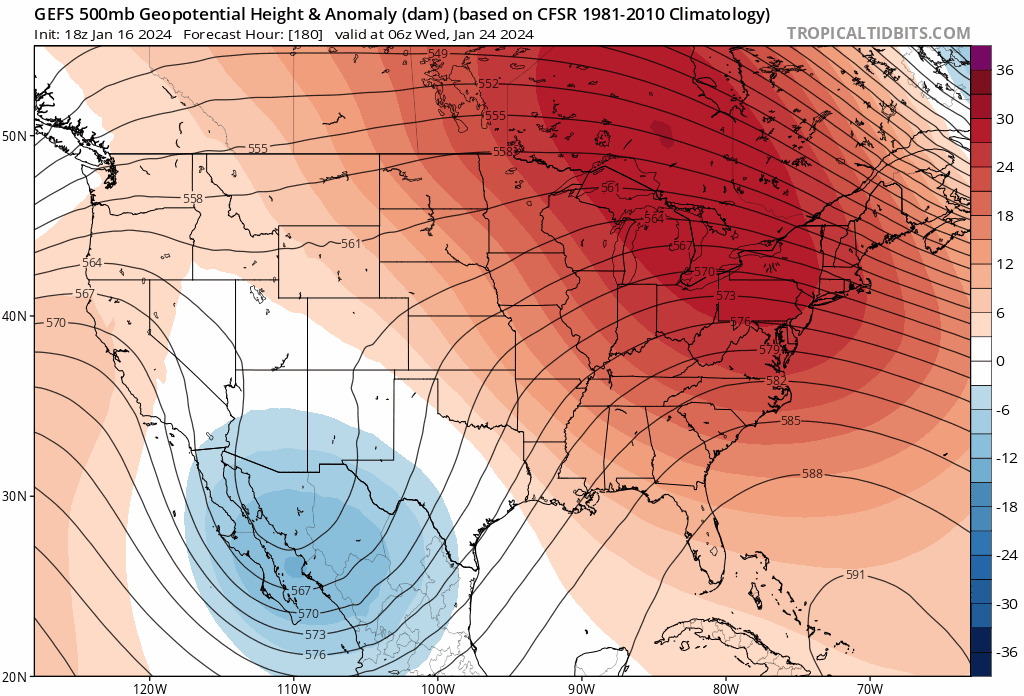
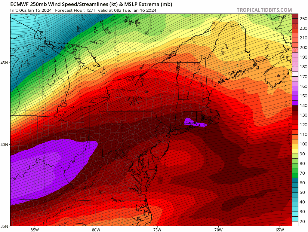
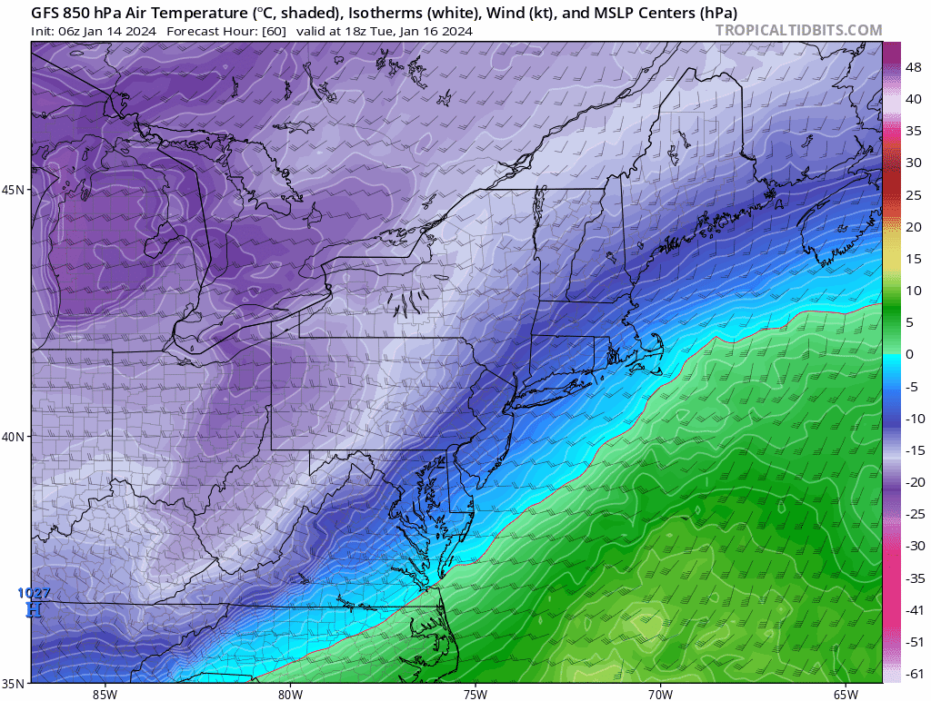
The 250 mb jet is really far north on the Euro/GFS.
The winter storm that had the 850 Mb low cut across SE MA and Boston, and ptype issues thorughout, the jet was like 150 miles southeast of this position...
-
21 minutes ago, The 4 Seasons said:
I just read BOXs AFD. Seems really conservative to me given the latest model/trends and doesnt match up with what their map has. Strange...
For now, we have held off on issuing any Winter Weather
Advisories for the region. There is a good possibility one
could be issued due to the threat of freezing rain and impacts
to the Tuesday morning commute. Snowfall ranges between 1-2
inches with up to 3 inches possible in northeast Massachusetts.
I got no horse in this race, but this trend is a PITA for BOX.
Probably why they are gun shy. At least this is why I would be...
Doesn't help either with how cold biased the GFS has been up until go time...

-
2
-
-
MJO progression slows dramatically as we head into phase 6, which is our warmest phase for Jan/Feb.

-
1
-
-


January 2024 -- Discussion
in New England
Posted
NAM is tracking way too cold. Shocker.
HRRR even worse.
PSM is already 26.