

jbenedet
-
Posts
6,566 -
Joined
-
Last visited
Content Type
Profiles
Blogs
Forums
American Weather
Media Demo
Store
Gallery
Posts posted by jbenedet
-
-
-
43 minutes ago, dryslot said:
That one would be big if we got it here, Pac won't cooperate.
I believe you’re right on this. The pacific worsening as this is trying to get going is outweighing the northern stream improvements in the east.
-
 1
1
-
-
And the weenies were rejoicing this morning on… who the eff knows.
You know, you guys can run these loops too…Just sayin’.
Hope springs eternal.

-
7
-
-
12z GEFS looks like dog shit for the 4th.
Gone.
-
Just now, STILL N OF PIKE said:
It has -5 925 Temps to MVY and ACK
warm lmao , polar high centered NW of Maine at 1032 with -30 C 850’s
You guys read model output verbatim. Report on it. Thanks for the pbp. Cool. We all can read.
-
 1
1
-
 1
1
-
1
-
 6
6
-
-
1 minute ago, dryslot said:
That one would be big if we got it here, Pac won't cooperate.
I think you can get an early phase; but it’s a mistake to extrapolate a further north track—it’s a cut-off slide ENE. Confluence over the western Atlantic.
-
1
-
-
That’s a robust -NAO turned to western Atlantic ridge for the 7th/8th. Thanks to the skunked pacific. -NAO be damned. Easterly flow, warm.
-
1
-
1
-
2
-
-
2 minutes ago, dryslot said:
12z GFS says no on the 5th.
That’s close for areas like Richmond VA, up to ACY.
12 hours earlier phase. Boom.
That region should be watching very closely.
-
1
-
-
11 minutes ago, WinterWolf said:
Outside of perhaps one poster…I don’t see anybody ignoring anything…
“Ignoring”. Not the right choice of words chief.
You lazy guys just need your daily dose of model crack to get through the day.
Hope springs eternal.
-
1
-
1
-
1
-
-
Jan 4 is the big dog potential when the pacific isn’t skunked.
It’s just too far south for us; save maybe extreme southern sections.
-
2
-
-
A whiff…
And then a whiff or rain.
Can’t wait.


-
4
-
-
1 minute ago, ORH_wxman said:
No it isn’t. It’s cold enough to snow down to Mid-Atlantic.
Until the storm comes in, and with it the pacific air.
-
1
-
1
-
2
-
2
-
-
The serviceable airmass for 4/5 is gone by the 7th.
-
1
-
1
-
1
-
1
-
-
The 7th one is all but completely off the table.
Even if the track somehow takes it north to our region, which is unlikely in and of itself, it will be flooded with tropical pacific air. Rain. Careful what you wish for.
You guys…SMH

-
2
-
1
-
1
-
2
-
-
Laugh at what you want but these dumazz tik tokers would have had higher verification scores than most of the people in here —degrees and all—by studying effin’ wooly worms for 3 min. Yup that’s right, those big ugly hairy mfers crawling around your yard in late fall.
But models…
Sebastian Maniscalco voice: “Aren’t you embarrassed???”
-
1
-
3
-
2
-
 1
1
-
1
-
-
20 minutes ago, CoastalWx said:
Who needs models when you have green grass and geese.
Yea guy, modelology FTW..Better off listening to the 12z CMC over the 12z GEFS. Right? That cohort of modelololgists wasting everyone’s time. Verification scores; easiest thing to check but let’s look at more garbage output because, well, we’re lazy and can’t think for ourselves.
Good luck.
-
5
-
1
-
3
-
-
17 minutes ago, Sey-Mour Snow said:
Closing shades for 3 weeks in Jan with a -nao in Central New England is not smart. Maybe down here on south coast we get skunked but even we can get lucky down here in the tropics.
Yes Jan 4 threat is real. I’ve made that clear. It’s a small window before the large scale pattern reasserts.
But I think this window is dry for our subforum.
-
Just now, NorEastermass128 said:
Closing the shades. Reassess around 1/20.
Yea that’s what I’m feeling.
-
2
-
1
-
-
8 minutes ago, Layman said:
Can confirm. More geese than people at the dying Fox Run Mall. Has a distinct late March, early April feel out there today.
Yea first time since last winter season. Add it to the growing list of signs pointing to a big warmup in coming weeks.
-
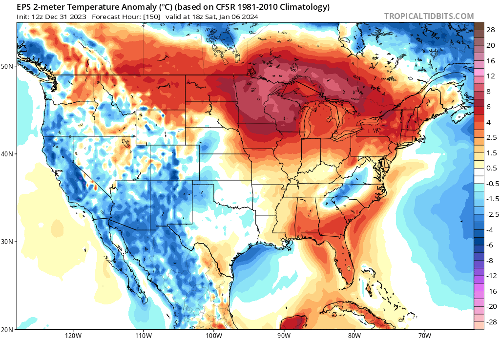
The 2nd week of January, beginning Jan 7th-ish, looks like torchiest (?) period so far this season. Whoever gains a pack prior will be wiped out during this window.
Very strong signal for significant +T anamolies with duration.Thinking this will be weenie cliff-jump period.
-
1
-
1
-
-
39 minutes ago, Typhoon Tip said:
I realize your tuggin' winter enthusiast pubes with this statement and it's all fun and all. Just the same, I saw geese in V formation communicating overhead in the midst of that 2017 March Nor'easter, not 10 minutes after there were two lightning flashes and the reporting thunder ... At the time it was S borderline S+ vis in the 1/3 mi range. 31 F I was like, 'whaaaa -'
I'm able to recall all that because in the moment it was just too weird - like one of those 'where were you when -' moments. Seeing them fly over, apparently they absolutely couldn't miss their flight so they had to risk it ?
To be sure, I think Jan is going to torch. The grass has greened up and it will stick for the next couple of weeks at least. That’s what all signs are pointing too-observationally, MJO, global guidance, and even the guys at the CPC. I’m not saying it will never snow again, but we are in a very poor synoptic pattern for snow at the moment, and it actually looks like it gets worse before it gets better. First week of Jan looks slightly AN, but then we’re back to +AN.
I do think it makes sense to wait until that analog consensus for El Nino’s —very late Jan into February period which tends to have a large scale switch to wintry conditions. Although, before getting more enthusiastic for a big comeback we need that timeframe to come within view.
-
1
-
1
-
-
We tried to tell em.
-
1
-
-
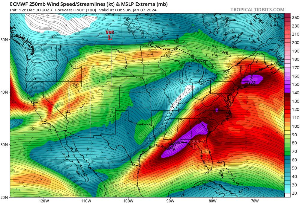
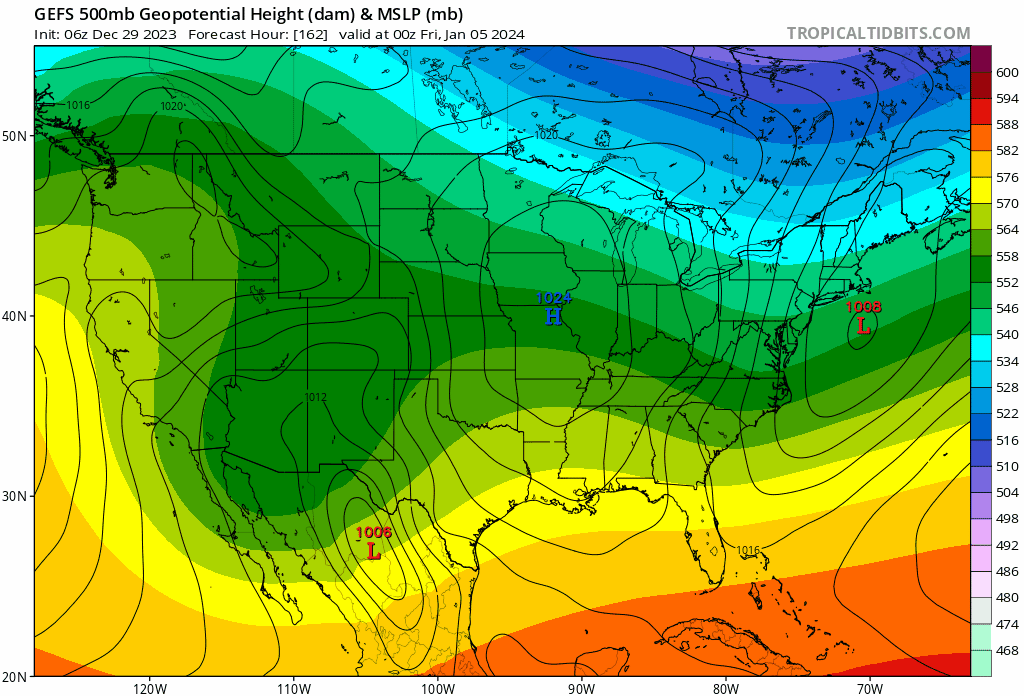
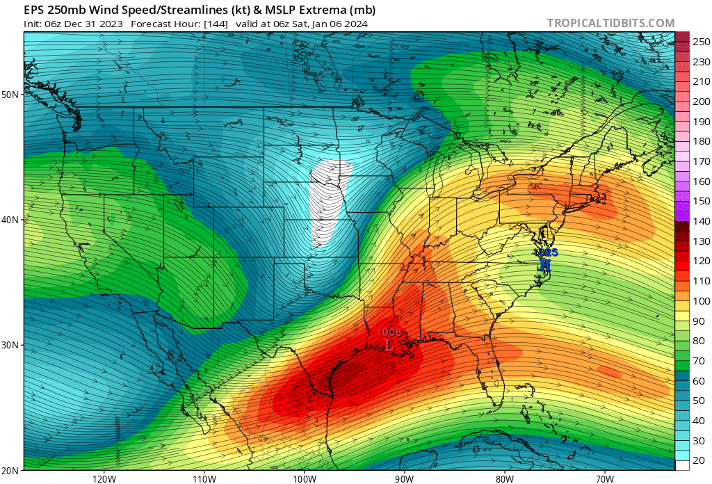
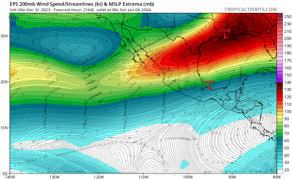
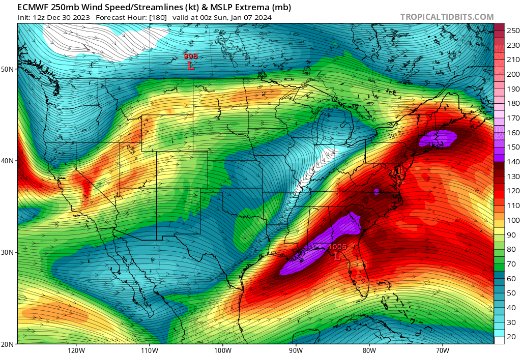
RE Jan4: The northern stream is improving but the southern stream is deamplifying over the western Atlantic. That’s the trend on guidance; and it’s supported by the teles.
My thoughts are still that the northern stream will dig for gold; and it can hook up with the southern stream shortwave much sooner, over the SE CONUS; but —despite this—the downstream UL height amplification over the western Atlantic will remain muted and therefore not allow enough latitude gain to bring SNE into the game.
Still think south of mason Dixon more interesting than Nova Scotia but both are very much in the game. At the same time, Portsmouth NH 40, sunny and dry. My best guess.
-
1
-
-
Epic flock of geese spotted in Newington. Close the shades to February.
-
2
-
4
-
2
-

January 2024 -- Discussion
in New England
Posted
That’s 2m temp anoms. Thanks. We know.
Your H5 is there also, because of that.