

jbenedet
-
Posts
7,150 -
Joined
-
Last visited
Content Type
Profiles
Blogs
Forums
American Weather
Media Demo
Store
Gallery
Posts posted by jbenedet
-
-
It looks like plain rain even to PSM by 12z tomorrow.
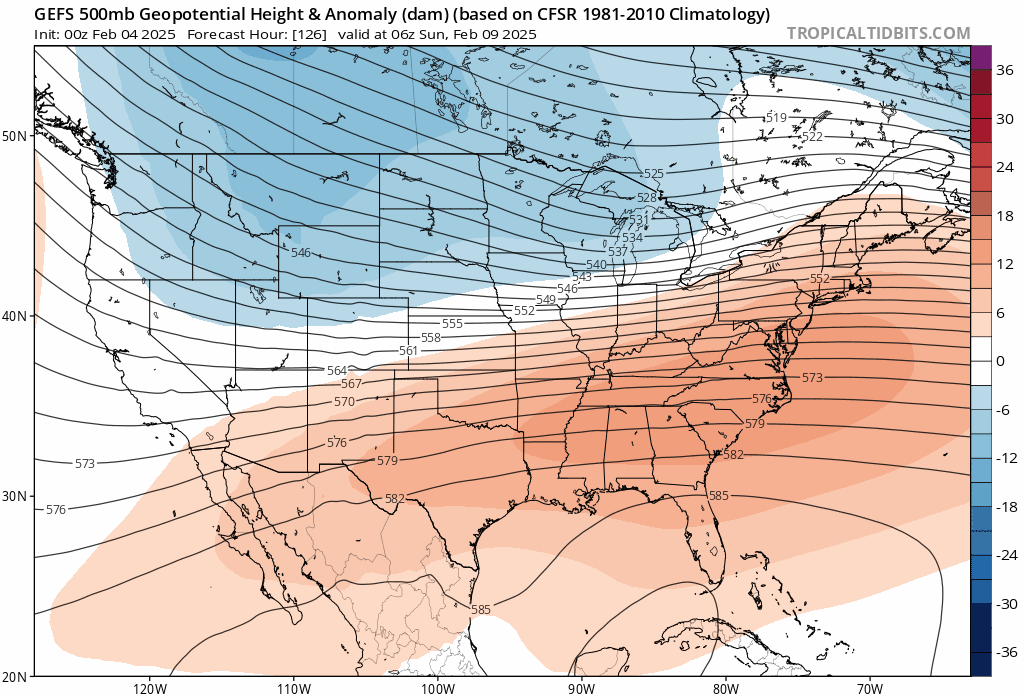
I still don’t understand why the guidance is so cold in eastern sections, directly down stream of these strong and persistent easterly winds.
-
 1
1
-
 1
1
-
-
-
1 hour ago, moneypitmike said:
Bleh.
Deep winter here now though.
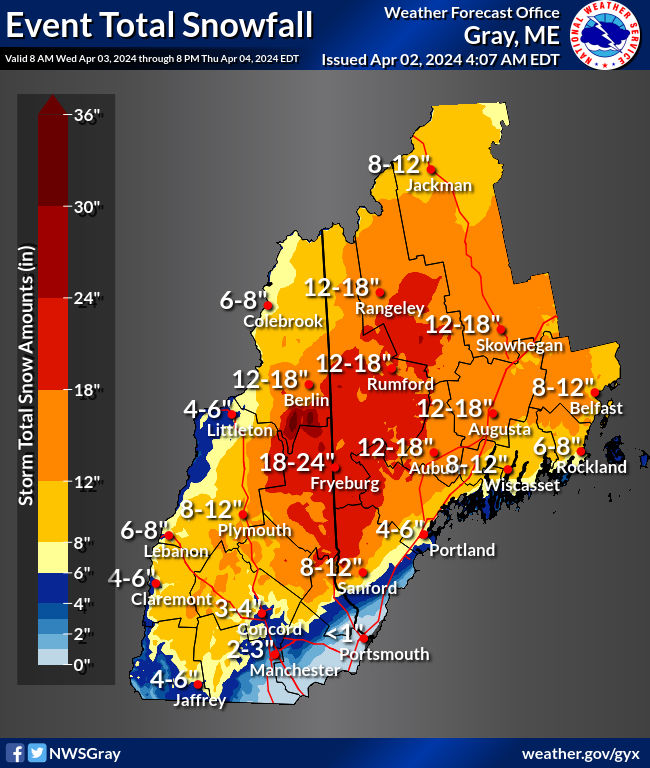
More in Portsmouth than Portland and Augusta?! Don’t understand this map in southeastern NH.
-
East winds rip up to Acadia. That ain’t your mesolow CAD signal for the coast.
-
1
-
-
-
I think it’s pretty straight forward—-There will be a coastal front that sets up and persists somewhere from PSM to DAW and likely right over my head on down to ASH.
I’m expecting a lot of 32-35F rain after 3-6” thump.
-
 1
1
-
 1
1
-
-
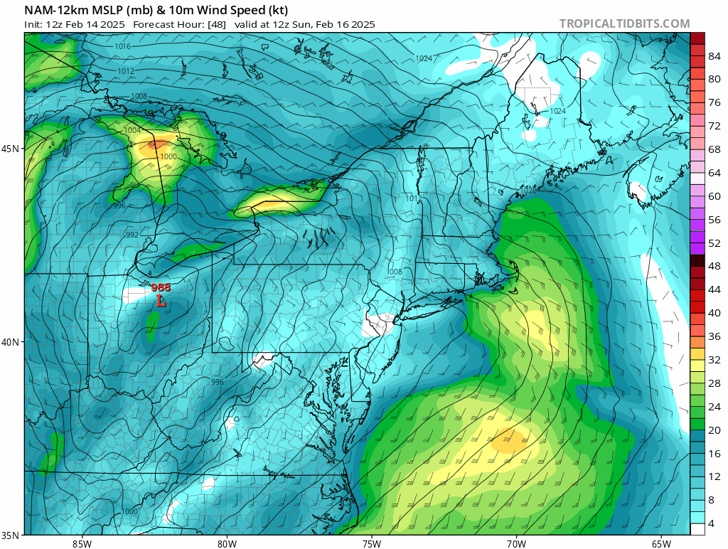
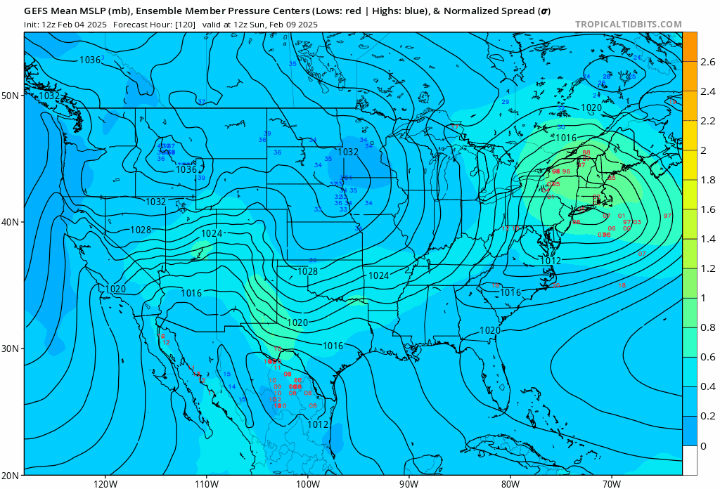
Unless you have a good surface high in south eastern Canada, you don’t get an early transfer with the best baroclinicty and vorticity to the west. It wants to bend back.
-
2
-
-
The surface temps on the GFS are ridiculous
-
If you pull the arctic phasing sooner - what happens?
That's the risk here.
I think the setup and teles promote early and clean phasing. I could see it bomb over VT/western MA..
It's a very deep system—Gulf meets arctic— and most are in the wrong part of the long wave to be on the cold side...is my guess
-
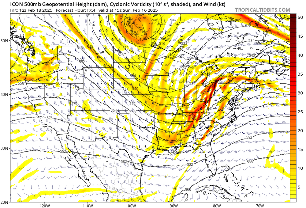
I’m looking at the amped teles and UL vort, and artctic/gulf potential phasing here and wondering how this isn’t a sub 985 low on guidance somewhere in the vicinity of Pittsburgh….The BZ is primed.
This looks like our strongest storm in a while with plenty of mid level dynamics as it enters our region…Nothing points to progressive either.
This should have the wave space for the full synoptic wave development—mid level occlusion before it ejects east.
I could see the evolution changing quite a bit from here.
-
 1
1
-
-
19 minutes ago, OceanStWx said:
It's been a pretty rough run of snow depth locally since 2018, and local research has definitely shown that we're losing total days with snow cover in the winter.
This one definitely has the feeling of the December 2020 storm on the ratio front. That modeled 300 mb deep DGZ was definitely a strong signal for upping SLRs. It's just so damn hard to push yourself to forecast more than 20:1. GYX has at least a 23:1 from the morning observation, so my CoCoRaHS gauge may not have been far off.
Great call up here. This storm did not perform at all as I expected. Completely wrong.
The whole precipitation distribution is much more as though the primary never completely fizzled all the way into CNE. The early transfer never panned out, and the dynamics followed…
-
2
-
 1
1
-
-
North of pike weenie shrinkage.

-
The HRRR qpf output looks much more like CMC/Euro AI.
Interesting battle.
-
RGEM surface warm bias but one of the coldest pieces of guidance for tomorrow

-
1
-
-
The CMC/RGEM is still with the Euro AI.
There hasn’t been a capitulation (yet).
-
17 minutes ago, OceanStWx said:
Let's call it 15:1 average SLR there, that's going less than .33" QPF on the high side, 0.20" on the low side.
71% of the ensemble members are 0.5" or more QPF. Gimme the over.
.33 LE sounds about right to me. 15:1 is on high side up here for ratios. You’re good on lack of compaction but weak on lift, in DGZ, as I see it.
That’s 5” at high side; 4” if you use 12/13:1
Also why is the 29% portion wrong? Any reasoning? -
2 minutes ago, SJonesWX said:
Several days ago I forecasted 5-8” for this area (MHT/ASH/CON).
what’s your forecast for that area?
3-5”.
-
 1
1
-
 1
1
-
-
1 minute ago, CoastalWx said:
Fluff job and mid level goodies will juice up SNH totals.
Yea that is true on ratios. Will see. Nashua on East could maximize the ratio aspect. I could see that.
-
The 6z Euro AI should be analyzed and weighed. I think the evolution and track makes a lot of physical sense given the tuck and lack of dynamics with this.
That said I do think it’s qpf is too dry for points SOP. 7” mean is a good bet there.
-
I still don’t buy the .5- 75” qpf contours into a chunk of NNE. Seems way to generous
This also looks tucky. Classic cold tuck setup that guidance ain’t catching until nowcast. It’s going to yield colder throughout but I also think that will intensify the snow accumulation gradient with highest amount south of pike and much less when you get MA/NH border. The cold tuck will maximize the snow potential for you guys in the south. congrats.
-
 1
1
-
 1
1
-
1
-
-
The GFS qpf distribution looks way too generous, north of pike given the overall Synoptics. Open frontal wave 1003 mb, very dry air mass, and weak UL vort. This isn’t an over-running setup either. euro/NAM make much more sense in this regard.
The best forcing continues to be modeled along the south shore of CT into SE MA. 7”; locally 10” is a good mean expectation around there. I wouldn’t be worried about taint either. It’s cold; and the cold has been really flexing the past 2 weeks. North of the pike this looks more like a moderate clipper with sharp cut off, but still enough for high end advisory.
I’m expecting 3” here in Dover.
-
1
-
-
Get to see by radar just how shallow the cold is which is pretty cool. Not an isentropic lift setup; holes in the precip.
If you went more aggressive with snowfall amounts, probably a good time to shave some off.
-
1
-
-
-
Seeing these big clown maps up here but she gon south.

-
1
-


PD Holiday Weekend Mess DISCO
in New England
Posted
Yes check out the euro.