-
Posts
7,099 -
Joined
-
Last visited
Content Type
Profiles
Blogs
Forums
American Weather
Media Demo
Store
Gallery
Everything posted by jbenedet
-
Yea timing was poor in both directions. Precip moved in after sunset last night but 850-925 was the main problem. Now 850-925 cool enough for snow, but best snows move in with crap airmass in early afternoon. A lot of 32.5 - 34.0 snow to fall which doesn't stack well without rates; and a 990 mb low doesn't get me excited about the rate potential.
-
I just came back from a trip out to the Berks - Lee, Great Barrington area. Saw 24 hours of light to mod snow amount to less than an inch. Been a similar story back in Dover. Interior or not, it's BL temps have been a major problem throughout SNE. People in this area are not used to being laser focused on BL temps. Growing up on LI you lived and died by it for snow total accums. This year in SNE tracking BL temps >> tracking radar. The former has been the problem, while the latter has been outperforming.
-
Common theme this year, in SNE and my hood is that when 850 is no Longer a problem; the BL is. There is no cold on the back side of this. Period. It’ll flip back to snow, and most will see quite a bit falling, but a lot of it gonna go down as white rain. 1) Sell the clowns. 2)Hedge with 5:1 in the colder spots. 3)Don’t believe it until you see it at the stake everywhere else
-
We’ve seen a lot of long duration events this season and this one also fits the bill with all the UL energy hanging back. So the Friday story is real but will probably be more mood-influencing than of substance with rates/temps that don’t allow it to stack up. Steady-state, “it’s beautiful/nice to see” vs I added another 3”. Type snow. The latter confined to higher elevations.
-
There’s also a needle thread option in areas in interior MA, that cold tuck well. Looks like the first wave of precip is out ahead of the warmest push at 850. There is “sweet spot” potential where surface is 32ish. Would see mostly snow, as 850 doesn’t warm >0C until it’s moving out/ending. Lose about 1/4 precip to sleet/ice at end. There’s a lull, and then Friday morning, part 2 all levels support…
-
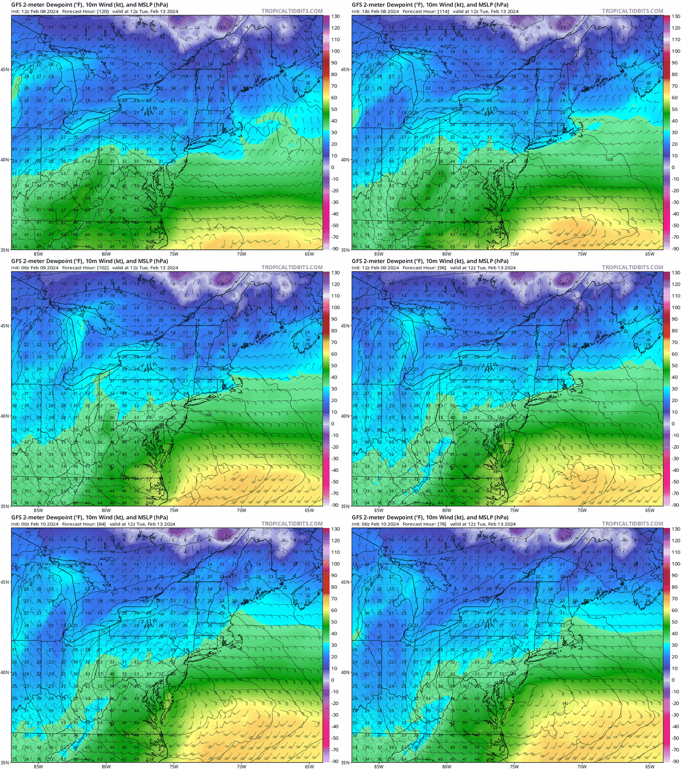
ARW2 seems within reason for what we might be able to eek out of the NW. The absolute low bar for overnight dews imo. All alone, but what's interesting is the GFS surface dews are colder than the NAM's. The NAM's TD's in Southern Ontario are wayyy too warm vs the rest of guidance which tells me it's too warm in our hood. By like +10F at any given location, in Southern Ontario. The NAM is going to correct colder at the surface into go time, me thinks.
-
If you mean Monday, yea, there’s a chance. Sure. But I think odds favor strongly against.
-
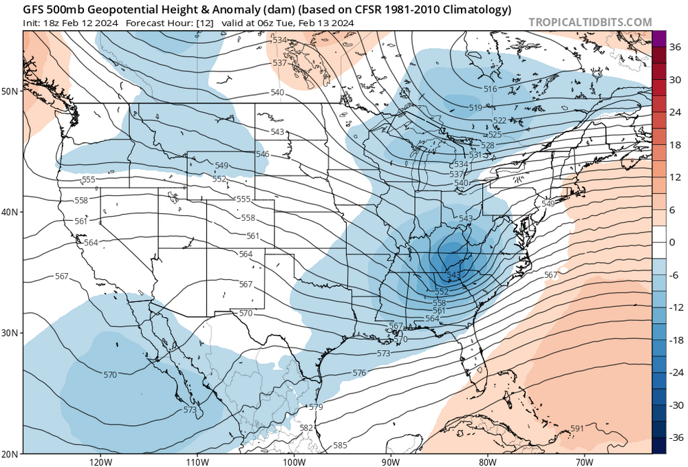
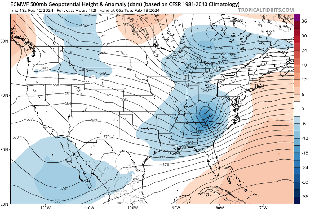
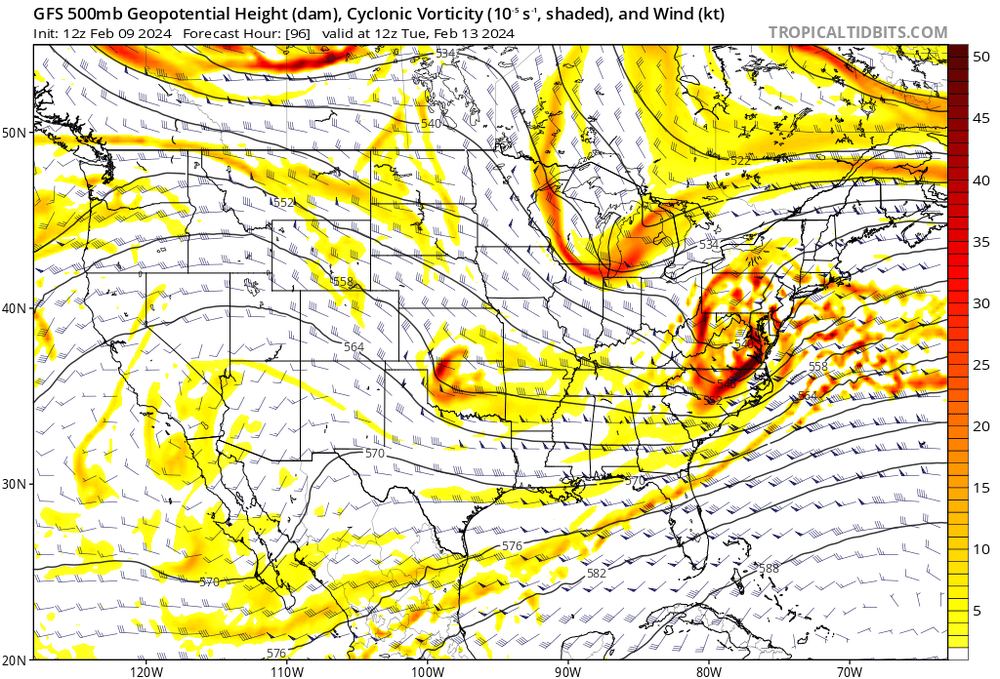
Don’t get it twisted. That is a fantastic look. And it’s quite different than the crap maps you and Crooklyn been passin’ around all season. I’m saying we cut on Monday and I’ll reassess and see that H5 maps still look like this at day 5. If so, weenies rejoice.
-
The 6z EPS pops the secondary about 3-6 hours earlier than the 12zNAM. If we take the EPS run verbatim and shift 12zNAM 850 thermals accordingly, the risk is asymmetrically tilted in favor of more snow where 850 is the warm layer, and surface sufficiently cold. Worcester west/North, line for example. Could be talking a few more inches than the clowns advertise. We watch.
-
Wine.
-
Crooklynwx selling more snow weenie H5 maps. The snow addicts in SNE can’t resist. This Monday threat looks like shit under the hood. Someone create a Back to brown thread for this shit.
-
The NAM clearly feeling the cold press in the primary --more than other guidance--but the primary holds on much longer (longitude) than other reliable guidance. Net-Net it's a warmer depiction because SNE skunked at 850. But being that the NAM is alone in this aspect, we sell for now... This is one of those where you have to smell the taint to get the highest totals... Cold tucks are significantly under-performing broadly this season, and I'm selling any of them advertised in the east until further notice. But we have seen them show up with stubbornness in the far interior, so I believe this is can be one of those situations.
-
For Thurs/Fri, The EPS has been trending positively for a more wintry solution in the marginal zones. Weaker primary, less latitude gain, earlier secondary.