jbenedet
-
Posts
7,807 -
Joined
-
Last visited
Content Type
Profiles
Blogs
Forums
American Weather
Media Demo
Store
Gallery
Everything posted by jbenedet
-
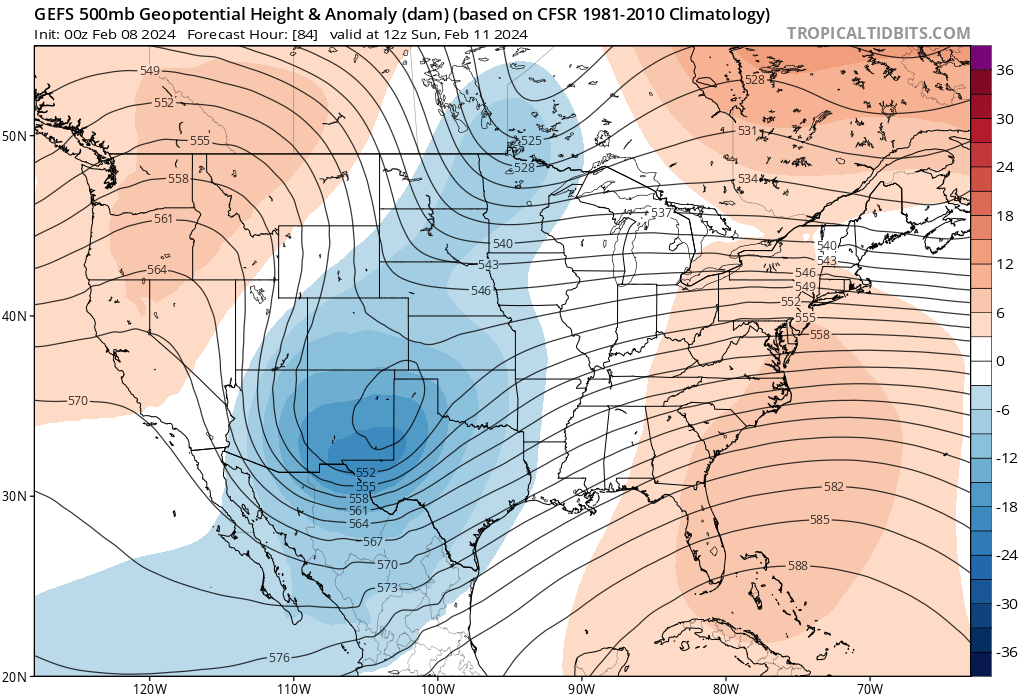
 There's still huge discrepancies just on how strong the southern stream vort is, and speed of it,, pretty early on around day 4 nevermind phasing. Kinda shocked by this, actually.
 -
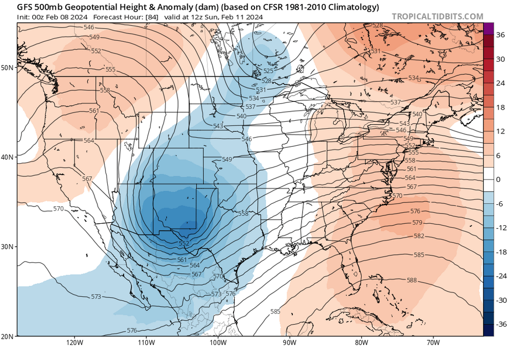
GFS looked more like CMC mid levels. I do think this was a shift towards other guidance, just didn't show much in the latitude gain factor in terms of sensible weather.
-
GFS is a lot slower than the EPS. It isn't at all buying an earlier phase, but a second vort in northern stream looks liable to hook up while over eastern conus. If not now, then in future runs.
-
That look on the GFS doesn't fit anything really. Not the MJO, not the teles; alone vs other guidance. Sure it could be onto something, but odds are strongly against imo.
-
That is an impossibility.
-
Triggered. and a liar. Had no idea I even made a call. lol. Not only does the guy read minds, he makes up their mind for them.
-
Pretty funny seeing these SNE weenies wanting to sell the GFS at 6z after hugging it at 0z
-
0z GEFS more phasing than the op. 18z EPS phasing > 0z GEFS 12z GFS and earlier runs were aligned with EPS and until 18z and 0z runs. I’m a seller of the flat and weak look. The 0z canadian is OTL also. Different than GFS but doesn’t make sense. I think the GFS lost the right idea from earlier today.
-
Sorry guys. 0z GEFS flaggin’ the shit out of the hang back idea of the southern stream vort.
-
0z GFS has a +NAO/+AO type evolution. Doesn’t fit.
-
0z GFS was BS the way it hangs back the southern stream and doesn’t phase at all. Hard sell. The GEFS and EPS both look more amped out west with much earlier and cleaner phasing than the op.
-
For S&G's.. 975/984 location right near PSM/PWM, is my bet at this point. And 975 good baseline in terms of intensity at that location.
-
Yeh; no kiddin'. The teles scream amped solution. This one looks like poor timing in a good longwave pattern. The Northern stream looks like it will phase early, and cleanly with the southern stream over the central US. The southern stream vort is also amped, early on out west. The building PNA ridge allows the northern stream to drop right into the central plains. Kaboom. I'm worried about warm sectoring into SE northern new england. This thing is gonna crank. Too much of a good thing, for most.
-
It was a Flop... February 2024 Disco. Thread
jbenedet replied to Prismshine Productions's topic in New England
Allow the multi-day torch to commence. Exceed average daily high by 10 am kinda day. 45 is a lock for PSM. 47 my bet. +12 -
It was a Flop... February 2024 Disco. Thread
jbenedet replied to Prismshine Productions's topic in New England
I was driving through Andover MA this past weekend and saw a field of broccoli heads coming up. Had to triple take it…. That’s at least a month early. -
It was a Flop... February 2024 Disco. Thread
jbenedet replied to Prismshine Productions's topic in New England
Yes that’s another good point. By this time of the year, for buildings/homes that get good sun, you’re def using less heat at 35 and full sun than 45 and clouds. And yea does a lot to improve your day to day sentiment in the heart of winter. -
It was a Flop... February 2024 Disco. Thread
jbenedet replied to Prismshine Productions's topic in New England
Not really. By feb, 35 and full sun is like 45 real feel; can even feel closer to 50 in city scapes, if wind is completely calm. Also does a lot to brighten things up—lower absolute humidity levels in winter and no vegetation maximize ISR in the biosphere, right at the surface. -
It was a Flop... February 2024 Disco. Thread
jbenedet replied to Prismshine Productions's topic in New England
Only because the snow maps weren’t producing much at all for New England. -
It was a Flop... February 2024 Disco. Thread
jbenedet replied to Prismshine Productions's topic in New England
Looks more like late November than early February. And this is before the warmup this week in the northeast which will push the pack line back to Winne. Wouldn’t use early feb climo with snow pack and SST’s up here… Better use a significant + surface temp bias in SNE or risk getting burned.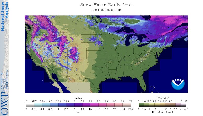
-
Did you say geese?
-
It was a Flop... February 2024 Disco. Thread
jbenedet replied to Prismshine Productions's topic in New England
That’s what makes a rat in this part of the world -
It was a Flop... February 2024 Disco. Thread
jbenedet replied to Prismshine Productions's topic in New England
Big snows will always be close in Dec and Jan, we live in New England lol. I def would not feel good about a forecast on that merit. -
It was a Flop... February 2024 Disco. Thread
jbenedet replied to Prismshine Productions's topic in New England
The outcomes to date have been pretty damn textbook significant El Niño. Just following that seasonal forecast would have yield great accuracy results to date -
It was a Flop... February 2024 Disco. Thread
jbenedet replied to Prismshine Productions's topic in New England
That curious look for the cold shot this weekend with massive ridge in plains and trough in the northeast is going to continue to flatten out It looks very MJO phase 6ish. Notorious lag, i know but we've been in phase 7 and will remain so into the weekend. Sell BN. Think good chance it turns out AN both days. Likely really nice for early feb.. -
The banding was good enough for 6" to the sea coast NH down to- Newburyport MA/Lawrence. But temps a huge limiting factor throughout. Pretty cool driving from Dover to DAW and seeing snow amounts triple in ~8 miles.