jbenedet
-
Posts
7,807 -
Joined
-
Last visited
Content Type
Profiles
Blogs
Forums
American Weather
Media Demo
Store
Gallery
Everything posted by jbenedet
-
 Kinda wild hearing the melting as the rates drop to light, and temps bump up a degree or two.
 -
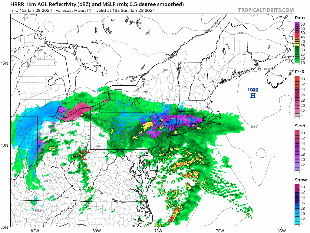
Solid heavy band over. Looks like coating on driveway. Maybe cold surfaces are half an inch.
-
Way too much of this white rain has been registering as snow on these algorithms. That’s the only reasonable explanation.
-
Radar looks good in northern mid Atlantic but that’s decaying as it swings east, and the mid levels open back up. Misconception to think that whole structure swings through tonight in that same state. It’s also going to speed up. I feel like 2” is optimistic scenario here; and most likely outcome is a coating.
-
Plain rain. occasional flake. 37/35
-
Really warm in CT where dry slot has moved in. Temps approaching 40. Wow.
-
Those areas that dry out are probably going to warm up to mid 30’s, before temps fall again in the evening Very early spring like.
-
I think part II is the focus for just about all except northern berks and southern VT, which cash in on both. Part II will produce in most areas but she’s going to be racing east at that point, so expectations need to be low, especially with BL temps hovering at/just above freezing throughout.
-
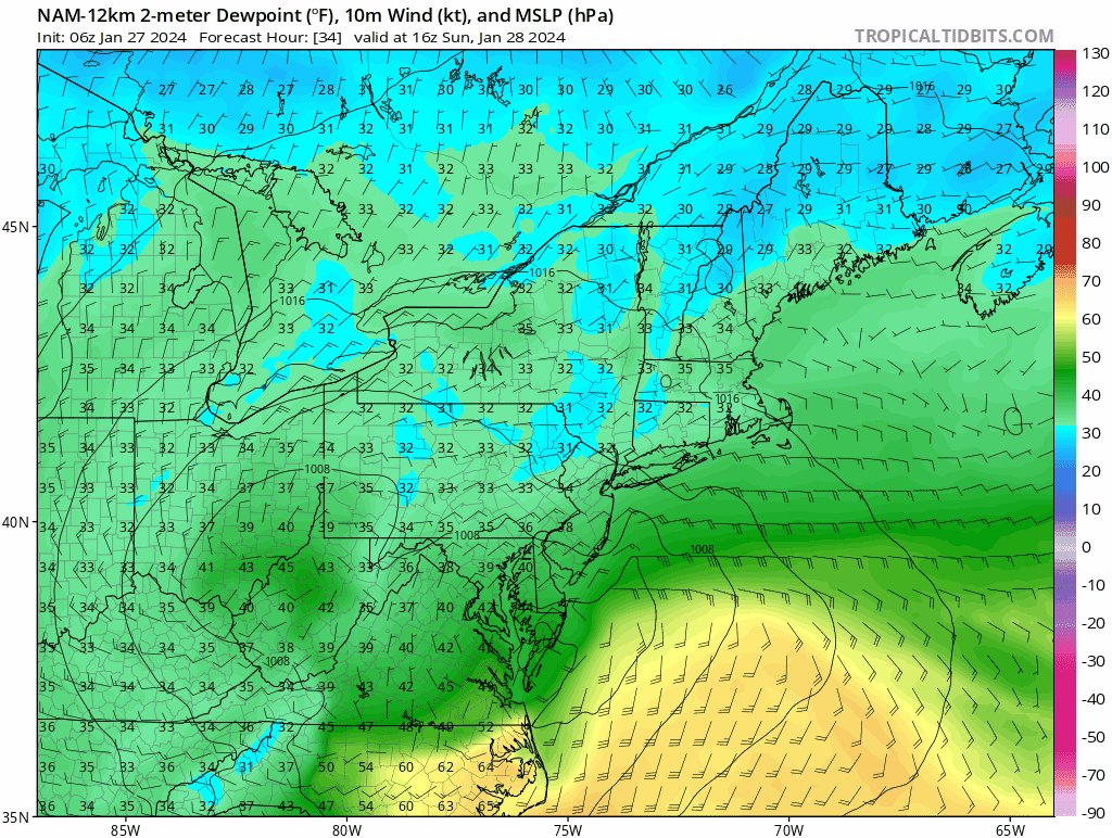
BDL: 37/35 woof.
-
NAM just toying with snow weenies. Breaking their hearts.
-
Yea this is all effed down there.
-
Yea. I’m saying the general idea. I don’t like that for your specific area at all.
-
Kinda makes sense with that early H5 occlusion causing two qpf maxes, one west, the other east, later on Monday. Much less in between…
-
That early H5 occlusion gonna cause heartburn up until go time.
-
It’s not just the sun man; be objective.
-
Of course now all the detractors will think I’m saying dendriteland will have p-type/ratio issues tomorrow. No, I’m not…sorry guys…
-
“It won’t mean much” Please elaborate. Everything matters at the margin. Wasn’t it just yesterday that you guys got skunked on modeled snow that never came?
-
What’s it like living in a bubble?
-
I’m talking about today. In regards to yesterday, Most of rockingham county, chief. Even DAW hit 37/36 in heart of Strafford.
-
Just paying attention to the last storm, and the one before that, and the one before that and….. Oh yea… and we are already at the NAM’s progged highs for today…
-
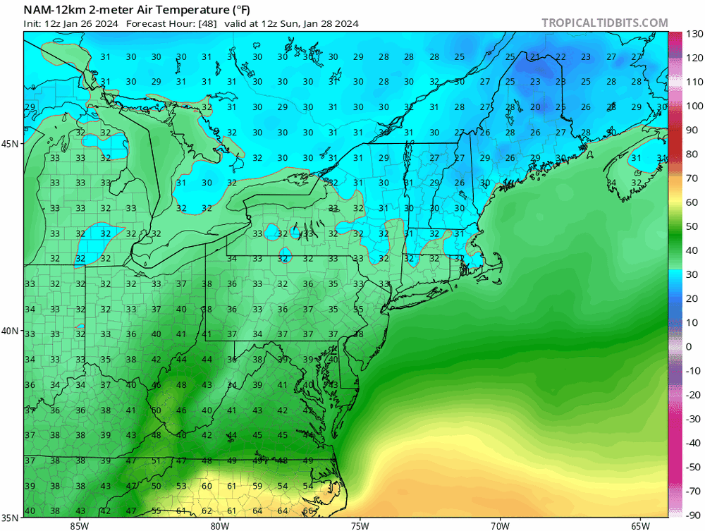
40’s today. Feels, sounds and looks like very late march. Short term guidance, again, lost.
-
Damn I better reconsider my thoughts then….
-
I believe best chance for accums is Monday. NAM is warm verbatim and that’s with a cold bias. These are dews folks; not surface temps….They are above freezing throughout the front end thump, and I don’t see this eroding quickly with 30 dews in Ontario and QC and a 1000 mb low… Start time is also late morning, strongest push is 12 -3 pm for the front end thump. Normally wouldn’t mean much in late Jan, but every fractional degree counts with such warm BL temps and very limited dynamics.