jbenedet
-
Posts
7,818 -
Joined
-
Last visited
Content Type
Profiles
Blogs
Forums
American Weather
Media Demo
Store
Gallery
Everything posted by jbenedet
-
Yes many changes still coming. And I don’t think model accuracy will increase stepwise until tomorrow’s event is somewhat in the rearview...
-
The teleconnections make a significant flip next week, and looks like tomorrow’s cutter will prove to be key in developing the blocking for next weekend’s event. odd to see the euro so warm given UL trough over Eastern conus in early December...at least it’s seeing the significant blocking much more than the GFS. Almost as though you need to overlay the blocking of the 12z euro with the temps of the 12z GFS to get a good idea of what’s coming next weekend...
-
The 6z GFS is much more in alignment with this evolution... Overall given the Synoptics and climo this recurve into northwest Fla makes much sense than the euro which has been wanting to bury Eta in the south central Gulf. The mid latitude westerleys are regularly in the northern tropics this time of year. I find it dubious that the front around day 4 will completely miss Eta.
-
Biggest risk for South Florida and the Keys is if the forecasted stall/meander occurs more closely to south Florida than is currently projected by NHC. A stall near the keys, or just off shore south Florida would greatly increase chance of very significant flooding. GFS has been hinting at this risk for several runs now. Tangent point but track uncertainty likely very high with this at short lead times given interaction with Cuba (and its high peaks), and then weak steering flow upon closest approach to Florida.
-
I think that is fair. For a very fast moving strong hurricane, it comes in more like a tsunami (for lack of a better word) than a gradual rise in water.
-
I think in a more qualitative way. It will come in like a wall. Subtle and then shocking...With background flow aligned on East side, it will increase fetch and therefore wave heights which will also help to push the surge further inland... So surge itself, not higher but more impactful—further inland in eastern half of storm and more surprising in terms of how fast the water rises...
-
We can compare hurricanes based on size intensity and track...but in terms of impact that doesn’t tell whole story. This one does has a few details that already make it unique and potentially far more impactful than it otherwise would be if we were just basing on the former characteristics. Surprise factor. Stronger than widely expected. Most are likely riding it out (for better or worse). Direct hit of a major metro city, that is very flood prone. Worst storm surge coinciding near/at time of high tide.
-
Instead of Lake Pontchartrain, I’d be looking at the many rivers around New Orleans to the south and east and worry about those backing up and heading north once the surge comes in..
-
Fortunately it will be hauling ass so hopefully that will mitigate surge. Yes, there still will be surge, but again, forward motion is so fast it may not have enough time to build surge inland too far or compromise levees. This looks like it will be a bad wind event however as time is going to run out before it can weaken from maximum intensity... Forward speed will not affect surge. Wave heights yes, surge, no. The storm surge will seem like it’s coming in like a wall bc of how fast the storm is moving into landfall... Also, I see New Orleans high tide is in 4 hrs, at *6:00 pm* CST. Seems like Zeta will be over New Orleans right around that time...
-
Reasoning? Every pc of guidance I have seen shows zeta intensifying—albeit slowly—right up until landfall. Current trends also show this is the case.
-
Core is intact and offshore. zeta looks quite healthy and symmetrical. Looks better than Delta did at same time...from what I recall...
-
6z HWRF is now showing a strong cat 2 at landfall.
-
-
Imo this is a case of mostly “b” . Speaking for NH, we never had an outbreak here (trending towards this now though) and so d and e don’t apply. What’s missed here —on a national level—is many younger and healthier people are getting it now... I’d combine this with “b” to explain trend in lower CFR. I think big risk for a reversal in positive CFR trend is flu season, combined with no lockdowns possibly resulting in overwhelming healthcare system and treatment quality deteriorating...That would be another “oh $hit moment” ... This risk remains low *for now*...fortunately...
-
So the GFS was right after all... Shame it lost the threat after having it for run after run after run, several days in a row...
-
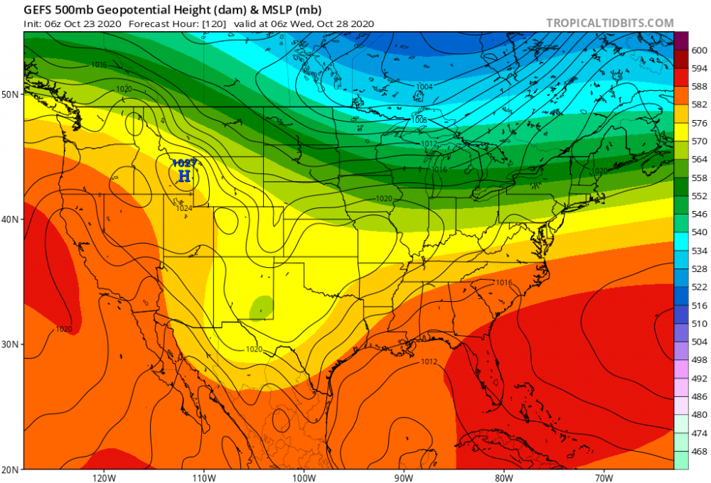
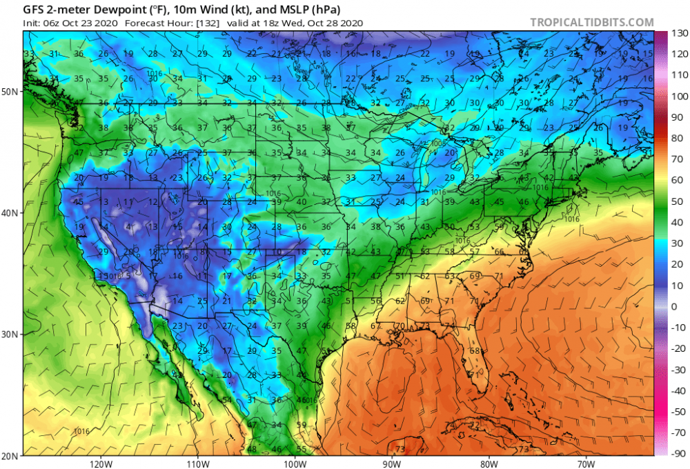
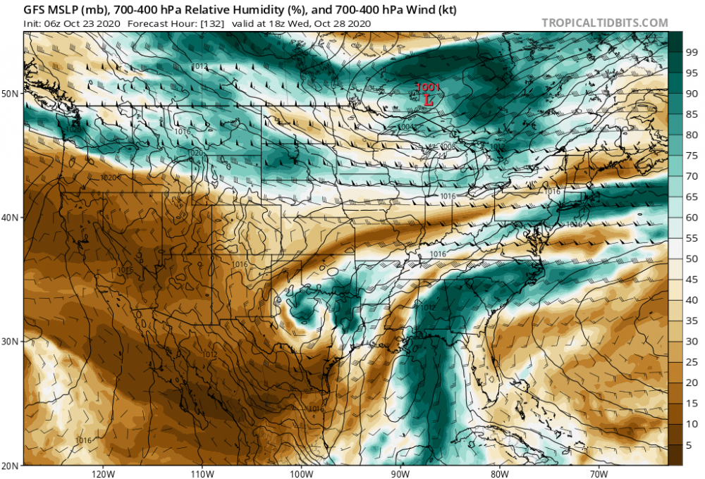
95L will be impacting the CONUS given this look. Florida to the Northern Gulf Coast, biggest risk. The latter, a persistence forecast, more likely imo. This should also be a TC system throughout—-not expecting evolution as a STC, given synoptically there will be a robust STJ connection due to shortwave trough over south central US driving warm, moist air over the w Caribbean/GOM/SE US during the period concerned... Dry air, an issue most of this season, unlikely to be a problem this time....
-
I’d just focus on out to day 9 right now. That’s when guidance is showing a potential TC. And it’s not in clown range. We need high confidence that a strong tropical cyclone will develop in the western Caribbean first. Everything else is for entertainment purposes at this point.
-
Looks like a worst case scenario unfolding for Cancún Mexico.
-
Looks like a TS...
-
Well about 72 hrs out from my post. NHC already assigned 10% chance to this wave...Still think this wave will be most interesting to watch this week.
-
Looks like development of next threat is about ~84 hrs out. At least that’s what GEFS/GFS is hinting at. Tropical wave passing through Florida strait/over southern Florida and into Gulf of Mexico—general track towards western Gulf coast.
-
Quite the blow up of convection off the Texas Coast...
-
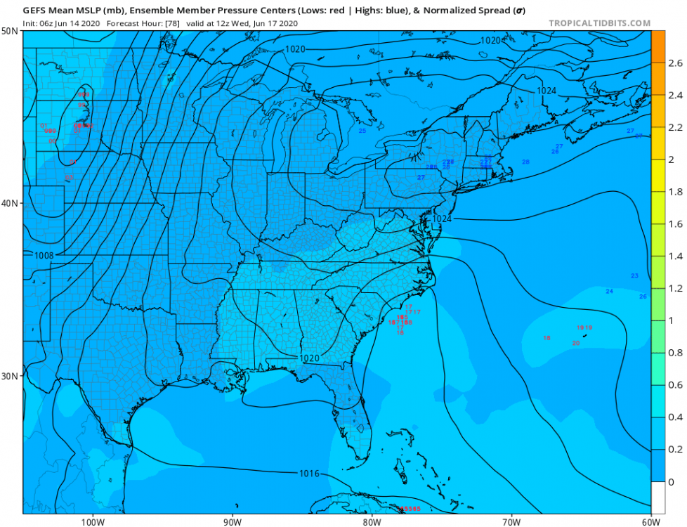
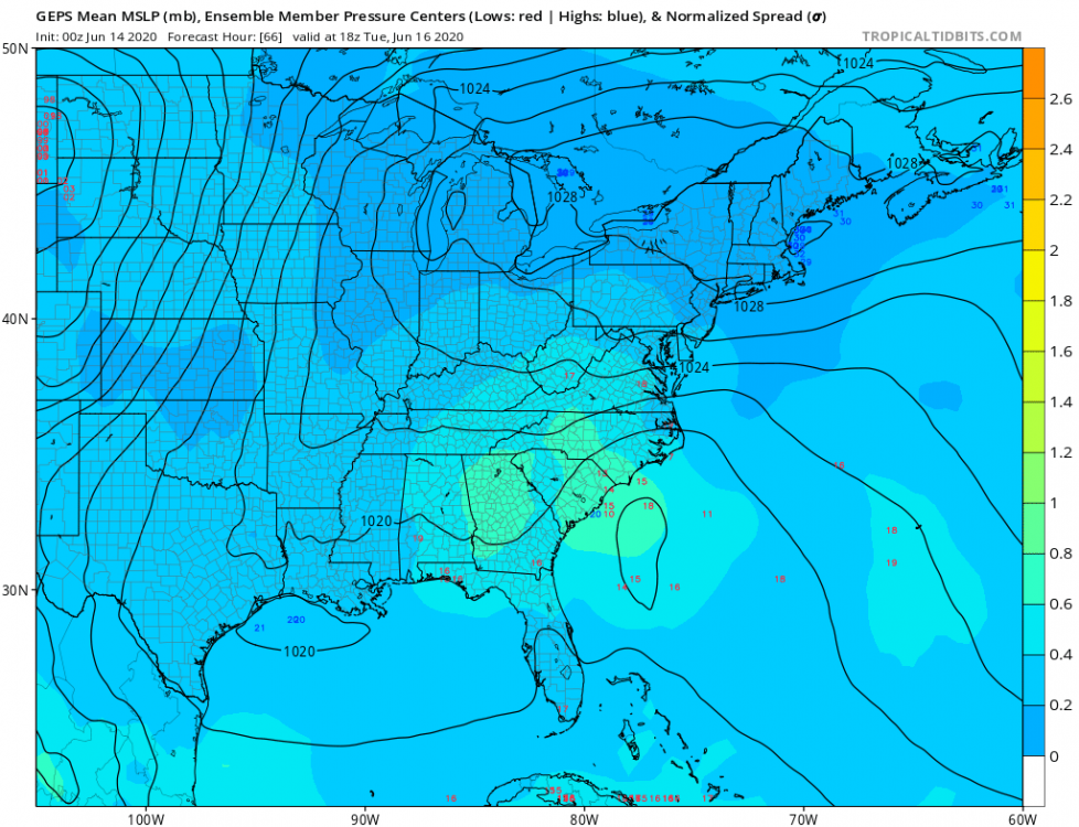
Would think this is adequate for a 10% lemon, over next day or two. A weak cold front is expected to move off the southeastern U.S. coast early next week, then stall over the northern Florida offshore waters through Wed. Low pressure may form along the front. The front will weaken into a trough from Wed into Thu. While this takes place, a trough will linger between South Florida and the NW Bahamas. Expect unsettled weather conditions over the waters in the vicinity of the Bahamas and westward to the Florida coast for the next few days. $$ Ramos
-
We have a -NAO/ -AO pattern developing in the eastern CONUS—synoptic scale troughing will predominate. I’m thinking sell the tracks into Texas, and look from central LA coast to panhandle Fla as biggest risk. Also hedge on the faster/more progressive side of guidance...6z GEFS really picking this up...
-
Tropical disturbance near Florida, on the Gulf side would appear Lemon worthy....