WeatherFox
-
Posts
1,523 -
Joined
-
Last visited
Content Type
Profiles
Blogs
Forums
American Weather
Media Demo
Store
Gallery
Everything posted by WeatherFox
-
Extreme Cold, Snow & Sleet: SECS 1/24 - 1/26
WeatherFox replied to TriPol's topic in New York City Metro
Last I saw was a 30% chance of snow in the long range for NYC. -
Extreme Cold, Snow & Sleet: SECS 1/24 - 1/26
WeatherFox replied to TriPol's topic in New York City Metro
Every model run will have changes. Trends and time will tell the results. -
Five to six days is way to early for any forecast detail and probability. Though we can have fun tracking the models, chatting and opining here.
-
No
-
NYC LaGuardia Airport 33 with light snow at 1am https://www.weather.gov/wrh/timeseries?site=klga
-
Wet in Times Square attm https://www.earthcam.com/usa/newyork/timessquare/
-
More observations: https://forecast.weather.gov/product.php?site=NWS&issuedby=OKX&product=RWR&format=CI&version=1&glossary=1&highlight=off
-
More observations: https://forecast.weather.gov/product.php?site=NWS&issuedby=OKX&product=RWR&format=CI&version=1&glossary=1&highlight=off
-
Moderate snowfall 12/14/2025 WWA up for most of the area
WeatherFox replied to WeatherGeek2025's topic in New York City Metro
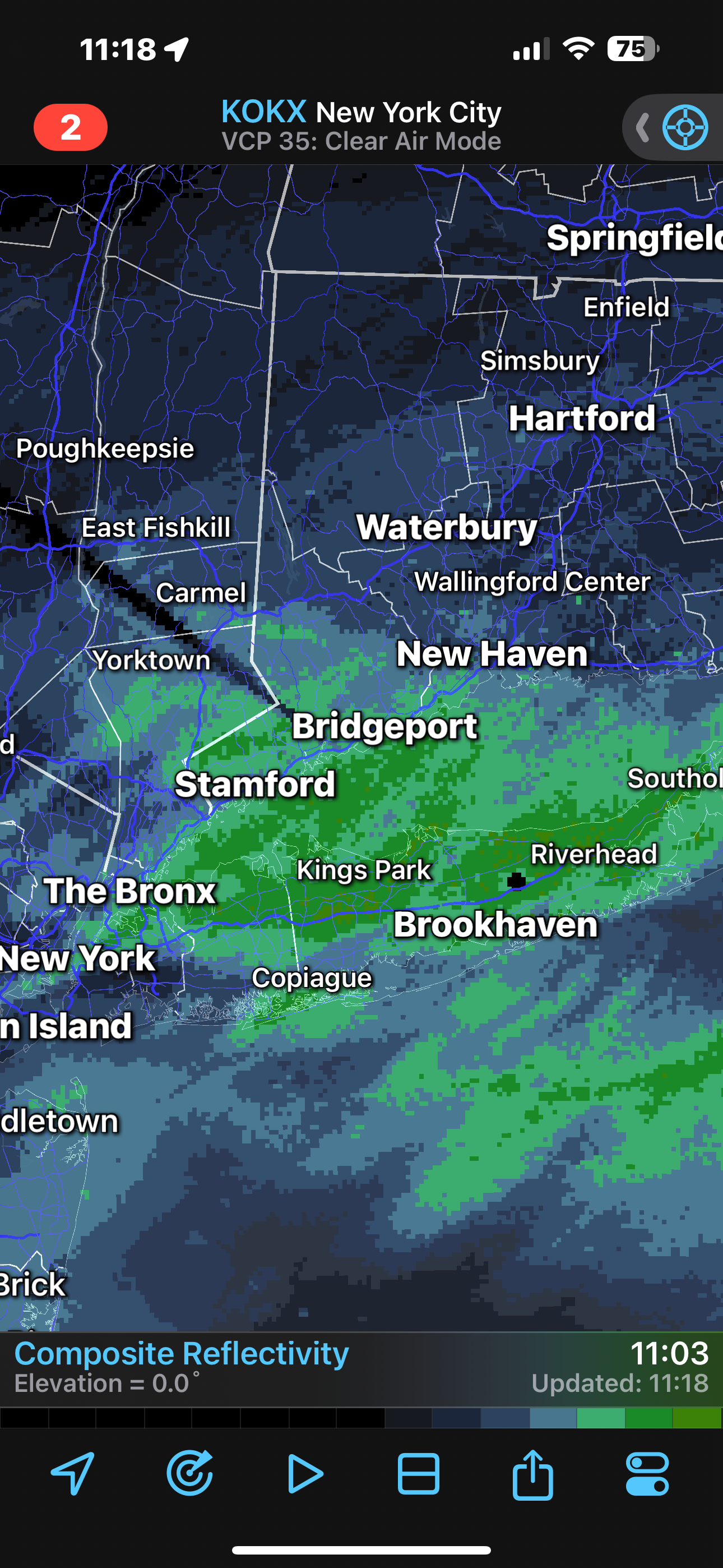
Regional radar loop. https://radar.weather.gov/region/northeast/standard -
Moderate snowfall 12/14/2025 WWA up for most of the area
WeatherFox replied to WeatherGeek2025's topic in New York City Metro
New York City, Central Park, NY temp down 2 degrees from past hour to 35 at 11 pm and light snow reported -
Moderate snowfall 12/14/2025 WWA up for most of the area
WeatherFox replied to WeatherGeek2025's topic in New York City Metro
NWS JFK, NYC International Airport https://www.weather.gov/wrh/timeseries?site=KJFK -
Moderate snowfall 12/14/2025 WWA up for most of the area
WeatherFox replied to WeatherGeek2025's topic in New York City Metro
NWS Central Park, NYC observations 37 degrees at 10pm https://www.weather.gov/wrh/timeseries?site=knyc -
In Orlando it’s coming down moderately in a far outer band cell!
-
3.6 at LaGuardia Airport
-
A fast moving low pressure system also reduces the snowfall totals. Enjoy whatever snowfall you receive.
-
The trend is not your friend.
-
Sat-Sun June 4-5, 2022...The upcoming weekend wl remain subject to approach of an area of disturbed weather presently taking shape over the western Caribbean. NHC projections have a "High" chance of development into a named system by the time it nears S FL on Sat. With an anticipated track presently near to south of central Fl, local rainfall projections are largely subject to how organized the system wl become by the time of closest point of approach to the area during this weekend. A rather sharp rainfall gradient is possible N-S over the peninsula should the system become more organized, and/or a track further south than currently advertised. A loosely composed baroclinic/hybrid system would potentially serve better prospects for local wetting rains, and with anticipation a NHC developed track and intensity forecast wl be used as baseline by late this week, future wind/rain forecasts wl remain subject to revision.
-
Just before my 4th Birthday, and contributed to my love of SNOW!
-
This will be a nowcasting event. Tho, Don's post shows increased and expanded potential.
-
NWS bumped Central Park a tab. Preliminary Snow Totals - January 7, 2022 ❄️LaGuardia: 9.7" ❄️Bridgeport: 8.4" ❄️Islip: 6.6" ❄️JFK: 6.2" ❄️Central Park: 5.8" ❄️Newark: 5.2"