CAPE
-
Posts
36,851 -
Joined
-
Last visited
Content Type
Profiles
Blogs
Forums
American Weather
Media Demo
Store
Gallery
Everything posted by CAPE
-
Wasn't expecting anything today here, but might pick up a bit from the decaying line. Amazing how dry it is despite getting 1.2" just a couple days ago. Well drained soil, long days, and big ass trees sucking up all the moisture.
-
Not even a marginal risk. No meso disco. We just can't know.
-
If you can survive OK, you shouldn't have much of a problem around here. As a weather enthusiast, you should have some sense of this.
-

2023 Mid-Atlantic Garden, Lawn, and Other Green Stuff Thread
CAPE replied to mattie g's topic in Mid Atlantic
Irish Spring. How any human can stand it is beyond me, but deer don't seem to like it. Put part of a bar(or a whole one) in a stocking and hang above whatever plant you want to protect using a Shepard's hook. Saved my roses a few times. -
A couple shots from Terrapin Park today. Needless to say it wasn't cloudy/ foggy. 'smoke on the water'. Wild.
-
I was just messing with you the other day. It is uncanny how that area almost always jackpots. Too bad it doesn't work that way for frozen lol.
-
2.2" for the month.
-
Pretty decent setup for heavy rain this weekend into early next week. Trough to the west with juicy air surging northward.
-
Must be an impressive gradient over the last couple days between your location and along the HoCo BaCo line.
-
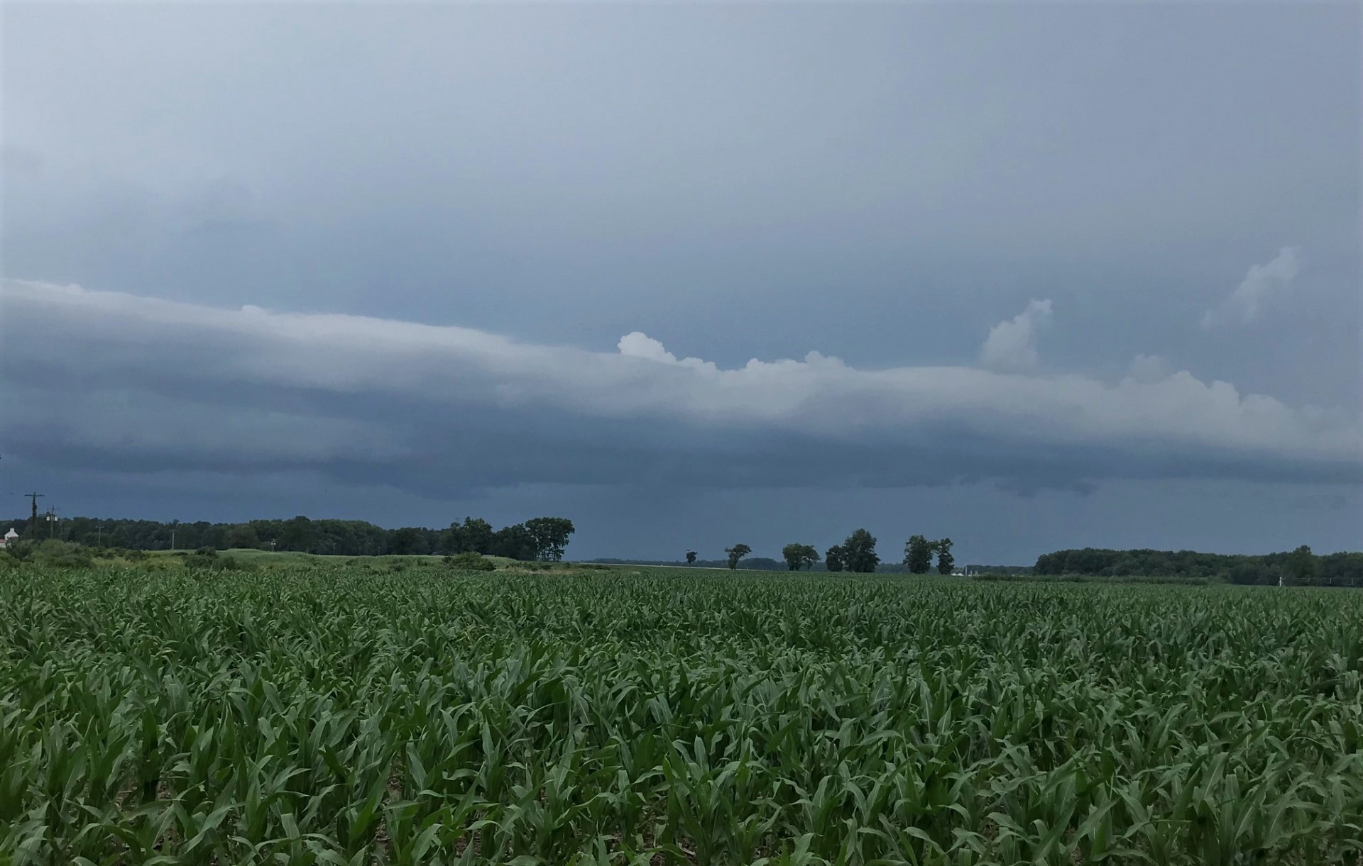
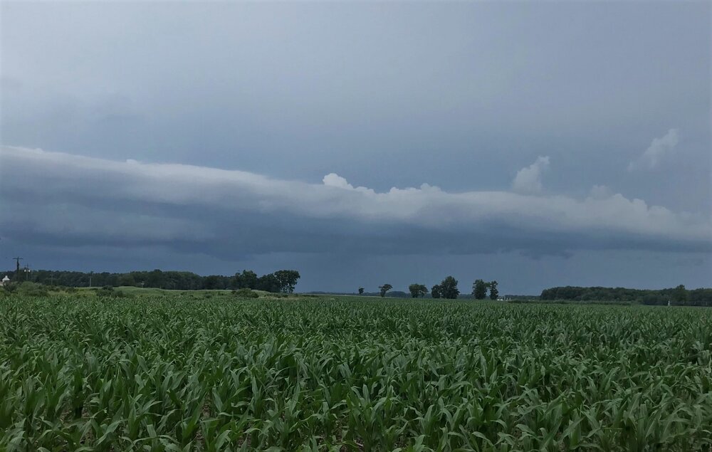
Shot of the western sky as the storm was ending.
-
1.21" total. Another line headed east towards the bay. Probably will weaken/slide a bit south.
-
This 'have not' became a 'have' finally. 1.10"
-
Best storm here since- April maybe? Torrential rain, gusty winds, and T&L. Nothing severe. Perfect.
-
Decent outflow boundary pushing ahead of the approaching line on radar. Lets see if this finds a way to fail here lol.
-
Incoming. Looks promising... couldn't possibly fail. Ahahaha.
-
2023 Mid-Atlantic Severe Wx Thread (General Discussion)
CAPE replied to Kmlwx's topic in Mid Atlantic
Definitely a bit of a hole here the last month. @WxUSAF- 2,785 replies
-
- 1
-

-
- severe
- thunderstorms
- (and 3 more)
-
2023 Mid-Atlantic Severe Wx Thread (General Discussion)
CAPE replied to Kmlwx's topic in Mid Atlantic
-
Not a drop yesterday. Picked up 0.03 this morning as a scrap from the better stuff just to my north and east. Recurring theme here. Looks like another chance for failure later lol.
-
2023 Mid-Atlantic Severe Wx Thread (General Discussion)
CAPE replied to Kmlwx's topic in Mid Atlantic
About what I'm expecting. Maybe one day I will have nice things, but probably not today.- 2,785 replies
-
- 1
-

-
- severe
- thunderstorms
- (and 3 more)
-
2023 Mid-Atlantic Severe Wx Thread (General Discussion)
CAPE replied to Kmlwx's topic in Mid Atlantic
Per radar loop it looks like it developed in eastern HoCo right along the Balt Co line, then really blossomed NE of there. -
Probably an indication of how deep their farm system is now. He kind of got "lost" in the overabundance of talent lol.
-
2023 Mid-Atlantic Severe Wx Thread (General Discussion)
CAPE replied to Kmlwx's topic in Mid Atlantic
Latest disco on the severe threat from Mount Holly- Deeper convection is forecast to develop to our west near a pre- frontal trough. The model forecast soundings indicate some discrete cells out that way should quickly consolidate into a convective line as it shifts eastward. An examination of model point forecast soundings indicate ample instability developing along with rather steep low-level lapse rates, and the mid level lapse are on the steeper side as well. The shear profiles are somewhat on the weaker side, however model soundings show some initial backed low-level flow with around 30 knots of shear. This would be enough when combined with strong forcing for ascent arriving for the risk for severe thunderstorms. Storms should organize into a line as it approaches our region with damaging winds and some hail the main threats. Given the backed near surface flow ahead of the line, cannot rule out some rotation within the eastward advancing squall line (QLCS) especially across Delmarva. CAM guidance shows convection quickly becoming linear, with even some hinting at strong outflow winds. Given the steep low-level lapse rates, downdraft instability (DCAPE) should be on the high side, which will enhance convective winds down to the surface especially associated with any forward surges in the line. With increased confidence in linear thunderstorm segments capable of producing damaging winds forming, the Storm Prediction Center now has much of our area south of the I-78 corridor in an Enhanced risk (level 3 of 5) for severe thunderstorms on Monday.- 2,785 replies
-
- 1
-
-
- severe
- thunderstorms
- (and 3 more)