
All Activity
- Past hour
-
It is interesting to note that the official intensity estimate by the NHC is outpacing ADT numbers. Raw T# right now is 7.5 but it is important to note that dvorak doesn't always handle tiny eyes well with an explosive CDO pattern such as this, and I am sure the met on duty that just upgraded Polo is well aware even if we won't get the discussion and explanation until the next package. That being said, numbers are skyrocketing up. Recon should be there by midday. I have little doubt Polo will be a Category 5, and an intense one at that.
-

Septorcher 2026 Discussion - Endless Summer
40/70 Benchmark replied to Damage In Tolland's topic in New England
WIZ GW -

Septorcher 2026 Discussion - Endless Summer
CoastalWx replied to Damage In Tolland's topic in New England
Winds overall would be less in that scenario, but perhaps more prolonged. -
Septorcher 2026 Discussion - Endless Summer
CoastalWx replied to Damage In Tolland's topic in New England
6z euro op is funny. Retros pretty far south, stalls south of LI then was about to wobble back NE at hr 144. -
2026-2027 Record-breaking El Nino
40/70 Benchmark replied to Stormchaserchuck1's topic in Weather Forecasting and Discussion
I think the solar cycle plays into that to some extent....descending solar approaching peak geomag is prime-time for super El Nino...it's not a coincidence. Now, add the unprecedented degree of OHC into the mix and it's a perfect storm for mother nature to make a max effort at heat redistribution. I know @Stormchaserchuck1has often mused that these higher-end El Nino deals shouldn't be as skewed towards +NAO as they are, theoretically speaking....well, it make sense given that they usually coincide with near peak geomag during descending solar. I get the sample size issue, but I think we need to make an effort to think beyond that as a community, and the solar angle makes sense...only super Nino that did not occur in this portion of the cycle was 1997. -
Septorcher 2026 Discussion - Endless Summer
CoastalWx replied to Damage In Tolland's topic in New England
I don’t think that strong. 925 would need to be 80-90kts and I don’t see that. Mixing barely to 925 as well. Unless this deepens more. -
Going to a wedding on the beach on Saturday in Asbury Park. How's mid afternoon looking? We got a chance of being clear until Saturday night?
-
GFS seems to chase the convection, leading to it's off shore solutions. Still a ways out though, could be correct, but I'm leaning towards the AI models on this.
-
i'm worried about my daughter coming from orlando thursday; they were saying last night the storm will be cranking already. normally i don't follow much this time of year, but damn....
-
Septorcher 2026 Discussion - Endless Summer
40/70 Benchmark replied to Damage In Tolland's topic in New England
I think the relaxed flow down south will leave us prone to some slow movers, so hopefully we can time one or three with recent cold. -
SKOL!!! Caleb Williams being soft memes have been cracking me up!
-
meh. the damage is done for anglers and a storm like this, early in the season is curtains for us. had two good days of offshore weather. thanks, regulators, for shutting porgy season down til sept 1st. black sea bass season finally opens, but it won't matter at all, as they will head offshore after this. its almost like they don't want us to catch fish.....fluke closes the 25th here, again, won't matter, no one will be able to fish. i know its supposed to be warmer and snowless this winter for us, but this morning i have my lined pants and flannel shirt on for my walk....feels like november weather.
-

2026-2027 Record-breaking El Nino
bluewave replied to Stormchaserchuck1's topic in Weather Forecasting and Discussion
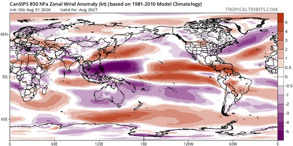
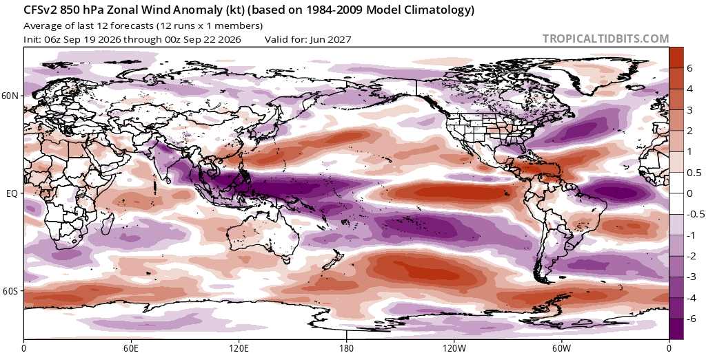
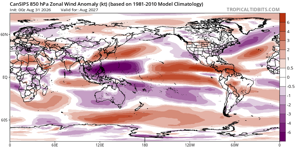
It would be interesting to know what the specific mechanism was that caused the WWBs to become stronger than 2023-2024 and even 1997-1998. While the CFS is outside its effective range by next June, it still has strong WWBs going. The CanSIPS indicates the same even though the SOI forecast relaxes. While it’s still too early in the game to know exactly what is happening, would be impressive if some type of bigger shift in the Pacific equatorial trade wind regime is occurring outside the usual ENSO dynamics. The WWBs north of the equator never fully relaxed in EPAC following the 2023-2024 El Niño event.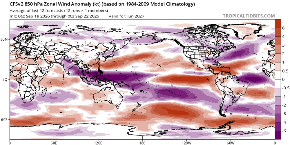
-

Septorcher 2026 Discussion - Endless Summer
weatherwiz replied to Damage In Tolland's topic in New England
May be talking about potential for hurricane force gusts along the coasts. But yeah I'm really intrigued to see what hi-res is like with the LLJ and really start digging into mixing potential. Have to watch too for some elevated CAPE grazing the coast -
1.79" since Sunday and 5.85" for the month. I'm hoping our well timed rain this summer means a good leaf season this fall. It'll really begin to show in a week or so.
-
.60 here overnight, lucky to get that with the heavy cells between 3 and 6:00 AM
-
Rain gage at home says 1.27" so far
-

Septorcher 2026 Discussion - Endless Summer
Damage In Tolland replied to Damage In Tolland's topic in New England
It happens more often than not in coastals and overrunning where it snows for several days of varying intensities. Unfortunately we won’t be able to have that happen this coming winter with little to no snow. But maybe next winter we can -
Septorcher 2026 Discussion - Endless Summer
40/70 Benchmark replied to Damage In Tolland's topic in New England
For once, your "days and days" mantra is befitting. -
Septorcher 2026 Discussion - Endless Summer
Damage In Tolland replied to Damage In Tolland's topic in New England
Yeltsin? -

Central PA Summer 2026 Discussion/Obs Thread
canderson replied to Voyager's topic in Upstate New York/Pennsylvania
I really really need Monday to stay dry from say 11-2. Praying. Large event at the capitol my wife is in charge of and yeaaa -
Septorcher 2026 Discussion - Endless Summer
CoastalWx replied to Damage In Tolland's topic in New England
6z euro AI is nasty. Will be interesting to see when we get into hi res territory with the LLJ. Unlike previous storms there will be days of NE fetch. I’m gusting to 25mph and the seas are rough. It’s only Tuesday. -
 I was thinking it looks like a Modoki La Nina/east-based El Nino at the same time
 -
Septorcher 2026 Discussion - Endless Summer
CoastalWx replied to Damage In Tolland's topic in New England
That would be pretty dam epic. -
Septorcher 2026 Discussion - Endless Summer
CoastalWx replied to Damage In Tolland's topic in New England
I think he misses some of the things I taught him.






.thumb.JPG.418e8a9a2902ae687ec35ff4bc0e038e.JPG)
