All Activity
- Past hour
-
That could only happen with a parade of anomalous SWFE's. If you are snowing, Dave and Ineedtorelax are most likely snowing.
-
https://www.wcvb.com/article/west-nile-virus-middlesex-county-3rd-human-case/65994951
-
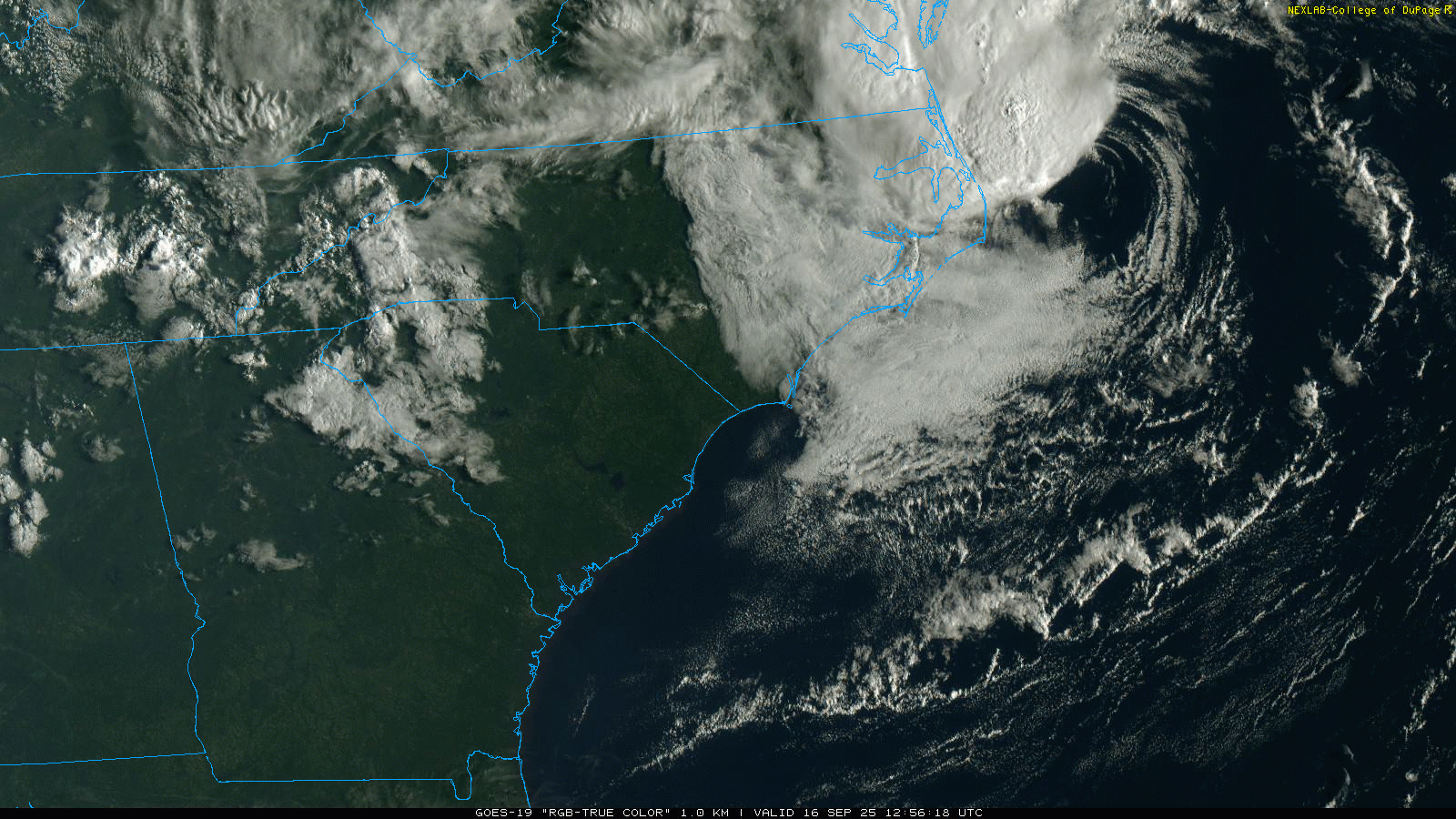
Bright sunshine across the Piedmont. Wasn't expecting that!
-
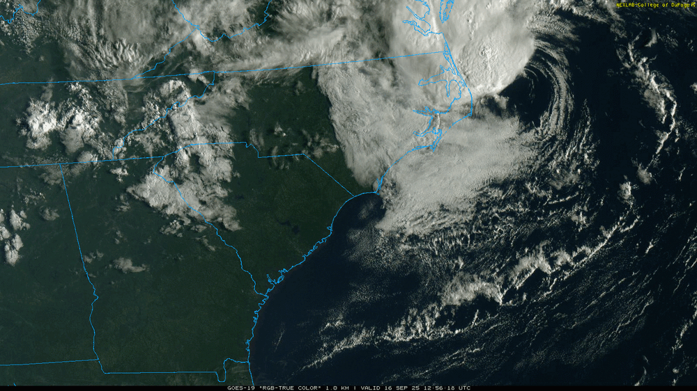
Looking at the local NWS stations, they have info on this regarding wind and flood, but I imagine this will unfortunately catch a lot of people by surprise from a communication standpoint. Weather Story for Southeast VA, Northeast NC & Southern MD
-
I haven't heard much about EEE or West Nile so far in the news. I wonder if the dry conditions will help with that
-
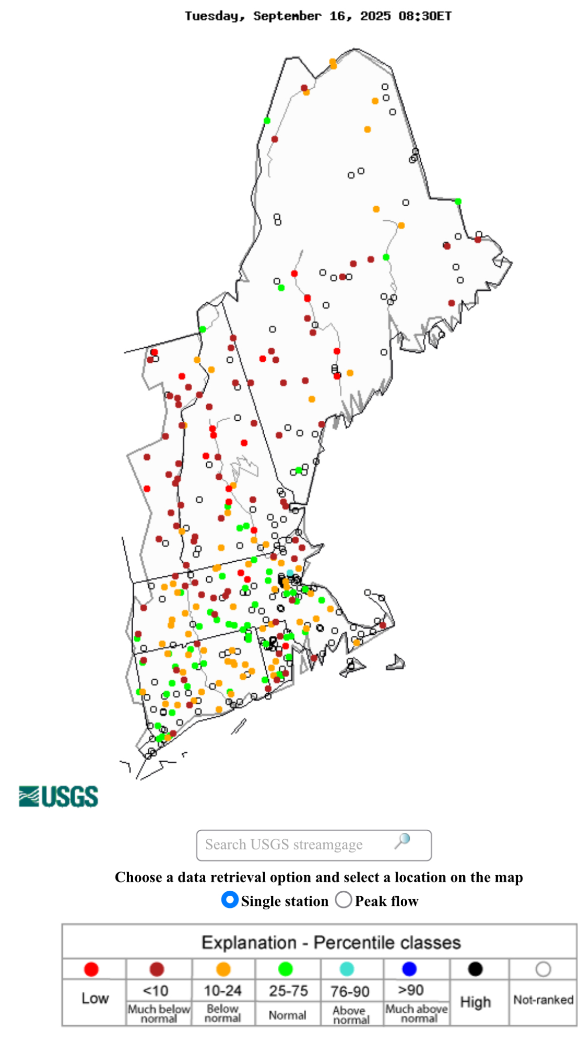
Record low streamflow. Memorable.

-
It's still a 2.5 hour drive from her campus... if she can get the Outdoor Club or whatever interested so they can carpool or take a van I think she should go for it. Her car is pretty old to make that trip a lot.
-
I’m not sure as it’s somewhat subjective. But the NHC never even had it at even a 10% chance to transition to tropical in any TWO, which is what really made JB mad initially.
-
It seems odd to not name it, especially given its proximity to land. This meets the Tropical designation criteria right?
-

September 2025 OBS-Discussion centered NYC subforum
Brian5671 replied to wdrag's topic in New York City Metro
I sure hope so, it's getting very dry here again... -

September 2025 OBS-Discussion centered NYC subforum
SACRUS replied to wdrag's topic in New York City Metro
-
September 2025 OBS-Discussion centered NYC subforum
SACRUS replied to wdrag's topic in New York City Metro
67 / 62 those partly cloudy forecasts were very questionable looking at the satellite vis loop yesterday. Some showers and light rain into the bottom half of NJ as the cut off ULL spins off the Mid Atlantic coast. Pushes north tomorrow with light drizzle. / rain and showers and a cool onshore flow keeping most places in the low 60s. Slowly clear out Thu and warms up on a NW flow. Fri warmest day of the next 5-7 mid 80s in the warmest spots. Dry cooler weekends- 70s then overall warmer beyond there. 9/16 - 9/17 : Clouds ULL , light rain - cooler 9/18 - 9/19: Warmer - warmest Fri ahead of front 9/20 - 9/21 : Dry / cooler weekend a bit below normal 9/22 - Beyond : Overall warmer -

Invest 92L--80% two day, 90% five day odds
Wannabehippie replied to WxWatcher007's topic in Tropical Headquarters
Satellite photos show an ULL dropping down, that probably will interfere with development. blob:https://www.tropicaltidbits.com/53dc1fce-b712-4618-afb4-c94259665cca -
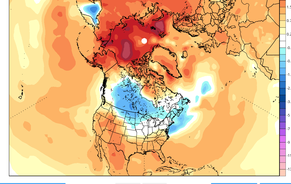
@snowman19This is related to what I was talking about. It’s not just the NE Pacific that’s so warm. It’s the entire N Pac., which isn’t necessarily even partially correlated to a cold winter in the E US like BAMwx and others are forecasting.
-

September 2025 OBS-Discussion centered NYC subforum
wdrag replied to wdrag's topic in New York City Metro
Of interest to me... the steadiest of all the modeling the past 5 days or so... the ECAI and its ECAIEPS. Rain is coming and underplayed I80 northward. I think NYC counts on 0.1-0.4" and up here in far nw NJ/ne PA/along the nYS border 0.05-0.30. WPC should have statistical comparisons of the ensembles and am surprised its so dry in its overnight forecast. Could be my interp is incorrect but while this wont be a great relief from the recent dryness, it will help, provided my interp is correct. Wont surprise me to see at least an inch in spots across theNJ/LI portion of our subforum. GEFS lagging and so we'll know tomorrow night and I guess that's what WPC tends to support. -

Invest 92L--80% two day, 90% five day odds
GaWx replied to WxWatcher007's topic in Tropical Headquarters
8AM TWO: getting very close now… Central Tropical Atlantic (AL92): Showers and thunderstorms associated with a broad low pressure area located about midway between the Windward Islands and the coast of west Africa have become better organized since yesterday. Environmental conditions are conducive for additional development, and a tropical depression or storm is likely to form in the next day or two as the system moves west-northwestward or northwestward at 10 to 15 mph over the central tropical Atlantic. * Formation chance through 48 hours...high...90 percent. * Formation chance through 7 days...high...90 percent. -
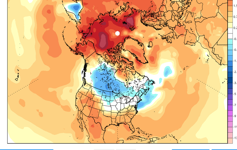
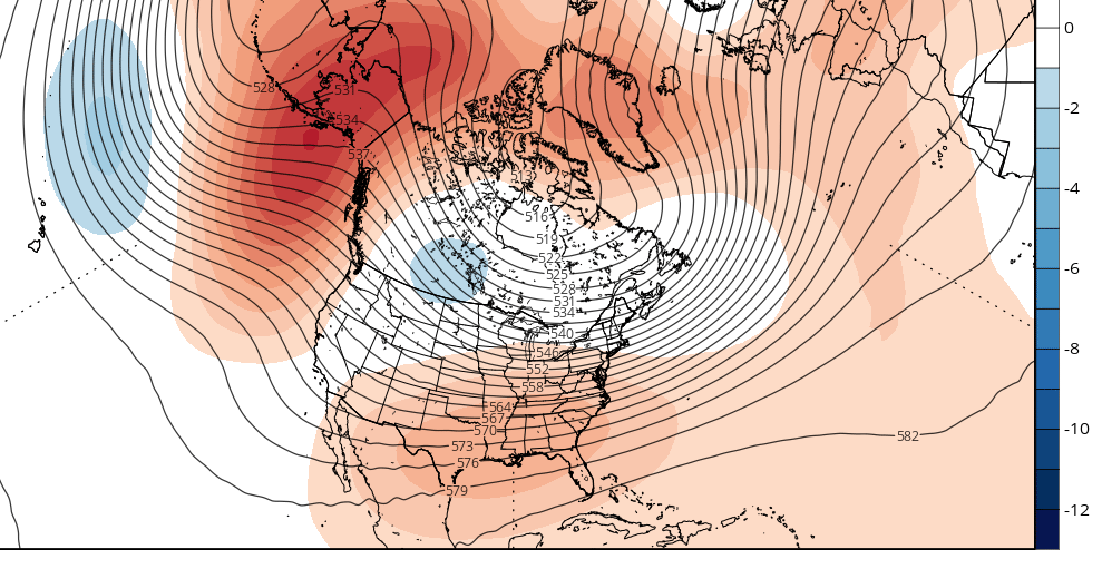
Looks to be a severe -WPO/EPO.....somewhat +PNA and a modestly -NAO/AO. PNA and especially AO are iffy...
-
Not that this is right per se, because it probably isn't....but I'm not sure folks appreciate just how cold this is given the 1984-2009 climo base. If I were planning to copy and paste a composite of the past ten winters as some often muse, this would give me pause.
-
Followup: Bastardi is livid that this hasn’t been named:
-
Bastardi is livid that this hasn’t been named:
-
It's coming.
-
CFS for December:
-
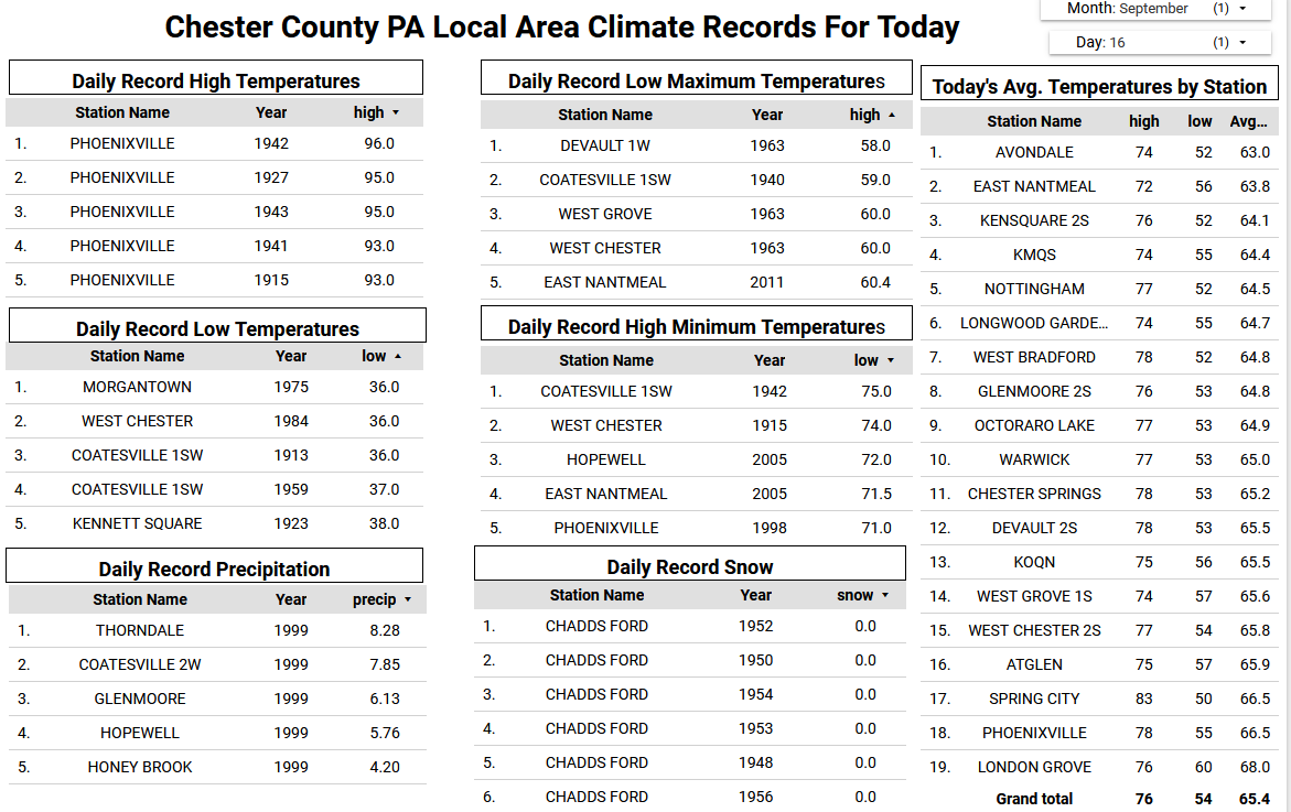
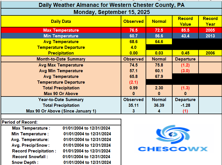
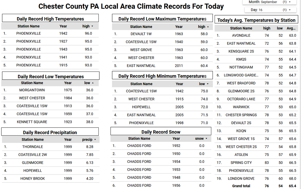
It’s a good bit cooler today with the flow off the ocean increasing and mostly cloudy skies. Despite the current NWS forecast for mid-70's I suspect across the higher spots we may struggle to escape the 60's to near 70 degrees for high temperatures today. Some showers arrive this evening and through the day tomorrow. Certainly not a lot of rain but any and all will be appreciated by our many area farmers. We briefly warm by Friday to the low 80's before we cool down for the weekend.
-
(002).thumb.png.6e3d9d46bca5fe41aab7a74871dd8af8.png)
E PA/NJ/DE Autumn 2025 Obs/Discussion
ChescoWx replied to PhiEaglesfan712's topic in Philadelphia Region
It’s a good bit cooler today with the flow off the ocean increasing and mostly cloudy skies. Despite the current NWS forecast for mid-70's I suspect across the higher spots we may struggle to escape the 60's to near 70 degrees for high temperatures today. Some showers arrive this evening and through the day tomorrow. Certainly not a lot of rain but any and all will be appreciated by our many area farmers. We briefly warm by Friday to the low 80's before we cool down for the weekend.
-
Yeah we are not getting any rain from this system at this point. NWS will have to catch up.
.thumb.png.4150b06c63a21f61052e47a612bf1818.png)