All Activity
- Past hour
-
You don’t just go by model output. You put what should happen
-
81.9F. 1st 80+ of the season.
-
Sunday will be fine. Next week will be around 80, so not hot, but most importantly, it won't be raining.
-
90 degrees? It won't make it to 60 today. And who knows what he rest of the week will be. Even the weekend looks like a wash out.
-
and most importantly, dry and sunny!
-
Man, you beer.
-
Heat cancel once again for next week. It looks as though the NYC Metro Region will wait a while longer to see its first 90 degree heat. The warmth will try to go over the top but another upper low will probably develop somewhere in the western Atlantic and keep the very warm/hot air from spreading into the northeast and mid Atlantic. Though we should not see the coolness of this week and last week with temperatures the first week of June mainly in the mid-upper 70s maybe a day or two up around 80. WX/PT
-
it's a park and not an accurate barometer (pun intended) for the city. If you want a better indicator for what Manhattan experiences you need to take those instruments out of the park.
-
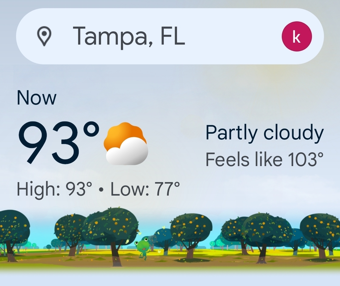
It seems like its been quite the stretch of hot weather across central Florida these last few weeks...really doing a number of SSTs. TPA has had many nights where they only drop into the upper 70's and I think even 80/81 at times...seems quite early for them.
-
Several days of 70+ next week is coming. Dews 4 daze
-
This is what I mean with climate change being non linear. It's not getting wetter everywhere and even where it's getting *wetter* there are more cycles of drought too. Our area has been and will experience more of this too. With the atmosphere able to hold more moisture it also means that the trigger point that causes rainfall will also be higher.
-
lol my brother lives in Lakeland Florida.. were complete opposites when it comes to weather..
-
Meh upper 80s and 90s yes.. upper 70s and low 80s wont cut it
-
Central Park is 57 degrees, colder than the stations on the east end and the ones getting rain lol Oooooooook Manhattan is the coldest spot in the area ahahahahahaha
-
No, it's not the case. If the atmosphere can hold more moisture it also means the saturation point is higher, which means you actually need more moisture to get it to rain. This is why you see cycles of drought and flooding further south. So at some point the drought will give way to destructive flooding, but it hasn't reached that point yet.
-
Dews up here lolz...

-
Sounds like good weather.
-
It's not that humid. Maybe some low 60s dews for a few days.
-
you're not a literate person so I wouldn't expect you to understand any of it, fool Monty you must live near one of those superfund sites that NJ is famous for, you're showing clear evidence of brain damage.
-
You would think it would get wetter overall in a warming world in the far north.
-
Thanks, this explains why the fires up north are not going anywhere. Do you think when the temperatures warm more those trees will be replaced with the more fire resistant trees that are prevalent farther south?
-
Prob 2 or 3 days of 80+ for MBY between today and Saturday of next week. Warm for sure. Nothing ridiculous for a while
-
Unfortunately there are only 3 dominant tree species in the Candian Tiaga. Balsim fir, Black Spruce and Larch. They are dominant because the can handle the extreme temperatures. They are all highly flamable. Until temperatures rise significantly (5c) that isn’t going to change. My theory is that the beginning of substantial climate change is acting to dry the forests out. Normally they would remain rather wet and cool in the summer.
-
You really post some of the dumbest crap I've ever read. It's remarkable. Impressive, really.
-
I hope that you found a paved trail to ride and stayed off the roads. People are crazy on a sunny and dry day.