All Activity
- Past hour
-
 Three laps around the office parking lot and I worked up a sweat. When the wind dies down and the sun pops out you can FEEL it.
 -
There’s people on twitter who think that just because it’s a La Niña it HAS to be above normal in ACE and named storms. As we all know on here, that’s just not the case, just like it doesn’t HAVE to be below normal when there’s an El Niño
-
Brought in the patio cushions for nothing.
-
Feel free to use any of my stuff, just reference the blog...all I ask.
-
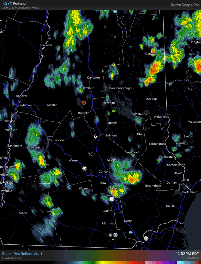
Pea-sized hail in West Concord. Low-level lapse rates are cool
-
Storm trying to pop around Norwell it looks like
-

2025-2026 ENSO
40/70 Benchmark replied to 40/70 Benchmark's topic in Weather Forecasting and Discussion
Yup...just my opinion. We'll see, but Like Chris said, late seasons have been active and protracted. PS: Not every hurricane season is going to be active, nor is every active season going to be 2005 or 2020. -
F off
-
Years ago, we ran strong -QBO against cold ENSO and there number of cold Decembers with fast starts was pretty significant. 1956, 1970, 1974, 1981, 1983, 1989, 2000, 2005, 2007, 2011, 2017, 2021 The only duds in that group are 1974, 2011, and 2021....and 2021 was a weird one with extreme bitter cold in Canada not that far away from the northern tier of CONUS. Only '74 and '11 had true awful death vortex pattern.
-

September 2025 OBS-Discussion centered NYC subforum
Stormlover74 replied to wdrag's topic in New York City Metro
Aaaand its gone. -

2025-2026 ENSO
PhiEaglesfan712 replied to 40/70 Benchmark's topic in Weather Forecasting and Discussion
You never know, though. 2007 was a strong la nina, and had Felix at around this time (the second big storm, after Dean). You'd almost be certain that another major hurricane was going to happen the rest of the way. But it didn't happen. 1992 was a one-storm wonder. 2007 was a two-storm wonder. I think we're headed for this type of year, rather than a 2005 or 2020. Not every hurricane season is going to be active. -
2025-2026 ENSO
40/70 Benchmark replied to 40/70 Benchmark's topic in Weather Forecasting and Discussion
It's the established climo protocol. I don't think using that represents a tacit denial of CC. Do me a favor and voice concerns over in the CC thread. -
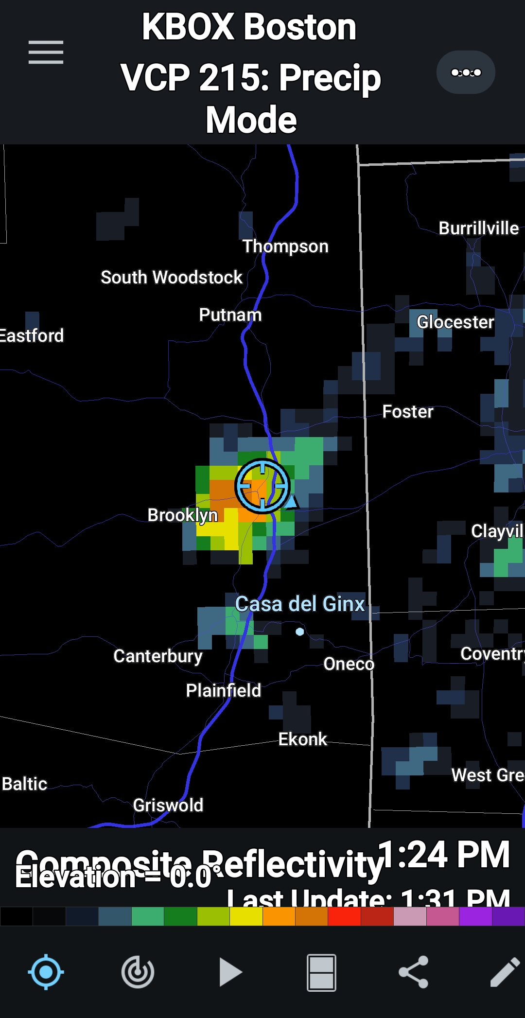
0.31" in that cell that passed by, 0.83" for the month so far.
-
Good, not home but my lawn needs it!
-
 locally the June heatwave was the big event of the summer-3 days of 98 or 99 which is impressive for here as we don't even get that many 90 degree days
 -
2025-2026 ENSO
40/70 Benchmark replied to 40/70 Benchmark's topic in Weather Forecasting and Discussion
I don't see why it matters unless someone is unconvinced of CC. We all understand that the world has warmed....but we measure based on current climo. -
 I immediately break out in hives when the thermometer hits exactly 32.222 degrees Celsius.
 -
 I had 3 days in a row here with two 88's and an 89. I think New Brunswick has 3 90s as well, but the hot spot Newark has 8 like Warlock. 90 is a fancy # we like to use, but like it matters being 88 or 90. No one on earth can tell the difference.
 -
2025-2026 ENSO
40/70 Benchmark replied to 40/70 Benchmark's topic in Weather Forecasting and Discussion
I don't care about the rankings. Most weather circles use departures based on current climo. -
2025-2026 ENSO
40/70 Benchmark replied to 40/70 Benchmark's topic in Weather Forecasting and Discussion
(Long winded) Mic drop- -
 Yeah 93 was the highest I got during that heat wave. It was impressive to be 90+ for 6 days in a row, but it was far from extreme heat. Also pretty impressive that we had only 1 hot week for the entire month of August and lots of low humidity days. July was brutal, but August has been a fairly comfortable month.
 -
Pouring
-
What are those drops of water falling out of the sky?
-
2025-2026 ENSO
40/70 Benchmark replied to 40/70 Benchmark's topic in Weather Forecasting and Discussion
I thought that was one of the more silly calls I have seen in a while. -
2012 (lowest), 2016 (2nd lowest), and 2024 (third lowest) are the top 3 lowest area minimums. 2016 and 2024 were quite close to eachother whereas nothing as come particularly close to 2012 since then. Area in 2025 is currently 7th lowest on record for this date. edit: I think you meant highest minimums..... Highest mins for area since 2007 are: 2013: 3.61 million 2014: 3.57 million 2009: 3.54 milion 2018: 3.23 million 2022: 3.21 million