All Activity
- Past hour
-

2026-2027 Strong/Super El Nino
snowman19 replied to Stormchaserchuck1's topic in Weather Forecasting and Discussion
Agree. We are very likely to be into a super El Niño (over +2.0C) by September -
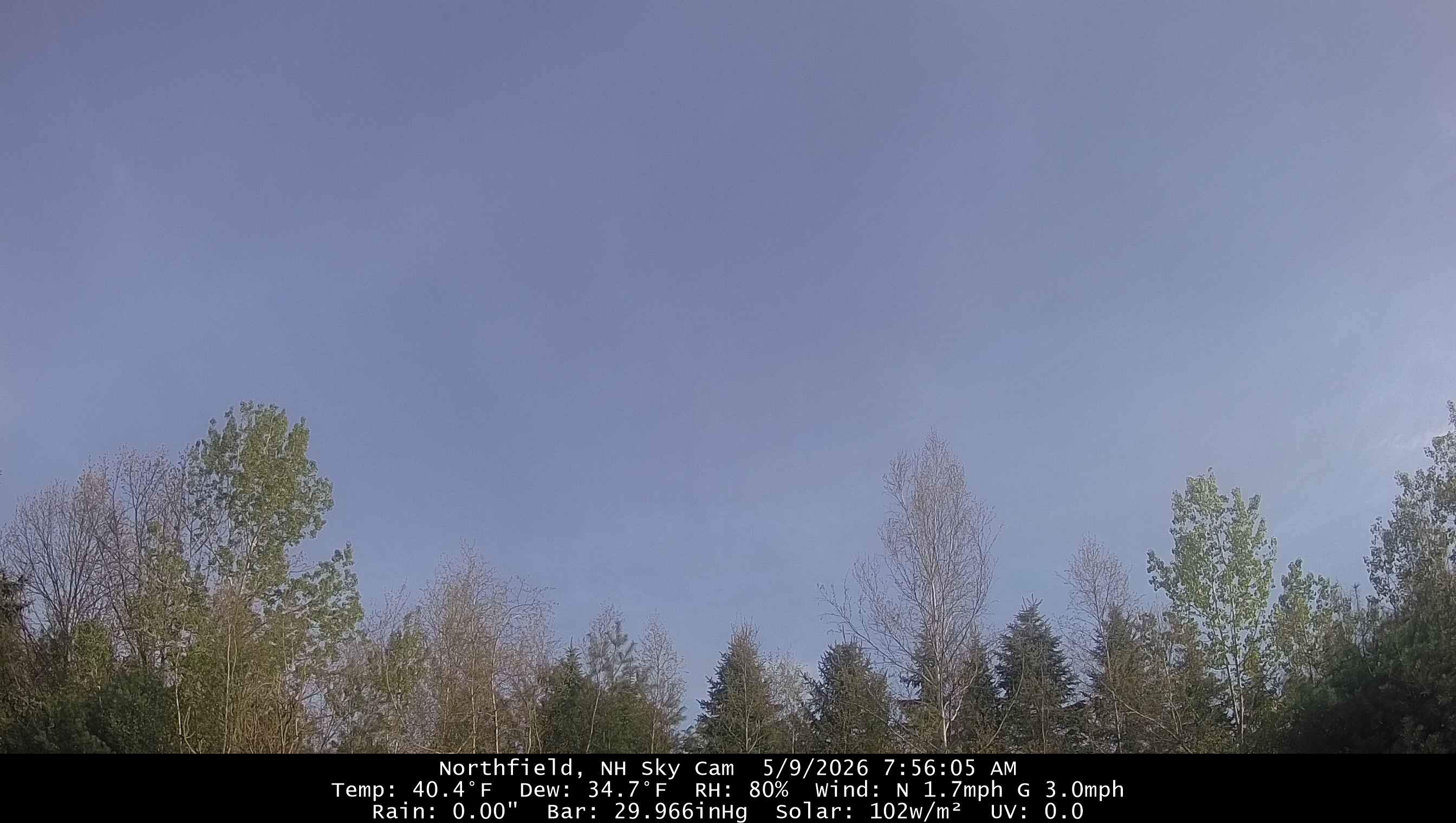
Nice morning. We sun for now.

-

Central PA Spring 2026 Discussion/Obs Thread
Mount Joy Snowman replied to Voyager's topic in Upstate New York/Pennsylvania
Low of 53. Looks like the rain should hold off just enough to get in our son’s 9am baseball game. -
Nice hot pattern shown there. You really are struggling
-
AN heights and BN precip. Sweet.
-

Winter 25-26 (All Snowfall Maps & Season Total)
The 4 Seasons replied to The 4 Seasons's topic in New England
yea i closed that gap of 36-48 from the last update on March 2nd. There was nothing under 48" from cocorahs stations but if you're right at 48 thats probably a min nearly statewide except for the cape/ACK -
Winter 25-26 (All Snowfall Maps & Season Total)
The 4 Seasons replied to The 4 Seasons's topic in New England
I wish there were some spotters in the upper elbow. It would help me know what to do there when there is a tight gradient. I rarely, if ever, see reports from Provincetown... - Today
-
Summer of 1816 incoming.
-
Another windy ass day on tap
-
Dandelions are blooming. Making sure I let them flower and spread their seed this year like tblizz.
-
Hope everyone is doing well in these dry conditions. I'm about to head out for the annual camping trip to the southwest and was reading the ABQ forecast discussion. It was informative (mostly in the short term), but also kind of funny (mostly in the long term), so I thought I'd share .SHORT TERM... (Today through Sunday) Issued at 107 AM MDT Sat May 9 2026 Day 1 Saturday: It is May so that means virga "bomb" season in New Mexico. Virga being rain that evaporates from a thunderstorm before reaching the ground. The rain cooled air still does reach the ground causing a dry microburst hence the "bomb" term. Today looks to be a decent set up for that to occur over the northern mountains into the northeast Highlands. Isolated activity should develop over the central RGV and then back over the Gila Forest as well. Instability (CAPE) looks rather limited with weak "moisture" over the state within increasing NW flow aloft. Storms will be moving pretty quickly as well so any convection could produce a quick microburst with winds most likely not reaching severe levels due to lack of CAPE and downdraft CAPE (DCAPE). Impacts from the gusty winds will be pretty minor and limited to the typical blowing dust and displaced trampoline or bouncy house. Day 2 Sunday: The downburst potential increases more on Sunday with a much more supportive upper level pattern. A fast moving short wave trough passes through northern NM on Sunday increasing the NW flow aloft and cooling aloft. Lapse rates steepen quite a bit more by early afternoon and supportive of CAPE around 400-800 J/kg and DCAPE around 600 J/kg. Deep layer shear increases to 30-40 kts especially from the Highlands south towards SE NM and in phase with the instability. HREF hints at a least small chance (<10%) of CAPE reaching 1000 J/kg in a few spots in E NM. Should the models be under forecasting CAPE then maybe there is support for a marginal severe weather risk for damaging winds. More than likely storms produce wind gusts closer to 50 mph than 60 mph. The main impacts from these kinds of winds will again be blowing dust but could damage weak structures and toss trampolines. Hi-res CAMs and synoptic models all have a pretty clear signal for convection developing in the Las Vegas (not Nevada) area of the Highlands in the early afternoon and then work off to the SE. Isolated activity then develops down the mountain chains towards the Sacramento Mountains. It looks like storms will be in the vicinity of Ruidoso but likely moving too fast and with not a lot of rain to cause any issues on the burn scars. The wildcard in all of this is the back door surface cold front that surges down the eastern Plains bring a surge of moisture to the region. Models need to have a good handle on it`s evolution and magnitude of moisture. The boundary layer moisture will be key to the whole convective scenario and where the forecast goes sideways for the intensity of storms. Will dewpoints in the 40s be the key to this all? Lastly we will throw in the mention of east canyon winds for the ABQ metro area late Sunday due to the back door front but just not a lot of confidence on the intensity of winds with it. 39 && .LONG TERM... (Sunday night through Friday) Issued at 107 AM MDT Sat May 9 2026 Day 3 Monday: The upper level ridge strikes back. Star Wars reference intended. Yes that synoptic feature that reared its ugly head back at the end of March comes back to life like Darth Maul. Synoptic ensemble model suites are all in pretty good agreement with an anomalously high (+12 DAM) 500 mb ridge building over AZ/NM on Monday. As such temperatures rebound quite a bit in E NM with temperatures back into the mid/upper 80s after 70s on Sunday. Day 4-7: Tuesday the ridge builds over NM with 590 DAM heights at 500mb or again about +12 DAM above normal. It will be quite possible that kind of 500mb height would be close to a record on the 18Z ABQ sounding. And that would make sense given this height would be right around the 99th percentile of climo. Heat risk builds into the moderate category for much of NM as high temps reach the 90s which will be only about 2 weeks ahead of schedule instead of 2 months (at least for ABQ metro). Roswell will probably be in reach of 100F. Wednesday through the end of the week the upper level ridge moves over Texas and southwest flow aloft develops over NM. A weak shortwave passes by on Thursday which could bring some elevated convection to the area. Again not much moisture with this system so virga will be the most likely outcome from any convection. After that ensemble model suites become quite divergent in their solutions. Cluster analysis shows exactly that...a cluster. GFS, ECMWF and Canadian ensembles all favor different outcomes from each other. All this means is that there is very low confidence in the forecast day 7 and beyond. 39/Discussion courtesy the WCM working night ops. Take it for what it is worth.
-
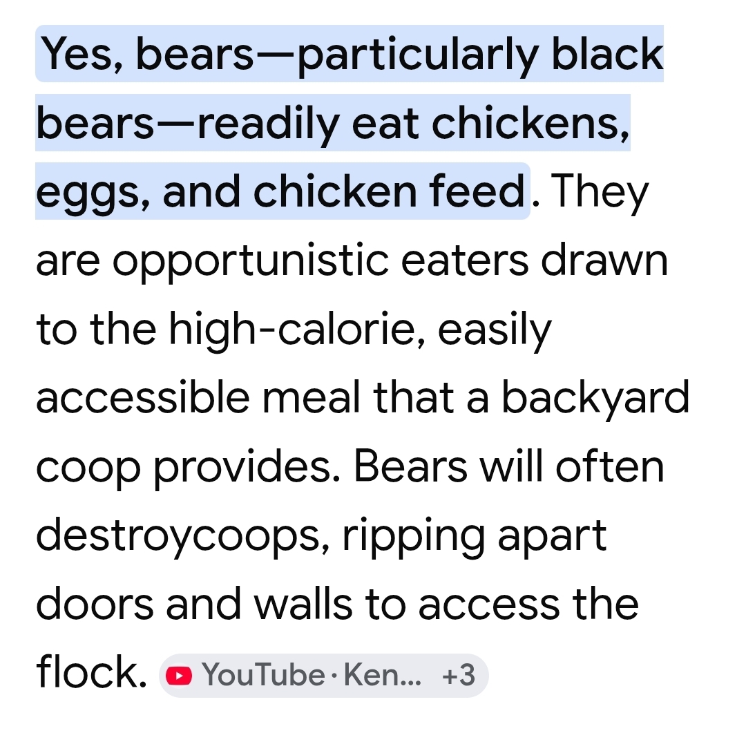
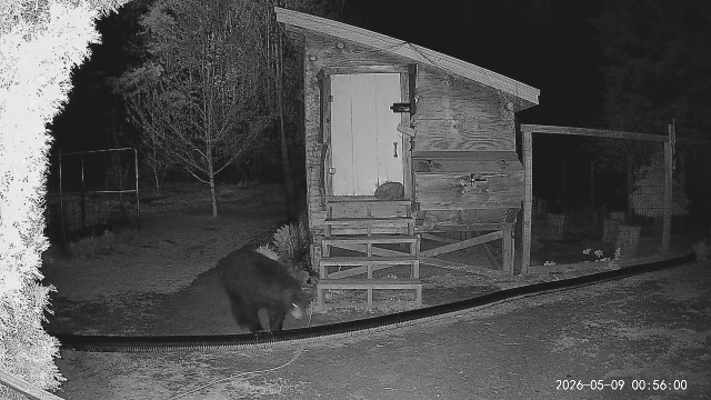
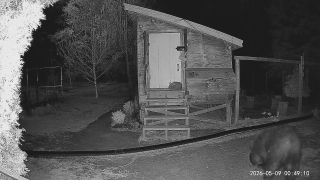
It was sniffing out the mealies and seeds and then went on to the trash. I leave their fans running at night for noise…hopefully to deter.
-

2026-2027 Strong/Super El Nino
bluewave replied to Stormchaserchuck1's topic in Weather Forecasting and Discussion
If you were following the seasonal forecasts last November, then you would have seen the ones keying in on the early stratospheric warming and easterly QBO influence warming were on the right track. But it took about 3 months to finally deliver the big KU event. Would have been nice if we didn’t have to wait 11 years for a both cold and snowy winter in what has become a sea of warm. https://opensnow.com/news/post/november-update-2025-2026-winter-forecast-preview -

Central PA Spring 2026 Discussion/Obs Thread
TheDreamTraveler replied to Voyager's topic in Upstate New York/Pennsylvania
This weather sucks in May. If this was before May I wouldn't have any problem with it but I just want it to be in the 70s/80s and be outside without wind/clouds/rain every other day -

2026-2027 Strong/Super El Nino
Stormchaserchuck1 replied to Stormchaserchuck1's topic in Weather Forecasting and Discussion
A little dip the past 2 days +1.4 over the past 3 months though puts us at +2.0 by mid August if the trend holds consistent -
Sneaky cold overnight 33F, clouds coming in 39
-
2009-2010 was a much weaker modoki compared to the 2023-2024 full basin event and what 2026-2027 is projected to be. Plus it occurred back in a much colder climate prior to the baseline temperature jumps in 2015-2016 and 2023-2024. This is why places from DC to Philly haven’t experienced anything close to those snowfall totals since.
-
End of the month maybe.
-
Damage?
-
2026-2027 Strong/Super El Nino
bluewave replied to Stormchaserchuck1's topic in Weather Forecasting and Discussion
Your local area has just finished the warmest 11 year stretch of winters into March following the big warmer shift in 2015-2016. Since the winters have still averaged below freezing, it still feels cold. But just not as cold as it had been in the past. So every local area has been affected to varying degrees by this warmer shift. This is why global and national temperatures are important since it shapes which will be felt locally. Places closer to the East Coast that have seen their averages climb to the mid to upper 30s over this period have definitely have felt warmer. It’s why this past winter felt so cold. This winter would have been closer to average in the old days. But relative to the post post 2014-2015 period it felt much colder even though many areas saw no record cold this past winter. It was great to see a return of the benchmark snowstorm tracks which had been absent for the past 3 seasons. The Detroit average 11 winter temperature through 2026 is 30.3°. The previous warmest 11 year stretch had been 28.9° ending in 1957. The earlier arrival of spring over this period resulted a 32.6° December through March average vs the previous highest 31.0° max in 2007. The biggest benefit of these warmer run of winters has been in the lake effect snow favored areas like Marquette. Warmer falls into winters boosted the Great Lakes temperatures and slowed the arrival of ice. So a great set up if you are a big lake effect snow fan. -
Holy shit
-
Haha. The damn bear got into our trash and opened up bags all over the yard. Asshole.
-

Winter 25-26 (All Snowfall Maps & Season Total)
codfishsnowman replied to The 4 Seasons's topic in New England
Just northwest of his 50.3, I had 48. Big big valley wide suck effect this past winter -
32.1° with frost. Of course clouds are moving in now just in time to lock the cold in.