All Activity
- Past hour
-
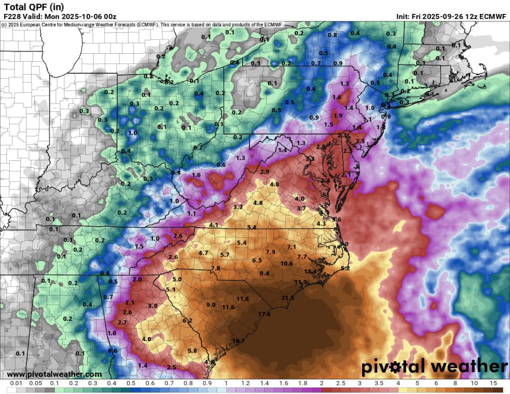
 12z Euro is a Matthew redux for a large portion of the Carolinas.
 -
 The high end rain potential here is very scary in the Carolina’s especially with what happened last year. That needs to be the messaging right now no one needs to focus on intensity yet
 -

September 2025 OBS-Discussion centered NYC subforum
donsutherland1 replied to wdrag's topic in New York City Metro
Westhampton reached 81° this afternoon. That broke the daily record of 80° from 1961. -
I saw my first lantern fly while I was in orange earlier.. I couldn't get a hold of it to kill it but neat to see. These spiders may look bad to @weatherwiz but pretty harmless
-
 It looks like the ensemble members on balance don’t have that coastal stall. The slower members stay OTS
 -
DCA 2.5" QPF on the 12z EPS mean through next 10 days
-
Wait. Hear me out. Ahhh nevermind. It’s not worth explaining. Ban if you must, but please reinstate me for our first winter storm failure.
-
 Pretty grim for a mean
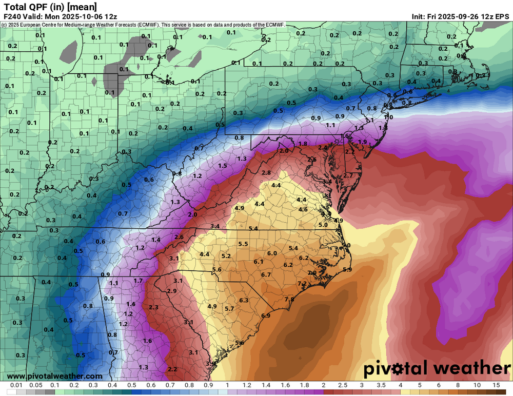
-
Download the gif on desktop. Upload it to imgur. Copy the direct link. Paste in the reply box and it should automatically embed.
-
I could see in a setup like this a primary flood zone near/North of where the center stalls, as well as a secondary flood zone where banding sets up away from the core of the system. With onshore flow and moisture being wrung out between the storm and the HP it the secondary banding could overperform
-
Don’t look at the specifics. I’m just highlighting the threat of widespread high end rainfall. That signal has been there consistently, even though the axis of heaviest rain has bounced around.
-
The sound you just heard was every emergency manager in South and North Carolina furiously trying to order extra water rescue teams.
-
The 12z euro is absolutely horrible for the coastal areas but would throw in beneficial moisture towards the area with possibly only minor flooding at that. Still two different camps in model solutions here. Sent from my SM-G998U using Tapatalk

- Today
-
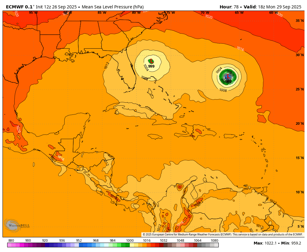
Note how the ridge above slams the door shut for an escape, even though Humberto is able to initially exert some influence. It leads to a prolific rain event...
-

Invest 94L—90% 2 day and 90% seven day odds of development
GaWx replied to WxWatcher007's topic in Tropical Headquarters
“Hilton Head landfall Thursday morning on euro” way out at hour 144 or so with devastating amounts of rainfall in SC. Then drifts S to near SAV. -
Invest 94L—90% 2 day and 90% seven day odds of development
GaWx replied to WxWatcher007's topic in Tropical Headquarters
Then per other sources it stalls just offshore for 24+ hours -
Closer to the coast than 00z, but a departure from the clear landfall at 06z. Humberto is pulling away as the ridge rolls over the top so the escape route probably closes. Still a lot to figure out with not a lot of time.
-
Invest 94L—90% 2 day and 90% seven day odds of development
GaWx replied to WxWatcher007's topic in Tropical Headquarters
12Z Euro H5 114 hits CHS: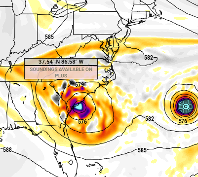
-
yeah those are chill, just scoop up and fling onto neighbors property ..and hope it doesn't come back.
-
Invest 94L—90% 2 day and 90% seven day odds of development
GaWx replied to WxWatcher007's topic in Tropical Headquarters
It appears that way. We’ll see whether the run gets going again as it’s been stuck at hour 78 for nearly 15 minutes -
It was you or the spider.
-
A bit more towards the stalled solution, with Humberto and Imelda's latitude closer together
-
Invest 94L—90% 2 day and 90% seven day odds of development
GaWx replied to WxWatcher007's topic in Tropical Headquarters
12Z Euro to 78 looks similar to 0Z at 90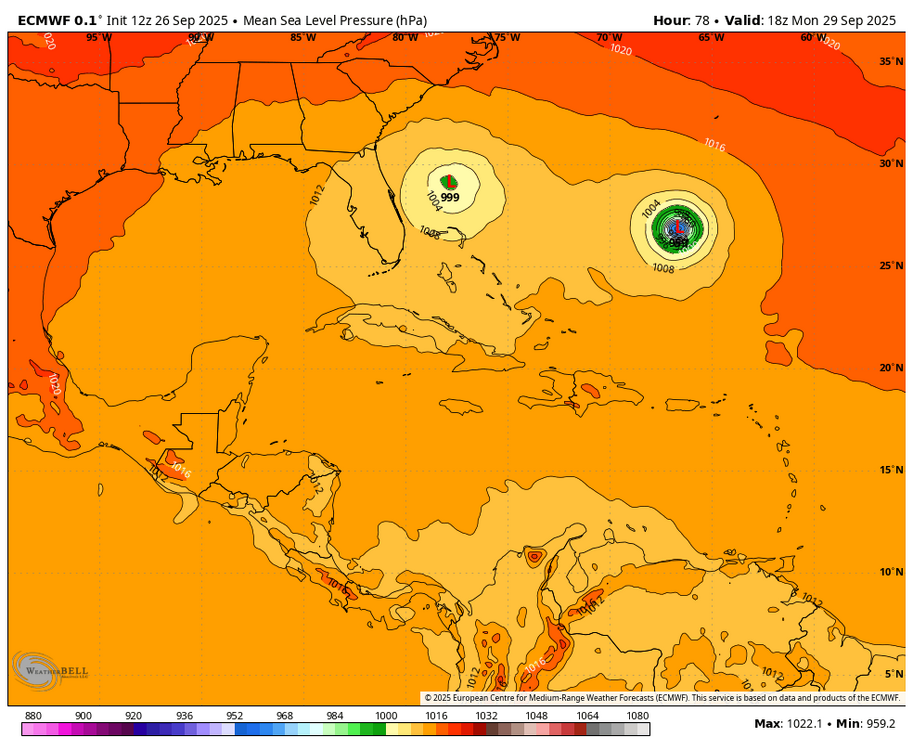
-
I mean, this is basically doing a @Ji where the D9 blizzard run becomes the floor and anything less is a bust.