All Activity
- Past hour
-
Interesting there are showers moving SE to NW towards the bay and showers moving NW to SE towards I-95 at the same time. I predict a convergence zone with incredible lift and flooding somewhere between the Fall line and the bay.
-
.58 with a steady soaking rain
-
 definitely, I hate this humidity, now it's just cool and clammy
 -
Ineedhurricanes is probably sitting out in his lawn chair in this.
-
I can remember countless summer days like this in the 80s.
-
The ones he installed in fuckin April?
-
Will those showers actually make it to 95??
-
This is what they want . It just is hard to comprehend . They’re inside huddled up yet are happy . Riddle me this
-
 Last several summer/winters have been all front loaded. Winter 23-24 died after that one week cold spell in January. The following summer also died in August, with September being almost chilly. This past winter died in mid February as well, with march being a blowtorch.
 -
Not an ideal summer day for sure
-
I’d kill for that. The well is getting precarious.
-
Windows wide open welcoming the great sleeping temps. about 1/2” here. Meh
-
It was a very susceptible record
-
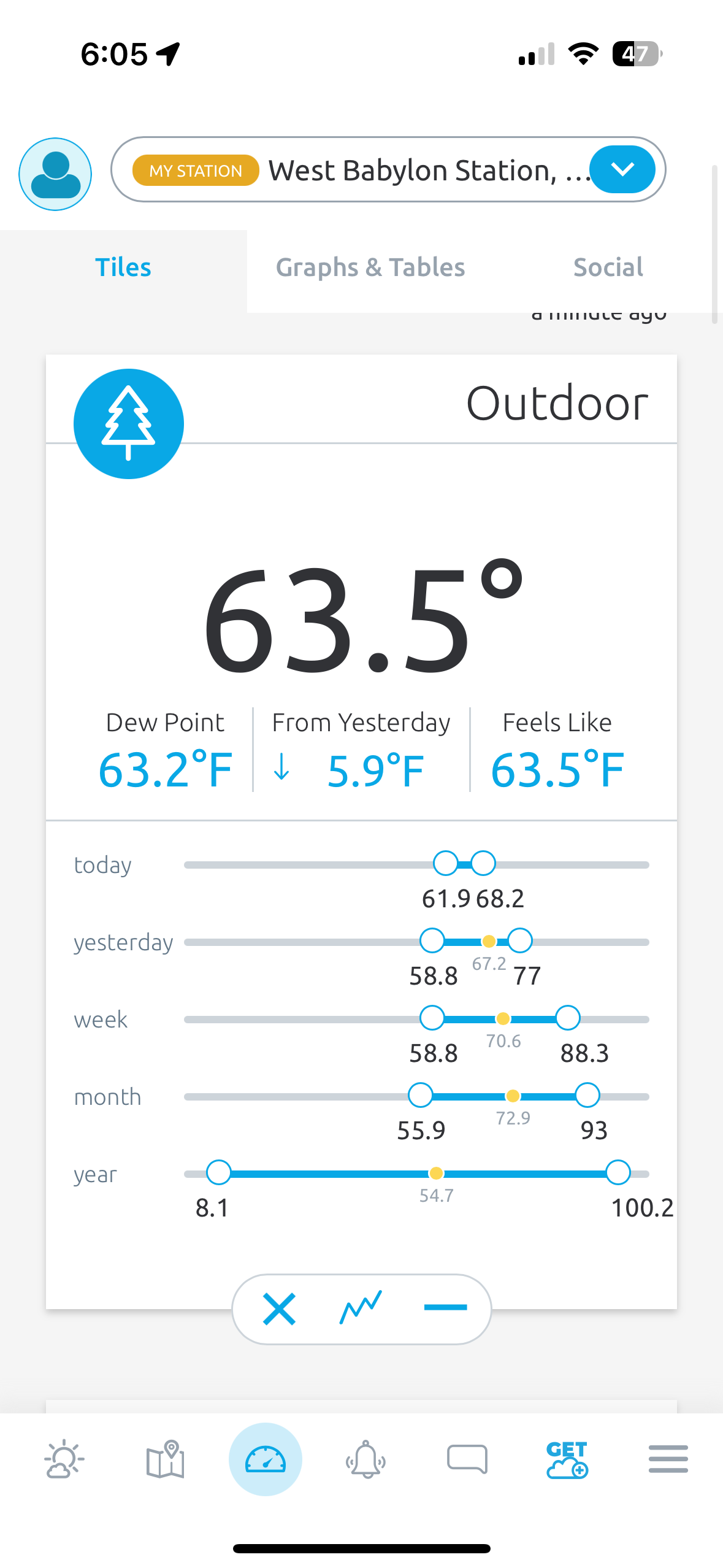
yep-some models showed that earlier with temps in the 50's most of the day...dropped down to 60 here as soon as the rain started. 68 was the high
-
It's still too humid. The dew should never go above 60.
-

2025 Atlantic Hurricane Season
BarryStantonGBP replied to BarryStantonGBP's topic in Tropical Headquarters
-
 I’m not ready for this. One more month of heat please.
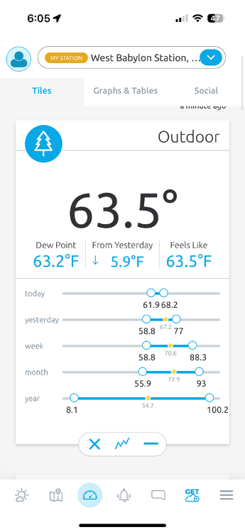
-
INVEST 99L FORMED: (40/40)
BarryStantonGBP replied to BarryStantonGBP's topic in Tropical Headquarters
PACK IT UP -
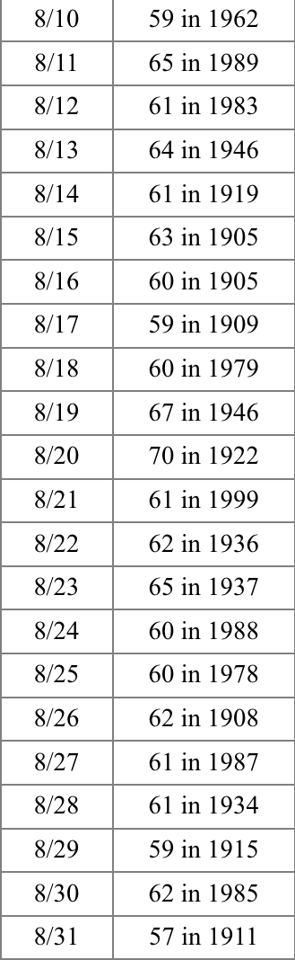
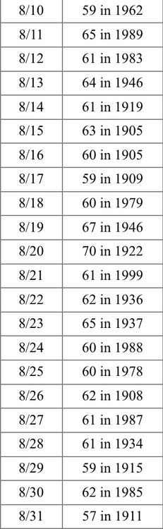
Don, where would 1983 be on this list with September included?
-
Nassau County really needs a micronet, there are probably big differences from the barrier islands to Sunrise Highway let alone what happens farther north. Sea breezes are very local and don't usually make it more than 2 miles inland.
-
2025 Atlantic Hurricane Season
BarryStantonGBP replied to BarryStantonGBP's topic in Tropical Headquarters
Sorry Fernand, it's Juliette's turn -
 The temperature peaked at 70° in Central Park. That was the coolest high temperature since June 17 when the high was 67°. Showers and periods of rain are likely into tomorrow. Most areas should see 0.50" or less of rain. However, some spots could see heavier rain. High temperatures will likely reach the lower and middle 70s tomorrow and then climb into the lower 80s on Friday through the weekend. The extended range guidance continues to suggest that the closing week of August could feature below normal temperatures. Precipitation could be near normal. There will be higher-than-climatological risk of at least one period in September with highs in the upper 80s or perhaps 90s. Summers similar to the current one have had September highs of 90 or above about 10 percentage points above that for all other years. The ENSO Region 1+2 anomaly was +0.6°C and the Region 3.4 anomaly was -0.3°C for the week centered around August 13. For the past six weeks, the ENSO Region 1+2 anomaly has averaged +0.53°C and the ENSO Region 3.4 anomaly has averaged -0.20°C. Neutral ENSO conditions will likely continue into early autumn. The SOI was -8.56 today. The preliminary Arctic Oscillation (AO) was -0.972 today. Based on sensitivity analysis applied to the latest guidance, there is an implied 84% probability that New York City will have a cooler than normal August (1991-2020 normal). August will likely finish with a mean temperature near 74.6° (1.5° below normal). Supplemental Information: The projected mean would be 0.6° below the 1981-2010 normal monthly value.
 -
Yeah I don't really understand the ACATT high fiving. Been a miserable summer for us.
-
Too bad this rain didn't sink south about 12 hours earlier could have had a lot more records set. This kind of cold is pretty rare. BDL smashed a record that stood for 103 years by 7 degrees.
-
not just yellow leaves, but leaves have actually been falling here for a few days now


.thumb.png.4150b06c63a21f61052e47a612bf1818.png)