All Activity
- Past hour
-
Ok that’s all of that
-
 37. My sensor is only 20' from the water so it won't reflect what's actually happening.
 -
Yes, I was using it for another thermometer, but that one doesn't have an app, so it was annoying. The sensor/device is the size of like a dry erase board eraser.
-
To Bluewave- A negative IOD apparently can change the pattern, the eastern USA may see an increase in snowfall or precipitation, as the combined effects of a negative IOD and La Nina can enhance atmospheric moisture and create favorable storm tracks. To Snowman- While the blob is cooling its such a large blob and the longer it's out there the more the impacts will be felt across the northeast USA and eastern Canada with plenty of cold and snow.
-
Thanks. So that's some other shield you happened to have already? And you stuffed the whole device, probe and all in that shield?
-
 Yeah the system is moisture starved-most of it is well north
- 15 replies
-
- 1
-

-
- wind damage
- power outages
- (and 1 more)
-

Overnight Wednesday, November 5, 2025 Wind Event
vortex95 replied to weatherwiz's topic in New England
The 18z HRRR looks almost identical synoptically. The low is just as deep and comma head stout. -
 53/52
53/52 -
I should have had a question about what the temp would be for midnight mass on Christmas Eve.
-

Overnight Wednesday, November 5, 2025 Wind Event
OrangeCTWX replied to weatherwiz's topic in New England
Was thinking the same thing. -
 This is just winds? No precip?
 -
 How many congrats Dendrite?
 -
Overnight Wednesday, November 5, 2025 Wind Event
moneypitmike replied to weatherwiz's topic in New England
thread cancel. -
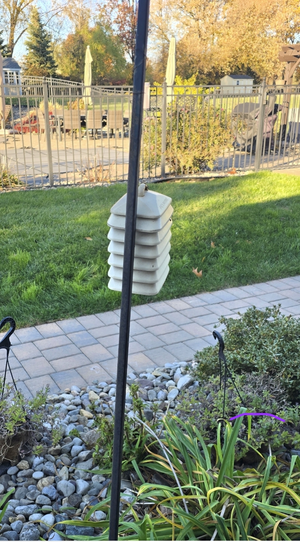
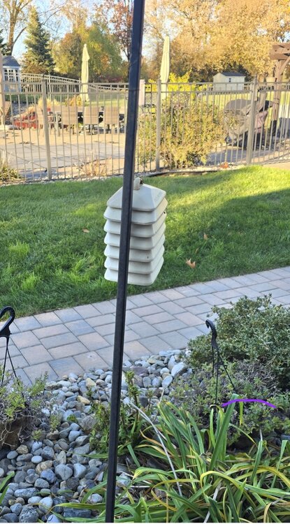
Perfect, you'll be good. I have it hooked to a plant hanger about 4.5' off the ground. I think im going to get a new shield now too as I had to rig the device inside of this with zip ties.
-
I will say 3 flood warnings and 1 6”+ rain event.
-
Let the winter begin.
-
Overnight Wednesday, November 5, 2025 Wind Event
CoastalWx replied to weatherwiz's topic in New England
Feel like 18z runs backed down a bit. -

Central PA Fall Discussions and Obs
mahantango#1 replied to ChescoWx's topic in Upstate New York/Pennsylvania
URGENT - WEATHER MESSAGE National Weather Service State College PA 108 PM EST Tue Nov 4 2025 PAZ035-036-056-057-059-063>066-051200- /O.NEW.KCTP.WI.Y.0011.251105T1800Z-251106T1500Z/ Fulton-Franklin-Perry-Dauphin-Lebanon-Cumberland-Adams-York- Lancaster- Including the cities of Lancaster, Lebanon, Gettysburg, Chambersburg, Carlisle, York, Hershey, McConnellsburg, Newport, and Harrisburg 108 PM EST Tue Nov 4 2025 ...WIND ADVISORY IN EFFECT FROM 1 PM WEDNESDAY TO 10 AM EST THURSDAY... * WHAT...West winds 15 to 25 mph with gusts up to 45 mph expected. * WHERE...Adams, Cumberland, Dauphin, Franklin, Fulton, Lancaster, Lebanon, Perry, and York Counties. * WHEN...From 1 PM Wednesday to 10 AM EST Thursday. * IMPACTS...Gusty winds will blow around unsecured objects. Tree limbs could be blown down and a few power outages may result. PRECAUTIONARY/PREPAREDNESS ACTIONS... Use extra caution when driving, especially if operating a high profile vehicle. Secure outdoor objects including patio furniture and holiday decorations. -
Raleigh - November 25. I don't think we hit freezing next week during that cold snap.
-
I have the 2902D. I was curious as to how you set it up outside/mounted it.
-
Central PA Fall Discussions and Obs
mahantango#1 replied to ChescoWx's topic in Upstate New York/Pennsylvania
URGENT - WEATHER MESSAGE National Weather Service State College PA 108 PM EST Tue Nov 4 2025 PAZ012-018-019-026>028-037-041-042-045-046-049>053-058-051200- /O.NEW.KCTP.HW.A.0002.251105T1800Z-251106T1500Z/ Northern Clinton-Northern Centre-Southern Centre-Huntingdon- Mifflin-Juniata-Tioga-Northern Lycoming-Sullivan-Southern Clinton- Southern Lycoming-Union-Snyder-Montour-Northumberland-Columbia- Schuylkill- Including the cities of Selinsgrove, State College, Mansfield, Lewisburg, Pottsville, Mifflintown, Mount Union, Lewistown, Bloomsburg, Huntingdon, Laporte, Lock Haven, Philipsburg, Wellsboro, Williamsport, Renovo, Berwick, Sunbury, Shamokin, Danville, and Trout Run 108 PM EST Tue Nov 4 2025 ...HIGH WIND WATCH IN EFFECT FROM WEDNESDAY AFTERNOON THROUGH THURSDAY MORNING... * WHAT...West winds 20 to 30 mph with gusts up to 60 mph possible. * WHERE...A portion of central Pennsylvania. * WHEN...From Wednesday afternoon through Thursday morning. * IMPACTS...Damaging winds could blow down trees and power lines. Widespread power outages are possible. Travel could be difficult, especially for high profile vehicles. * ADDITIONAL DETAILS...Isolated gusts over 60mph are possible, especially within thunderstorms that move through Wednesday afternoon and evening. PRECAUTIONARY/PREPAREDNESS ACTIONS... Use extra caution when driving, especially if operating a high profile vehicle. Fasten loose objects or shelter objects in a safe location prior to the onset of winds, including patio furniture and holiday decorations. && -
Which station do you have? WS-2902a you can't connect additional devices, but 2902b you can. I followed this:
-

Overnight Wednesday, November 5, 2025 Wind Event
weatherwiz replied to weatherwiz's topic in New England
Waiting on the 18z HRRR bufkit but the 18z HRRR has a pretty solid line moving through which may or may not contain some thunder/lightning. There are some important notes about this to keep in mind: 1) Typically (probably often) we don't see much in the way of wind transported down to the surface within these lines in this kind of setup. There are several reasons for this, however, perhaps the most important is the air becomes too stable too quickly, inhibiting winds from mixing to the surface. 2) The presence of any thunder/lightning (as we saw last night) increases the potential for strong winds to make it to the surface via downward momentum transfer and this indicates the presence of instability. The challenge tomorrow evening will be, will the weak instability we may have be just enough to aid in this process? 3) In terms of the region as a whole, the winds will likely begin to increase significantly and quickly just behind the line. You'll have strong CAA advecting within the 1-3km level which is going to vastly increase your low-level lapse rate - this will be the catalyst for mixing down stronger winds. Also, there may be some evaporative cooling going on just behind the line (as we may still have some llvl moisture present) which will further help to initially mix down winds. 4) There are always going to be very local mesoscale and microscale processes which will have a great impact locally. With this, we will likely see this either perform accordingly or maybe even slightly overperform within areas which are prone to higher wind events. Subsequently, there will be areas where the wind doesn't seem impressive at all. That has nothing to do with the setup, that is a product of microscale processes and local topography. (This is something that also can be applied to just about any weather event). But with many forecast soundings showing nearly a dry adiabatic profile up though 3-4k with a drying profile, we should mix sufficiently...but there could be some caveats such as if there happen to be any subtle just above sfc inversions. If this was coming during the day it would be difficult to find any concerns -
Thanks for the update! If it's not too much to ask whenever you get the chance, can you take a picture of it and how it's set up? Thanks!
-

Mid to long range discussion- 2025
WinstonSalemArlington replied to wncsnow's topic in Southeastern States
Amped