All Activity
- Past hour
-
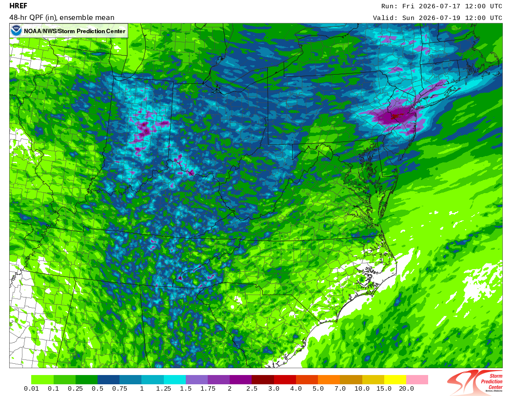
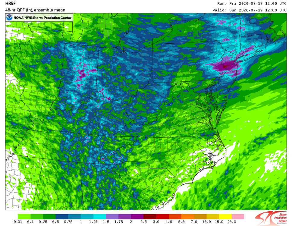
The usual. Congrats eastern PA/NJ.
-
Today's Highs (smoke mostly cleared north of phl) New Brnswck: 89 EWR: 88 LGA: 88 PHL: 88 TTN: 87 BLM: 86 TEB: 86 NYC: 86 JFK: 86 ACY: 85 ISP: 84
-

Saturday, July 18, 2026 Thunderstorm/Severe Weather Potential
CoastalWx replied to weatherwiz's topic in New England
Probably won’t happen -

2026-2027 Super El Nino
Stormchaserchuck1 replied to Stormchaserchuck1's topic in Weather Forecasting and Discussion
Honestly the pattern since 1998 looks like a Hadley Cell expansion, which you see in both the North and South Hemisphere, which usually points to equilateral Pacific as a main cause -
2026-2027 Super El Nino
Stormchaserchuck1 replied to Stormchaserchuck1's topic in Weather Forecasting and Discussion
I think there are global things in motion/phase, and you see this reflected in the PDO. I agree SSTs are secondary to air patterns. -
2026-2027 Super El Nino
Stormchaserchuck1 replied to Stormchaserchuck1's topic in Weather Forecasting and Discussion
PDO is less related to ENSO than people think. Maybe more so west-based events correlate, but east-based events primarily effect the North Pacific High -

2026-2027 Super El Nino
LakePaste25 replied to Stormchaserchuck1's topic in Weather Forecasting and Discussion
IMO, I think of the PDO like snow cover. If a large area has deep snow cover (or lack thereof), it can enhance (or weaken) a polar high, which can impact an individual storm track. But it can only do so much. If you have a cutter going into ORD, snow cover in new england or the mid atlantic won’t stop it from cutting. And over time, as we know, those repeated cutters will weaken the snow cover. So think of the super Nino as the pattern driving the cutters, and the -PDO as the snow cover. The super Nino will continuously override it over time with a zonal jet until it flips to +PDO. I know this is not a perfect analogy because El Niños mean less cutters literally. But you get the idea. -

2026-2027 Super El Nino
EasternLI replied to Stormchaserchuck1's topic in Weather Forecasting and Discussion
Ah, but are we talking sst pdo, or upper air pdo (like the one I posted)? -

2026-2027 Super El Nino
snowman19 replied to Stormchaserchuck1's topic in Weather Forecasting and Discussion
-
Good watch for Os fans. Not that we need a dose of reality, but this is good stuff, if not depressing.
-
 Highest gust on record for the summer set in July 1996, correct? They had PL at the time IIRC. And I think this same storm system resulted in record flooding in Quebec.
 -
Coldest I could find outside mtn location in New England is 47 at Fox Brook ME.
-
Oh please let this verify!
-
Recall during the Olympics in China, the smoke pollution was never called such? You would get official statements like, "it is mist" or "it is getting ready to rain."
-
I agree it is not as bad as 2018, but when you talking tenths of deg when it comes to exceeding records, it does matter, and the longer the period, the more this drift is a problem when talking avg temps. 1 F bias does not sound like much for a single day, but it is big over the course of a month, and keeps increasing the longer you go.
-
2026-2027 Super El Nino
EasternLI replied to Stormchaserchuck1's topic in Weather Forecasting and Discussion
Personally, I have a sneaking suspicion that the reason for that is a long term deep multidecadal -pdo state (since 2000). Which is evident on the H300 PDO plots (image below). I'm wondering if this might mitigate the super el nino effects somewhat. As there is research out there suggesting that possibility. Sort of would explain the lack of the north Pacific low thus far... If / when one would develop. It would explain it being weaker than one would expect in a super el nino according to said research. This is also quite interesting... -
If it thick enough, it does. Put it this way on an ideal radiation cooling night, if there was a layer of thick smoke at 20,000 ft, do you really temps woild drops as low as if there was no smoke? Yes, the SW/LWIR physics are not the same as WV clouds, but it is still a cover, so to speak. Why did BOS only hit 90 on 7/14 when 97 was fcst?
-
Today it was DC's turn for thick smoke. VIS at KDCA got as low as 1.25 mi and VV restriction of only 200 ft! METAR KDCA 171252Z 00000KT 1 1/2SM FU VV020 28/17 A3007 RMK AO2 SLP183 T02780167" CoastalWx, remind you of doing TAFs for India? Every night, the VIS like clockwork would drops big time to 1/4 mi or less from smoke at so many airports, not from wildfires, but industrial pollution.
- Today
-
I need a slow moving tropical depression. Just over 7" of rain here the last 4.5 months.
-
It looks good on you. Lol
-
Hit 92° at ORD and 94° at MDW today.
-
Hit 92° at ORD and 94° at MDW today. ...2026 90°+ Day Tally... 11 - MDW 11 - ARR 10 - ORD 10 - RFD 10 - LOT 9 - PWK 9 - UGN 8 - DPA
-
We need a storm tomorrow as badly as the Wizards need a 50-win season.
-
 CAPE changed their profile photo
 -
I think I'm gonna go with it.
-
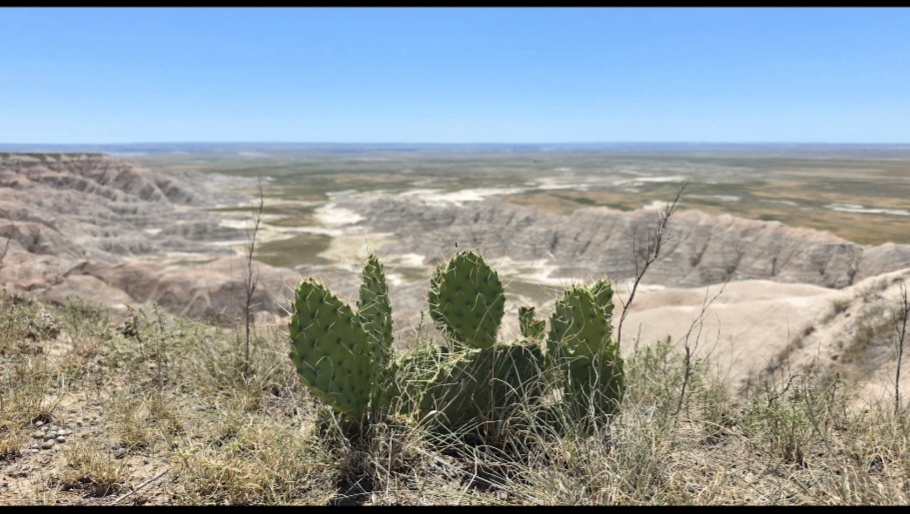
@CAPE I took this pic at the Badlands just for you. I considered making it my profile pic.