All Activity
- Past hour
-

E PA/NJ/DE Summer 2026 Obs/Discussion
BBasile replied to PhiEaglesfan712's topic in Philadelphia Region
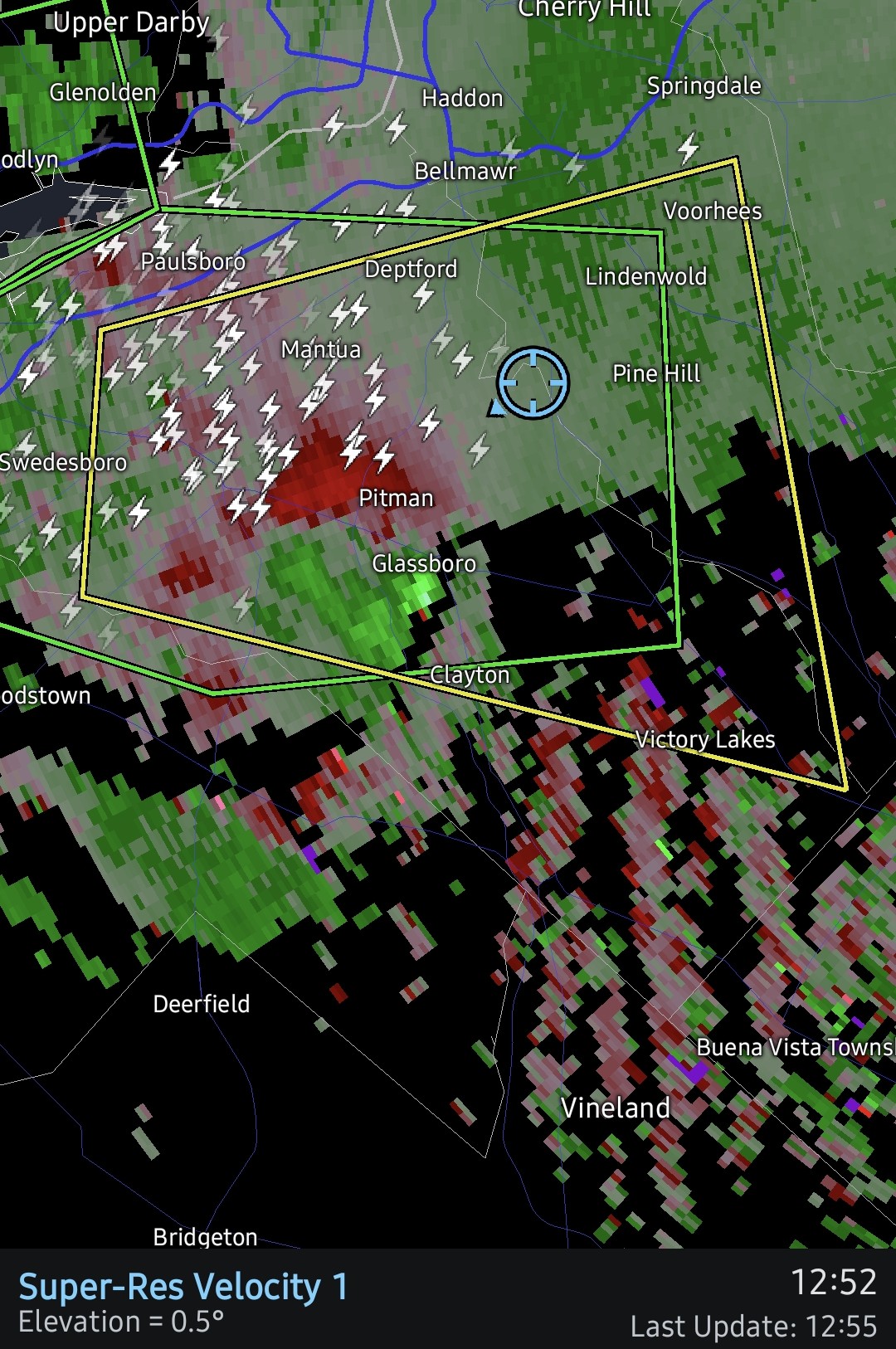
Rotation tightened up a bit with the latest scan. -
 Here is a good post about it: [url=http://www.medguideusa.com/guide/lasix/]Lasix guide[/url]. Highly recommended!
 -
Getting a heavy downpour now, but I can see that the worst of this round is gonna miss me just to the south.
-
1.5 inches now in the last 45 minutes
-
Keeping in mind that the UKMET was one of the earliest, to consistently predict Dolly with runs doing that going back as far as 7 days fwiw: The 12Z UKMET has a low form in the subtropics well off the SE coast that later either his or is about to hit the SE US for the 3rd run in a row. Yesterday’s 12Z’s low was weak and it was about to hit NE FL at the end (Sept 2nd). Today’s 0Z had a TS about to come into the S portion of the FL E coast on Sept. 3rd. Today’s 12Z UKMET has TCG at hour 108 that initially moves W but then strengthens into a TS that turns NW to hit Charleston on Sept. 3rd: NEW TROPICAL CYCLONE FORECAST TO DEVELOP AFTER 108 HOURS FORECAST POSITION AT T+108 : 29.8N 74.4W LEAD CENTRAL MAXIMUM WIND VERIFYING TIME TIME POSITION PRESSURE (MB) SPEED (KNOTS) -------------- ---- -------- ------------- ------------- 0000UTC 01.09.2026 108 29.8N 74.4W 1013 26 1200UTC 01.09.2026 120 29.8N 74.8W 1011 30 0000UTC 02.09.2026 132 29.5N 75.8W 1009 36 1200UTC 02.09.2026 144 30.3N 77.3W 1008 37 0000UTC 03.09.2026 156 31.4N 78.5W 1004 39 1200UTC 03.09.2026 168 33.1N 80.0W 1001 39
-
He will now post a day 15 map showing heat....
-

E PA/NJ/DE Summer 2026 Obs/Discussion
soadforecasterx replied to PhiEaglesfan712's topic in Philadelphia Region
Feel like that storm should be tornado warned. -
too early for that it's 7:10 tn
-
E PA/NJ/DE Summer 2026 Obs/Discussion
BBasile replied to PhiEaglesfan712's topic in Philadelphia Region
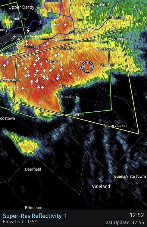
Rotation sliding by to my South.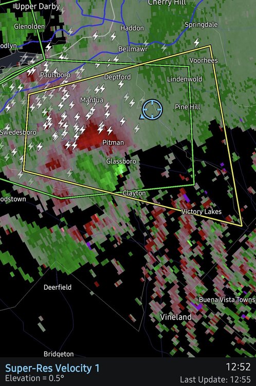
-
Sorry you're not getting your desired torch late summer pattern. No more 90s in central park until next may/june is a given at this point. Too rainy and niño like.
-
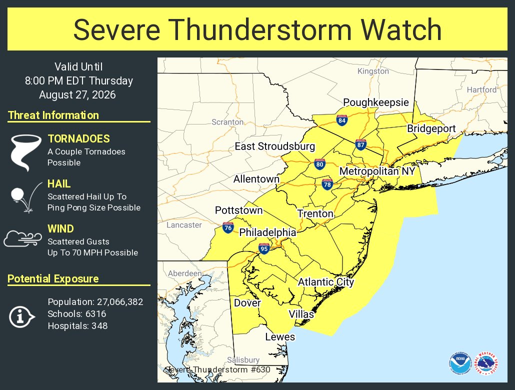
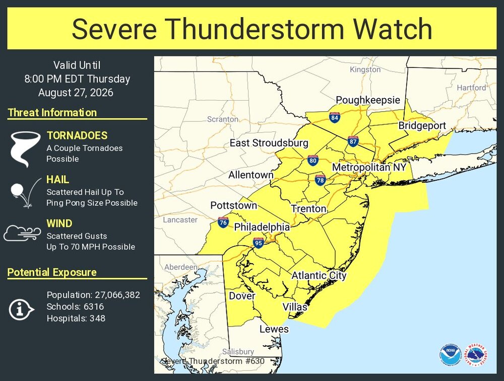
Another severe thunderstorm watch has been issued just now for my area. I don't remember so many in the month of August!
-
https://www.spc.noaa.gov/products/watch/ww0630_radar.gif They call off the Mets game yet ? Difficult to call off since its the Brewers last game here this year
-
For more information, visit Medical Guide - it helped me a lot.
-
The day before it's always hard to predict what areas will get the heaviest storms. But with multiple rounds today, most areas should do well.
-
For what it's worth, the 12z CMC shows the remnants reorganizing in the Florida straits and then riding up the east coast of Florida as a formidable tropical storm. If the remnants can stay together, I don't think it's out of question that it can reform closer to the conus. We've seen open waves reorganize plenty of times.
-
Here you are
-
Holy shit its insane here. Torrential rain
-
Great. Dolly dies again in August. Can't catch a break.
-
Driving through the heavy rain now. Thunder and lightning in Staten Island.
-
Storm over Staten Island went Severe - still no Watches update Watch just issued WWUS from KWNS SVR from KOKX
-
Getting some good thunder now and flash flooding. Already over .75 inches in the last half hour
-

2026-2027 Record-breaking El Nino
LakePaste25 replied to Stormchaserchuck1's topic in Weather Forecasting and Discussion
Locally I’d much rather have December 1997 over December 2015. But I have my expectations very low. -
E PA/NJ/DE Summer 2026 Obs/Discussion
SouthernNJ replied to PhiEaglesfan712's topic in Philadelphia Region
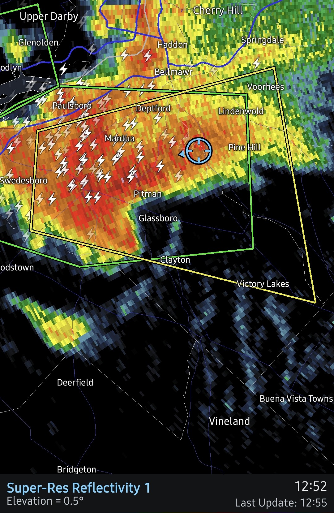
The storm's core has shifted a few times, though it appears the strongest winds were on the south side of Mullica Hill and moving into Pitman as well as adjacent townships. -

2026-2027 Record-breaking El Nino
40/70 Benchmark replied to Stormchaserchuck1's topic in Weather Forecasting and Discussion
Will be interesting to see how close we get this year...my guess is 2015 like. -
2026-2027 Record-breaking El Nino
LakePaste25 replied to Stormchaserchuck1's topic in Weather Forecasting and Discussion
Would be nice to get one winter without an aleutian ridge, even if we’re dealing with an extended pac jet more often than not.