All Activity
- Past hour
-

2026-2027 Super El Nino
PhiEaglesfan712 replied to Stormchaserchuck1's topic in Weather Forecasting and Discussion
I feel like if the PDO doesn't reverse, especially with how big of an el nino we are expected to have, we are pretty much in a permanent -PDO. We haven't had a +PDO winter now since 2015-16, which was more than a decade ago, and is unprecedented. Even in previous predominant -PDO periods, we got a +PDO in there somewhere. Also, if we don't reach 175 ACE this year, it would be sixth straight year that we don't reach the threshold. Here is a list of longest periods with no hyperactive (175+ ACE) seasons: 1. 1962-1994 (33 seasons) 2. 1894-1925 (32 seasons) 3. 1934-1949 (16 seasons) 4. 2006-2016 (11 seasons) 5. 1927-1932 (6 seasons) [2026 would tie this streak, which began in 2021] The thirteen hyperactive (175+ ACE) seasons are: 1893 1926 1933 1950 1955 1961 1995 1998 2003 2004 2005 2017 2020 -
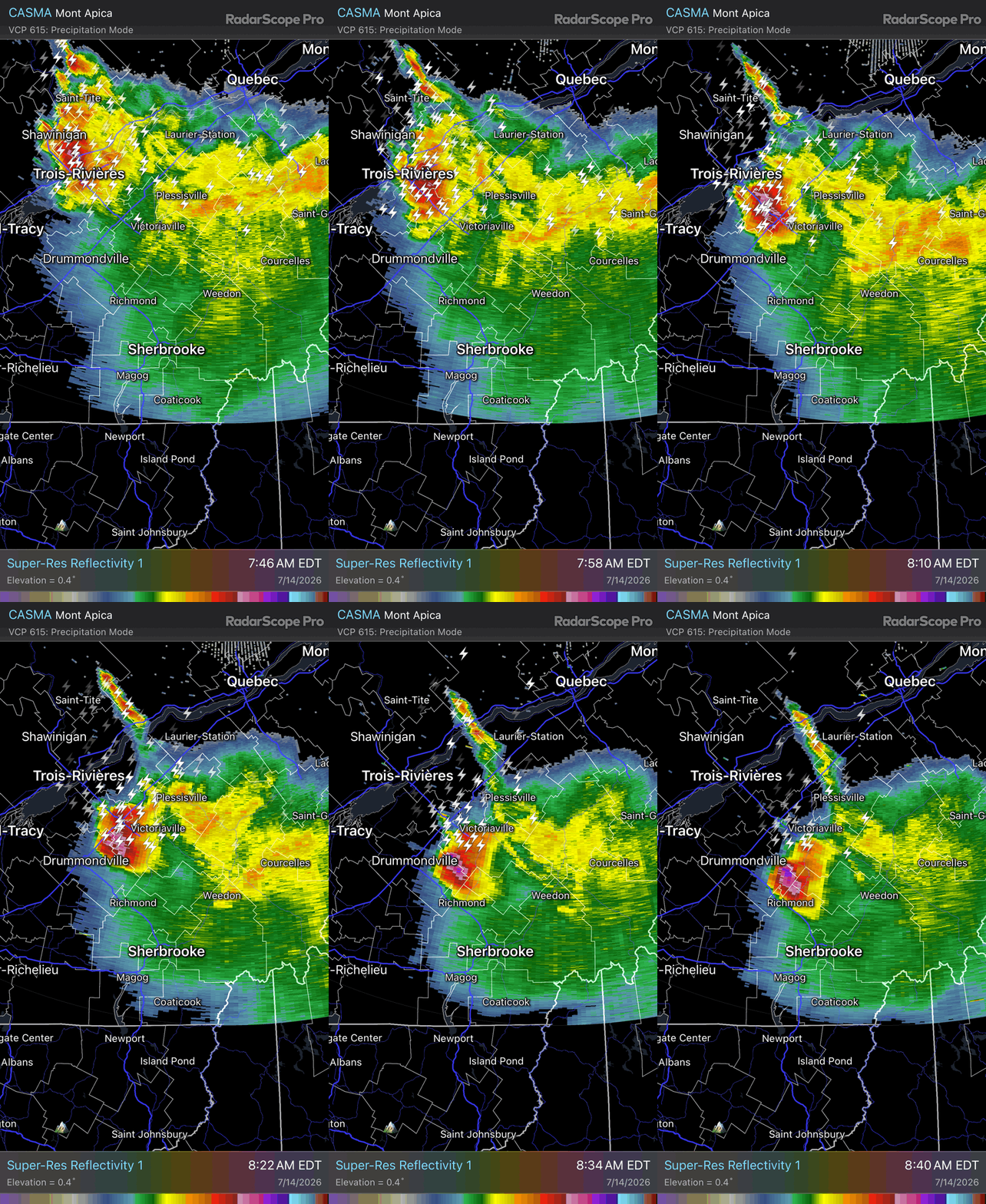
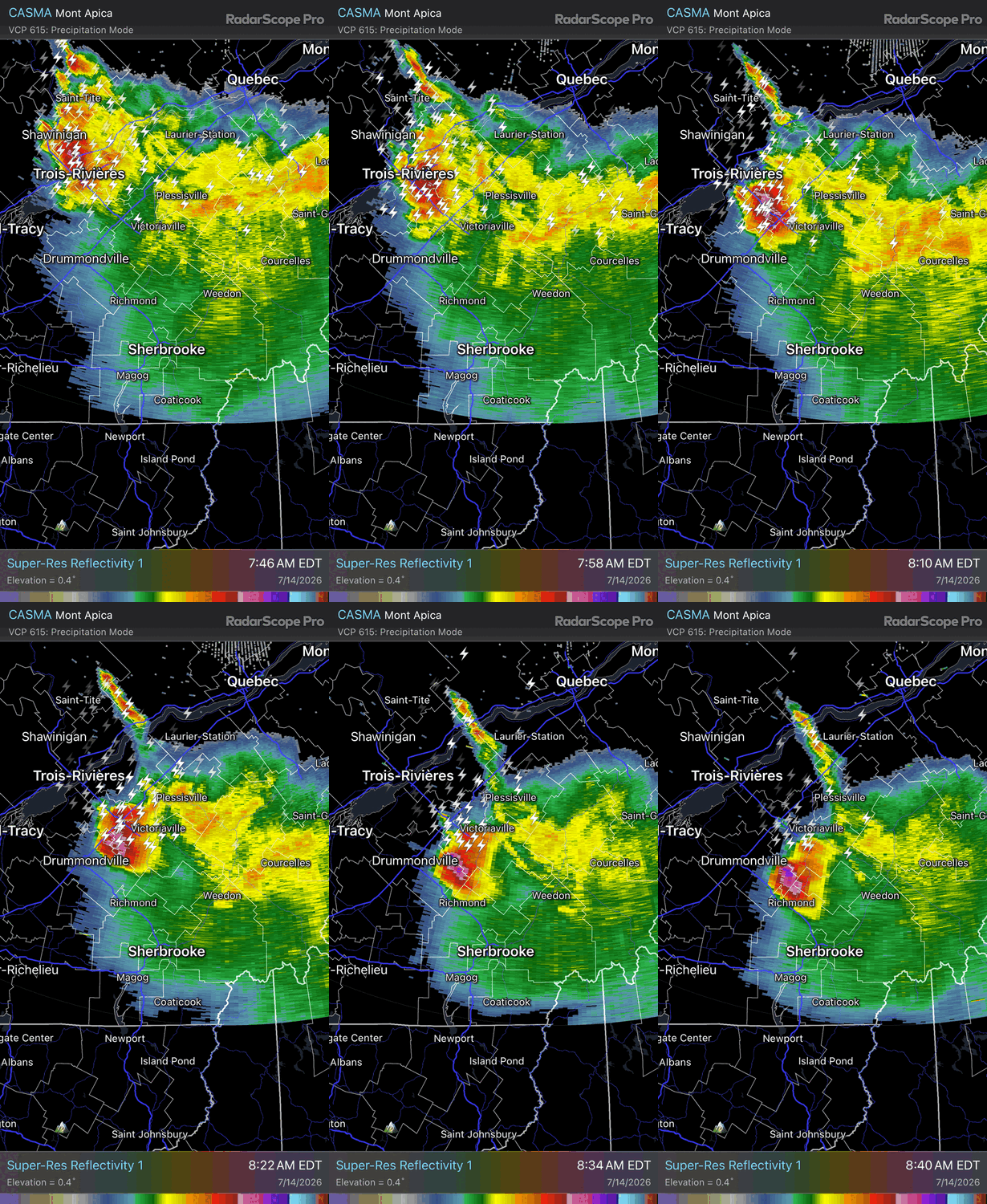
 That was the pregame. After party at GYX later today.
 -
 That looks like it has a nasty hail core per ZDR. Probably dropping some big ones
 -
 Is Ekster at the office or still riding one of those cages at the clubs in YSC
 -
I knew a 10% would eventually come
-
 https://www.acudarthealth.com/products/acudart-at-home-lyme-test Going off of memory here so please verify....I think Quest Diagnostics offers appointments to be tested for Lyme Disease. Also there are tele health services that you can contact.
 -
More like Sherbroke
-
All timer for MLT
-
Congrats moose
-

2026-2027 Super El Nino
40/70 Benchmark replied to Stormchaserchuck1's topic in Weather Forecasting and Discussion
The influence of ENSO, especially warm ENSO, is more geographically restricted now and more largely relegated to the tropics, regardless of it's intensity. Powerful events are more influential....in the tropics. However, the mid latitudes are now more dictated by these marine heat waves and expanding ridges. I get what Adam is saying....this El Nino is a powerhouse, but it's just that it's more the scope of Andrew rather than Katrina. -
Beats the usual smells in that area
-
That might also explain why the models have backed off on what was nascent potential for cap busters along the front Wednesday...
-
I've read that if that tornado had either started a bit sooner or just tracked a few miles different the death count would have been substantially higher. Just missed a more concentrated populated area by a few miles
-

2026-2027 Super El Nino
bluewave replied to Stormchaserchuck1's topic in Weather Forecasting and Discussion
Yeah, I have been saying this for a while now. Once past the spring predictability barrier, the models like the Euro do a great job with ENSO SST plumes forecast. So the record breaking nature of this event isn’t in doubt. We can see the strong coupling with the atmospheric patterns in the tropics and the very high shear in the Caribbean. But the subtropics or mid-latitudes continue to do their own thing. It’s a very strong -PDO pattern north of the tropics rights now. If this mid-latitude pattern can continue to have some influence going into the winter, then the Aleutian low could split or end up in a different location than usual. It’s also possible the typical strong Nino ridge south of Hudson Bay could at least at times get displaced further to the south over the Eastern CONUS. This could mean that the heavily precipitation zones with the STJ may vary from the 1997-1998 locations like we saw in 2015-2016 and 2023-2024. -
Yeah not feeling too optimistic about much sun today, but it’s early.
-
 This one was pretty big as well. Still the 2nd deadliest New England Tornado after Worcester in 1953. https://en.wikipedia.org/wiki/1878_Wallingford_tornado
.jpg.328e948627a1b6a88ceceba79d08b0f3.jpg)
-
Certainly possible the smoke could have an impact on surface temperatures but with an elevated mixed-layer moving in and dewpoints climbing instability shouldn't be an issue. Also, in terms of the MCS...this may sort of set the boundary for where the corridor of highest severe weather potential exists. This will probably leave behind some residual outflow boundaries and also have to watch out for a strong differential heating zone which may become established. But once the MCS passes things should begin destabilizing quickly. Big question I think is going to be do storms pop during the afternoon (like HRRR has). These would be more discrete/supercell and pose the greatest risk for very large hail and tornadoes
-
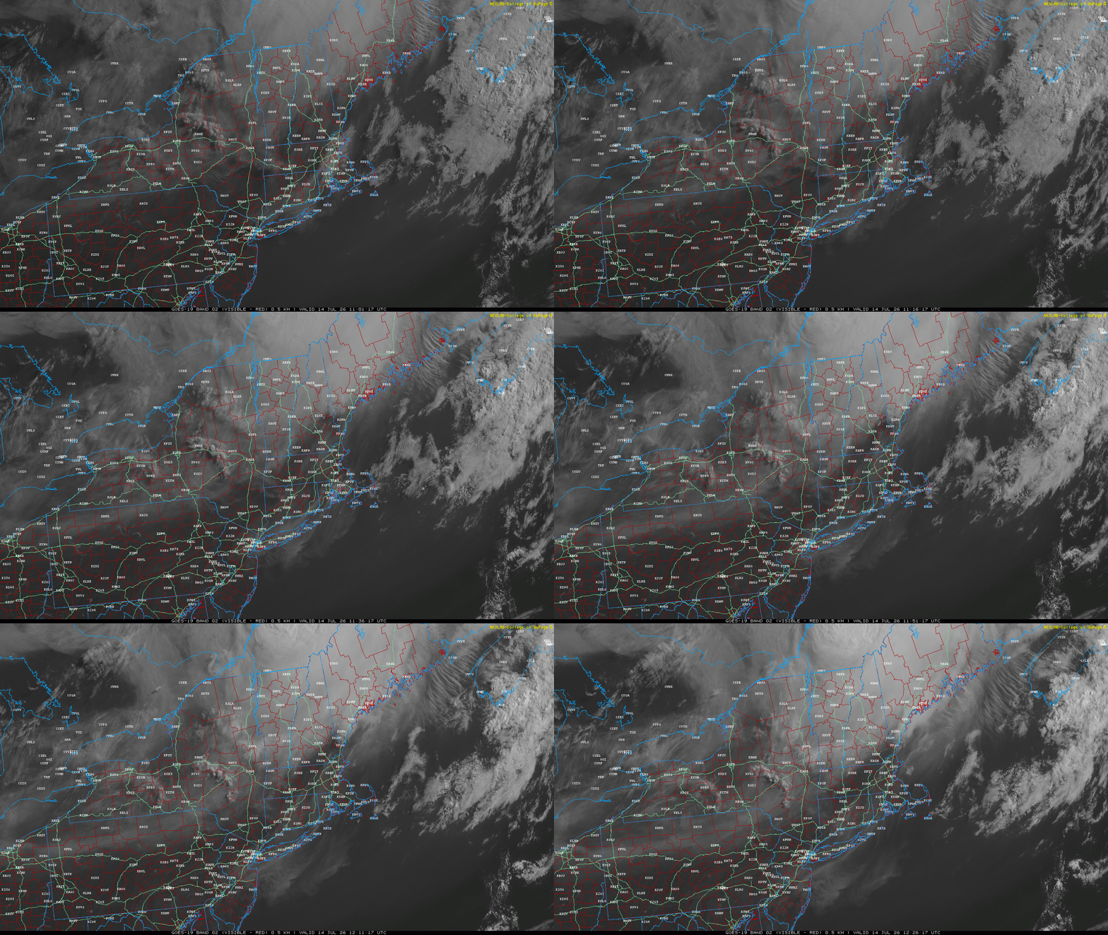
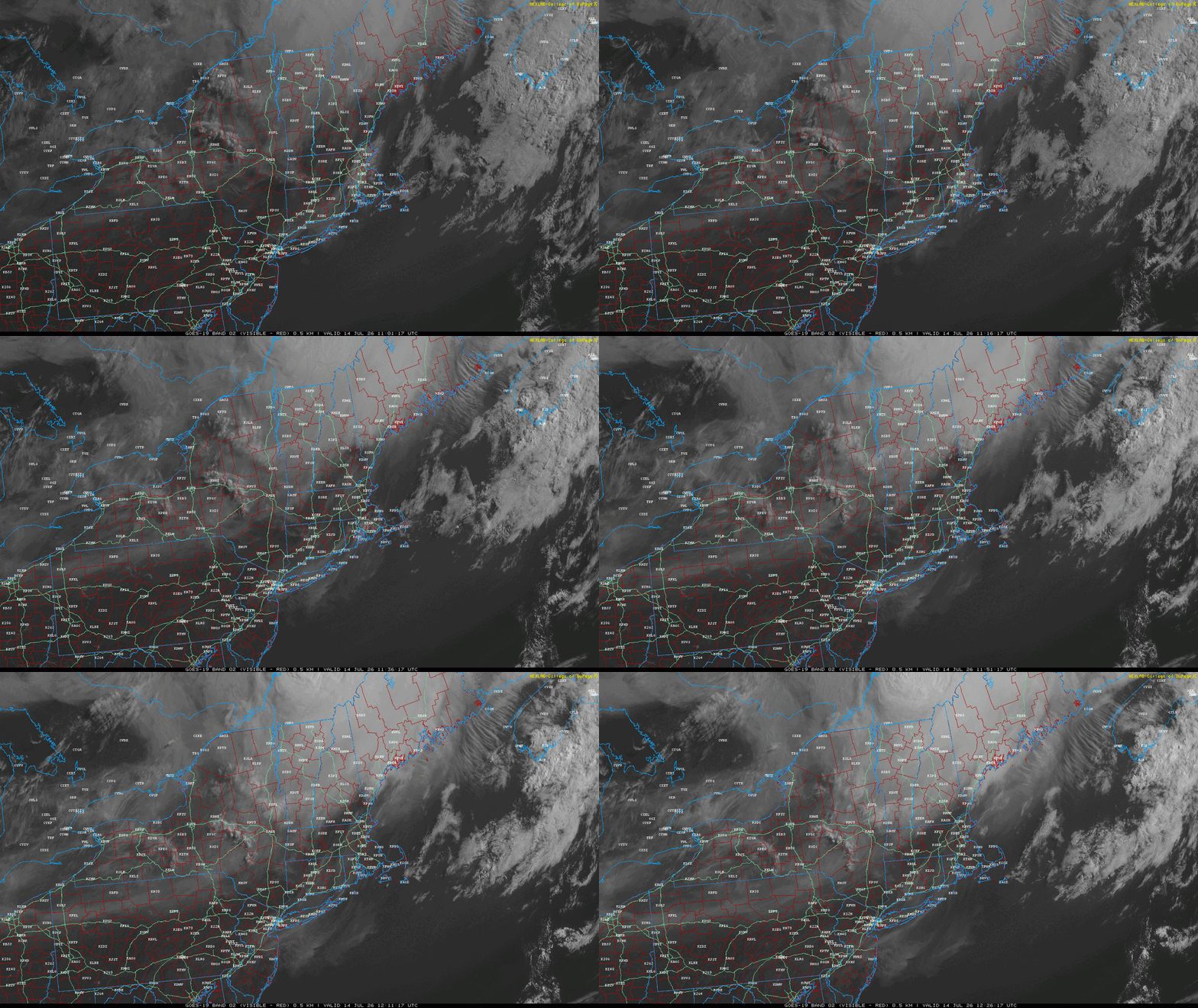
 I noticed the wild fires N of Superior yesterday. Their plumes were streaking from source, due E at ludicrous speeds... owing to the ridge amplitude kissing the modest lower heights over midriff Canadian shield. ..blah blah. That said, there's definitely an MCS that's raged through eastern Ontario ...curving now SE through western QUE and is producing the typical outflow anvil canopy. It seems likely based upon these observations that both are true. It's probably hard to parse out of the vis satellite images how much is smoke and how much is cloud...I'd suggest most of what is seen is cloud however.
 -
Tough way to run a torch day. Maine stealing the rain. Looks like a nice storm diving into the CT Lakes in a bit. Been limiting screen time…just hit or miss posts. Lots of eye inflammation and migraines. Should probably get a lyme test but that would require going to a dr. 71°
-
There is mixed research on smoke and storms. In some cases the smoke layer can actually hold the cap longer and allow the instability to really build before breaking (think smoke absorbs heat and warms that layer aloft). But that really depends on the height of the smoke layer.
-

2026-2027 Super El Nino
LakePaste25 replied to Stormchaserchuck1's topic in Weather Forecasting and Discussion
A lot of times, these seasonal models lean too heavily into the ENSO state. Same with the CPC seasonal outlooks. We saw that the last 2 winters with too much emphasis on the SE ridge in the East. Since this El Niño is going to be very strong to historic, I feel that the generic outlooks for the seasonal mean this winter will end up being more accurate. We will also need to see if the pacific jet strengthens this Fall and begins to reverse the -PDO. -
Gorgeous morning. Nice breeze bringing in that ocean air smell into Meadowlands in Kearny, seagulls laughing. Close you eyes you could almost envision being at the shore.
-
 Wiz to his credit mentioned this as a possibility just yesterday
 -
 Looking at the sat pics this morning there are lots of fires burning in Southern Ontario. The thick smoke plume is moving into our area. How much is this going to affect the severe storms later for NNE? Also the MCS is creating a lot of cloud cover especially this morning. So we are not getting much insolation. Maybe this will reduce convection later?
 -
I knew what you meant ... I was just adding for general readers that physics requires that a well mixed column has to obey the adiabat temperature distribution in general. If it is 2 am , and the 850 is 20C, and it is well mixed, it's in the 90s at the sfc. Whether or not the atmosphere is can be well mixed at 2 am or not is another matter LOL. That's why nearing evening on hot days, if one is excruciatingly nerdy enough like me... they might notice the light west wind that had steadily rustled leafs all afternoon suddenly goes calm; it's because the surface - albeit still hotter'n Hades - has slipped below the adiabat. That adiabatic temperature might be 98 given the 850, but the sfc has by then dropped below that temp...etc. DP plays a role... if the air is heavier it may stay elevated longer. The other way to think of it is that the mixing height has slipped lower than 850, and if there is a weaker/no gradient in those lower levels, that extinguishes the momentum.