All Activity
- Past hour
-
We need that for the occasional meltdown from Cory and his traveling measuring adventures.
-
Feels like we slightly underperformed on lift/QPF too. Ended up closer to the more flaccid guidance. Those big solutions down here were ripping an inch and quarter of QPF easy in the pike corridor
-
Is that what the charts show? Hope so. We hit the breaks big time and March is a long month if we can’t get anything interesting.
-
5.3”/0.53” final Cores were 2.1”/0.28” and 3.2”/0.25”
-
Sounds like the Capitals are waving the white flag on this season... Dowd moved yesterday... Carlson this morning
-
Might happen for Wednesday. But we should torch for a few days before that.
-
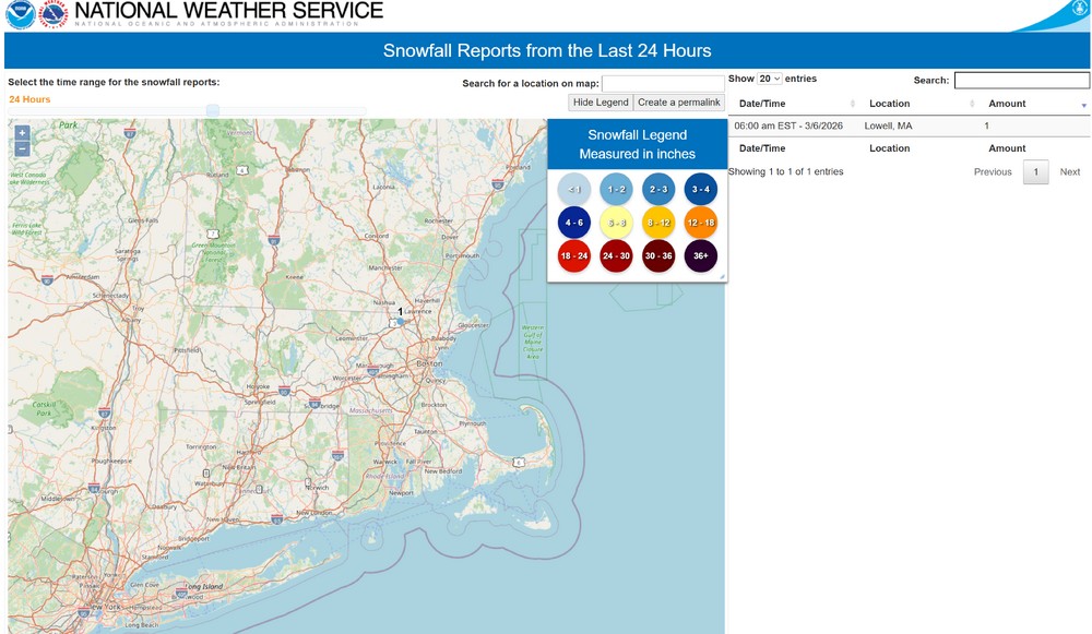
Funny you post this. I'm lying in bed too lazy to get up. I looked at my webcam and guessed about an inch in Lowell. Checked the NWS map and the only post was Lowell reporting 1" (wasn't me), so I can stay in bed although I do have to pee. F'k it I'm up. Sucks getting old.
-
Andover 4.0 Ashburnham 3.2 Lowell 1.0 Westminster 0.8
-
Let him in?
-

E PA/NJ/DE Spring 2026 Obs/Discussion
JTA66 replied to PhiEaglesfan712's topic in Philadelphia Region
Phone now showing 72F on 3/11. I’ve lost 8 degrees in 24 hours. -
Some rumbles of thunder last night 830-930. Nice slug of rain too, picked up .68
-
never. ineedsnow would lose his shit. plus it's adorable. this one on the other hand...
-
I’d argue the tuck over performed considering it’s dropped below 30 here. Did not expect that.
-
Backdoor?
-
i think i've heard that figure skater analogy over 100 times in college met classes. lives in my head rent free
-
We need that emoji banned
-
Warning flags were there. That elevated warm nose was just warm enough to produce mostly sleet CON-south. I think all models underestimated it a bit, but some of the mesos were a little more sleety looking. It was so thin on forecast soundings just above the cold wedge that models may have needed more vertical levels to really “see” that full +1C in there…just guessing there. I thought 2m temps looked fairly spot on although I didn’t focus on what mesos had for everyone.
-
Just north of it, yes.
-
probably the first solid significant (>0.75") rainer all winter, at least since Jan 1. Dec had a couple.
-
Over 1.5" of badly needed rain at Central Park. Not bad at all.
-
1.10" in the gauge .. nice event for the stein worries
-
any reports in N MA? nothing is plotted yet on the interactive map...im guessing there was about 1-3 N of RT2?
-
no. 18.
-
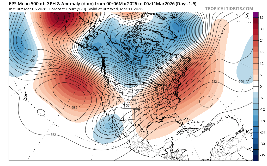
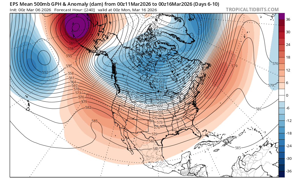
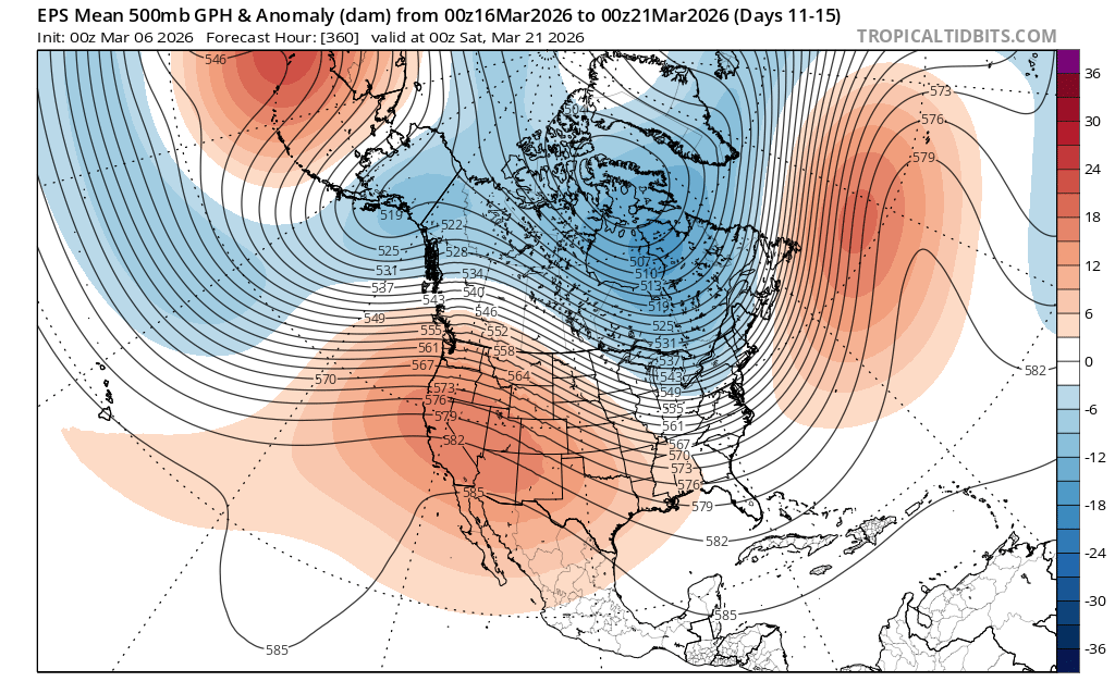
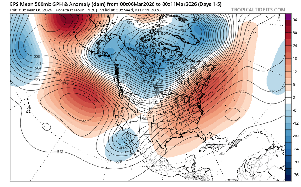
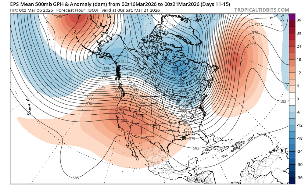
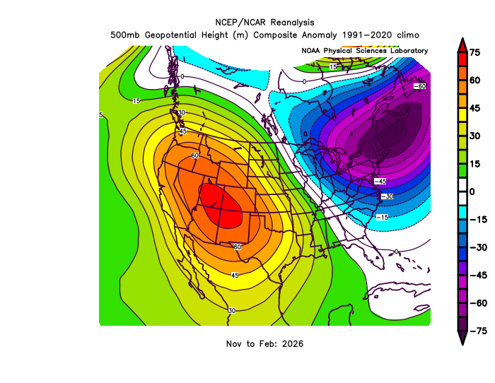
Pretty impressive how the record ridge out West which began back in November is continuing into March. But the Northeast trough isn’t quite as strong as it has been. So it looks like a weaker reflection of the pattern in the Northeast at least. This corresponds to the typical backdoor pattern that we see in the spring.

-
I'm sayin'