All Activity
- Past hour
-
I accept. Where do I sign?
-
Yes. That's what I was referring to irt research. I'd saw a thing or two on where you had did that. Was that dependant on La nina location Larry ?
-
For many, or most, at least in eastern areas...... Which is it?
-
The GFS loves to dig and amplify stuff thouhh. Look what it did January 2025 and what it did for 1/16. It’s a known bias. Wouldn’t put any credence into it
-

January 2026 Medium/Long Range Discussion
NorthArlington101 replied to snowfan's topic in Mid Atlantic
Slightly better map, but yeah, this is a 1-2”+ storm for many of us.
-
GFS looks quite a bit more consolidated
-
Blah, blah, blah ... ...... Joking...... but I didn't believe it ... YET
-
You also fail to mention it’s rain for many, or most, at least in eastern areas
-
Gfs is improving
-
I think this latest GFS will be significantly better for us from how the H5 is looking out over the plains. Still probably a bit too broad though.
-
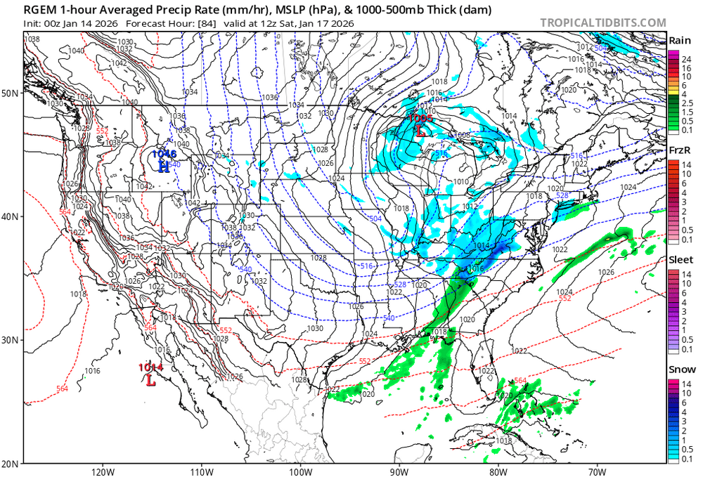
The GFS at 84hrs looks like it has a sharper shortwave with more vorticity crossing into North Dakota. I think that's the vorticity that sharpens the base of the trof a day or so later... we'll see... could be a slightly better trof for Sunday
-
Actually, I did a study recently that surprisingly showed that Jan phase 6 in the SE (using GSP as a representative) has had a mix with a bit more cold vs warm phase 6 Jan periods. Examples of cold during La Niña in Jan: 1975 (8 BN), 1976 (9 BN during a long period of 13 days), 2000 (4 BN), 2011 (7 BN during a long period of 12 days), 2022 (9 BN), and 2025 (5 BN). There were some mild Jan phase 6 periods during La Niña also like 1989 (+8) and 2008 (+8) although those two were only 3 days long each. Keep in mind though that the current phase 6 started off mild. So, it remains to be seen how cold it will end up overall as it’s progged to last through ~Jan 21st.
-
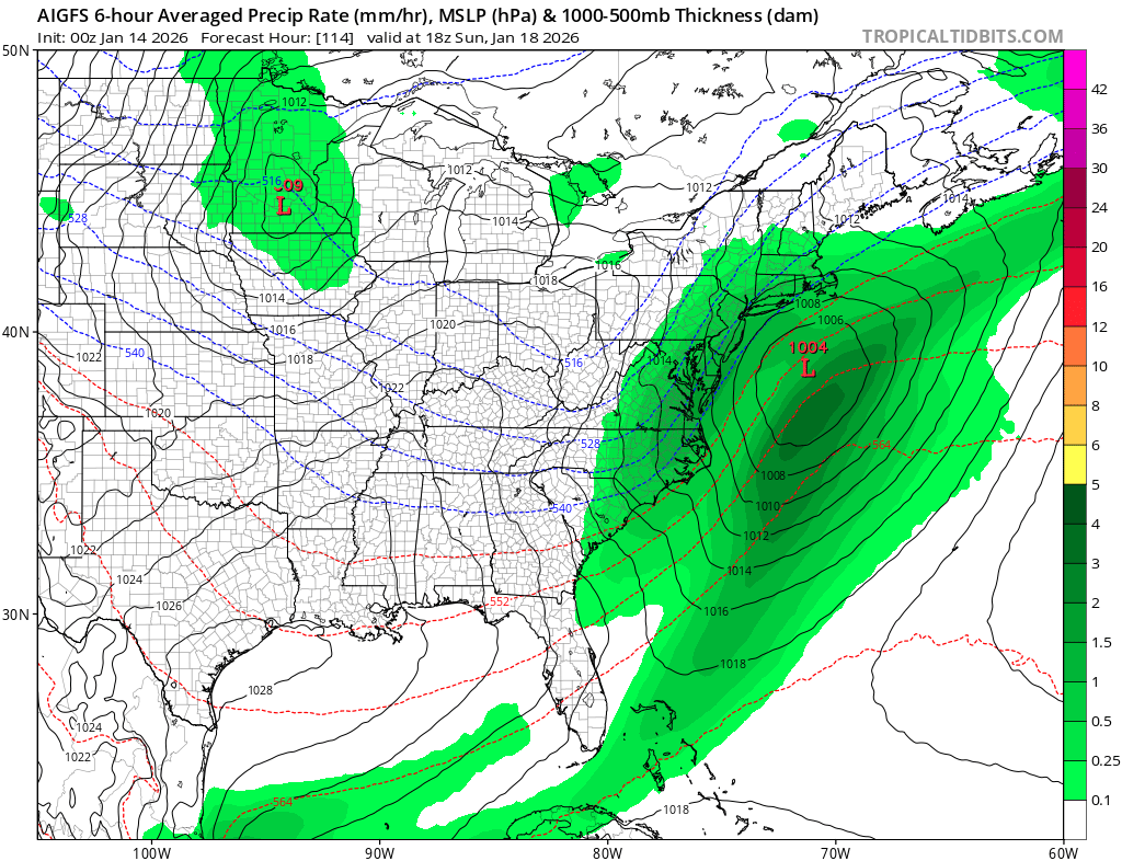
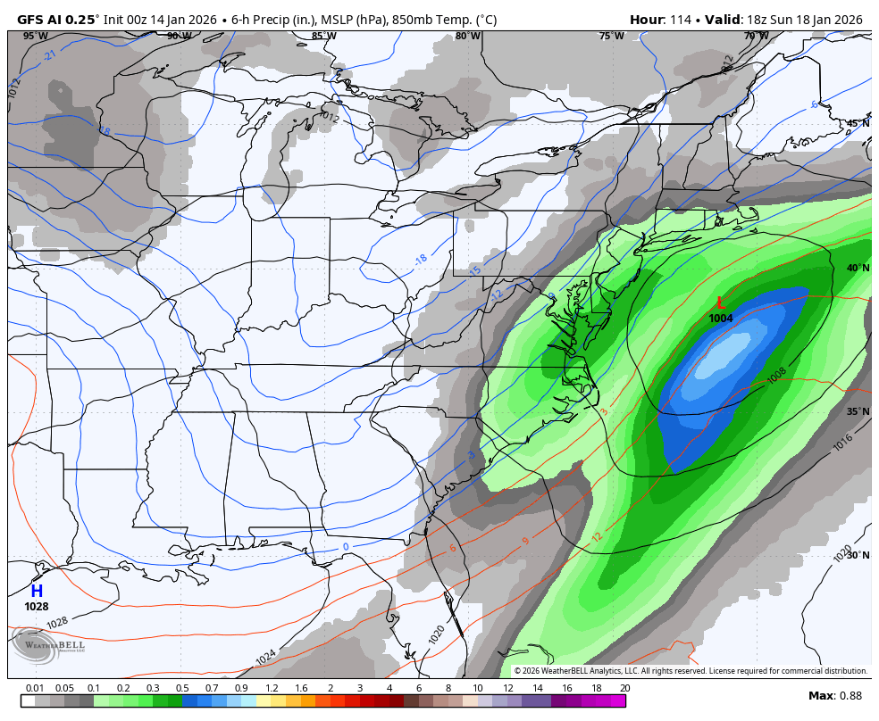
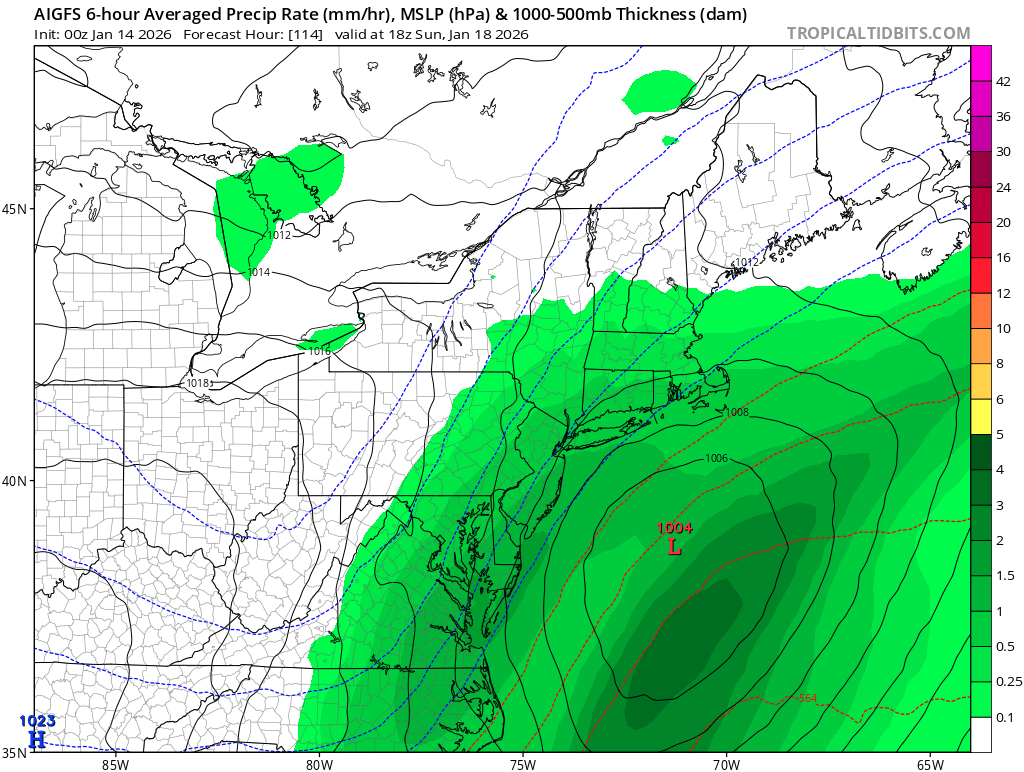
this looks really good the storm is a bit weak but that's a decent snow event GFS AI

-
A storm is eventually going to happen with the PNA being positive.
-
Icon and Ai gfs bringing back the 18th
-
AI GFS showing a storm offshore, moderate precipitation for Sunday during afternoon and evening. You want more than ICON and AI GFS in your corner thouhh or you end up with a 1/16 repeat
-
Icon and Ai gfs bringing back the 18th
-
Get ready for Lucy to pull the football by tomorrow or Thursday
-
AI GFS is decent for the 18th. We continue seeing some positive trends.

-
It's a blend of the Model's as most know as it's pretty obvious. I don't know how many are used or which one's to come up with the Average of them all. It's been awhile since I was told by the NWS . They just explained it and said it's the one they use. I don't think any Model's are given more weight than the others. If the better Model is showing 10" for a given area while 2 of the worst are showing zilch, the printout is going to be very low and may be way off. So, it's overall a good Idea Model. You get the average of the Consensus so to speak but, it can sometimes be way off because of what I mentioned above.
-

2025-2026 Fall/Winter Mountain Thread
Tyler Penland replied to Buckethead's topic in Southeastern States
Frontal passage tomorrow looks fun, at least. -
Snows for 30 hours N&W of NYC on the ICON. Seems unlikely but fun to look at. A 6 hour period of steady rain or snow with flurries or light rain with the initial week overrunning seems more plausible.
-
Reggie looks like it's going to cook past 84 huh New Englanders?
-
Was just about to say that Icon has white rain for us on Sunday with some moderate snow inland. Also, we might catch a few snow showers Thursday evening during the anafront system.
-
Pick a date, Any date, Eventually you may get it right.


.thumb.jpeg.f5c6ba9d911ec96b3b124f8606aee58e.jpeg)